TRANS-AMERICA TRAIL
Ride Report
Part1: Tellico Plains, TN to Salida, CO
By Jerry Lewis
The Trans-America Trail is a dual-sport motorcycle adventure designed by Sam Correro. Sam did a truly great job of designing a route that consists of about 80 percent off-pavement roads which crosses 4,800 miles of the U.S. from eastern Tennessee to the Pacific coast in Oregon. The official trail head is Tellico Plains, TN, Sam having relocated the starting point from Jellico, TN. At his web site http://www.transamtrail.com, Sam sells the paper maps, roll charts, and even a GPS track for the TAT.
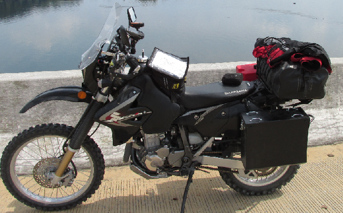
Having completed the CDT (Continental Divide Trail) with my friend Greg Camp in September 2012, I began planning my 2013 ride of the TAT in earnest. I began by selling my 2008 KLR and purchasing a 2012 Suzuki DRZ400-S. The KLR was a great workhorse of a bike but I wanted something lighter (minus 100 lbs.) with better (much) suspension. Also, after a bad experience on the CDT with a pair of Kawasaki soft bags, I sprung for some aluminum panniers (pan-yers) from Happy Trails.
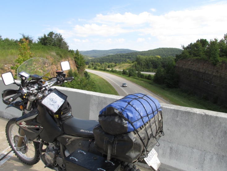
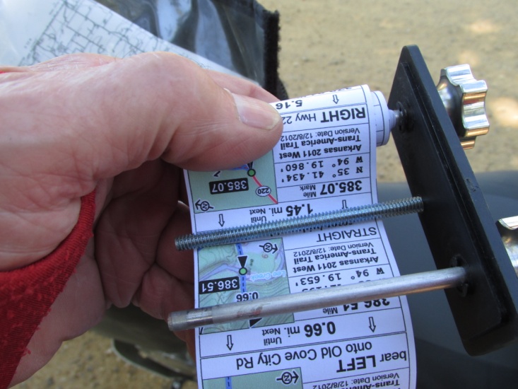
The second step was to purchase the roll-charts and paper maps from Sam. Using his paper maps, I began the tedious process of building my own GPS tracks and routes in Garmin Map Source to load on my trusty Garmin 60CSX GPS. I adapted my roll chart holder for a RAM mount and purchased a SPOT Messenger satellite tracker also with a RAM mount.
My friend Greg originally planned to make the ride with me but had to cancel. Committed to the ride, I decided to ride it solo. Though advised by some that this was dangerous, I pressed on with my planning, relying on the SPOT Messenger, my PSB (personal satellite beacon), and prayer for some peace of mind. I decided early on that I would only ride the eastern half to Salida, CO., saving the rest for 2014. I planned the ride for early September 2013, hoping to avoid some rainy weather and be finished before the snow began in Colorado. After a bad camping experience on the CDT last year, I decided to lighten my load by leaving all camping gear at home and riding off-trail when necessary for the comfort of a motel. I installed a set of Dunlop 606 knobby tires to which I’m really partial and a smaller Wolfman tank bag. Because of the limitations of my 60CSX GPS, I realized I would have to split the route/track in half. This meant I would need access on the trip to a computer to load additional tracks from Map Source so I purchased an Acer Netbook that would make the trip with me. As additional preparation for the ride I made an 800 mile and a 500 mile ride here in Texas to get familiar with the DRZ and the luggage system which really paid off.
My brother-in-law Kenny Paxton agreed to haul me from Lubbock, TX to Tellico Plains with bike and gear in the back of his pickup (he let me ride in the front). He has a son who lives in Atlanta about 100 miles south of Tellico so it gave him a chance for a short visit.
Kenny and I left Lubbock on Friday morning, September 6th about 9:30am. We spent the first night in Little Rock and then arrived in Tellico Plains on Saturday evening. We had reservations at the Lodge at Tellico, a really great place to stay.
Sunday, 9 September 2013 (Day 1)
![]()
![]()
![]()
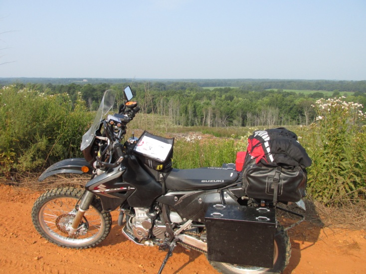
We ate a great breakfast buffet at the Lodge and Kenney headed for Atlanta. It was cool when we got up but by the time I got the bike loaded and left around 9:30 (later than intended), I was sweating profusely. The humidity was almost unbearable after dry west Texas. However, once moving the humidity actually had a cooling effect.
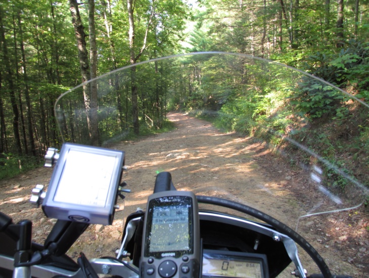
I headed out of Tellico Plains on Hw 68 and quickly turned west on a bitumen surfaced jeep road. Before long that road turned to gravel and rock as it climbed steeply through heavy forest. About 6 miles in I came to the first of four creek crossing within the space of a mile or two. A couple of the creeks were deep and wide which I crossed without a problem. The forth crossing was a mossy rock bed and I wound up dabbing both feet to keep from falling. So there I was, not 30 minutes into the ride with both feet wet.
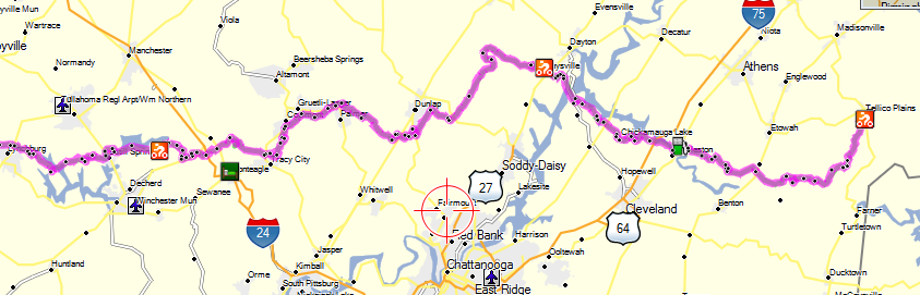
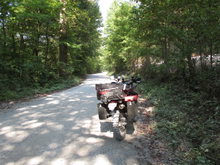
As the day wore on it was stifling hot when I stopped but fairly cool if I kept moving. It was a beautiful forest ride with the trees making a tunnel over the road for miles on end. The morning passed with only about 50 miles of actual dirt. The roads were very narrow jeep type roads covered with hot-top or bitumen. Even when high up in the forest I encountered lots of very rural houses sitting on acreages just off the road. Regardless whether a trailer or a large house all of the yards were beautifully landscaped like small parks. I ate lunch in Dayton, TN at Wendy’s (terrible food) and gassed the bike. I stopped mid-afternoon to rest my cramping hands and made reservations in Lynchburg, TN. I arrived in Lynchburg at 5:15 pm … back on central time already… after riding 215 miles in 8 hours and 45 minutes.
Lynchburg is the home of Jack Daniels Distillery though the visitor’s center was closed by then. I got a nice motel for $65 and walked next door to a Subway for supper. Not my first choice but it was “small town Sunday evening” and the few restaurants had already shutdown.
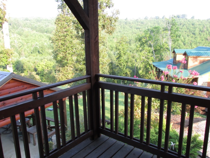
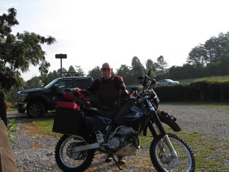
Our balcony – Lodge at Tellico Self-portrait – 9:30 am Day 1, 9/9/13
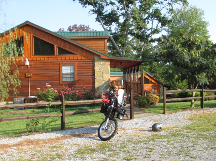
Lodge at Tellico First dirt – Day 1 Tennessee
Day 1 – Tennessee Day 1 – Tennessee
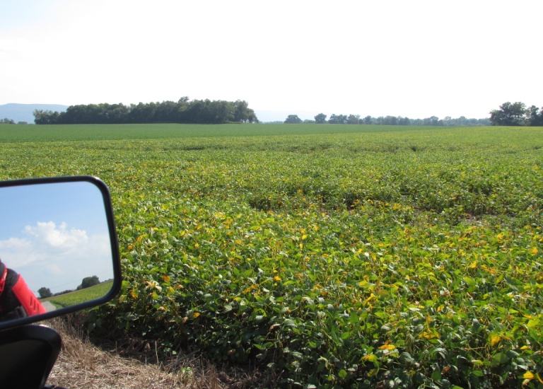
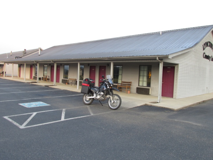
Lots of soybean Motel in Lynchburg
Monday, 10 September 2013 (Day 2)
 I ate breakfast at a gas station-store-café and headed out of Lynchburg at 7:45, a much better start time than yesterday. Day 2 I saw more dirt, (maybe 40%) and the rest was pavement or bitumen. I encountered ten or more creek crossings today, some running fairly deep due to rains that moved through just ahead of me. I only got some heavy sprinkles but some of the roads were muddy and very slippery. A little after noon I ran into two TAT riders from the Carolinas taking a break beside the trail. One guy was on a 650 Suzuki DR and the other a 650 Honda XLR. As we visited briefly I was thinking “I really need to get moving so I’m not riding in these guys dust”. I realized after I left them I didn’t even ask how far they were traveling. I think we leap-frog’d each other the next couple of days but I never saw them again … just their tracks. I arrived at my destination of Pickwick Landing State Park about 4 pm with a thunderstorm headed my way. The Landing is located on the Tennessee River and the 4 story inn (think Hampton quality) is state owned. It was very nice with a buffet restaurant and a balcony overlooking the river, all for $70 a night. I pigged out on the buffet as my lunch that day was peanut butter crackers, a Payday, and Gatorade. Mileage for the day was 215 miles.
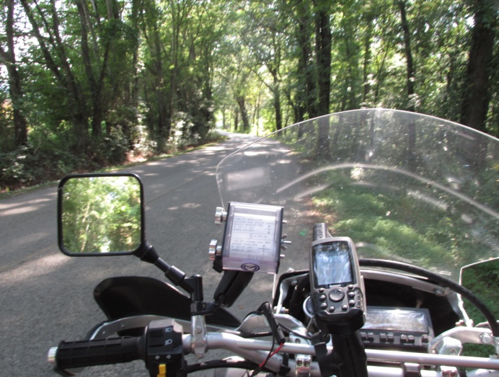
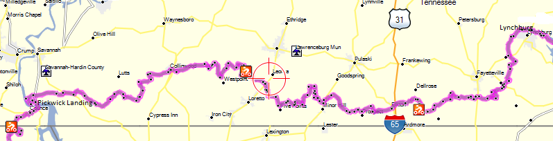
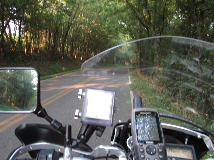
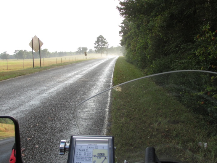
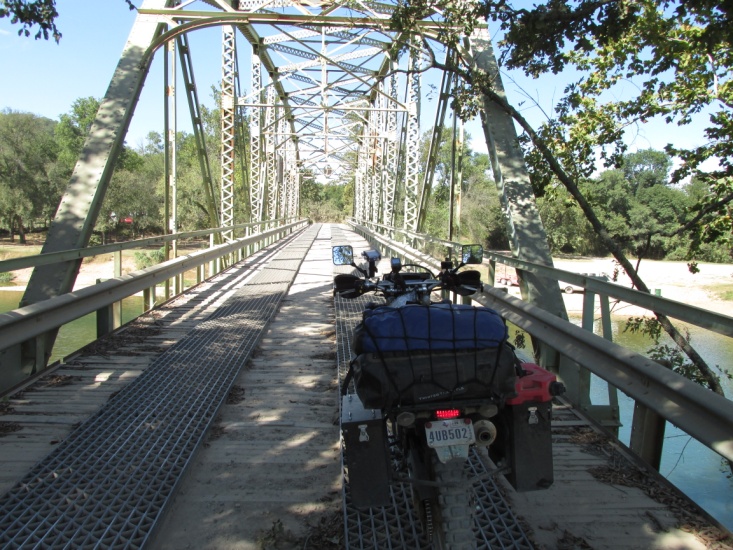
As I mention earlier I’m using 4 methods of navigation: maps, roll chart, GPS routes, and GPS tracks. The maps so far have been dead-on but I experienced a couple of minor errors in the roll chart. The “routes” are helpful but as always the GPS occasionally tries to reroute me to some nearby highway. The “tracks” have been perfect however so I rely on them more.
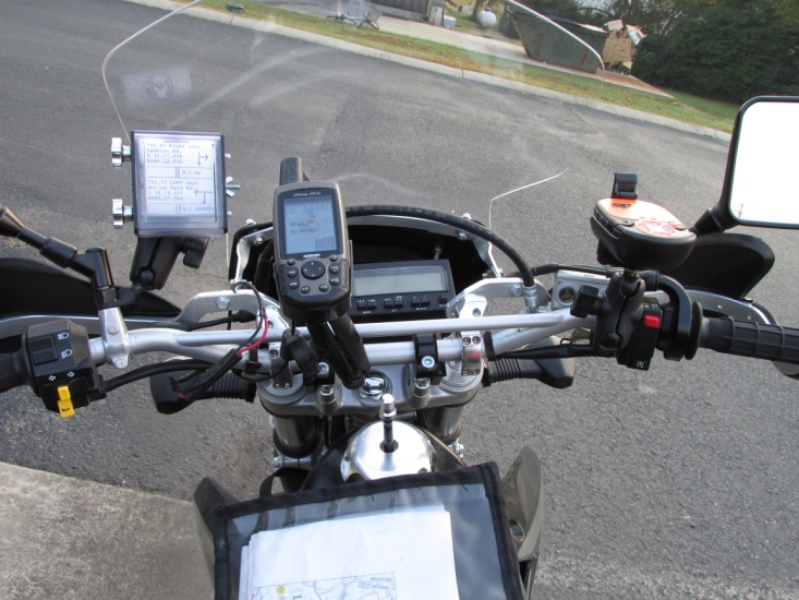
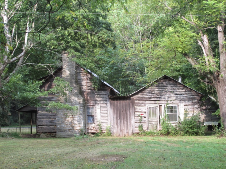 – Roll chart – GPS – Digital odometer – Spot – Maps Civil War era house
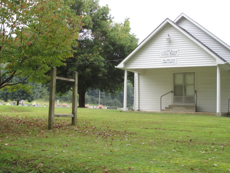
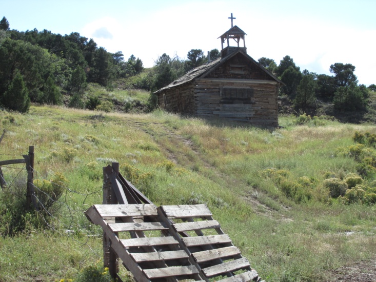
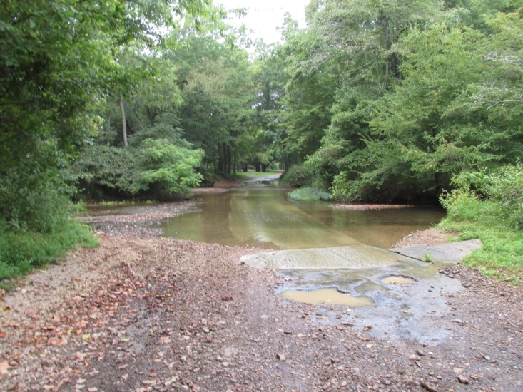 – Very rural Church of Christ – Tennessee Slick water crossing by the church
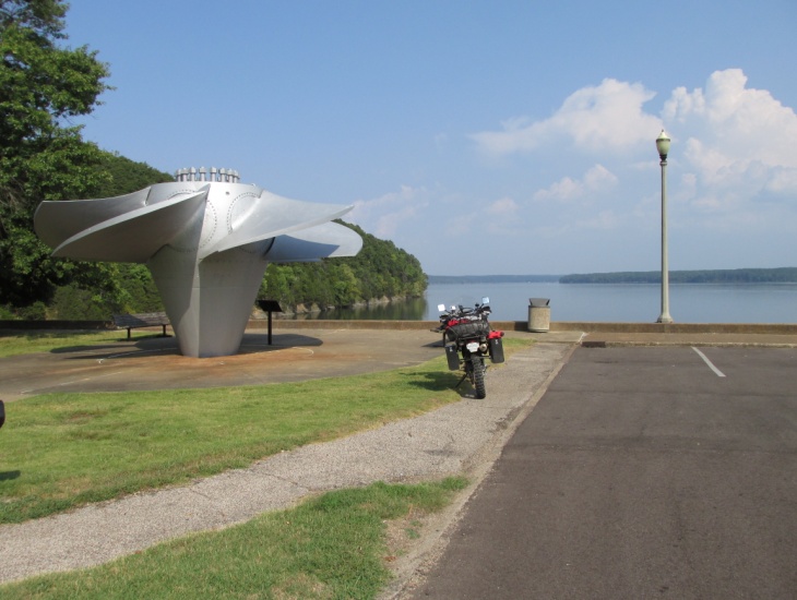
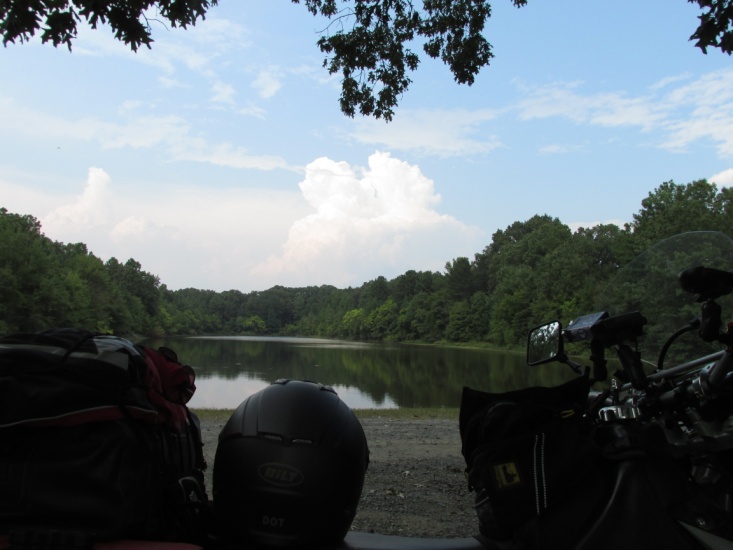
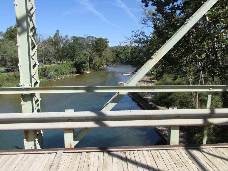
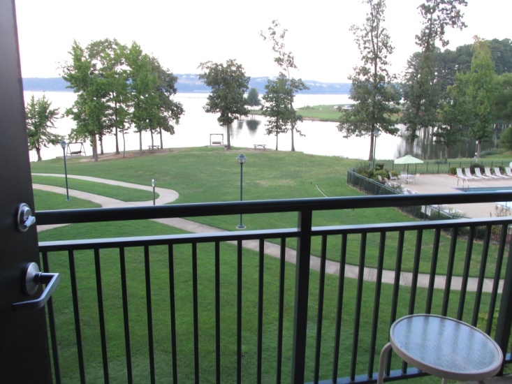 – Tennessee River turbine prop @ Pickwick Landing, TN Room view Pickwick Landing Lodge
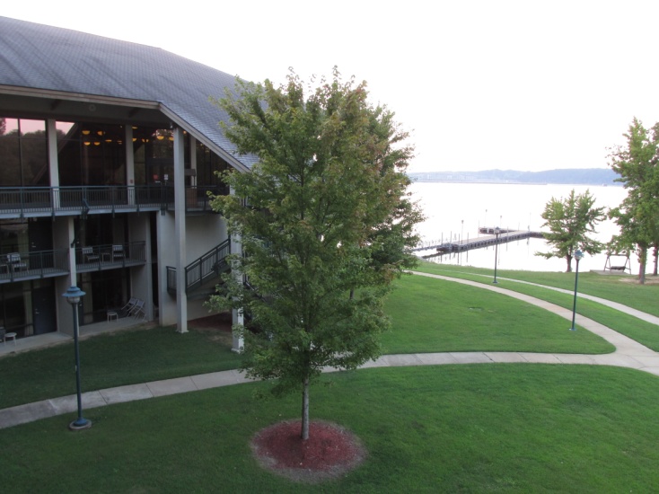
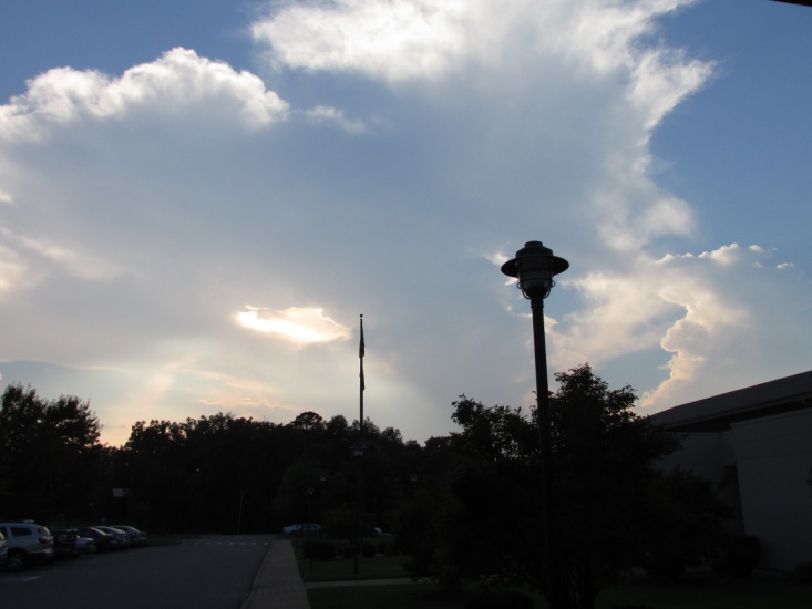 – Lodge at Pickwick – view of Tennessee River Thunderstorms moving into Pickwick
Tuesday, 11 September 2013 (Day 3)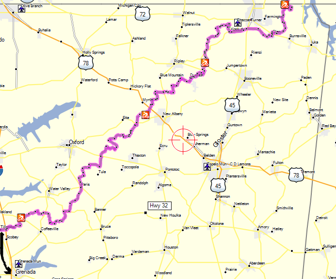
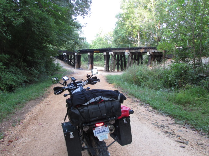 I ate a great breakfast buffet at the inn and left Railroad bridge south of Pickwick Pickwick Landing about 8:15 am. It was a little later than I planned but the breakfast was worth the delay. I had ridden about 5 miles out of town when I realized I forgot to gas up. Afraid to risk it I rode back to town and filled up. Having lost about 30 minutes, I vowed to fill up each evening from then on. About 7 miles later I crossed into Mi-ss-iss-ipp-i and witnessed the terrain change immediately. The hills were much lower with less forest but with a lot of wild undergrowth. The roads for Day 3 were more dirt than yet encountered … 70% dirt, 30% paved. In the a.m. I got into a little slippery mud and then some very deep sand where I had to drop to first gear and tractor through. The Mississippi roads were very rural and I saw a plethora of broken down trailer houses with junk filled yards … very different from the immaculate landscaping of Tennessee. As Sam had warned, navigation on this stretch of roads was very tedious but between his roll chart and my GPS track I never got lost.
I ate lunch at Pizza Hut where I loaded the second half of Day 3 in my roll chart holder and refilled my Camelback. Several times on the trip I had to reload the roll chart midday as the chart was too long to fit the complete day in the holder. It was very hot and humid and thunderstorms were building all around.
After lunch the trail meandered around a couple of thunderstorms but the roads were left very wet and muddy. Many of the roads were covered in large crushed rock which was deep enough in places to be dangerous, as bad as or worse than riding in sand. I made it to the Econolodge in Grenada, MS about 7 pm. after riding off-trail about 20 miles to find a motel. I rode 240 miles for the day though only about 200 was actually on the trail. That evening I adjusted the throttle free-play to help some erratic throttle response at low speeds. Otherwise, the DRZ has performed beautifully and has been much more forgiving to ride than the KLR. After gassing up and a good BBQ meal a tired old fart hit the sack.
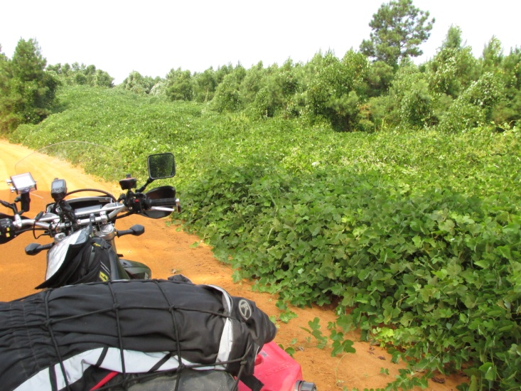
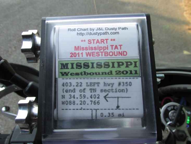
Roll chart at Mississippi state line Kudzu is taking over
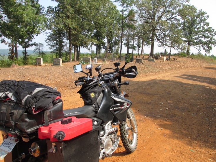
View of terrain a few miles into Mississippi Very old cemetery on top of a hill
Just missed a shower Got a shower here – Grenada, MS
Wednesday, 12 September 2013 (Day 4)
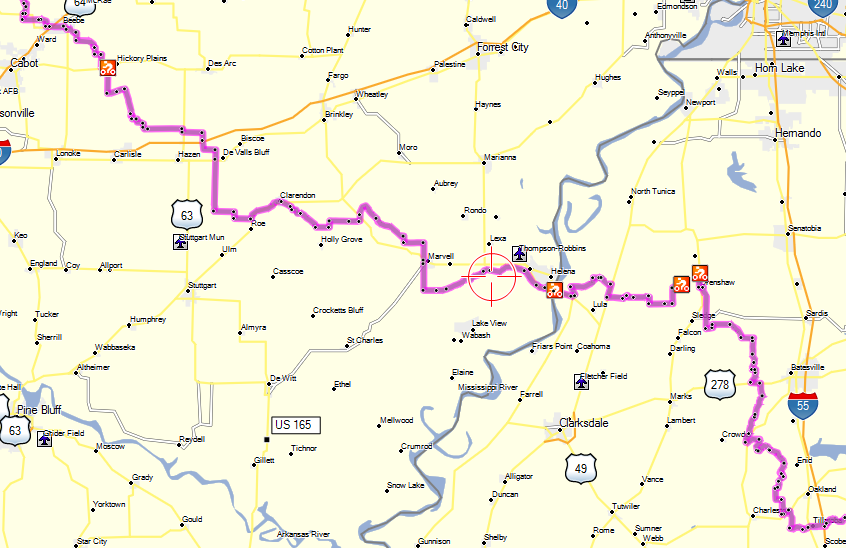
As I left Grenada about 7:45 my destination that evening was Beebe, AR. The first 20 miles of my day was pavement as I made my way back to the trail. The landscape west of Grenada was much prettier with nicer homes and acreages. I rode past Sam and Lora’s house (marked on roll chart) in the middle of nowhere. As I neared the Mississippi River some of the trail was atop dirt levees and the terrain leveled out and gave way to more cultivated land.
I crossed the River at Helena, AR where I made a quick tour of town, grabbed a bite for lunch and reloaded my roll chart. A few miles west of Helena I began seeing signs about a TAT rest stop but it was closed when I passed by. A couple of miles later a guy in a pickup flagged me down. The man’s name was Glenn, a local farmer and really nice guy who runs the rest stop. He said they keep a log of TAT riders so he took my picture and bio to post it at the stop. He related that a guy on a Harley with side car riding the TAT had recently stopped by. Also, he met a couple of guys on Honda Trail 90s riding the TAT east from California.
The thunderstorms began to build again and I dodged a big one but got caught in a shower for a couple of miles. Following the storms I rode through a couple of “lakes” in the road each about 100 yards long. One I could see the bottom but the other I couldn’t but made it through without mishap. Also, I got into some deep sand for about a mile that was damp from the rain with ruts a foot deep. I rode slow and managed to stay in the ruts.
Not far from Beebe, I ran into a young farmer who said he had ridden the Arkansas portion of the TAT. A few miles later I came to my third “bridge out” of the day. The first two had been repaired but the third was truly out. I thought about riding through the creek but the banks were steep and muddy and riding solo I decided it wasn’t smart. I rode a 3 mile “u” around the bridge and got back on trail. I arrived at Beebe, AR about 6:00 pm and got a motel having ridden 265 miles … about 235 miles on-trail.
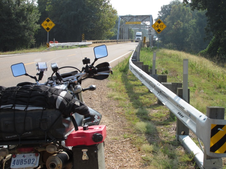
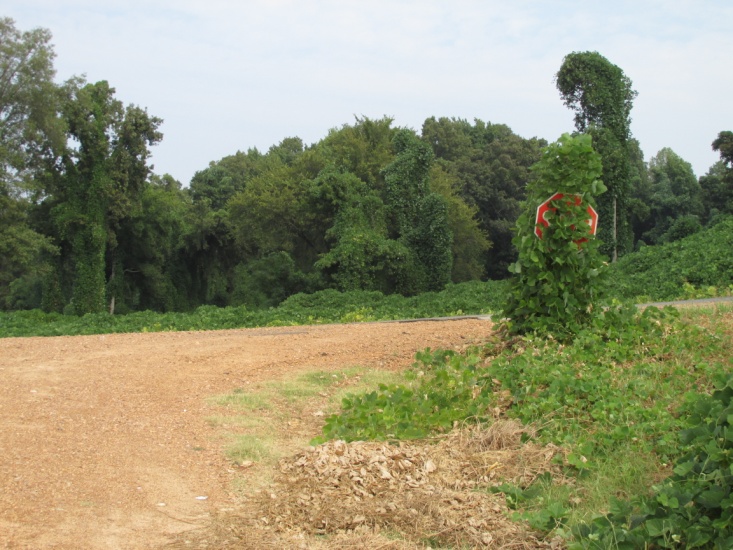 _ Rural bridge in Mississippi Kudzu ate the stop sign
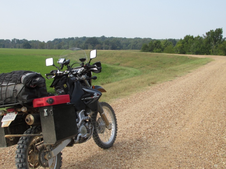
Levee road near the Mississippi River Lake in game preserve – Arkansas
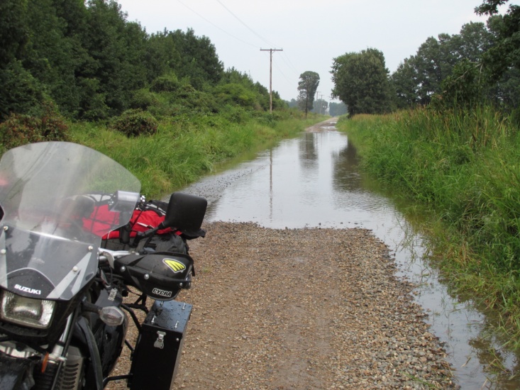
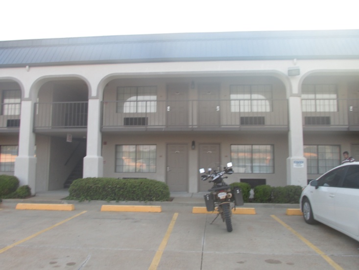
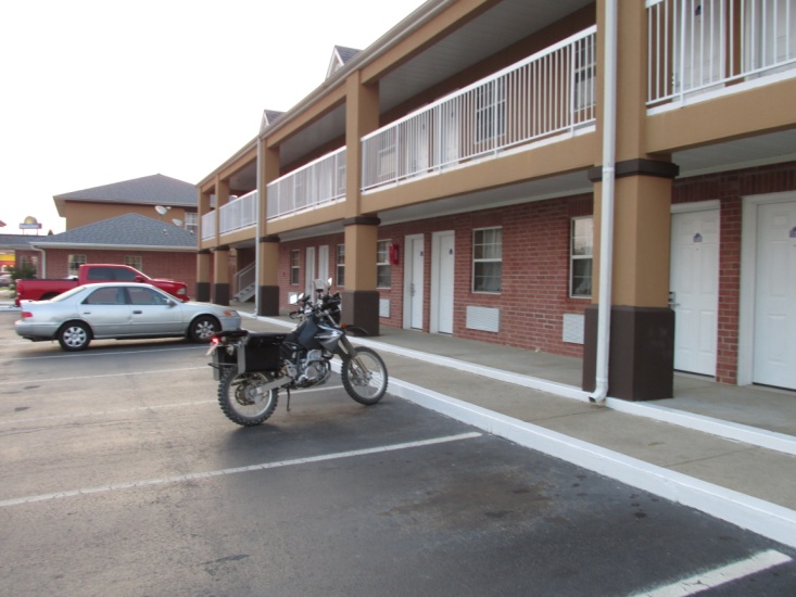 – Couldn’t see the bottom (16” deep) Motel – Beebe, AR
Thursday, 13 September 2013 (Day 5)
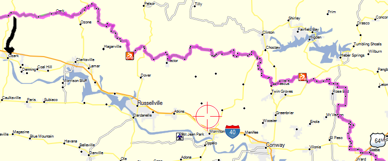
As Beebe, AR is actually on the TAT, I was immediately back on-trail when I left at 7:45 on 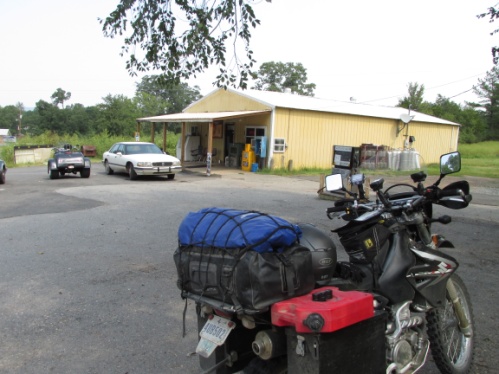 Day 5. Early in the day the picturesque scenery reminded me a lot of Tennessee. I stopped for lunch in the tiny town of Scotland, AR at a Mom-and-Pop-store-gas station-grill. They cooked me the best cheeseburger I had on the entire trip. The afternoon was great fun spent almost entirely in the Ozark National Forest. The roads varied from wide and smoothly graded to steep and rough jeep roads. At one point I got into some freshly oiled dirt roads that were extremely slimy and had to ride real slow for a few miles. Later I encountered a light shower and although my raingear wasn’t needed the rocks were wet and slippery for a few miles. There wasn’t a lot to see as I was surrounded by trees but occasionally there were photo-ops at scenic overlooks. About 5:00 pm I left the trail and headed south on HW 23 about 20 miles to Ozark, AR on I-40 where I got a motel and some grub. That evening I studied my maps and considered riding the trail to I-544 and then head south to Fort Smith for a short day and do some laundry. However, I decided I would keep on truckin’ into Oklahoma the next day.
The day was mostly uneventful but the riding was the best yet. The roads were mostly Ozark forest with a lot of elevation change and about 90% dirt. My mileage for the day was 230 miles, 210 of which were on-trail.
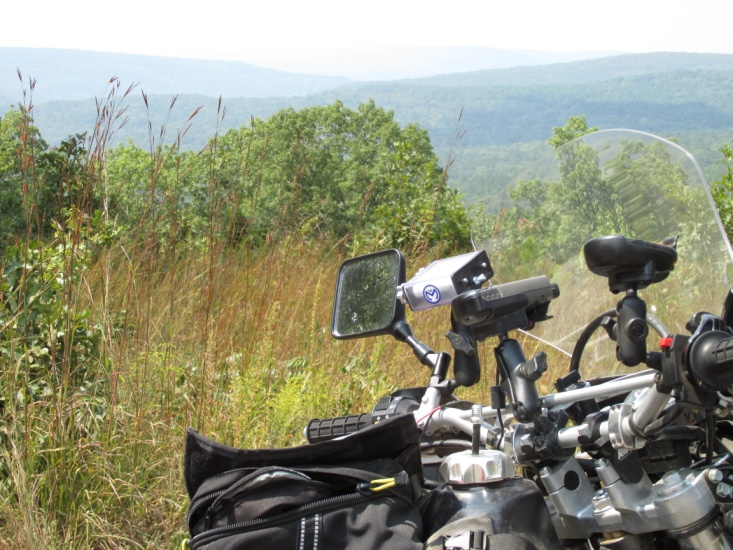
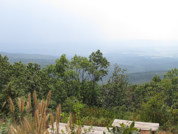 – Views form high up in the Ozark national Forest
FRIDAY, 14 September 2013 (Day 6)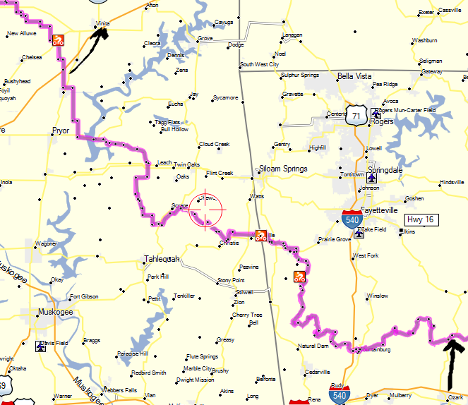
I ate a good breakfast of eggs and pancakes at a truck stop on I-40 then headed the 20 miles up HW 23 to the trail. I headed west again in the Ozark Forest riding mostly jeep roads. At one point I found a buck deer that wanted to race … he paralleled me in a pasture for a quarter mile and then jumped in the road in front of me and led me that far again down the road. After I’d covered about 40 miles I came to I-544 where I continued west. I rode a mixture of graded roads and rocky jeep roads as I gradually lost some elevation. It was here I encountered perhaps the most technical road of the whole trip. It was Warpath Road and was really rough for a half-mile or more. The road (to use the term loosely) is a steep dry creek bed full of large rocks and lots of deadfall. I learned later Warpath is infamous among TAT riders. While taking a break a local in an old truck stopped and checked out my DRZ relating to me that it was just the bike he was looking for. As I wasn’t sure exactly what he meant by that, my hand casually slipped to my tankbag and hovered over my Glock 40. I guess he realized how his words sounded because he suddenly smiled, waved and drove off.
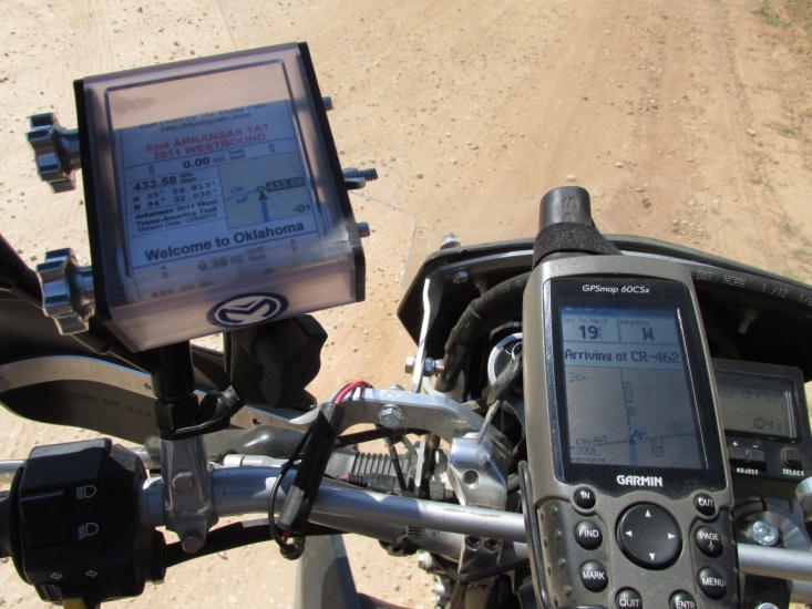 – TAT crossing I-544 north of Fort Smith, AR Roll chart – Welcome to Oklahoma
Around one o’clock I wrapped around a hamburger in Lincoln, AR about 10 miles east of the Oklahoma border. As I left Lincoln I got into some more fresh oiled dirt but not as soupy as yesterday. I crossed into Oklahoma on a dirt county road in the middle of nowhere. The roads were similar to those in western Arkansas but with lower rolling hills and less forest. I dodged a few more deer as the area was pretty remote and wild. Nearing my destination of Venita, OK the landscape leveled off with long straight stretches of dirt county roads. I arrived at Venita about 6 o’clock and checked into a dump of a motel, but it did have a clean bed and hot shower. I located a Subway and took my sandwich to the local laundromat where I ate and washed enough clothes to finish the trip. My mileage for the day was 250 miles with 217 miles on-trail.
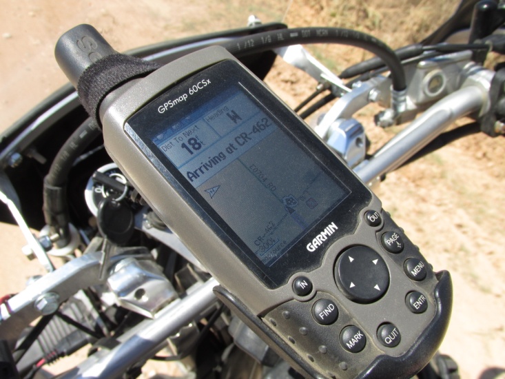
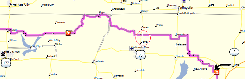
 – GPS shows county road at Oklahoma- Arkansas line Mid-day change of roll-chart
Rural bridge in eastern Oklahoma
SATURDAY, 15 September 2013 (Day 7)
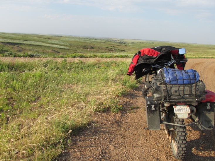
It’s 7:40 a.m. in Venita with partially overcast skies and chilly temps but I leave town wearing my armored shirt. After a few miles I start thinking hypothermia and stop to don my Fieldsheer adventure coat for the first time on the trip. I’ve been thinking for days, “Why did I lug this thing along?” After the straight boring roads from the previous afternoon I’m pleasantly surprised by the good riding. The 130 miles to New Kirk, Ok that morning consist of several creek and low water crossings with undulating topography (hilly for rednecks). Some of the area was wide open grassland and some was wooded … a thoroughly good ride!
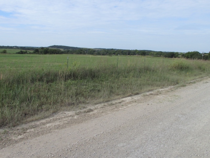
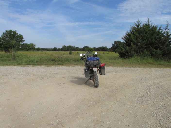
Extreme northern Oklahoma west of Venita Looking into Kansas at border road
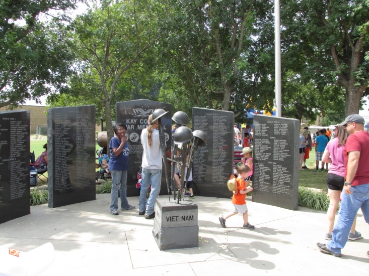
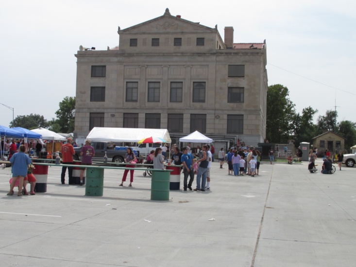
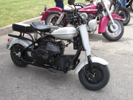
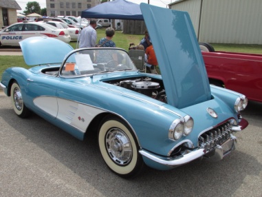
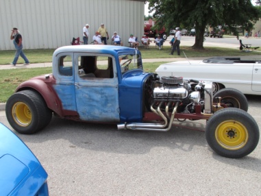
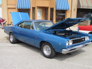
I arrived in New Kirk looking for gas and food when I was delighted to discover the town was in the middle of their Fall Festival. The town square was covered with local folks and food booths. The way it worked was you just picked up a plate or cup and walked around getting free samples from the local cooks. There was also a car/motorcycle show which I perused for a while taking plenty of pictures.
Oklahoma east of New Kirk
Fall Festival New Kirk, OK
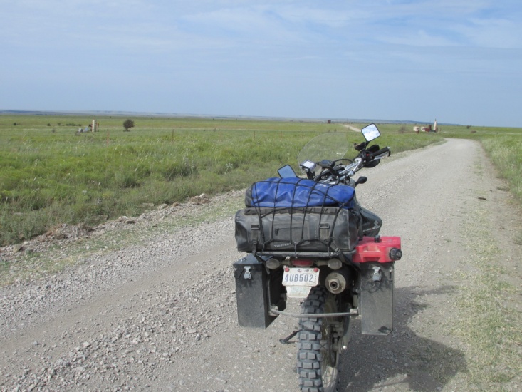
West of New Kirk, the afternoon was a different story. I again encountered many more miles of boring straight roads … many made rub-board by all the oil field truck traffic. Some of the roads also had deep powdery sand that was at times treacherous (I don’t like sand). One stretch of road was 35 miles long without a turn and another 25 miles, and several 10 miles or more. Every mile was an unmarked dirt cross road with built up blow-sand that often necessitated slowing down and checking for cross-traffic. Even though I was in the middle of nowhere, I never knew if a truck might arrive at the intersection at the same time I did. In spite of road conditions, I still averaged 40-45 mph often running 55-60 between intersections.
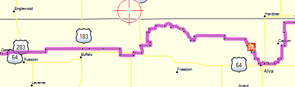
I arrived in Alva, OK around 6 p.m. really tired and for the first time a little discouraged. I’m dreading tomorrow as I anticipate more of the monotony of today, traversing the Oklahoma panhandle east to west. The motels in Alva are not much and it seems that all of the court type motels on the TAT are foreign owned. Most are clean enough but really run down. There was a Holiday Express and a Comfort Inn for $130 a night but a little out of my budget. I rode 260 mile today, about 250 of which was on-trail.
SUNDAY, 16 September 2013 (Day 8)
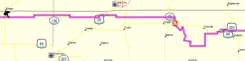
After a tour of Alva in the early morning darkness, looking for someplace to eat breakfast besides McDonalds, I finally surrendered to the Golden Arches. I left town at 7:45 not much impressed with Alva, OK. With another cool morning I wisely started out with my coat today. As I mentioned, I assumed the morning roads would be more of the same from yesterday but I was quickly disabused of that notion. The terrain north and west of Alva changed into rolling hills and decent roads which rambled across a number of ranches. I did, however, encounter more sand later in the morning whereupon I decided to try a different technique for riding in sand. I had always heard you should move back on the seat and accelerate, and that had been my practice. The idea being that the front wheel would float on top of the sand … and maybe that’s true with some bikes and certain types of sand. But what I found was that if I moved as far forward on the seat as possible, the front wheel seemed to stabilize and the handle bars quit trying to tank-slap. The right speed is also important, not too slow and not too fast (it really hurts when you fall going 50 mph). Most of the roads that morning were hard packed with crushed rock and so I made good time. About one o’clock I came to a highway 6 miles south of Liberal, KS, and I had already traveled 175 miles. About a mile earlier I had hit reserve on my 4 gallon tank (though I do carry a one-gallon Rotopax fuel cell) so I went off-trail to Liberal for gas and lunch.
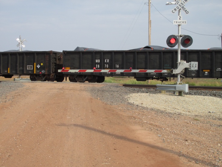
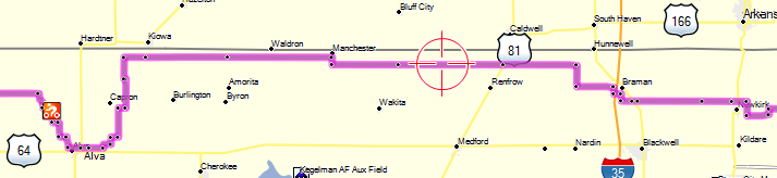
 – Waitin’ on a long freight in the middle of nowhere Oklahoma – West of Alva
Afterward I rode the 6 miles south back to the trail and headed west again. I began to see 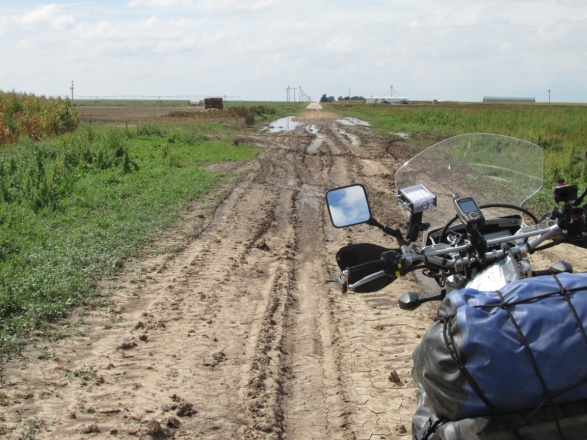 thunderstorms to the west and I found myself riding some deeply rutted and slightly muddy roads from previous rains. At one point I came up on a mud bog about a quarter mile long and knew I’d never make it through. Instead I rode through the bar ditch and up into the adjacent field where I rode through shallow mud parallel to the road until I passed the bog. A little further on I came to another bog and when I attempted to skirt it I spun out in the mud and shot up into the field and fell over. No problem … just got a little muddy. That was my second and final get-off of the trip, both times in mud. Thankfully I never really crashed on the entire trip though I did have an issue with my panniers (see Epilogue).
About 4 p.m. I came to the highway 3 miles south of Elkhart, KS where I planned to motel-it. I found a nice older motel, (American owned) with a covered area to park my bike. I laid down for about an hour but when I walked outside to go find some supper I saw that there was a large thunderstorm hanging over the edge of town. Before I could finish a quick meal the rain was coming down in buckets so I rode quickly back to my cozy room. As I sat in the room checking weather reports I‘m worried what is in store for tomorrow. Today’s ride was a good day of 260 miles, 240 of which were on-trail.
MONDAY, 17 September 2013 (Day 9)
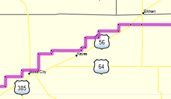
Well as I feared, it rained all night in Elkhart. When I left town about 8:30 a.m. the rain had stopped but there was dense fog and chilly temperatures. I rode pavement south to the trail and attempted to head west on the dirt county road. I slipped and slid all over for about a hundred yards before I gave up and headed back to the pavement. US 56 highway runs southwest from Elkhart to Boise City, OK so I returned to Elkhart and proceeded on 56 towards Boise City. The trail here zigzags west and south but stays basically parallel to the highway so a couple more times I attempted to ride the dirt county roads but they were just too slick. I decided to ride the 40 miles of pavement to Boise City, hoping the dirt roads would be better that further to the southwest. When I arrived there, I was gassing up when it began to rain again and I realized it just wasn’t going to work today. I got a motel about 10:00 a.m. and got out my laptop and started checking weather reports. I decided to cool it for the day and see what the morrow would bring. I lay up in the motel spending the day reading and working on my photos on the laptop. By this time I was seriously contemplating ending the trip and heading south toward Lubbock on the pavement. Late that afternoon I went outside and found a WR250R Yamaha dual-sport sitting outside one of the rooms. I wrote a note and stuck it on the bike saying if you’re riding the TAT and want to visit I’m in room so-and-so. About 9:30 p.m. there was a knock on my door which I answered and met Bob Haven from Canada. Bob had been riding the TAT, following my tracks a half day behind me for the last several days. We visited for about an hour and decided to ride together the next day if the roads permitted.
TUESDAY, 18 September 2013 (Day 10)
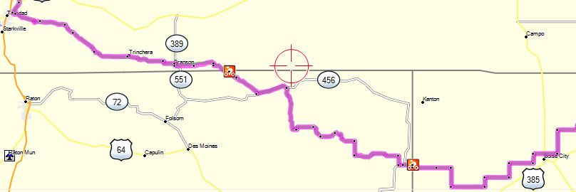
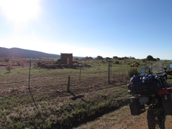
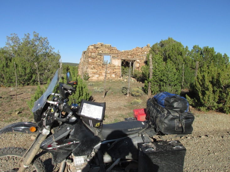
I left word with the motel office for a 6 a.m. wakeup to be ready for my agreed upon 6:30 breakfast time with Bob. No call and I woke up at 6:30 and peeked out the door to see Bob ready to go. He patiently waited while I got ready and then over breakfast we got better acquainted. We decided to ride west of Boise City and check the condition of the dirt roads. Bob had plans to head north from Trinidad, Co. to the Colorado Springs and get a new tire so we agreed to part company at Trinidad. We left town about eight o’clock and found the first road to be muddy but passable. However, after a couple of turns things went from bad to worse and we wallowed through two mud holes about 12” deep and 40 feet across. Then we came to a “road-lake” a half a mile long and decided to backtrack a little ways and hit pavement. We rode a paved state road that parallels the dirt trail a mile away for the remaining 30 miles to the New Mexico border. At the border the road turned to back to dirt but it had a good rock base with a high center crown so most of the rain had drained off. The roads through New Mexico were ranch roads as opposed to farm roads and apparently they maintain them well as they’re the only access the ranchers have to civilization. The ride through New Mexico was only 60 miles and in the middle of nowhere we crossed into Colorado. It was a really good morning’s ride wandering through various ranches with rolling hills. At one point we came upon a very steep stretch of switchbacks and topped out on a plateau with a great view. We rode a quick pace and covered the 140 miles to Trinidad by 11:30 a.m. Mountain Time, having left that morning on Central Time.
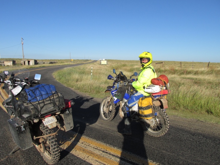
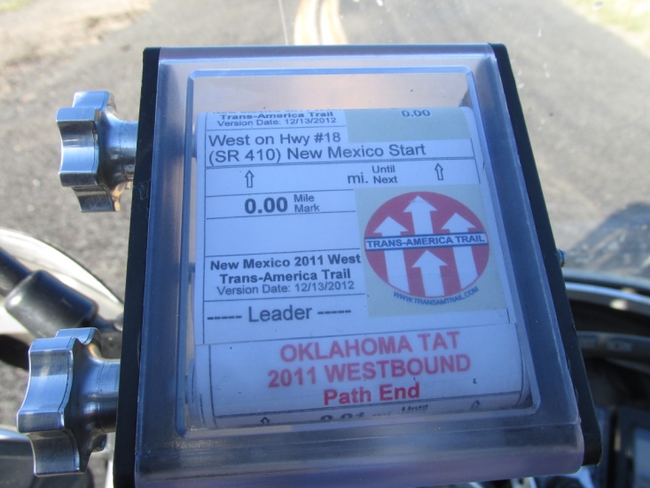 – Bob Haven (and my shadow) at New Mexico border Roll-chart Oklahoma – New Mexico border
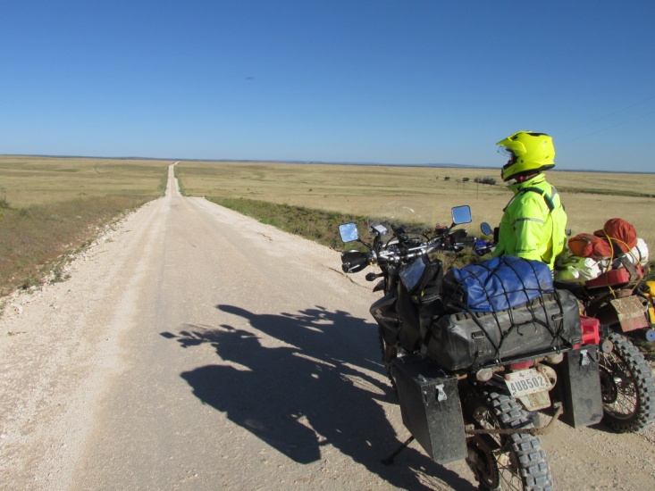
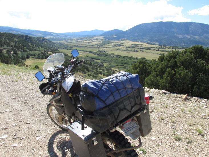
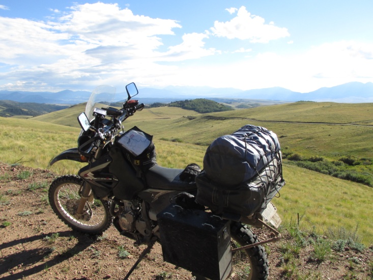
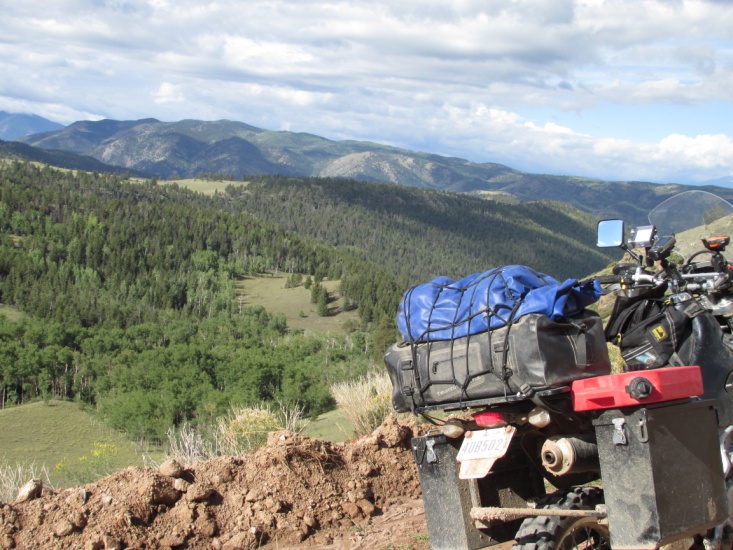
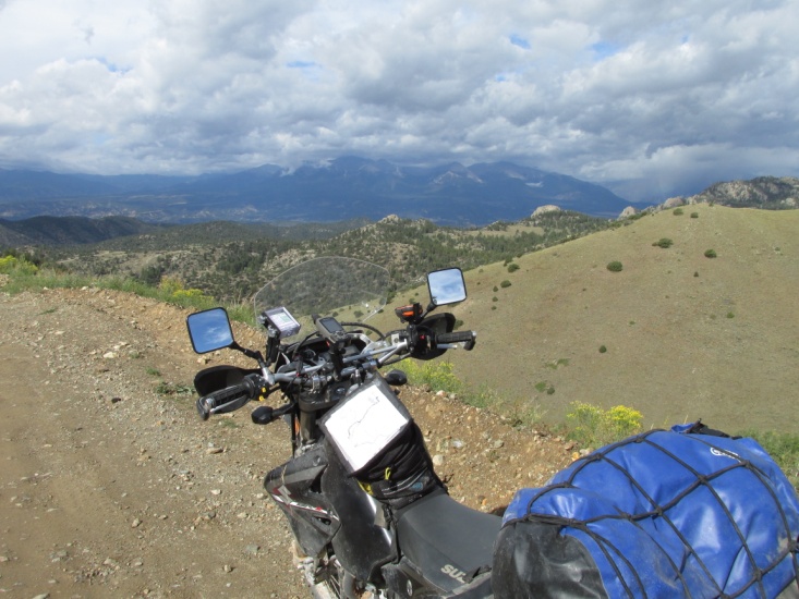
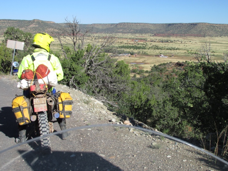 – Northern New Mexico ranch road Overlook east of Trinidad, CO
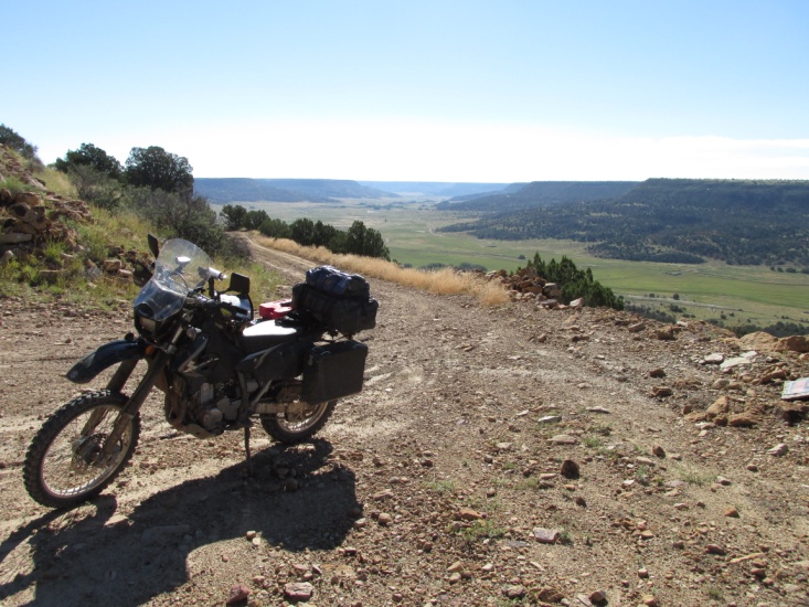
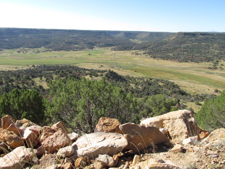 – Overlook east of Trinidad, CO
After lunch, Bob left for Colorado Springs planning to backtrack to Trinidad and ride the TAT all
the way to Oregon. I really enjoyed his company and wished I could ride with him on to Oregon. I heard from him later that he had to give up on finishing the TAT this year due to rain and washed out roads west of Moab. He hopes to try and finish next year. One thing I learned while riding with him was that he was running Tubliss inserts in his tires and I vowed to purchase some for my DRZ. They allow you to ride with very low tire pressure and if you pick up a nail you can simply plug the hole just like a tubeless tire.
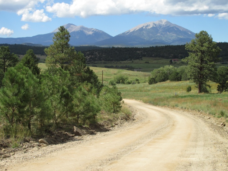
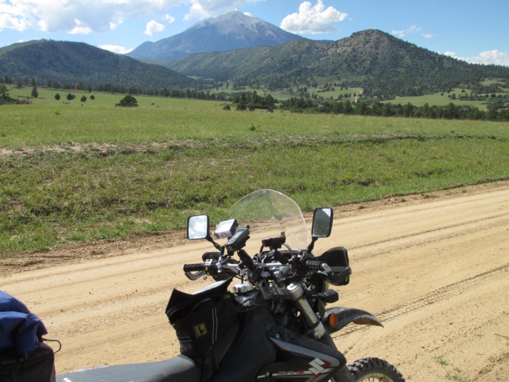
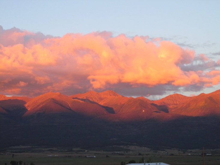
 I left Trinidad east of town parallel to I-25 and headed north and then west though high desert. The mountains loomed on the horizon to the west and shortly after crossing I-25 about 15 miles north of Trinidad I was riding mountain roads that were, without a doubt, the best ride of the trip so far. The roads were in fantastic condition and I passed through miles and miles of foothills until I began to climb and topped a pass at 10,652 feet. At that elevation it was cold so I bundled up in my jacket and left it on the remainder of the day. The scenery was simply amazing and I stopped often for pictures. My destination was Westcliffe, CO, a small town sitting in a high mountain valley surrounded by tall peaks. I arrived about 6:15 p.m. and found a really nice motel on the west edge of town. After a good supper I got my brother Dave on the phone in Canon City, CO and arranged to meet him and wife Pam 65 miles north in Salida, CO tomorrow for lunch. This was my longest day mileage wise with a total of 305 miles.
Northwest of Trinidad, CO

Four picturesque scenes between Trinidad and Westcliffe
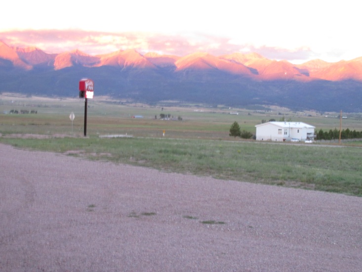
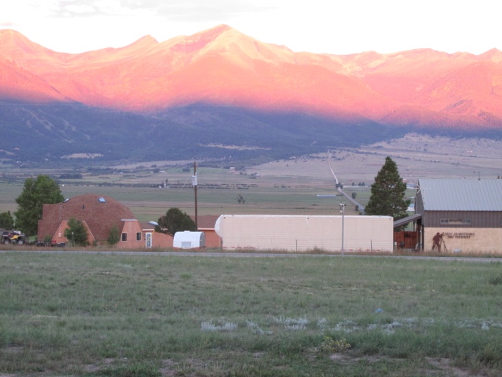 – Sunset on the peaks at Westcliffe, CO
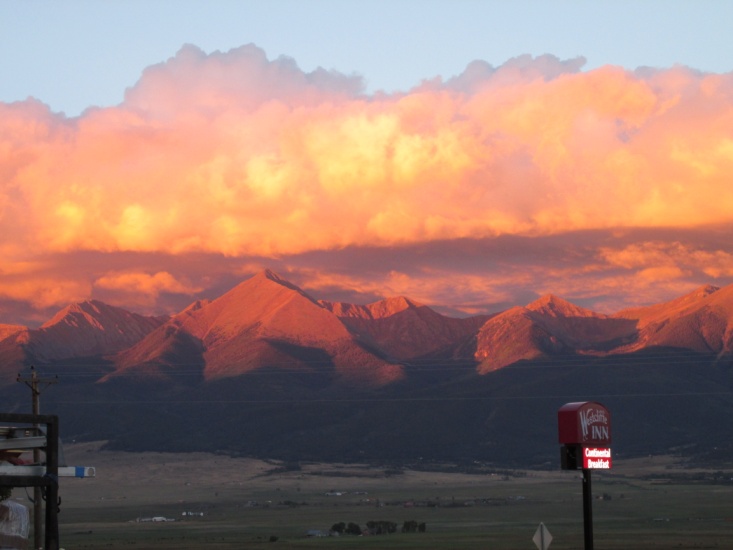
 – Sunset on the peaks at Westcliffe, CO
WEDNESDAY, 19 September 2013 (Day 11)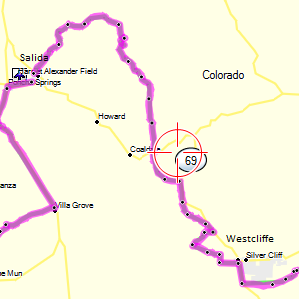
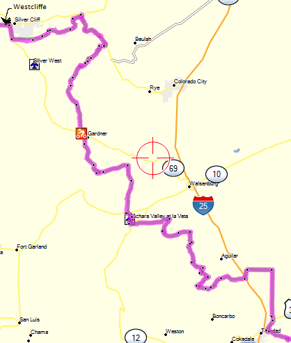
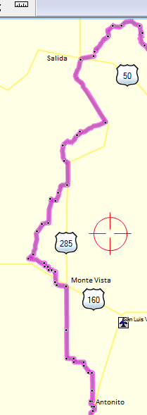
I ate a light breakfast at the motel and headed north out of Westcliffe around 8 a.m. The trail in the morning basically paralleled HW 69. Intermittently the trail would head off into the mountains and then come back to pavement. Eventually a nice twisty pavement turned off 69 into the mountains and dropped me into Cotopaxi, CO on US 50. As I headed north out of Cotopaxi the trail got interesting and rain clouds began gathering. CR-12 was paved for a few miles but then turned to graded dirt. I continued to climb to over 10,000 feet where the road became a narrow jeep road. By the time I reached these high elevations the rain had moved out ahead of me but it was quite chilly. The roads were not particularly muddy but very slick and I had to really pay attention. I came up on several hunters’ camps at that altitude and remained above 9,000 feet for many miles until the road began to gradually descend toward Salida. I arrived in Salida about 11 a.m. having traveled about 70 miles.
 – Mountain scenes between Cotopaxi, CO and Salida, CO
While waiting on Dave and Pam, I rode all over Salida trying unsuccessfully to buy a front inner-tube. My spare tube in my Moose fender bag had fallen off my bike somewhere along the way. Beware … as big as the town is there is not a single motorcycle store in town. Dave and Pam traveled over the mountain from Canon City in their 4 wheel drive Pathfinder on some of the same roads I had ridden and arrived about an hour later. After lunch and a good visit I said goodbye and left Salida on US 285 headed south. It was goodbye also to the Trans-America Trail for this year with plans to ride the second half starting in Salida in the summer of 2014.
![]()
HEADING HOME
 My plan was to meet my wife Lyn in Santa Rosa, NM on Friday the 21st and trailer the rest of the way back to Lubbock. I had laid out a route through southern Colorado and northeastern New Mexico with about 50/50 dirt and pavement. As I rode south on US 285 at over 8,000 feet, the DRZ didn’t want to take throttle due to the elevation and I had to gradually creep up to 60 mph. I came to the first dirt section and headed into the mountains west of 285. After about 10 miles the graded road tuned into a really washed out jeep road that headed up over a 10,000 foot pass. I quickly decided the smart thing to do was head back to 285. After riding a little further south I again tried a dirt county road that soon turned into a goat path after a few miles, so it was back to the highway again. At that point I gave up and rode the chilly 28 miles of pavement on into Monte Vista, CO. where I had planned to find a motel. It was only about 3 o’clock so I decided to head on further south where I finally managed to pick up some dirt roads. I rode the 40 miles of dirt into Antonito, CO with thunderstorms building all around me and got a motel on the edge of town. After checking in I met a couple of guys who were there to ride the narrow gauge train, one of whom was an avid motorcyclist. Later that evening I went to a local café to eat and after sitting down the two guys (don’t remember their names) came in and ate supper with me. We had a nice visit talking about bikes and my trip. About dark the storms moved in and it rained a big part of the night. Since leaving Westcliffe that morning I’d ridden about 230 miles.
THURSDAY, 20 September 2013 (Day 12)
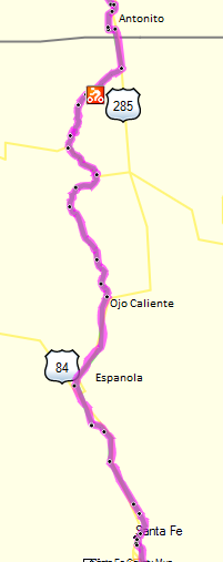 When I left Antonito about 8 a.m. the skies were still threatening but I headed south down US 285 into New Mexico. I planned to turn west into the mountains just south of the New Mexico line and ride some of the forest service roads I had ridden last year on the Divide Trail. On my first attempt the road was too muddy so I went a few miles further down 285 and turned west on FS87. It was muddy but I was able to stay in the ruts made by hunters and quickly gained some elevation. In some places the road had mud bogs due to the hunters’ trucks but I managed to make it to US 64 west of Tres Piedras. From there I had a good ride on mostly dirt NM-111 until I again intersected US 285 just north of Ojo Caliente. I continued down 285 to Espanola, had a burger, then enjoyed a scenic ride on NM-590 into Santa Fe. I checked in early to my motel and then found a movie nearby. The skies had cleared and it was a really pretty day. I rode only about 150 miles for the day.
FRIDAY, 21 September 2013 (Day 13)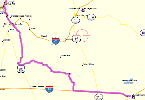
 My plan was to meet Lyn at noon in Santa Rosa so I left Santa Fe about 8 a.m. and briefly headed east on NM 300 which runs parallel to I-25 on the north side. I turned south on CR-51 which wanders south across rugged ranchland until it eventually intersects US 285. It was a good ride although there were lots of small mud bogs. After riding south on 285 for a mile I came to CR-24C. Interestingly, the road was marked as a dead-end. I knew that my paper maps and Map Source showed it to go on through so I decide to chance it. At first it was in decent condition but then became deeply rutted and very muddy. It was a beautiful ride between some large mesas so I took my time and eventually made it through to pavement at NM-3 which took me south 10 miles to I-40. The day was overcast and chilly so it was a cold 43 miles on I-40 into Santa Rosa. Lyn was a sight for sore eyes and right on time so we loaded the bike, ate some lunch, and headed the 200 miles east to Lubbock.
EPILOGUE
As I think back on the trip I am once again grateful to have had the time and money to ride the eastern half of the Trans America Trail. I’m especially grateful to my patient and understanding wife for her encouragement to make the ride. A year ago, after finishing the Continental Divide Trail, I wasn’t really sure if I wanted to continue to ride dual-sport. However, after riding the TAT, all I can think of is planning my trip to finish the western half and then making more trips. A great deal of my renewed dual-sport enthusiasm has to do with the Susuki DRZ400 S. It is such a lightweight and stable bike and off-pavement I felt much more in control of the bike than I did on the KLR 650. I found my panniers somewhat dangerous as they painfully banged my calf anytime I dabbed a foot so I sold them and purchased soft-bags and frames from Wolfman. Also, I purchased Tubliss inserts but will wait to install them until I get new tires.
As for making the ride solo I have no regrets. I really enjoy riding with friends and appreciate the added element of safety … but riding solo is also great fun and offers a unique sense of adventure. Jerry Lewis, March 2014