The Lone Star Loop
Designed & Ridden by Jerry Lewis
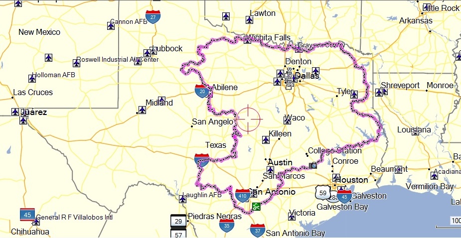
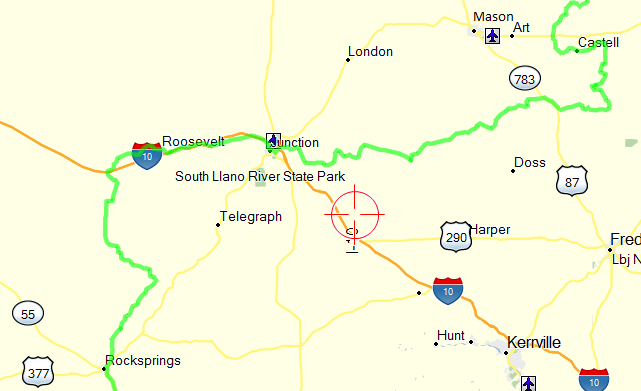
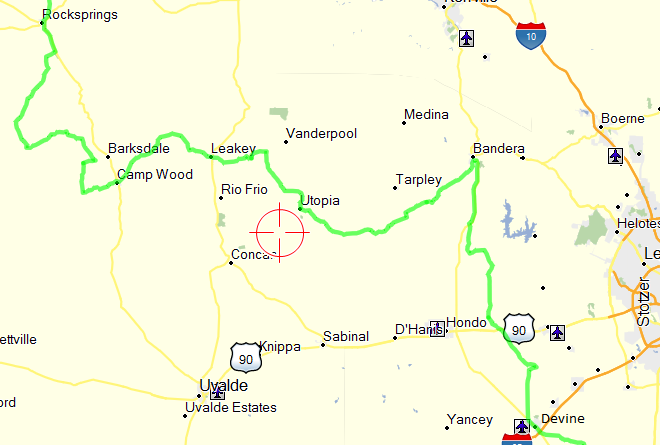
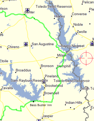
The Lone Star Loop is a 2,200 mile Dual-sport motorcycle loop in Texas. Loops are ideal for dual-sports in the sense that a rider can join the loop at any point and when finished they are back at the point they began.
I began working on the Lone Star Loop in the fall of 2014. My goal was to design a dual-sport motorcycle loop around Texas that consisted of eighty percent dirt roads. Using a current issue of Roads of Texas map book and Google Earth l searched for roads that appeared to offer somewhat challenging and scenic rides.
Once I had connected the various sections I verified the roads were indeed public-access county roads using TXDOT’s on-line grid map system. Finally, I “flew” the entire 2,200 miles of the Loop at a low altitude again using Google Earth.
I posted the Loop on the Two Wheel Texan forum and received a good bit of interest and suggestions. Some portions were ride-verified by me and a few members of the forum. However, only about 25% of the roads were verified prior to my planned trip to ride the entire Loop in September 2015.
I was hoping that riding buddies Yancey Jones and/or Greg Camp would join me for the ride but both had health issues so I decided to make the ride solo.
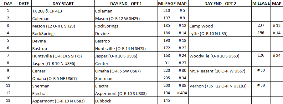
Below is my planned itinerary for the Loop. The only time I deviated from the plan was the last two days as recorded later in this report.
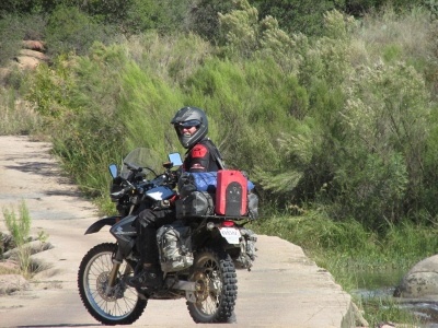
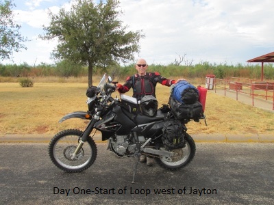
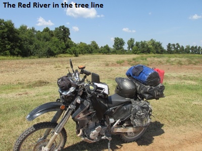
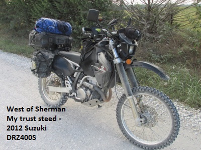
Me and my ride … 2012 Suzuki DRZ400-S

Lone Star Loop – Ride Report
Day One – September 18, 2015
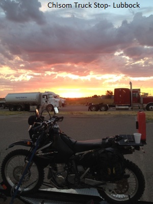
My good friend and sometimes riding partner, Yancey Jones, agreed to haul me and my Suzuki DRZ 400S about 75 miles east of Lubbock to join the Lone Star Loop. After a good truck-stop breakfast Yancey dropped me off about 9 a.m. at a road side park on US 380 a few miles south of Jayton. I rode about 3 miles of the Loop and suddenly remembered I hadn’t reset the stats on my GPS. After stopping to reset the GPS, I rode a few more miles and noticed that my green track-line had vanished from the GPS map page. I checked and sure enough all my tracks were deleted when I reset the stats. I pulled off and quickly unpacked my laptop and then transferred the Loop tracks back to the GPS. As an alternative I could have relied on my paper maps in my tank bag but the GPS track saves a lot of time.
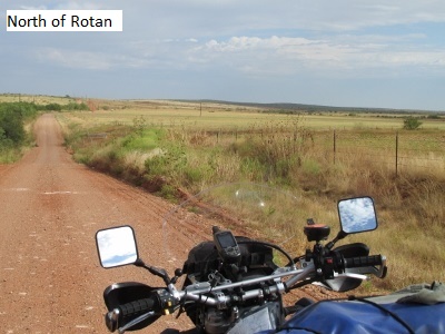
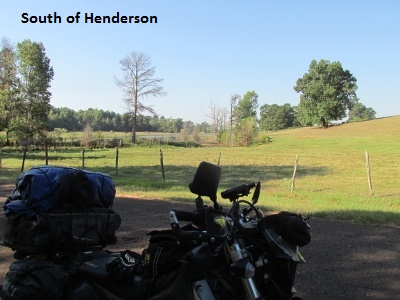
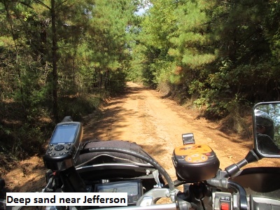
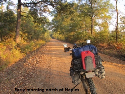
 The morning was pleasant with a small thunderstorm building just to the west of me. The roads were in good shape except for occasional patches of sand. Saw lots of quail early, some turkey, and even a large red-tail hawk checked me out. The hunters were out in force setting up their camps. I rode into Hamlin about noon after covering 85 miles. It was already in the mid 80’s so I went in the DQ to eat and cool down.
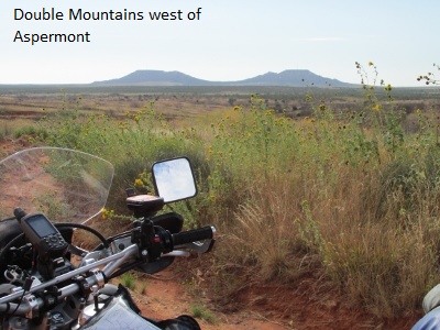
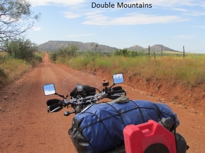
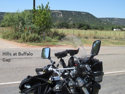
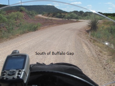
After lunch I covered the 45 miles to Abilene without incident as I observed B-1 bombers circling overhead. The temp was now in the mid 90’s so I gassed up at a convenience store and took advantage of their AC while drinking some Gatorade. The Loop south out of Abilene necessitated several miles of pavement to Buffalo Gap and then a bit more before finally hitting dirt again. The terrain around Buffalo Gap was very green and hilly. The roads were mostly good graveled surface but eventually turned into some two-track across a ranch that was a bit more interesting. The best riding of the afternoon was across a different ranch south of Novice and east of the SW Oilfields.
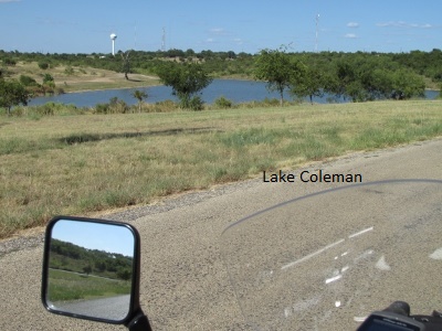
I rode into Coleman about 4:45 having covered 227 miles. It was really hot so I checked in the Budget Inn, unloaded the bike, and turned the AC on high. Later I went to Pizza Hut for supper, gassed up and located Tiffany’s which is my breakfast destination in the morning.
It was a good first day and a fun ride even though I have ridden all of these roads on previous trips. The bike performed flawlessly but early on I had some misgivings about my new Pirelli front knobby (Dunlop 606 rear tire). I mistakenly ordered the soft-terrain version of the Pirelli which has a different knobby pattern. It was really squirrely at first, especially on pavement at 65 mph. But even in the dirt I didn’t trust it. By the end of the day it was better … don’t know if the tire just needed breaking in or if I simply got used to it.
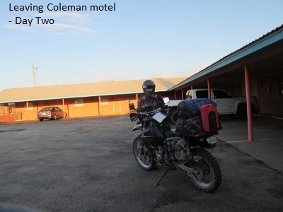
Day Two – September 19, 2015
My 69 year old body was a little stiff as I fell out of bed a little before 6 am. I immediately checked the weather on my I-Phone. I had gone to bed concerned it might be raining as a front was due to arrive during the night with a forecast of rain. Fortunately radar showed the rain to be north of Coleman. After a hardy BEBB (bacon-egg-biscuit-breakfast) at Tiffany’s I loaded up and was on the road by eight.
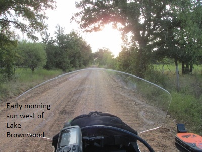
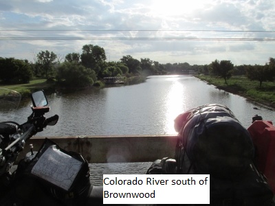
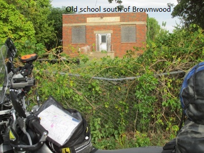
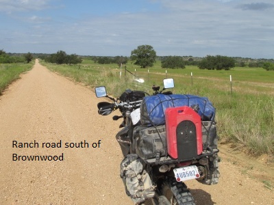
The morning was nicely cool with partly overcast skies. Just west of Grosvenor I played dodge-the-deer a couple of times. The Loop meanders around the north and east side of Lake Brownwood. A lot of the road surface is bitumen even though they are only county roads. It was a really pretty and pleasant ride that eventually intersected US 277-67 at Early just east of Brownwood.
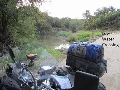
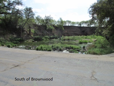
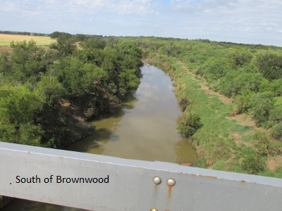
As I traveled south of Brownwood I was riding some roads for the first time. Again some of the roads were bitumen but I didn’t mind as they traversed pastoral ranch scenes and crossed several creek-bridges and low water crossings. I came upon about 15 buzzards feasting on a young deer. They took flight as I passed by but some of them swooped back down toward me to see if I was edible.
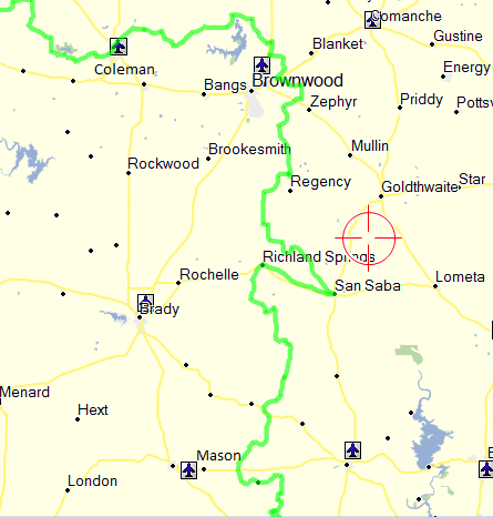
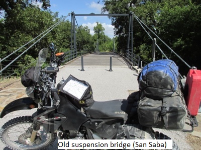
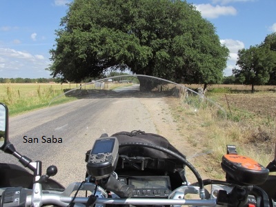
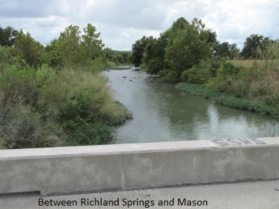
The Loop takes an easterly turn to San Saba and then sharply back west to Richland Springs. I designed it that way because one, it is a nice ride and two, because there is lodging in San Saba which is scarce south of there. I arrived in San Saba about noon and encountered a brief shower while I grabbed a bite and gassed up. As I Left town I noticed more clouds were building to the south and west.
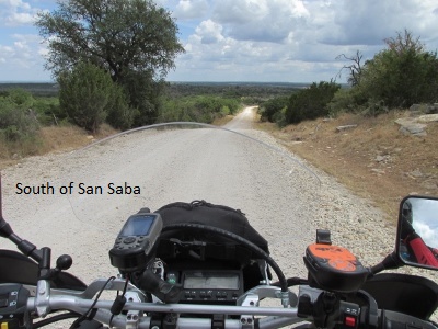
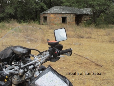
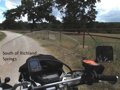
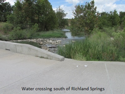
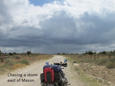
The roads south of Richland Springs are really great, with miles and miles of two-track that meander across several remote ranches. In several places there are nice vistas overlooking green pastures dotted with cattle and live oaks. The clouds grew darker and one storm that appeared to be in my path was putting out some serious rain. As the road continued to alter direction, I changed my mind about ten times as to whether I would ride into the storm or miss it. Finally, at the last possible minute the road turned east and I just got a few sprinkles. As I traveled further south congratulating myself on my good fortune, low and behold the road turned back west and I caught the back side of the storm. I got a little wet and rode for a ways on some squirrely wet caliche the storm had left in its wake.
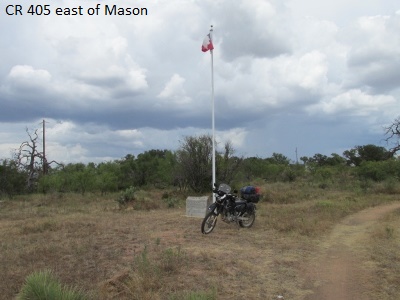
The really interesting thing is the rain and overcast brought out the deer in droves. A couple of times I literally had to lock up the brakes when they crossed my path. I decided to be safe and slow it down a bit. I saw 25 or 30 deer in a ten mile stretch near Lone Oak Mountain northeast of Mason.
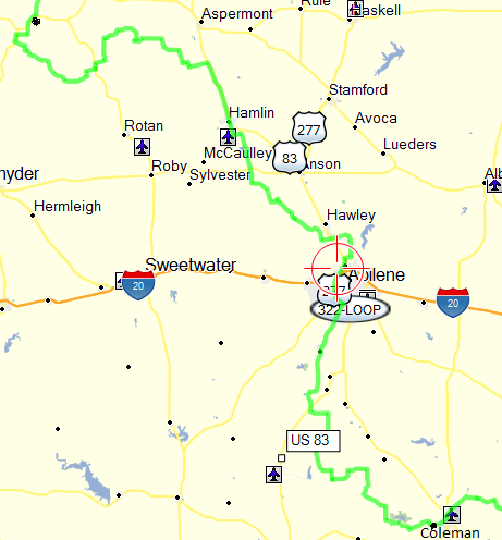
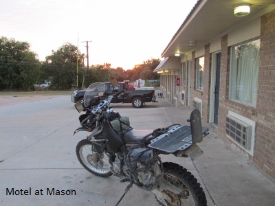
I intersected SH 29 and traveled 12 miles west to Mason where I had a room reserved. I rode a total of 215 miles and arrived about 3:45 pm. Excellent day, great roads!
Day Three – September 20, 2015
(The deer 1, Jerry 0)
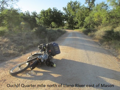
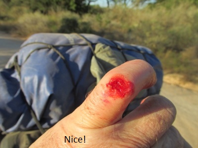
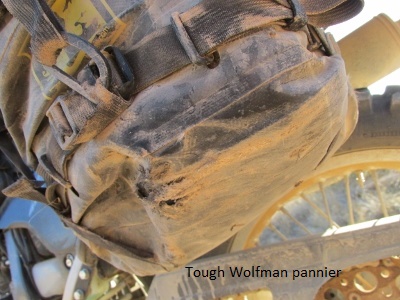
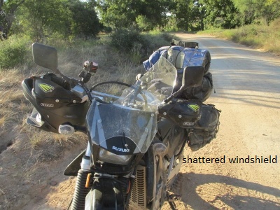
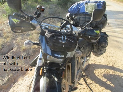
After enjoying another excellent breakfast in a 110 year old building in downtown Mason I was on the road by eight. I had 12 miles of asphalt to get back to the Loop so I slipped on a sweatshirt. 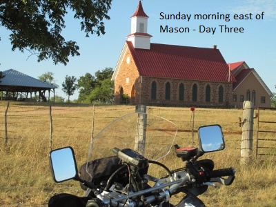 Bauerville Road is the county road that heads south from SH 29 toward the Llano River. The road is basically one lane comprised of hard-pack dirt covered in BB size gravel with brush and trees growing right to the road edge. I was standing on the pegs and running about forty just feeling the groove. Suddenly I saw a good size deer coming through the brush from my left at a dead run and about to cross my path. All those things you read and practice about panic stops went out the window as in that split second my brain was yelling “STOP!” I slid for about 75 feet (I later measured it). Still sliding, and just as the deer passed five feet in front of my nose , the back tire came around and I did a low-side crash before sliding another 40 feet. I switched off the still running bike and lay with my leg under the bike for a few seconds while I took an inventory of body parts. After I got myself and the bike off the ground (no small feat) I noticed my left pinky was stinging. When I got my glove off, my knuckle was a bloody pulp with a small hole down to the bone. My windshield was broken and my left pannier had a small hole … other than that the bike was okay. After a little first aid for my finger, I cut the rest of the windshield off with a hacksaw blade (never leave home without one) and continued my “adventure”.
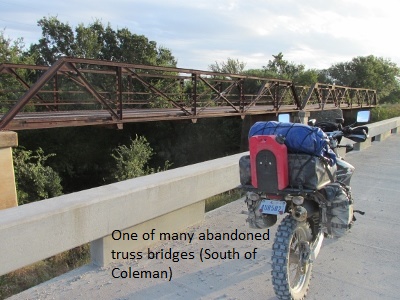
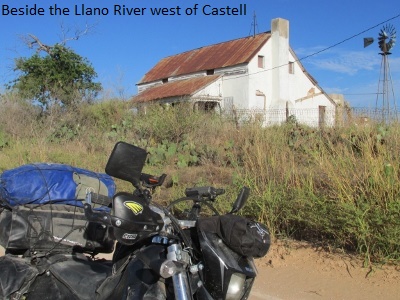
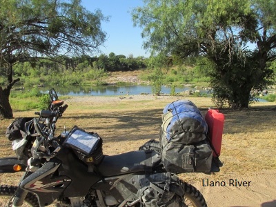
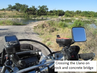
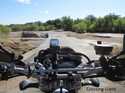
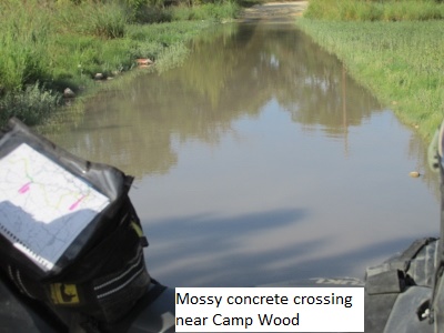
Riding a bit slower and more alert I passed the tiny town of Castell, then crossed the Llano River on a bridge of large rock with a layer of concrete and continued south. When designing the Loop and “flying” it in Google Earth, I had noticed and was a little concerned about the large number of low water crossings on this section. As it turned out, many of them were dry slabs of granite. However, three times I crossed creeks running 6-8 inches over the rock bed. These were extremely slick with moss (think James River Crossing), so I crossed in first gear with my boots in the water and sliding flat on the mossy rock like training wheels. It was still squirrely, but I didn’t fall. I saw a lot more deer and came across numerous old two-story stone ranch houses dating from the 1800’s.

Most of the Loop roads so far have been Class 1 roads (Improved dirt, gravel, etc., passable by any motorcycle capable of off-pavement travel). That rating, however, covers a wide spectrum of road conditions. Portions of CR 410 east of Junction I would rate as Class 2 (Poorly maintained dirt, gravel, etc. Rocks, sand, mud holes, ruts, inclines, water crossings, or other similar obstacles make this road difficult for larger, heavier adventure motorcycles and requires some rough terrain riding skills) but still doable for most dual sport riders.
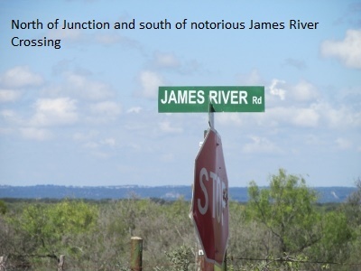
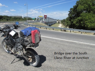
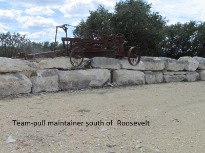
I arrived in Junction about 12:30 and grabbed a cheeseburger at Isaac’s. I bought some first aid supplies for my pinky and a set of “deer whistles”. I know all the arguments … no one has ever proved if they work … but if they scare away 50% of the deer that’s 50% I don’t have to worry about. I’ve spent a lot of time riding both on and off road in the Texas hill country and I have never seen such a large deer population. I’m sure I surprised over a 100 deer today. After I installed the whistles it honestly seemed as though the majority of the deer ran away from me at a right angle. I left Junction headed west on FM1674 paralleling I-10 for about 15 miles to Roosevelt.
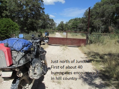
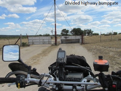
I continued west on CR 260 and CR 307 easing over some more mossy, low-water crossings. For the last leg of my day’s ride I crossed I-10 and rode south on Edwards County Road 930 which crosses about 30 miles of great ranch country. One 15 mile section had ten “bump gates” and six “get-off-and-on gates”. FYI … a bump gate is a free swinging livestock gate with a counter weight. You push the gate with your front wheel or bumper … the gate swings open while you quickly drive through, then the counter weight closes the gate. Along CR 930 I saw many more deer, even some “exotics” with long straight vertical horns.
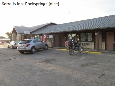 Hot and tired I rolled into Rocksprings about 4:30, grateful for a really enjoyable ride and a respite from in-deer-ing moments. The mom-and-pop Sorrells Motel in Rocksprings is small but by far the best I’ve stayed in thus far. Mileage for the day was 192, shortest day so far.
Day Four –September 21, 2015
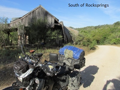
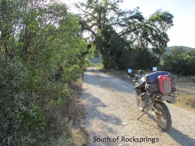
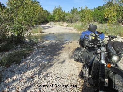
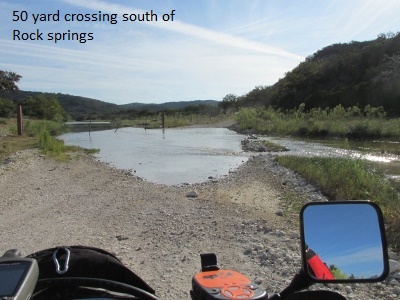
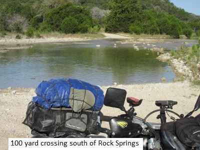
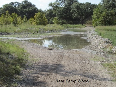
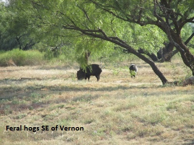
Rocksprings, being the small town that it is, had no restaurants open for breakfast. So I settled for a breakfast taco and coffee at a convenience store and was on the road at eight. South of Rocksprings I turned west off SH 55 onto CR 3220. Initially the road had some short stretches of moderate sand but it soon turned very rocky with some minor wash outs. It was a good ride but a good deal more technical and much of which I’m sure would rate a Class 2 dirt road designation. There were fewer deer but enough to keep me cautious and my speed down. I passed through 12 bump-gates and half a dozen get-off-and-on gates before I made it back to SH 55 at Camp Wood. There were also several water crossings, one of which was 100 yards across and two more that were 50 yards across, all a foot or more deep. At one point a family of feral hogs crossed my path about 50 yards in front of me. In this area I also saw the biggest, fattest jackrabbits I’ve ever seen. The terrain was much dryer southwest of Rocksprings with thick cedar and live oak growth. It took me just shy of three hours to ride the 55 miles to Camp Wood due to opening the gates and the more technical roads.
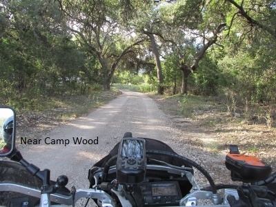
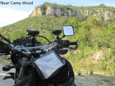
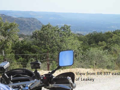
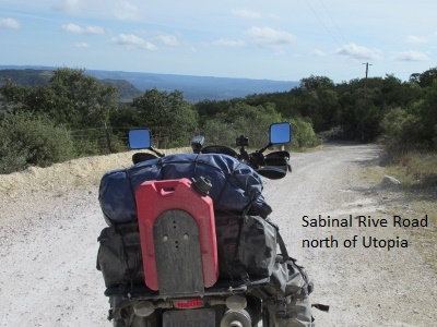
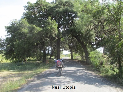
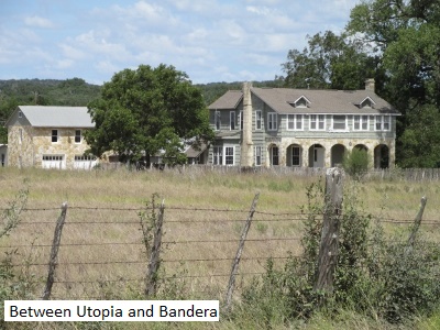
There aren’t any county roads that connect Camp Wood and Leakey so I rode RR 337, one of the “three twisted sisters”. If you gotta ride asphalt, RR 337 is a great ride. I continued on RR 337 past Leakey to the intersection with the Sabinal River Road which is mostly dirt and takes you south into Utopia.
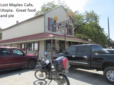
I had hoped to time my ride where I could eat lunch at the Lost Maples Café in Utopia. Sure enough I rolled in at exactly noon and had my usual cheeseburger and pecan fudge pie.
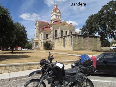
The afternoon took me mostly east on a mixture of easy dirt and bitumen county roads until I arrived at Bandera. Again, asphalt into Bandera and back south was a routing necessity because of the scarcity of county roads. There are plenty of county roads but most turn private after a few miles.
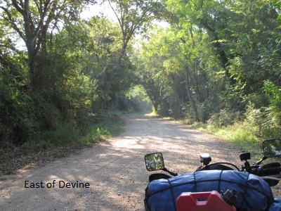
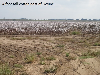
Eventually I turned off on CR 251 and continued south on mostly dirt until I arrived in Devine at about 4 pm. I got a decent motel in Devine at the junction with I-35. It was really hot this afternoon … near 100. The best of the ride was before noon, but all in all it was a good day’s ride of 195 miles.
Day Five – September 22, 2015
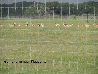
I had to settle for McDonalds in Devine … once again not a breakfast restaurant in town. I needed to do a little Mapsource housekeeping on my laptop so I didn’t get away till 8:30. The Loop took me southeast from Devine toward Pleasanton. Got into some moderate sand on a few of the roads … some of it deep enough for a little pucker factor. I really don’t like sand! I came upon a feral hog and a few deer early … even rode by a couple of deer farms. The roads were anything from two-track through brush to wide, smooth gravel. After the last two days in the hill country the roads seemed pretty tame and scenery less dramatic. At this point in the Loop the county roads mostly just routed me around highways and cities.
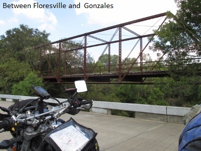
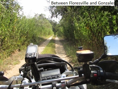
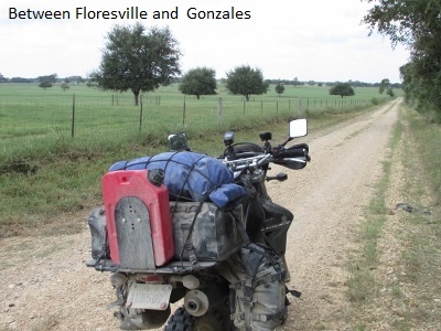
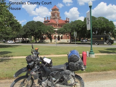
After 100 miles I detoured 3 miles south and ate at the Texas Stop Sign (Dairy Queen) about noon. The scenery in the afternoon was a little prettier and I even saw some evergreen trees of some type. I passed through Gonzales and took a couple of pictures but it was too hot to do any historical sightseeing. Just a casual observation … the economy in the area seems a little depressed.
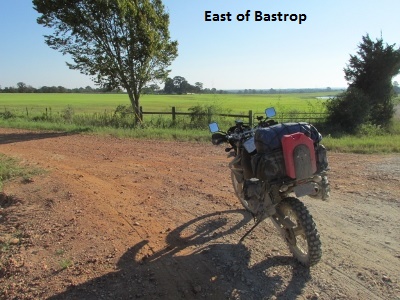
 I got into Bastrop a little after four and got a really nice room, or so I thought, at the Bastrop Inn. The afternoon was really hot and the day was pretty much uneventful. But it was great just being on two wheels and riding off the beaten path. My mileage for the day was 206.
Six – September 23, 2015
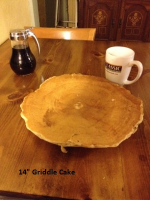 Up at six and looking forward to a real breakfast. I discovered Maxine’s on Main Street in downtown Bastrop. I highly recommend Maxine’s and her Willy’s special … eggs, meat, grits, and a 14“ griddle cake that literally hides the plate by a couple of inches. I only ate a fourth of the griddle cake.
The motel AC quit working during the night and the room got pretty warm. When I informed the proprietor the next morning he got angry, erroneously thinking I was trying get a refund.
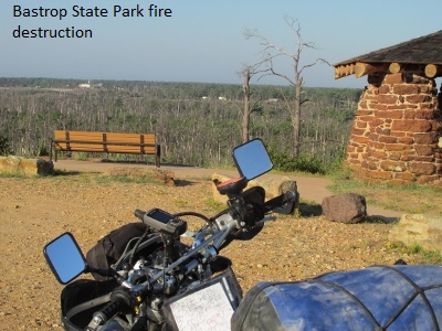
By the time I don my riding pants, boots, and armored jersey, and then load the bike with gear bags, tank bag, GPS, and Spot Tracker it takes me a good half hour to be ready to ride. It was 8:30 when I headed east through Bastrop State Park.
I remember reading about the fire in the park back in 2011 but had never seen the devastation. The lady park ranger routed me a different way through the park, because the roads I had included when designing the Loop were closed. I enjoyed the ride through the park anyway, as some sections were untouched by the fire. (I’ve since made changes to the GPS files to reflect the new route.) The morning was cooler and the scenery more pleasing … in some ways the most pleasant part of the Loop thus far.
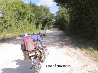
 About noon and 100 miles into the day, I arrived at Washington-On-The-Brazos. I stopped at the state run museum located there and spent a very pleasant hour at a really great facility. I few miles later I stopped in Navasota for gas, an energy bar, and some Gatorade … no lunch for me after that huge breakfast.
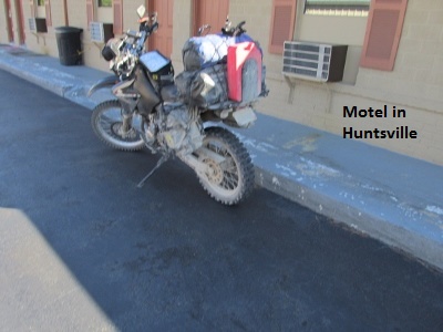
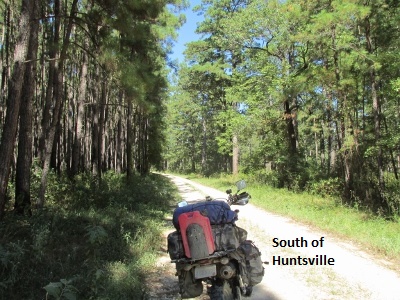
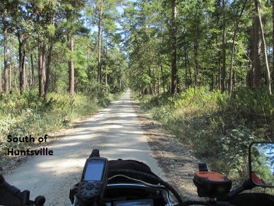
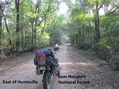
 The highlights of the afternoon were the roads through Sam Houston National Forest. It was awesome riding the good two-track roads through a tunnel of 100 foot pine trees and breathing the strong and fragrant pine scent. I was enjoying it so much, I went 3 miles past my turn and had to double back to New Waverly, leaving the Loop there and riding SH 75 north into Huntsville for a motel.
I arrived about 4:30 at the Baker motel on SH 75 (business) and found a great place for supper at the Farmhouse Café. It was a superb day and I covered 195 miles. I’ve ridden right at 1,200 miles since last Friday, September 18th.
 When you’re riding solo mile after mile, you have too much time to think and I found myself getting philosophical about the Loop. There was a lot of pavement today. Some of it was merely connecting highways but a lot of the county roads had varying forms of asphalt topping. I realized I was feeling the need to apologize to hypothetical future riders because there was too high a percentage of asphalt. I decided my regrets were irrational because, 1) no one else may ride the Loop anyway and, 2) the bikes we ride are called “DUAL SPORTS”. That means dirt AND pavement … and not knowing when or if the road surface will change is part of the “adventure”. The special thing about riding dual-sport to me anyway is seeing the back-road beauty and history that is hidden from the view of the majority of travelers. Please excuse my musings …
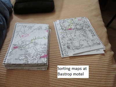
Each night at my motel I typed up the days ride and posted it on the Two Wheel Texan forum. I posted the following note at the end of Day 6 (A disclaimer: Anyone on the forum reading my ride report may wonder why I include some of the stuff I do. When I do a long ride I make a ride-book which includes pictures and my ride report narrative. So the stuff I include in my posts is what will be in my ride-book.)
Day Seven – September 24, 2015
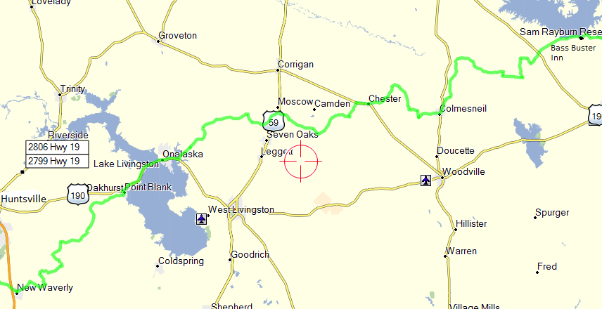
I once again settled for a “golden arches” breakfast and then left Huntsville about 8:30. I began the day on asphalt quickly traveling the 12 miles south back to New Waverly to rejoin the Loop. The morning sky was clear and at 64 degrees it was the coolest so far. The morning roads were more of yesterday’s offering … an assortment of asphalt, gravel, dirt, and sandy two-track. I’ve been surprised at how sandy the soil is in this part of the state, and of course that translates into sandy dirt roads. The scenery was excellent as I traveled rural lanes bordered by beautiful green pastures, and then the next moment I would be enveloped by a dark tunnel of pine trees.
I spooked a few deer this morning, but no close calls. I’m sure these forests are full of deer but they seem content to avoid the roads. Near Point Blank and US 190, I checked out a dirt road I had earlier made a note of that would negate about 10 miles of pavement. The problem was that Roads of Texas and the TXDOT grid map showed the road open but Garmin’s City Navigator map doesn’t show it to go through to US 190. In fact, the road does connect to US 190, so I have changed the Loop to correspond.
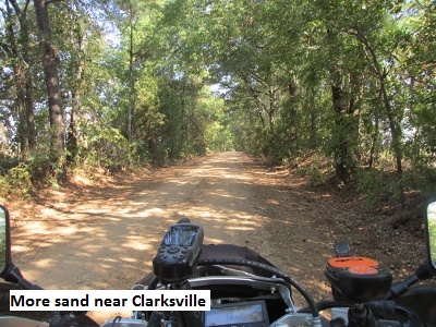
With 115 miles under my belt, I stopped about 12:30 at the Texas Star Café in Colmesneil. The food was great and it was a nice break with the mercury already pushing 90 degrees. Shortly after lunch I turned north onto CR 3325. Much to my chagrin, I encountered the deepest and longest stretches of sand so far on the Loop. I made it through without crashing but was relieved to get beyond it.
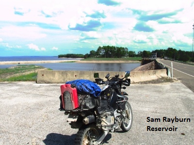
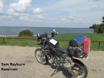
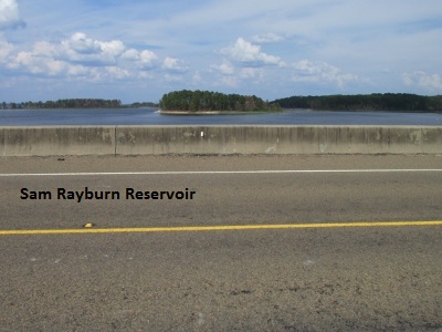
I had planned to go off-route 10 miles south to Jasper having made a reservation there. As I came over the Sam Rayburn Dam on RR 255 I noticed the Bass Buster Inn, a fishing lodge I’d seen earlier on Google maps when planning my itinerary. I had dismissed it as an option because I wasn’t sure if gas and eats were available nearby. Fortunately, there were both right across the parking lot, so I canceled my reservation in Jasper and got a room.
I parked in front of my room still wearing my armored jersey, riding pants, and helmet. A lady from the room next door was sitting outside with her blue heeler. 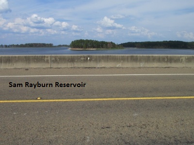
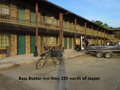 When the dog started to growl at me she told me not to worry … it was just that the dog wasn’t used to seeing someone dressed up like Spiderman. I was appropriately insulted but I gave her my most humble smile. The good news was that staying at the Bass Buster saved me the additional miles of highway riding to Jasper and back. This change in lodging also gave me my shortest day so far of 163 miles.
Day Eight – September 25, 2015
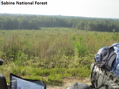
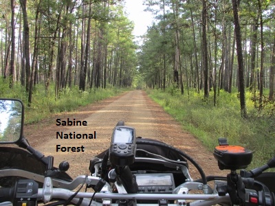
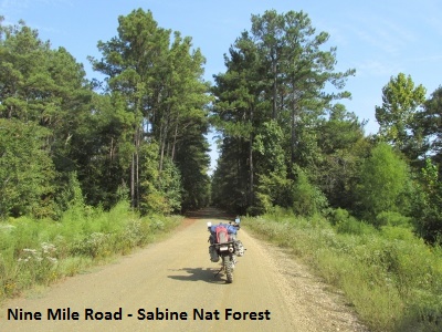
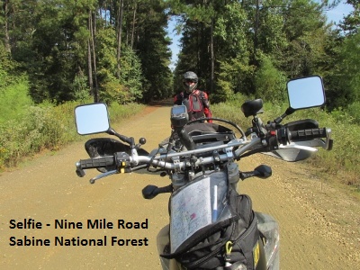
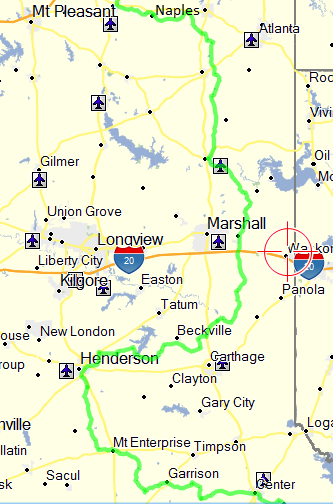
I enjoyed another great artery-clogging breakfast worthy of any dual-sport adventurer. I left the Bass Buster Inn at 8:30 heading east into the morning sun. A few miles of RR 255 and I turned north on CR 1105 due to my longing to ride a little more SAND (yeah, right!). The good news was that very shortly the road surface got better and I noticed even the forest soil was getting darker and less sandy. The roads through the Sabine National Forest north to Yellowpine were really great due to the undulating and circuitous topography (Sorry, I have to use that phrase at least once in every ride-log.)

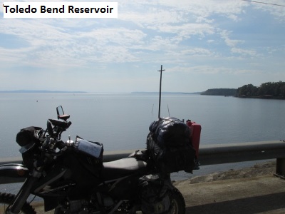
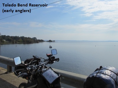
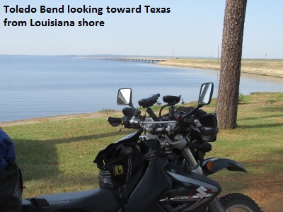
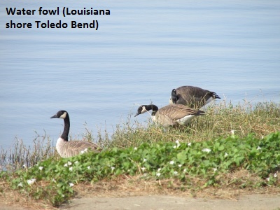
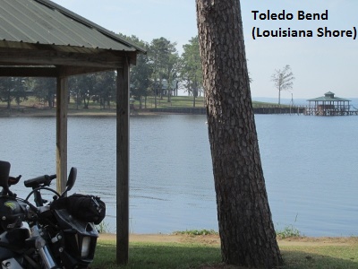
From Yellowpine, I rode US 87 to Hemphill then FM 3121 to SH 21. I followed SH 21 to the Sabine River Bridge and went off-route briefly to ride across Toledo Bend Reservoir to Louisiana. After shooting some photos looking back towards Texas, I precariously videoed my ride back across the bridge while holding my camera in my left hand. I really wish I would have sprung for a GoPro.
The dirt county road northeast from Pendleton Harbor was a good easy ride with more undulation (sorry). After a few miles I rode north on CR 140, the road that connects to Nine Mile Road. Nine Mile Road became a question mark as I originally planned the Loop. The word was that the east end of the road near Toledo Bend was closed, and no one was sure if it opened up further west. Well, the good news is, the road is open from CR 140 west. As I looked back to the east, Nine Mile was open as far as I could see but I didn’t want to take time to see how far it was open.
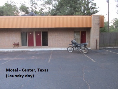
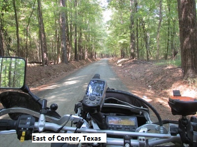 The rest of the roads through the forest were a good ride as they brought me into the outskirts of Center, my day’s destination. This day was planned as a short day to rest up a bit and do some laundry. I only carry enough changes of clothes for eight days. After a bite of lunch I drove all over town asking locals where a washateria was before I found the one I was looking for. (Center’s street layout is confusing with several highways and FM’s converging from different directions.) While doing laundry, I typed up my day’s ride (yes dear, I separated the lights and darks).
 I enjoyed some great Mexican food for supper at Las Margaritas on the square.
I’ve been blessed with no rain to speak of so far on the trip. I was concerned I might encounter some mud bogs as I did on the eastern half of the Trans-America Trail. One thing I’ve found unusual about east Texas weather is the absence of the wind (a constant where I reside in west Texas home). I mean not even a breeze. It’s been a good day with good roads. The mere 100 miles I rode today was a welcome break.
Day Nine –September 26, 2015
I couldn’t find a single breakfast café in town, so I had my first ever Whataburger breakfast … pancakes and sausage, not bad really. The temp was in the upper 50’s this morning so I put on my armored coat for the first time. I got away by 7:45 with the day ahead of me the longest I’d planned. 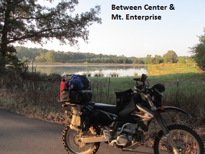
I think every rural house in this part of the state has at least three unchained dogs. I once read that the way to avoid dogs is to slow down and drop a gear then nail it just as they get close to you. It throws their timing off and they can’t change direction and accelerate quickly enough. I had plenty of opportunity to try it out this morning and it really works. (Except for the wile dog hiding behind a sign on a sharp right hand turn where I couldn’t speed up … he nearly got me.)
As the morning wore on, large percentage of the roads were single-lane tracks of either bitumen or oiled-dirt roaming through the forest. The hard road surface was really a good thing for me as otherwise I would have been enduring a lot more sand. As it was, I got into the deepest sand yet, once in the morning and once in the afternoon. The sand was 10-12 inches deep for long stretches. The sand in the ruts was only 3-4 inches deep but the trick was trying to stay in the ruts. On edge, I expected any moment to dump the bike.
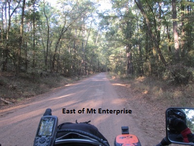
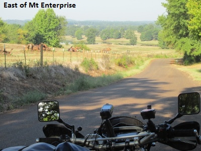
As I rode into Mount Enterprise, they were about to start a parade down Main Street. The high school band was getting ready to march so they waved me on by. The whole town was lined up along the curb as I passed by. They must have thought I was part of the parade in my “Spider Man” outfit because people started waving as I rode by. I thought about entertaining them with a wheelie, but figured I’d dump it in front of the whole town.
Got into Beckville about noon and ate a great cheeseburger at the convenience store grill … the only eating establishment in town. One of the things I really enjoy is riding through all these small towns while observing their old buildings and wondering a little about their history. Another of the things I’ve noticed is a lot of poverty in east Texas. The shacks and broken down trailers of these folks struggling to get by are scattered up and down the rural back roads.
Hot and tired from fighting the sand, I gutted it out until I made it to Naples. I then rode 4 miles west off-route to Omaha where I had a room reserved. I arrived about five at the Cajun Cowboy Motel … a well designed combination motel an RV park. It’s owned by a really nice older couple (really not much older than me), the Goforth’s . They also own a restaurant downtown where I enjoyed a good chicken fried steak while Mrs. Goforth quizzed me about my trip. So much for my cholesterol … “let’s see now, pancakes, sausage, cheeseburger, onion rings, chicken fried steak, french-fries, key lime pie”. I’m gonna do better tomorrow …
Mileage for the day was 230 and a total of 1,668 miles since I started the Loop, Friday a week ago.
Day Ten September 27, 2015
I was informed by Mr. Goforth that the closest place for breakfast was 4 miles east at Naples, so I loaded up and left about seven. Turned out the café in Naples wasn’t open on Sunday, so I sat down at the convenience store with some coffee and an apple fritter. An older gentleman came in and sat down at the next table and quizzed me about where I was from and what I was doing. As he told me about himself I learned he had lived in Naples for many years and had worked at a local steel foundry for forty of those years. I didn’t even know they made steel in Texas.
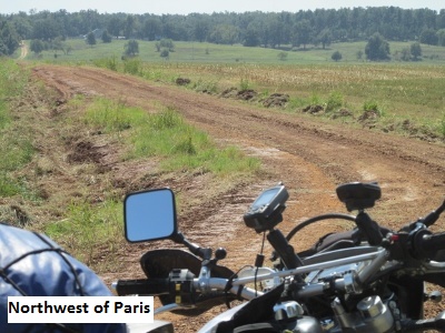
 As I attempt to describe the roads on the Loop I quickly run out of adjectives. That said, they were “excellent” today … almost all dirt and very little bitumen or sand. Many of the roads were roller-coaster like in the morning but then the terrain flattened out as I neared the Red River. One particularly good road was CR 2235 south of Manchester. Today there were still numerous trees, but now they were oak instead of pine. I had three deer run across my path about 30 yards away early this morning, and I played tag with canine mutts off and on all day.
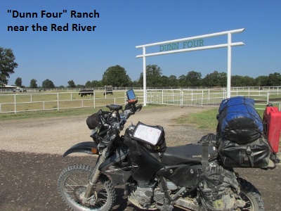
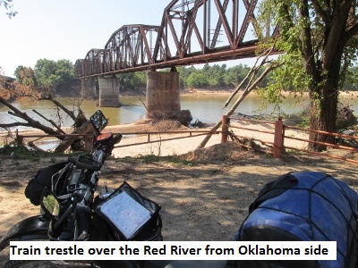
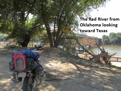
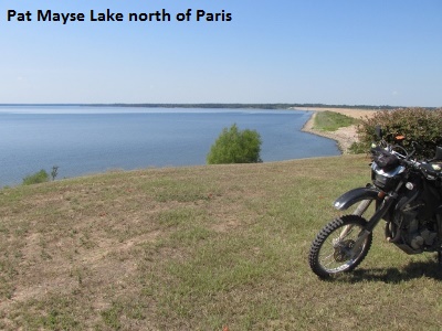
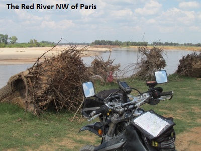
At the Loops intersection with US 70/271 I found there’s really no city at Midcity much less a town but there is a DQ where I grabbed a bite around 11:30. I looked for gas but there was none to be had at Midcity and none 3 miles north at Arthur City on the Red River. Since I carry a one gallon Rotopax I continued on, assuming I would find a gas station somewhere along my route. I rode across the bridge at Arthur City (no city there either) into Oklahoma and shot a few pictures of the Red River. A few miles further west, I rode over the dam for Pat Mayse Lake.
Just south of Elwood I came upon the first “impassable” road closure of the trip. I had noticed a lot of trees down in the area as I traveled along CR 2105. After a short ways, I found the road barricaded with downed trees pushed into a pile by the county crews. I’m sure a tornado must have come through there in the recent past. Perhaps it was the one that hit a few miles north in Blue, Oklahoma back in May. In any case, I rerouted a mile south, a mile west, and a mile north and I was back on track. When I re-intersected the west end of CR2105 the road was closed back to the east also. It was clear that they plan on permanently abandoning that section of road so I changed the Loop track to correspond.
The afternoon wore on and so did I. It wasn’t as hot today but the continuous string of dirt roads and the frequent turns were making a slower day and taking a toll on my old body. As I neared 200 miles I still hadn’t found any gas, but I decided to push on and use my Rotopax if I ran out.
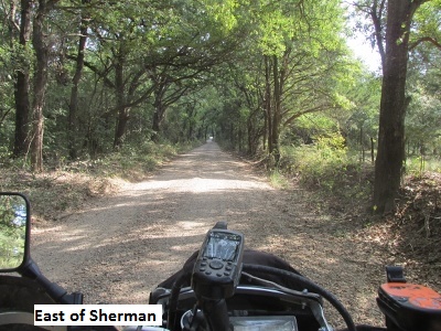 When I finally intersected US 75 Bus just north of Sherman and pulled into a station, the odometer read 234 miles. My larger tank holds 3.9 gallons and I filled up with 3.82. The saying “running on fumes” comes to mind.
The motel in Sherman I had planned to stay at was a dump. I checked three other older motels along Business 75 that apparently had people living in them. Wanted no part of that, and opted instead for a really nice La Quinta. Mileage for the day was 235.
Day Eleven – September 28, 2015
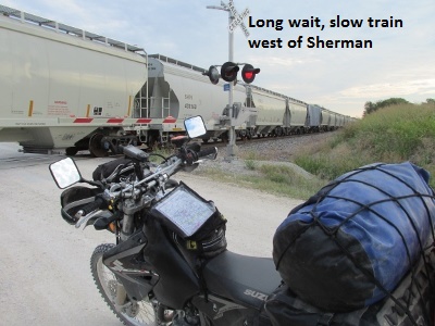
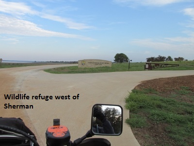
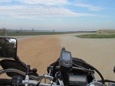
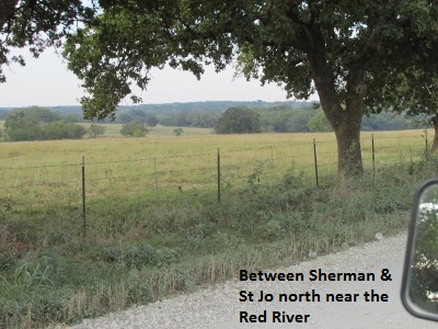
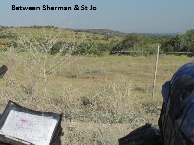
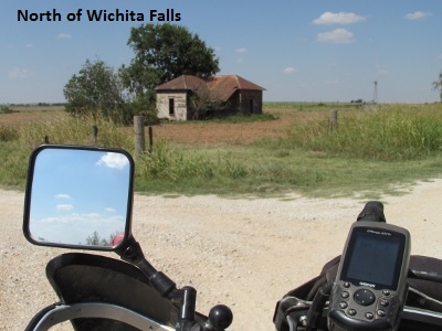
Having missed a traditional breakfast for a couple of days I pigged out on Mama’s Pancake Breakfast at Cracker Barrel. When I left Sherman about 7:45 it was a cool 63° but I elected to wear just a sweat shirt over my armored jersey. A thin ban of clouds obscured the rising sun keeping it in the 60’s until about 10:00. I was chilled at times but didn’t want to take the time to change to my heavy coat. Early morning brought me mostly paved county roads. In the middle of nowhere, I was delayed for a bit by a mile long train moving about 15 mph. A few miles further I came to the Hagerman National Wildlife Refuge where I saw a lot of water fowl but little else.
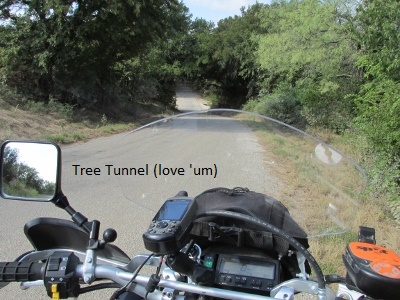
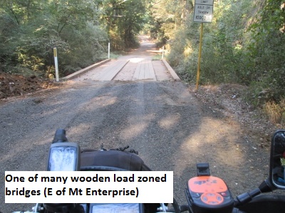
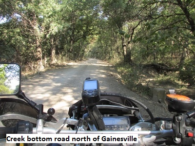
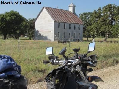
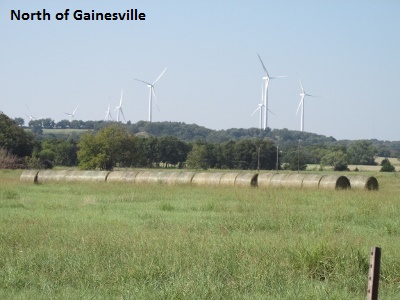
As I rode just south of the Red River, the terrain became very hilly and thickly forested, primarily with oak trees. The scenery and the roads in this region were some of the best I’ve experienced on the Loop. In some ways it resembles the hill country, but it is greener and more picturesque. There were many creeks with load-zoned bridge crossings with the road winding down to the creek and climbing back up. The rolling hills I passed through brought beautiful pasture scenes followed by sections of almost continuous tree-tunnels and, thankfully, very little sand.

 I made Nocona on US 82 about noon having ridden 110 miles. After a fill up and a quick snack at a convenience store, I found an auto parts store where I bought a can of Sea-Foam and added some to my gas tank. The DRZ had performed flawlessly except at slower speeds with a constant throttle opening it had begun to surge a little. After adding the Sea-Foam and riding a few miles, it seemed better but didn’t go away completely.
After Nocona, I continued to run close to the Red River. I made a couple of vain attempts to actually ride one of the county roads down to the banks of the Red River before finally succeeding. The land began to flatten out and more and more the trees disappeared giving way to mesquite. 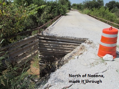 I ran into one road that had barricades set up but rode ahead to check it out. A corner of the small concrete bridge had broken away but I was able to safely ride around the barricades and continue on. A little later, I encountered another road that showed to be county maintained, but seemed to change to a private turn-row past a ranch house. I decided the prudent thing was to turn around and go 3 miles north and change the Loop track to reflect the new road.
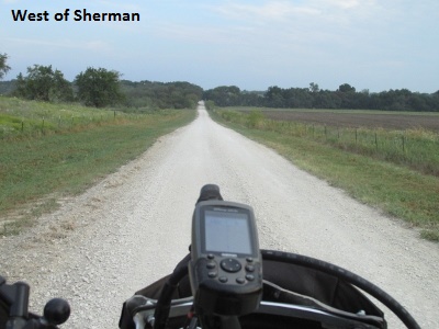
As I passed just north of Wichita Falls, most of the roads were smooth gravel alternating with some blacktop. The smooth roads and the openness of the terrain allowed me to travel much faster so I began to toy with the idea of skipping Electra where I had a reservation. My rationale was that if I extended my day to Crowell, it would allow me to finish the Loop the next day and then ride the slab on to Lubbock. I was beginning to “smell the barn”.
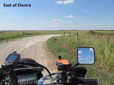
I arrived at Electra after 205 miles where I filled up and called my wife to have her cancel my reservation. She agreed to make a new reservation at Crowell ,so I hit the road again chasing the sun.
 As I neared Crowell, I came to the almost deserted town of Thalia. Following the original route between Thalia and Crowell I came to a section of two-track that was little more than a turn-row of deep sand. I had ridden the road last spring but it was decidedly worse now. I detoured a mile north and rode into Crowell on US 70. Again I modified the Loop track to reflect the change along.
I arrived in Crowell about 5:45 and stopped at the Werley Inn. The motel is old but very clean and run by a nice young couple who also farm in the area. I was hot, dusty, and tired but I had enjoyed 280 miles of some really great country. I ate some pizza and worked on the changes in Mapsource but was too tired to post my day’s ride on the forum.
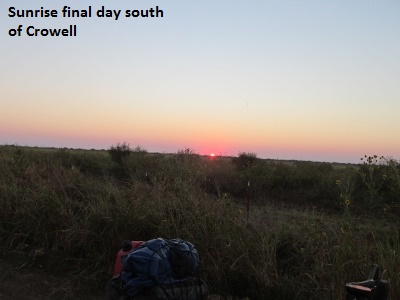
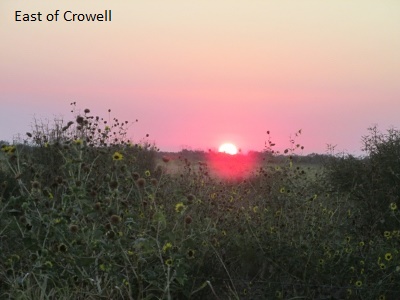
Day Twelve – September 29, 2015
Up at 5:30, I walked a block to Tater’s where I ate a hearty breakfast while the local farmers and ranchers drank coffee and gave each other a hard time. I wanted to get an early start, but I wound up waiting for enough light to ride. With the sun still below the horizon, I pulled out at 7:15 and rode southwest from Crowell on dirt roads closely bordered by mesquite and cedar. I rode about 25 mph for a while being a bit concerned about deer grazing in the early light. Sure enough, I encountered deer three different times in the first 30 minutes.
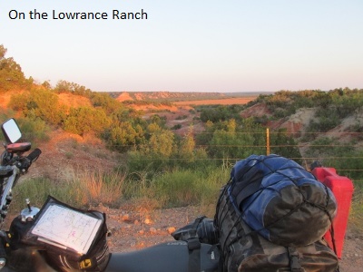
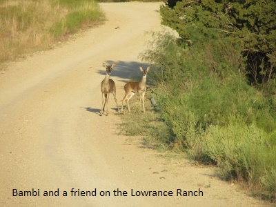
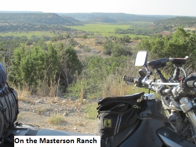
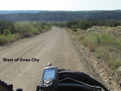
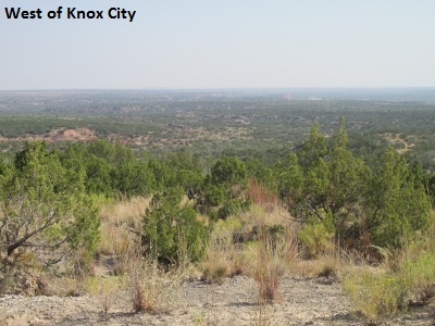
After a few miles the terrain dropped off into what they call the “breaks,” which was much more visually interesting and the riding became more fun. The Loop then turned due west and headed across the Lowrance Ranch. The ranch land offers wide open vistas and rugged canyons as it crosses from Knox County into King County.
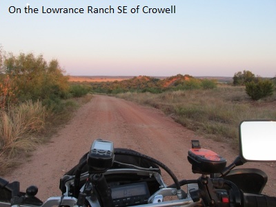
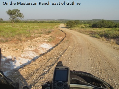
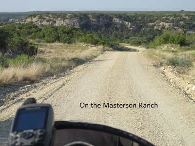
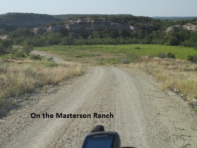
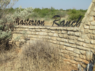
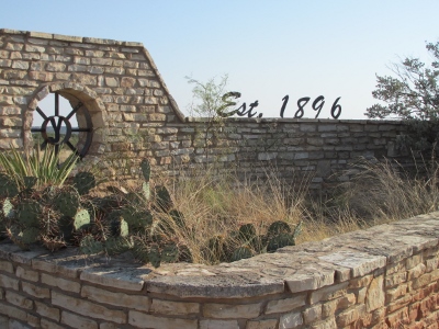
The road eventually makes a “T” where I turned south for many miles. The county road is great knap-of-the-earth riding across the J Y Masterson Ranch (Est. 1896), eventually intersecting toward US 82 between Guthrie and Benjamin. The route across both ranches totals about 50 miles and is a great ride with excellent roads that meander in an out of canyons and across vast prairies.
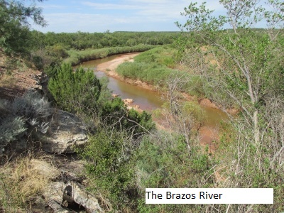
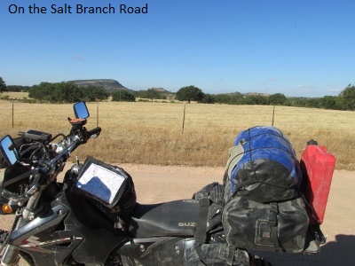
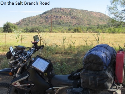
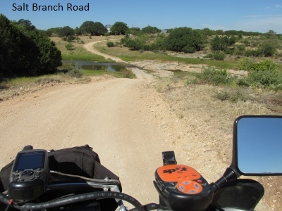
I turned east on US 82 to the intersection with SH 222 that heads southeast. The Loop turned south on dirt again a few miles northwest of Knox City. The county roads change numbers a few times as they traverse many miles of oil rich “breaks” in very rugged country. The roads, however, were very good. As I climbed up high along the shoulder of Kiowa Peak, it seemed like I could see forever. I then followed the Salt Branch of the Brazos south for a bit before turning west for the final leg of the Loop toward Jayton.
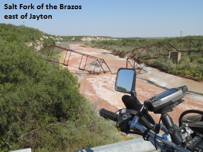
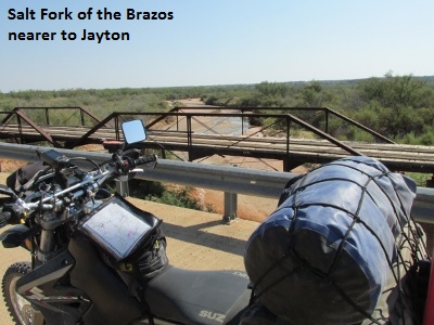
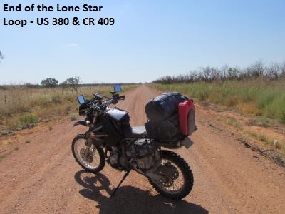
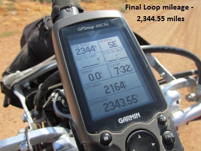
As I neared Jayton a little after noon, I decided to bypass the town for lunch and finish the last few miles of the Loop. About 12:45 I came to the intersection of US 380 and CR 409 where I began my journey twelve days before. To that point I had traveled 160 miles for the day. As I checked the stats on my GPS, my grand total for the Lone Star Loop was 2,344 miles.
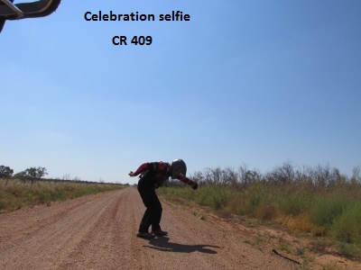
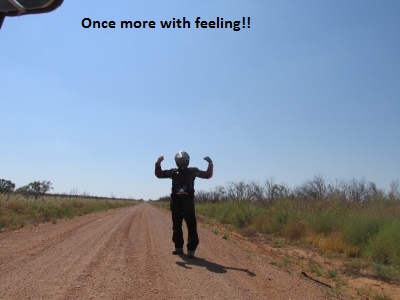
After a prayer of gratitude for a safe trip and a couple of “selfies”, I mounted my trusty steed and rode the 80 miles of asphalt back to Lubbock, anxious to see my wife and family.
Postscript – Lone Star Loop
As I thought back on the trip I asked myself if there was anything I’d change about the route or my ride. Honestly? Not really. The roads offered a tremendous variety of scenery and ride-ability. The goal of 200 miles per day was reasonable and offered ample time for picture taking. Even the close call with the deer served a good purpose by slowing me down a little before something worse happened. Well, maybe there could be a few more breakfast choices.
I am truly grateful to the State of Texas for all the great roads and to the Lord for the beautiful and diverse land he created that we know as Texas.
Jerry Lewis September 2015
“Hurry up and let’s ride! …….”