The Arkansas Loop
6 October – 12 October, 2017
Dual-Sport Ride Report
By Jerry Lewis
Why We Ride Dual Sport
by eveRide ADV
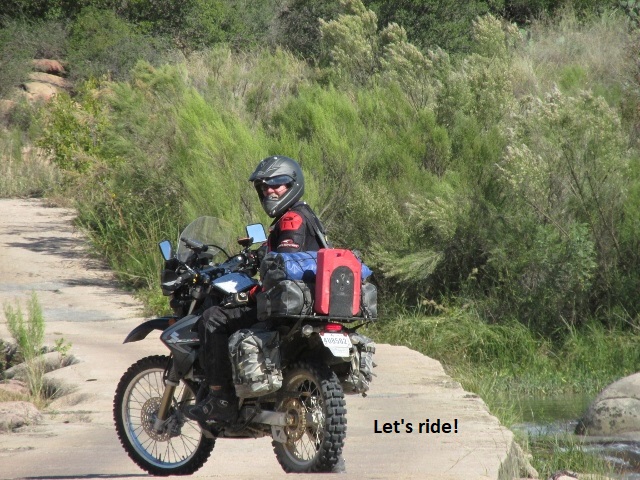
You know that feeling in your gut you get when all your bags are packed … ready to go. Wherever your journey takes you – maybe a few days or a few weeks – there’s excitement, anxiety, anticipation, fear. Fear is the key. It’s the difference in a vacation and an adventure. A fear of setting out under imperfect circumstances with equipment that is far from ideal. Fear that is at the same time decimated and compounded the minute you embark. The coward in you burns to turn around and give up, and just return to the norm, while courage and curiosity pushes you forward. It happens every time. I set out on thousand mile, 7 day journey aboard a DRZ 400 dirtbike with a bald back tire. On the road the DRZ is slow, loud, and bone-rattling uncomfortable. Why do it on a dirtbike? Becomes sometimes we choose to handicap ourselves to push a little harder. My route was designed to go no faster than 60, and see every vacant, forgotten back road in western Arkansas. You roll the dice when you choose back roads over familiar freeways and tourist routes. You can see nothing but brush and tumbleweeds spread between random dilapidated gas stations or you might see what few ever dare to. No car. No trailer. It’s just you and a bike that can take you anywhere. This is why we ride the dual sport motorcycle. Adapted from eveRide ADV (italics mine)
(See excellent video at https://youtu.be/oIOAbNX30gU)
I chose to begin my ride report with this narrative because it reflects so well many of my own thoughts and feelings about the adventurous aspects of Dual-sport motorcycling.
The Arkansas Loop
Introduction
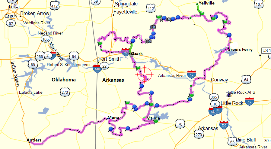
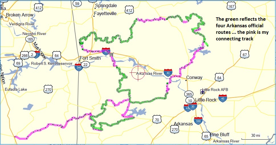
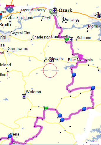
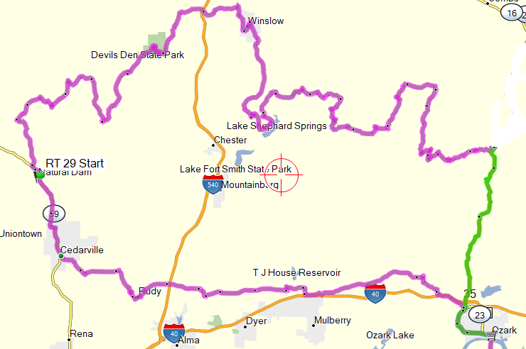
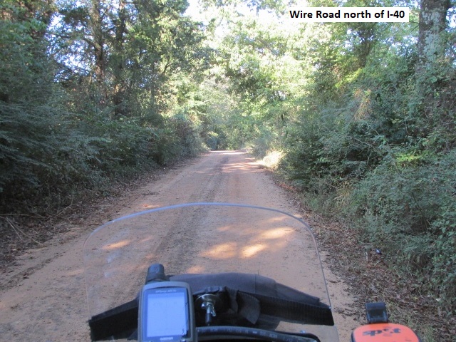
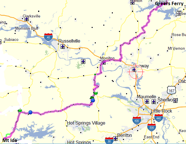
During January of 2017, I began planning my solo dual-sport ride in Arkansas. The process was somewhat different this year as it was necessary for me to design portions of the route. In the last few years, the state of Arkansas has begun to enthusiastically encourage motorcycle tourism. They publish a topnotch brochure with maps, places of interest, etc. While most of the routes they have produced traverse scenic paved roads, they now offer six point-to-point, off-road, dual-sport routes. Being a fan of routes in the form of a loop, I took four of their routes in the western half of the state and connected them. The first step was to purchase an Arkansas gazetteer (map book) that displays county and forest service roads. After copying the necessary pages, I traced the four routes and then connected the routes, using dirt roads wherever feasible. The final step was to input the routes in my MapSource software and then convert them to “tracks” in WinGDB3. As I’ve mentioned in previous reports, a GPS track is effortless to follow while riding but I have learned the value of having paper maps in my tank bag viewer. The maps serve as a backup to the GPS while allowing me to see the “big picture” of the geography I’m passing through.
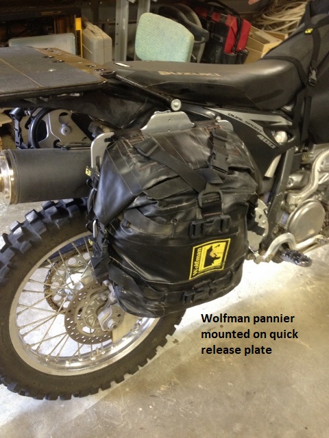
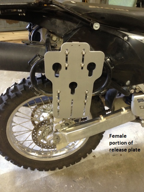
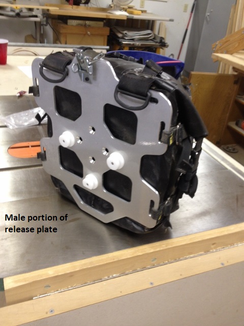
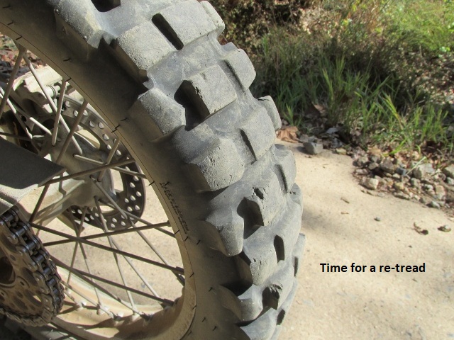
As usual, I planned my trip for early fall to take advantage of the typically mild weather. My ride would cover approximately 1,030 miles over a seven day period (see itinerary). The only major improvement made to my trusty Suzuki DRZ 400S, was to add a set of Wolfman’s Pikes Peak Rapid Release Plates. The two-part aluminum plates attach to my Wolfman side racks and make it a very simple process to remove the soft panniers (saddle bags) at night. Another advantage is that if I have a get-off, I can quickly remove the pannier on the high side and make the bike easier to pick up. I decided the tread on my knobby tires was adequate and only did normal maintenance in preparation for the trip.
Itinerary

Since I would be riding “solo” again, I would carry a Fast-Find Personal Location Beacon (PLB) and a SPOT GPS Tracker. Both units have the capability of summoning first-responders to my exact location should I be seriously injured (assuming I’m conscious to activate them). In addition, the SPOT allows my wife and brother Dave to follow my track in real-time. Dave again plans to follow my track through Arkansas, “flying” the route on his computer using Google Earth.
As I’ve said before, half of the fun of a dual-sport trip is the planning and anticipation. As the time drew near, there was a bit of uncertainty or trepidation, remembering some of the really difficult trails I rode last year on the OAT . . . wondering if there would be more of the same this year. One difference that I was looking forward to this year was that I’d have some company. Long time friend and former riding partner, Yancey Jones, was hauling me to Oklahoma in his Tacoma. After I debarked, he planned to generally follow my route on pavement and then meet me in the evenings at our motel. 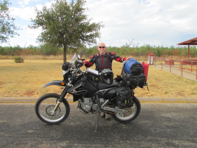
Day One – Friday, 6 October, 2017
(Lubbock, TX – Mena, AR)
Yancey and I left the Cast Iron Grill in Lubbock about 7a.m. headed for Antlers, Oklahoma. After getting briefly lost a couple of times, we arrived in Antlers about 3:15. The trip was about 400 miles and we were running about an hour and a half later than I anticipated. By the time we unloaded my scooter from his pickup and I changed into riding gear it was 3:45.
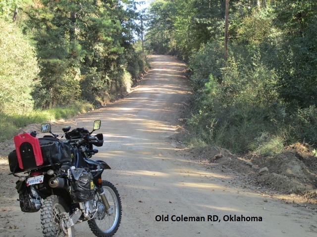 I rode east on OK3 for 12 miles before turning northeast on Cloudy Road. It was a pleasant 75 degrees as I rode through a forest of pine and oak on a mixture of blacktop and graded dirt. At Pickens I turned on to Old Coleman RD and continued east. About 50 miles into my ride I came to a game preserve sign and a locked gate on 61000 RD. 61900 RD continued on to the left, so I followed it for a while looking for an intersection with US 259. After trying a couple of rugged jeep roads that branched off, I realized my GPS compass indicated I was getting farther away from 259. At that point I decided to return to the locked gate and reorient myself on the map. I then back tracked a bit further and headed south on the 621600 RD and connected with US 259. As I rode into Smithville a few miles east the sun was setting and I still had about 40 miles to go. I took a minute to call Lyn in Lubbock with a heads-up in case Yancey called her concerned about me (yeah, right!) I’ll mention here that my technophobe friend, Yancey, still carries a “flip-phone” with very limited coverage so we were seldom able to communicate during the day.
I debated with myself for a moment whether to take paved OK4 to US 71 and into Mena or to continue on the forest roads. This was definitely deer country and my DRZ has rather poor lighting. So I decided it would be safer on the dirt forest roads at 35 mph than 65 on the highway. The ride through the forest in the dark was exhilarating if a bit unnerving but I had no trouble.
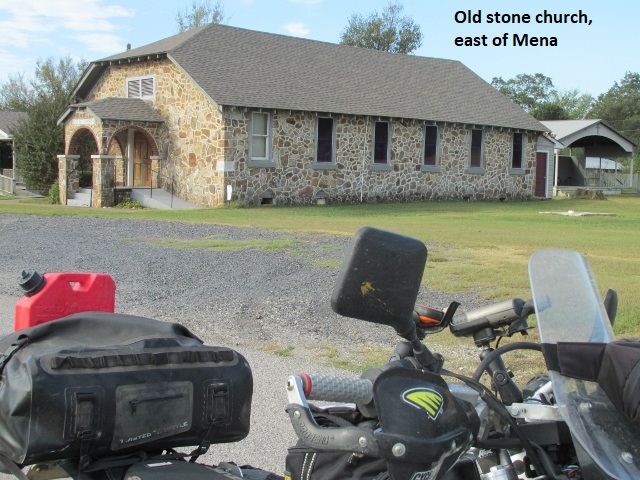
I arrived in Mena about 8:15 to find a worried (??) Yancey pigging out on a great buffet at our motel. He had given it some serious thought and decided if he was going to have to come looking for me he’d rather do it on a full stomach. I’d covered 100 miles from Antlers and the “adventure” had definitely begun.
Day Two – Saturday, 7 October, 2017
(Mena, AR – Ozark, AR)
It’s really unusual to find a motel nowadays with a restaurant, but the Lime Tree Inn in Mena had a great one with breakfast and dinner buffets. However we ordered off the menu and enjoyed an excellent breakfast before I garbed up and left town at 8:30. As I rode east on AR8 the skies were clear and the thermometer had already climbed to 70 degrees. After 15 miles of pavement I turned north on CR63 to CR68 then briefly east on AR88. Turning onto dirt CR70 I meandered north and then west through the Ouachita (WASH-i-ta) National Forest. CR70 was good riding at first but started climbing and became about as technical as I’m comfortable with, given my gear load. My green GPS track indicated a right turn on FR172 so I obeyed and immediately started a steep climb. The road was really rocky and washed out and climbed very steeply up and down and back up again. It was as technically challenging as any of the roads last year in Oklahoma. At one point I stopped and checked my map. It indicated the first part of FR172 was a dotted-line 4-wheel drive road that eventually became county maintained Turner Creek RD. I had promised myself if I got on a road like this I’d turn around and find a safer way. However, as I studied the map it was obvious it would require going back down what I’d just climbed up and detouring for about 25 miles of pavement. I reluctantly continued on, making slow progress over and around fallen trees and large loose rocks, almost falling several times. I wasn’t sure if this was part of the Arkansas designed trail or my own connecting track. Later I checked and found it was indeed the state’s trail. In my opinion, FR172 would be an okay dirtbike road but shouldn’t be part of a general use dual-sport route.
Eventually I made it to Turner Creek RD and then rode US 270 a few miles east before turning north again on Robertson Creek RD. This was a good forest road that carried me to east bound AR28. I turned south and then east on two-track county roads 655 and 79 through Chula, headed for Aly on AR27. Right before Aly, I came to another gate and had to detour a couple of miles to get back on track. Traveling north on FR4104 I was up on the pegs enjoying 10 miles of good forest road before connecting with AR307 for a few miles. It was overcast, about 75 degrees, and looking like rain when I got to Briggsville about 1:00 p.m. My stomach thought my throat was cut, so I rode about 5 miles east on AR28 to Rover. There I got fuel for my bike and myself . . . a greasy (but good) burrito . . . and then headed back west to rejoin the track.
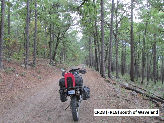
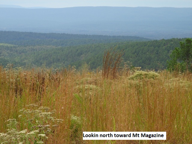
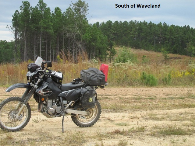
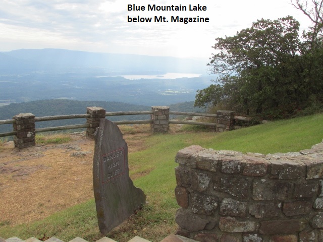
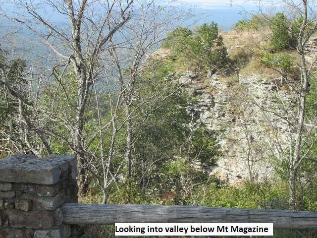
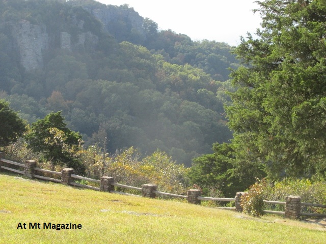
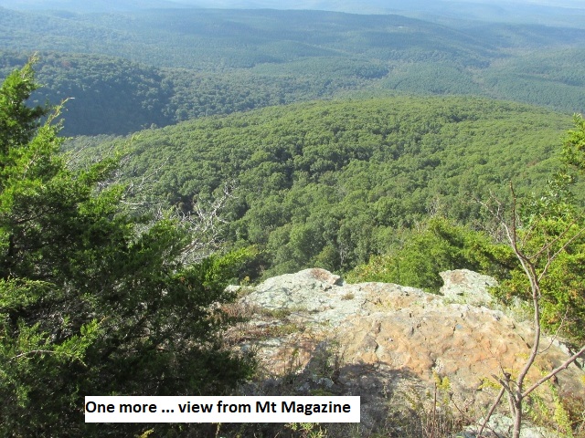
I rode a great 2-track FR818 west for about ten miles before turning north on Blueball RD which descended steeply on switchbacks to AR80. After a short jog east I turned north on CR28 (FR18), a great ride in the Ouachita Forest eventually coming to Waveland. At Waveland I could see the imposing silhouette of Mt. Magazine just to the north. Following more county roads, I intersected AR309 and began the circuitous climb up Mt. Magazine.
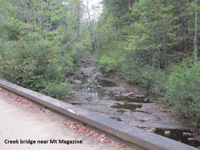
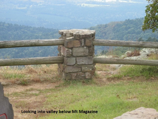
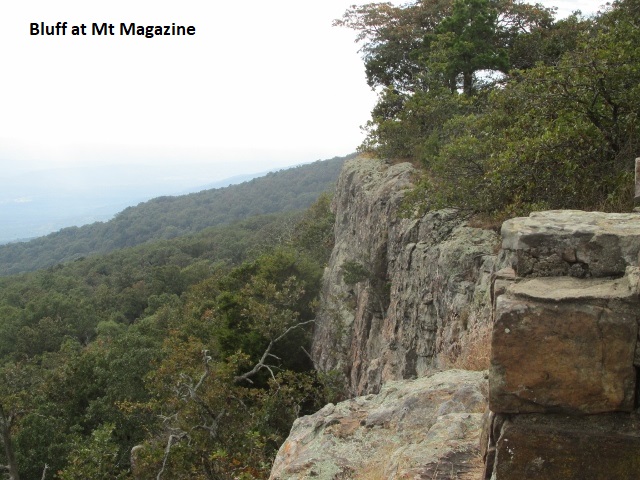
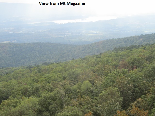
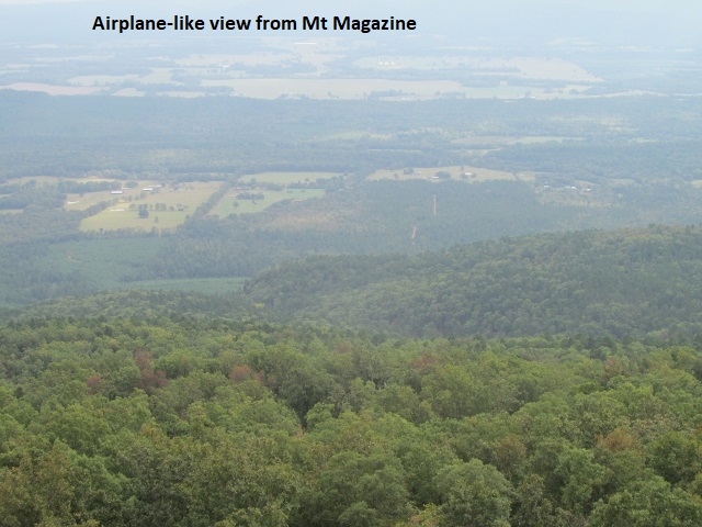
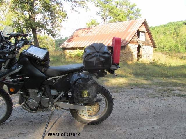
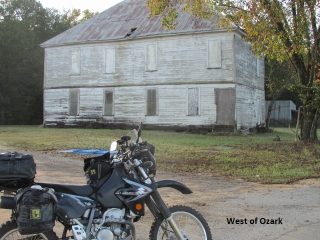
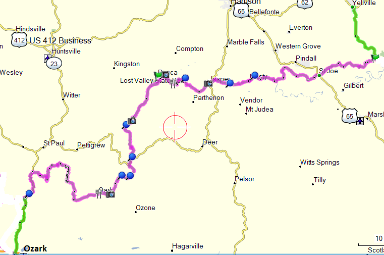
I topped out at Mt. Magazine State Park and made a loop through the park taking pictures. The airplane like view was tremendous but I knew my photos wouldn’t do it justice. The park has a really nice state owned lodge and a few condos . . . I had checked them out earlier but at $200 a night I wasn’t interested. I bailed off the back side of the mountain on Greenbench and Robert Hill forest roads and into the town of Paris, the only town of any size since Mena. I lost my gas cap vent hose along the way so I bought a foot of generic hose in Paris before heading on to Ozark. After a few miles on a couple of county roads I again intersected AR309 and rode across the Arkansas River Bridge and into Ozark about 5:30. When I got to the Oxford Inn I found Yancey sitting on a bench outside the office. They wouldn’t let him in our room since it was reserved in my name. He had already been there a couple of hours so he sat in the shade and took a nap.
Yancey said he enjoyed the day but complained a little about the winding roads (really? ha, ha). I also had a great day and complained about FR172. Mileage for the day was about 200 miles.
Day Three – Sunday, 8 October, 2017
(Ozark, AR – Ozark, AR Loop)
I was still dark in Ozark as Yancey and I drove up to the truck stop on I-40 and enjoyed a great platter of eggs and pancakes. (Incidentally, having Yancey’s truck along has been nice because I don’t have to ride to eat and I don’t have to carry all my clothes on the bike.) Back at the motel I changed clothes and loaded all my gear, fired up my GPS, SPOT, and DRZ and left town about 8:30. It was a beautiful morning with the temp around 62 as I rode Pound Ridge RD north from Ozark.
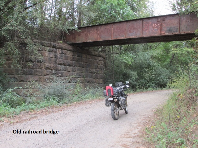
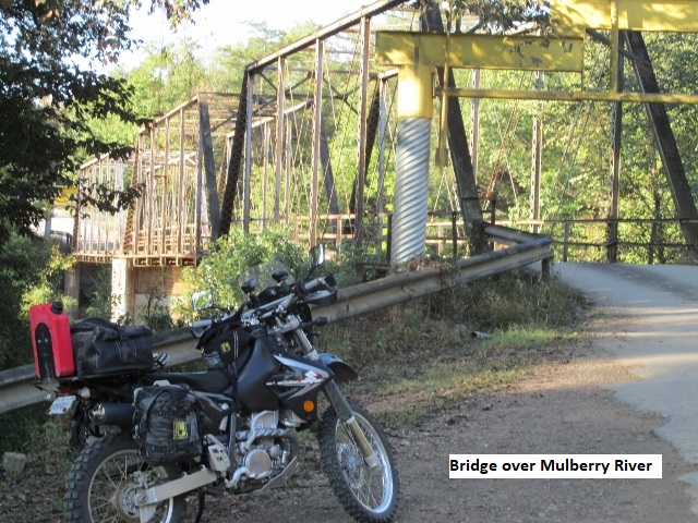
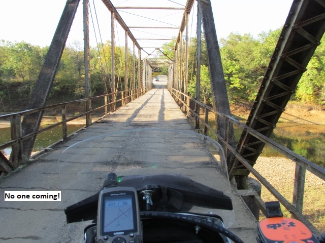
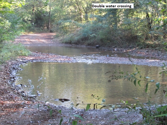
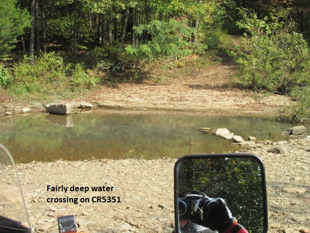
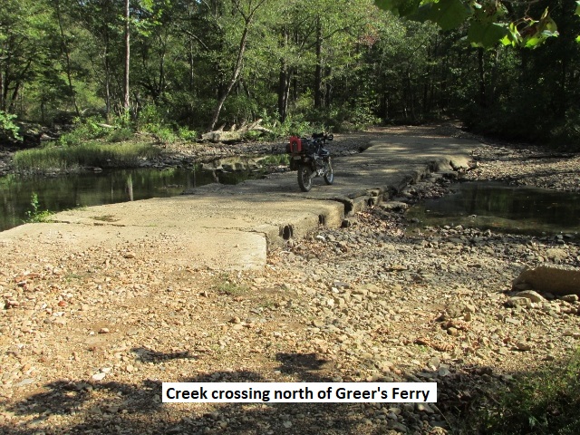
Today’s ride consists of a loop through the Ozark National Forest, circling me back to Ozark for the night. About 18 miles in, I scared up a small deer that jumped the fence and disappeared into the forest . . . haven’t seen much wildlife so far. The roads have been a mixture of dirt and narrow blacktop, truly nice easy riding. The topography has been much more “open” today, especially compared to the ubiquitous tree tunnels yesterday. I stopped for a photo op at a cool one-lane truss bridge over the Mulberry River. I’ve been west bound all morning, paralleling I-40 just a few miles south of my track. There have been lots of narrow paved country lanes with pretty country homes and manicured lawns . . . and motorcycle chasing dogs. I came to my first creek crossing after passing over I-49 . . . it was actually two crossings a few yards apart and fairly deep. The day was heating up quickly, so midmorning I stopped in Cedarville on US59 to shed my coat and borrow the facilities. There was TV news in the store about Hurricane Nate hitting the Mississippi coast during the night. Hoping it doesn’t bring rain to this area of the state.
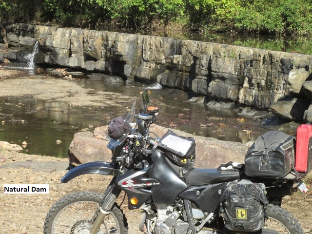
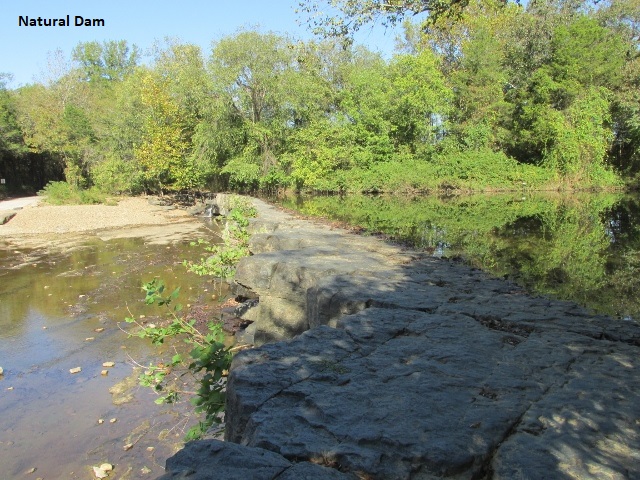
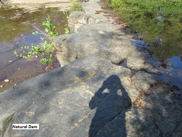
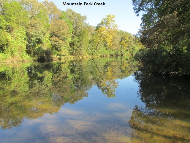
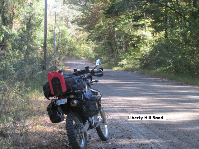
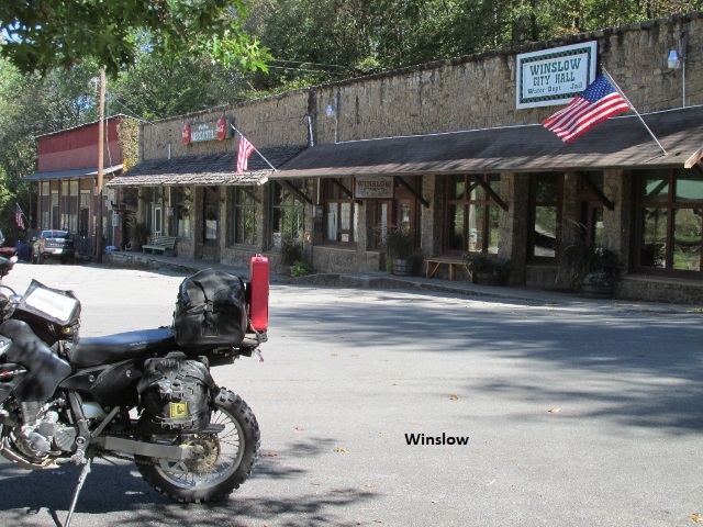
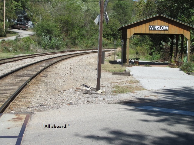
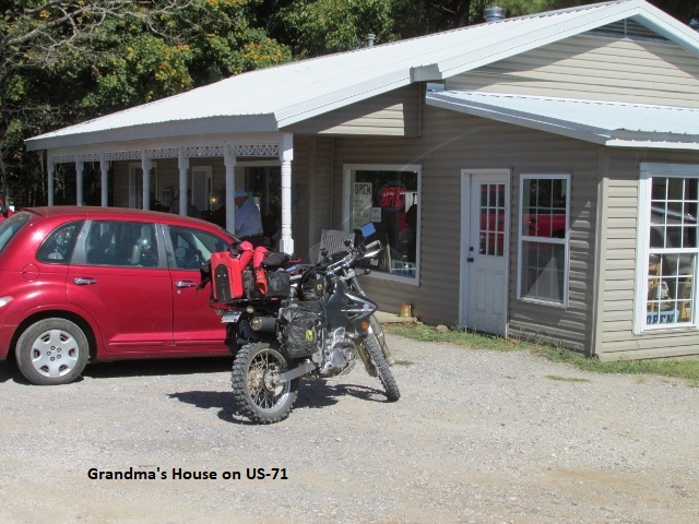
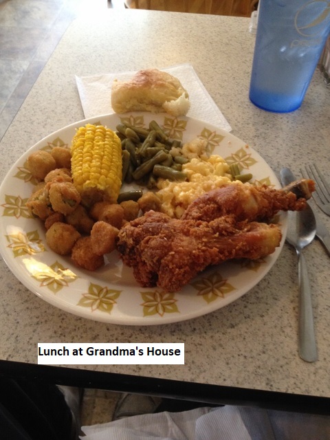
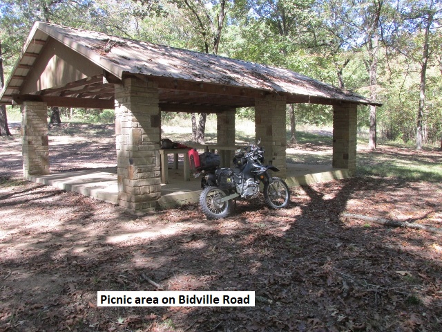
Jumping on US59, I rode the slab north for about 6 miles to Natural Dam. As the name implies, the dam is a natural stone wall about 6 feet high and 200 feet across spanning Mountain Fork Creek. The dam makes a pretty little lake and spillway. Leaving US59 behind, I rode into the national forest again and began climbing up Liberty Hill Road. I topped out on a ridge and rode once again through continuous tree tunnels. Following Barker’s Gap and Cold Creek Crossing roads for several miles, I eventually intersected AR220. AR220 is a really nice mountain road (though under some construction) that winds through the mountains to Devils Den State Park before merging with AR74. A little after eleven, I stopped at a nice picnic area in the park for a short break. Crossing I-49 again, and headed east on AR74, I came to Winslow, a small mountain town on the railroad. I searched for a café for lunch with no luck so I continued south a few miles on US71 to Grandma’s House. I had previously seen the restaurant on Google Maps, and when I arrived the parking lot was full, being about noon on a Sunday. I went in to discover a huge buffet and a packed house but managed to secure a tiny solo table. Surely I was an amusing site in my Spiderman riding gear, sitting among all the church folks in their Sunday best. The food was awesome! Best buffet I ever encountered . . . two bars for meat, one for vegetables, one for salad, and two for dessert. After grabbing some fried chicken drumsticks and all the trimmings I approached the dessert bar . . . decision time! Unable to make up my mind, I showed great restraint and settled for small pieces, chocolate, coconut, pineapple, and banana cream pie.
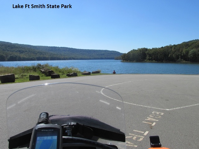
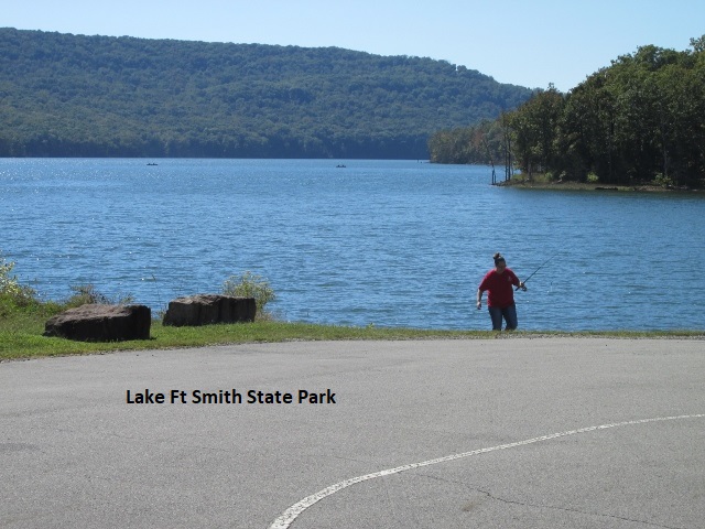
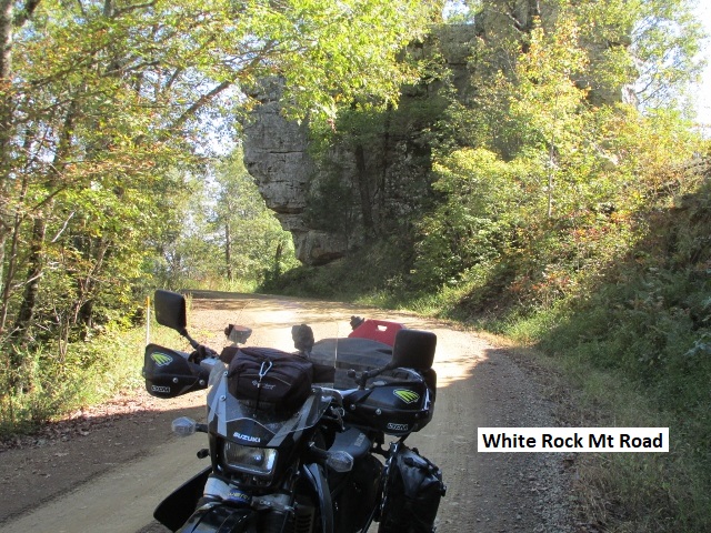
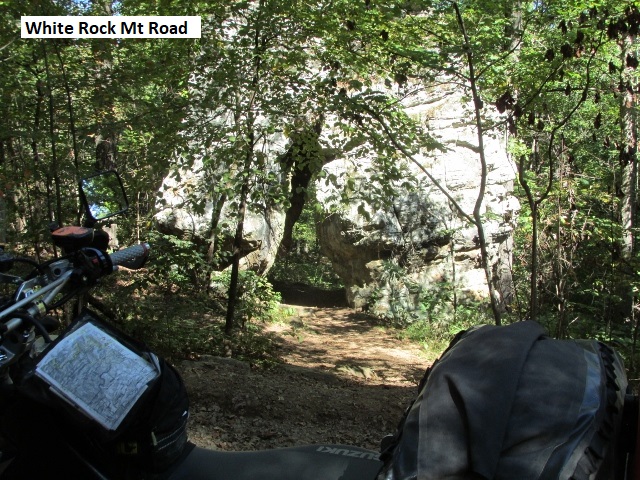
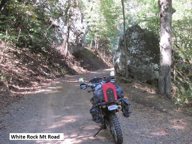
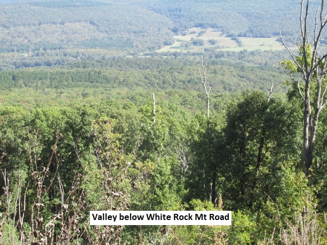
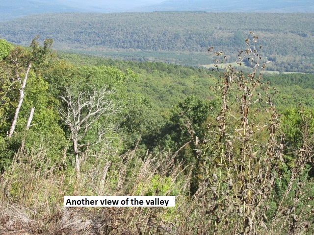
Stuffed to the gills, I continued south on US71. I turned left on AR400 and dropped into Ft Smith State Park . . . pretty little mountain lake with some nice lodging. Leaving the lake on Shepherd Springs RD, I climbed quickly back into the Ozark Forest. Topping out on a ridge, I rode over Bidville RD, Hurricane Cree RD, Bowles Gap RD, and Potato Knob RD for about 25-30 miles. These three roads follow a ridge in the form of an “S” meandering through the forest some 2,000 feet above the surrounding valleys. It is really great forest riding with loads of curves and switchbacks. There are numerous places along the ridge with beautiful overlooks into the valleys on both sides of the road. In places I experienced wet roads and occasional mud puddles. It seems the rain clouds I witnessed yesterday while in the Ouachita Forest were actually dumping their rain here in the Ozark Forest. About 3:15, I came off the ridge on White Rock RD at the juncture with AR23 and turned south toward Ozark. AR23 is a great highway for motorcyclists, winding down out of the mountains to Ozark at I-40.
Today was an awesome ride . . . about 90 percent dirt this afternoon, as good a dual-sport ride as you’d want. I rode about 160 miles with great weather and no bike problems on my faithful DRZ. Yancey had a good day. He’s just enjoying his first trip to Arkansas and all the scenery, just taking his time and relaxing . . . I think I woke him up when I rode up to the motel door.
Day Four – Monday, 9 October, 2017
(Ozark, AR – Yellville, AR)
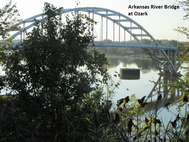
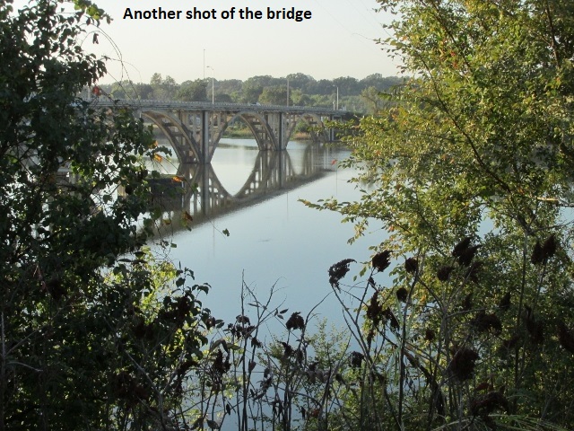
After another truck-stop-breakfast, I left Yancey at the motel and rode through town to the picturesque Arkansas River for some snapshots. Leaving Ozark about 8:15, I began climbing as I headed north on AR23 for about 25 miles of blacktop where I would rejoin the trail. Didn’t mind the pavement as it was a great twisty ride with a bit of fog and a pleasant 60 degrees.
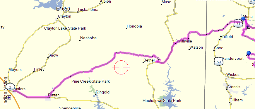
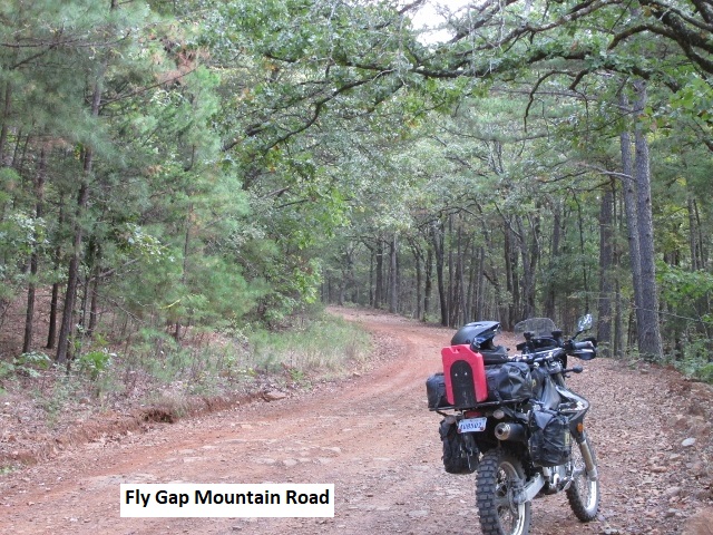
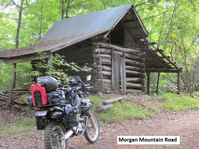
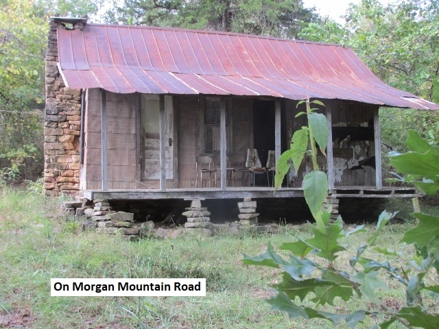
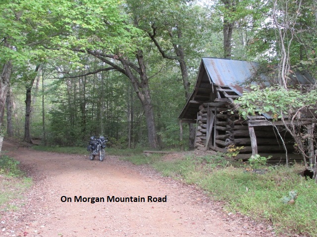
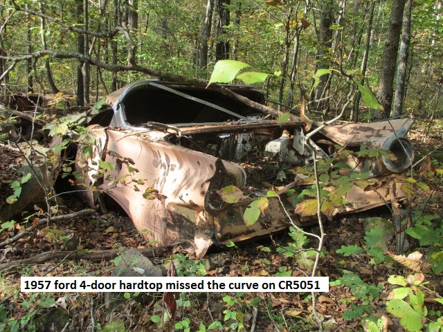
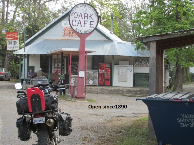
I turned east on Flygap RD into the forest and climbed quickly up to a ridge bordered by occasional clearings, some of which were actually cultivated. I was feeling a little tentative on the loose gravel so I set an easy pace until I could get in the groove. Traveling mostly east, I connected with Morgan Mt RD, then onto CR4460, before turning south for a few miles on CR5051. It was a good forest road but tight enough that I was only averaging 20-25. I passed by what appeared to a small militia compound without seeing a soul . . . just signs welcoming vets. Suddenly, 5051 went into a freefall off the mountain and merged with CR5099 . . . was really glad I was riding down not up. At the end of 5099 I turned east on AR215 (215 is part of the Trans-America Trail I rode in the fall of 2013) toward Oark (not Ozark). The ridge before 215 was really enjoyable riding. I notice there were fewer pines and more deciduous trees in this area. Earlier, I jumped up a couple of large feral hogs and a bit later three large mule deer paused in the road to check me out before bounding into the brush. If you blink you’ll miss Oark on AR215, a tiny little town with a requisite photo-op of the old country store, doing business since 1890.
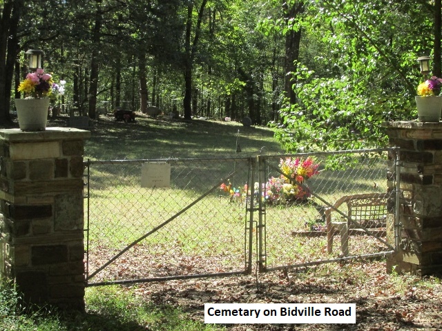
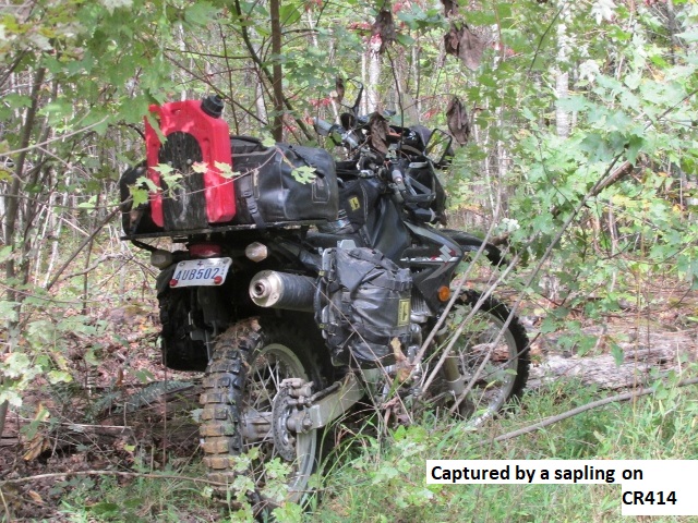
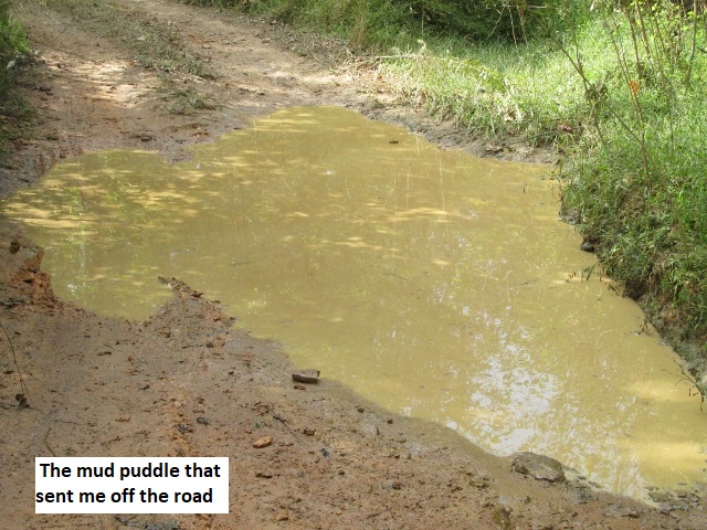
Leaving Oark on CR5440, I hit dirt again at Catalpa and headed north On CR5351, eventually turning onto AR21 for a few miles through Fallsville. Many of these “towns” are little more than wide spots in the road with few if any buildings or commerce. The trail broke off pavement on CR414, not too bad at first, but it quickly turned into the road from hell! At the time I wasn’t sure if 414 was my interconnecting track or the original Arkansas route. I later verified it was the latter, but as I have expressed before, a road with this level of difficulty doesn’t belong on a dual-sport route. I guess I’m spoiled to county road maintenance in Texas, but some of what Oklahoma and Arkansas consider county maintained roads leaves a lot to the imagination. CR414 is at best a jeep/dirt bike two-track. It descended very steeply before crossing a wide, rocky, and shallow creek and then began to climb just as precipitously. The steep narrow track was strewn with boulders, dirt mounds, deep mud puddles, and washouts. The adjoining vegetation encroached into the road bed, so it was impossible to ride in one of the two tracks without being constantly struck by the brush. Rounding a blind turn I plunged into a deep mud puddle and as I hit the far bank, the bike wheelied and brought me to a violent stop in the middle of a sapling. The sudden stop was due to brush that had lodged between the bike frame and brake pedal, locking the rear brake. Thankfully I was unhurt, but it took several minutes of tugging before I could extricate the DRZ from the sapling and continue the harrowing track. I continued my battle with rocks and brush for several miles before finally connecting with an actual county maintained CR5.
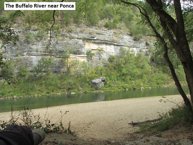
After several miles I connected with AR43, and about 1:00 I rode into Ponca where I’d planned to get some lunch. All that Ponca had to offer was high priced foofoo sandwiches at a store/gas station so I rode a few miles on AR74 to Lowgap. No actual town at Lowgap, only a cantina that was closed on Mondays so I borrowed their covered deck and assuaged my hunger with a cheese and sausage pack, Payday, and some Gatorade. Turning off 74 onto CR20 I rode some good dirt two-track to AR327 and into Jasper. While gassing up in Jasper I visited with a young guy riding a KTM 1190. He lived there but was new to the area and had been exploring a lot of the dirt roads around Jasper. AR74 carried me east a few miles to CR84, to AR123, and then CR72 to Mt Hershey. Mt Hershey RD came close to Hurricane River Cave which I’d notice on the map. I decided to detour a couple of miles to the cave and check it out. But get this . . . when I got to the end of the overgrown road, the cave was “Closed for Remodeling”. My afternoon consisted of easy riding on good county roads, some dirt, some gravel . . . nothing technical but still loads of fun. Lots of water sport opportunities with the Buffalo River and WMA paralleling my route for many miles.
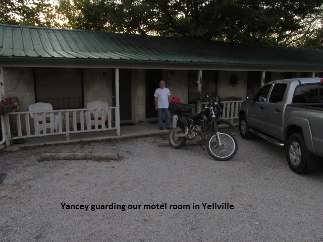
After the cave debacle, I rode Chinquapin RD, Moscow Love Rd, and Woolum RD (love the names!) into Saint Joe where I picked up some pavement for a few miles to Tomahawk Church Rd. The terrain had gradually changed from mountains to low hills and picturesque valleys. Tomahawk eventually dumped me onto AR14 which I rode north 15 miles off-route to Yellville to meet Yancey at the Carlton Marion Inn.
In the afternoon the temperature had climbed to the low 90’s (too hot!), as I covered 175 miles by the time I got to Yellville. Yancey managed to get access to our room and caught a few zees before I arrived. The motel was a mom-and-pop court, locally owned, that had been completely refurbished, even new windows. Great place! I prefer a place like that to a high-dollar hall-entry, 4-story box. We enjoyed some good catfish for supper at a local joint before retiring to watch Monday Night Football. Great day! (Except for CR414)
Day Five – Tuesday, 10 October, 2017
(Yellville, AR – Greers Ferry, AR)
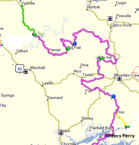
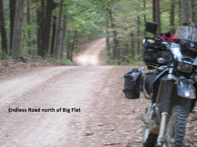
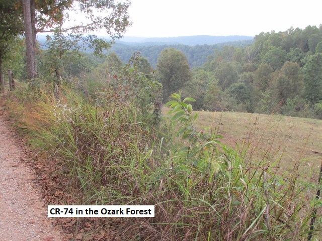
After locating the pizza place the motel folks recommended for breakfast, Yancey and I chowed down on a really excellent breakfast. Visiting with Lyn last night, she related that a cold front had hit Lubbock dropping the temp to 41 degrees with a windchill of 35. I left Yellville around 8:30 and headed south on AR14. It was cool and I had 15 miles back to the trail plus another 20 miles of AR14 to Big Flat. AR14 is an awesome road-bike highway. Winding through the Ozark Forest, I counter-steered through the continuous curves on silky pavement. About 9:30, I stopped to shed my coat and noticed clouds moving in over the mountains . . . looks like it might rain later. I turned northwest on Spring Creek RD at Big Flat and immediately began losing elevation. After a couple of miles, the road and the dry creek became one and the same for a quarter mile before I began to climb again on Endless RD. It was really good riding but rather slow because of the continuous tight turns. The problem with narrow, tight turns is “limited sight distance”. . . you never know who or what you’re going to meet in the middle of a turn so it pays to slow down a bit. Endless made a 180 onto CR1283 and I enjoyed one of the best roads of the trip so far. It was still narrow but had gentler turns with less climbing . . . just right to stand on the pegs and hit my groove. CR1283 runs east and parallels the Ozark Highlands Trail, a hiking and mountain biking trail. After about 6 miles the route turned north on AR341 for 8 miles before I caught some more dirt on CR74 and 75. Late morning I found myself up pretty high, riding through lush pine forest while enjoying a bit more open terrain and viewing scenic valleys below. I was really having a great time as I cruised by several small ranches and the skeletal remains of 150 year old cabins. At one point, I scared up a large gobbler . . . don’t know who was more startled, him or me. As I turned off CR75 onto Bear Rd, the temp hovered around 75 and the skies were grey. Bear turned out to be a somewhat rugged two-track but not too technical. Next up was Sandy Flat and Green Mt roads. Sandy was a bit challenging but nothing like CR414 yesterday. Green Mt was especially fun as it wound down the mountain to AR5.
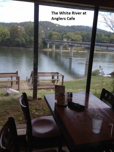
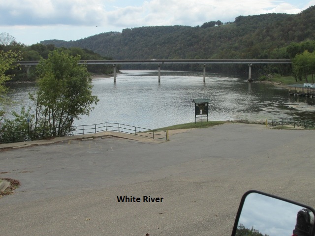
As I rode south beside the White River for a couple of miles on AR5, I came to the junction with AR14 once again. At the intersection was large gas station/store/restaurant named Anglers. Being as it was almost 1:00 I decided to check it out. It was a serendipitous stop as it turned out to be an excellent place to get some grub. The restaurant was perched on the bank of the White River and my booth faced a picture window with a good view of the river. I enjoyed a first-rate cheeseburger while reading my Kindle and watching the river roll by.
As I climbed aboard my DRZ to head west on AR14, the clouds had moved out and it was getting hot. About 10 miles down the highway is the turnoff to Blanchard Springs Caverns so I decided to check it out. I toured the visitor’s center, looking at pictures and reading the history before deciding to skip the tour and get back on the road.
I made a left off AR14 onto Mitchell RD and followed it half a dozen miles to AR66. I had laid out an alternate route to avoid several miles of pavement so I turned west on Happy Hollow Rd. It was a nice winding road, paved at first and then good gravel. Just south of Timbo and about a mile before I connected with AR263, I encountered a “road work ahead” sign. I traveled a few hundred yards and sure enough I found new crushed rock, soaked in very wet oil. Rather than backtrack several miles, I discovered I could ride a foot wide band of rock along the bar-ditch and miss most of the oil.
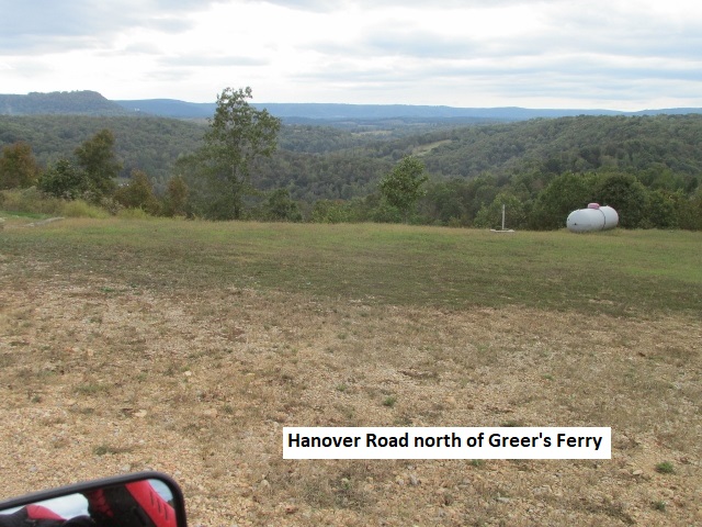
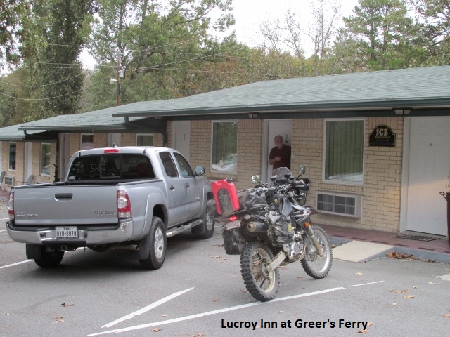
By mid-afternoon, the skies had clouded over again and the temperature began to drop. I was still about an hour from Greer’s Ferry. Heading generally south, I rolled along good county roads with less forest and a variety of rural homes . . . some nice, some private junk yards. I came out in a clearing on a hilltop where I caught the smell of burned wood and found there’d been a recent forest fire. Next was Hanover RD which was much more fun to ride, like riding a good Forest Service road. As it meandered through the national forest I scared up another deer that quickly did a 180 into the trees. Several miles later I briefly intersected AR263 again and then followed AR225 to AR92 and rode into Greer’s Ferry. After a bit of searching, I found the Lucroy Inn on the north edge of town. Having traveled around 160 miles, it was about 4p.m. when I arrived and found that Yancey had managed to gain access to our room. I hate that because he gets first pick of beds! The Lucroy was another mom-and-pop court, really well maintained and comfortable. We ask the manager at the motel about supper and she sent us to Bentley’s, and as it turned out, a really good restaurant. “Eat to ride, ride to eat”. 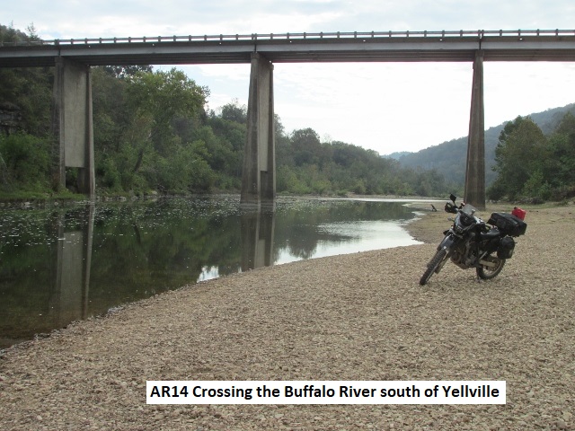
Day Six – Wednesday, 11 October, 2017
(Greers Ferry, AR – Mt Ida)
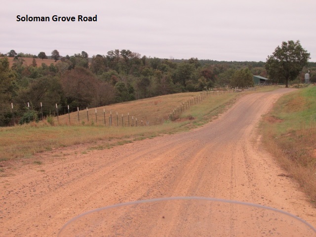
Yancey and I enjoyed another excellent breakfast back at Bentley’s Café . . . I may have to go on a diet when we get home. Well, the dropping temperature I felt yesterday was a cold front moving through and it’s in the upper 40’s this morning. I left Greer’s Ferry about 8:45 on AR92/16 headed southwest for about 15 miles before turning south on Rockhouse RD. I next continued southwest, traveling Tywood RD, Holland RD, and Batesville RD before stopping at US65 and Solomon Grove RD. I’ve been about 30 miles and its 9:30 so I thought I’d warm up for a few minutes . . . pretty chilly and my hands are especially cold. It has been a good easy ride through rolling hills, alternating between pine forest and rural homes nestled in green pastures.
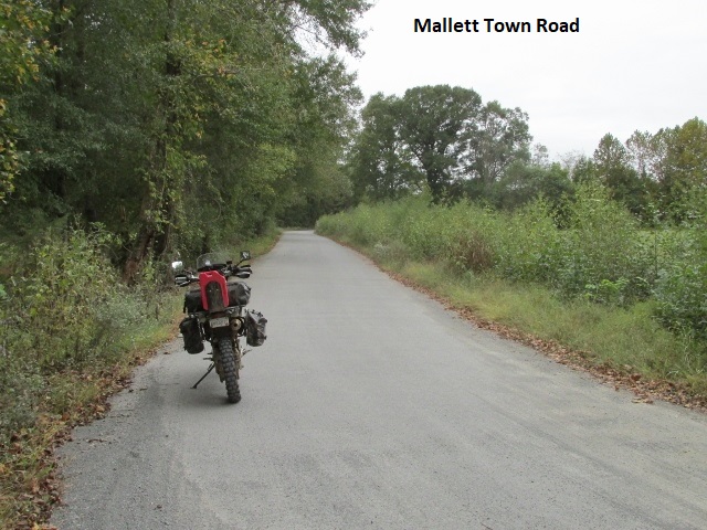
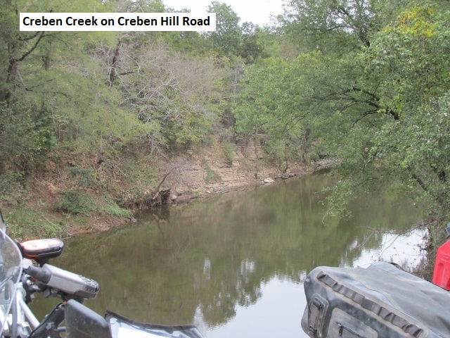
Mallet Town RD took me west to AR124 then south on Creben Hill RD. At the fork with Chapel RD I came upon a road construction sign, so following my usual modus operandi, I rode ahead to see if I could get through. Sure enough, a road crew was building a new bridge over a creek. I stopped and made eye contact with one of the men who took mercy on me and waved for me to come on. He then proceeded to direct me around their forms and ditches and rebar sticking up which threatened to impale me. I really appreciated his help as it would have meant a several mile detour. However, about a half a mile further, I came to a steel gate blocking traffic from the other direction. There was a small gap in the gate so I rode through and went on my merry way. Still chilly but trying to warm up. Been a good morning, easy riding, nothing technical.
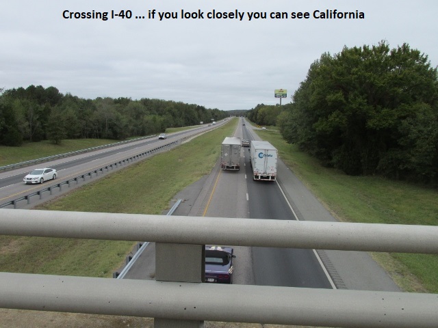
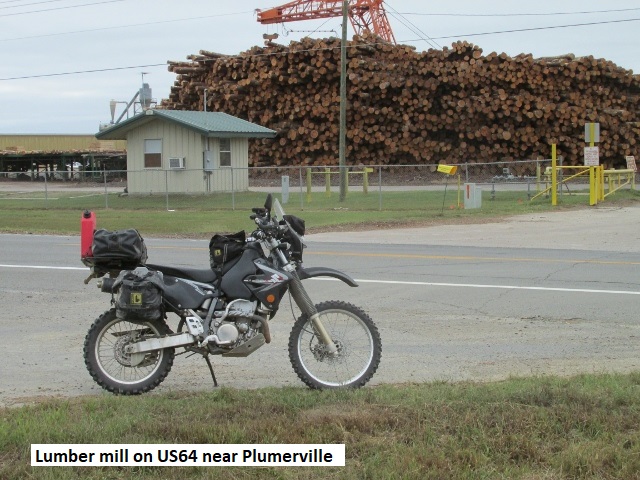
After a few miles riding a really dusty Bell Mt RD, I got behind slow vehicles three different times. My only options were to stop or try to overtake them in the blinding dust. I decided to pass and they were nice enough to pull over when I got close enough they could see me through dust. I crossed over I-40 then passed by a large lumber mill as I rode west on US64 while I paralleled I-40 for about 12 miles. On the outskirts of Morrilton, I took AR9 then AR113 south before turning west on Bone Hollow RD. When I came to AR9 again at Perry, a bad wreck had just occurred involving a large trash truck and a pickup. First responders hadn’t arrived but someone had the pickup driver sitting on the grass dressing a head wound.
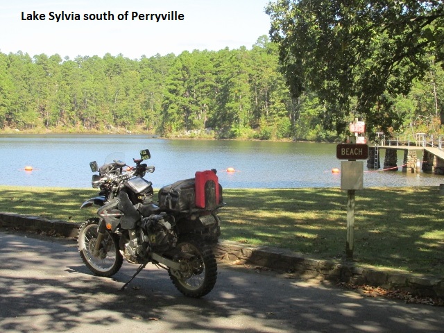
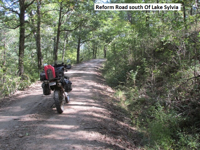
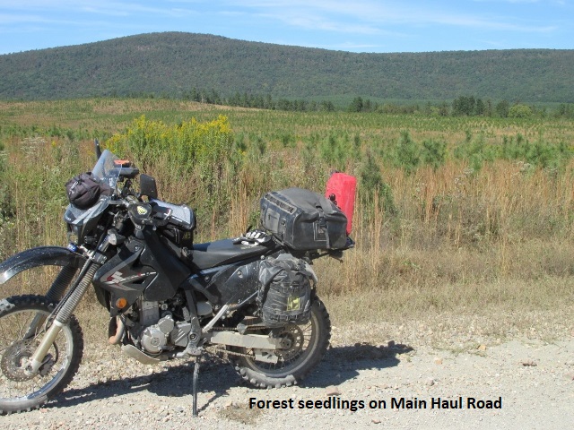
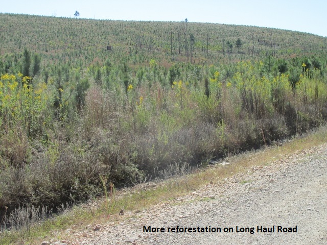
A few miles further I came to Perryville where after vainly looking for a decent eatery, I settled for a piece of dry pizza and a large coffee at a convenience store. The sun’s out now but still a chilly 60 degrees. Just south of Perryville my GPS showed to turn east briefly on AR216 and then south on Greathouse RD. After a half-mile on Greathouse I came to a locked gate and private-road sign. I backtracked to AR9 and then went south to AR324 that took me to the Lake Sylvia recreation area. The pavement ended there so I continued south on FR152 and Reform RD before coming to a fork in the road. My GPS track showed to turn west on FR114 for 22 miles to AR7. As Yogi Berra said, “If you come to a fork in the road, take it” so I took 114 and started climbing immediately. It was a terrible road, very steep and washed out, an unmaintained Jeep road with lots of rock. After fighting it for a quarter-mile I stopped and thought, “I’m not doing this . . . life’s too short!” After consulting my map, I rode south for about 5 miles and turned west on FR24000. FR24000, also known as Main Haul RD, is a great graded road which parallels FR114 all the way to AR7. Riding a fast pace on Long Haul RD, I spooked three large mule deer as I passed by re-forested meadows that sloped away into the hills. Once I hit AR7, I turned north for about 5 miles to rejoin my designated track westbound on Gladstone Forest RD (FR11).
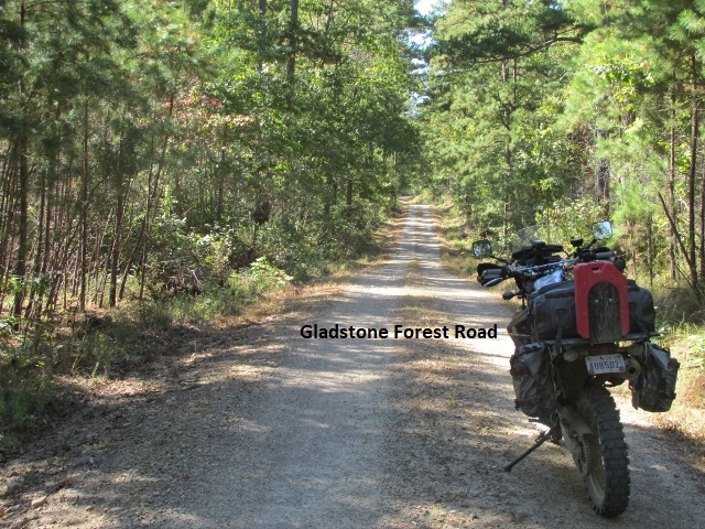
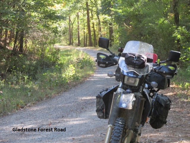
After finishing 26 miles of Gladstone Forest RD, I stopped at the intersection with AR27. Without a doubt, Gladstone is the best road of the trip!! It’s everything I enjoy about riding dual-sport. A smooth and narrow two-track with gradual grade changes and nice curves, it encourages standing on the pegs as it wanders through coniferous forest tunnels. It was an amazing road . . . never saw another vehicle for 26 miles!
I journeyed south on AR27, briefly veering off onto Rifle Range RD and High Shoals RD before cruising into Mt Ida. I filled up about 4:15 having ridden 175 miles, and then found Yancey chilling at the Royal Oak Inn. The motel was our least favorite of the trip, really small and old, but clean with decent beds. We had a decent meal at the Mt Ida Café before retiring to the room for the night.
Day Seven – Thursday, 12 October, 2017
(Mt Ida – Mena, AR)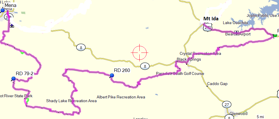
After a return visit to Mt Ida Café for breakfast, I parted company with Yancey about 8:30 with a cool 50 degree, 60mph wind tugging at me as I journeyed east on US270 for 13 miles. Womble Silver RD did a 180 back west off of US270 then continued on Owley RD. Next I rode Crystal Park RD which climbed switchbacks over the Crystal Mountains and passed by a crystal mine open to the public. Crystal hunting is a local pastime, they even hold contests among the hunters for the best crystals. Next, I followed Collier Springs to AR27 just north of the town of Norman. All of the roads this morning have been great, 30-35 mph peg-riding, traveling over well maintained 2-track through the Ouachita Forest. Comparing the two, the forest roads in the Ouachita National Forest generally seem much better maintained than those further north in the Ozark Forest.
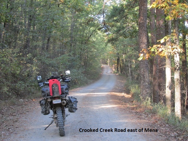
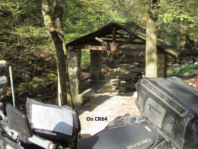
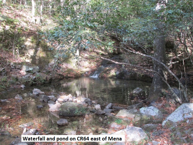
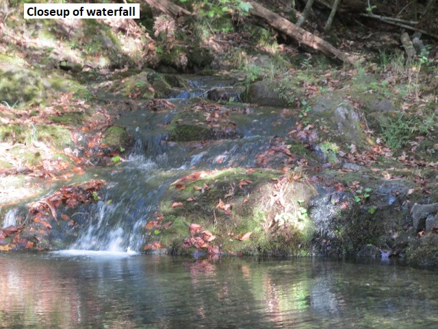
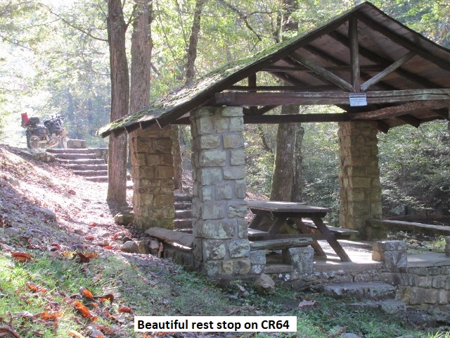
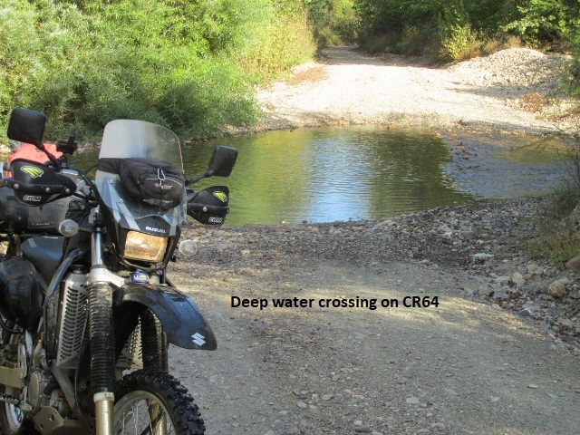
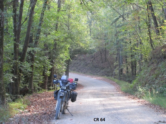
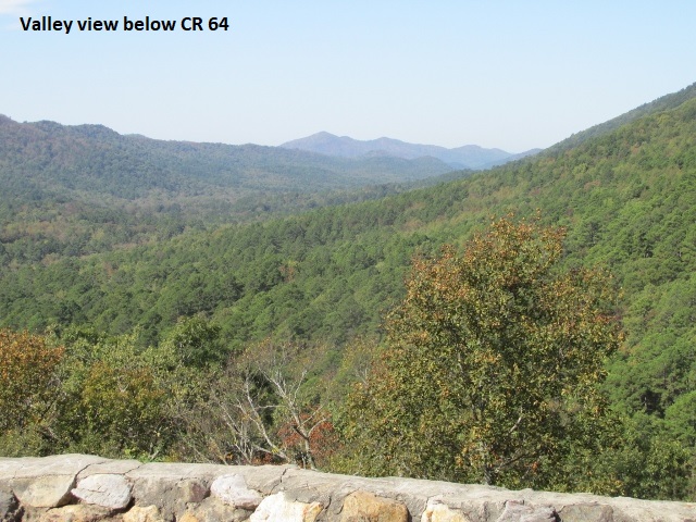
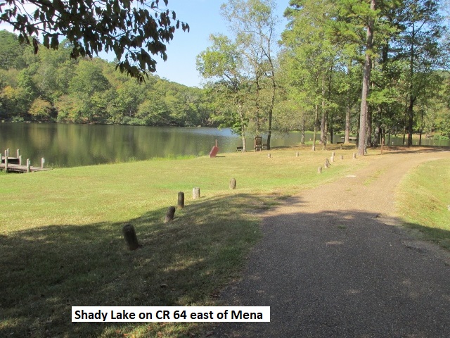
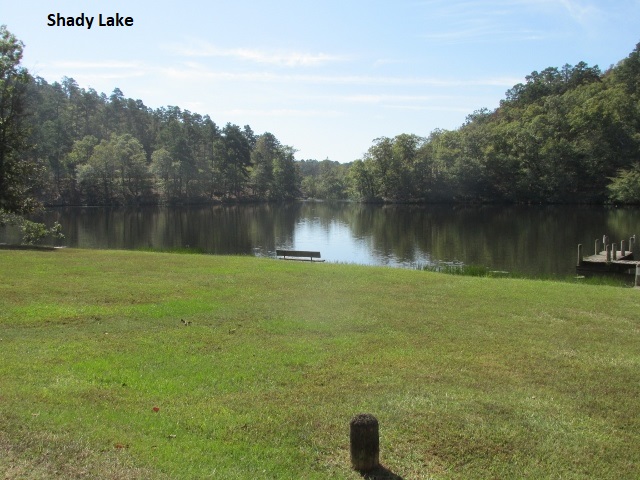
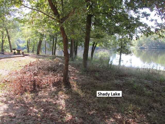
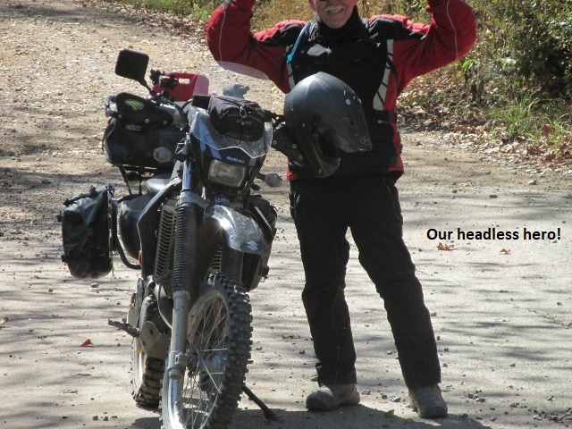
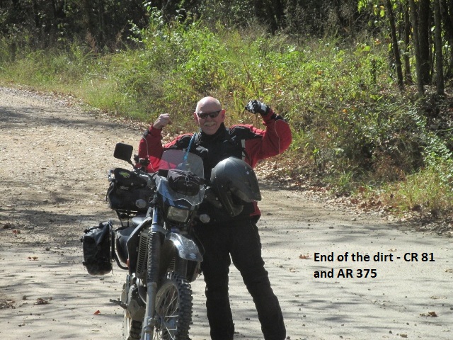
Leaving Norman on AR8 for a couple of miles, I turned onto Polk Creek RD for 10 miles before forking off on Crooked Creek RD. The sun was gradually warming things up as I made good time over roads on a par with yesterday’s excellent Gladstone Forest RD. CR260 and 601 continue to push me west until I hit CR64. As I turned south on CR64, a sign warned “narrow and rough road ahead”. The sign was outdated as the road had been resurfaced with crushed rock. The crushed rock is good for 4-wheel vehicles but makes the traction a bit squirrely on two wheels . . . feels like the front tire could wash out any second and dump me. I experienced a lot of elevation change, up and down, as CR64 continued south to Shady Lake. Shady is a small, picturesque mountain lake, with camping and a nice recreation area. Leaving Shady Lake on pavement, I missed my turn on “Old Shady Lake RD” and after a mile hit AR246. As a result, I mistakenly turned left and went about 3 miles before I realized what had happened. The dirt Old Shady Lake Rd to AR246 is closed and the new paved road I traveled to 246 is not shown on either my paper map or GPS map. Following 10 miles of pavement, my track turned off AR246 onto CR402 and back into the mountain forest. It was fitting that the final dirt of the Arkansas Loop, county roads 79 and 81, offered me a really superb ride . . . it was a fun, fast paced, up-on-the-pegs ride for 15 miles. At the intersection with AR375, I stopped and took the obligatory, celebratory, selfie . . . stumbling across the road in my riding boots, trying to beat the timer.
AR375 was also a fun, twisty slab ride for the 15 miles into Mena. Having traveled 100 miles, I arrived at McDonald’s in Mena about 12:45 where I met Yancey. We grabbed a quick bite before loading the DRZ in his truck and heading west towards Durant, OK. At Durant we pigged out on barbecue before settling into a room at the Best Western. Getting an early start Friday morning, we made it back to Lubbock about 2 p.m.
In seven days I covered approximately 1,100 miles, 100 miles from Antlers to Mena, and then 1,000 miles on the Arkansas Loop. I had a great time! I think Yancey did too.
Epilogue
As usual, as I compose this “Ride Report” it’s been several weeks since I finished the Arkansas Loop. In fact it’s four days to Christmas. The Loop was a true “adventure”! I’m really appreciative to the State of Arkansas and their encouragement of two-wheel recreation, and also to the riders who developed the dual-sport routes. Western Arkansas is really pretty and an excellent region for riders of all types. There wasn’t a lot of variety of terrain most of the roads were in the mountain forest. Mountain forest riding is technically fun (except for CR414!!) but I prefer a little more open country . . . guess I’ve been a flatlander too long. The people of Arkansas were really friendly and helpful.
The Wolfman quick–release plates were a great investment. At the motel each night it was really nice to be able to take my panniers into the room. Once day, when I let the bike fall over while stopped on an incline, I removed the top-side bag and found it much easier to pick the bike up.
Mileage each day was less than I usually manage, but about right given the slower pace necessary in the mountains. The weather was good with only a few sprinkles and tolerable heat and cold.
As always, I really appreciate my wife supporting my need to find adventure on two wheels! Also, I’m very grateful to the Lord for the opportunity, for a safe trip, and for the lack of any bike problems.
Sitting here in the cold of December, I’m already thinking about next year and another adventure . . . probably the New Mexico BCDR (Back Country Discovery Route).
Jerry Lewis 22 December, 2017