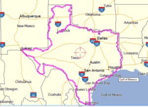
Texas Border Loop
By Jerry Lewis
(This is a ride report I put together in September of 2016 from notes
I’d made while traveling the Loop in the fall of 2005.)
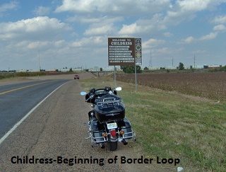
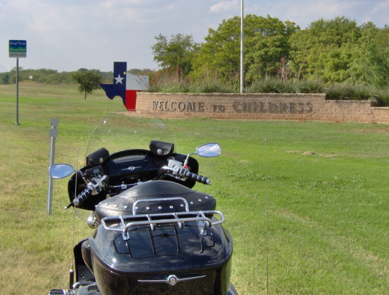
My goal for the Texas Border Loop was to circumnavigate the border of the state of Texas solo on my 2002 Yamaha Midnight Venture. The criterion was to stay as close to the actual border as paved roads would allow. Estimated time for the trip was nine days, including a day at my daughter Terri’s near Van Alstyne. Projected mileage is 3,470 miles with an average of 434 miles per day. I decided I would need a common point to start and finish that was near the Texas border. I chose Childress as it is near the junction of the eastern panhandle and the northern border as defined by the Red River. Due to the potential for cold weather I elected to travel counter-clockwise from Childress, thereby getting the colder part of the ride behind me.
Day One (Saturday, October 8, 2005)
 After dreaming of this trip for over a year, it was time to leave. My bike was loaded to the hilt. Enough clothes for nine days, leathers, electric jacket, several maps, voice recorder, MP3 Jukebox, and digital camera.
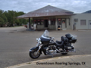
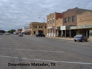
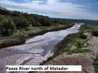
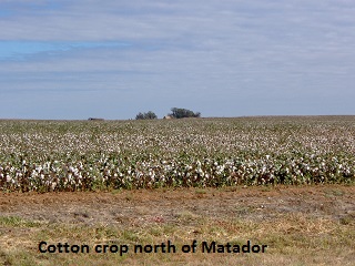
After breakfast at the Tech Café with friends, I left at 8 a.m. under sunny skies and a chilly 48 degrees. A blanket of clouds rolled in at Ralls, and by Crosbyton I stopped and slipped on my electric jacket. I turned north at Crosbyton and dropped off the cap-rock meandering through some pretty ranch land. The cap-rock is part of the same escarpment that forms Palo Dura Canyon 70 miles to the north. I stopped briefly in Roaring Springs, a pleasant little town of maybe a hundred souls. It was like stepping back in time 75 years. For a moment I fantasized about retiring there and being the town handyman. Then it was on north to Matador where I picked up SH-94. Highway 94 is a nap-of-the-earth road … a term I borrow from military pilots to describe roads which follow the natural terrain … up, down, and around over undulating topography. The pavement on the road was good but the roadway was narrow with no shoulder.
My knuckles turned white and my eyes anxiously searched the three foot high grass along the right-of–way as I remembered the “plethora” of feral hogs in this part of the Texas.
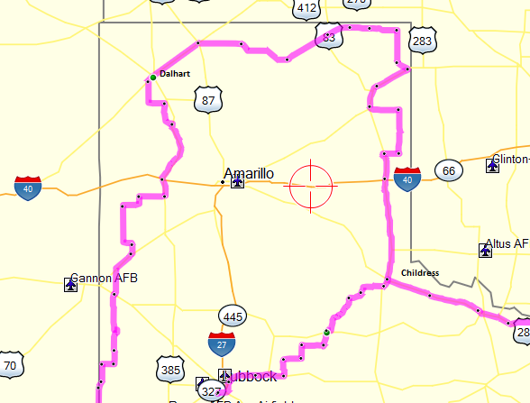
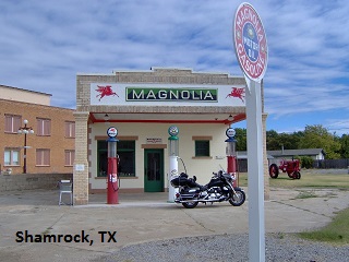
After 60 miles or so I arrived in Childress to actually begin my Texas Border Loop. Continuing up the eastern border of the panhandle on US 83, I arrived in Shamrock at the junction with I-40. After taking some photos of a couple of restored early gas stations I realized I was hungry. I had good intentions of snacking for lunches and eating a good breakfast and supper. Well, like most good intentions … I found a grocery store where I bought an apple, some fruit yogurt, and a cup of coffee to take the chill off. The young lady who waited on me asked where I was going and the conversation quickly revealed that she and her husband were avid riders. One of the really cool things about bike trips is the friendly and curious folks you meet along the way. I sat on the porch of a closed café and ate my “snack”.
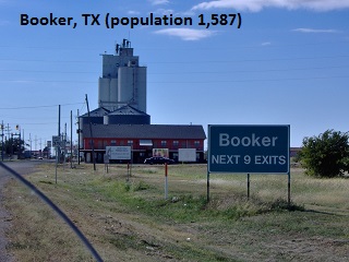
By the time I made it to Higgins in the northeast corner of the panhandle I was running on fumes, so I gassed up and continued north a bit further to Follett. The route then turned west along the top of the panhandle on SH-15 through the tiny burg of Booker. Someone there has a sense of humor as the green highway sign proudly proclaimed, “Booker, Next Nine Exits”, the nine exits being the only nine streets in town. SH-15 maintained a westerly heading through Spearman to Stratford where I joined US 54 southwest to Dalhart.
 Other than the odiferous chicken farms I passed along the way, the rest of the trip to the Comfort Inn in Dalhart was uneventful. Speaking of my motel … after eating next door, I returned to my room and stretched my weary 510-mile-eleven-hour body on the bed to watch the tube when what to my bloodshot eyes should appear but a ceiling covered with West Texas flies. After grabbing a weapon, one of the motel “mini” bath towels, I began to pop the flies from the ceiling. After about 20 minutes of carnage, I happened to look down and discovered that the floor was covered with white “popcorn” … the ceiling acoustic. I would have loved to have been a fly on the wall (pun intended) the next morning when the maid came to clean the room.
Day Two (Sunday, October 9, 2005)
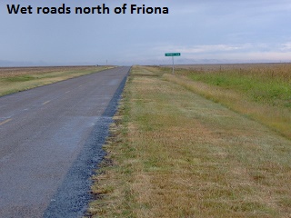
 I motored out of Dalhart, fly capitol of Texas, at eight. Heading briefly west on US 54, I turned south on farm-to-market roads until I intersected US 385 at Channing. I encountered light rain as I skirted Texas Boys Ranch, the tip of an iceberg of what lay in store. The landscape in the area was pretty in a rugged sense as the Canadian river makes its way east through its watershed. South of Vega I took CR 2587 west to SH 214 and south to Friona, passing uneventfully by flat farmland and countless cattle feed yards.
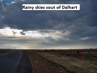
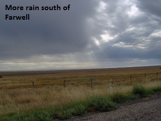
Rolling down CR 1731 south of Farwell the clouds ahead of me had that shade of dark-blue that causes a biker to ask, “This is supposed to be fun, right?” I rode bravely (stupidly?) on into the maelstrom trying to decide if it was yet time for the old rainsuit. With the wind howling and big drops of rain falling, I sat on a plow and sheltered behind an old barn while I tried to wiggle into my one-piece rain suit.
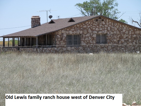
As I rode south in heavy rain on Stateline Road west of Denver City I passed by “the ranch”, the old Lewis family ranch house. The rock-slab house was built by my dad, Billy Sunday and helpers in the 40’s on the half-section his father, John Byron Lewis, had homesteaded many years before. My grandparents, parents, and sister Jan were living there when I was born in ’46.
The pavement soon ended so I headed east in a downpour on SH 83 to Denver City. As the rain leaked down my collar and pooled in the crotch of my jeans I decide it was time for a two o’clock lunch at the Denver City Dairy Queen. After downing a Hunger-buster and four cups of coffee while ignoring the waitress’s suggestion that I must be crazy, I climbed on my trusty Yamaha and headed for Seminole and then on to Andrews.
By Andrews the rain had stopped, but as I turned southwest on SH 115 to Kermit I notice that the sky in that direction was no longer dark-blue but pitch-black … with frequent streaks of lightening. But what to do? I needed to stay on schedule. So I said a prayer (prayers?), gritted my teeth and rode on. I tried not to think about all those stories I’d heard about lightning striking motorcyclists and the fact that I was the tallest thing around for miles except for scattered pump-jacks. That was probably the scariest 46 miles I’ve ever ridden! I’ve always heard that if you count the seconds between a flash of lighting and the resulting thunder it equals the miles from the lighting strike. Well, forget counting … this was nano-seconds. The rain was coming as hard as I’d ever seen. Anything over forty and I was hydroplaning. Cars and trucks were pulling off on the muddy shoulder … not an option for me with a thousand pounds of bike, rider, and gear. A few miles from Kermit the rain lessened but as I entered the town I was amazed. There was a river of water … literally 18 inches deep flowing down Main Street … kids were floating down the street in rubber rafts!
Cold and wet I wrapped around some coffee, which felt better than it tasted, at the Dairy Queen and wrestled with whether to go on to El Paso. I quickly discovered that I had miss-figured the distance from Dalhart to Kermit. Instead of 285 miles it was 445, a difference of 160 miles. As usual, it looked like such a short distance on the map! It was already five o’clock, I’d traveled 445 miles with 160 more to El Paso, and there were more storms looming in the west. (Remember this was 2005, before smart-phones and instant weather radar). I surrendered to common sense hoping to make up the miles the next day. Schedule or not, enough is enough. I ask the waitress which of the three motels in Kermit was best and got a room for the night. After a quick shower I hit the sack early thanking the Lord I made it this far. As I doze off, I think, “Surely tomorrow’s got to be better”.
Wow, what a day!!
Day Three (Monday, October 10, 2005)
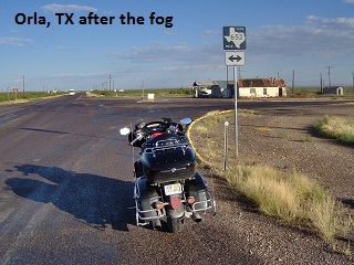
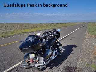
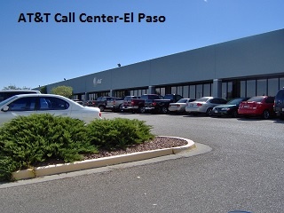
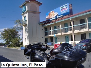
 My plan was to leave at first light and make up some miles but I awoke to dense fog and a soaked bike. I finally got away about eight but was only able to do 45-55 mph due to the near zero visibility. As I headed west on SH-302 I turned my flashers on and watched my “six” for oil field trucks barreling down on me in the fog. Even though I was carrying a 2 gallon gas can, I stopped in Mentone and topped off my tank. It was a good thing I did because there was no more gas before El Paso 170 miles west. Finally, at Orla the clouds dissipated and I had a great ride on FM 652 to the Guadalupe Mountains. Joining US 180, I was on familiar ground as I continued on to El Paso. Up until my retirement from AT&T in ’99, I made the trip from Lubbock to El Paso so many times I could have driven it blindfolded. For old-time’s sake I rode by the La Quinta (my home-away-from-home for several years) and then the AT&T Call Center near the airport where I spent many working days.
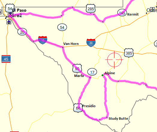
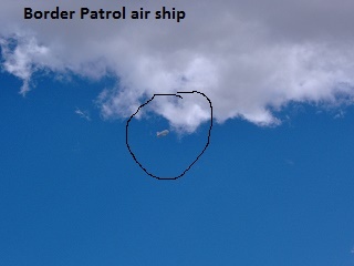
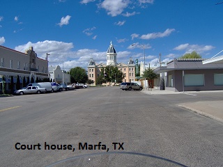
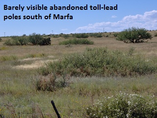
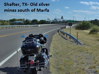
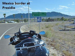
As I rode southeast from El Paso on I-10 I lunched on crackers and a banana and then turned onto US 90 at Van Horn. Continuing southeast along US 90 I spied aloft a US Border Patrol tethered airship which keeps an eye on the Texas/Mexico border. At Marfa I turned due south on US 67 to Presidio. This was another familiar highway as I rode through the ghost mining town of Shafter. I spent a few months of my early career with Ma Bell climbing poles on the old open-wire toll lead between Marfa and Presidio. Again I carried extra gas as I was a little leery of stopping in Presidio being a lone “gringo”.
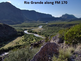
As the afternoon waned, I traveled down FM 170 along the banks of the Rio Grande to Study Butte. Since that trip I have ridden FM 170 many times enjoying again the great rollercoaster ride and scenery. When I reached Study Butte It was decision time. My original plan was to ride a few miles east into Big Bend National Park and then north on US 385 to Marathon. However, the sun was getting low in the sky and I had no desire to dodge deer, feral hogs, and antelope in the dark. The alternative was to take SH-118 the 80 miles north to Alpine. So I hooked it on toward Alpine arriving at dusk with no threats from wildlife. It was a great ride but I was butt-sore and weary after twelve hours that covered 650 miles of far west Texas.
Day Four (Tuesday, October 11, 2005)
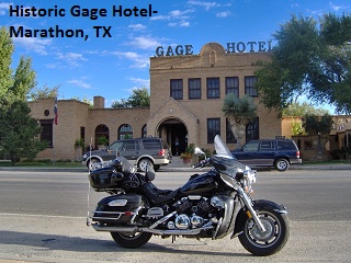
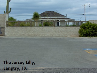
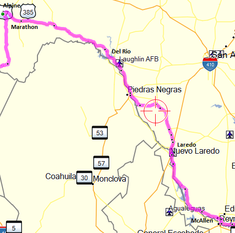 When I rolled out of the sack I was still tired from yesterday’s long ride. I left Alpine about 8:30 with temps around 50 degrees. I followed US 90 east to Marathon where I shot a picture of the historic Gage Hotel. Then it was on to Sanderson and Langtry, home of the notorious Judge Roy Bean. As I neared Comstock I was delayed a half-hour while repairs were being made on the Pecos River Bridge. It’s really quite a view as I crossed the highest highway bridge in Texas which spans the canyon some 275 feet above the river.
I’d been 200 miles by noon when I reached Del Rio and sat down at Luby’s for some good chow and couple of desserts. Traveling US 277 to Eagle Pass, I observed more eagles than I’d seen in my whole life. It was my first time to visit the city of Laredo and I was totally underwhelmed … bad roads, terrible traffic, and very third-world appearance. I was still 140 miles from McAllen and as the temperature climbed I shed my coat and gloves and pushed on. As I came to Roma the road turned out to be stop-and-go traffic, 30-45 mph, for mile after mile as I passed through several small towns. I finally arrived in McAllen about 7:30 and stopped at the first decent motel I saw. McAllen impressed me as a clean, busy, and progressive city. After 530 odd miles for the day, my weary body was wishing I’d planned a day to recuperate.
Day Five (Wednesday, October 12, 2005)
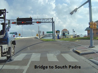
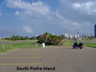
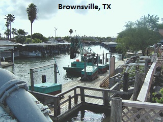
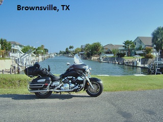
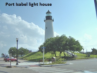
 Around eight I rode south from McAllen to Hidalgo in order to follow the border more closely on US 281 to Brownsville. Traveling south along US 281 and closely paralleling the Rio Grande, I soon passed by the Santa Anna Wildlife Refuge. Other than the occasional small town or snow-bird RV park the countryside was mostly cultivated. The traffic was really heavy in Brownsville as I made my way to the Port Isabel lighthouse and across the Queen Isabella Bridge to South Padre Island. In 2001 some barges rammed part of this bridge killing several people in the aftermath. After snapping some pictures on Padre I rode back across the bridge and took US 77 to Harlingen and then north toward Kingsville. It wasn’t long before I came to a Border Patrol check point where they stop vehicles and inquire as to citizenship. When the car in front of me pulled away, the agent waved at me to move ahead. I mistakenly thought he was telling me to continue on since I was on a motorcycle. While I slowly rode by him, he suddenly came running after me screaming “Stop! Stop!” … which I immediately did. I tried to explain my mistake but he was really “pist” (family joke) and proceeded to tell me how stupid I was and how I better get my act together. What an “a-hole”!
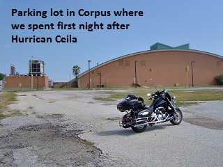
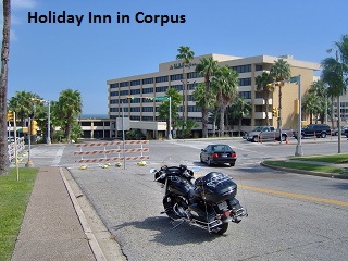
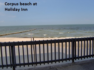
Arriving in Corpus Christi I detoured down to Shoreline drive for a little nostalgia trip. In 1970 I spent a couple of months in the Holiday Inn on Shoreline Drive while I and my phone company buddies helped make repairs after the devastating Hurricane Celia. We moved into the hotel two nights after the storm where we occupied windowless rooms with sopping wet carpet. Stopping at the Holiday Inn, I shed my boots and took a few minutes to wade in the Corpus Christi Bay before riding on.
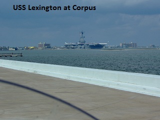 As I left Corpus and crossed the Bay Bridge heading to Aransas Pass, I spied the USS Lexington aircraft carrier which is a floating museum in the bay. Wishing I had time to take a tour, I instead pressed on east riding SH 35 into Port Lavaca for the night. I arrived there about five and found a car wash and cleaned up my bug encrusted bike. Afterward I found an excellent seafood restaurant and then hit the sack at my motel. This was my shortest day so far, having ridden 372 miles.
Day Six (Thursday, October 13, 2005)
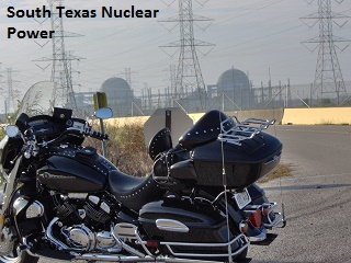
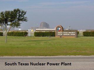
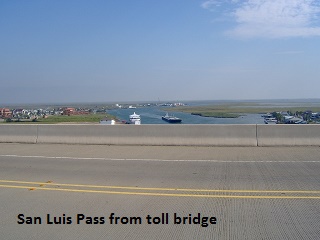
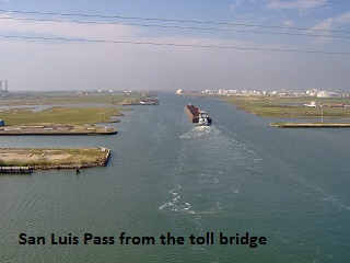
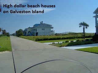
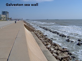
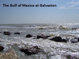
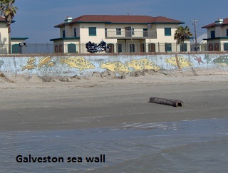
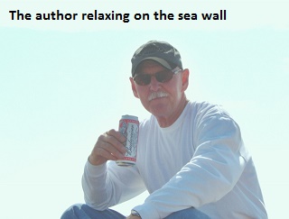
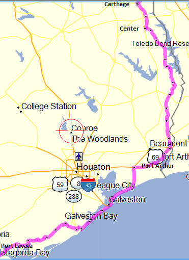 The weather was really pleasant as I rode east across Port Lavaca Bay bridge still following SH 35 to Port Comfort. After passing through Palacios I turned onto FM 521 and rode east past the South Texas Nuclear Generating Station. That was the first nuclear plant I’d seen and wasn’t even aware Texas had one. FM 521 is a great motorcycle road twisting through forests of oak trees as it parallels the gulf coast on the way to Freeport. Leaving Freeport, I rode across the San Luis Pass-Vacek Toll Bridge which connects to the southwestern end of Galveston Island. Highway 3005 runs the length of Galveston Island, and as I motored along I passed mile upon mile of million-dollar beach homes along the road. When I reached the city of Galveston, I climbed down the sea wall stairs and sat for a while. Enjoying an adult beverage, this son of the arid Texas plains watched with fascination as the waters of the Gulf of Mexico crashed into the rocks below. Back on the bike, I observed some damage on the eastern end of the island caused by Hurricane Rita, but not near what I would see at Port Arthur.
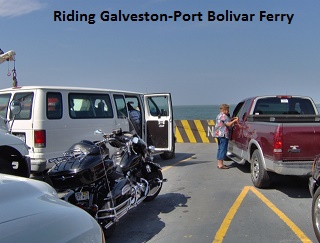
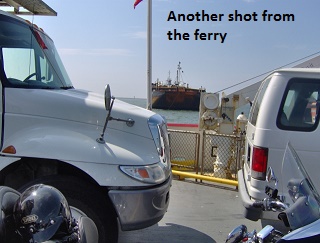
 Saying goodbye to Galveston Island, I boarded the toll-free Galveston-Port Bolivar Ferry which connects travelers to SH 87on the Bolivar Peninsula. The boat trip covers about three miles and takes about twenty minutes. One gregarious fellow on the ferry talked my leg off, plying me with questions about my trip. After a few miles I detoured north on SH 124 as SH 87 was closed from that point on. The eastern portion of SH 87 has been washed out repeatedly over the decades and has been closed continuously since 1990.
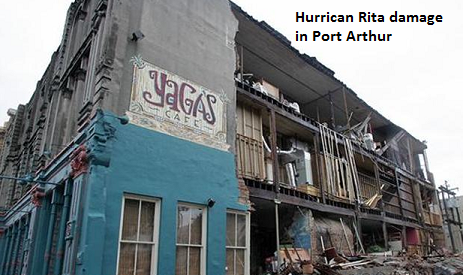
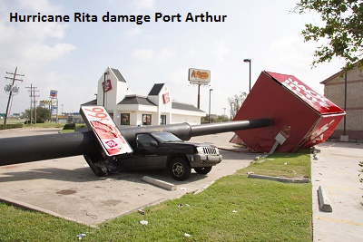
I began to notice more storm damage while still 25 miles west of Port Arthur along SH 73. Hurricane Rita had made landfall three weeks before on September 24th, 15 miles south of Port Arthur pushing winds speeds of 120 mph. I was truly amazed at the extent of destruction as I rode into the city. The destruction wasn’t total but so wide spread … it seemed that every building I saw had some damage. Sheet metal was everywhere, power lines were down, signs and traffic lights were down, and broken and uprooted trees all over. Leaving town, my route took me north along the eastern Texas border tracing the Sabine River.
I continued to see storm damage along US 87 all the way to Center, 150 miles north. Most of the damage was in the form of downed and broken trees in the Sabine National Forest. The road through the forest was really good riding but I had to be careful of crews clearing the roadway and bar ditches.
I rode into Carthage just as darkness descended and ate some barbeque before I found a room at a local fleabag. It had been an 11 ½ hour day covering 435 miles.
Day Seven (Friday, October 14, 2005)
 I overslept a little so I quickly loaded up and left Carthage around eight. I rode US 79 for a ways then SH 31 north to Marshall where I grabbed some breakfast at IHOP. Leaving Marshall I rode SH 43 to Atlanta (
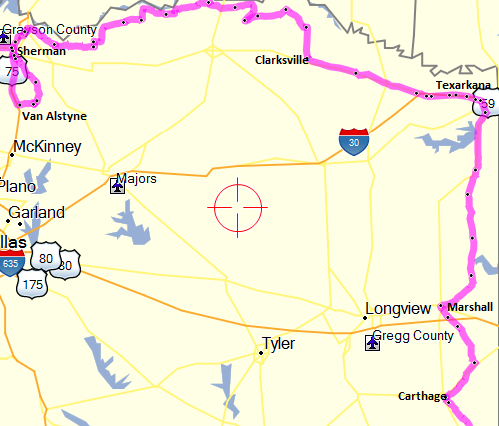
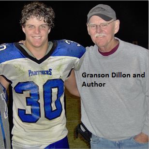
 ![]() Texas). SH 43 was a really nice bike road as once again I found myself winding through dense pine-forest. At Atlanta I connected with US 59 which carried me north to Texarkana, the very northeast point of my Loop. I next headed west on the old US 82 in order to avoid the parallel highway, I-30 … not a big fan of riding interstates. Continuing west I could have zigzagged north and west on a few FM roads and been closer to the Red River. However, time was becoming a factor as I had an appointment that evening in Van Alstyne to watch my grandson Dillon play football … a fullback and middle linebacker in his senior year.
Texas). SH 43 was a really nice bike road as once again I found myself winding through dense pine-forest. At Atlanta I connected with US 59 which carried me north to Texarkana, the very northeast point of my Loop. I next headed west on the old US 82 in order to avoid the parallel highway, I-30 … not a big fan of riding interstates. Continuing west I could have zigzagged north and west on a few FM roads and been closer to the Red River. However, time was becoming a factor as I had an appointment that evening in Van Alstyne to watch my grandson Dillon play football … a fullback and middle linebacker in his senior year.
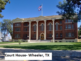
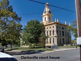
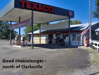
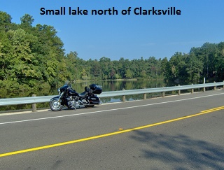
Arriving in Clarksville I took a picture of one of Texas’ architecturally ornate court houses, a site which I always appreciate. After leaving Clarksville headed north on SH 37, I turned west on a series of FM roads that closely paralleled the Red River and the Oklahoma border. A little past noon I came across a gas station-café and enjoyed a really good cheeseburger and some pie.
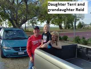
 Still headed west I passed through the tiny towns of Telephone, Ivanhoe, and Ravenna before turning south at Denison on US 75. I rode US 75 to Van Alstyne and then east to spend the night in the country with my daughter Terri and her family. My distance for the day was 345 miles … all in all, an easy relaxing day.
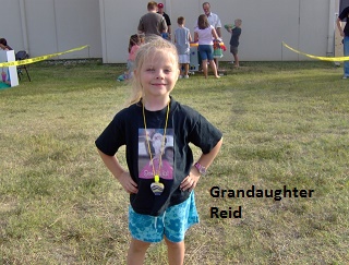
I don’t recall who won the football game that night but my grandson had a good game, as usual. Dillon is now married and has three little girls. His sister Reid is now sixteen and will soon graduate high school. “Sunrise, sunset, sunrise, sunset” … where do the years go?
Day Eight (Saturday, October 15, 2005)
No travel on Saturday … spent the day with daughter Terri and family.
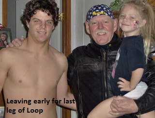
Day Nine (Sunday, October 16, 2005)
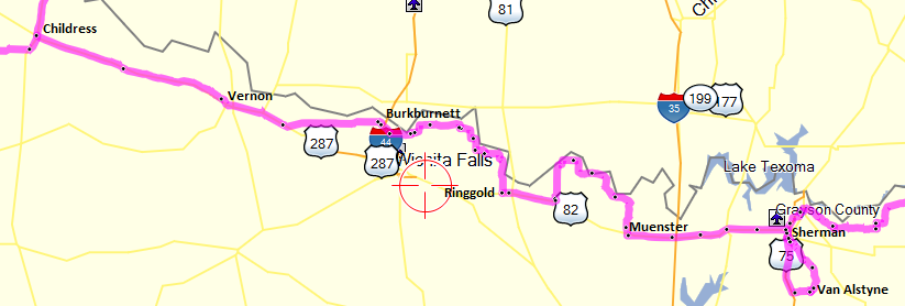
Around eight I left Terri’s after an enjoyable visit and headed north to Tom Bean and then on to Sherman riding SH 11. It was a cool 60 degrees as I headed west on US 82 to Whitesboro where I stopped for a late breakfast. At Muenster I turned north and followed FM’s 373, 677, 2953, and 103, passing through Illinois Bend and Spanish Fort and then south to Nocona rejoining US 82. That sequence of roads took me north and then west very near the Red River. Just west of Illinois Bend there is new bridge on FM 677 that crosses the Red River into Oklahoma. These turned out to be great motorcycle roads and while I was turning around at the bridge a group of about 25 Harleys rode by me.
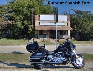
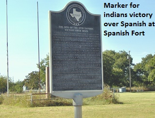
Spanish Fort is now a ghost town but has a really interesting past and worth a Google. Between 1750 and 1757 the Taovayas Indians established two permanent villages on opposite sides of the Red River near the site. The Taovayan village was fortified with entrenchments, wooden stockades, and a moat and protected by some 6,000 Indians flying the French flag. A hundred years later the ruins were mistakenly thought to be Spanish and settlers erroneously named the town Spanish Fort. The town grew to fair size due to cattle drives and its proximity to a Red River crossing.
 Traveling west again on US 82 I turned north on FM 2332 and then west again, eventually winding up in Burkburnett. Still headed west, I rode to the junction with US 287 and then ate a late lunch in Vernon. Continuing west on US 287 I passed through Chillicothe and Quanah and finally arrived at Childress thus completing my Texas Border Loop. I had been 290 miles since Van Alstyne and I still had 145 miles to go to Lubbock. By that time I was “smellin” the barn” so I beat a path for home.
Epilogue
The Texas Border Loop was a truly enjoyable motorcycle trip … experiencing firsthand the tremendous variety of scenery in Texas … a variety that I would suggest is not equaled by any other state. The actual Loop itself was approximately 3225 miles after subtracting the side trips. Except for the day of rain the weather was beautiful. Except for a certain Border Patrol agent, the people were friendly and interested in my adventure. My wife Lyn mentioned recently that she would like to join me for a redo of the trip in the near future. Who Knows? Maybe we will …
Jerry Lewis, September 2016