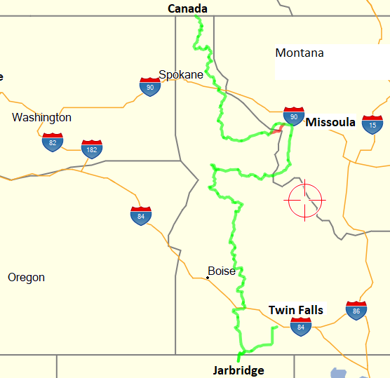
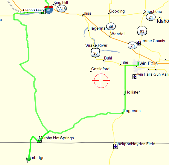
Idaho Backcountry Discovery Route
14 August 2020 – 28 August 2020
By Jerry Lewis
IDBDR Introduction
For those bored from binge watching TV due to Covid-10, welcome to my dual-sport “ride report” for 2020. The BDR routes are scouted and planned by a non-profit group known as Backcountry Discovery Routes (BDR). The Idaho Backcountry Discovery Route, like all the BDR’s, is a multi-day, off-road dual-sport motorcycle adventure. It is intended for intermediate to advanced riders and can be ridden on most street legal dual-sport and smaller adventure motorcycles. Following is an excerpt from the BDR website describing the IDBDR:
If you’ve ever wanted to ride endless twisty mountain roads, the Idaho BDR will throw corners at you for days on end. You also won’t get many digital interruptions because your cell phone won’t have reception on much of this route. It’s a true off- the-grid ride that is long enough, at 1,250 miles, that you might just use up an entire rear knobby tire.
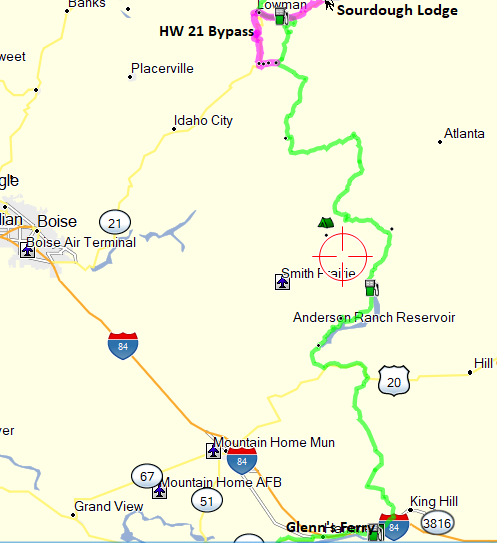
Starting in the historic town of Jarbidge, NV the route crosses range lands and then heads into the Boise National Forest and treats riders with views of Andersen reservoir and epic alpine camping at Trinity lakes. Tiny towns and treasures like Burgdorf Hot Springs make this a bucket list ride for sure. You’ll travel where Lewis and Clark made history and experience the legendary Magruder Corridor and Lolo Motorway which skirt the roadless Selway-Bitteroot Wilderness. You will reach modest hints of civilization as you pass through Sand Point, Bonners Ferry on your way to the Canadian Border.
IDBDR Preparation
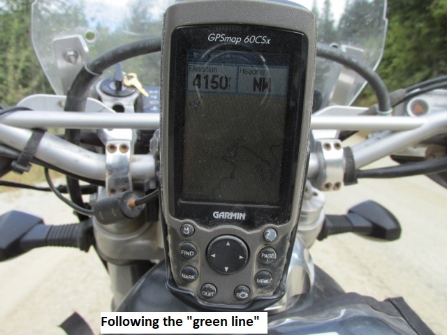
I had considered riding the IDBDR for a couple of years but I vacillated due to the distance From Lubbock to Idaho and also the remoteness of much of the route . Considered to be one of the easier BDR’s, some of the riding is still very technical and even hazardous, particularly riding solo. Solo, since once again I couldn’t twist anyone’s arm to accompany me. As usual, I spent several hours checking ride reports from other riders. I knew the weather in that latitude could be quite cold even in early September, so I decided starting mid-August was best. While lodging was scarce on the New Mexico and Colorado BDR’s, Idaho is in a class by itself in that regard. I considered the various distances between towns and realized I would have to go off-route a couple of times to find lodging. In addition, it would require a couple of short days to avoid extra-long days and perhaps having to ride after dark. Since lodging was scarce, I made reservations for each night of the trip. As usual, rather than depend solely on my GPS and the Butler map, I copied thirty-odd 11 x 17 pages from an Idaho gazetteer then highlighted the entire IDBDR. That way I could place each day’s route pages in my tank bag map pocket for easy reference. As I’ve mentioned before, while following the routes green line on my Garmin 60 CSX is the quickest way to navigate, having paper maps serves as a backup. It shows me options for rerouting (what I call “bail-outs”) due to road closures or bike problems, as well as displaying the “big picture” of the route.
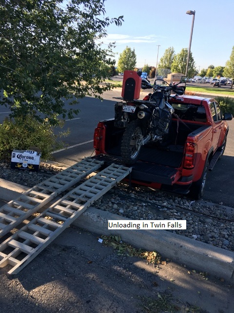
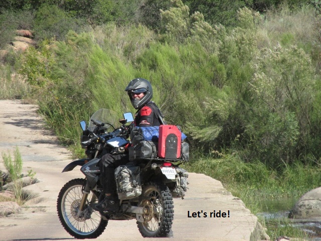
Since Idaho was so far, I would transport my Suzuki DRZ 400S in my Chevy Colorado to Twin Falls, Idaho and leave the truck at the Best Western. I checked with the motel and got permission to leave it in their parking lot. As with the Colorado BDR, I would have to plan a return route from Canada back to my truck at Twin Falls. Due to time restraints and a distance about 700 miles, my return trip would be on pavement. Again, consulting the gazetteer, I mapped out a scenic and twisty route over mountain highways to add some fun factor. Bike preparations consisted of general maintenance items and some new knobby tires. The only novel thing I did was make a small tool to facilitate removing my panniers (saddle bags).
Since I’d be riding solo, I would carry “on my person”, my Fast-Find Location Beacon (PLB) as well as my Garmin InReach Mini tracker/communicator. Both these units are capable of summoning first responders to my exact location should I be seriously injured (assuming I’m conscious and can activate them 😉). They provide the ability for family and friends to follow my track on Garmin’s web site in basically real-time. In the off chance I’m injured to the point I can’t activate an emergency call, if those tracking me notice an unexpected period of non-movement on the tracker, they will have my latitude/longitude info and can notify local rescue if they. The ability to send and receive text messages with the InReach Mini via satellite offers me and my family even more peace of mind.
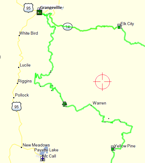
Master Map and Intinerary
General Information
As I’ve done the last few years, throughout the day I periodically stop and make voice recordings on my I-phone. I do this in order to remember and describe the scenery and riding conditions for later transcription. This ride report is based on those recordings.
One last bit of information: I will periodically refer to the classification of a given road, indicating the degree of technical difficulty involved in riding that road.
Following is the rating system I will use:
Class 1: Improved dirt, gravel, etc. Passable by any motorcycle capable of off-pavement travel.
Class 2: Poorly maintained dirt, gravel, etc. Rocks, sand, mud holes, ruts, inclines, water crossings, or other similar obstacles make this road difficult for larger, heavier adventure motorcycles and requires some rough terrain riding skills.
Class 3: Rugged, unmaintained dirt, gravel, etc. roads. Significant obstacles such as moderate sized rocks, deep sand, deep or long mud sections, deep & wide water crossings, and/or steep inclines with loose terrain & tentative traction make this road/trail extremely difficult for large adventure bikes and very challenging for large dual sport motorcycles such as 650cc thumpers. Advanced rough terrain / off-road riding skills advised.
Class 4: Extremely rugged road that contains highly challenging obstacles such as steep drop-offs, deep & fast moving water crossings, very steep inclines with loose surface, boulders, deep & long mud sections, downed trees, and deep & long sand sections. Generally not passable by large adventure bikes, extremely difficult for large dual sport motorcycles such as 650cc thumpers, and very challenging for smaller dual sport / trail bikes. Should be attempted only by those with significant rough terrain / off-road riding skills and experience.
Note: Roads are classified according to the most difficult section of that road. Classifications should indicate the most difficult section a rider will encounter along that road. For example, a road may be a class 1 with the exception of a class 2 water crossing. The entire road is, therefore, a class 2 road, even though the majority of the road fits in class 1. The single class 2 river crossing means the road must be classified overall as class 2.
Day One – Friday, 14 August 2020
Lubbock to Green River, UT
The day finally arrived, and I left Lubbock about 6:30. Made it before noon to Albuquerque where, due to Covid, I searched in vain for an open dining room. Finally grabbed something to go and headed west on I-40 to Gallup, then north on US-491 through the Navajo nation to Moab. The road was 55 mph with tiny Indian villages every five miles, slowing the speed to 35 for three miles. It was really hard to make any time. At some point, I was behind a car and a pickup following a slow moving truck when we came to a passing lane. The passing lane was not long so I sped up and began to pass all three vehicles. As I passed the pickup, I glanced right and saw, to my chagrin, it was a sheriff. I pulled back in and slowed to 55 but quickly saw flashing red and blue lights in my mirror. The deputy was real young (aren’t they all anymore) and courteous. He explained to me that the speed limit when passing is still 55 mph (I never have understood that??) then told me to slow down and drive safely. No ticket!! On I traveled through Shiprock, Cortez, Moab, all the way to Green River, Utah and found a room and some Mexican food, having made 760 miles for the first day.
Day Two – Saturday, 15 August 2020
Green River, UT to Twin Falls, ID
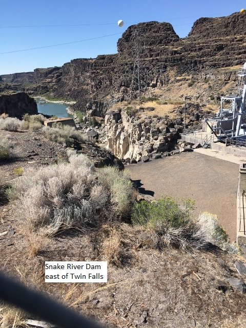
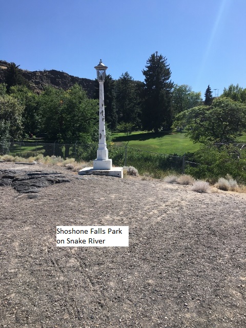
After breakfast I left Green River around 7:30, traveling through some rugged mountains and winding roads around Price, Utah, then north through Salt Lake on I-84. I eventually stopped for lunch at Snowville at the Idaho border. Found a mom and pop café and enjoyed a burger and some delicious hot cherry pie alamode (this is a vacation!). When I got close to Twin Falls, I exited the interstate to take SH-50 into town. This gave me a chance to view the Snake River Canyon. I took several photos and made a couple of detours down into the canyon to check out Shoshone Falls park. The Best Western motel was old but cheap, so I unloaded the bike and I drove the truck around a while to check out the town. It was an easy day of 400 miles today as I drove the whole way listening to an audio book. I’m chomping at the bit to start my ride tomorrow.
Day Three – Monday, 16 August 2020
Twin Falls to Glenn’s Ferry
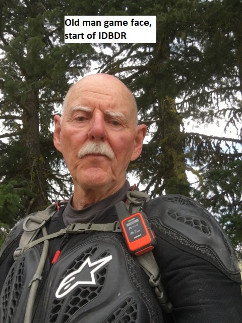
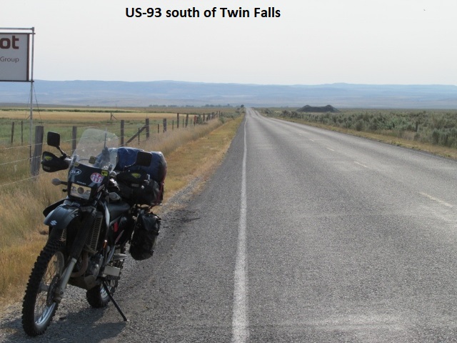
This is my first recording on the Idaho Back Country Discovery Route. It’s Sunday morning, August 16th, 9:45 local time … been riding about 45 minutes. I left Twin Falls riding south on US 93 to the official start of the route in Jarbridge, Nevada. At Rogerson I turned off on Three Creek road headed due west. This road will eventually turn south to Jarbridge. Currently, the road is narrow and paved but if memory serves me, at some point it turns to dirt. The area I’m in right now is mostly farming with a few hills dotting the horizon; really pretty country. It was a little cool when I left this morning but it’s already getting hot, headed for 105 degrees in Glenns’ Ferry where I’m staying tonight. Heat wise, I’m afraid it’s going to be a grueling day.
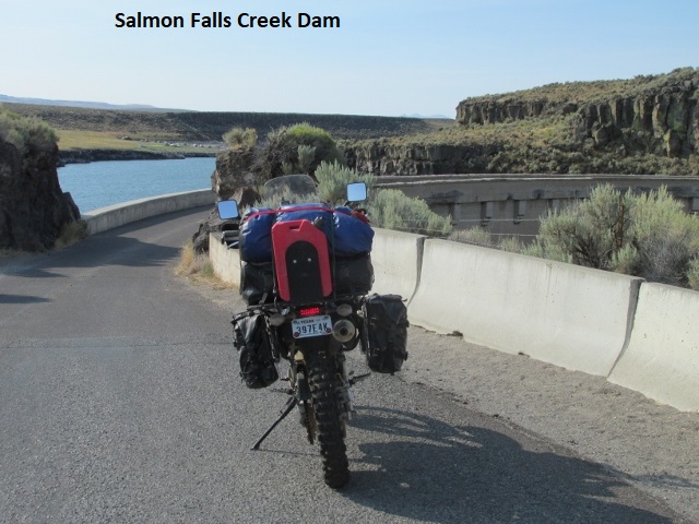
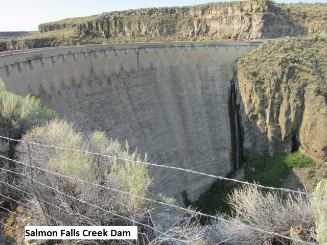
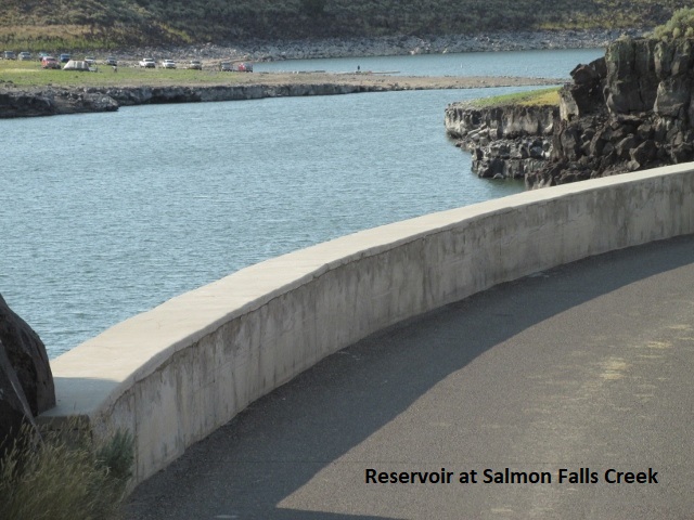
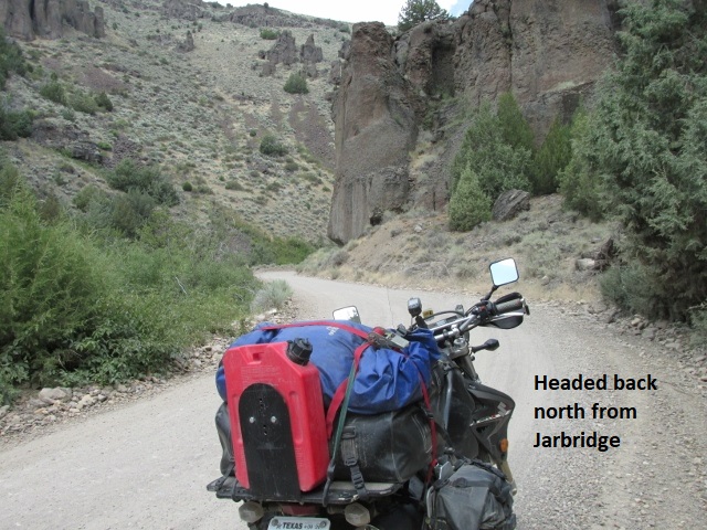
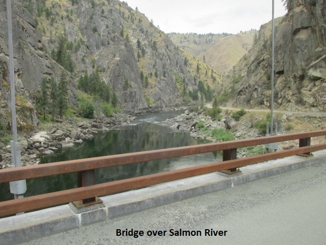
It’s 12:15 and I’m now in Jarbridge Nevada, the official start of the Idaho BDR. It’s been an adventuresome 96 miles thus far. A few miles west of Rogerson, I crossed over the scenic old dam at Salmon Falls Creek Reservoir. About 20 miles after I turned off US-93 my bike died and I coasted to a stop. Didn’t know what was wrong at first but quickly decided I was out of gas. I thought I recalled gassing the bike in Lubbock but obviously my memory’s not what it used to be. Fortunately, I carry a gallon of gas with me in a Rojo cannister for such senior moments, so I quickly emptied it into my tank.
I now was faced with a decision; go back 20 miles to Rogerson or continue on for the 50 miles to Jarbridge. The bike gets about 50 miles to a gallon, so I decided to go on to Jarbridge, knowing I’d be cutting it very close.
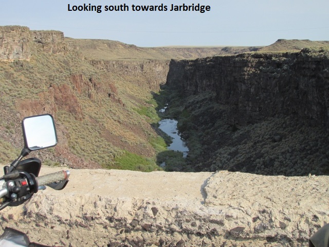
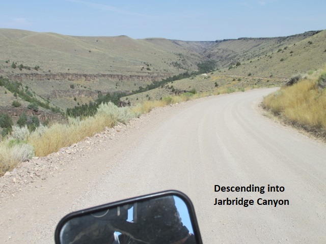
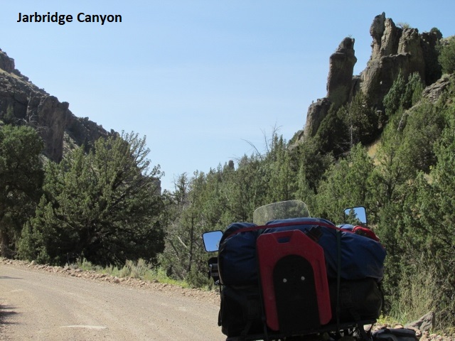
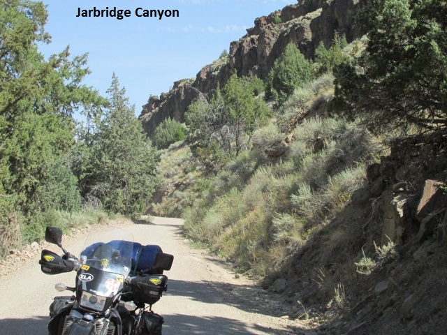
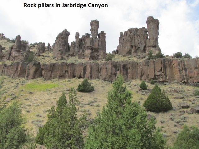
The pavement soon ended, and the road dropped into a deep canyon winding south following the Jarbridge river. Really neat 10 miles of one-lane road through the canyon lined with rugged rock outcroppings cleaving precariously to the canyon walls. About three miles before Jarbridge I ran out of petrol again. I turned the petcock to reserve, knowing my reserve was all but nonexistent. That bought me another two miles. As I was offloading gear to lighten the bike so I could lay it on its side, some guys in a truck stopped and helped me. Laying it down allowed the fuel from the right wing of the tank to flow to the left wing where the fuel petcock is located. Fortunately, that got me two more miles into Jarbridge. I was really relieved to find a stand-alone gas pump there and the $4.35 a gallon price was a bargain. After filling up I found this picnic table in the shade (very hot) where I’m now enjoying my crackers and Gatorade. Fixing to leave and retrace my path north through the canyon continuing in the general direction of Glenn’s Ferry. 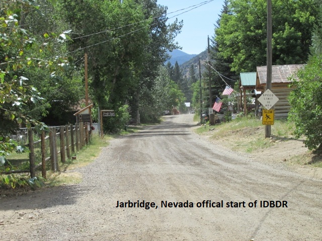
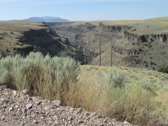
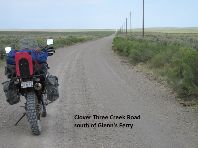
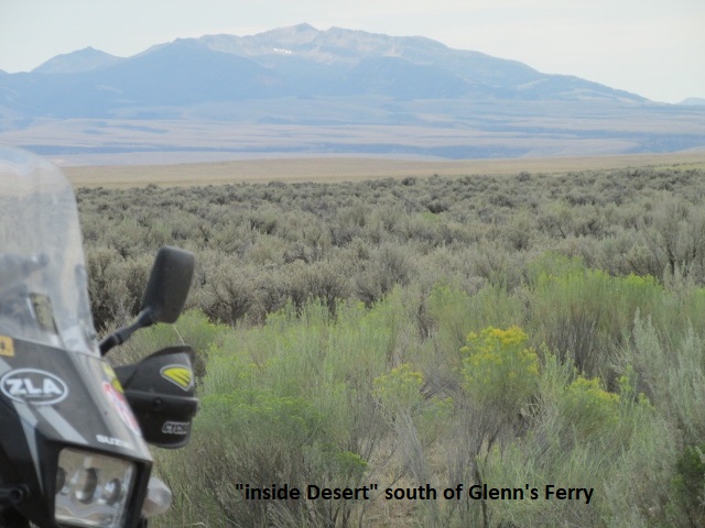
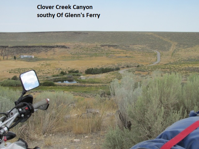
Been 151 miles and just dropped off into Clover Creek canyon and then climbed back up to this overlook. After I left Jarbridge the trail took me all the way back to pavement and then north on gravel on Clover Three Creek road. Same as this morning, the flat prairie is covered with sagebrush, occasionally cut by deep canyons and gorges just to the east of me. Really wide-open country out here, officially the “Inside Desert”, but the “big empty” seems a better name. I’ve only seen one vehicle this afternoon. Cumulous clouds dot the sky and I’ve felt a few very light sprinkles. I believe I’m about an hour south of I-84 which will take me east into Glenn’s Ferry. It’s a scorcher but bearable as long as I’m moving along at 45-50 mph. The roads have been a mixture of caliche and gravel. In places the gravel is golf ball size and deep enough to make for some squirrely riding.
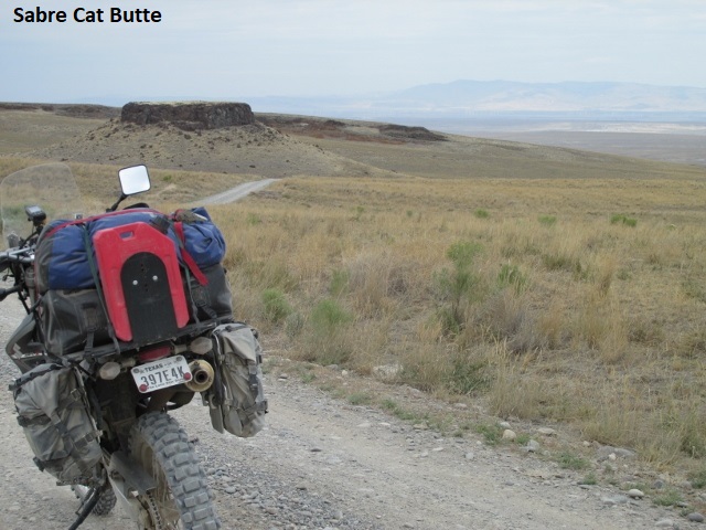
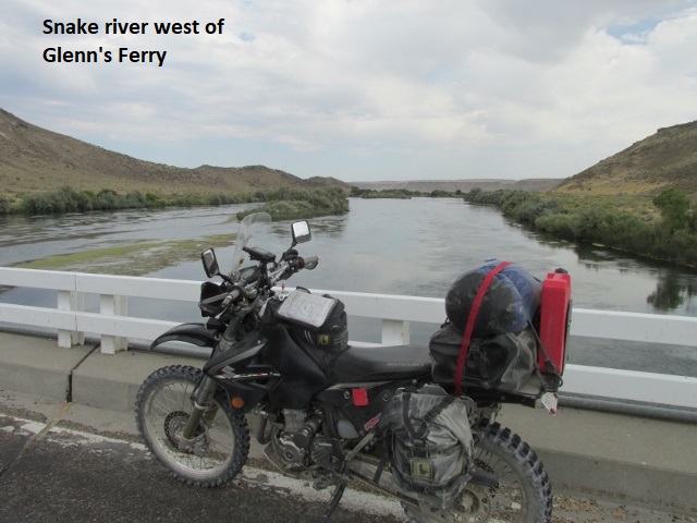
It’s now about 4:30 and I arrived in Glenn’s Ferry about 3:30. After my last stop, I turned off on East-West road, a nice two-track which was a welcome change after the gravel. It was a lot more fun riding, winding around and dipping down into some small valleys. Eventually it took me around Sabre Cat Butte before connecting with aptly named Pothole road … terribly rub-boarded. Finally hit Browns Creek road which led me to SH-78 that parallels I-84 and into Glenn’s Ferry. As I travelled SH-78 east, I had a great view of the wide Snake River as it continued its westward flow. The thermometer only made it to 100 today so I’m guessing the high cloud cover ameliorated the forecasted 105.
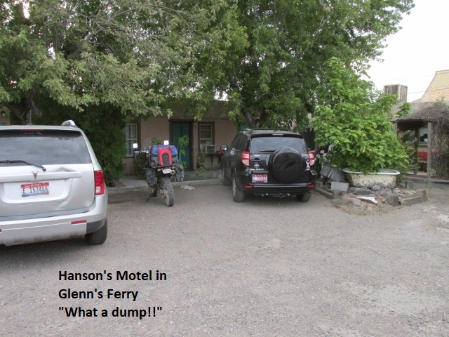
Glenn’s Ferry is very small, stretching east and west beside the Interstate. I had made reservations at Hanson’s Motel and Café but being Sunday, the café and office were both closed. A sign directed me to the bar located on the back side of the building for access, but the bar was also closed. After knocking on the door, the bartender let me in but couldn’t find my reservation. In any case they had a vacancy, much to my chagrin. Wish they hadn’t had a room and I would have moved on; the place is a dump. Guess it’s clean enough, just old and rundown like a seedy old hunter’s motel with people living in a couple of the rooms. Got two beds and a shower so I guess I shouldn’t complain at $54 a night.
Day Four – Monday, 17 August 2020
Glenn’s Ferry to Loman
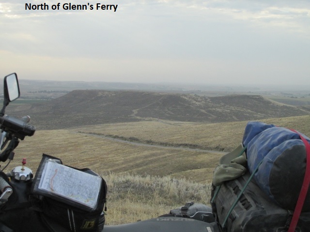
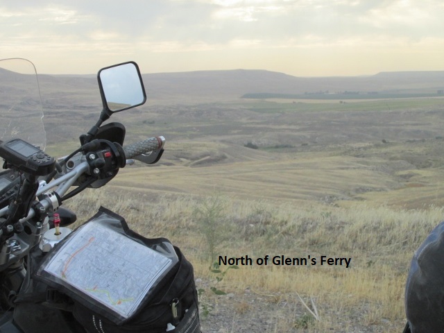
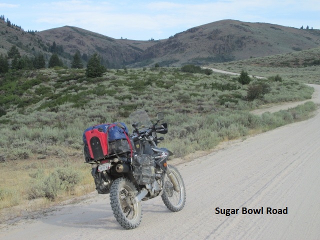
Well, it’s Monday morning about 8:50, I’m about 22 miles north of Glenn’s Ferry. Someone just now stopped and graciously asked if I needed any help. I suppose that due to the remoteness of these roads, locals make a habit to check when they see someone stopped. As I left town on Old Highway 30, I began climbing almost immediately up onto a plateau with a nice view of the Snake River meandering off to the west. I turned off on dirt Sugar Bowl road with more of the ubiquitous sagebrush. I then forked onto Bennett Mountain road which took me by something called Immigrant Crossing. I think part of this road is the original Oregon Trail, not sure. I just got into the mountains for the first time and now in the Boise National Forest, encountered my first evergreen trees of the trip.
Pretty pine forest cleaved by this smooth graded forest road. The temperature is about 70 under partially overcast skies. Looks like I’ll soon ride out from under the cloud cover as I continue north. I enjoyed an excellent breakfast at the Hanson’s Café about 100 feet from my door. By the by, I did remember to fill up with gas last night so hopefully I’ll avoid a repeat of yesterday’s debacle. Worst motel ever … EVER! Shower didn’t work right, the TV didn’t work right, WIFI didn’t work at all, and as soon as I turned out the light, I felt something crawling on my chest. I mashed it so thoroughly between thumb and finger that after turning on the light, I couldn’t determine what kind of critter had attacked me. Needless to say, it was a while before sleep arrived.
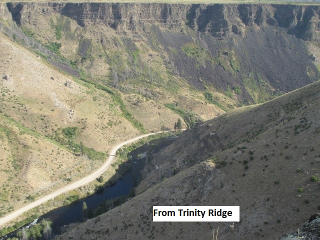
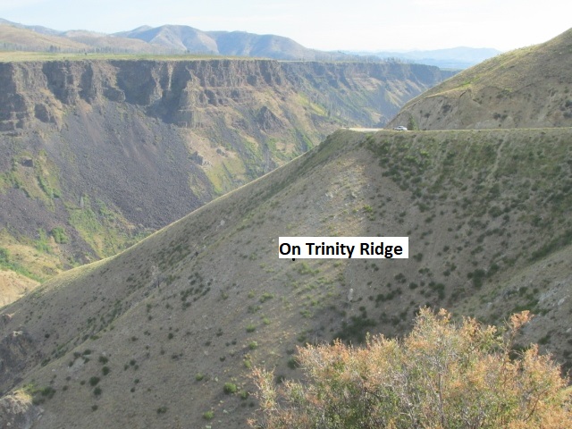
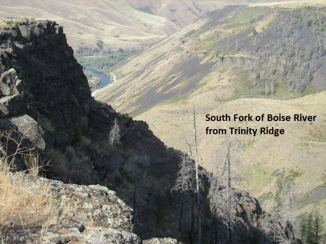
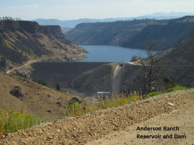
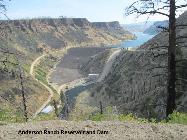
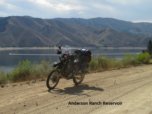
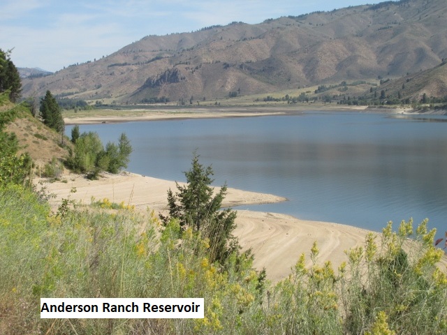
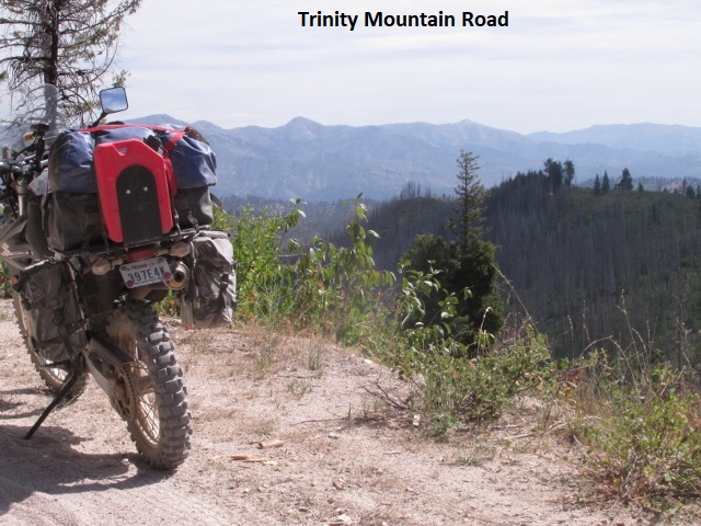
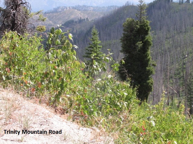
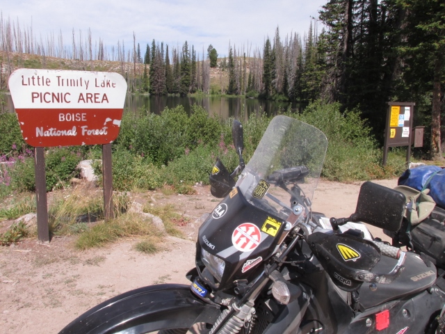
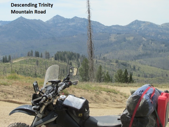
Somewhere in the Boise National Forest: It’s now one o’clock, been 98 miles. Sitting at about 7,800 feet on top of a knoll that’s part of Trinity Ridge, the highest elevation I’ve seen so far on the trip. May be as high as I get, don’t think there’s much over 8,000 feet on the whole IDBDR. Been a steady climb, however, since Glenn’s Ferry lies at about 2500 feet. I descended to US-20 and rode a few miles before turning back north on Anderson Dam road. Mile after mile, I wound around the shore of Anderson Ranch Reservoir until I came to the small recreational community of Pine. There I hit paved SH-61 for about 15 miles to Featherville, another small town given to a myriad of vacation homes and rentals. I left there on a class-3 Trinity Mountain road which climbs up to Trinity Lake and Lookout. The road was a bit technical in places requiring my undivided attention. I took a fork off-route for a couple of miles to check out the lake (wasn’t overly impressed) before backtracking. Back on route, the road grew a bit more rocky and I decided I’d misread my GPS at another fork in the road. After negotiating a difficult U-turn, I rode back a ways before deciding I had been on the correct fork all along. As I attempted to turn around again, I leaned the top-heavy bike over so far that I had to just let it continue all the way to the ground. On narrow mountain roads there’s no room to simply turn around. It’s about a three step maneuver which involves turning the bike into the high-side of the road, rolling back a few feet, then forward again, each time getting more perpendicular to the road until you can complete the U-turn. A bit like turning your car into a driveway backing out and turning around, but obviously more difficult. After removing the high-side saddle bag (using my homemade tool) and my dry-bag to reduce weight, I was barely able to raise the bike back on its wheels. One of the rules of solo off-road riding is “never ride solo on a bike you can’t pick up by yourself”. After reloading my gear, I rode to this nice shady spot for my lunch snack.
It’s partially overcast again with a pleasant breeze, probably in the upper 70’s. Feeling weary right now, fighting that bike back vertical took a lot out of my 74-year-old body. Still have about 60 miles to Lowman. I saw my first wildlife of the trip, a single deer wandering around in a tent campsite with the campers nowhere in sight. Otherwise, I haven’t seen anything but birds and chipmunks.
 I’ve been riding at this high elevation for a good ways and have observed a great deal of damage from past forest fires. Very scenic area with nice mountain vistas almost any direction I turn. Of course, my photos will never do it justice.
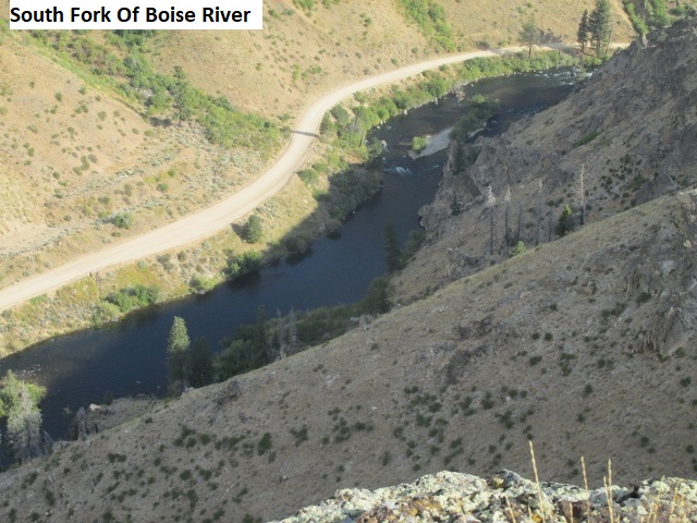
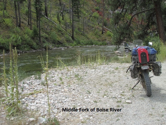
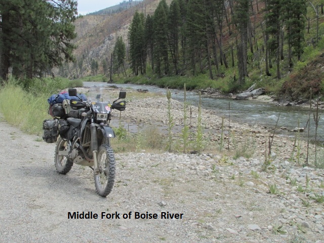
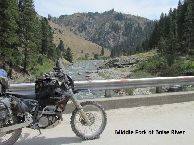
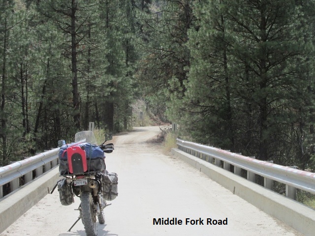
This is my final recording for Monday. I’m now at the Sourdough Lodge a few miles east of Lowman. After my last recording, I enjoyed a beautiful ride following the Middle Fork of the Boise River for several miles. Every bend in the river awarded a slightly different perspective of the beauty of God’s creation. The forest service road itself was very smooth and pleasant to ride. Suddenly my GPS showed a hard right on Road Creek road and I immediately started a very steep climb up a sandy, washed out jeep road.
I had to sit down and hang on as I fought my way up the side of a mountain. After topping out I started descending just as steeply on switchback after switchback. It was very physically demanding, adding to my fatigue. I finally leveled out on fairly smooth North Fork Boise River road which soon brought me to the junction with Banner Creek road, my last dirt for the day before hitting SH-21. My plans changed when a sign displayed a warning, indicating Banner Creek road was closed and unsafe to travel on. For perhaps the first time in my off-road experience, I decided not to ride ahead and see if I might be able to get past the damage. It was getting late in the day and as tired as I was, I didn’t want to chance getting into an impassible mess and having to turn around. After consulting my map, I elected to stay on Little Beaver Creek road, a smooth county road, for about 4 more miles until I intersected SH-21. If I had to ride pavement, highway 21 from there to Loman was about as fun as it gets. It drops about 3000 feet over several miles via one of the most winding roads you’ll find anywhere. What I didn’t realize was that Banner Creek, the road that was closed, would have hit SH-21 about 15 miles east of Lowman, much nearer my lodge. As a result, I wound up riding pavement several miles north to Lowman then another 15 miles east on pavement to the lodge. I arrived at the Sourdough Lodge about 4:30, gassed up, took a shower, and walked next door and ate supper. The lodge was made up of a few separate buildings with a few rooms in each, nice but not plush, and much better than last night. A half-dozen Harley riders arrived after I did, and I visited with a couple of them. Nice folks. About 30 minutes after returning from supper, the power went out all over the whole lodge complex. I sat outside my door in the dark and cool of the evening and read my kindle until 9:30 when the power came back on and I hit the sack. Really hoping the ride tomorrow to Yellow Pine is easier and cooler … really got hot and tired today. In spite of everything though, it was a good day. I rode some fun roads and enjoyed some really beautiful country.
Day Five – Tuesday, 18 August 2020
Loman to Yellowpine
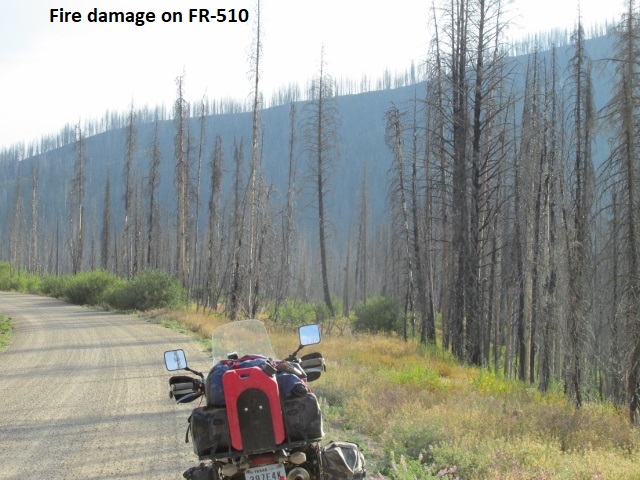
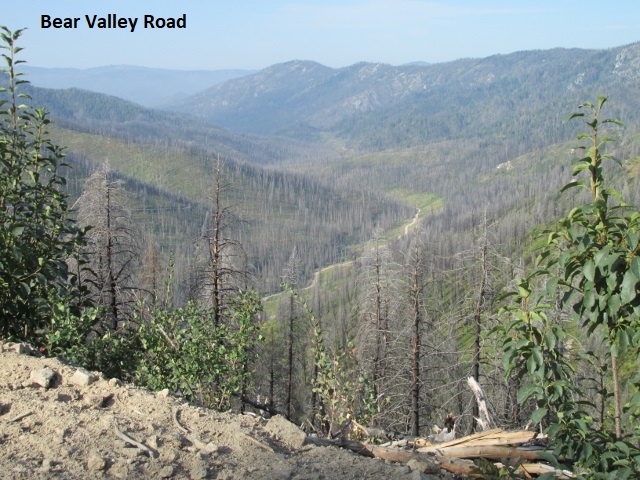
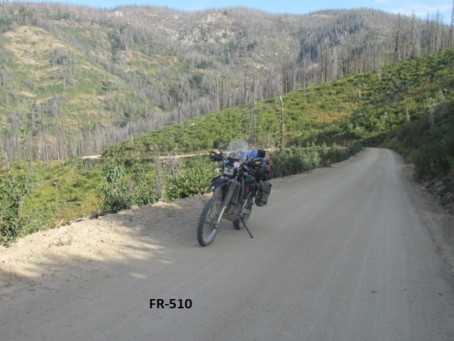
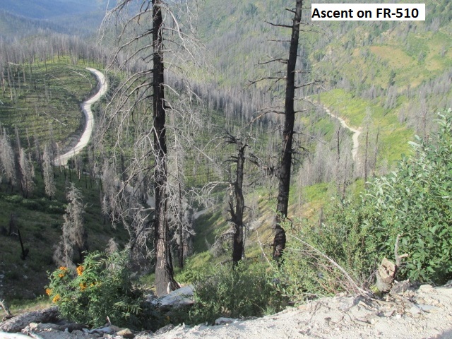
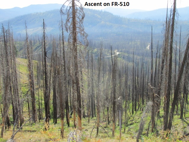
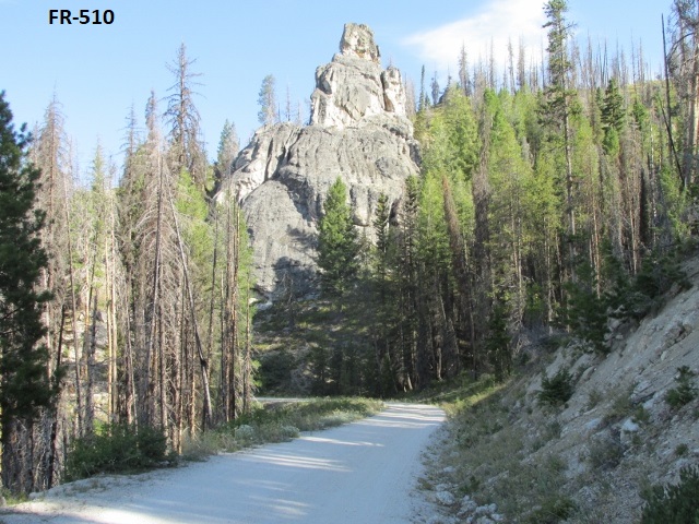
It’s Tuesday morning and I’ve ridden about 28 miles, 15 of that on pavement just getting back to the BDR track. I’ve been riding Bear Valley road, a really nice ride snaking through the Boise National Forest. I had to bypass Long Creek road, a section of the original track which has been closed due to a dangerous creek crossing. Started climbing very steeply on FR-510 but it was well maintained with lots and lots of exceptionally tight turns and switchbacks. As I topped out, I was amazed at the widespread damage from previous forest fires. Now as I consult my map, it looks like I missed my turn a mile or so back, so I’ll have to backtrack a bit. With the temp in the mid 50’s when I left the lodge this morning my jacket felt good, but I decided now’s a good time to store it away. Having started at about 4,000 feet, I’m now over 6,000. The morning is really pleasant! A little ways back I scared up a couple of whitetail deer.
Hooray! Finally found my groove! The last two days I never seemed to get completely comfortable on the bike. Yesterday’s roads were particularly technical in places and I was unusually anxious about falling or getting into something way over my head. The roads today have been amazing … mostly fun two-track with only minor erosion.
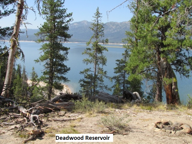
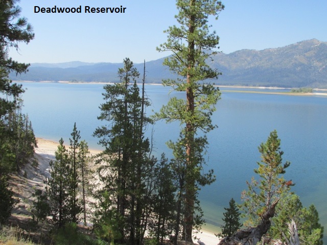
I have encountered some occasional deep ruts though which can grab your front wheel and put you down. The ruts and intermittent sand boosted my pucker factor a bit and kept me on my toes. I’m impressed that the forest service keeps these high roads in such good repair, especially given the amount of snowfall in these mountains. Simply great roads and beautiful scenery! After passing through another burn area, I’m back in a lush section of forest. Just took advantage of one of nature’s free bathrooms (TMI). Been running about 20-25 now that I’m feeling the groove. (Perhaps I’ve related this before) The “groove” is when my body and the bike become one … throttle, balance, clutching, shifting, and braking become seamless, almost unconscious actions. It’s not about speed but rather smoothness and confidence, none of which I felt yesterday. I’m really enjoying the morning; moderate temperature, brilliant blue skies sporting a few cottony clouds. As I near Deadwood Reservoir, this road has been remarkable. First, I climbed a real steep section before topping out at about 7,600 feet and then gradually descended to about 6,000. The road has generally stayed at that elevation for several miles as it wonders in an out of the fingers of the mountain face. At times I ride a half mile in and back out between fingers when I can see the road a hundred yards across a ravine. As a crow flies, I’m not covering much distance but actually riding several road miles. It’s just been a great ride! It’s now 10:50 and I’ve covered 50 miles. I assume I’m close to halfway since this is a short day to Yellow Pine.
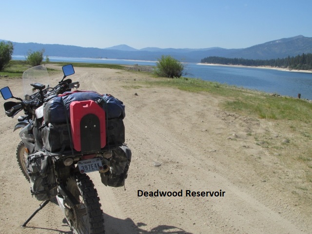
Near noon now as I stop to eat a bite at a riverside camping spot, I’ve ridden about 85 miles. Leaving the Deadwood reservoir, I rode probably 15 miles through a valley on Landmark Stanley road before starting a climb over a saddle at 6500 feet and then descended into another valley. Eventually, the road brought me here to Landmark, which I believe is a historic ghost town. I estimate about 25 more miles to Yellowpine.
The ride through the valley has been relatively easy though I did nearly dump it once. Running about 40, I suddenly encountered some deep sand, 8 to 10 inches of silt, with no time to avoid it. Desperately fighting the handlebars as the sand attempted to swallow my front wheel, I somehow manage to get through it, shaken but thankfully unscathed. As I relax here and finish my lunch, I’m guessing it’s upper 70’s.
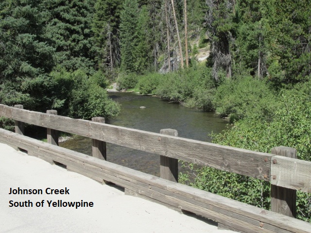
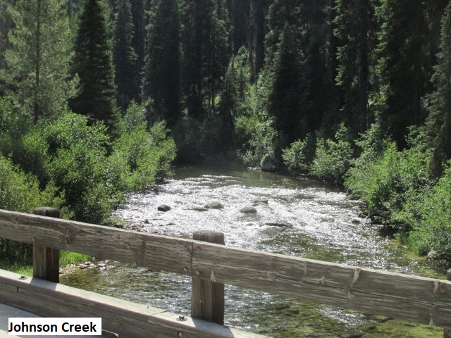
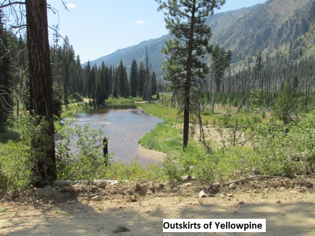
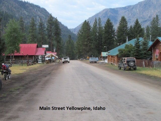
After lunch, the 25 miles of Johnson Creek road into Yellowpine was well maintained but with steep climbs over a couple more saddles. It was a scenic ride that followed the creek into town. It was an easy-going, uneventful ride but somewhat uncomfortable with the temps now at about 90. I traveled 110 miles for the day (one of my short days) before arriving here a little after two o’clock.
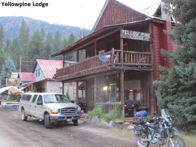
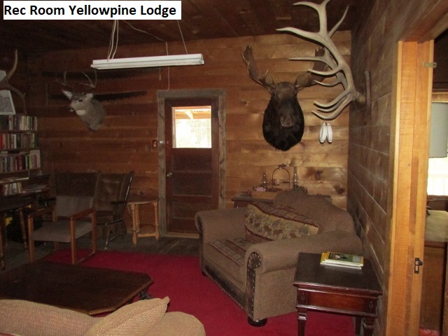
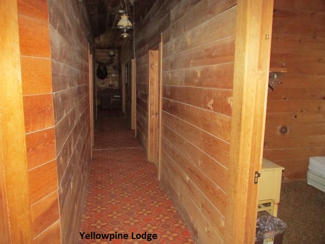
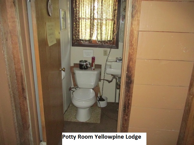
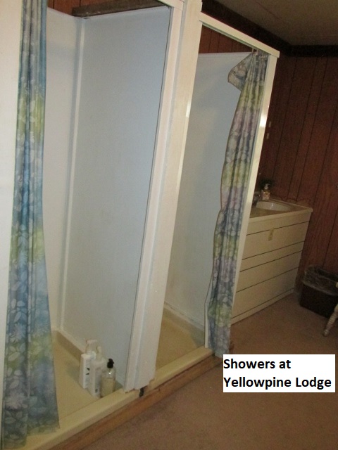
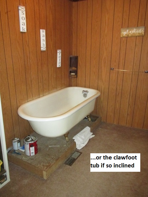
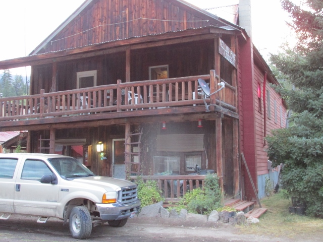
At the moment, I’m sitting here in my hotel room at the Yellowpine Lodge. The old hotel is about a hundred years old and reminds me a lot of the Pitkin Hotel last year on the Colorado BDR; individual bedrooms with a common shower and toilet down the hall. My room is upstairs and I’m the only guest tonight as was the case at Pitkin. The owner’s granddaughter who took my reservation, failed to record it, but thankfully they had plenty of vacancy. Next door is a café and an old store across the street. The store is very minimally stocked with groceries, but I did manage to scrounge up enough to put together a lunch for tomorrow. Fortunately, the store also has gas which is dispensed from an above ground tank with a mechanical meter counting gallons. When I checked in, I had to pay cash as there is no Wi-Fi or cell service at the lodge. I’ve relaxing in my room reading my Kindle and enjoying a cool Coors Light.
The hotel has been operated for many years by a friendly old couple in their mid-eighties. Several years back there was major mining in the area, and she ran the hotel as a thriving boarding house, fixing meals for the miners.
About six I walked over to the store where half a dozen locals were ensconced outside in lawn chairs chewing the fat. Turned out one of them was the cafés lady proprietor who offered to fix me something to eat although she’d already closed. Had to sit outside of course due to Covid.
Later this evening, when I started looking for a place in my room to plug in my various chargers, the only thing I found was an extension cord hanging from the single pull-chain ceiling light. Lest I sound unappreciative, the lodge did offer reading material in the room … some National Geographics from the 90’s. Don’t mean to sound critical of the lodge as it was really a pleasant experience (adventure?). Without cell or Wi-Fi, I settled for sending Lyn a message on my InReach satellite communicator and reading my Kindle till bedtime.
Day Six – Wednesday, 19 August 2020
Yellowpine to Grangeville
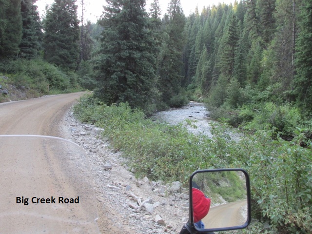
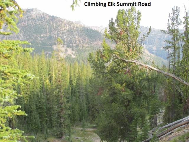
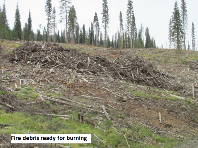
It’s Wednesday morning about 9:15, and I’ve been 33 miles. Had a little rain shower in Yellowpine last night but not sure how much accumulation. Had a good breakfast this morning. The café lady had told me I could come early at seven when she was feeding some road workers. Though she doesn’t officially open till eight, she offered since I was wanting an early start. I managed to leave town by 7:40 which was great with a 185-mile day ahead of me. Looks like mostly dirt with a lot of elevation variation and a fair amount of class-3 two-track. Leaving town on Stibnite road, a smooth class-2, I rode a few miles on a bit of slippery surface-mud before turning onto Big Creek road and passing through Profile Gap. I passed by several cabins before heading northwest on Elk Summit road, a mild to moderate class-3, rocky with frequent washouts. Passed a sign indicating road construction ahead. As I continued on the steep and quite narrow two-track, I saw evidence of recent grading.
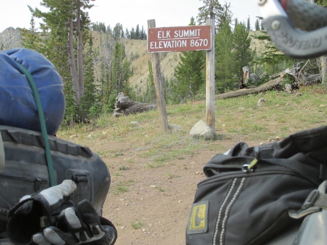
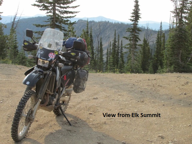
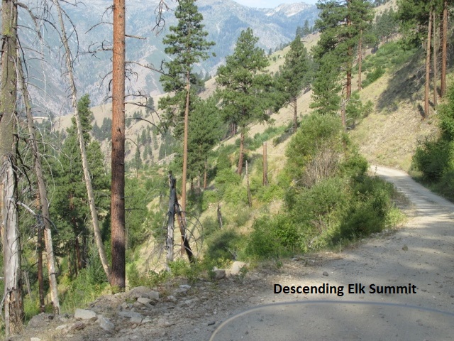
I wondered what kind of road equipment they could get up here on this remote road. Coming around a sharp bend I found out; I came face to face with a full-blown grader/maintainer. As I hugged the mountain, he pulled up beside me and ask if there were more bikes behind me. He indicated there was a truck dropping crushed rock behind him, so he radioed back and let them know I was coming. I’m sitting now on Elk Summit, elevation 8,670, the highest I’ve been so far, may be the highest elevation of the trip. Quite a ride up here, just took my time on the long continuous and winding grade. Still wearing my coat with the temp around 70. It was around 60 when I left this morning but when I climbed over 7,000, my cold hands let me know the temp had dropped considerably. A while back I surprised a pair of white tail deer standing in the road.
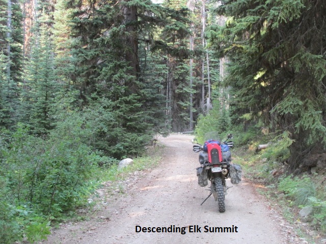
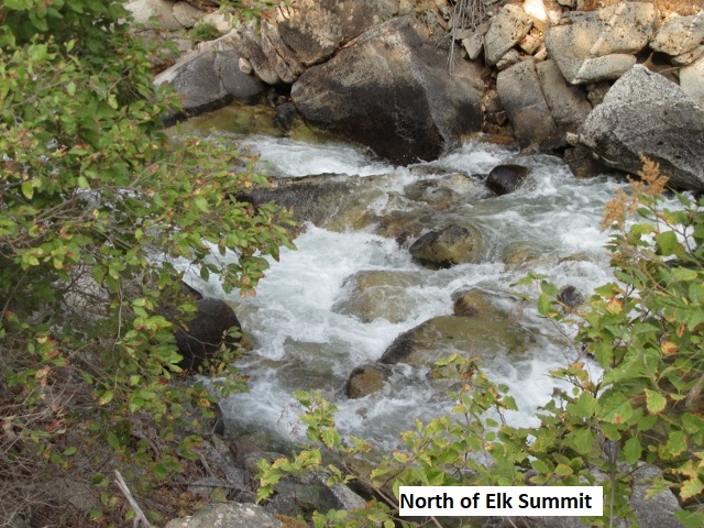
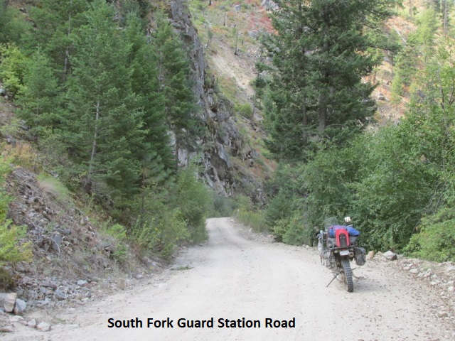
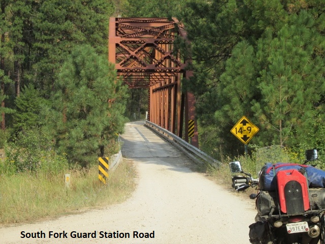
Let’s see, it’s now ten after eleven and I’ve been 60 miles, and parked at 6,914 feet. Dropping off Elk Summit was quite a ride, super steep low gear riding through numerous, very tight switchbacks. I couldn’t believe how many switch backs as I descended over 5,000 feet in thirteen miles. I finally leveled out at a campground with several vacation homes nearby, maybe South Fork Guard Station. I am surprised people locate their cabins in an area that requires access by such rough and steep four-wheel drive roads. Leaving the valley was another long and steep climb to over 7,000 feet on much better FR-340. Almost ended my trip on the front of a four-wheeler.
Having already met one ATV, I moved to the right edge of the road as a precaution. Rounding a sharp bend another ATV came hauling butt and sliding through the turn, missing me by less than two feet. I stopped and tried to no avail to flag down two following ATV’s and give them a piece of my mind. All were young teenagers, obviously thinking they were indestructible. Even without the near miss, this road is a bit intimidating … very narrow with the outside track just inches from vertical drops of several hundred feet. About a mile further I met two dual sport riders apparently riding the BDR southbound. Which reminds me, that’s the third group of riders I’ve met, including the two groups of four I met yesterday. As usual, I just waved but then later wished I’d have stopped and asked about road conditions ahead. My earlier concerns about the roads being tight and slow were justified. I’m not making very good time, so far only managing 60 miles of the 180 to Grangeville.
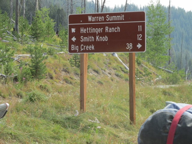
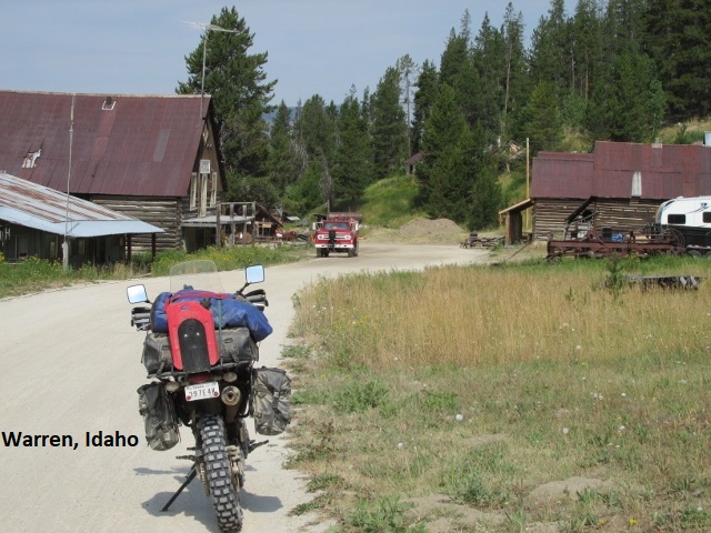
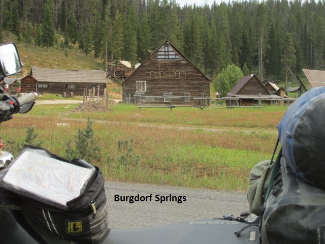
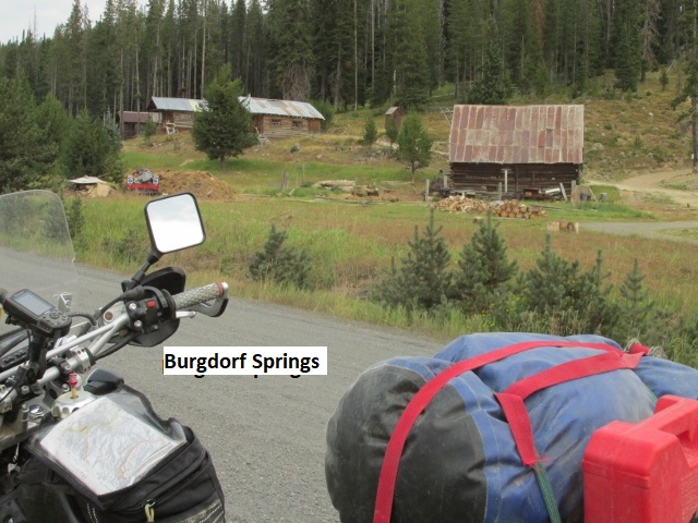
Just stopped for lunch about 12:20 having traveled 80 miles. Dropped down into the little town of Warren with a surprising bit of traffic and an abundance of vacation homes. I left Warren on graveled SH-21 so was finally able to make some decent speed. Eventually 21 turned to pavement and riding fast I missed my turn for Burgdorf road and had to backtrack a couple of miles. Back on track I came to Burgdorf Springs, a primitive lodge where a lot of BDR riders stay the night. It’s currently closed, I’m assuming due to Covid-19.
I’m eating my snack in a campground nearby while enjoying cool temps with partial overcast. The ride has been pleasant but not sure what lies ahead with still over a hundred miles to go. It may be supper time when I get in, but unless I run into some bad roads, I should make it well before dark.
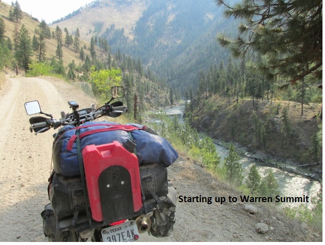
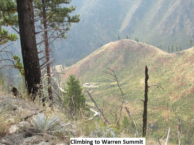
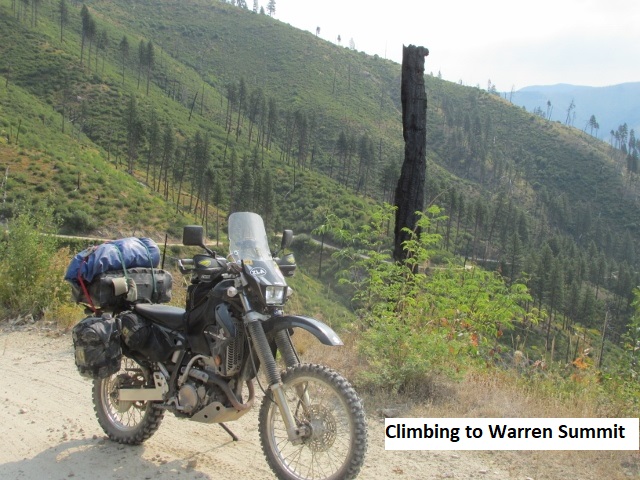
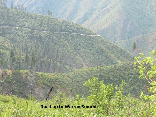
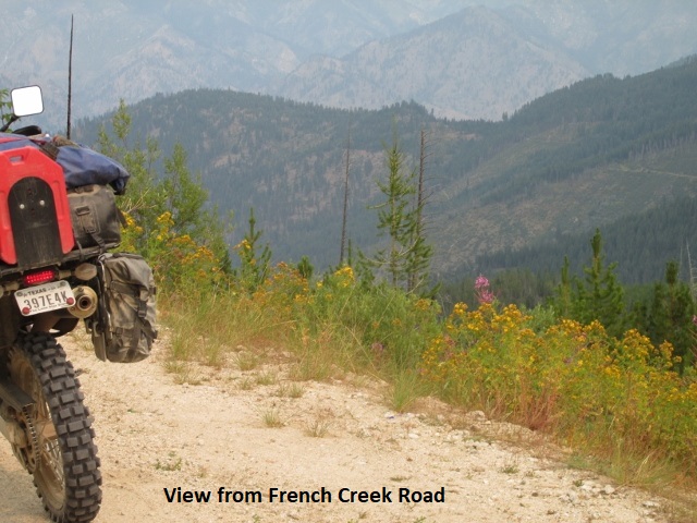
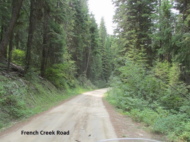
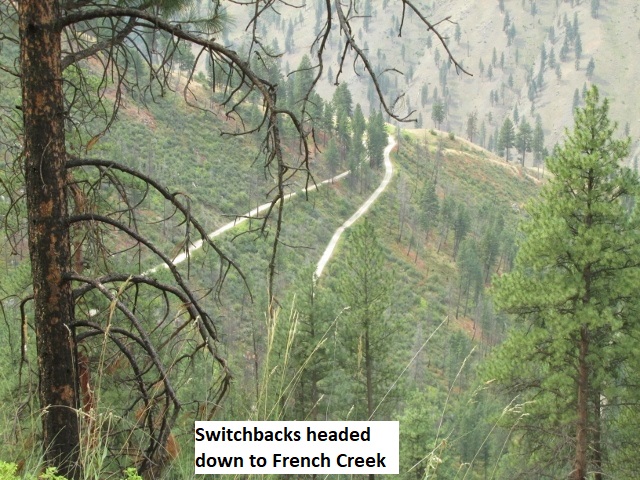
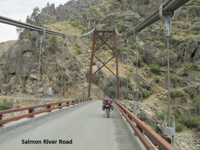
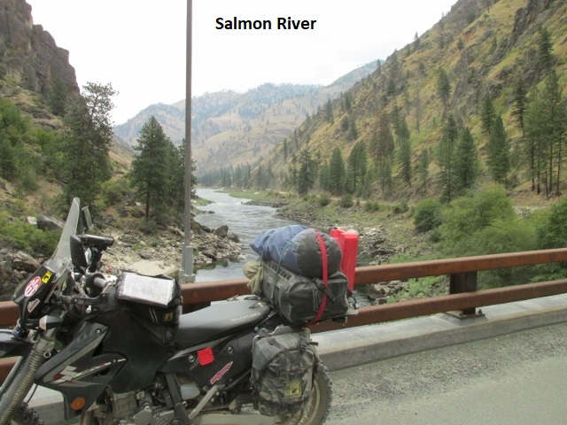
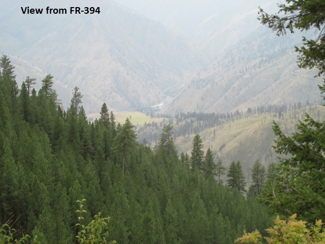
Having now ridden 126 miles at 2:10 in the afternoon, I’m currently stopped on a gravel forest service road. After lunch I continued traveling Burgdorf road a few miles before turning off on French Creek road. I caught up with another rider riding a little slower than I was. Not wanting to try to pass him, I stopped and killed a few minutes taking some pictures. I then was able to pass him when he stopped at the old school bus “photo-op”. I waved and kept moving, not wanting to get behind him again. Shortly, I came to the section of the trip with all the long, long switchbacks, the most awesome switchbacks I’ve ever ridden. As I looked below, I could see the switchbacks cut into the mountain as they snaked back and forth while descending a few thousand feet into the valley below. Absolutely an amazing ride! Seemed like I’d never get to the bottom. About halfway down I came up behind a Tahoe moving slowly (fearfully?) down the mountain. After following a while, I honked, waited and then honked again. I know they saw me but wouldn’t let me by, so when I got a small opening between switchbacks, I blew by them. Down in the valley, I passed through the village of French Creek before traveling down the Salmon River road a few miles as it meandered beside the river. It was an incredible ride! The river is very wide and beautiful with intermittent sections of rapids. There were groups of rafters preparing to challenge what appeared to be some extremely technical white water. At Riggins Hot springs, I turned off on forest road FR-221 which is one route all the way into Grangeville. The sign at the turnoff said “Grangeville, 65 Miles”. If the road remains like this, I should make good time even though it’s extremely rub-board. Although 221 has been an easy ride and would take me all the way to town, I will follow the BDR instead when it forks onto some technical jeep roads, FR-643 and FR-394, before rejoining 221.
Somewhere ahead I’ll detour off the BDR for about 15 miles which will permit me comfortable lodging for the night in Grangeville. Not near as hot today although it’s rather humid under an overcast sky. Been a great day, great fun riding, just been concerned about making my destination before late.
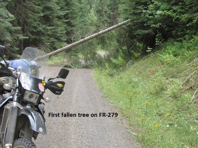
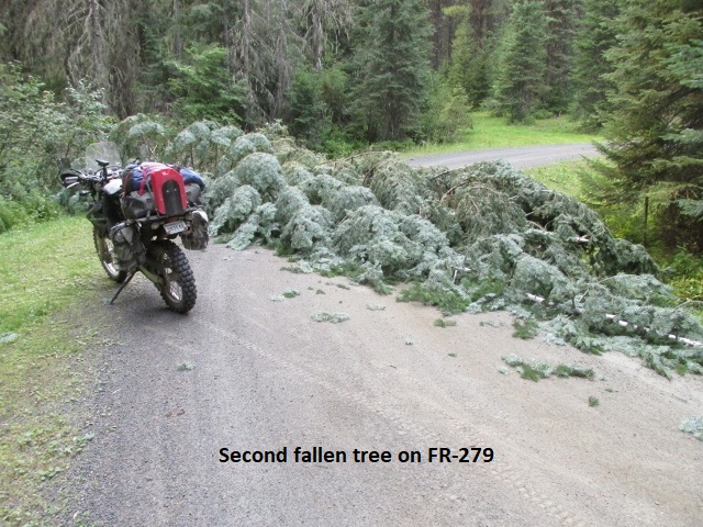
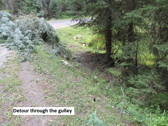
It’s now Wednesday evening and as I record this, I’m sitting in my motel room in Grangeville. The ride on FR-221 was as uneventful as I hoped. It was a nice forest road and if I had stayed on 221 it would have been an easy ride into Grangeville. However, as I mentioned before, the BDR showed to turn off on FR-643 as noted that on my paper map. If I’d realized what lay in store, I probably would have stayed on 221 the rest of the way. 643 was a moderate class-3, pretty washed out with sections of ongoing logging. It was tedious riding for a good ways and brought me to an abandoned spot called Florence where gold was first discovered in Idaho. As I continued on, now riding FR-394, I encountered more technical riding before dropping back down to 221. 643 and 394 had been extremely slow but back on 221 I could once again make some speed. Eventually 221 turned to blacktop but after about 15 miles the detour I had mapped out forked off on FR-279. It was a very narrow gravel two-track winding through the forest. I made turn after turn and climbed up and down low mountains as I paralleled a large valley off to my right. Suddenly, I came upon a large fallen tree blocking the road as it extended from the embankment on my left to a ravine on my right. I could see where another bike had passed under the trunk by riding through the bar-ditch on the embankment side. Following suit, I barely made it under due to my windshield as I pushed branches out of the way. About a mile further, there were two large trees lying flat in the roadway completely blocking my way. It appeared the previous rider had turn around at this point. It would be a lengthy detour back to 221 if I turned around so I scouted the roadside for a way past the blockage. By moving some deadfall in the gulley below the road, I was able to slide down into the gulley and ride back up onto the road. Within just a few miles, I came to Mount Idaho where I hit pavement and rode into Grangeville. After checking-in at the Gateway Inn, I walked across the street for some mediocre Mexican food then came back and performed my nightly bike maintenance. Back in civilization with cell service, Wi-Fi, and air conditioning, I’ve been catching up on phone calls and texts. Wound up being 198 miles and a ten-hour day. I knew this morning it was going to be a long day since my maps indicated much of the riding would be slow and technical. I’ve ridden worse, more technical roads, but nothing as relentless. It just never let up all day long and wore me to a frazzle! Little did I suspect some roads even more relentless were in my future.
Day Seven – Thursday, 20 August 2020
Grangeville to Hamilton, MT
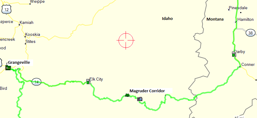
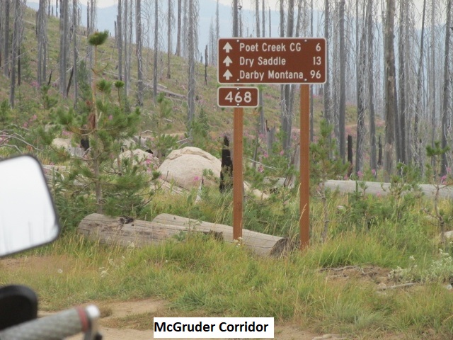
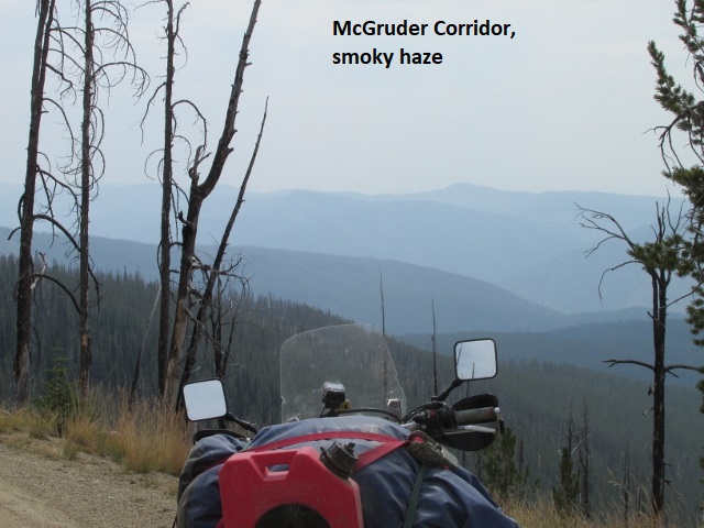
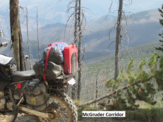
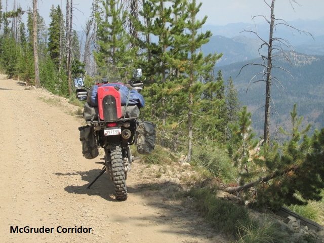
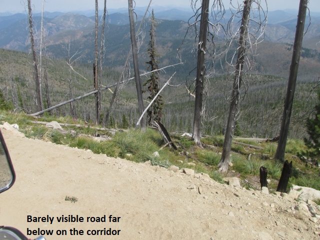
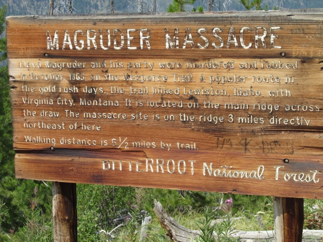
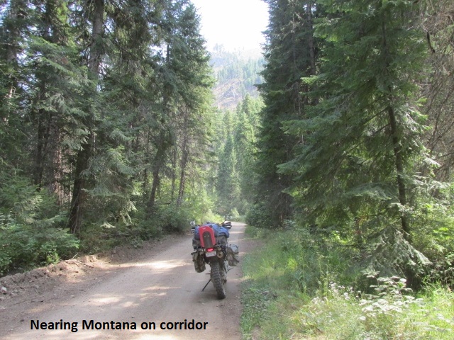
A bit of geography regarding the IDBDR is probably in order at this point. While this route is officially the “Idaho” BDR, it makes a brief foray into Montana. Due to the narrowness of Idaho at this latitude and the fact that there is no motorized traffic allowed in the Selway-Bitterroot Wilderness, the BDR folks found it necessary to take the route east through the Magruder Corridor into Darby, Montana and then north on US 93. Having thereby circumnavigated the wilderness, the route then heads back west into Idaho a few miles south of Missoula, Montana.
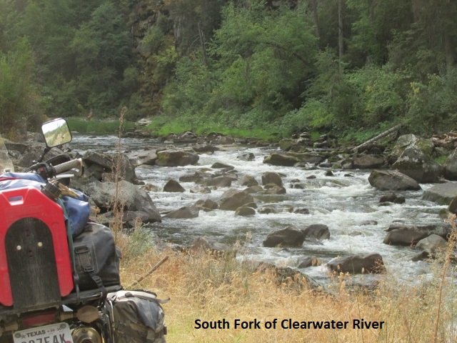
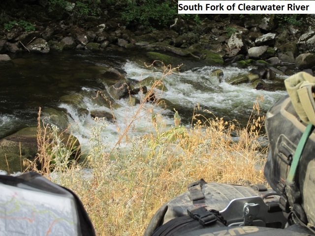
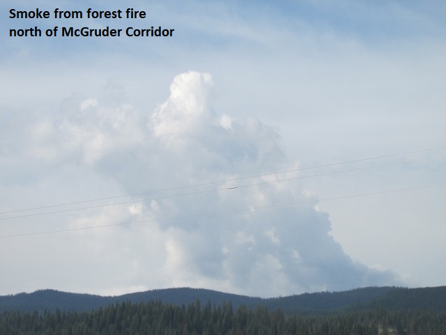
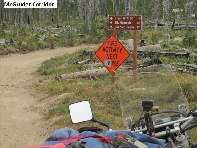
This my first recording for Thursday. I’m currently in Elk City and it’s 9:15 “Pacific time”. Found out last night that the time zone changes to Pacific in the northern half of Idaho. I broke-fast at a nice mom-and-pop café in downtown Grangeville. It turned out to be the official gathering place for the ubiquitous group of old-timers busy solving the world’s problems and lying to one another. After breakfast, I retrieved my map and cautiously approached their table, unsure how they’d react to me and my riding getup. They were welcoming so I quizzed them regarding the best way out of town. My map showed SH-13 (paved) left town headed north a few miles before turning east to SH-14. Since I was off-route on the BDR, I had mapped out Mount Idaho Grade road to get me back on the route. It was a winding county road which ran due east from Grangeville before intersecting 14. The road would save me several miles, but I couldn’t determine from the map how difficult it would be. After some blank stares, one guy chuckled and said, “Oh, that’s paved all the way to 14”. The topography around Grangeville is rather unusual. From the western edge of town and looking north and west, all I saw was rolling prairie with a mixture of grassland and farming. By contrast, as I headed east on Mount Idaho Grade road, I found that the town sits on the edge of an escarpment above a sprawling valley. As I began my descent, a magnificent view of the scenic valley unfolded before me. As I counter-steered through numerous hairpins, the roadway quickly dropped more than a thousand feet before intersecting SH-14. All the way to Elk City, highway 14 was a thrilling ride through almost continuous S-curves as the road held tightly to the winding South Fork of the Clearwater river. When I was gassing up here in Elk City, a couple of local guys ask where I was headed. When I informed them I was headed east on the McGruder Corridor to Montana, they warned me the Corridor might be closed due to an active forest fire. When I asked if there was any other way to Montana, they grinned and replied, “not from here”. They suggested verifying the closure rumors at the local ranger station. Taking their advice, I found the station and spoke to the lady ranger on duty. She informed me the road was currently open but a sizable fire near the Corridor was being allowed to burn. As a result, the road could possibly be closed at any time. Hopefully, I’ll make it through before they decide to close it. Really relieved it’s still open and I can avoid a 200-mile detour on pavement to my destination of Hamilton as well as missing a major section of the BDR. It’s jacket-cool this morning but I’m making decent time, having already covered a fourth of the 200 miles I have to go today.
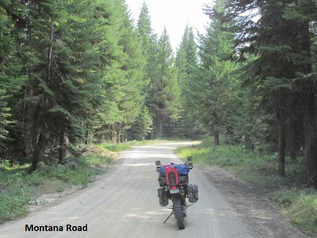
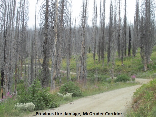
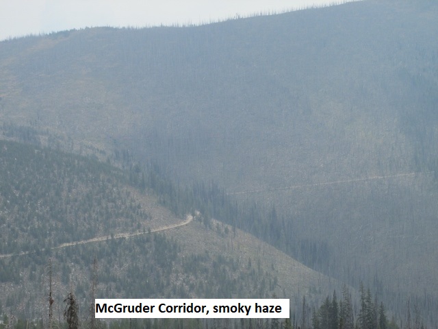
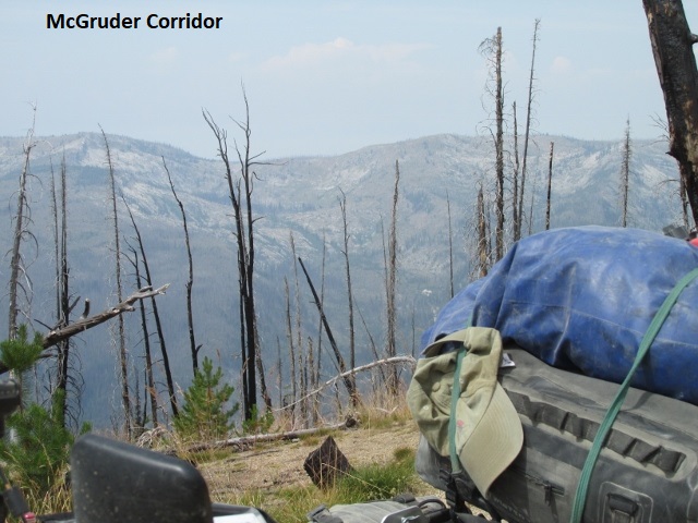
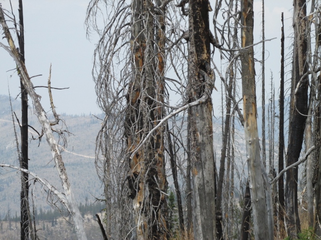
It’s now ten after eleven and I’m parked on Montana road in the McGruder Corridor at about 5000 feet. I left Elk City on gravel then rode paved Red River road through the villages of Gold Point, Gibler, and Lightfoot before turning off on Montana road. As I traveled east, the smoke continued to thicken and I passed several campers headed west away from the fire area. Just passed a sign warning of fire equipment for the next fifty miles. I think the fire is north of me along Elk ridge, but the fire fighters are using the Corridor as access. The ride has been great! As the road rambled through the Bitterroot National Forest encompassing the Clearwater Mountains, it morphed from two lanes to an upper class-2 two-tack. I’ve just ridden through a long stretch scarred by a previous fire, leaving nothing but blackened tree stalks as far as I can see. The road has changed again to a moderate class-3, a bit technical with steep up and down and frequent washouts. I’ve shed and redonned my coat a couple of times but think I’m finally done with it. Think the road may have leveled out for now so if there are no surprises, I should make Darby, Montana early afternoon then slab it north to Hamilton.
It’s one o’clock and I’m a little over halfway at 113 miles. Resting in a small campground at about 7,000 feet and eating my lunch. Since my last recording the road has continued as a mild to moderate class-3, still steep and washed out in places. At my last recording, I thought I was leveling out but that was not the case as I soon climbed to over 8,000 feet.
At one point, I found myself eating dust behind a couple of large ATVs which graciously stopped and let me pass. Shortly after, once again I was behind a couple on a small 4-wheeler with no mirrors. Unable to pass on the narrow track I finally honked, which surprised them, and they immediately pulled over. I next met a dual-sport headed west so I flagged him down. After inquiring, the rider confirmed the road behind him was still open. I was greatly relieved as there are no “bail-outs” along the Corridor, you either travel east or west. A little later, I merely waved as I met two more guys on large dual sports. Having met several pickups and campers, I’m surprised that people bring them to this remote area as the road is rough as a cob (is that an outhouse saying?). The last couple of miles have smoothed out a bit so hoping I can make better speed. A lot of this is 10-15 mph so if it doesn’t improve, I may have a late day. On these rough class-3 roads, much of the time I stand on the pegs so the bike’s suspension works more effectively and allows the bike to find its own equilibrium. In this way, the suspension is affected less by my body weight since my center of gravity while standing is lower, i.e., at peg-level, as opposed to seat-level when all my body weight is on the seat. However, it is farther to fall when standing and the further you fall the more it hurts! Also, riding slow over really rough ground, it’s difficult while standing to quickly “dab” a foot to recover my balance and stop a fall. So, while I prefer standing, sometimes it’s safer to sit down and “tractor” over the bad stuff.
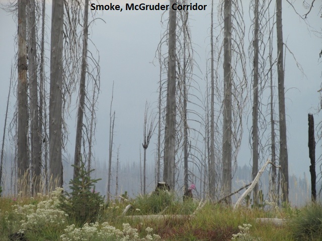
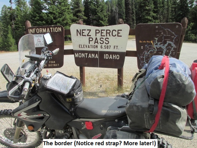
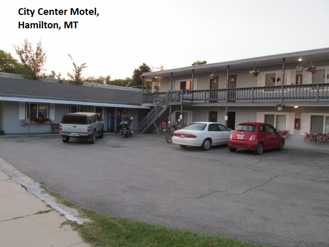
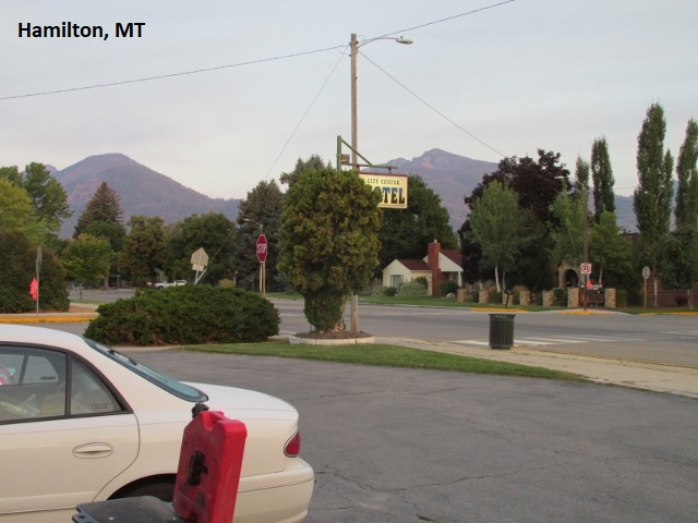
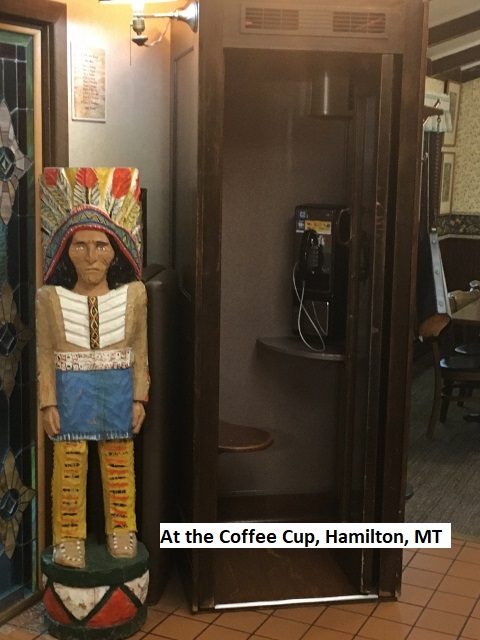
As I’m making my final recording for the day, I’m gratefully relaxing in my motel room in Hamilton, Montana while my body is telling me it’s bedtime. After my last recording, I left the campground and immediately climbed to about 8,300 feet. The good news was that as I topped out, the road surface improved dramatically. Still narrow and very steep with lots of switchbacks, I found it a much easier and enjoyable ride. I now could ride some sections at 25-30 mph. Nonetheless, it was still difficult to make good time due to the frequent switchbacks. At one point I topped out on the Nez Perce Pass, this being the Idaho-Montana state boundary. The road was paved as I dropped off the pass, then changed to gravel for a few miles and then back to pavement. It is common in the mountains for roads to follow the natural path of a river, and in this case it was the Nez Perce Fork of the Bitterroot. Eventually, I intersected US-93 at Darby, MT., then continued north to Hamilton. My reservation was at the City Center Motel. It was old and small but clean, and tended by a couple of friendly, senior ladies (more senior than me). Wasn’t planning on it, but since it was only late afternoon, I decided to wash my growing pile of dirty clothes at a nearby washateria. Afterward, I went to the highly recommended Coffee Cup Diner for supper where they served me more food than three of me could eat. I plan to return there for breakfast. The evening is pleasant, and it was a good ride today with an interesting mix of road conditions. Never got hot today, maybe upper seventies under mostly overcast skies (or was that smoke). Good day but long, 210 miles, I think. Have another long day tomorrow, maybe 175 miles. The first 30-40 will be paved which should shorten my ride-day.
Day Eight – Friday, 21 August 2020
Hamilton, MT to Pierce, ID
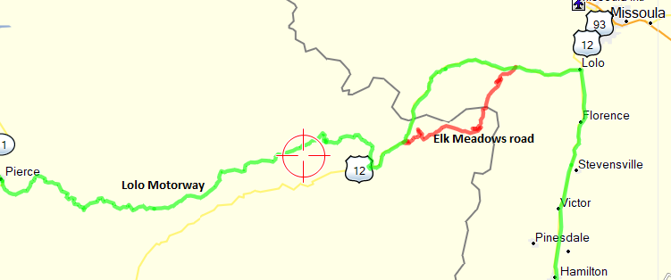
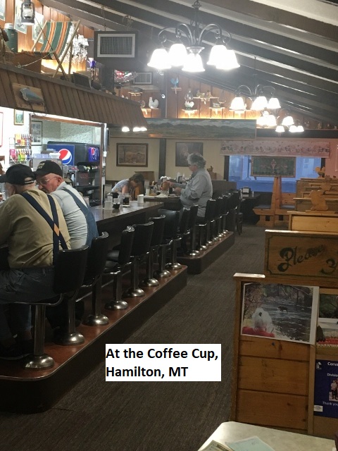
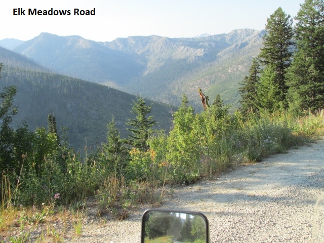
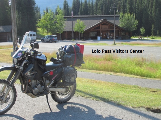
It’s late morning as I make my first recording of the day. I’m currently sitting in the parking lot of Lolo Pass Visitors Center at 5300 feet, having traveled 88 miles since leaving Hamilton. After a enjoying a great breakfast at the Coffee Cup, I left about 7:30 headed north up US 93. It was really chilly with the temp in the mid 40’s, so my body was wrapped in all my cold weather gear. At the town of Lolo, Montana I turned west on US-12 for about 10 miles before encountering the first dirt road of the day. The BDR showed Elk Meadows road as a dirt alternate to 12 and I was pretty sure it was designated as “expert” or “difficult”. I’m no expert, so it was with some misgivings that I left US-12 and rode into the 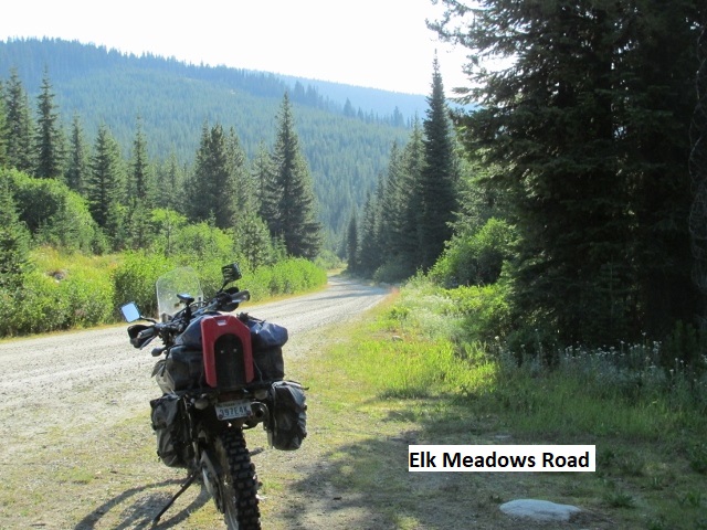 forest. Turned out to be some of the best 40 miles of the trip. Beginning as a smooth gravel forest road, it changed to a mild class-3 two-track which climbed maybe a thousand feet before descending into a valley. After a few miles, I began to climb again, eventually intersecting US-12 here at Lolo Pass. About three miles back, the designated BDR track made a left turn up a steep, washed-out jeep-road. I debated with myself about attempting it but reneged and stayed on the good two-track for the short distance to the highway. Don’t know if I’m turning into a wuss or just making better choices. It’s warmed up some, but I’ll keep my gear on till I leave the pavement again.
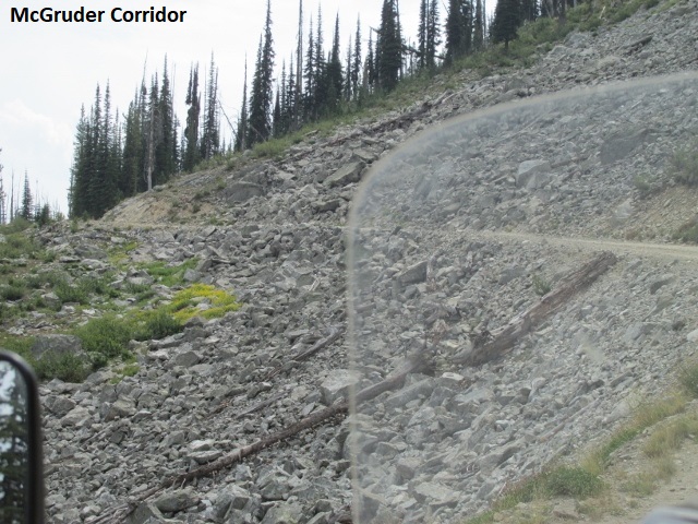
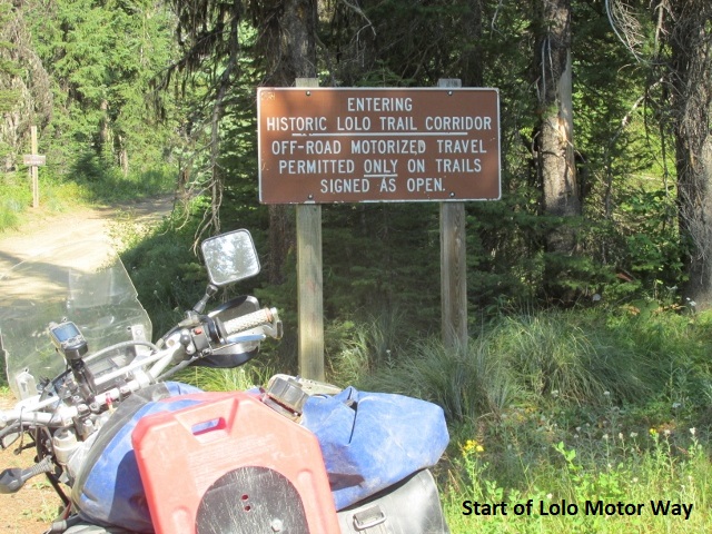
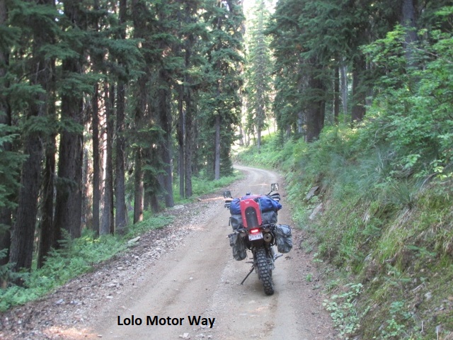
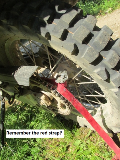
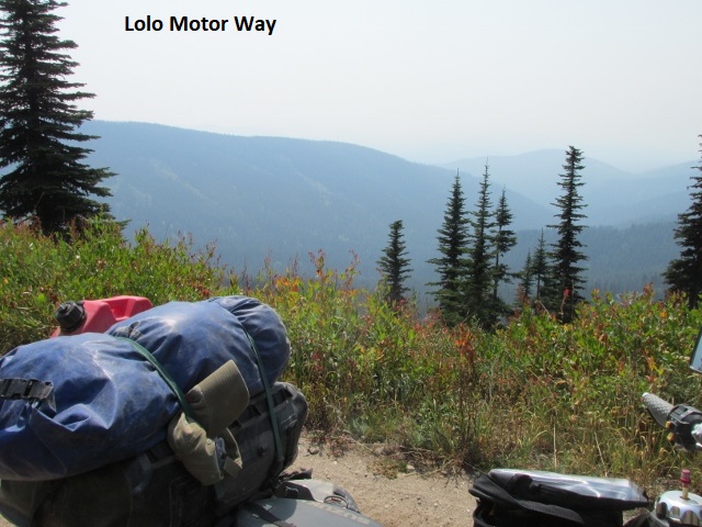
Where to begin?!! This is only my second recording of the day and I’ll have very few photos to share. It’s now about 5 o’clock and I’m at the hotel in Pierce. I left Lolo Pass for a few fun miles of a twisty section of highway 12 before turning on dirt on FS-560. The road was a steep, narrow, single lane which followed the face of a mountain northeast for several miles. The route then turned west on what the map designates as Lolo Motor Way. It ought to be numbered “666” because it’s for sure the road from hell. As I turned my DRZ onto the Motor Way, I had no idea what the rest of the day would portend. If I had known, I might have looked for an alternative. As I peruse my map here in the hotel, I see that to avoid the Motor Way it would have required a return to US-12 and heading west for about 80 miles then about 80 miles north to get to Pierce. The short version is that the Motor Way is by far the most technical part of the IDBDR yet. I’ve ridden roads equally technical but never anything of that duration. It was over 75 miles of some of the most torturesome jeep roads I’ve ever ridden. The roadbed was covered with large loose rocks, frequent washouts, deep ruts, significant erosion, and recurring steep elevation changes. The difficulty level just would not let up! I’m sure the Lord had my guardian angels (surely plural) working overtime as I came very close to falling numerous times. And given all the rock, a fall would have most likely ended badly. Early on, I stopped to shed my coat and was passed by a couple of riders on KTMs. Throughout the day we leapfrogged each other whenever I or they took a break. I noticed earlier they are staying down the street from me here in Pierce. About halfway, and desperately needing a rest, I passed a parked group of 6 or 8 riders. I for sure didn’t want to get behind them so I waved and blew by them. Sometime after that, I bottomed the suspension and immediately heard a clanking noise. I quickly stopped and found that the ratchet-tiedown holding my dry-bag had come loose and wrapped around my sprocket. I was forced to cut the strap into small pieces to remove it from the chain and sprocket. From then on, I stopped every little bit to check the tightness of the bungies I used to replace the strap.
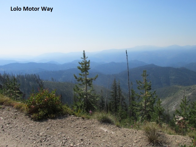
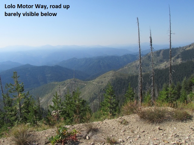
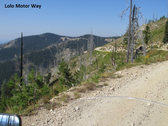
If I were thirty years younger and riding a 225-pound dirt-bike instead of a 340-pound dual-sport loaded with another 50 pounds of gear, I might have actually enjoyed the ride. One of my first discoveries when I started riding dual-sports was that they are NOT dirt-bikes, and a person shouldn’t try to ride them like one, that is unless they enjoy an occasional fall. That said, while riding on the Motor Way I discovered an exception to that truth. The primary reason a dual-sport should usually be ridden less aggressively is because the extra weight makes a tremendous difference in how the bike handles when riding rough dirt roads. A loaded dual-sport bike is like riding with a 120-pound passenger. After experimenting on the Motor Way, I found it actually easier to ride aggressively, much like on a dirt-bike. Otherwise, I’m not sure I would have finished without falling or that I’d have made it to town before dark. Dirt bike riders soon learn that speed and momentum are usually your friend when the trails get difficult. Speed and momentum work hand and glove with the bike’s suspension creating a gyro-affect that keeps the bike moving in a “linear” direction. Too slow, and the first big rock you hit grabs the front wheel and sends you careening away at an angle or lays you down. So much of that seventy-plus miles, I stood on the pegs and rode as hard and fast I dared. To be such an inhospitable road, there was sure a lot of traffic as I met several pickups, ATVs, and dual sports. As I bounced along, I groused about the BDR folks including this road on their route. What were they thinking? But later, after checking out the map I saw they really had no choice. The only northerly route west is I-90, and US-12 is the only southern route. The Lolo Motor Way is the only option if you intend to ride east-west off-road. The level of difficulty was just more than I bargained for! At 74, it may be that my “ride-clock” is telling me it’s time to find shorter, easier rides.
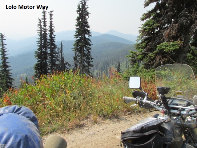
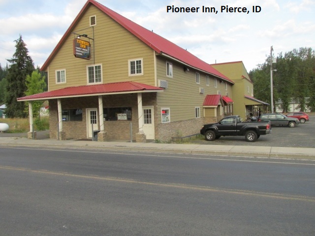
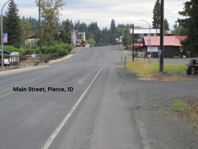
I gratefully left the Motor Way behind and rode dirt forest roads that seemed pretty tame as I passed over Beaver Saddle and French Saddle. Dropping down a thousand feet, I came to the 250 road which became blacktop after a few miles as it brought me into the small village of Pierce. I located the Pioneer Hotel on Main Street, an old two-story building that had been completely remodeled. A sign in the front window said to call for access. Right!! No AT&T service in Pierce! A lady living in back loaned me her cell phone and I called the lady innkeeper who soon arrived and let me in. All the rooms are upstairs and have been nicely renovated from top to bottom. Really nice place! I bought some bungie cords at the hardware store across the street then rested a while in my room.
A bit later, I walked to an overly busy saloon/café (Anyone like some Covid-19 to go?) and ate supper. Although I had no cell service, my room did have Wi-Fi so I was able to text with Lyn. As I pondered my day and ride on the Lolo Motor Way, I decided it was analogous to the ups and downs of life. As in life, just when things look like they’re about to get better everything may suddenly go to hell in a handbasket. Or maybe like Lucy and Charlie Brown (“Kick the football Charlie, I promise I won’t move it.”). I kept thinking that the road was about to get better, or at least not worse. Then suddenly, once again I’m climbing over rocks and washouts, up the side of a mountain, gritting my teeth as I give it the gas and hang on. As I write this now, I sound a little melodramatic, even to myself, but in the moment I was exhausted and feeling anxious.
Well, I’m really tired, probably a three-Advil-night. Really hoping tomorrow is easier. I was under the impression this part of the BDR, i.e., north of the Bitterroot, was going to be easier. Wrong!!
Day Nine – Saturday, 22 August 2020
Pierce to Wallace
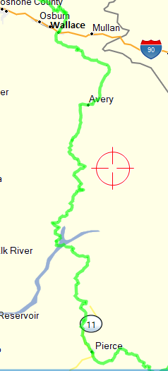
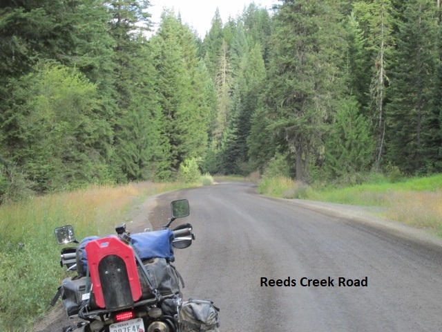
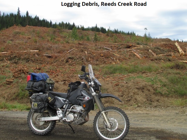
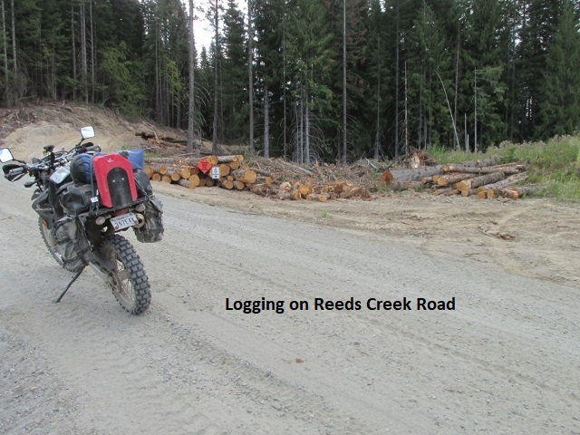
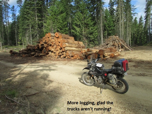
It’s 8:40 Pacific time and I’ve journeyed 30 miles. I left Pierce about 7:40, with temps in the low 60’s and under a partial cloud cover. I must confess I was sort of dreading today after yesterday’s epic ride. But thankfully, so far, it’s been pleasant riding on mild gravel forest roads. Haven’t gained much elevation yet and it appears that may be the norm for today. I left town on SH-11 and then turned off on Reeds Creek road where I passed a large tool yard filled with logging trucks. I’m glad that it’s Saturday and the trucks are idle since it’s evident they’ve been working these roads. A lot of what they’re logging is the remains of previous fires. Going to be a shorter day today, approximately 125 miles into Wallace.
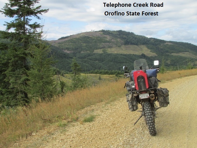
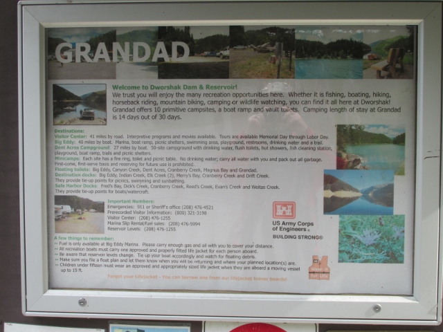
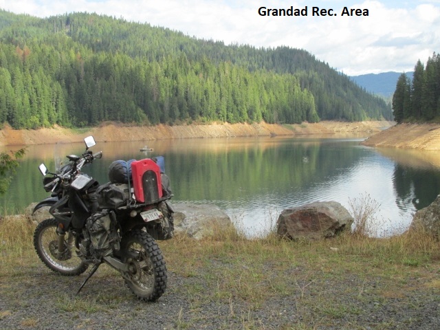
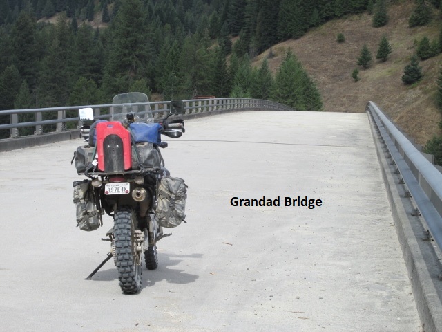
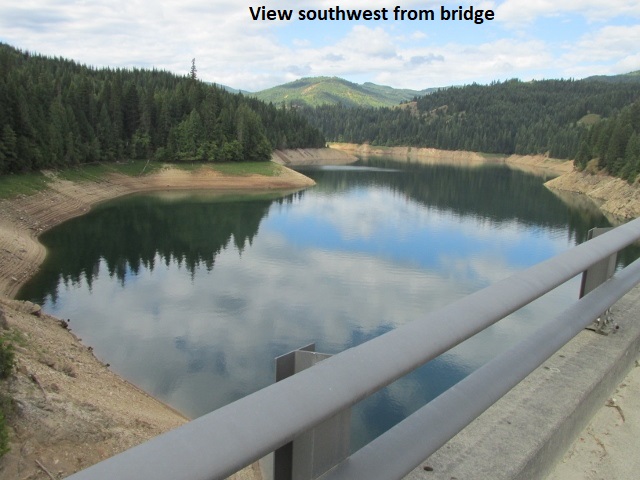
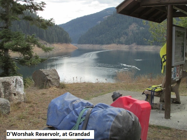 My chronometer indicates 9:30 a.m. and I’ve already covered 43 miles. As I record this, I’m parked at Grandad Recreation Area, home to the D’Worshak Reservoir. Absolutely beautiful lake nestled in some low mountain with water like a mirror. The lake is apparently long and narrow as a sign indicates the marina is 35 miles by water. The route so far has been easy gravel with nominal elevation variations, as it meanders through the Orofino State forest. Still some cloud cover but has warmed up to mid-70’s. I continue to encounter logging in the form of reclamation of burned areas. Very scenic! Have already taken more pictures than I took all day yesterday.
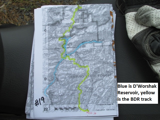
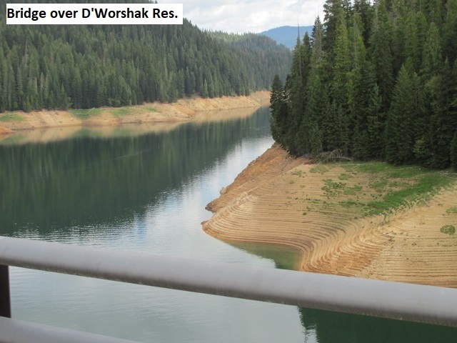
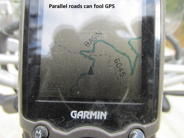
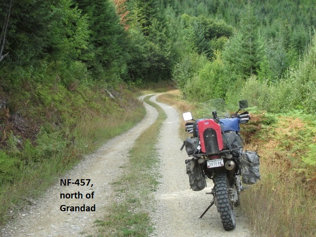
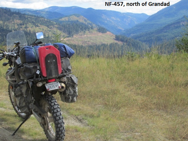
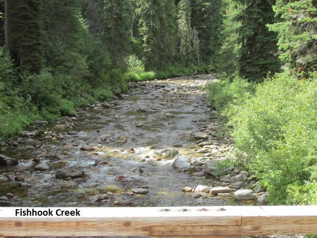
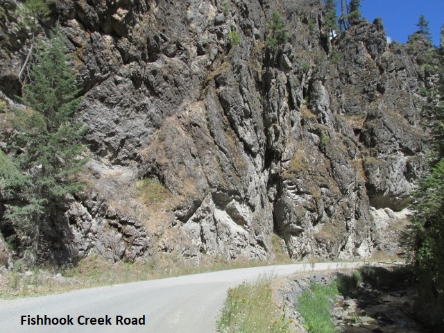
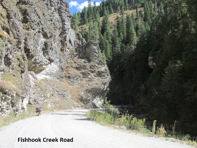
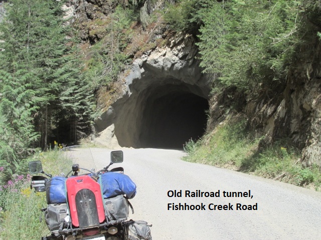
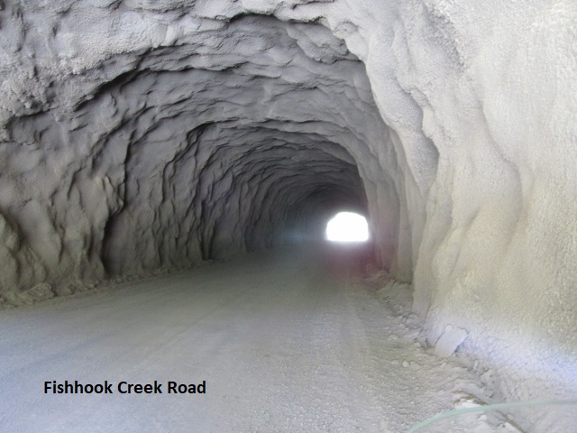
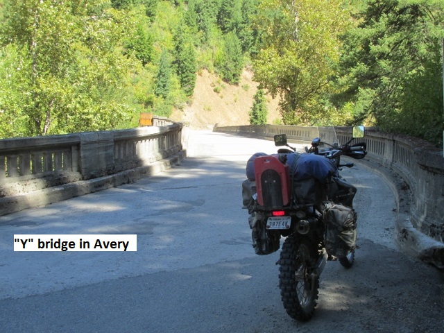
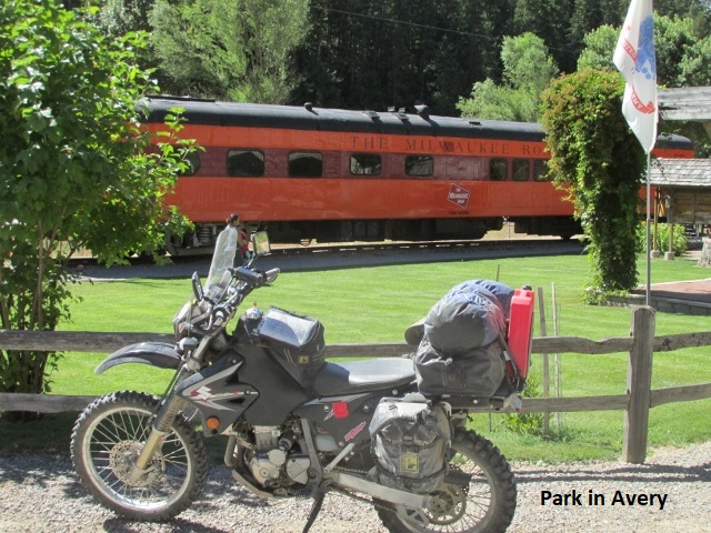
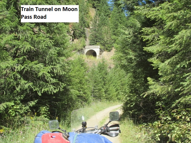
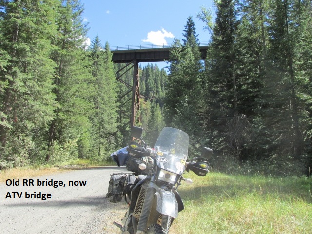
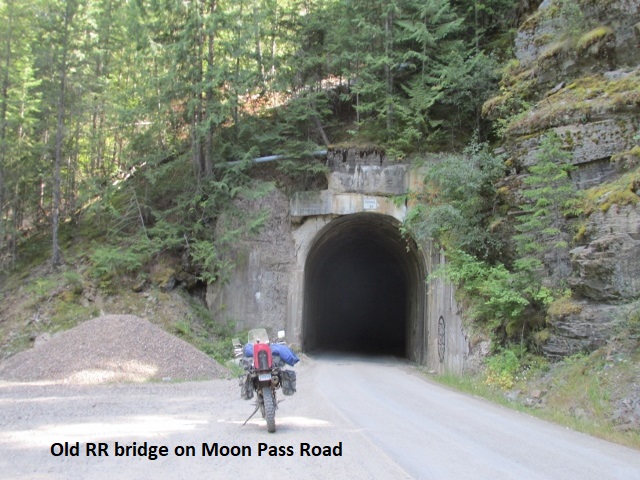
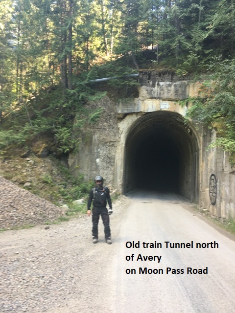
Currently I’m in the charming small town of Avery on the St. Jo River. It’s 12:30 and I’ve ridden 105 miles. Though just a village, Avery is very touristy with a plethora of rafters, ATVs, road-bikes, dual-sports, etc., etc. It’s still in the upper 70’s as I people watch in a small park while eating my lunch at a shaded picnic table. I’ve had quite an interesting ride after I left Grandad. After consulting the map this morning, I was a bit concerned about the route. The map displayed lots of zig-zag dotted lines which often means unmaintained jeep roads. I crossed the lake at Grandad on a new bridge and began to climb at once. The road was two-lane gravel which soon devolved into a narrow two-track. I was really enjoying myself as I stood on the pegs and wound through the forest for mile after mile, blessed by simply perfect weather. Speaking of which, except for century mark temperatures the first two days, I’ve enjoyed really great weather. The lake at Grandad was around 2500 feet and as I climbed over 4,000 it got a bit chilly. I was riding gravel on the wide Indian Dip road when the GPS led me off on forest FR-301. Immediately the road became very steep and rocky, not as bad as the Motor Way but bad enough. Fortunately, most of the large rock was imbedded so I just took my time and picked the best track through it. After a few miles, I came to what’s known as the Blue Cabin (it’s painted blue, duh!). The cabin is very primitive but free for anyone to camp there. Just as I arrived at the cabin about six ATVs decided to leave in front of me. They were just putting along so one by one I was able to pass them. The rough, rocky road continued to climb for a long way before it topped out but then was just as bad as I descended the back side. Eventually, it became a smoother two-track before widening into nice gravel on Fishhook Creek road. As the road continued toward Avery, it hugged the edge of Fishhook Creek passing beneath massive vertical slabs of granite. It was an awesome ride and at one point I passed through a hundred-yard-long tunnel blasted through the solid granite mountain. The road eventually intersected SH-50 a couple of miles west of Avery. I believe there are some more tunnels on the BDR as I ride north of Avery. Several times on the trip, and twice today, I was forced to backtrack a quarter mile having missed a fork in the road. Very often these mountain roads Y-off but then closely parallel each other for a distance, with maybe one fork ascending and the other descending. My GPS is normally extremely accurate, but when two roads are close and parallel, it takes several seconds for the GPS to reconcile my location. By the time the GPS “resolves” and correctly displays my location, I may have traveled a distance down the wrong fork. I still have about 25 or 30 miles to Wallace, so I better get moving.
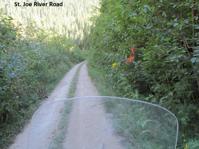
I’m now sitting in my comfortable room as I record my after-lunch ride to Wallace. Leaving Avery, I traveled north on the narrow St. Joe River road as it followed the north fork of the river. The bordering vegetation had encroached to the point that the road was only wide enough for ATVs and brushed my arms as I rode in the right track.
The BDR map showed to pass through some old train tunnels in this area and it appeared I’d missed them. However, St. Joe road soon merged with Moon Pass road so I doubled back south for a mile and rode south through the tunnel and then back north. Really cool! Folks in a jeep saw me trying to take a selfie and stopped and did the honors for me. The remainder of the ride to Wallace was really pleasant, traveling over a mixture of two-track and graded forest roads. It was truly an easy afternoon and, all in all, just a great day with perfect weather and beautiful scenery. Except for the roads to Blue Cabin, the road conditions were mild and fun. Days like today are why I ride dual-sport, makes it all worthwhile!

I arrived in Wallace about around 3:15 but due to construction along I-90, I wound up wandering through some residential areas before finally arriving at the Wallace Inn. It’s an older motel but really upscale, particularly when likened to some of the places I’ve lodged on this trip. Ought to be for $130 a night!
Wallace is a really cool old own. The residential areas are populated with small old cottage homes (probably 1900-1930 period) in pristine condition with immaculate yards. There’s a very active downtown and I read somewhere that every building downtown is on the historic register. All of them have been restored or updated, just a beautiful little town. Pretty touristy though and I can see why. I sat on the sidewalk to eat, thanks to Covid, and enjoyed homemade tacos prepared by a couple of senoritas at their kiosk inside the bar. As I prepared to don my helmet, I laid my clear prescription glasses on my bike seat, climbed on the bike, and promptly sat on them mashing them flat. I went next door and bought some reading glasses to finish the trip. Back at the motel, the desk clerk offered to let me park my bike under the awning and next to a window where he could keep an eye on it. Really classy place!
Day Ten – Sunday, 23 August 2020
Wallace to Sandpoint
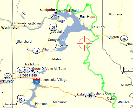
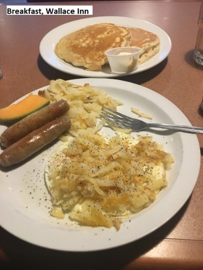
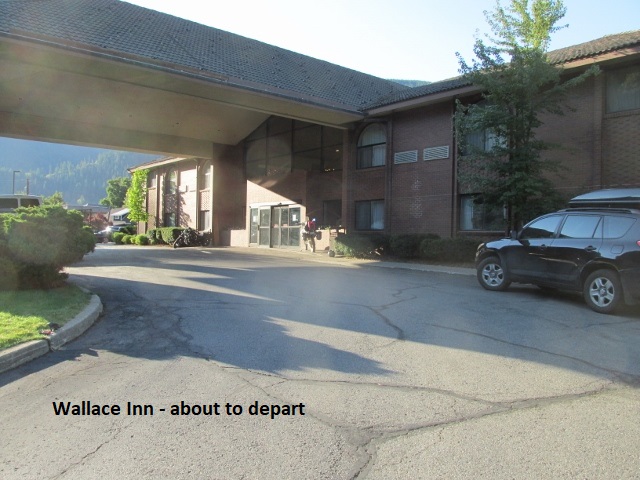
Lord’s Day morning (Thank you Jesus!) and I’ve traveled 36 miles of the 160 to reach Sandpoint this evening. Had a great breakfast in the dining room at the Wallace Inn and got away around eight.
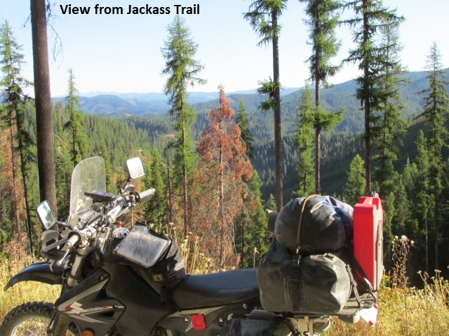
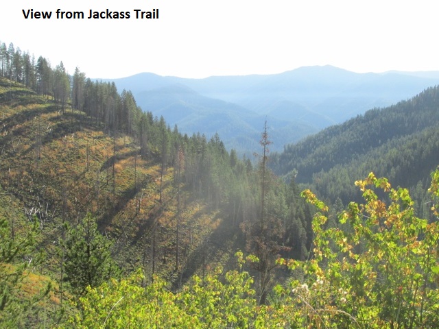
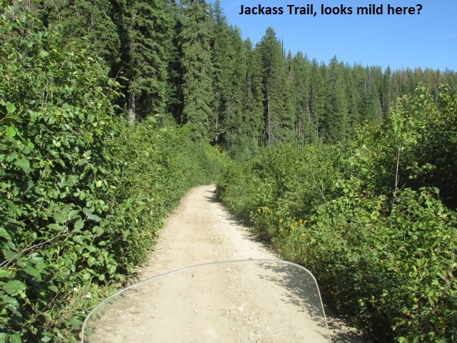
Been feeling somewhat trepidatious this morning, toying with some superstitious thoughts, wondering if maybe my “good luck” has run out. But actually, I don’t believe in luck … it’s about preparation, skill, wise choices, and the Lord’s protection. Feeding my unease was the moderate class-3 jeep road I found myself riding soon after leaving town. It was called Jackass Trail and it lived up to its name. For some distance it was also a streambed and I was once again bouncing over rocks and scrambling through washouts. After about three miles the road moderated to something more enjoyable. I was once again “in my groove” as I motored through the Coeur D’Alene National forest on a gorgeous morning. When the riding is easy, I find myself daydreaming about various things. One idea I toyed with was to write an article about “Solo Dual-Sport Riding”. I had lots of good ideas for the article as I rode, but now while typing this ride report I fail to remember a lot of them. Currently I’m stopped on the paved Coeur d’Alene River road but soon I’ll be back in the forest.
A few minutes ago, I met a rider on a BMW GS and gave him the closed fist sign. I’ve now become familiar with their signaling system while riding here in Idaho. So many vehicles use these forest roads that they use hand-signals when meeting another vehicle. A closed fist means you’re a solo rider or the last in a group. Otherwise, you hold up the number of fingers corresponding to the number of riders behind you. It goes without saying that if there’s only one rider behind you, you don’t hold up your middle finger 😊. Before I figured all this out, I would hold up one finger to let them know I was the only rider. Since I was actually telling them there was one more bike behind me, I’m sure they kept wondering where it was.
And another thought rolling around in my road-addled brain … I keep seeing signs that this is grizzly country. So now I’m wondering how to react if I round a corner and there’s a momma grizzly with her cubs in the middle of the road. I mean, it’s difficult to turn around quickly in the middle of a two-track and make a run for it. Another idea that came to me is to suggest to the BDR folks that they include, in some format, an indication of the class of each dirt road on their routes. It would give old guys like me the option of bypassing more difficult roads.
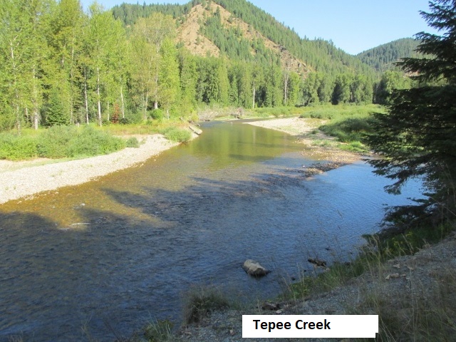
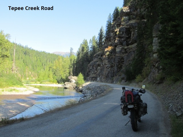
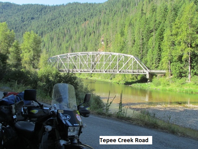
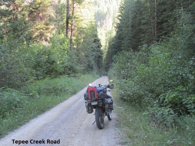
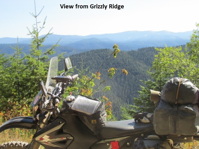
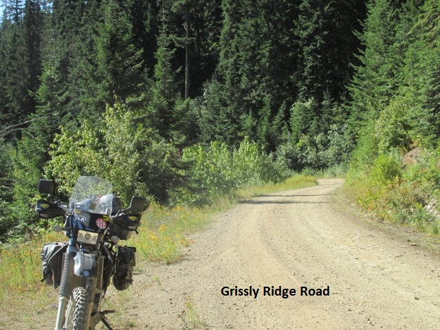
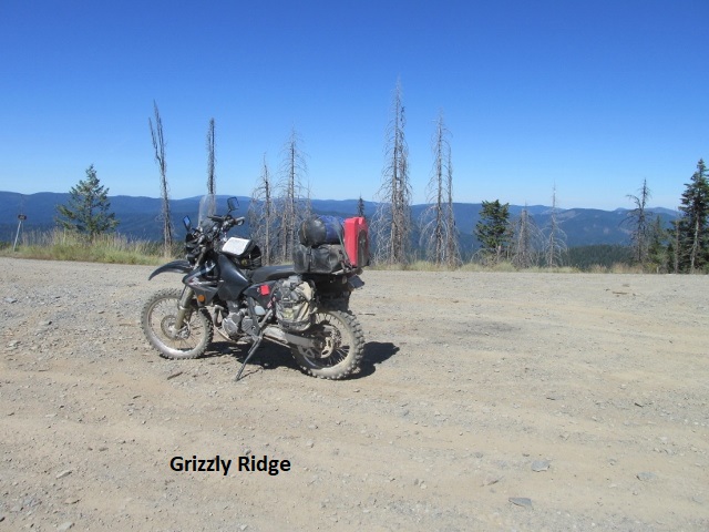
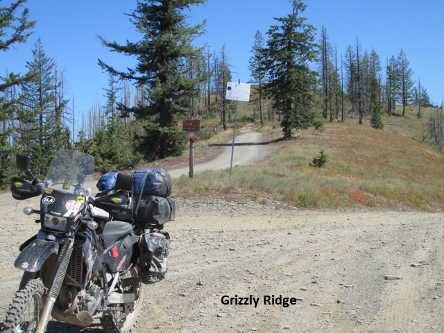
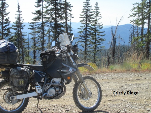
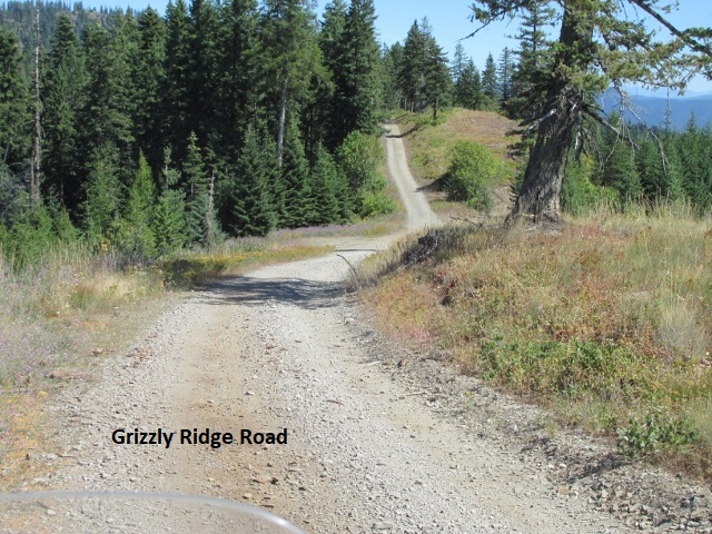
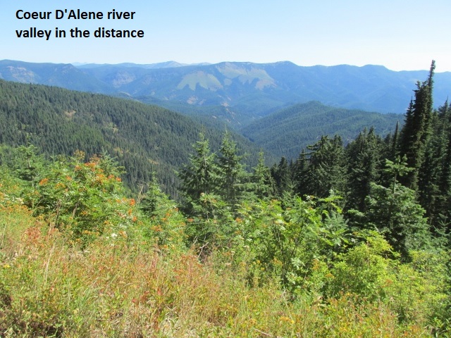
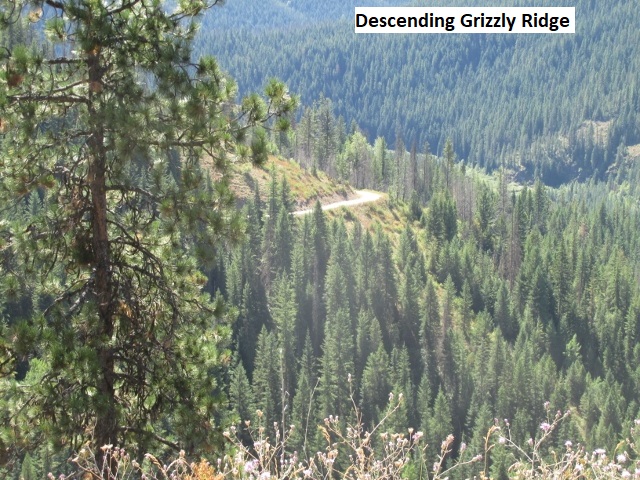
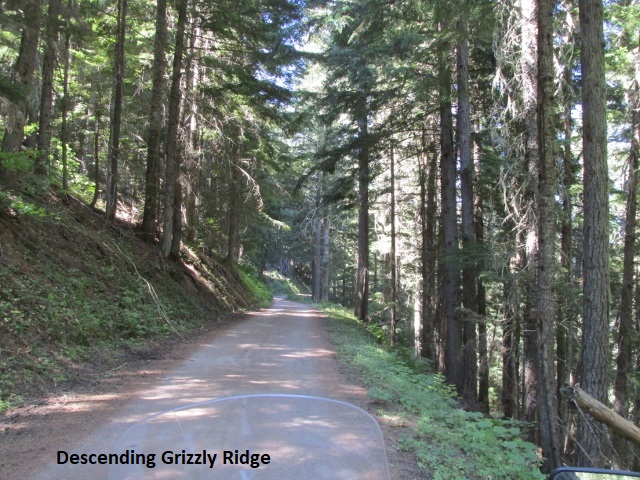
After 84 miles, it’s now 12:15 and I’m sitting in the shade on top of a mountain. Resting and snacking here in the forest and enjoying a beautiful day. The ride has been just great! The roads have varied from mild to moderate class-2’s. Been rambling through the forest, climbing up some knob or across a saddle and then dropping back into the forest. Interesting road names around here: Grizzly Ridge, Spyglass Peak, Tepee Creek, and Independence Creek. The elevation here is 4,435 feet and it’s probably around 70 degrees.
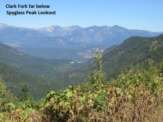
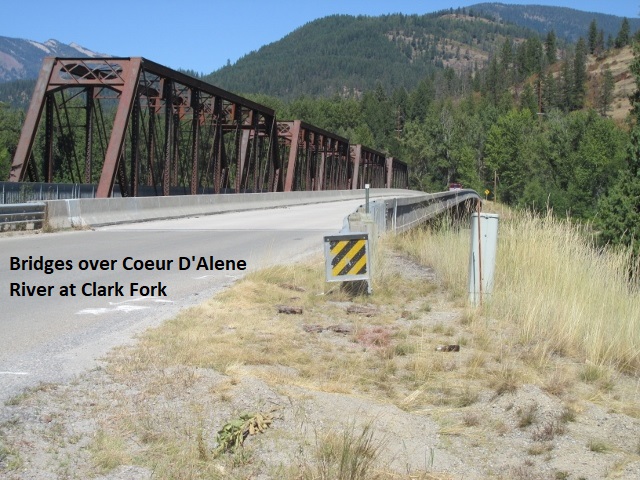
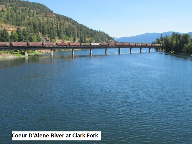
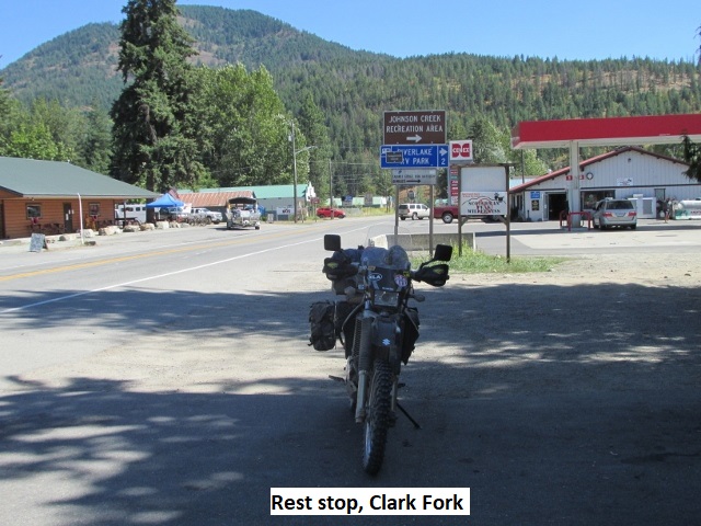
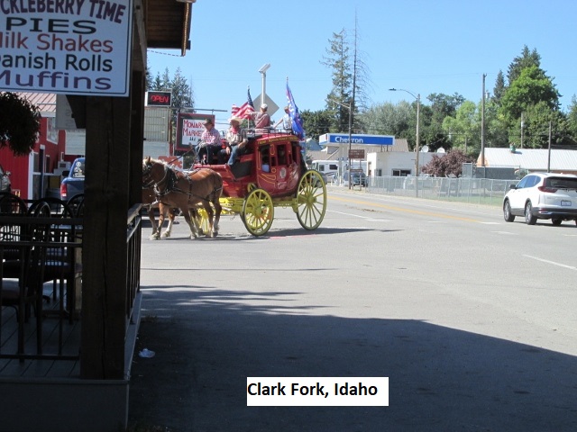
The time is 1:55 and I’ve stopped here in Clark Fork to refuel, having traveled 112 miles. Busy little valley town on SH-200 surrounded by a ring of mountains a few miles away. Looks like I’ll be riding back into the forest shortly.
Still have about 40 miles or so to Sandpoint and I’m hoping for some mild roads to finish the day. Since lunch, the route has been easy and fun, almost always surrounded by forest and only occasionally breaking out on a saddle to enjoy a picturesque overlook. A wide river parallels the highway here, the Clark Fork of the Pend Oreille River, I think. A few miles back I met three dual sports and we did the finger-fist signal. Good system! Here in town the temperature has climbed into the low 80’s.
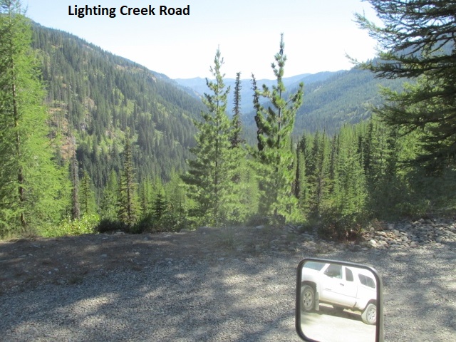
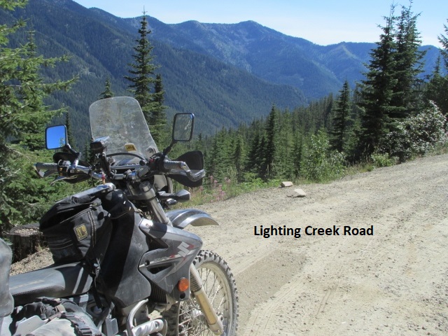
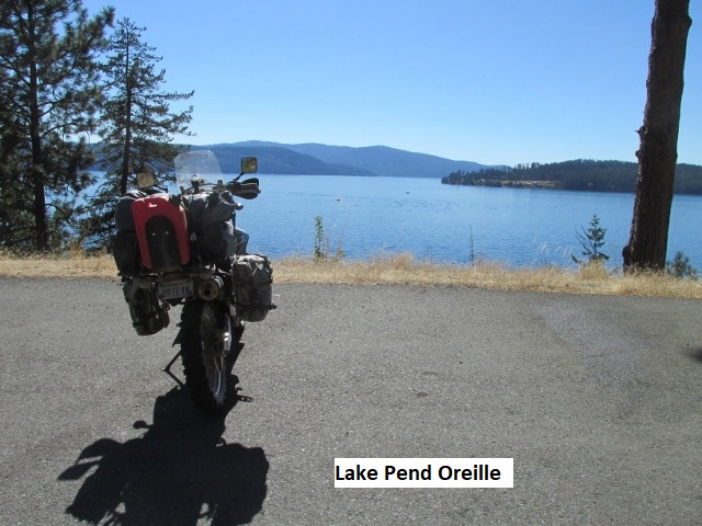
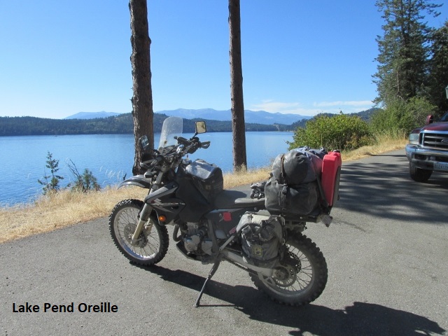
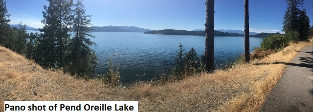
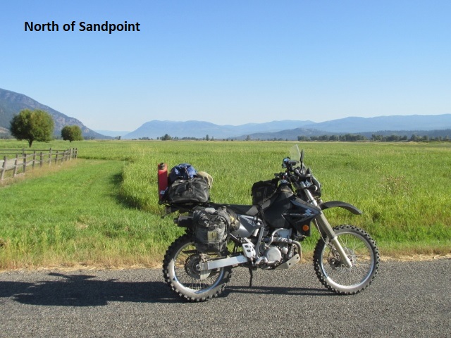
Final recording for Sunday: After leaving Clark Fork, I turned off on Lighting Creek road, a good gravel road headed north and east up a canyon. The road narrowed and continued to climb as it morphed into a mild class-2. Near the top of the climb was a trail back to Chair Falls but I wasn’t in a mood for a hike. I continued on as the road turned sharply back to the west. The road was single lane with a steep embankment on my right and a steep drop-off to my left. While still at a high elevation, there were intermittent pullouts occupied by vacant cars or trucks. The strange thing, what I couldn’t figure out, was where the occupants had disappeared to. The very steep embankment on both sides of the road was certainly not conducive to hiking so maybe the “Rapture” had occurred 😉? The road began to gradually descend into a canyon and eventually brought me back to SH-200 a few miles east of Sandpoint. Here the highway borders Pend Oreille Lake so I stopped for some pictures. I rode various paved county roads north and west that brought me to the Fairbridge Inn on highway US-95. The motel’s not great but clean and there’s gas and restaurants right across the highway. It was an easy and pleasurable day of 160 miles with perfect weather. Tomorrow is a short trip to the Canadian border and the official end of the BDR.
Day Eleven – Monday, 24 August 2020
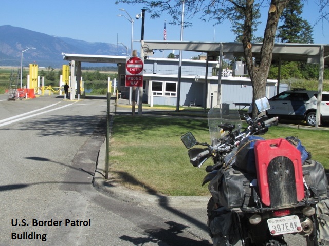
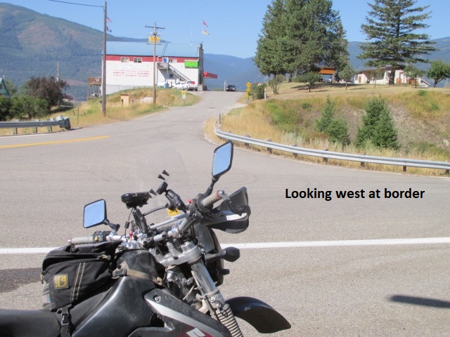
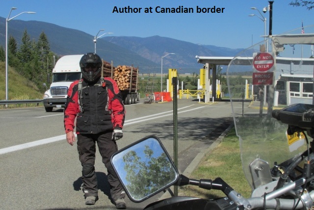
Sandpoint to Canadian Border
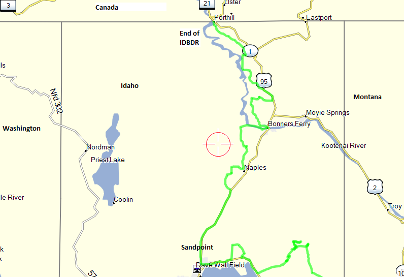
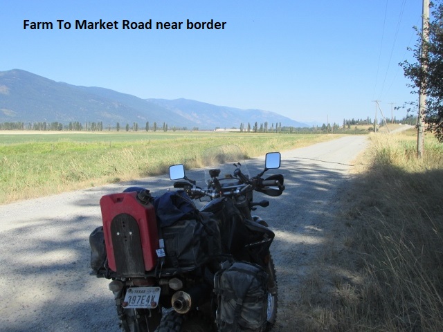
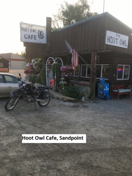 Very early this morning I rode a few blocks to the Hoot Owl Café, great little mom and pop place where I enjoyed a terrific breakfast, maybe the best of the trip. I left the café about 7:15 headed north with the temp in the mid-40’s. There’s not a lot of dirt road options between Sandpoint and the Canadian border since this part of Idaho is very narrow east to west. As a result, I knew I was in for some slab time on US-95 this morning. After traveling thirty-odd miles I stopped to check the map and sure enough, I’d missed my turnoff. The track on my GPS is merely a green line representing the road so although I was following the green line, it was actually my return track that I’d be riding back from Canada. Rookie mistake! So, after backtracking for 12 miles, I found my turnoff and was back on route riding a mild dirt county road. After a few miles I came across a sign reporting “Bridge Out, Road Closure 9 Miles Ahead”. I was already aware of this closure per the BDR website. Their suggested alternative was to simply ride US-95 and SH-1 to Porthill at the Canadian border. Forewarned, I had designed a very circuitous detour that was mostly dirt.
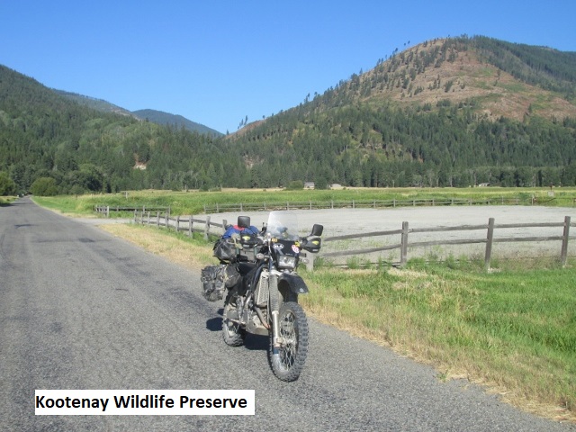
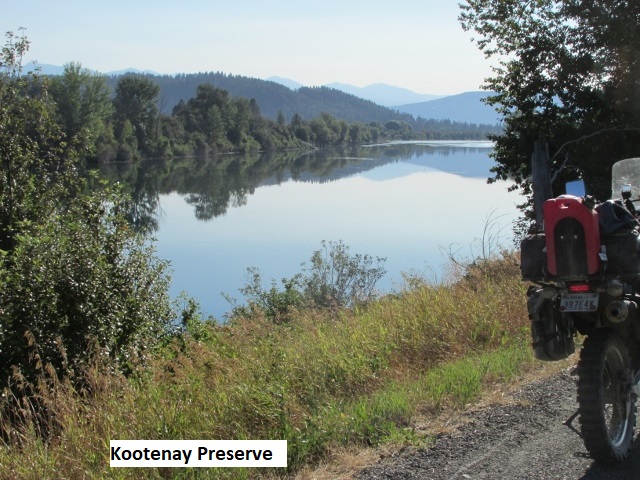
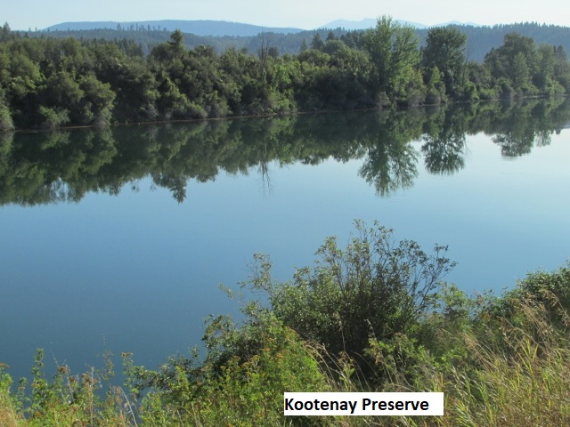
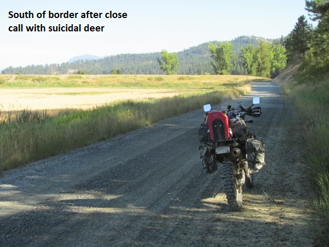
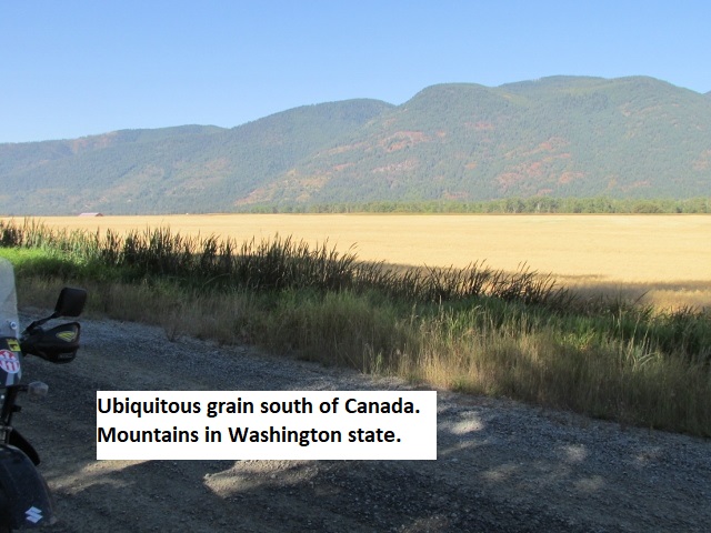
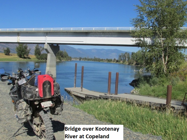
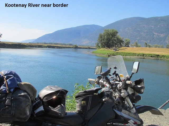
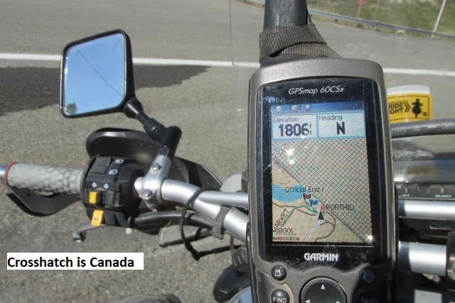
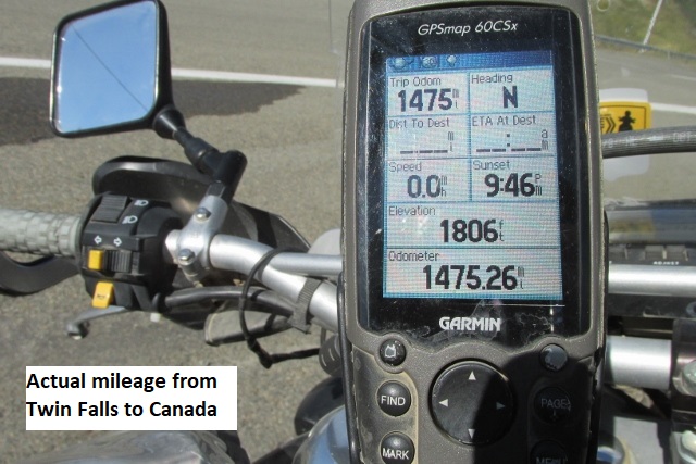
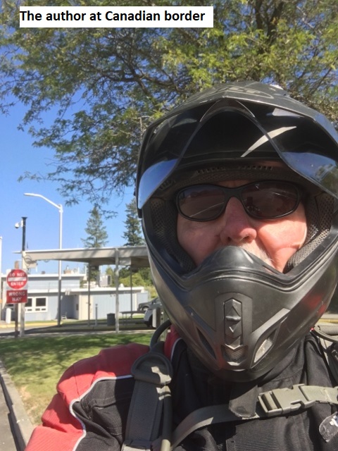
The area was very picturesque with mountains all around as I followed the Kootenay River north. There was a great deal of wheat farming in the valley along with the Kootenay Wildlife Refuge where I halted momentarily. As I was cruising along beside an embankment on my right at about 35 mph, suddenly a deer leaped from the embankment into my path, perhaps 20 feet in front of me. It was so sudden I scarcely had time to get on my brakes but somehow avoided a painful collision. Thank you, Lord! At Copeland, I came to the bridge which spans the Kootenay River, the bridge I thought was “out”. However, the bridge was obviously in use so I concluded the missing bridge must have been further south on the West Side dirt county road. I rode the two miles of pavement to the border where I took some selfies and texted Lyn and a couple of friends to relay my successful finish of the Idaho BDR. My GPS trip odometer indicated 1425 miles since leaving Twin Falls. Wow! What a ride!
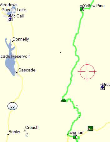
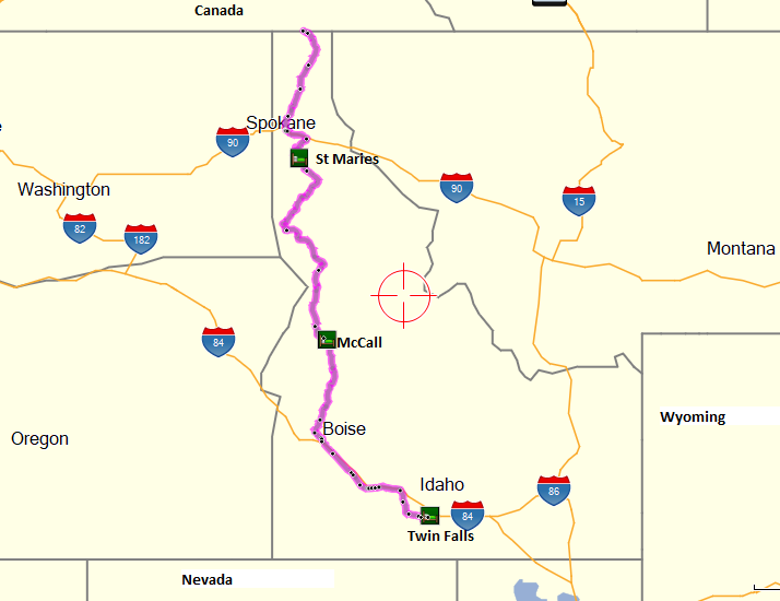
Headed south from the border, I stopped after several miles and got gas and a snack. I then continued south towards St. Marie, my destination for the night. It was a pleasant scenic ride for several miles until I got into some heavy street traffic around Coeur d’Alene. It was stop and go with long lights until I jumped on I-90 for about 15 miles. The interstate was only two lanes as it climbed a few miles up a mountain and then dropped off steeply through big sweeping curves, kinda fun for an interstate. I then turned south on SH-3, continuing south all the way to St. Marie. It was a fun, counter-steering ride which meandered around five separate fair-sized lakes before bringing me into St. Marie. The motel I’m staying in is a cinder block affair but seems clean enough. Interesting that there’s a group of four or five Hispanic migrants staying here who have a small, enclosed trailer where they cook their meals in the parking lot. Been a good day, and now that I’m on pavement I’ve managed 260 miles today. I considered riding further, but it doesn’t get me home any sooner, just a shorter day tomorrow. Climbed up to around 90 degrees today but wasn’t bad as long as I was moving. Tomorrow, I have about 240 miles through some more very scenic country to McCall.
Map for day 12 and 13
Day Twelve – Tuesday, 25 August 2020
These accounts of my trip back to Twin Falls will be brief as I made no recordings and my return is not the real focus of my ride report. For my return trip I had mounted my I-phone on the handlebars and was able to play continuous music through my Bluetooth hearing aids. This really helped pass the time, and for a while I even listened to an audio book. I left St. Marie on SH-3 which continued to be scenic with twisty roads through the national forest. After many miles I intersected US-95 a few miles east of Lewiston that sits on the Washington State border. The day was cool and overcast and just as I arrived at Grangeville where I’d stayed on the ride north, it started to rain for the first time of the trip. At the truck stop I got a bite to eat, then donned my rain jacket and took off in very light rain. Fortunately, after just a few miles the rain stopped. I paralleled the wide Salmon river on US-95 for many miles before splitting off on SH-55 the rest of the way to McCall in the Payette National Forest. My reservation was at the Brundage Inn right on 55 at the western edge of McCall. One of my favorite places on the trip, it was an older single-story mountain lodge with a long, elevated porch and an adjacent restaurant. My room included an antique barber chair as furniture. It was early afternoon, so I rode through town and discovered that most of the town is scattered along a few miles of the highway. It reminded me somewhat of Ruidoso, NM and just as crowded with tourists. The town sits on the edge of Payette Lake and that afternoon there were lots of people swimming, sunning, and boating. In the evening I sat on the porch pondering the great day and reading my Kindle until bedtime.
Day Thirteen – Wednesday, 26 August 2020
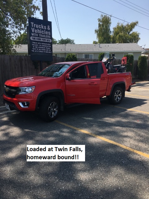 Riding through McCall around seven this morning, I didn’t see any viable breakfast options, so I left town and rode in chilly weather about 30 miles to Cascade. I found a mom- and-pop and wrapped my cold hands around a coffee mug while I enjoyed an excellent breakfast. I continued south to Boise and turned east on I-84 almost all the way to Twin Falls. I turned off the interstate at Bliss and rode SH-30 into Twin Falls. It was a fun two-lane winding through some hills and valleys and it provided a nice view of the Snake River. The ride today was pleasant but uneventful and I arrived at the Best Western around noon. I found my pickup unmolested but slathered in tree sap. I quickly loaded the DRZ, changed to street clothes, and grabbed a sandwich at the “golden arches” and headed north out of town.
I went north because it gave me another great view of the Snake River canyon and connected me with I-84 east. I planned to drive as far as Salt Lake but had not made any reservations … would just wait and see how tired I got. The miles passed quickly as I zoned out with my Jack Reacher audio novel. The ninety miles from Ogden through Salt Lake to Spanish Fork on I-84 was six-lane, bumper-to-bumper traffic moving anywhere from 80 to 20 miles an hour.
Almost got sideswiped once by a truck in some construction and was really glad when I stopped in Spanish Fork and got a room for the night. I had ridden 240 miles on my bike and another 270 in the truck.
Day Fourteen – Thursday, 27 August 2020
I left Spanish Fork around 6:30 on US-6 and drove to Price, Utah before stopping for breakfast. US-6 had joined US-191 and took me to Green River, where I briefly traveled I-70 before turning south on 191 again to Moab. At Monticello, I split off on US-491 to Cortez, Colorado and finally to Shiprock, New Mexico. There I decided to turn east on US-64 to Farmington and Bloomfield and forego the slow trip south through the reservation to Gallup. I picked up US-550 south to Cuba and then Bernalillo at I-25. At Bernalillo I decided to try to contact an old army and dirt-bike buddy, Verne Kilfoy. I hadn’t seen or talked to Verne in several years, so I googled him and was shocked when it came up with his obituary. Blew me away! He had died last March after a long struggle with cancer. I went on to Albuquerque and down to Old Town and the La Placita Mexican restaurant. One of my favorite places, I had to sit on the sidewalk to eat because of Covid. It was great anyway! I’d traveled about 550 miles from Spanish Fork. I got a room at the Ramada Plaza and called Verne’s wife to express my condolences before hitting the sack.
Day Fifteen – Friday, 28 August 2020
Leaving Albuquerque in the dark I drove to Santa Rosa, grabbed a sausage biscuit and kept trucking. I was “smelling the barn” now and made it back to Lubbock around noon and got a long overdue hug from Lyn. Thank you, Lord!
Epilogue
After all the planning and anticipation, It’s really hard to believe that the Idaho BDR is now history. While riding, the days are somewhat of a blur, passing so quickly and often leaving me exhausted and ready to hit the sack early. Idaho wasn’t as scenic as Colorado, probably because I was surrounded by trees most of the time. That said, it was still a beautiful ride with lots of great rivers and lakes. I say this every year, but I’m always amazed at the Creator’s magnificent and beautiful creation! The Lord has truly blessed me with good health, the financial means to make trips like this, and keeping me safe on the ride. As always, Lyn was very supportive (I’m sure she enjoys a break from me now and then). The weather was great, except for the heat the first couple of days, and no bike problems except the broken strap. Looking back, my only regret is the difficulty of the Lolo Motor Way, but “it is what it is”. I think in the future though I’ll be more attentive to my fuel supply. Really grateful I never had a fall, though I survived several close calls and did drop the bike the one time.
This is probably my last Back Country Discovery Route since those that remain are too far or too difficult. It may also be my last trip of this duration. As I drove toward Lubbock, I began to think I might prefer to take shorter trips and more often. As the miles slipped by heading home, I started planning to make a “toy hauler”, a combination camper and bike trailer, out of my enclosed utility trailer. By the time I made it home, I had most of it planned out in my head. At the time of this writing, I’m about 95% through with construction and looking forward to an early spring “shake-down”expedition with trailer and bike.
In conclusion, the Idaho BDR was a great ride … very beautiful country and fun roads … mostly! Once again, I’m really glad I was able to ride it … and survive it!
 Jerry Lewis, December 2020