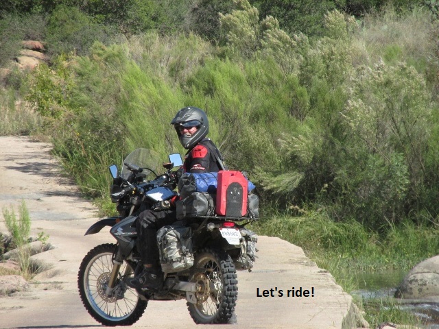
Ride Report
Colorado Backcountry Discovery Route
8 September 2019 – 16 September 2019
By Jerry Lewis
COBDR Introduction
For those with nothing better to do, welcome to my dual-sport “ride report” for 2019. The BDR routes are scouted and planned by a non-profit group known as Backcountry Discovery Routes (BDR). The Colorado Backcountry Discovery Route, like all of the BDR’s, is a multi-day, off-road dual-sport motorcycle adventure. It is intended for intermediate to advanced riders and can be ridden on most street legal dual-sport and smaller adventure motorcycles. Following is an excerpt from the BDR website describing the COBDR:
“If getting high is your thing, Colorado offers some of the tallest mountains passable by motorcycle in the US. With several passes over 12,000 feet, there is no shortage of views on this route, just shortness of breath while taking in the sights in the thin air of Ophir, Corkscrew, Hurricane, California, Cinnamon, Cumberland, Cottonwood, Weston and Hagerman passes.
Beginning in the four corners location where, CO, AZ, NM and UT intersect, this 675-mile route winds its way north through the Rocky Mountains to the Wyoming border. The terrain includes dirt roads with rocks, sand and even a few water crossings to keep it exciting.
Best time of year: July through September. Most of the route can be done in late June. Depending on snowpack you might not make it through some high passes until sometime in July.”
As I mentioned in last year’s NMBDR report, BDR furnishes free GPS tracks for each of their discovery routes and an associated $15 Butler map. The maps are very high quality fold-out maps rendered on excellent water resistant paper.
“Butler Maps was created by motorcyclists who run the gamut of enthusiasm … young to old, dual-sport to casual cruiser … they attempt to create maps suitable for any type of rider. Their concept is simple … research, ride and share the best riding experiences so riders can spend more time twisting the throttle.”
COBDR Preparation
I have wanted to ride the COBDR for a few years now but I’ve been somewhat intimidated. Some of the riding is very technical and even a bit dangerous, particularly riding solo. Solo, since my friend Yancey who sometimes follows in his truck, begged off for health reasons. Riding friends Kenny and Milton couldn’t afford to be gone from work that long. Before deciding to attempt the ride, I spent hours checking ride reports from other riders. I knew weather conditions in Colorado are always a factor, so I decided early September was my best bet. Much like the NMBDR, lodging would be somewhat scarce due to the remote areas. I played around with various distances between towns to come up with something workable. Wanting to avoid surprises, I made reservations for each night of the trip. Rather than depend solely on my GPS and the Butler map, I copied about thirty, 11 x 17 pages from a Colorado map book and highlighted the COBDR route on each page. That way I could place each day’s route pages in my tank bag map pocket for easy viewing. As I’ve mentioned before, while following the green line on my Garmin 60 CSX is great, having paper maps serves as a backup. It shows me options for rerouting due to road closures or bike problems, as well as displaying the “big picture” of the route.
On most of my previous long rides, someone has typically hauled me and my bike to the starting point then picked me up and drove us back to Lubbock. Since Colorado was so far and I was going alone, I preferred to haul my bike in my Chevy Colorado (seems appropriate) to my starting point in Cortez. Of course that raised the question of how I would get from Wyoming back to Cortez. What I needed was a “loop” but the official BDR is a one way trip. Grabbing my Colorado map book and using MapSource software and Google Earth, I mapped out a 75 percent off-road route from the Wyoming border back to Cortez. Now I had my “loop” and instead of 700 miles off-road, I had approximately 1100 miles. My excitement and commitment were growing.
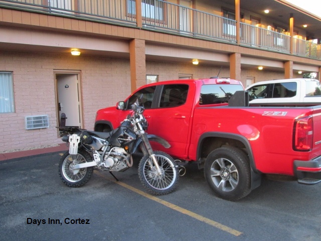
One of my concerns was leaving my truck unattended for 8 days in Cortez. I checked with the Cortez Days Inn and got permission to leave it in their parking lot. As insurance, I bought “The Club” steering wheel lock and installed locking lug nuts on my truck wheels. After I re-shod my trusty 2012 Suzuki DRZ400 with new knobbys and installed new sprockets and chain, the bike was ready to go.
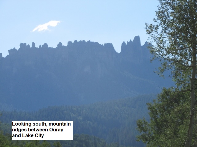
My major hesitancy about doing this trip was attempting to ride over some of the high passes near Ouray. Several riders have bemoaned the treacherous ride up Ophir Pass with a couple of miles of large rock tailings that will eat your front wheel. I had ridden Cinnamon and California passes on the Trans-America trip, when Yancey fell on Cinnamon and sprained his ankle. My DRZ is carbureted rather than fuel injected so it doesn’t run well at those high altitudes. Then there’s also the steepness, the sheer drop-offs, the big rocks and wash outs to contend with. After changing my mind a dozen times I decided to “wuss out” and bypass the passes and ride the “easier” northern route from Ouray to Lake City. Some reports I had read indicated the easy route was really fun riding and beautifully scenic.
Since once again I’ll be riding solo, I’ll carry my Fast-Find Location Beacon (PLB) as well as my Garmin InReach Mini tracker/ communicator. Both of these units are capable of summoning first-responders to my exact location should I be seriously injured (assuming I’m conscious to activate them ☺). As I’ve mention before, family and friends can follow my track on Garmin’s web site. In the off chance I can’t activate an emergency call, those tracking me will have my latitude/longitude info and notify local rescue if they notice a period of non-movement on the tracker. The ability to communicate both ways with the InReach Mini via satellite offers me and my family some peace of mind.
As I’ve done the last couple of years, throughout the day I will periodically stop and make voice recordings on my I-phone. I do this in order to remember and describe the scenery and riding conditions for later transcription. One last bit of information: I will periodically refer to the classification of a road I’m riding, indicating the degree of technical difficulty.
Following is the rating system I will use:
Class 1: Improved dirt, gravel, etc. Passable by any motorcycle capable of off-pavement travel.
Class 2: Poorly maintained dirt, gravel, etc. Rocks, sand, mud holes, ruts, inclines, water crossings, or other similar obstacles make this road difficult for larger, heavier adventure motorcycles and requires some rough terrain riding skills.
Class 3: Rugged, unmaintained dirt, gravel, etc. roads. Significant obstacles such as moderate sized rocks, deep sand, deep or long mud sections, deep & wide water crossings, and/or steep inclines with loose terrain & tentative traction make this road/trail extremely difficult for large adventure bikes and very challenging for large dual sport motorcycles such as 650cc thumpers. Advanced rough terrain / off-road riding skills advised.
Class 4: Extremely rugged road that contains highly challenging obstacles such as steep drop-offs, deep & fast moving water crossings, very steep inclines with loose surface, boulders, deep & long mud sections, downed trees, and deep & long sand sections. Generally not passable by large adventure bikes, extremely difficult for large dual sport motorcycles such as 650cc thumpers, and very challenging for smaller dual sport / trail bikes. Should be attempted only by those with significant rough terrain / off-road riding skills and experience.
Note: Roads are classified according to the most difficult section of that road. Classifications should indicate the most difficult section a rider will encounter along that road. For example, a road may be a class 1 with the exception of a class 2 water crossing. The entire road is, therefore, a class 2 road, even though the majority of the road fits in class 1. The single class 2 river crossing means the road must be classified overall as class 2.
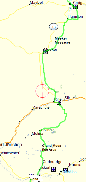
Master Map and Intinerary

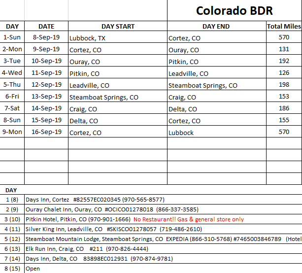
Day One – Sunday, 8 September 2019
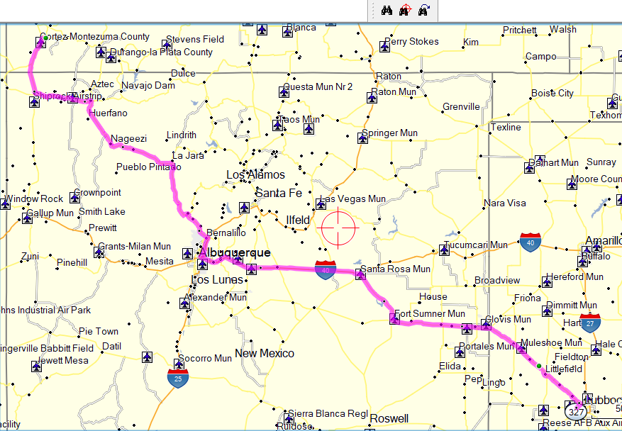
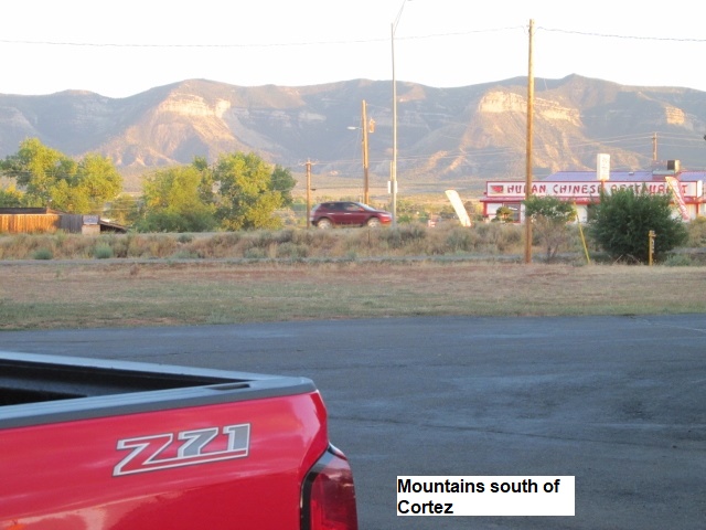
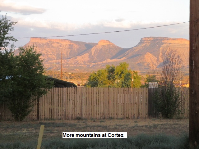
The much anticipated day finally arrives and I rise early, eat a quick breakfast, kiss the wife, pet the cats, and I’m gone at first light. The trip to Cortez is 575 miles and I’d like to make it there fairly early. The morning drive is uneventful and after passing quickly through Albuquerque, I turned off I-25 at US-550 and stopped in Bernalillo for lunch. Headed north on 550 through Cuba, I spied some of the nearby rock towers to the west and my mind traveled back 12 months to my ride through here on the NMBDR. At Bloomfield NM, I turned west on US-64 and then north again on US-491 at Shiprock. Having gained an hour in time zones, I pulled into the motel around 4:00. After checking in, I found a suitable incline and tried to unload my bike. The front wheel was stuck in the rack and I finally had to let out some air to dislodge it. After driving around Cortez for a bit, I wound up eating some pretty decent Mexican food just across the parking lot from my room. I discovered at my meal what proved to be true throughout the rest of the trip: Regardless of the time of day, I could expect to pay $12-$14 plus tip for a sit-down meal. Ouch!
Day Two – Monday, 9 September 2019
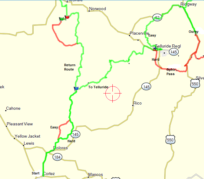
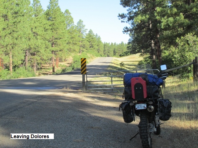
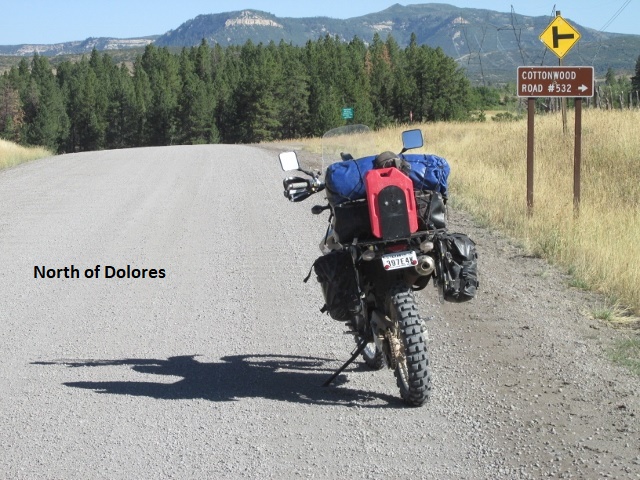
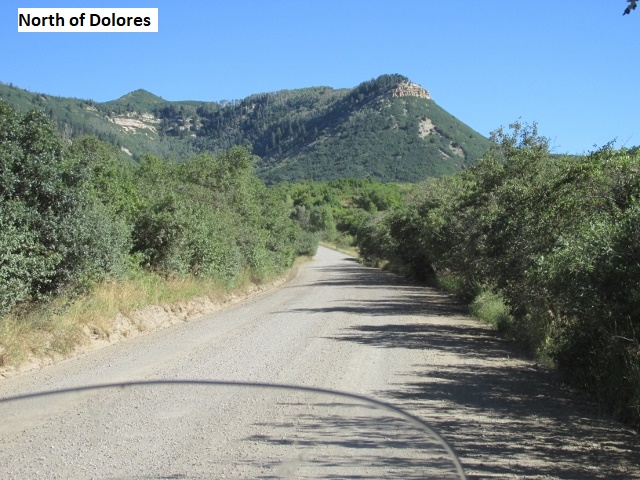
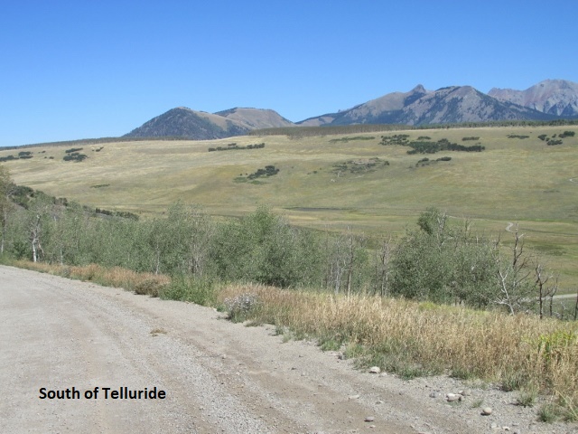
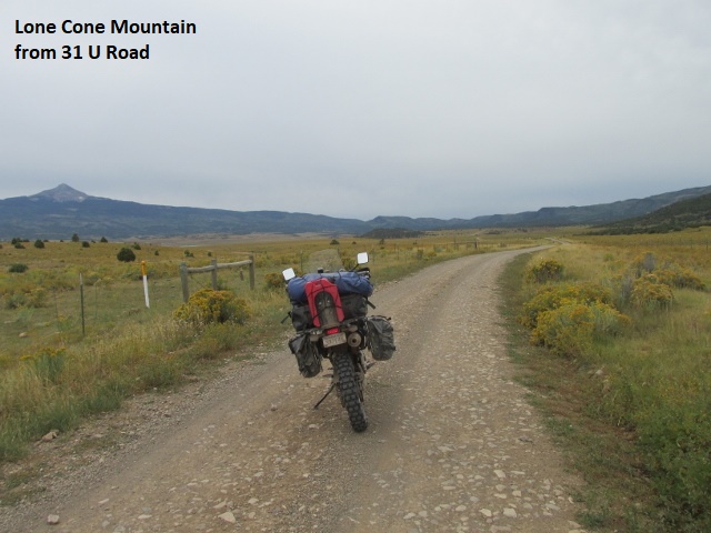
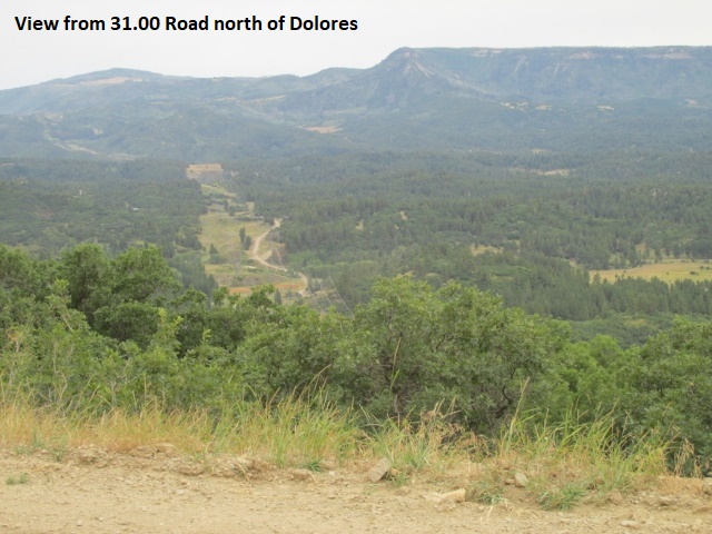
Recording 1: It’s now about 9:10 and I’m just north of Dolores after the 10 mile ride from Cortez. It was a chilly 44 degrees this morning when I got up, but probably 55 by now. I ate breakfast at Denny’s and left Cortez round 8:45. After passing through Dolores, I traveled pavement on the 31-00 RD a few miles north and turned off on a Forest Road Y-00. The road was in the San Juan National Forest and immediately began climbing. It is truly a beautiful fall morning!
Recording 2: It’s 10:00 and I’ve ridden 28.5 miles. The Y-00 RD morphed into a 4-wheel drive jeep road. It was my first real test of the trip, probably a class 2.5 degree of difficulty. The road was pretty washed out in places with deep ruts. It was a little early in my ride for that kind of road, making me skittish as I hadn’t hit my groove yet. When I first start to ride on a trip, and even for a short time each morning, there’s some trepidation. After several miles, my bike becomes an extension of my body: The throttle, the clutch, the handlebars, shifting gears, choosing the best line, and bike balance all become a seamless process without much conscious thought … my “groove”. That’s when the fun starts! The Y-00 I was riding was the harder of two route options, the other being W-00 RD, a smooth gravel county road. I was relieved when I intersected W-00 and could relax a bit. After following it a ways, I came to my second choice of “easy or hard” and again took the harder of the two. FS RD C was again a class-2 and proved to be an exhilarating ride as it followed a power lead up over a mountain. After a few miles I descended to the 31-00 RD, now a smooth gravel county road.
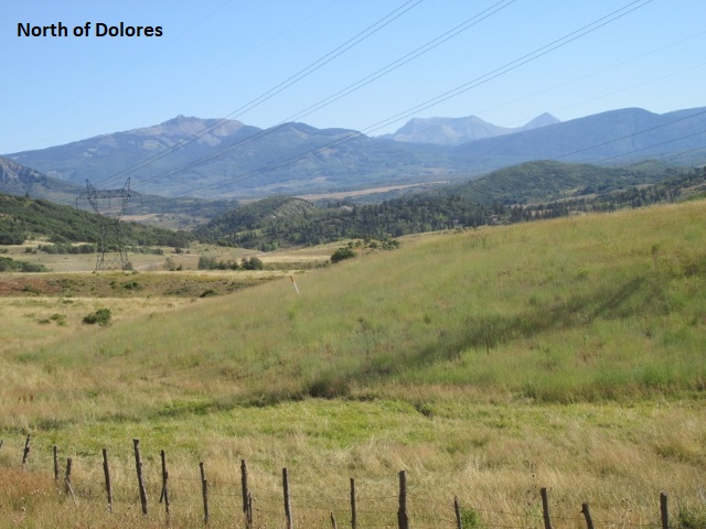
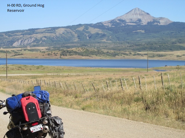
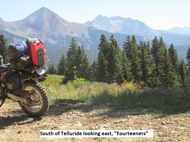
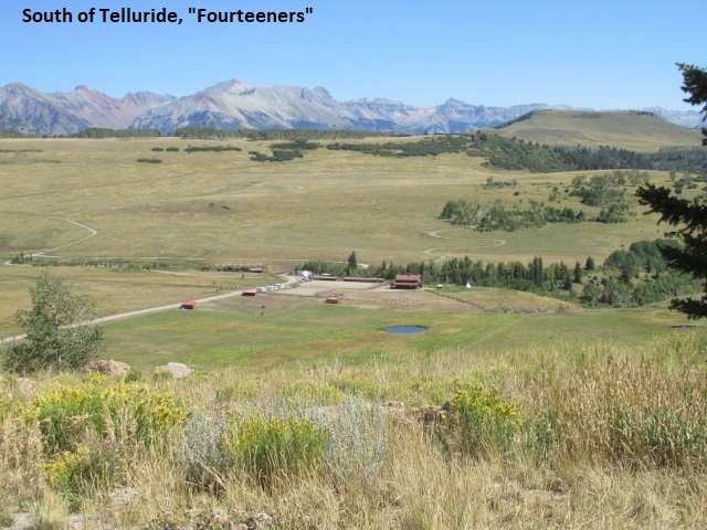
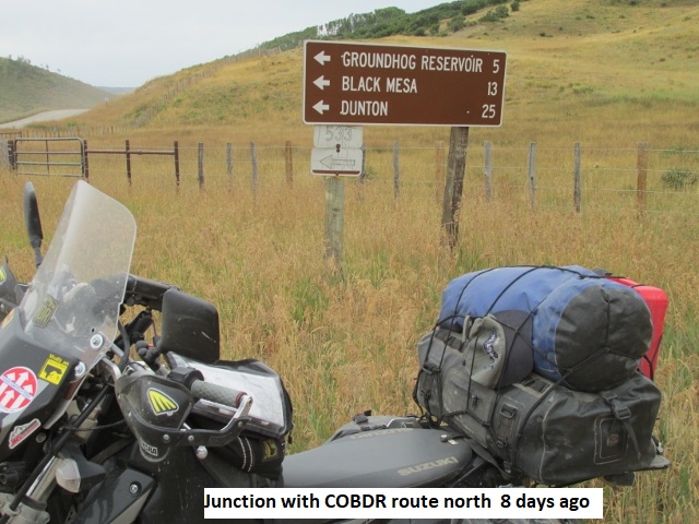
Recording 3: I’ve traveled about 55 miles and it’s now 11:00. After my last stop I continued north on 31-00 RD for about 12 miles, then northeast on H-00 RD past Ground Hog Reservoir. The small mountain lake was very scenic with campers and a few cabins along the shore. For several miles past the lake, the road was a nice mild single lane through the forest. It then changed to a “jeep road” 49-G RD and I’m stopped at 10,845 feet, having climbed numerous switchbacks. It’s kind of chilly at this elevation since I shed my coat liner fairly early this morning after that first rough stretch. It’s still a gorgeous day with beautiful scenery and majestic mountains northeast of my present location. I’m assuming those are some of the “fourteeners” between Silverton and Telluride.
Recording 4: 49-G finally topped out at about 10,980. Descending through more switchbacks 49-G was a nice single lane forest road that leveled out in a nice, wide valley, with the mountains now to my east. It shouldn’t be much further to Telluride from here. Thinking back, I just realized the only wildlife I’ve seen so far was a single doe mule deer.
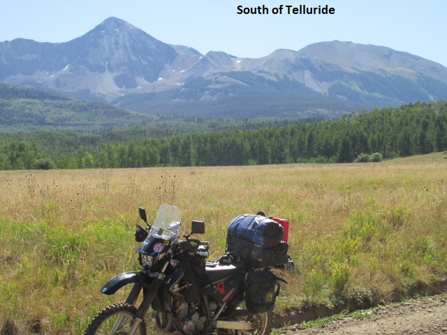
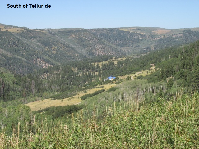
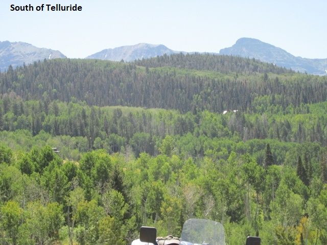
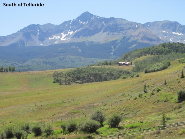
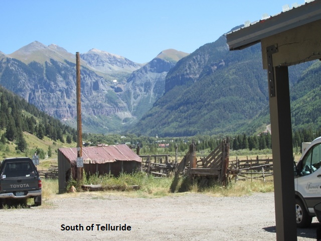
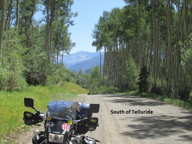
 Recording 5: Well, I made it to Telluride about 1:00 and grabbed a bite to eat at a gas station on the edge of town. After my last recording I met 3 dual sport riders headed the other way. I didn’t stop to visit assuming they were on the last leg of the BDR having started in Wyoming. I climbed up the 56-L RD onto a mesa with amazing vistas and mountains all around. Close now to CO 145 highway, there were several vacation homes scattered at the top of the mesa. A few miles back, I was briefly delayed by road construction on the highway. I’m fixing to head back out the highway to Last Dollar Road which will take me around the shoulder of a Whipple Mountain to Ridgeway. If I hadn’t already decided to skip Ophir Pass, I would be turning south here.
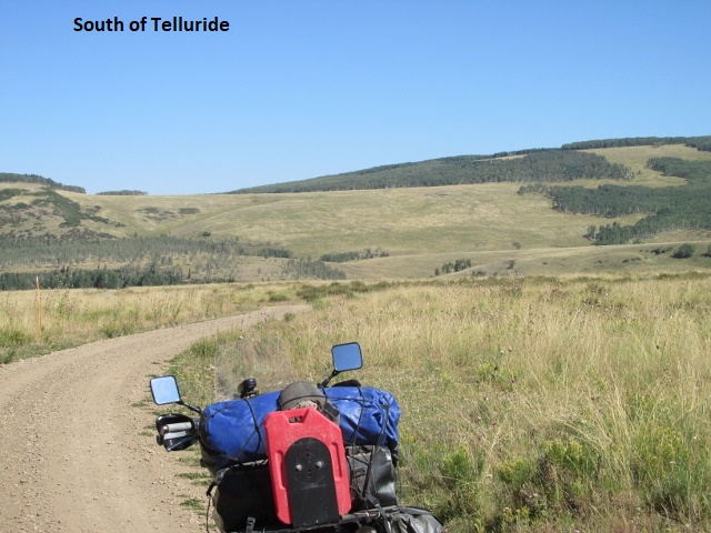
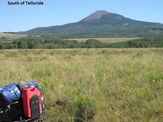
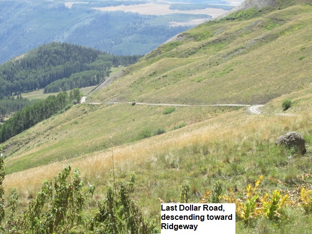
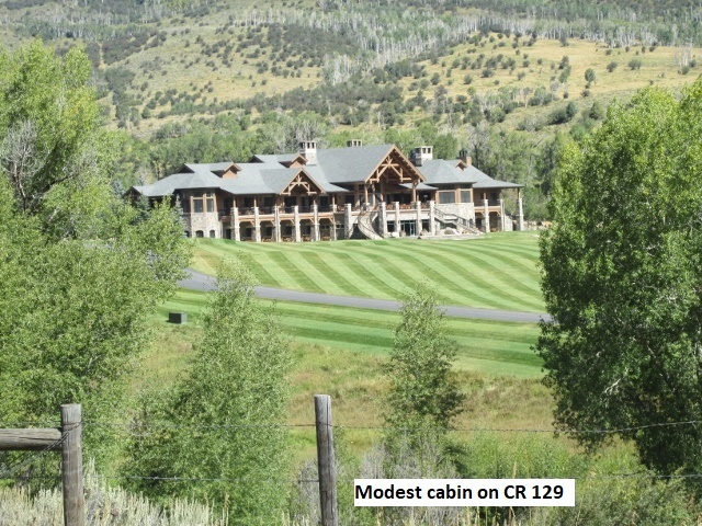
Recording 6: As I left Telluride on the Last Dollar Road (T60), the road was paved for a short ways and then changed to gravel as I climbed rapidly above the valley below. Once again, there were several very expensive looking vacation homes spread out along the road. Looking to the south I had a great view of the mountains. I followed the road for a long ways as it wound in and out among the serrated face of Whipple Mountain. I came upon a sign reading “Warning: Narrow Winding Road Ahead” and the truth of that was immediately evident. I rode by a group of campers who waved as I continued to climb. The road became increasingly steep and washed out, a class 2.5 or 3 and I thought “This is getting too rough”. I carefully studied my GPS and realized I was closely parallel to my intended green track but slightly south of it. Thinking it might be a GPS error, I turned around and rode back to where I’d seen the campers. After visiting with a young lady there, it turned out the 58-P RD that I wanted was almost hidden as it forked off in the middle of their camp. It was still fairly rough for a ways, probably a class 2, but much better than the other fork. I traveled that road for a long way as it wound along the slope of North Pole Peak and then began to gradually descend toward Ridgeway. At one point I just happened to check my mirror and discovered a bike right on my tail. I wasn’t sure how long he’d been behind me on his KTM, but I gave him room and waved him by. Eventually I hit pavement on CO 62 and rode about 5 mile into Ridgeway.
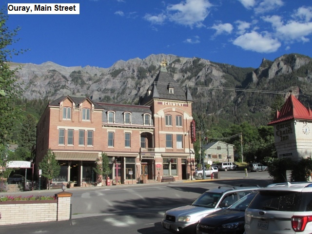
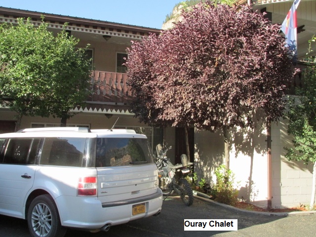
After stopping for gas in Ridgeway, I continued south on CO 550 for 10 miles to Ouray, arriving about 3:15. Knowing I would probably arrive early, I’d been considering riding the 8 miles south of Ouray to check out the more difficult section of the BDR that I planned to bypass. These roads climb over several 12,000 foot-plus passes before dropping into Lake City. Cinnamon pass had just reopened after heavy rains washed out parts of the road. Arriving at the junction of the trail with 550, I decided to ride up Cork Screw Gulch a ways and see just how bad it was. It was indeed rough and eroded and very steep, but doable. After steadily climbing for about 4 miles I came to a meadow with a primitive restroom and parking area. Here the road became even steeper and looser with very tight switchbacks as I battled my way toward Hurricane Pass. After about a half mile, I came to a guy standing next to a huge BMW 1200 GS after someone apparently had just helped him pick it up. He was stopped in the middle of the switchback so I had to ride around him. I almost fell myself as I tried to keep momentum and ride out of the switchback. My engine was losing power, “loading up” due to the steepness and elevation. Feathering the clutch, I made it about a hundred yards up to a somewhat level spot. There were three more GS’s parked there waiting on their buddy below. Since my bike was bogging down I decided “this is far enough” and carefully turned around. Riding down, I passed the guy still in the switchback and began to careful descend toward highway 550 four miles below. The road was so steep going down that my rear brake overheated and was suddenly useless. I managed to stop the bike using my front brake and clutch. After letting my brakes cool for about 10 minutes I made it safely to the highway. Back in Ouray I checked into the Ouray Chalet, a really nice, older motel … very clean and well maintained with a friendly staff. $104 a night in Ouray for a clean bed and a nice shower is a great bargain. I enjoyed a good meal at a little pizza place down Main street. Counting my sojourn up Cork Screw I traveled about 160 miles today.
Day Three – Tuesday, 10 September 2019
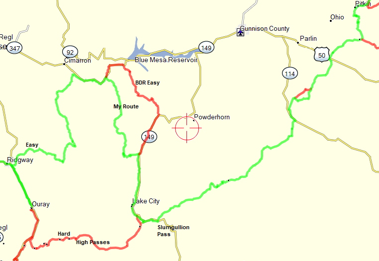
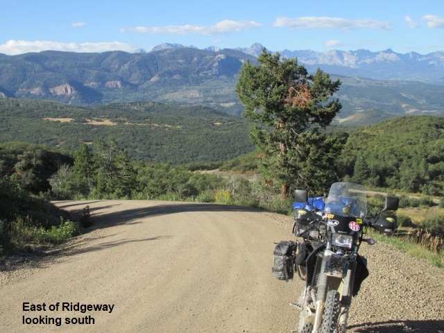
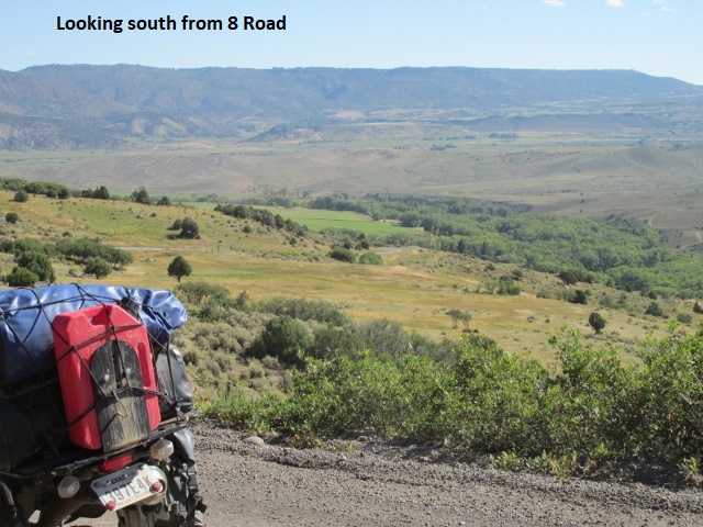
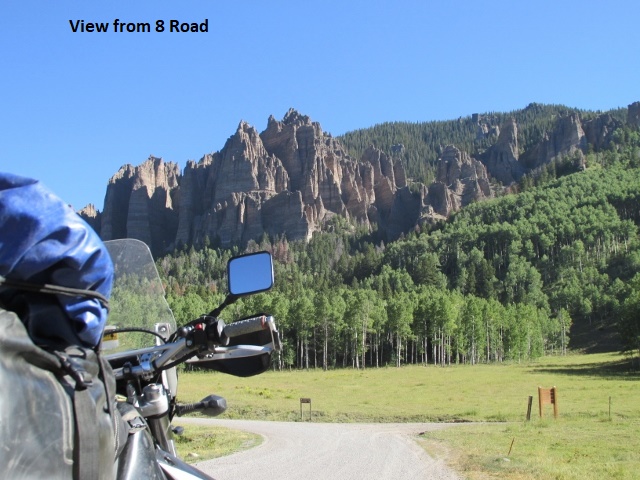
Recording 1: I ate a great breakfast at a café recommended by the hotel, then loaded up and got away about 8:30. I rode US 550 from Ouray north to Ridgeway to join up with the “easy” northern route to Lake City. It’s now about 9:25; I’ve covered about 25 miles, 10 of which were on pavement. It’s warmer than forecast, a very moderate 50 degrees under mostly clear skies. Leaving Ridgeway on the nice gravel 12 RD, I was presented with some of the prettiest scenery of the trip thus far. The 12 RD gave way to the 10 RD, then the 8 RD (FS RD 858) as I climbed from the valley up to about 9,500 feet. Looks like I may be about to start back down from this elevation. The roadway has been good gravel but I ran into some construction signs a ways back, indicating a possibility of a 2 hour delay ahead. No problem so far.
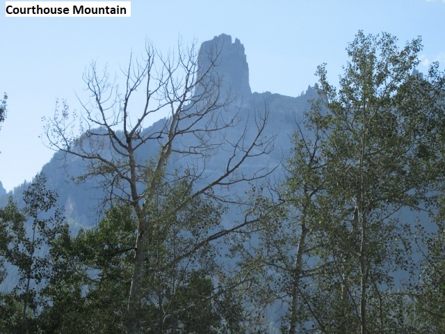
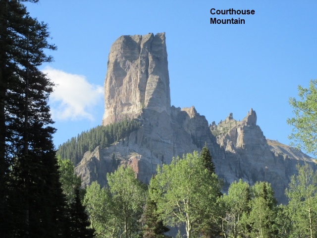
Recording 2: As I check the time, it’s 10:25 and I’ve ridden 54 miles. The morning’s warmed up to around 60 degrees as I sit at the intersection of Cimarron Rd and US 50. I ended my last recording assuming I was starting to descend, but instead climbed to over 10,000 feet over Owl Creek Pass. There I shot some pictures of a magnificent granite column which rose thousands of feet and had been visible to me for many miles. I believe it’s known as Courthouse Mountain. The ride has been great! So glad I took this road instead of the high passes south of Ouray. Just fun riding and I don’t think I’ve seen prettier scenery anywhere. A little ways back I scared up three healthy looking doe mule deer in the middle of a blind turn, scaring all four of us. The road wound mile after mile through the Uncompahgre National Forest before passing by numerous vacation homes as I neared US50. I’m about to jump on US 50, headed east for a few miles before turning south on forest roads which will take me to CO 149.
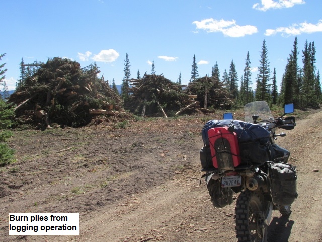
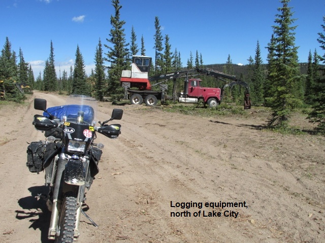
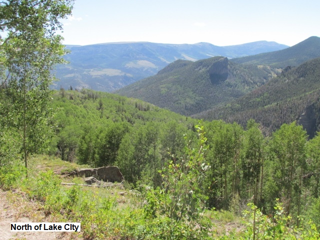
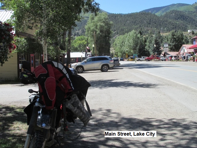
Recording 3: I just intersected FR868 and CO 149 about 10 miles north of Lake City. I’m about jump on the highway and ride CO 149 into town. It has been a great ride ever since I turned off US 50 on the 867 RD near Blue Mesa Reservoir! The official “easy route” showed to follow US 50 a bit further east and taking the 25 RD south to CO 149. However, 867 appeared on Google Earth to be more interesting, and proved to be a good choice. As usual, the road began as a good graded county road before changing to a forest service road after a few miles. I was on edge as I rode through some deep sand for a couple of miles. The sand was due to ongoing road construction where heavy road equipment had pulverized the surface into talcum-powder. As I continued climbing to over 11,000 feet, I kept seeing warning signs about logging trucks. Sure enough, I encountered an area where they were removing dead trees, killed by the beetle infestation. Looking to the south, I realized I was passing on the north side of the peaks which harbored the high mountain passes I had decided not to ride. After topping out several miles back, I began a lengthy descent with switchback after switchback … really fun riding. A few minutes ago, I was stung on my cheek by a wasp or bee … really smarted and left venom visible on my face.
Recording 4: I’ve now traveled 50 miles since leaving Lake City, and it’s 3:30. I think I still have about 45 miles before I reach Pitkin to end my day. When I was leaving Lake City I stopped to make some changes on my GPS. When I started riding yesterday, I forgot to zero out my trip “stats” that the GPS record, so I stopped on the side of the road to clear them. In “zeroing” my stats, I inadvertently also erased all my “tracks”. This necessitated digging out my laptop and reloading the tracks on the GPS before I could continue.
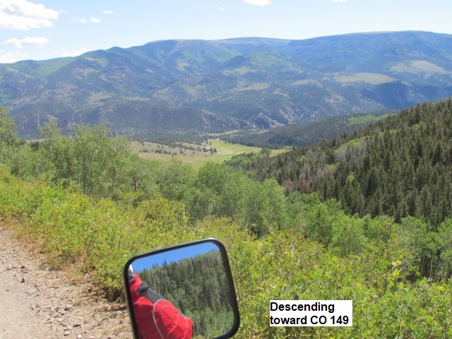
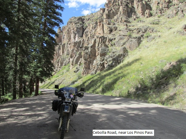
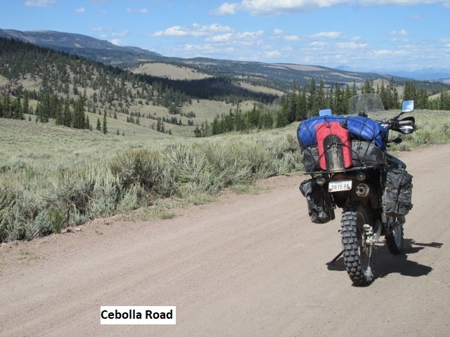
The ride so far this afternoon has been fast, mostly 50-60 mph on gravel county roads. I rode CO 149 out of Lake City almost to Slumgullion Pass before turning off. The devastation wrought on the forest by the beetles is near 100 % around the pass. I took Cebolla RD. east, a really neat road that follows Mill Creek through a canyon for several miles before climbing over Los Pinos Pass. After the pass, I meandered in and out of the forest on the KK-14 RD before descending into a wide, open valley. As I rode past several ranches in the valley, I was treated to an austere and lonely landscape as I drew near CO 114.
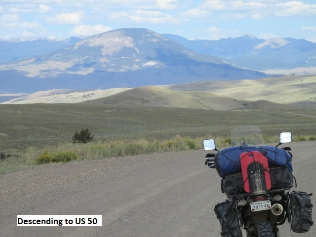
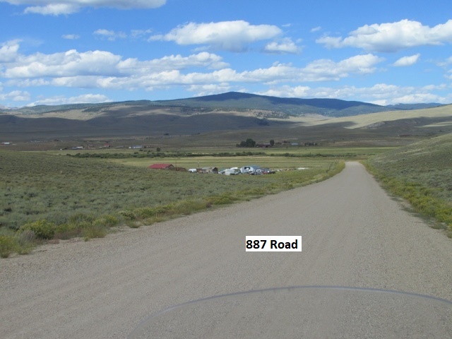
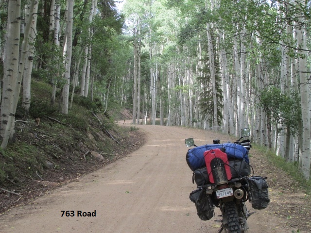
Leaving CO 114, I continued northeast on the gravel 14-PP road all the way to US 50. Checking the map, I’ve been riding through the Gunnison National Forest and I notice I’ve scribed a huge “V” from US 50 south to Lake City and back northeast to US 50. Crossing 50, I took the 887 RD a ways then due north on RD 763. This was a great single lane road through the forest with lots of switchbacks. I rode up above 11,000 feet, crossing Waunita Pass before descending to Pitkin.
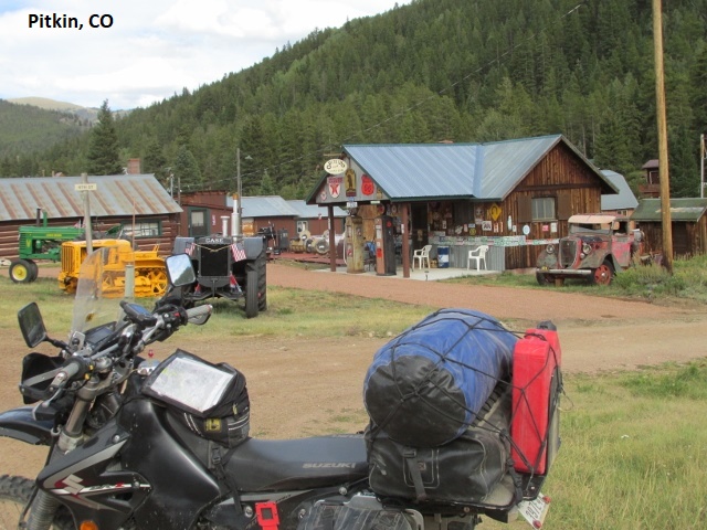
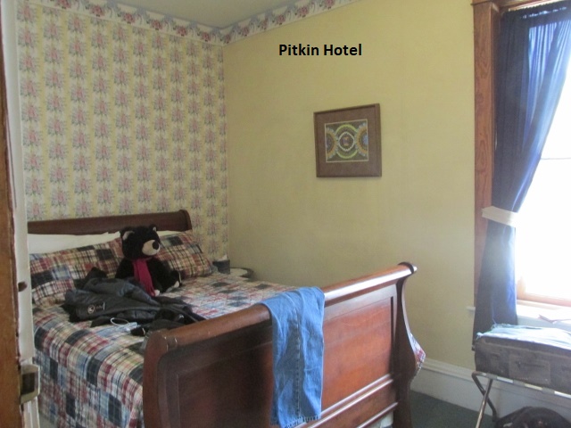
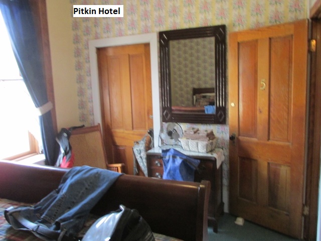
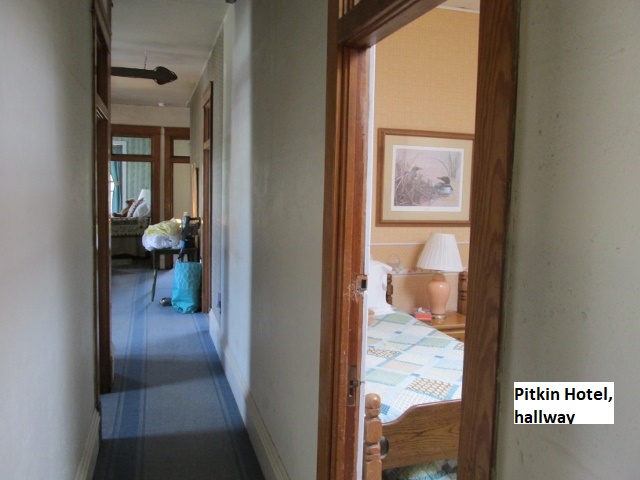
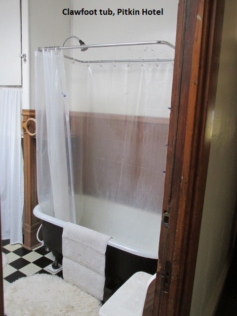
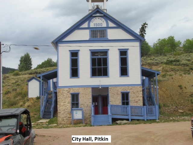
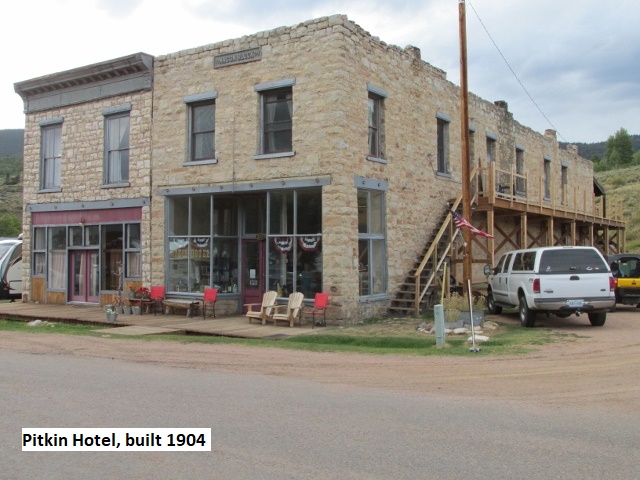
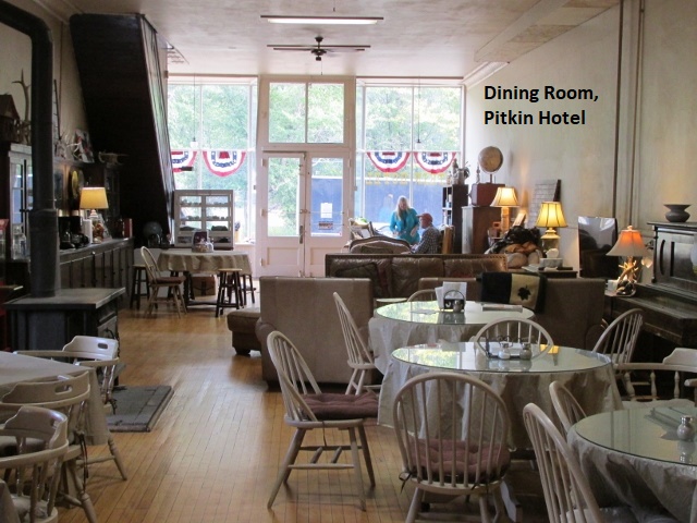
I arrived in Pitkin about 5:00, having ridden about 200 miles today. I rode up and back on the only two streets in town before stopping at my hotel. Pitkin, currently with about 70 residents, was founded in 1879, and is said to be Colorado’s first mining camp west of the Continental Divide. The Pitkin Hotel is a two-story stone building built in 1904. It’s a really cool place run by Bob and Lyn, real nice folks. Lyn informed me I was the lone occupant for the night on the second floor. The room was clean but small, having 12 foot ceilings and the only furnishings being a bed, chair, and dresser. The bathroom and claw-foot tub/shower was down the hall. When I had to make a couple of bathroom trip during the night, I just padded down the hall in my drawers. I shot the breeze for a few minutes with four guys staying in the bunk house adjacent to the hotel. They have been coming to Pitkin for several years to ride their side-by-sides (two passenger four-wheelers) and staying at the hotel. Pitkin has no restaurants, only a gas station/store, so at the hotel I warmed up a once frozen burrito. It was chilly out and looking like rain so I parked the DRZ under an overhang. Apparently whatever heat they have in the hotel was not turned on yet. Freezing in the middle of the night with my neck-gaiter pulled over my ears, I rummaged around and found another blanket and slept well the rest of the night.

Day Four – Wednesday, 11 September 2019
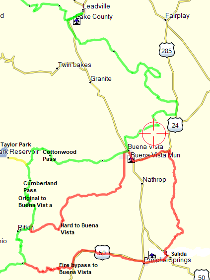
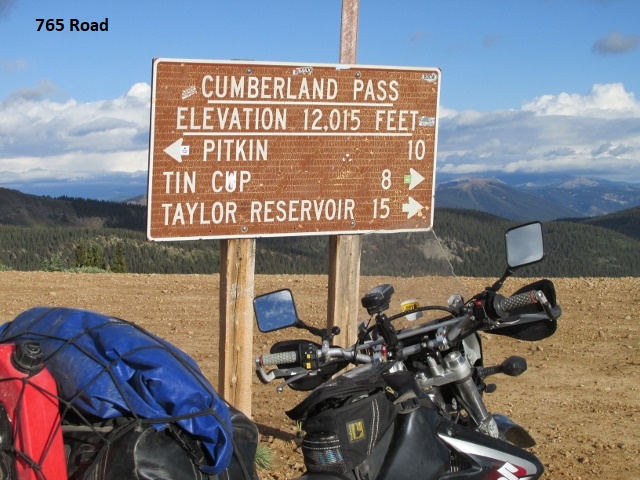
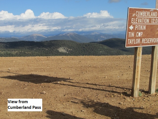
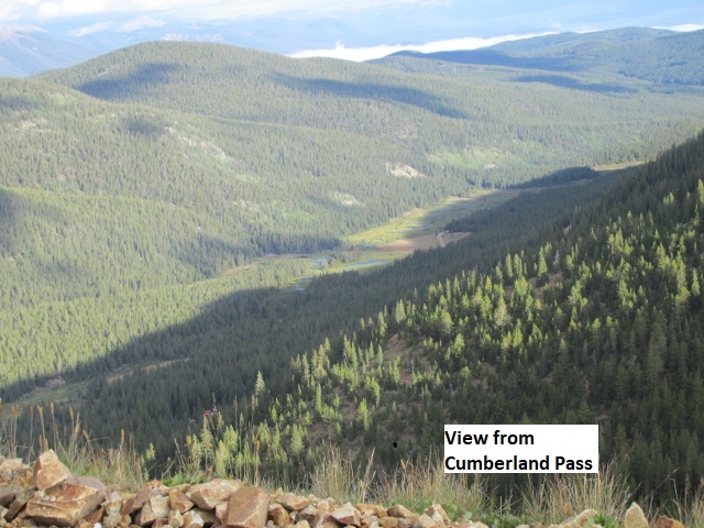
Recording 1: I drank some coffee and ate a sweet roll at the hotel, then loaded up and mounted my mechanical steed. When I pulled out of Pitkin it was a chilly 45 degrees. It felt cooler because of the dampness left by a quarter inch of rain during the night. I took the forest road 765 out of town and began a gradual climb out of the valley. Eventually, I climbed up over 12,000 feet as I rode over Cumberland Pass.
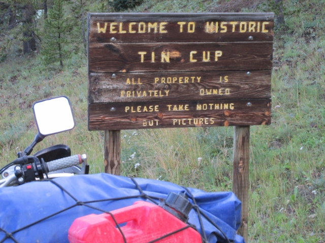
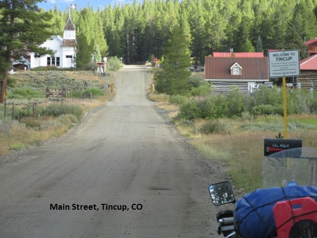
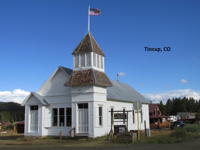
After the pass, 765 began a rapid descent via several switchbacks into the tiny mining town of Tin Cup (Pop. 2). In town, I passed by several very old log cabins scattered among newer vacation homes. Tin Cup got its name from one of the prospectors that carried out his gold dust in a tin cup. In the late 1800’s with a population of around 1,500, Tin Cup was ruled by the underworld. Every time a new sheriff was hired, he would be told what to do by the leaders of the underworld and killed if he didn’t comply. As a result the Boot Hill Cemetery is filled with honest sheriffs and other good people that didn’t go along to get along.
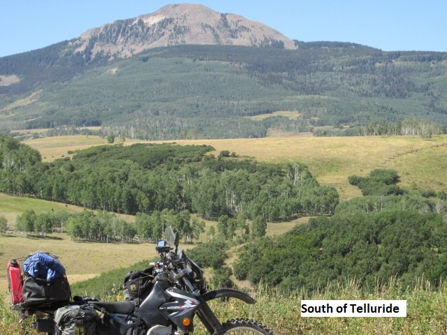
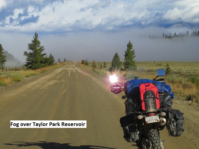
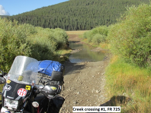
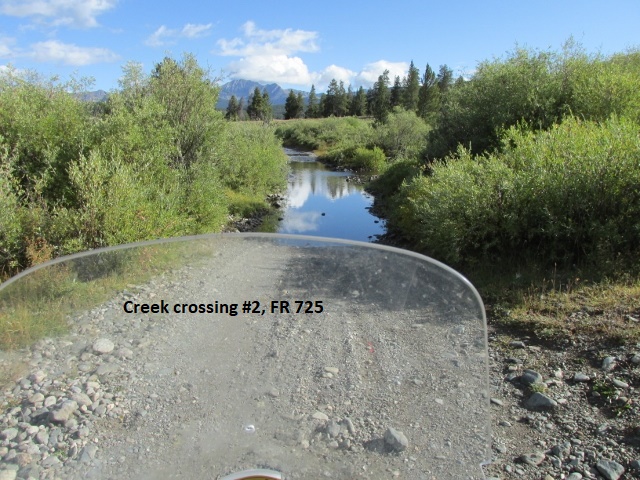
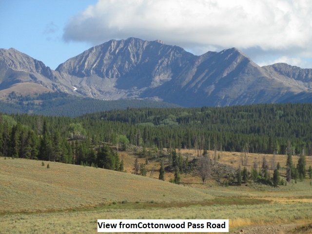
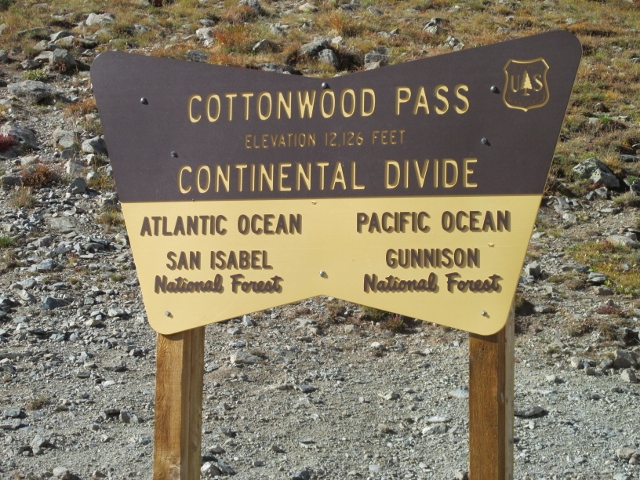
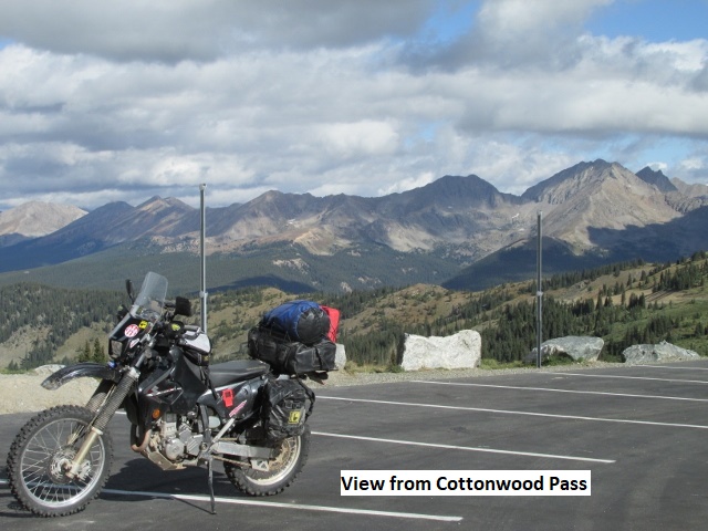
Leaving Tin Cup, I continued on the 765 RD climbing up to Taylor Park, a high mountain lake with a store, various lodging, and RV parking. As I approached the lake, a cloud settled over the mountain severely limiting visibility. In order to check out Taylor Park, I had deliberately passed my indicated turn a few miles back, so I turned around and headed back. Back on the track, FS RD 725 resembled more of a goat path as it meandered across a grassy meadow that was dissected by a small creek. Almost immediately I had to ride through a long and deep water crossing. Nearly falling in the creek when the bike got sideways, I stuck my boots in the water and saved it. Leaving the meadow behind, the road improved after entering the forest. After a few miles, I intersected pavement and rode the 209 RD heading towards Buena Vista. It was brand new pavement that carried me through the San Isabel National Forest, up and over Cottonwood Pass while crossing the Continental Divide above 12,000 feet. Previously gravel, the pass section of the road from Buena Vista to Taylor Park was finally paved this past August. They were still working on the shoulders in a few places, forcing me to stop a couple of times for one-lane pilot-car traffic. It was an absolutely beautiful ride on pristine asphalt, punctuated by countless switchbacks as I wound downward to Buena Vista. Though not as lengthy, to me the road rivals the Million Dollar Highway between Durango and Silverton.
I finally arrived in Buena Vista about 11:15. The trip from Pitkin took me two and half hours and my sweet roll was a distant memory. Riding down the main street, I started drooling when I spotted Jan’s “mom-and-pop café”, with three dual-sports parked out front. Wrapping my cold hands around a mug of steaming coffee, I order eggs and pancakes and all the trimmings. While I chowed down, Mike, one of the riders, came over and sat down to visit. They were not riding the BDR per se, just some off-road forest loops in the area. He was a nice guy and I enjoyed the time as we shared war stories. Mike even invited me to come back and ride with them sometime. I just got a text from my brother Dave who is once again following me on his computer with Google Earth. Apparently there’s a problem with my InReach tracker. For some reason, the Garmin share page is not displaying the tracks where I’ve ridden. Before heading on to Leadville, I need to stop somewhere and buy a hat to replace the one that blew off the scooter this morning.
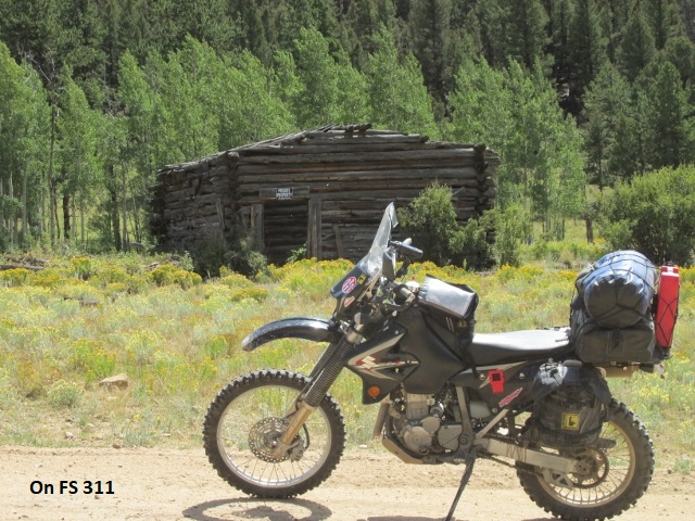
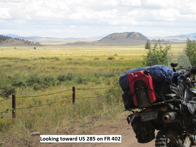
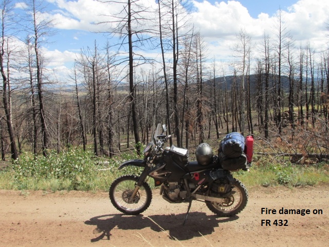
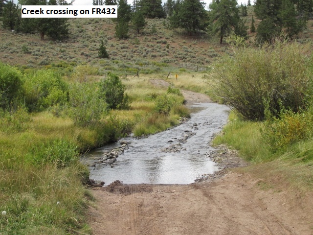
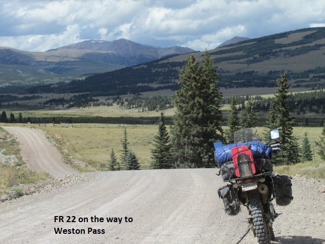
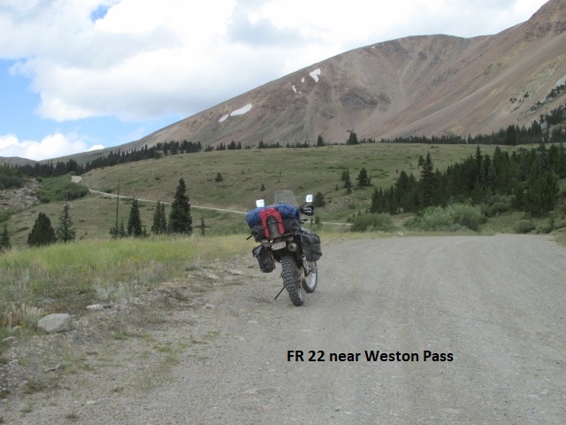
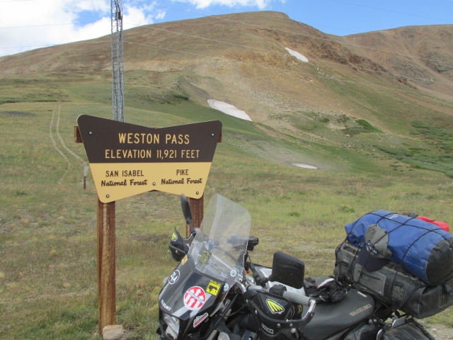
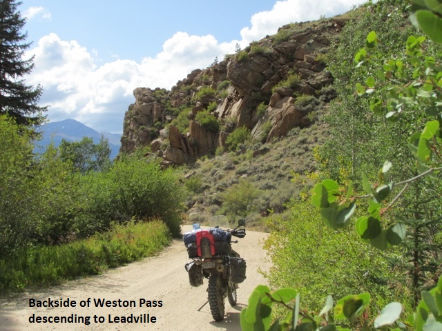
Recording 2: It’s about 3:40 and I’m now in Leadville. I checked in to the Silverking Motel, nice older lodging on the main drag. I had a really difficult, technical ride this afternoon. Right after leaving Buena Vista, I traversed a very challenging sandy area that was designated as such on the Butler map. The locale is an off-road playground for 4-wheelers which covers several square miles. There has been so much traffic over the trails that the surface has been pulverized into deep talcum-powder sand. It’s hard to adequately describe the trails which consisted of tight turns, steep up and down grades, marked by ever present washouts and ruts. I was almost exhausted when after about 10 miles, I fought my way out of the sandy basin and found myself on a good forest service road, RD 311. Somewhere along 311 I ran into a two separate pairs of riders, KTM’s and GS’s respectively, heading the opposite direction. I always think about stopping to chat but rarely do. FS RD 311 was several miles of a gnarly and fun class-2 track before connecting with roads 309/402. This was a fast and easy ride through a wide valley which took me to US 285. I rode the highway north for 5 miles and then turned west onto FS RD 432, which took me back into the mountains. 432 was a good gravel road for a ways, but soon digressed into a much steeper and narrower forest road. Back in the summer, this section of the BDR was closed for a while due to a forest fire, and the result of the fire was very evident as I rode through. Sections of the road got pretty hairy, being at least a class 2.5-3 in difficulty. Now in the Pike National Forest, I eventually joined the FR RD 22 which carried me northwest. This was a good road for a ways (I’m seeing a pattern here) before becoming steep and narrow as I climbed up to Weston Pass. It was a neat ride but very chilly as I topped out over 12,000 feet, bucking a strong wind under overcast skies. The ride down from Weston was once again a 2-2.5, very rough and rocky for a good distance. Finally reaching black top, I passed several vacation homes before intersecting US 24 and riding into Leadville. It was great riding today … very technical and tiring and also very cold at the higher elevations.
The terrain wasn’t as scenic today, so I stopped less often for photos. Weather-wise, not sure what tomorrow has in store. The motel clerk indicated they were expecting a dusting of snow overnight. I’m cold and tired so I’m going to walk across the road to Pizza Hut for supper. I plan to eat at the motel in the morning, rather than riding somewhere to eat in freezing temperatures. Today was shorter in mileage, 135 miles, but more technical riding.
Day Five – Thursday, 12 September 2019
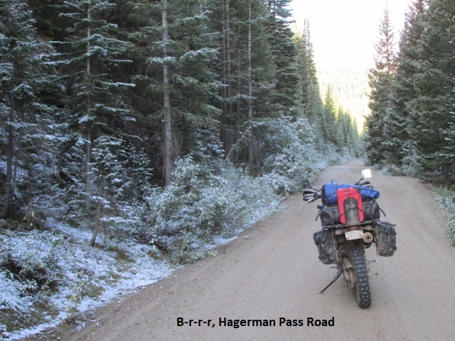
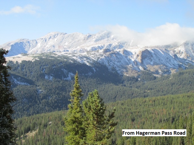
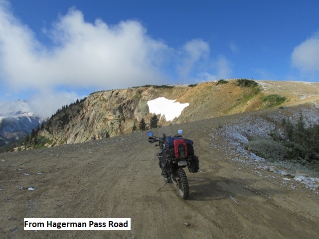
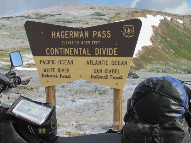
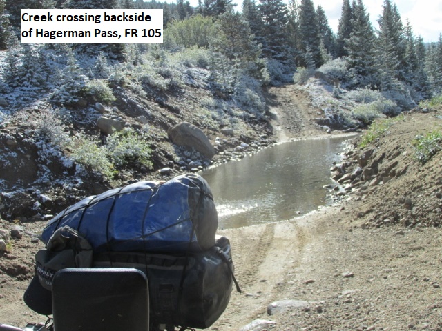
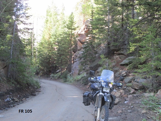
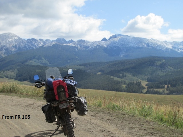
Recording 1: It’s Thursday morning about 10:30 and I’ve ridden 43 miles since Leadville. It was a very cold 31 degrees when I left about 8:30 after eating a very mediocre breakfast at the motel. I rode pavement for a ways around the west side of Turquoise Lake. Just west of lake, I turned off on FS RD 105 and headed up toward Hagerman Pass. The gravel roadway soon gave way to a 4-wheel drive jeep road. At this point, I encountered about an inch of snow on all the trees and brush beside the road and on the surrounding peaks. I was fairly comfortable in spite of the cold since I’d layered up with everything I had. My hands were a little cold, but the chemical hand warmers I had slipped in my gloves helped somewhat. As I climbed, the road became increasingly rough, at least a class 2.5-3. The road was very steep with lots of large rock, bowling ball size to large watermelons. The only saving grace was that the rocks were mostly imbedded so they didn’t move around. I recalled reading a ride report that mentioned the rugged nature of the Hagerman pass. It was one of those difficult climbs where I didn’t dare stop. I had to just keep the power on, fighting the handlebars as I bounced from rock to rock. My guardian angel was working overtime, helping me keep the shiny side up. I finally reached Hagerman Pass at a little over 12,000 feet.
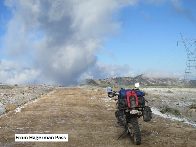
Descending the north side of the pass, the road was still very rough for a good ways but then became a smooth forest road with some switchbacks. After several miles, I came to Frying Pan Road near the small town of Meredith and then rode pavement a ways before turning back onto Brush Creek RD. At the beginning of the road was a sign stating “Impassable When Wet”. This stretch was also designated as such on the BDR map and I hadn’t gone far before the reason was obvious. Though the road was now mostly dry, there were very deep ruts for several miles. Such ruts are dangerous on a bike and it takes a lot of concentration to ride beside the ruts without slipping into them. The road was wet from some light overnight rain but thankfully wasn’t muddy. Riding in the White River National Forest, I climbed fairly high over a saddle before dropping down into a pretty valley. I’ve stopped here in the valley for a minute, enjoying the nice view of the mountains rising above me.
 Recording 2: After surviving the “impassable if wet” section, I joined Gypsum Creek Road which had the same “Impassable When Wet” designation. With more deep ruts, it was mostly dry and I made it just fine. I encountered more riders going south this morning, two pairs and a single (I think KTM’s). After the rough, narrow portion of Gypsum Creek Road, it changed to an easy gravel county road for probably 15 miles. Per usual, when I neared pavement again I passed the ubiquitous vacation homes and then rode into Gypsum. It’s now 12:15 in Gypsum at a Kum-and-Go where I grabbed a Gatorade and something from the deli for lunch. The weather’s pleasant here in town, mostly sunny in the low 60’s.
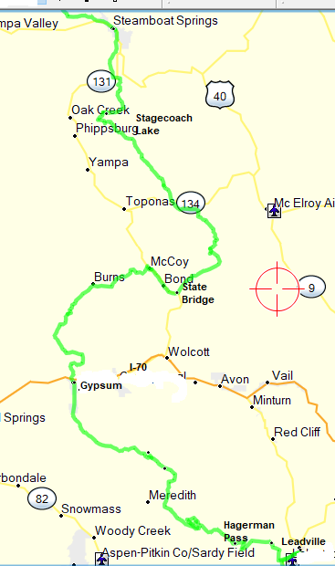
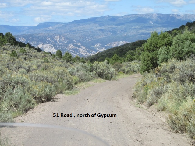
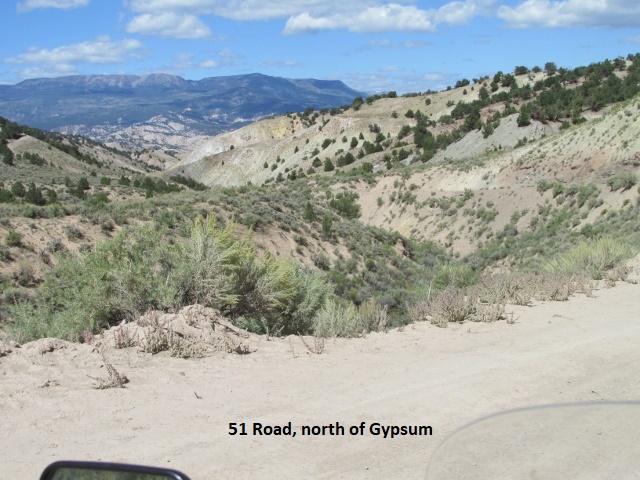
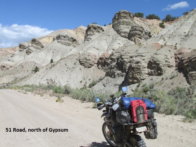
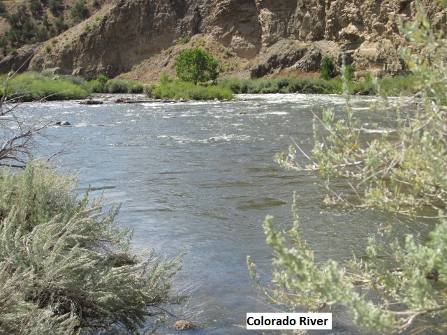
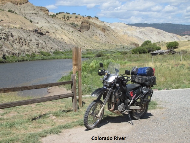
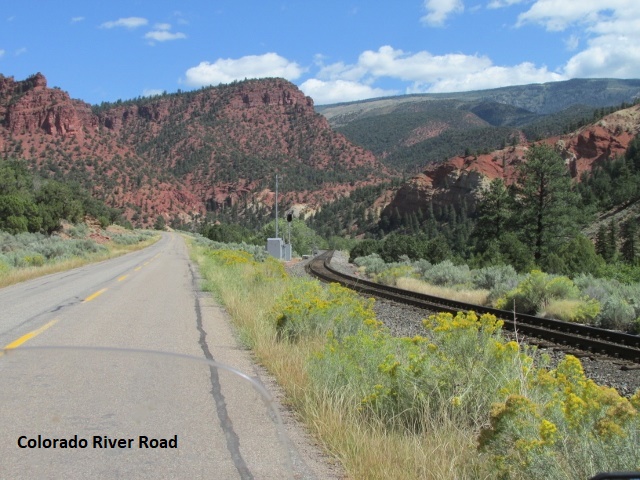
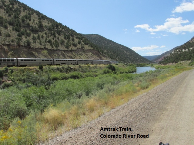
Recording 3: After crossing I-70 at Gypsum I immediately began a rather steep climb up the 51RD, a wide gravel mining road. As I topped out on a mesa, I stopped to take in the panoramic view of I-70 and the valley two thousand feet below. The terrain reminds me a great deal of portions of New Mexico … high desert with five-foot tall sagebrush and sandy soil. I followed the two-track 51-A north across the mesa for several miles until the road began a descent through a narrow canyon of tall eroded cliffs. The rugged canyon was very scenic as the road continued to wind downward for several miles as it followed a dry creek. Intersecting the Colorado River Road, I left the branch canyon behind and traveled mainly north. The road was paved at that point and obviously earned its name from the fact that the highway closely paralleled the Colorado River. As the road wound through the canyon, the pavement gave way to a smooth, wide gravel road displaying beautiful views of the river mere yards away. A railroad track also closely followed the river and gave me the chance to photograph an Amtrak passenger train as it whistled by.
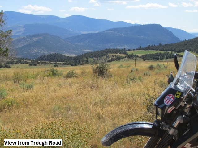
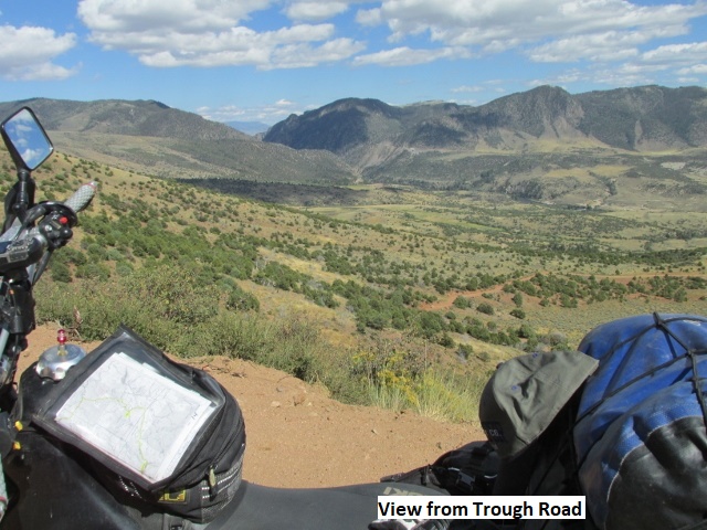
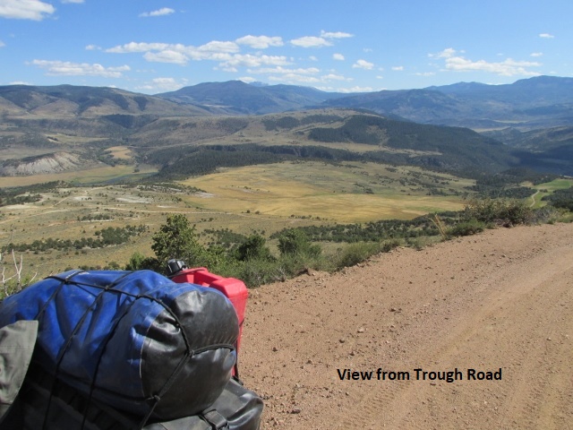
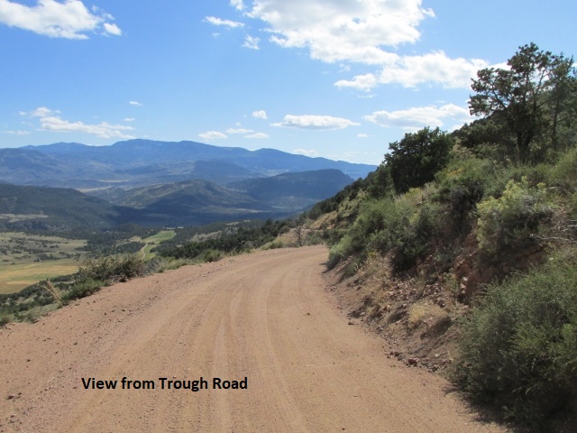
I chased the river road for many miles through Burns and then the road tee’d at the hamlet of McCoy. I then rode paved CO 130 from McCoy to the town of State Bridge where I turned off on Trough RD. It was a great dirt road that climbed up high and gave me beautiful airplane-like views of the canyons and river valley below. The road crossed BLM land and may have been the best road yet. It was simply fun riding … just easy, scenic, up-on-the-pegs mountain riding. I continued to gain elevation as I rode through the forest for several miles. I passed by the town of Radium and into the Routt National Forest on FS RD 212.
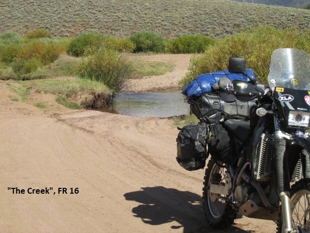 Riding the Continental Divide Trail back in 2012, Greg Camp and I tried in vain to locate this same FS RD 212 as we headed south. Unable to locate it, we detoured through Kremmling. I was glad to finally get to ride it but knew I would eventually come to “the creek”. On the same trip, Greg and I encountered “the creek” crossing on FS RD 16 where the water was 2 1/2 feet deep and 40 feet across. On that ride, after making it halfway across, my KLR drowned out. Greg waded out and supported the bike while I climbed off and we then managed to push it to the far bank. Afraid to try the crossing on his bike, Greg decided to ride the highway a few miles east and meet me. He inadvertently turned west at the highway and we were separated for a couple of hours.
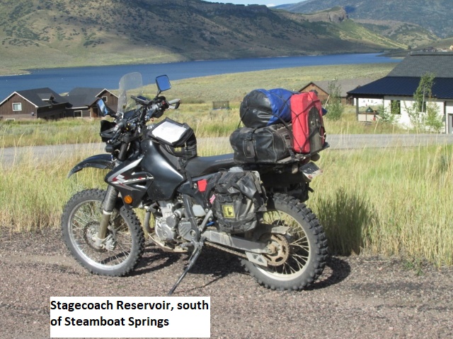
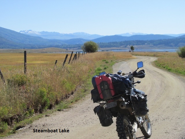
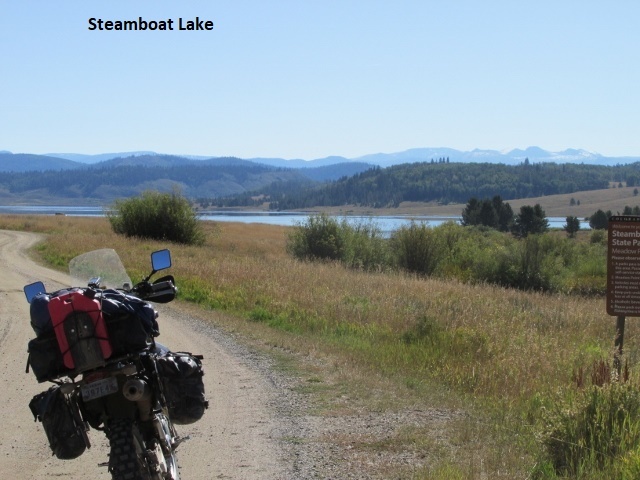
This time my DRZ made it just fine, although the traction was squirrely in the middle. After crossing highway CO 134 and heading north on Forest Road 16, I very shortly came to a “Road Closed” sign. As usual, I assumed the sign was intended for “other people” so I continued on. To bypass this road would have required a paved detour of 30 miles. After about a mile, I came to two workers with a tracked backhoe and a pickup who were replacing a drainage pipe across the road. The workers were almost done, so I parked and waited about ten minutes. When finished, they swung the bucket to the side and waved me by. As I rode by, it was obvious by their body language the guys didn’t appreciate me riding around their sign. A few miles further, I stopped and killed the bike when I spied a Stetsoned rider on a really tall, beautiful horse approaching. He stopped, and after a “howdy” said that it really wasn’t necessary for me to stop. I told him that on occasion I had spooked a horse or mule and had rather play it safe. As I continued north I came to Stagecoach State Park, a large mountain recreation area and lake. I traveled pavement around the west side of the lake until turning off on Road 18 on the north side. The 18 RD is a dirt track that circumscribes the north edge of the lake before turning north and following Martin Creek almost all the way to Steamboat. Paralleling the creek, I found the road muddy with numerous large mud bogs.
 When I arrived at Steamboat Mountain Lodge in Steamboat Springs, there were four guys unpacking their dual-sports bike, three KLR’s and a BMW GS 850. They were also riding the BDR but headed south, having started this morning at the Wyoming border. After checking in, I visited awhile with one of the guys, each of us sharing conditions of the trail we had encountered. I went and gassed up and found a “build-your-own” burrito place for supper. It was a good day with some beautiful scenery and fun, fast riding this afternoon. I rode about 200 miles today.
Day Six – Friday, 13 September 2019
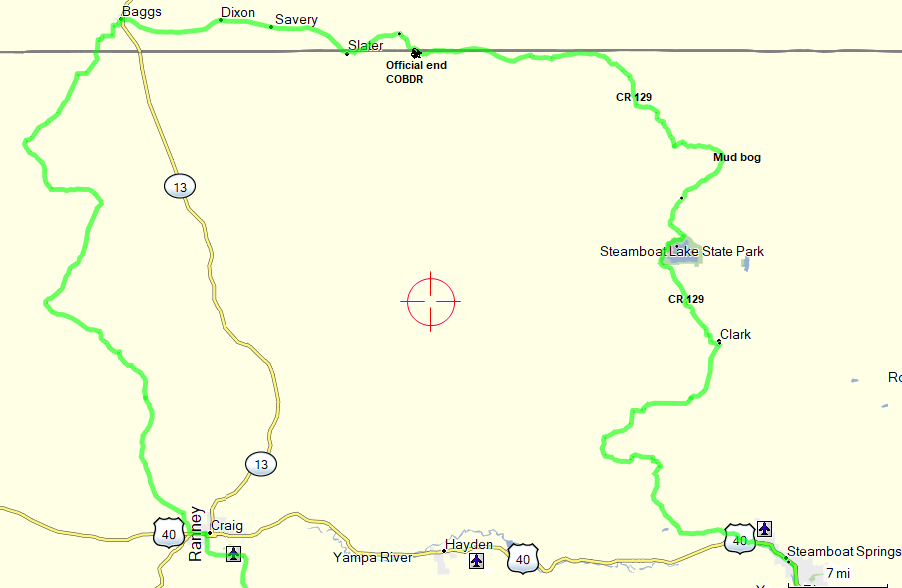
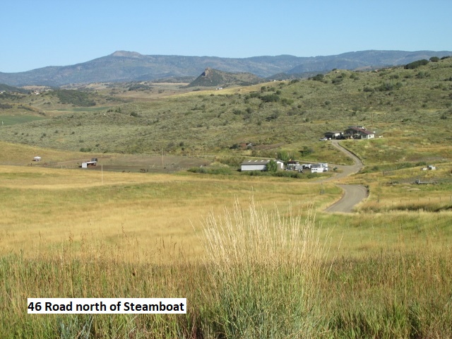
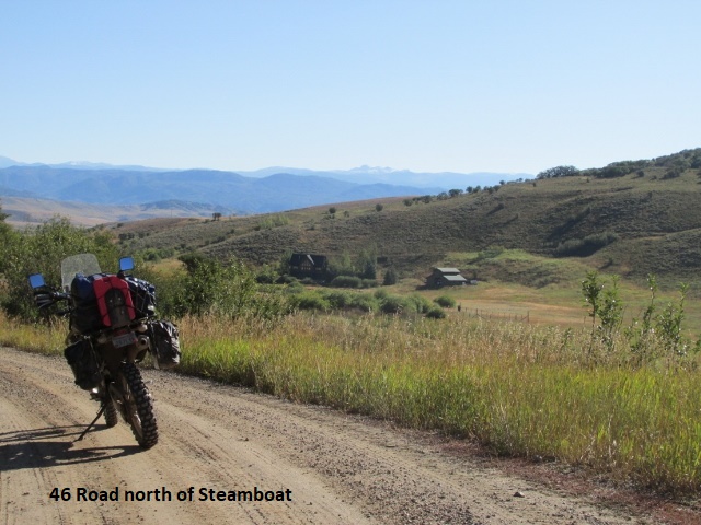
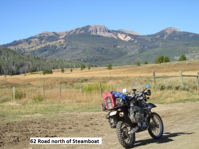
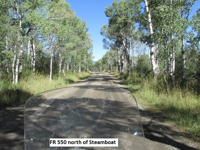
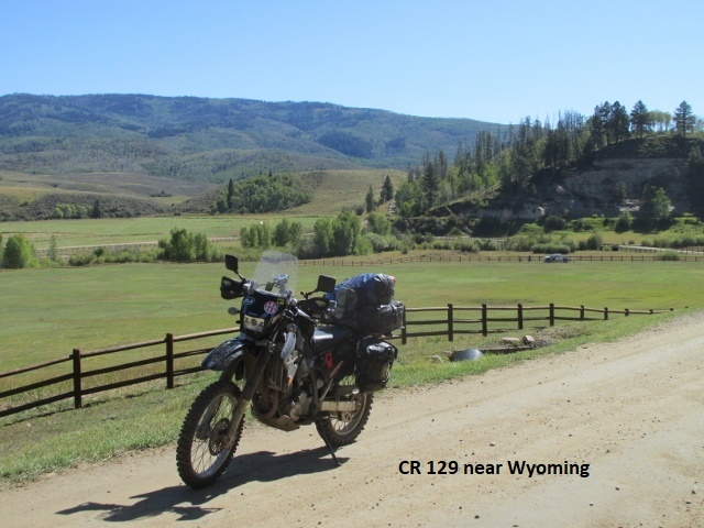
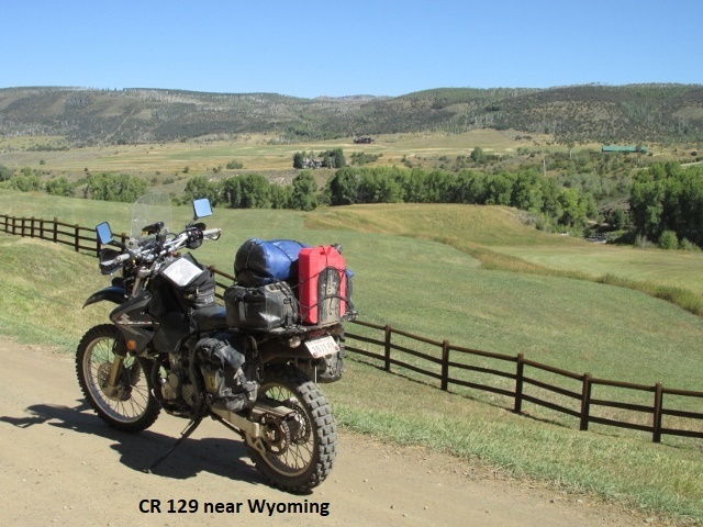
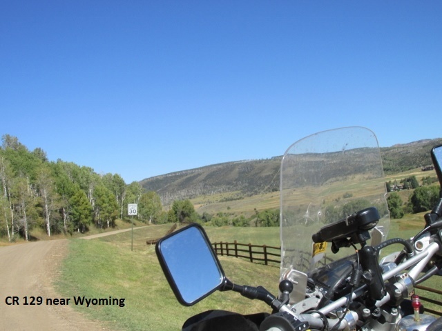
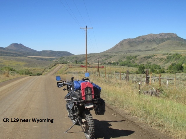
Recording 1: Due to the cool temperature and to save time I ate breakfast in the motel. As I loaded up this morning, one of the riders came out and visited a bit before being joined by his three buddies. They warned me about deep mud north of Steamboat Springs and I cautioned them about Hagerman Pass. All four of them were fairly new to off-road riding and indicated they might skip the pass. I headed west from Steamboat on US 40 briefly then turned north on the gravel 42 RD. That was followed by the 46 and 56 roads, all of which transported me through some foothills before intersecting CR 129 where I now sit. I’ve been riding about an hour, it’s now 9:50 and I have covered 30 miles. CR 129 is paved at this point and I’ll travel north a ways before turning left on CR 62 which will take me around Steamboat Lake. Roads thus far this morning have been fast, class 1 to a mild 2 with occasional light mud. The terrain has been hilly with a few low mountains, inhabited by hay farms, small ranches, and vacation homes. The area is very open and to the east I can see what I believe is the west side of Rocky Mountain National Park.
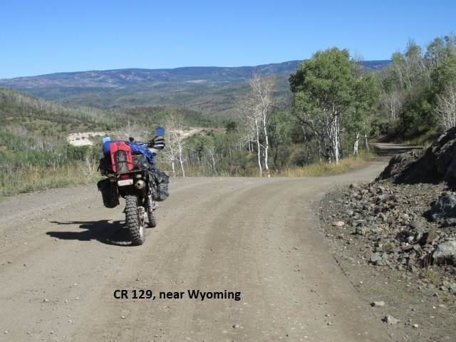
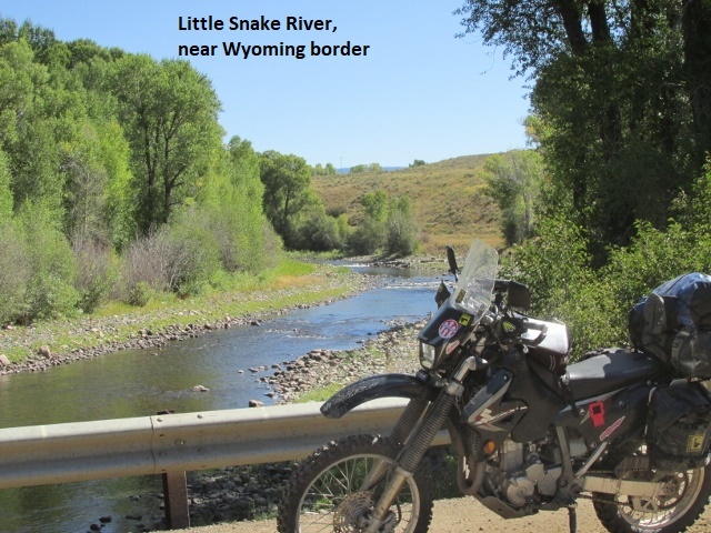
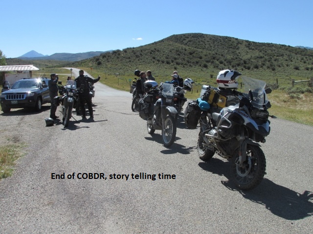
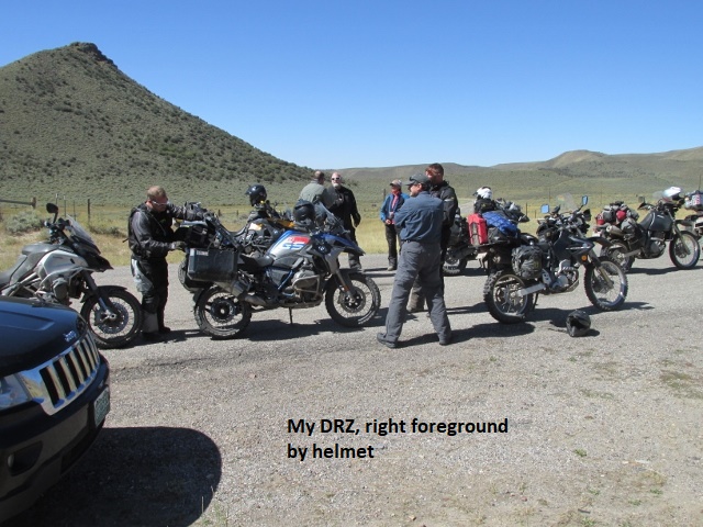
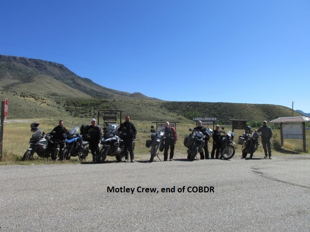
Recording 2: After my last recording, I enjoyed some really fun riding as I continued north toward the Wyoming border. Riding fast on pavement, I twice had to slow to a crawl as a large flock of sheep decided to cross the highway. CR 129 was paved for several miles and then just as it turned to dirt, my track broke off to the right headed east. I was enjoying the nice ride on FR 550 through the forest when I noticed a very muddy two-track headed north. It looked like a bunch of 4-wheelers had really chewed it up and as I passed by, I was relieved it was not my road. About a mile further I glanced at my GPS and realized my green track-line had disappeared. I promptly turned around and when I found my track again, low and behold, it was the muddy two-track, FS RD 501. I realized this was the same muddy road the guys in Steamboat had warned me about, the road where two of them had taken a hard fall. As I approached the road, I spotted three dual-sport riders. Two had just started down the muddy road and one was about to start. I followed the third rider until we came to a huge mud bog. The two front riders barely made it through the bog while the guy in front of me was hesitating. I saw this as my chance to get in front of them and keep riding. Throwing caution to the wind, I went busting through the mud, very glad I didn’t fall in front of them and embarrass myself. The road continued to be muddy as I dodged some bogs and plowed through others before finally reconnecting with CR 129. I continued north for several miles and then the road turned west as I passed through a beautiful valley that paralleled the Little Snake River. I couldn’t resist stopping a half-dozen times to capture the beautiful scenery on “film” as I drew near the official end of the BDR.
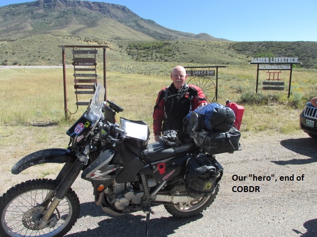
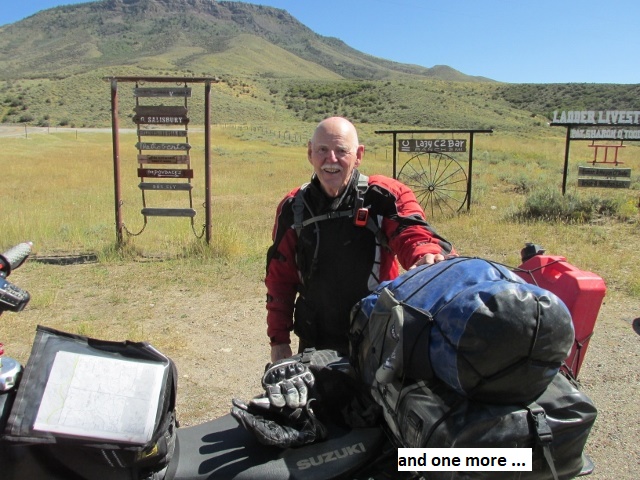
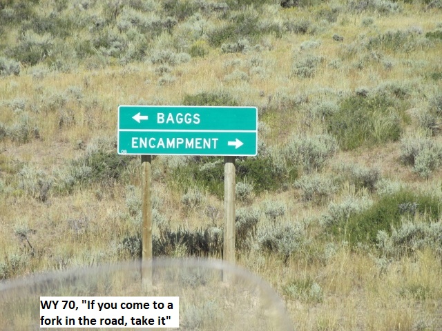
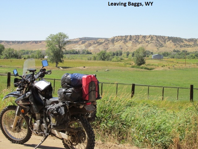
At the end of the route, just a few miles north of the Wyoming border, I stopped to celebrate my successful conclusion of the COBDR. Just as I killed my bike, the three riders I had passed rode up beside me. We shed our helmets and had only begun to visit when four more riders pulled up. The first three were from California, one an attractive lady about 35 who looked like she knew her way around a scooter. Like me, they had also chosen to bypass Ophir Pass but they did ride over Corkscrew, Hurricane, and Cinnamon passes. They had ridden several of the BDR’s in other states and had the stickers to prove it. We all shot the bull a few minutes while snapping photos until a guy and his wife pulled up in a sports car. He offered to take a group picture, so we lined the bikes up and struck our best pose. Knowing I still had many miles to ride before Craig, I said goodbye and headed west on WY 70 to Baggs.
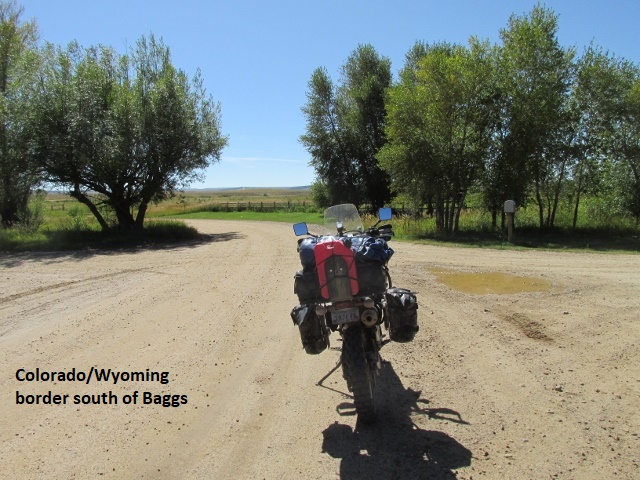
It’s a really beautiful day here in Baggs, Wyoming, about 70 degrees and not a cloud in the sky. I just finished a good lunch and some great carrot cake. It’s now 1:30 and I’ve covered 105 miles since Steamboat. Shortly, I’ll be heading south for a few miles back into Colorado and then on to Craig for the night.
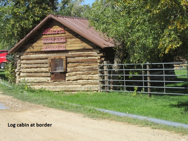
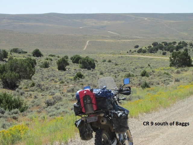
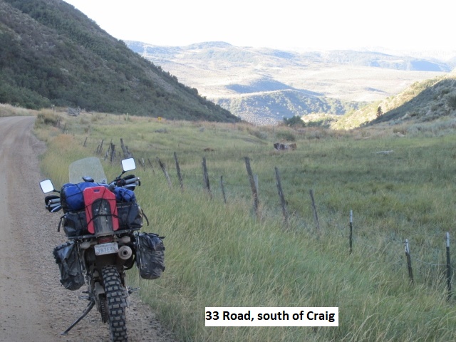
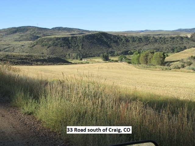
Recording 3: The ride from Baggs was through very intriguing landscape. It was only about 4 miles over county roads to the Colorado border. The state border fell in the middle of some ranch buildings so I stopped and shot a photo or two. I was now riding the untested portion of my trip, i.e., the route which I had designed in Mapsource. Though I had “flown” the route in Google Earth, I had no idea of the road conditions that lay ahead. As I rode south, I began to climb as the track carried me over good gravel county roads. Continuing to gain elevation, I stopped and realized I could see 50 miles any direction. The “undulating topography” was high desert, some of the most remote and desolate land you’ll find in North America. It was truly the “middle of nowhere”. The terrain consisted of rolling hills, narrow valleys, gorges and ravines blanketed mostly with sagebrush without a tree in sight. It was genuinely awesome in its stark barrenness. To my left, I could see mountains 50 miles to the east that a few hours ago I was riding the other side of. The further south I rode, I came to areas of dryland hay farming on now rolling hills. I turned southeast off gravel CR 9 onto CR 118, a sandy two-track with numerous mud holes. It was a fun road as I rode around, and sometimes through, several mud bogs before once again riding fast over a variety of gravel county roads. Eventually, I hit pavement a few miles north of Craig. I hadn’t seen much wildlife, just a few cattle and the occasional hawk until just outside of Craig. In a pasture east of the road was a herd of 50-60 grazing antelope.
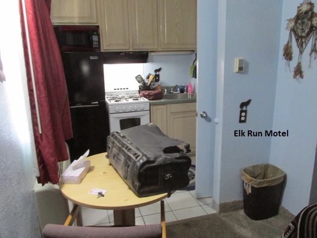
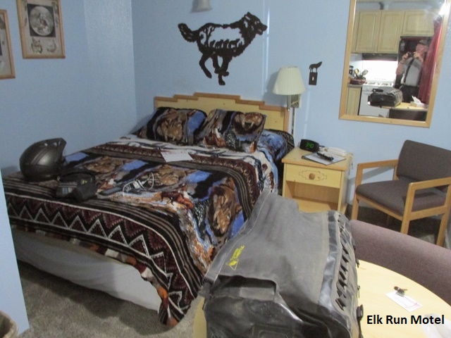
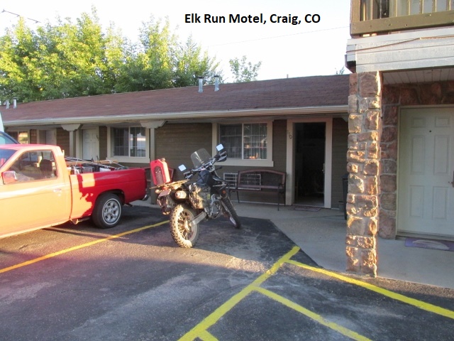
It was only about 55 miles from Baggs to Craig so it was only 3:30 when I rode into town, having ridden about 155 miles today. After gassing up, I located the Elk Run motel and checked in. Elk Run was more than just a motel, obviously catering to hunters. The tiny room had a queen size bed sandwiched between two walls and a kitchenette comprised of a full fridg’, 4-burner stove, sink, microwave, dishes, and cookware. Craig appears to be a clean, thriving small town, probably about 10,000. There seems to be lots of choices for good eats (always a priority). I found a busy mom and pop, hole in the wall, Italian restaurant downtown and enjoyed some great sausage lasagna for supper. The DRZ key switch has been acting up causing the bike to die a couple of times on the trip. I bought some powdered graphite and doused the switch liberally hoping that would help (it did).
Day Seven – Saturday, 14 September 2019
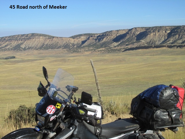
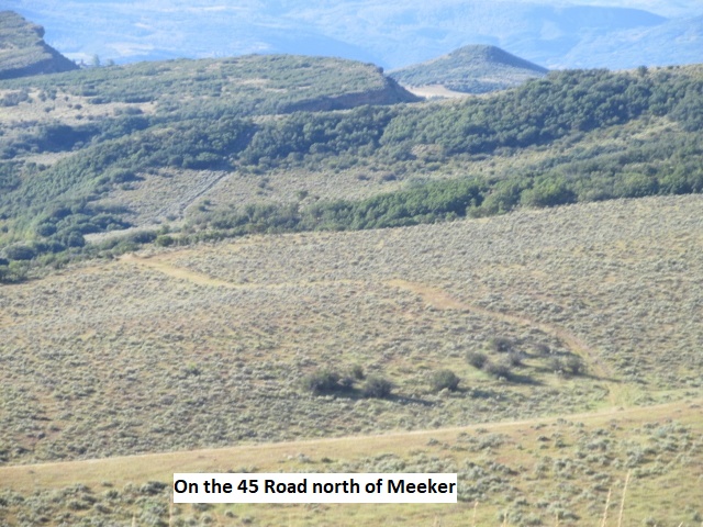
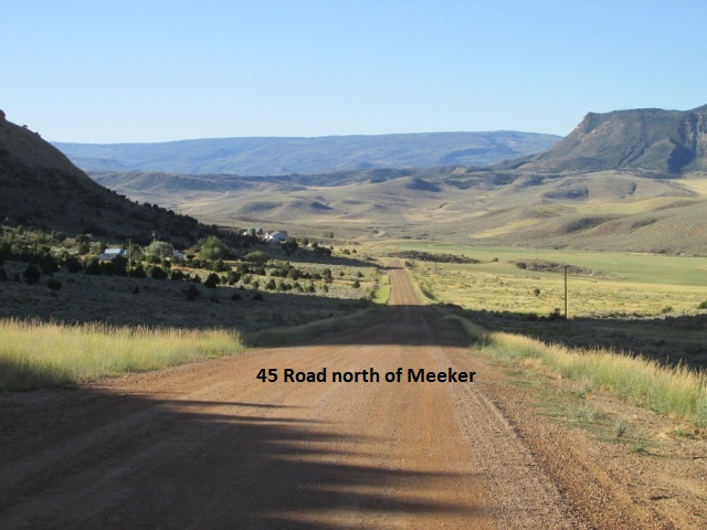
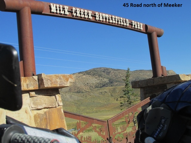
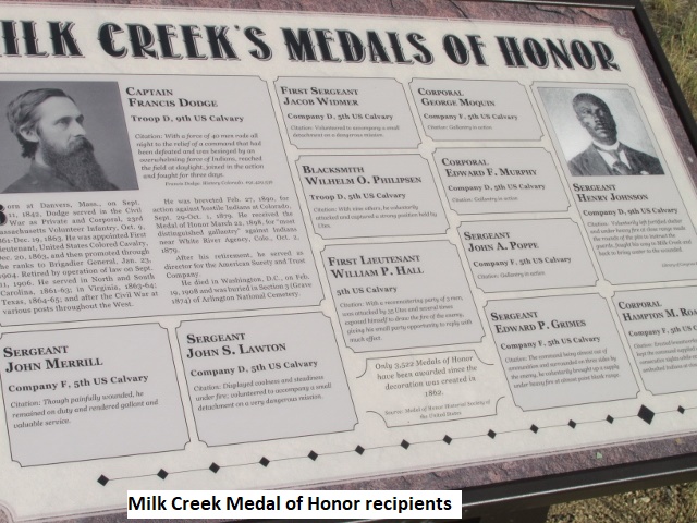
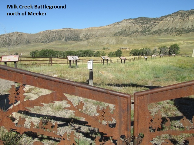
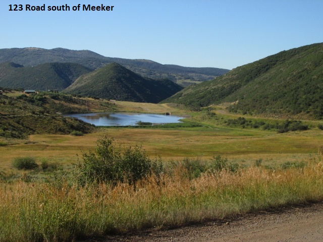
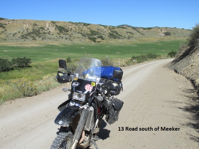
Recording 1: It’s now 10:15 and I’ve ridden about 65 miles this morning to a spot south of Meeker. So far, it’s been nice, fast riding over graded or gravel county roads. The ride on the 33 RD was great, passing through a very scenic area of low mountains and valleys. Following CO 317 west for a few miles, I turned south on the 45/15 RD with CO 13 paralleling my route a few miles to the west. North of Meeker, I halted at the memorial sight of a major battle between Native American Indians and the US Army, one which had lasted several days. I spent 30 minutes there reading and taking pictures. The fight was started after both parties violated existing treaties and engaged in random killings. The action escalated to a full scale battle in which the surrounded troopers had to be rescued by soldiers from forts in Wyoming. There were, I believe, eight Medal of Honor citations awarded, most posthumously. The town of Meeker was later named after the Indian agent killed by the Indians. I’m currently on a narrow road passing through some pretty forested foothills. It was a little cool when I left this morning but the temperature is now a comfortable 60 degrees, great weather, and great ride!
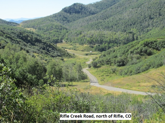
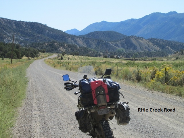
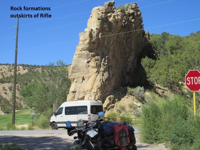
Recording 2: Still paralleling highway CO 13 only a few miles west, the 13 RD turned into a fun two-track for several miles as I motored through an aspen forest. When I passed a county line marker, the road changed to Rifle Creek Road, a wider county road. Through all of that, I was passing through a really pretty valley surrounded by low mountains … just really beautiful country. The weather has been great and the roads fast for the last several miles. Eventually, I intersected CO 13 and rode into the town of Rifle. I’ve ridden 110 miles and it’s now 12:45. I have stopped here in Rifle at a convenience store to gas up and grab a snack for lunch.
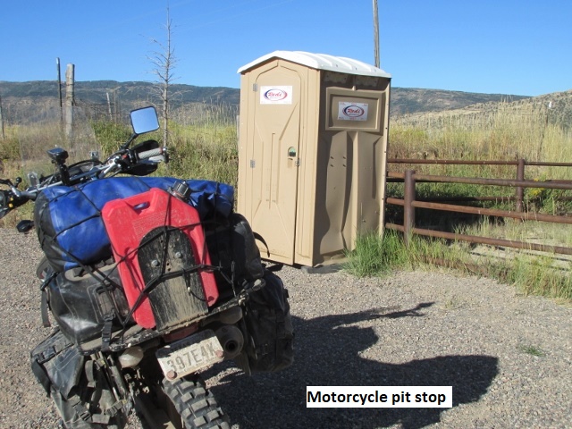
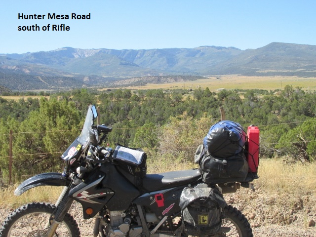
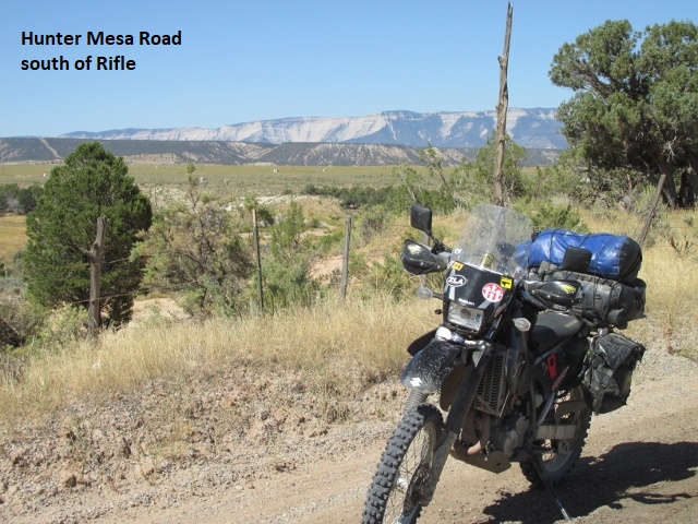
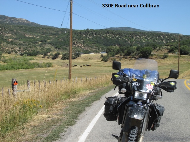
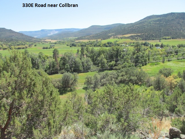
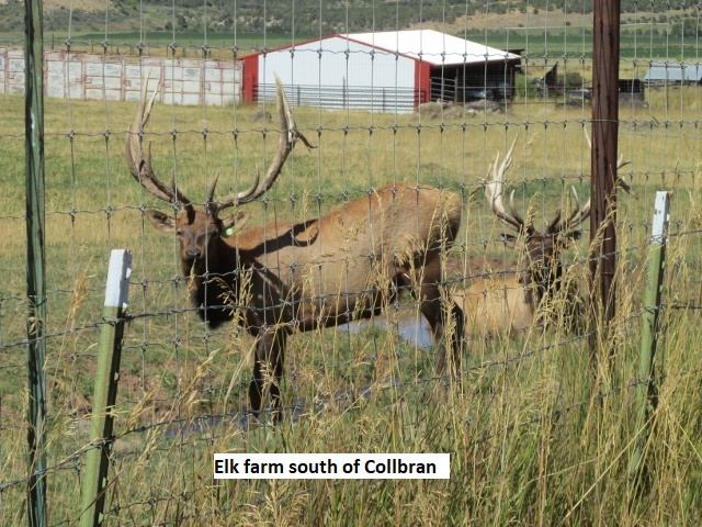
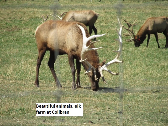
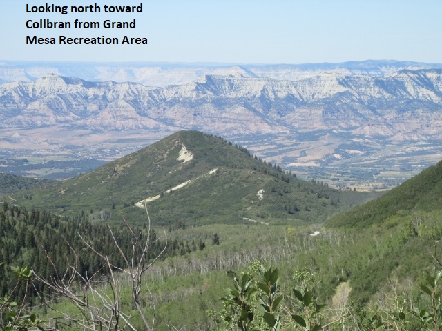
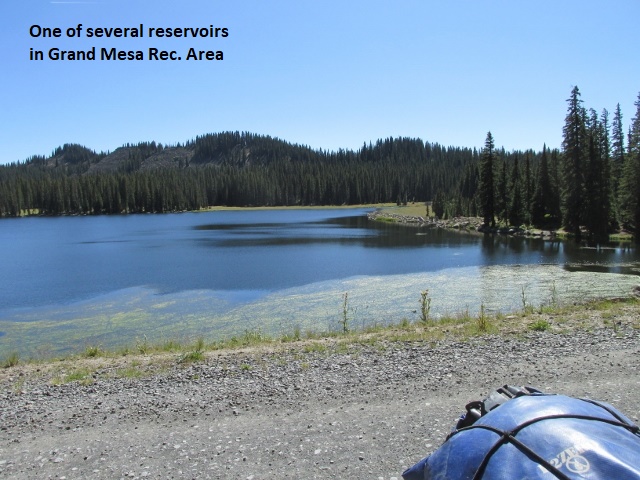
Recording 3: I left Rifle on Hunter Mesa RD on smooth gravel to Dry Hollow RD. There I joined the 330E RD and quickly climbed through some switchbacks to about 6,500 feet where I had a great view of Rifle in the valley below. After several more miles, I began descending into a canyon along Buzzard Creek before riding into the small town of Collbran. The ride into town was very scenic and the town itself is very quaint and clean, apparently catering to visitors and shoppers. Out of Collbran, I traversed smooth asphalt on the 59 00 RD, quickly climbing up to the entrance of the Grand Mesa Forest and recreation area. The pavement soon ended and the gravel road continued up into the forest to around 10,000 feet. The road up the mesa was terribly rub-board, maybe the worst I’ve ever ridden. Until I topped out, I could not find a good speed to ride or a smooth lane that was not rub-board. I’m currently above 10,000 feet in Grand Mesa National Forest, having traveled 155 miles at 2:30. Today is Saturday, so the whole mesa is busy with weekenders pulling RV’s and riding 4-wheelers. I passed by a couple of reservoirs above 10,000 feet and think there are several here on the mesa. A ways back, I was getting pretty hot and thought of changing to my lightweight armored jersey for the first time on the trip. However, at this elevation the temperature is much cooler so I’ll wait a while. It’s probably 60 degrees and just beautiful up here, not even a breeze. I have stopped to take advantage of one of Mother Nature’s shady and free bathrooms before continuing. Checking the map, it appears the track gets pretty crooked as I begin to descend toward pavement in a few miles.
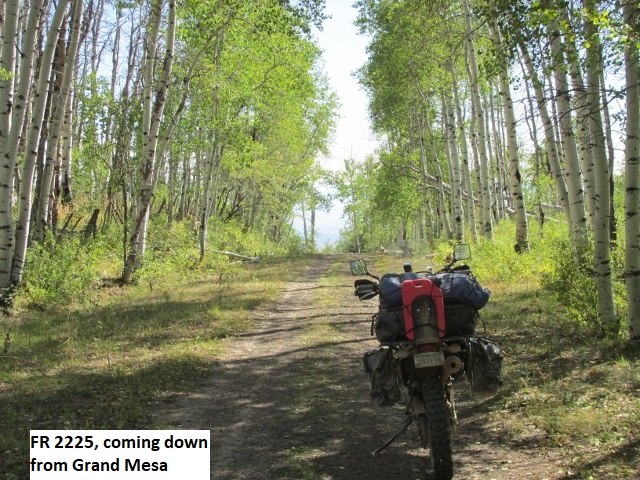
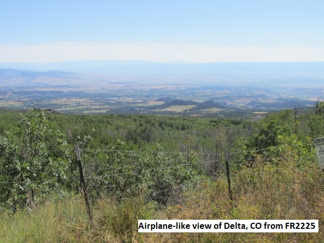
Recording 4: Traveling down the winding gravel road from the mesa, there was a steady stream of pickups and RV’s headed up for a weekend in the cool mountains. I enjoyed the amazing vistas of the valley far below where Cedaredge, Orchard City, and Delta are located. The elevation difference (4,000 feet) is so great I experience the sensation once again of flying above the valley. The roadway finally changed to pavement and would have taken me on in to Cedaredge. Instead, I rode FR 2225, a two-track through the forest that wound around the irregular face of the mesa as I descended. The track turned out to be the most technical of the day … a class 2.5 covered with loose rock and some washouts, but it was fun nevertheless. I begin to get hot again but decided to tough it out. After a few miles, the road improved as I passed by some residences before finally hitting pavement.
It was about 20 miles through Cedaredge and Orchard City to Delta. I arrived at the Days Inn in Delta about 3:45. The motel is nothing to write home about, clean but a bit run down. The desk clerk mentioned a car show in town so I left to check it out. On the way I took pictures of a lot full of old 40-50’s cars in various stages of decay. By the time I found the car show, they were already taking down the vendors booths. On the way back, I found nourishment at a bar and grill near the motel. I rode about 185 miles today.
Day Eight – Sunday, 15 September 2019
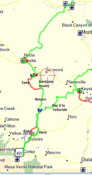
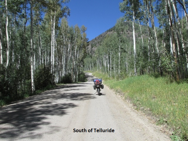
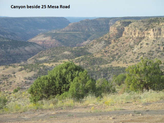
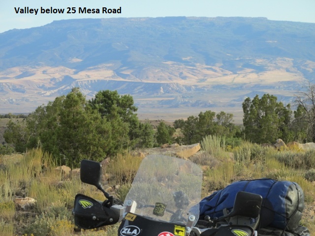
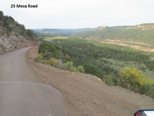
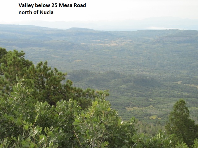
Recording 1: Well, it’s 9:30 in the tiny town of Nucla on a beautiful Sunday morning and I’ve ridden 55 miles. I planned on an early start, hoping to get further toward Lubbock this afternoon, so I left about 7:30. I’m starting to “smell the barn”. After riding out of town on a gravel county road, I passed occasional residences before encountering a sign indicating, “Private Road Ahead”. I doubled back about 4 miles and navigated another county road that put me back on track at the 25 Mesa Road. The origin of the name Mesa Road was immediately obvious as I climbed onto a high mesa. The mesa was BLM land and bordered by deep, ruggedly beautiful canyons on both sides, mini-Grand Canyons. The terrain was high-desert, blanketed with sagebrush for several miles. I continued to climb to about 7,500 feet and after several more miles, entered the Uncompahgre National Forest. Mesa Road was an exhilarating and beautiful ride, consisting of a wide, smooth, undulating roadway with numerous switch-backs. I ascended to over 9,000 feet in the forest before starting down a twisting path into Nucla. At one point, I almost decorated my handlebars with a set of antlers. Fortunately, the deer leaped up an embankment instead of crossing my path. I could have ridden 55-60 mph on parts of Mesa Road, but kept my speed down due to the heavy roadside growth that possibly hid lurking deer. I met several pickups carrying Sunday morning hunters heading into the forest. There’s some high cloudiness above me now and a cloud bank moving in further south. Cortez has a chance of rain this afternoon so I’m hoping to beat it. I can see tall mountains to my southeast, probably around Telluride.
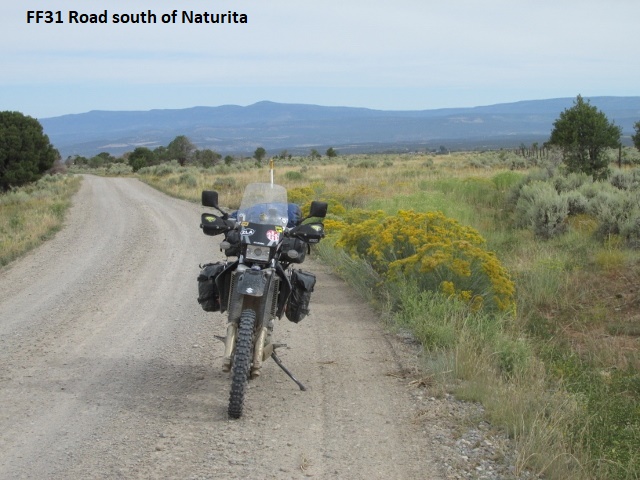
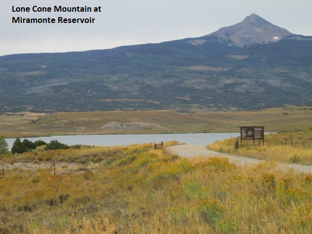
Recording 2: A few miles south of Nucla, I dropped into the San Miguel River valley. I then passed through the small town of Naturita which is strung along the river bank for a mile or so. My track emerged out of the canyon onto gravel county road FF31 which led me across another mesa to U29 RD. I had the option of staying on the U29 for several more miles and enjoying a relatively easy ride. Instead, I turned off on a knap-of-the-earth two-track that I had mapped out, ominously named Black Canyon. The road turned out to be a class 2-2.5, very rough and rocky, often eroded, with lots of up and down. After a few miles of “pucker factor”, I connected with a somewhat better 38Q road through the Uncompahgre forest. I followed the road for many miles, dodging ruts and realizing it would be impassable after a substantial rain. When much further south I joined gravel 31U RD, I began to notice some very light sprinkles. 31U was fast riding, south and then east, and finally brought me to Miramonte Reservoir. The lake lies at the base of Lone Cone Peak which rises to 12,680feet. The peak has been dominating the horizon for many miles. As the name indicates, the pointed mountain sits all alone in a large valley 20 miles due west of Telluride. As I rode around the lake and felt more light sprinkles, I noticed the clouds toward Cortez were continuing to bloom and darken. I began to ponder whether I might need to detour to pavement if it really started to rain. After consulting the map, pavement wasn’t really an option and thankfully, the clouds never opened up.
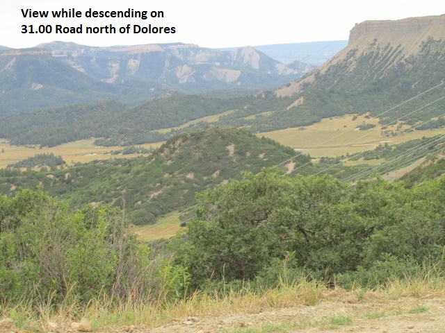
As I began a long descent toward a valley, the roadway became narrower and steeper, exhibiting many blind turns and occasional switchbacks. For safety reasons, I have adopted a habit when approaching blind turns and topping blind hills of staying as far right in the roadway as possible. Approaching traffic often takes their half out of the middle, so this habit affords me a safety cushion. My windshield even bears a “Ride Right” sticker provided free by the BDR group as a reminder for riders. The Lord was looking out for me on that road as I met and 18-wheeler in the middle of one of those narrow, blind turn. He was hauling butt, towing a lowboy trailer loaded with a grader. In the sudden rush of adrenalin, the truck seemed like one of Hollywood’s mechanical monster as he hurtled toward me, engulfed in a wall of dust. Even though I was as far right as I could ride, the “monster” only cleared me by about three feet. A short ways later, I intersected the road I had ridden north eight days ago on the way to Telluride. Several miles north of Dolores I hit pavement again. A bit further south, I chose to remain on pavement and bypass some of the technical forest sections I’d ridden on my trip north.
I passed quickly through Dolores and continued the 10 miles to Cortez, arriving about 1:00. I rode on to the motel and was happy to find my Colorado truck unmolested. After loading the bike and changing clothes, I grabbed a snack at a convenience store. As I headed out of Cortez, a light rain began to fall. I had hoped to spend the night in Farmington, New Mexico or maybe even further in Cuba. Driving through intermittent rain to Cuba and with lots of daylight remaining, I decided to drive all the way to Bernalillo. Once there, I decided to continue to Albuquerque and eat some Mexican food in “Old Town”. I called around and found a great $71 room at a four-star hotel recently purchase by Ramada. It was easily the nicest lodging of the trip and a nice way to finish up. Monday morning, I rose early and was back in Lubbock by 1:30.
Epilogue
It’s really hard to believe that I’m finished. When I think back it’s all kind of a blur. The days passed so quickly and busily, leaving me tired and ready to crash at the end of each day. Can’t believe it’s over! I couldn’t have asked for a more scenic ride … always amazed at the Creator’s magnificent creation! I’m looking forward to seeing my pictures and thinking back over the last eight days. I feel really fortunate … the Lord has blessed me with the health and financial means to make this trip. As usual, Lyn was very supportive (she would say it’s one of my more benign vices). I enjoyed great weather, beautiful scenery, and virtually no bike problems. In retrospect, I have no regrets about skipping the high passes and instead riding the northern route to Lake City. Amazingly, I never had a fall, though there were a few close calls. I nearly dropped the bike a few times and almost lost traction on the front tire on occasion. All in all, it was a safe, beautiful, and fun trip. Really glad I was able to do it!
Jerry Lewis November, 2019