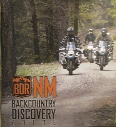
New Mexico
Backcountry Discovery Route
27 September 2018 – 5 October 2018
Ride Report
By Jerry Lewis
New Mexico
![]()
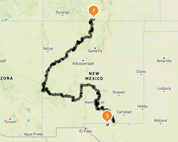
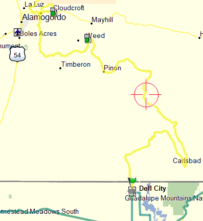
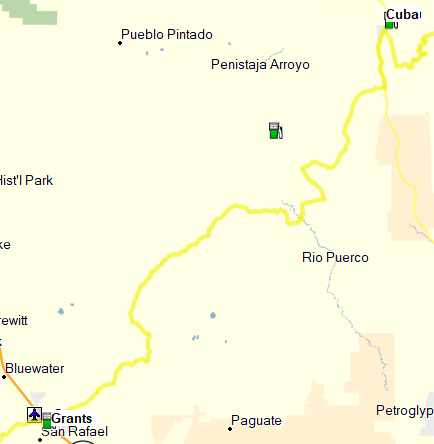
NMBDR Itinerary
NEW MEXICO BACKCOUNTRY DISCOVERY ROUTE (NMBDR)
Introduction
Welcome to my 2018 dual-sport “ride report”. Most of what is included in these pages is the truth with very little hyperbole. Names haven’t been changed to protect the innocent, because there aren’t any innocent.
The New Mexico Backcountry Discovery Route is a multi-day, off-road adventure that sends dual-sport motorcycle riders through the most dramatic and rugged landscapes in New Mexico. The route begins in the tiny farming community of Dell City, Texas, a few miles south of the New Mexico line, and ends in Antonito, Colorado. This route is roughly 1,200 miles long and utilizes a variety of paved and unpaved roads with rocks, mud, sand and water crossings to make it fun and challenging as it traverses five national forests and three arid desert regions. It is intended for intermediate to advanced riders and can be ridden on most street legal dual-sport and adventure motorcycles. The route was planned by a group known as Backcountry Discovery Routes (BDR). Along with many other riders, I’m indebted to BDR for the superb routes they design. BDR is a great organization and following is a summary of their stated purpose:
- Backcountry Discovery Routes is a non-profit organization whose mission is to establish and preserve off-highway routes for dual-sport and adventure motorcycles.
- BDR works with the forest service, land managers, and agencies responsible for public land, to keep trails and remote roads open for motorcycling.
- BDR is able to map new routes, provide free GPS tracks and advice.
- Backcountry Discovery Routes’ goal is to create a new Backcountry Discovery Route each year for the Adventure Community. For each BDR route, a Butler Motorcycle Map and free GPS tracks are produced.
As mentioned, BDR furnishes free GPS tracks for each of their discovery routes and the associated Butler maps running about $15. Butler maps are very high quality fold-out maps rendered on excellent water resistant paper. Butler Maps was created by motorcyclists who run the gamut of enthusiasm … young to old, dual-sport to casual cruiser … they attempt to create maps suitable for any type of rider. Their concept is simple … research, ride and share the best riding experiences so riders can spend more time twisting the throttle.
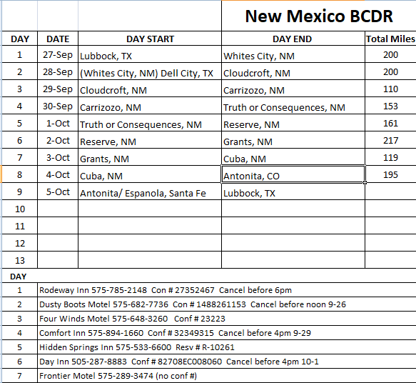
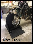
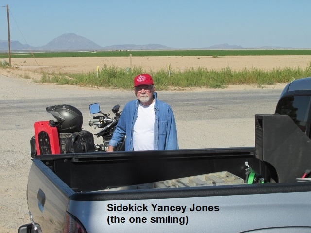
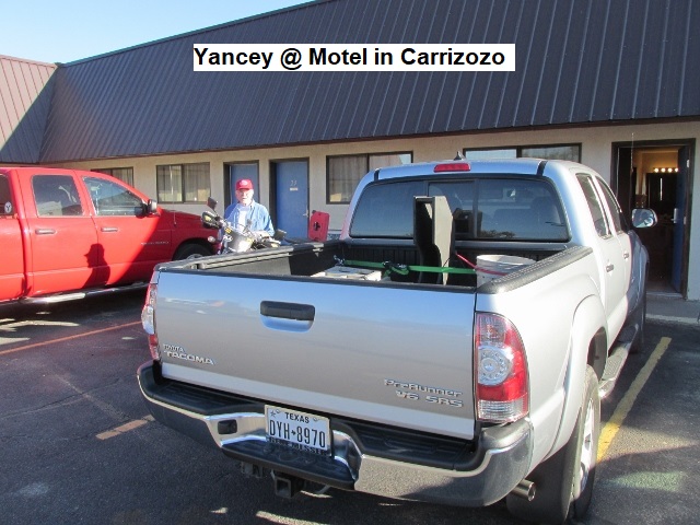
In preparation for the NMBDR, I spent a lot of hours checking weather conditions, ride reports from other riders, and checking out lodging that would be somewhat scarce. Also, I copied the daily map sections from the Butler map so that I could place each section in my tank bag map pocket for easy viewing. Following the green line on my Garmin 60 CSX is great, but having the paper maps serves as a backup and gives me the “big picture” of the route. Initially, I hoped brother-in-law Kenny and our good friend Milton, both excellent dirt riders, would join me. They decided the time commitment was too great, but brother-in-law Jeff planned to ride the section with me from Cloudcroft to Carrizozo. My good buddy and former riding partner, Yancey Jones, agreed once more to haul me and my Suzuki DRZ 400S in his Tacoma to the start of the trail at Dell City, Texas. He would drive pavement and sight-see, and then meet me each evening at our motel. I built a two-by-four and plywood wheel chock for his truck that made hauling my bike simpler (worked great!). Of course, he griped about my paint job ☺!
Since I’ll be riding solo, I will once again carry my Fast-Find Location Beacon (PLB) as well as my new Garmin InReach Mini tracker/ communicator. Both of these units are capable of summoning first-responders to my exact location should I be seriously injured (assuming I’m conscious to activate them ☺). As I’ve mention before, family and friends can follow my track on Garmin’s web site, so in the off chance I can’t activate an emergency call, those tracking me will notify rescue after a period of non-movement on the tracker. I’ve switched from the SPOT tracker to the InReach because 1) it allows two-way communication using text messaging, and 2) it uses a satellite network that gives better satellite connectivity. As this route traverses some of the most remote and isolated regions in the country, the ability to communicate both ways offers some peace of mind. In addition to the new tracker, I’ve installed a new and brighter LED headlight along with new windshield mounts on the DRZ. Also, I moved my windshield bag to the right-rear body panel. Wife Lyn bought me some great new riding pants with lots of pockets.
One thing that will be a little different in this ride report is that occasionally I will drop the sentence subject (I, I’ve, we) and part of the time I’ll be writing in present-tense. As I’m riding, I periodically stop and make voice recordings on my I-phone. I do this in order to remember and to describe the scenery and riding conditions for later transcription. Since these are done mostly present-tense, I decided to include them as such.
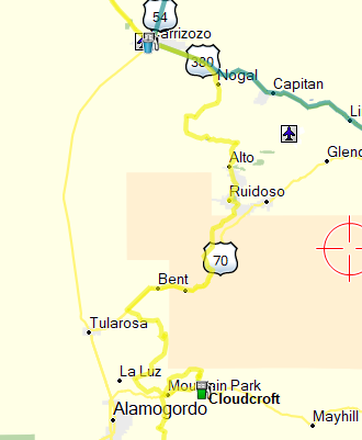
Day One – Thursday, 27 September 2018
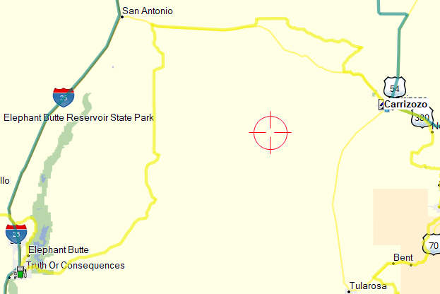
Since Dell City lies approximately 300 miles west of Lubbock, Yancey and I planned to overnight in Carlsbad, New Mexico in order to get an early ride start. When I checked motels in Carlsbad, I was flabbergasted! A Hampton was $250 a night and Motel 6 was $150. Later learned this was due to the oil boom in the area. We opted for a $120 room at a nice Rodeway in Whites City, 20 miles closer to Dell City. We left Lubbock mid-afternoon and Yancey drove us (at a sedate pace☺) toward New Mexico. Since Yancey and I have known each other so long and we’ve heard each other’s stories umpteen times, I tried reading in my Kindle to pass the time. Well, that was a mistake as I soon contracted a migraine. Arriving at the motel after 6, we ate some decent Tex-Mex at the only restaurant in town and called it a day.
Day Two – Friday, 28 September 2018
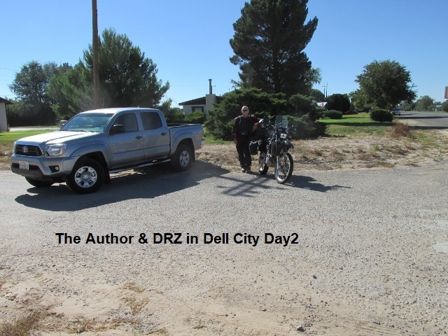
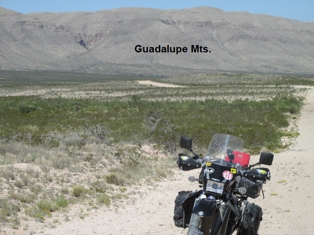
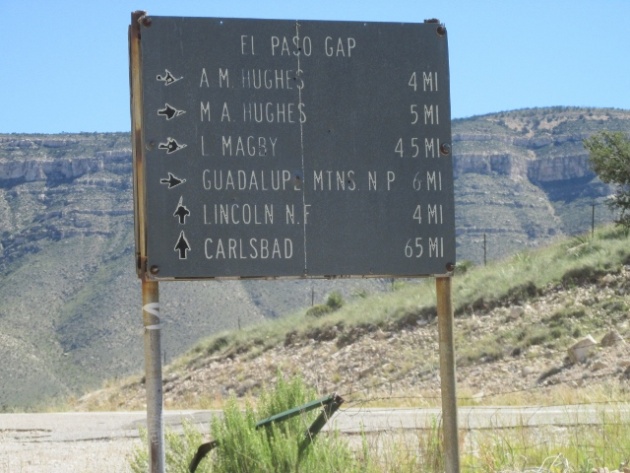
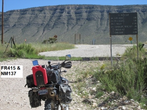
I’m now a few miles out on the NMBDR … this is my first ride recording on the first day. Yancey helped me unload my bike in Dell City and then he headed west on US180 to El Paso. From there he’d drive US54 to Alamogordo and then up the mountain 18 miles to Cloudcroft. By the time I got my scooter rolling north on CR-G1 into New Mexico, it was already 10:15 Central time. Ridden now about 55 miles and arrived at El Paso gap, the first pavement. Roads have been fairly smooth averaging 40-45 mph most of the time. Occasionally, riding got more technical through some canyons and arroyos, slowing me some. About 10 miles north of Dell City, rode up on a herd of 20 or so antelope, and just a few miles back I scared up 3 large mule deer. About 15 miles after leaving, I met four dual sport riders just finishing the last leg of the NMBDR … Father and son and a couple of friends. They indicated the roads and weather had been excellent for the most part. They had been camping for the majority of the trip. We wished each other well and I continued north for a ways before the rode angled northeast toward the Guadalupe Mountains. The roads through this area changed designations 4 or 5 times as I traveled through the desert. As I neared the base of the mountains, the road made a hard turn to the southeast and wandered through a canyon for probably 25 miles and then began to climb. It finally dead-ended at pavement where I’m now taking a break.
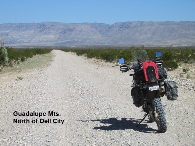
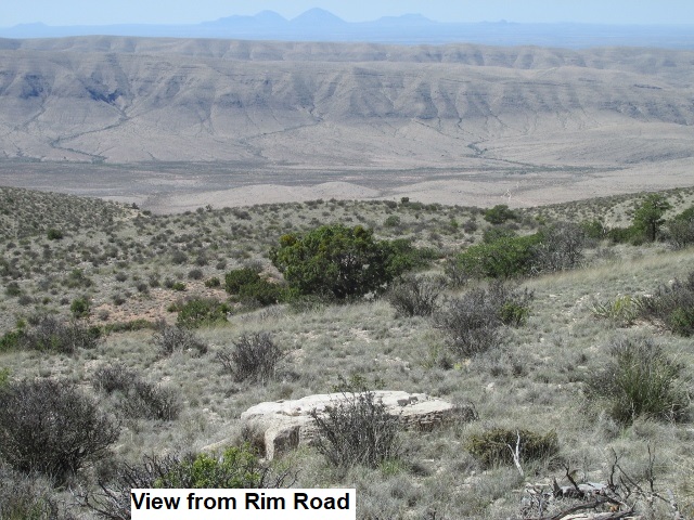
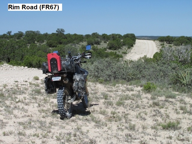
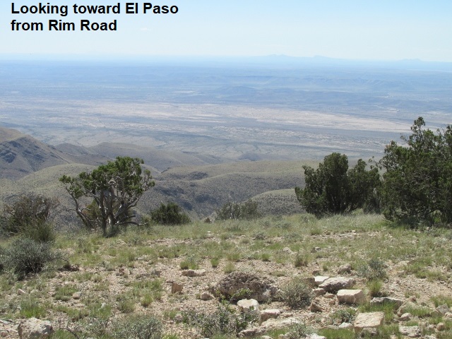
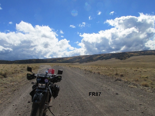
I chased NM137 about 5 miles north while continuing to climb by way of some switchbacks up to a ridge on the west side of the Guadalupe Mountains. The trail forked left off of the pavement on Rim Road and into Lincoln National Forest. It proved to be a nice gravel road following the western edge of the mountains overlooking the valley below. I can see the roads far below that I rode earlier and great desert landscapes for many miles in the direction of El Paso. The temperature is around 90 while the forecast for Dell City was approaching the century mark. At this point I estimate that I’m around 40 miles from Weed, NM … and gas and food.
It’s about 1 o’clock and still on Rim Road (FR67) … amazing ride! Most of the way the road is right on the edge of the rim … feels like flying in a plane as I look out over the valley 2000 feet below. Haven’t seen any ponderosa pine trees yet, mostly pinion or juniper and lots of it. Have seen plenty of grazing cattle, some of which stubbornly blocked my path. The road’s been in fair condition, a little rocky and washed out in places, but not bad. Making pretty good time but still several miles from Weed. Fixing to hit CR44 which will connect with NM24 which will take me into Weed. Having a ball! Great Ride!
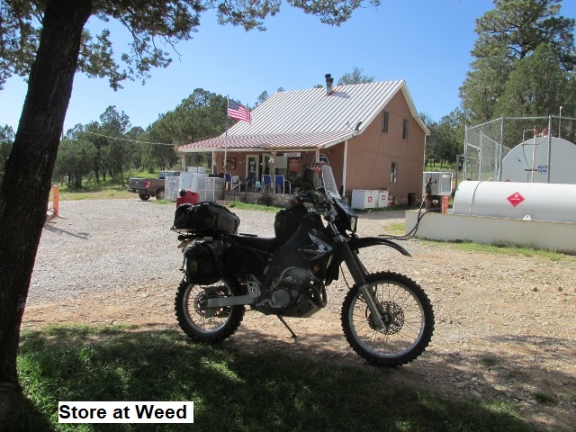
Now a few minutes after 3 mountain time, and I just arrived at Weed. Gassed the DRZ and grabbed a root beer and some peanut butter crackers (lunch) at the old store, before sitting down at their shaded picnic table. I’ve been about 154 miles, still have about 45-50 to go. The pavement ride on NM24 was longer than I realized, taking me through the village of Piñon before dropping me here at Weed. As the day was slipping away, the pavement was a good thing as it allowed me to make some better time.
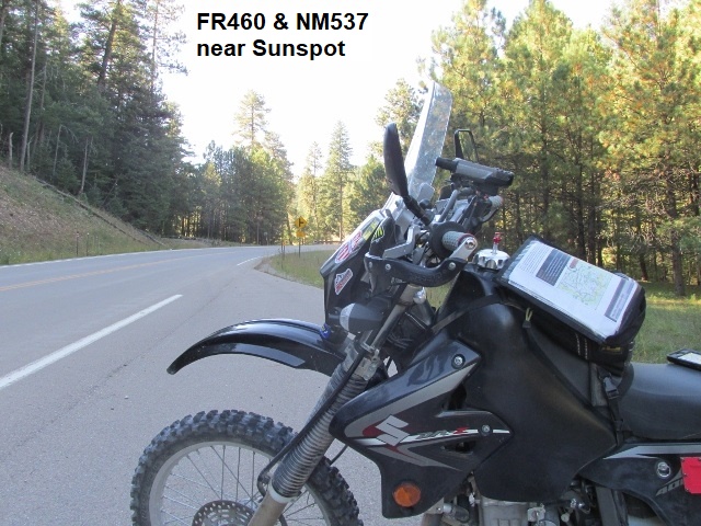
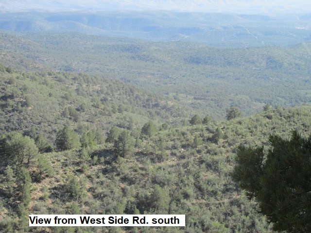
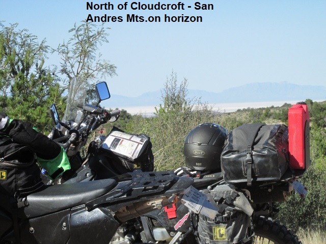
The clock says 4:20 and I’m stopped here at NM537 which runs down to Timberon. I left Weed and rode FR171, a great forest service two-track for several miles. Suddenly it started climbing, becoming steeper and steeper with wash outs, mud, ruts, and rock before finally dropping down to FR460. FR460 has been a great road with phenomenal vistas to the south, concluding with an enjoyable and really steep switchback decent for 3 miles. Here in a couple of miles I’ll catch the West Side road (FR90) that winds through the forest 500 feet below the Sunspot Observatory. I’ll then circle north to the Alamogordo highway and take US82 into Cloudcroft for the night. The temps here in the forest shade have already dropped to a chilly 60 degrees. The skies have been mostly clear throughout the day. It’s been a great ride but I’m getting tired … glad the day’s almost done.
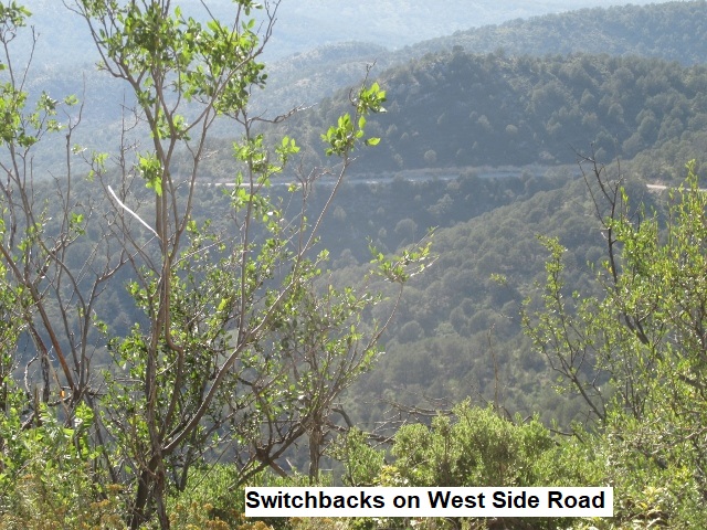
As I traveled the West Side road, it was further to US82 than I remembered … probably 25 miles. The road was in good condition as it wound around the mountains above Alamogordo. I’ve ridden this road on dirt bike trips when it was such a mess of mud and ruts it was hard to keep the shiny-side up.
Eventually I intersected US82 at High Rolls and rode pavement east about 10 miles into Cloudcroft. By the time I met Yancey at the Dusty Boots motel it was dusk and much cooler, maybe mid-50’s. My trip gauge indicated I’d traveled 217 miles from Dell City, a rather long day considering terrain. If I’d realized how late the day would be, would have tried an earlier start at Dell City. After shedding my riding gear, we walked across the parking lot to a nice little mountain town café for some chow.
Day Three – Saturday, 29 September 2018
As I make my first recording of day it’s currently about 3 in the afternoon on the second day of riding (while recording I’ve an audience listening in … a cow wondering who I’m talking to). Brother-in-law Jeff Paxton left his place in Ruidoso early this morning and rode 40 miles on his DRZ to meet us in Cloudcroft. About 9:15 it was still chilly so Jeff and I donned our coats and left Yancey to fend for himself. Yancey planned to travel west down the mountain to Alamogordo and then catch US54 directly to Carrizozo, bypassing Ruidoso.
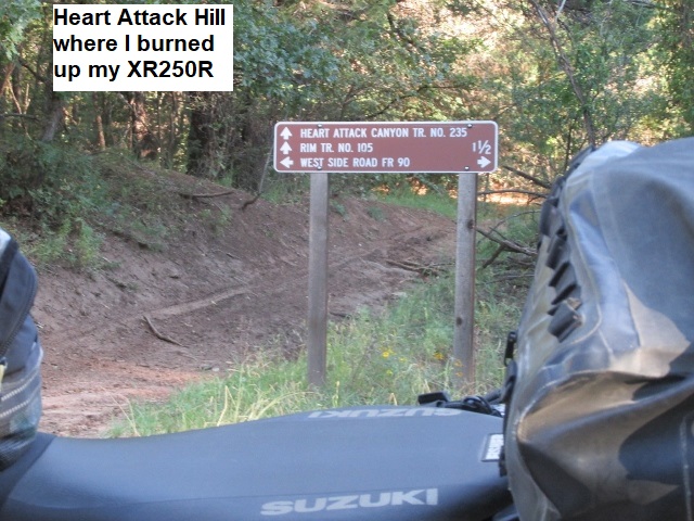
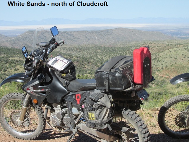
We rode west on US82 for about 3 miles then turned north into the forest on FR206. FR206, followed by FR162, were both great roads … really fun and picturesque two-tracks snaking through the forest for several miles, high up in the mountains. The route eventually opened out into a high meadow with great vistas to the west toward White Sands. After some photos we began a steep winding decent into High Rolls.
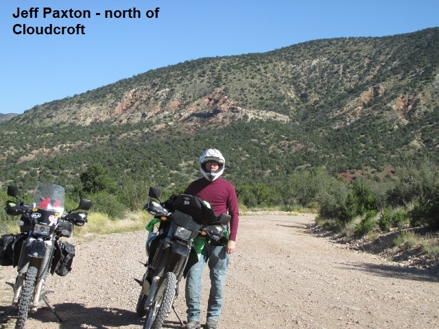
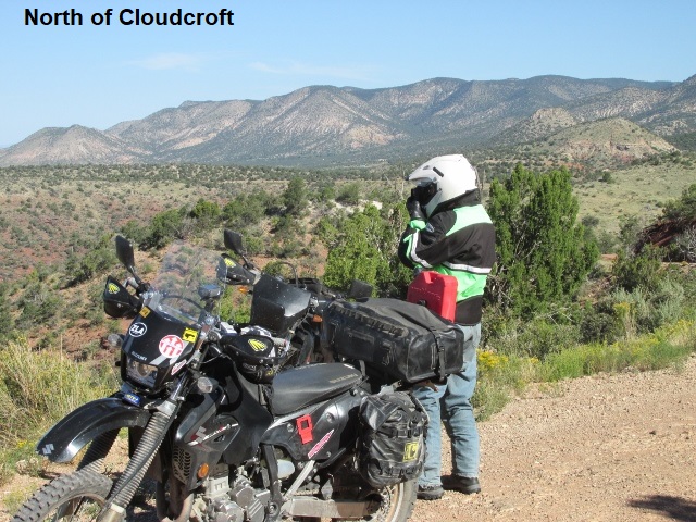
Out of High Rolls we traveled Fresnal road, a fun and winding paved country lane which gave us a chance to practice our counter-steering. At a “T” intersection we hooked a right onto Laborcita Canyon road and set a relaxed pace, passing by several rural homes and neat small ranchettes. We were headed mostly north in the general direction of Ruidoso and I began to think the pavement might take us all the way to US70. Wrong!! After about 5 miles, I was getting somewhat bored with the asphalt when suddenly the pavement ended and we found ourselves on forest road FR329. It was a jeep road, and I mean a “4-wheel drive” jeep road … probably the most technical riding on the trip thus far. Extremely steep, it climbed to a high elevation before beginning an equally steep descent. The road was very rocky and loose with lots of wash out. I have ridden worse but it was a bit more technical than what I enjoy on a loaded dual-sport. On top of the mountain I had my first and only “drop” of the trip. Riding in front, I encountered a very sharp, left-hand descending turn which was blocked by a fallen tree. I rode uphill around the base of the tree and as I turned down the hill, I allowed the bike to stall. When I stuck out my “downhill” foot to catch the bike, I couldn’t reach the ground so I fell headlong onto the forest floor … left leg pinned under the bike. Unhurt, I managed to free my leg by the time Jeff got to me. I was really glad he was there to help me pick up my bike that lay with handlebars headed downhill. He wisecracked that I reminded him of Superman as I flew through the air with both arms outstretched. I didn’t feel very “super” about then, just embarrassed. Eventually, we rode out of the forest into foothills and high desert where we traversed numerous arroyos and washes before intersecting US70. At that point we were about 10 miles south of Mescalero and we rode another 10 miles before turning left on White Mountain road, a nice curvy paved road. It meandered across the Mescalero Apache reservation and around by the Mescalero School before dumping us out in the middle of Ruidoso.
 In Ruidoso Jeff introduced me to a great hamburger joint in town called the Hall of Flame Burgers. After lunch we rode up the canyon to Jeff’s place where he shed some extra clothes. We sat on his deck for a few minutes and enjoyed a cup of coffee with his wife Debbie. We headed north through town on NM48, turned left on NM37 and then left again on Bonito Lake road. As we approached Bonito Lake we saw several signs announcing that the lake was closed. When we reached the dam, the lake was completely dry and heavy equipment was reshaping the lake bed. We were concerned the construction might block our route but made it through without incident. We turned onto FR108 which crests at over 9000 feet before transitioning to FR400 which descends the north side of the mountain and passes through Nogal Canyon. It’s a really great ride … a steep, dirt, one-lane track with numerous tight switchbacks. As we approached the village of Nogal on NM37, we encountered a plethora of ubiquitous vacation hideaways. Since my destination for the day was Carrizozo further west, Jeff waved adios and turned back toward Ruidoso. At this point the official NMBDR track follows NM37 to US380 and into Carrizozo. However, I deviated from the route a couple of miles and caught Ranchmans Camp dirt road (FR212) which intersects US380 a few miles further east. Beautiful day … mostly clear skies with the mercury around 80.
I arrived in Carrizozo about 3:30 having traveled 120 miles since Cloudcroft. It was designed as a short day but lots of fun and especially enjoyed Jeff’s company. Yancey and I ate some excellent Mexican food and retired to the motel to watch some Saturday night college football.
Day Four – Sunday, 30 September 2018
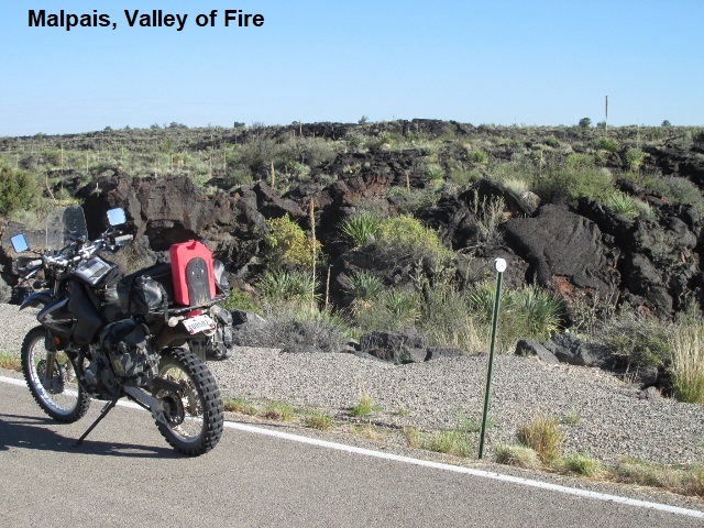
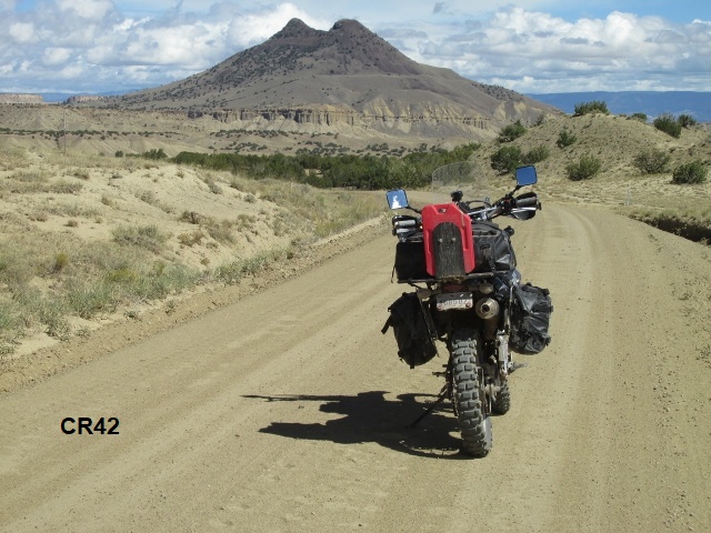
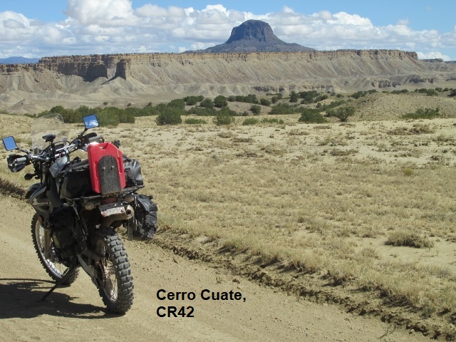
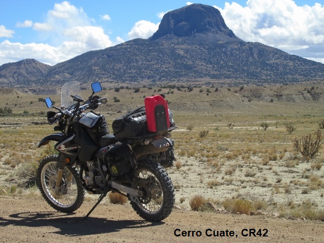
After adding a few ounces of oil to my thumper engine and lubing my chain, I left Yancey at the Four Winds in Carrizozo about 9. Riding west under clear skies, the mercury hovered around 70. A few miles out I stopped and took some pictures of the Malpais in the Valley of Fire. The Malpais, Spanish for “badlands”, was named by early Spanish explorers. It’s an area of land covered in old lava flows, sandstone bluffs, ice caves, and lava tubes. Snapping some pictures, I continued west on US380 several miles before turning north onto CR-A12.
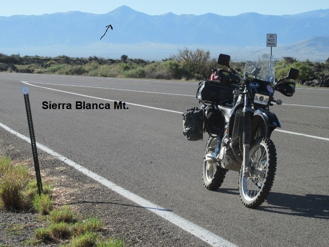
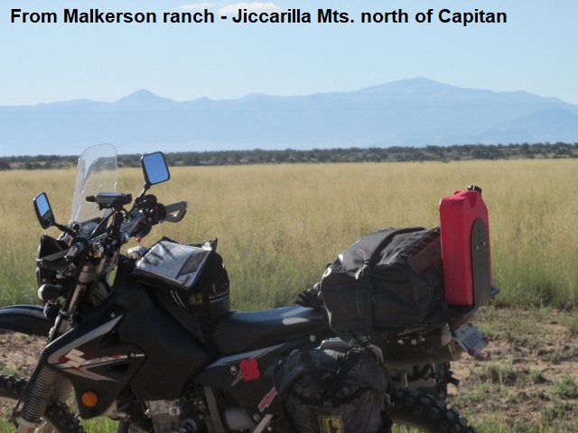
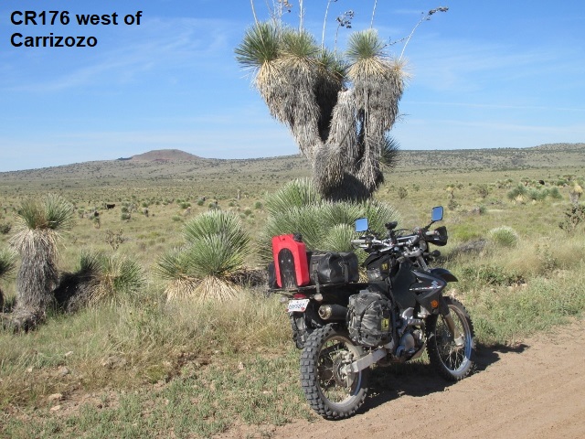
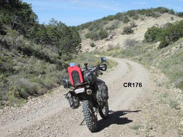
Next I rode north across the Malkerson ranch for a half-dozen miles. The ranch terrain is fairly flat with great views of the Jicarilla Mountains to the east, north of Capitan. Turning back west on CR176, I enjoyed a challenging high-desert two-track for maybe 20 miles. The countryside is ruggedly beautiful as I climb up into some hills on Iron Mine Ridge. The track soon dropped down into a twisting, undulating canyon as I carefully avoided occasional deep ruts. CR-176 would probably be impassable following even a small amount of rain. Haven’t really seen any wildlife today, just several head of cattle and one large tarantula. Eventually the road surface changed to a wide graded ranch road before rejoining US380 at the northern boundary of White Sands Missile Range.
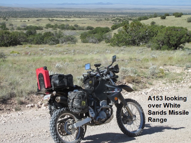
Have traveled now about 35 miles off-road and face about 20 miles of pavement west on US380. I rode within spitting distance of San Antonio on I-25 before the route turned me south on CR-153 where I quickly passed by the Fite ranch headquarters. It’s now about 10:45 and 80 degrees. Thought about detouring into San Antonio and having a green-chili cheeseburger at the Owl Café but decide to keep riding.
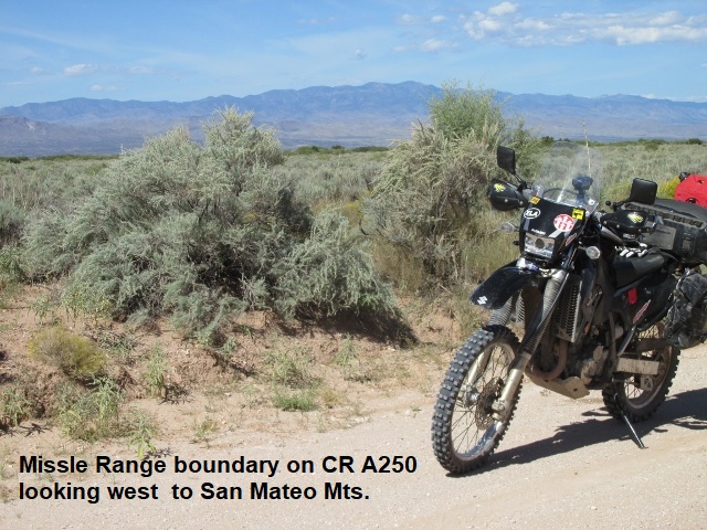
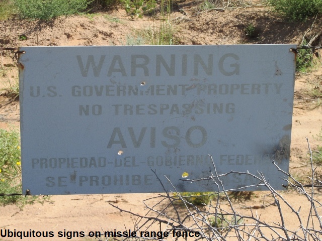
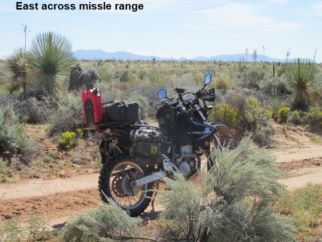
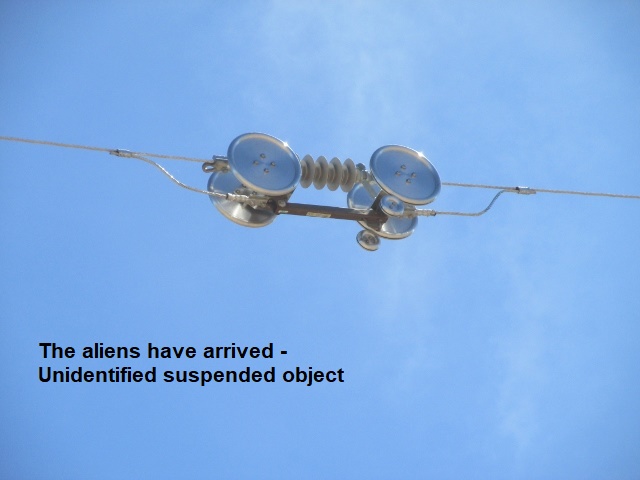
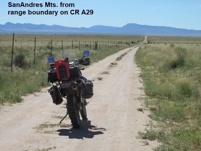
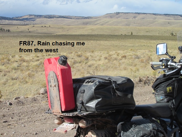
Have been traversing sagebrush desert and starting to see some clouds to the southwest (maybe the leading edge of storms spawned by the hurricane that’s pounding Baja). Around noon and 100 miles into my day, I find myself in the middle of nowhere. The terrain now, is mostly knee-high grass as I ride parallel to a “bob”-wire fence that marks the west boundary of the missile range. To my south I have a good view of the San Andres Mountains that define the western edge of the missile range. As remote and starkly alone as I feel here, it’s only about 20 miles west to I-25. The road has become a bit monotonous, but fortunately the sand has not been as deep as advertised (which is really a good thing). I encountered something interesting associated with the missile range boundary … several miles of 35-foot utility poles with a single strand of cable on top and some kind of large metal contraptions occasionally suspended from the strand. Not power … maybe some kind of antenna or passive radar for the range.
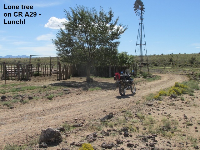
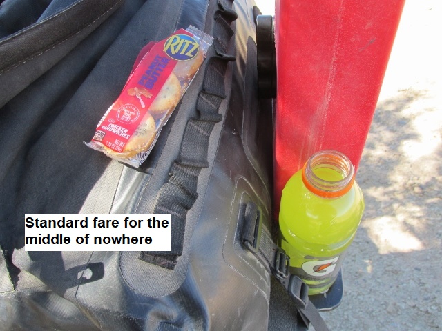
If I can ever find some shade in this treeless expanse I plan to stop and eat my PB crackers and drink some Gatorade. Lo and behold, about 12:30, I came upon an old stock tank and windmill with a welcoming shade tree. Not sure of the temp, but it is HOT! As I eat my meager lunch I’m accompanied by some cows grazing among nearby lava outcroppings.
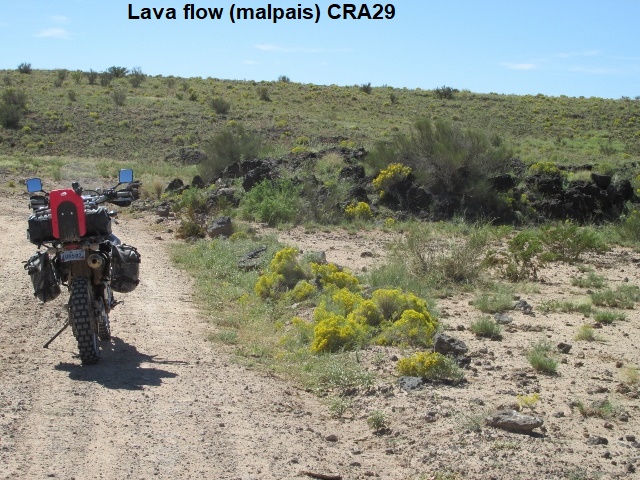
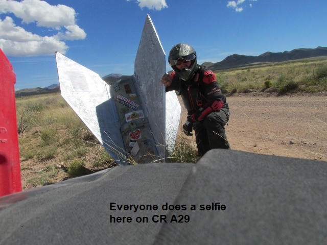
Still traveling south, the road designation changed to A250, A29, and finally A26. As I continued toward the mountains the road into the foothills became more interesting riding. A29 was mostly a good gravel road. The downside was the recurring wide washes that the road passed through, apparently formed by rain runoff from the nearby mountains. The washes weren’t too bad but it was hard to judge their condition until I was in the middle of them. I nearly bought-the-farm once when I topped a rise and immediately dropped into a deep wash, hitting it too fast and bottoming the suspension. Once again the DRZ’s long travel suspension saved my bacon.
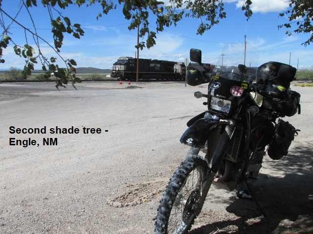
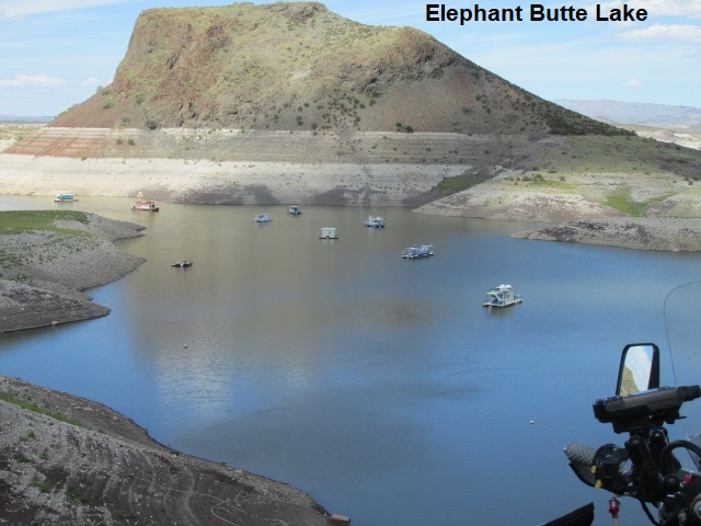
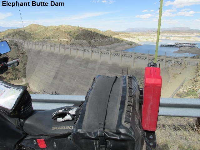
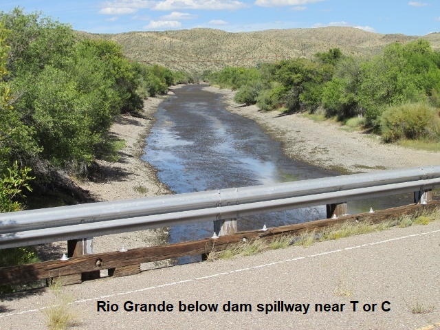
About 2 o’clock I arrived at the intersection of A26 and NM51 and what’s left of the town of Engle. It’s hot and windy as I sit in the shade of the second tree I’ve found in the last 100 miles. As I wait in Engle for a lengthy train to pass a mere 50 feet away, I only have about 10 miles of pavement that separates me from T or C. Originally named Hot Springs, T or C (or if you prefer Truth or Consequences) was renamed in 1950 after the radio/ TV game show by that name. As I neared T or C, I came to the dam for Elephant Butte Lake and decided to kill some time. Spent a few minutes checking out the dam and some of the old buildings constructed by the Civilian Conservation Corp (CCC) during the depression years.
I met up with Yancey at the Comfort Inn (best lodging of the trip) about 3:30. After I rested my tired bones a bit, we went back out to the dam in his Tacoma, then rode around town before finally settling on Pizza Hut for supper. It was a fine day of riding, roughly 160 miles. Much of the route passed through some rough country known as the Jornada Del Muerto (Journey of Death) … thankfully it wasn’t such for me☺!
Day Five – Monday, 1 October 2018
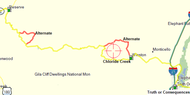
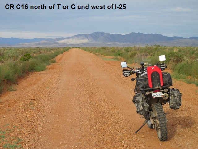
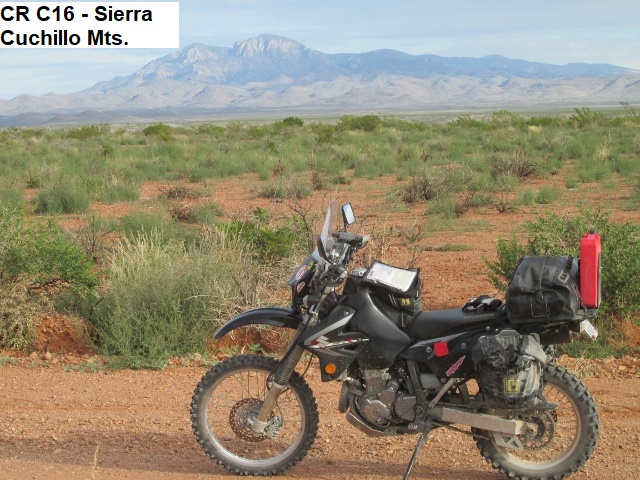
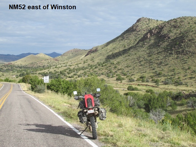
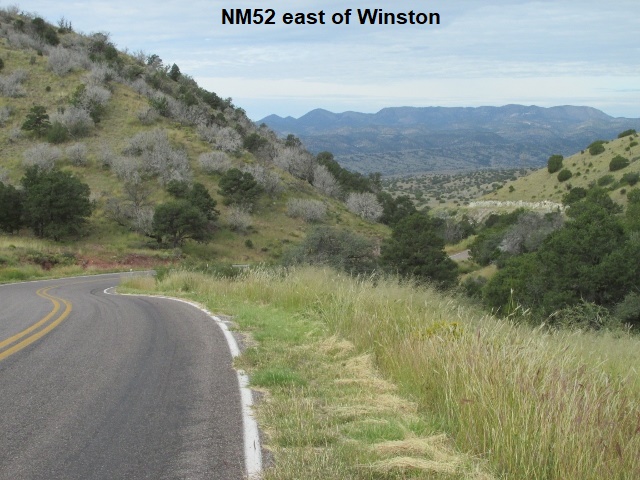
Monday morning, I’m now about 25 miles into my day, sitting on CR-C16 roughly 15 miles west of I-25. I left town and rode through the village of Elephant Butte before catching paved CR-C54 which winds in and out along the shoreline of the lake before connecting with I-25 after 15 miles. Last night and this morning, I’ve been watching the weather with pregnant concern as storms spawned by the hurricane in Baja have moved into Arizona. Some heavy rains are not more than a 100 miles to the west moving north-northwest in the general direction of Reserve, New Mexico, my destination for today. I designed a couple of alternate tracks on the computer last night in the event I need to reroute to avoid heavy rain and mud. My alternate routes are also dirt so I’m on my own if they’re also muddy (fat chance Yancey would get his Tacoma muddy to rescue me ☺). I’ll continue west now into the mountains on NM52 to Winston, NM.
Made it to Winston, a small isolated mountain town, one that’s not really on the way to anywhere. Currently stopped at a small country store where I just took on some petrol (only regular available) and borrowed their facility (TMI). People inside were real friendly and the store well stocked with a little of everything. Guess it has to be stocked well, given it’s the only store for 50 miles.
I departed town on narrow paved streets which abruptly ended and ushered me immediately onto FR226 following Chloride Creek. I had read quite a bit about this section on the internet and considered taking the alternate “easier” route on NM52 and NM59. The trail follows Chloride Creek, crossing the creek probably 50 times. Much of the way road lies between canyon walls towering 50 feet above the trail in the narrow canyon. Additionally, the creek is subject to flooding, so I hope to clear the canyon before it starts raining.
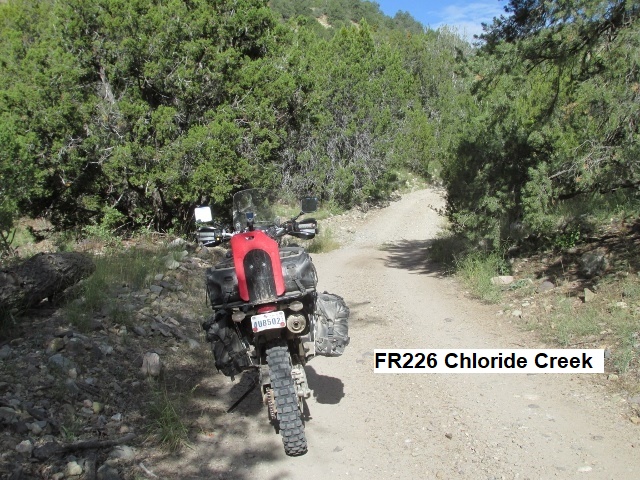
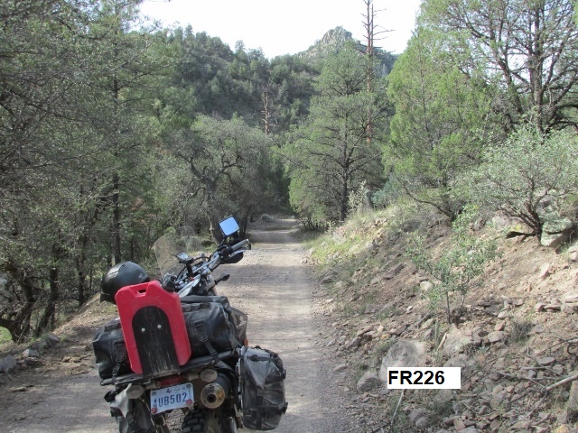
I’m now at the intersection of FR226 and NM59 (a paved road at this point). Chloride Creek turned out to be a 4-wheel drive jeep road. It was a bit challenging but still fun with lots of loose rock and a few wash outs. The canyon along the creek eventually opened up a little and FR226 became a good forest two-track before I arrived at this spot. Thought I was going to get wet when a small thunderstorm built up right above me on FR 226.
As I turned onto NM59 I left the cloud behind and I’m now enjoying a mix of sunshine and clouds. Around 12:30 and 90 miles ridden, I pulled off NM59 in a little copse of trees overlooking a forested valley and ate my PB crackers, Gatorade, and Payday.
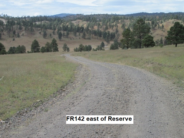
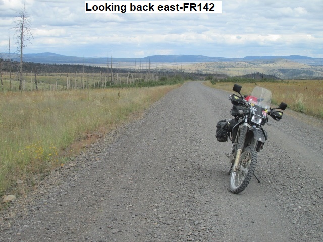
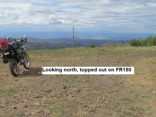
I’m not too many miles from Reserve … been 150 miles and it’s a little after 3. I’ve stopped here to admire the beautiful valley below me. I’m sitting on FR141 as it begins a winding descent out of the mountains to the Francisco River valley to NM435 which will take me into Reserve. To say the afternoon has been interesting is a bit of an understatement. After lunch I followed FR142 for several miles, a peaceful ride through the Gila National Forest. When I arrived at the intersection of forest roads 142, 28, and 119 and it was decision time (play the theme from Jaws here!). The NMBDR Butler map shows that FR119/180 (9 miles) is the “rocky route” and FR28 (18 miles) is the easier, alternate route. I decided to try FR119/180, thinking that if it got too bad I’d just turn around and take FR28. Well, it got bad, BAD!! Once on FR180, I decided not to turn around: These highly technical roads are a conundrum … by the time you decide you’re in over your head, you figure you’re as likely to crash going back as going forward. I’ve may have ridden steeper roads but none any rockier than FR180. Nine miles doesn’t sound like much but when you can only make 10 mph tops, that’s an hour of bouncing from rock to rock as you pray not to fall. A serious injury here would mean a helicopter ride out so I was really grateful when I reconnected with FR141. Shortly, after surviving CR180 and back on FR141, I found the road surface to be poorly paved blacktop. So, when I saw a sign that read, “WARNING! Rough Road”, I had to laugh. Obviously the sign person didn’t understand the meaning of “rough”☺. Was really glad I took FR180 in spite of the difficulty because, when I topped out at over 10,000 feet I was rewarded with some of the most beautiful vistas I’ve ever be held. I could see 50 miles in almost every direction and to the west, Arizona and the Mogollon Rim. As I gazed out over the valley to the west and north the sky was almost black with heavy rain clouds. Even now it looks like it is raining in the mountains just west of Reserve. Haven’t experienced any rain today, though it’s been all around me. The weather has been ideal, but I feel sure it will rain in Reserve tonight.
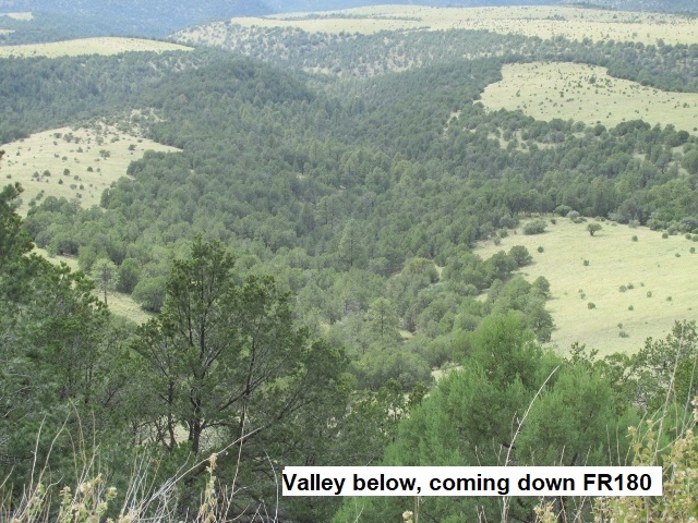
FR141 was a blast as it snaked its way down out of the mountains for several miles, eventually straightening out as it morphed into NM435, carrying me the last 25 miles to Reserve. The 6-room motel in town wasn’t recommended so I gassed up and rode west out of town for 7 miles to our lodging at Rancho Grande Estates. Yancey had already arrived, so a little later we loaded into his truck and drove in light rain back to Reserve. We enjoyed a great sandwich supper at a tiny café on Main Street (maybe the only street?). It was a great day of riding, a little over 160 miles. Overall, today was definitely the most technical riding thus far.
Day Six – Tuesday, 2 October 2018
Peeking out the window early Tuesday morning, I observe hard rain and lots of standing water. Looks like rotten weather for riding. Wondering what the day held in store, Yancey and I took the truck back to Reserve to grab some breakfast at the little diner. The lady owner/chef had a taste (pun intended) for unusual fare, so I tried some of her lemon pancakes and homemade syrup-butter mix. I’d give breakfast maybe a seven. 
Back at the room, we checked the radar along the intended BDR track. The route would take me west into the mountains on FR232 and up to the Arizona border before turning north on FR209 for a few miles to US180. Following the NMBDR at this point was obviously a no-go as heavy storms abounded. Frustrated but resigned, we loaded the DRZ in the pickup and headed north on US180 to Luna, hoping to reengage the track there. Reaching Luna, the rain had let up and I considered taking FR220 north from there. At the gas station we quizzed a hunter familiar with the area about forest road conditions. He advised that with the heavy rainfall, some of the roads were sure to be a muddy bog. I was anxious to get back on the trail but decided to heed his warning. In order to stay on pavement, we drove a zigzag course northwest to Springerville, Arizona and then east on US60 towards Quemado, New Mexico. Most of our highway detour we were drenched by heavy rain, but it let up as we drove east on US60.
The next juncture with the NMBDR track was at US60 and CR-A7, and when we arrived, the rain was behind us. We were about halfway between Springerville and Quemado with chilly temps and overcast skies. As we unloaded the bike, dark clouds were quickly moving in from the southwest. I was encouraged to see that CR-A7 appeared to be relatively dry.
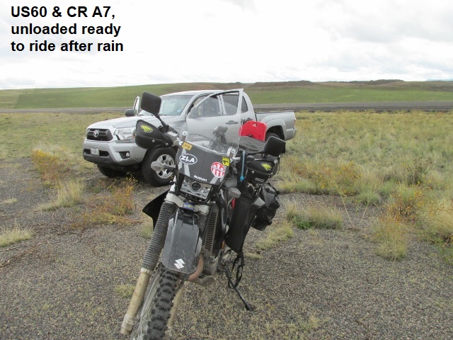
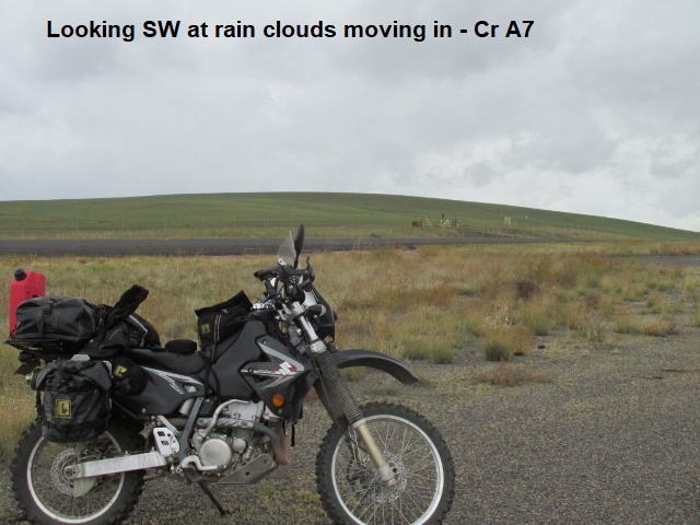
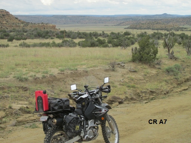
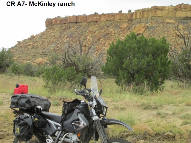
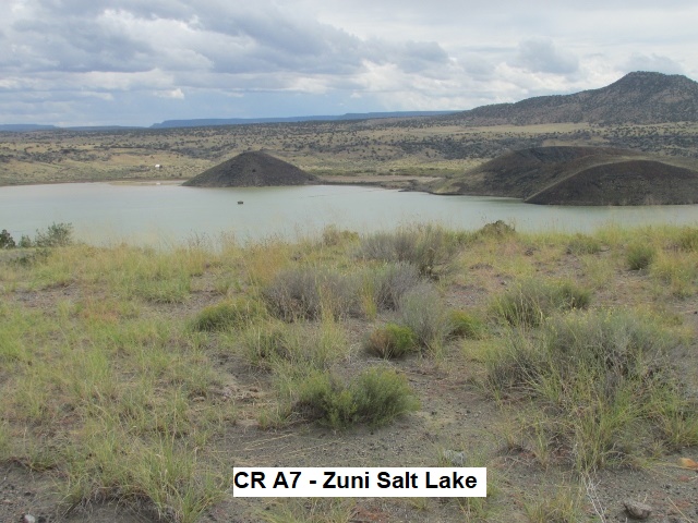
At approximately 11:45, I left Yancey and started down the two-track road just as light rain began to fall. I was truly disappointed having to bypass about 70 miles of the route that morning, but “discretion is the better part of valor” (valor read as “not crashing”). The mud wasn’t deep on the road as I headed north, but the surface was extremely slick due to the light rain. The rest of the day I’ll be headed mostly north, aiming for Grants, New Mexico to finish the day. About 30 minutes later the road is dry as I descend into a broad high-desert valley of piñon pines and rugged mesas … a really pretty and lonesome landscape. Traveling north across McKinley ranch I pass by occasional ranch houses and skirt Zuni Salt Lake, a small lake surrounded by low hills.
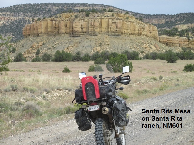
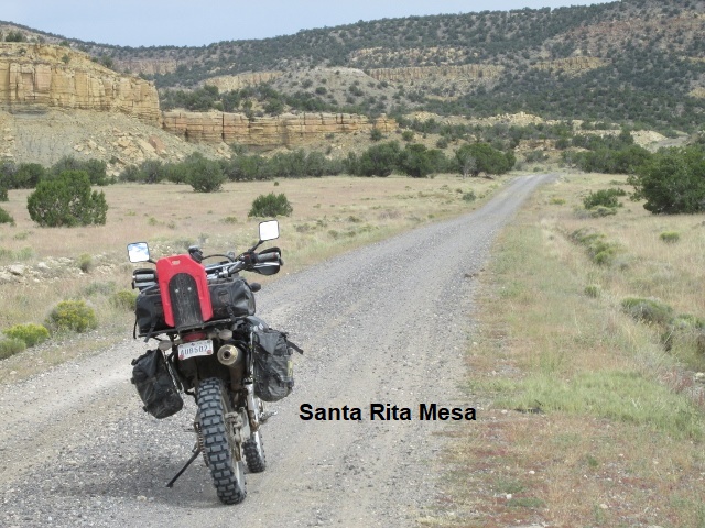
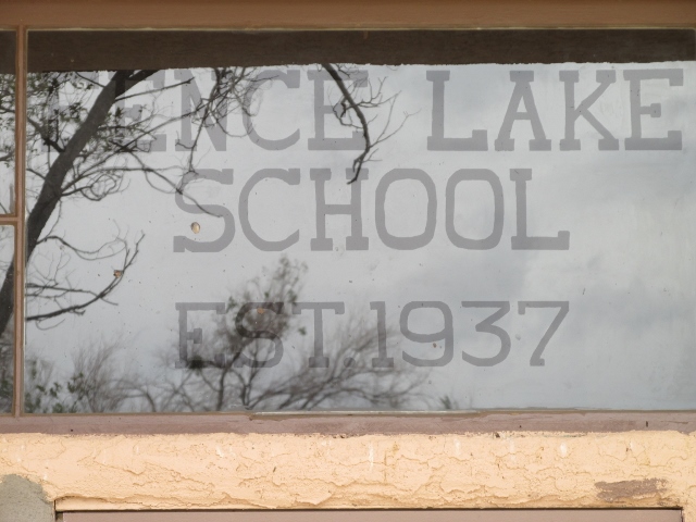
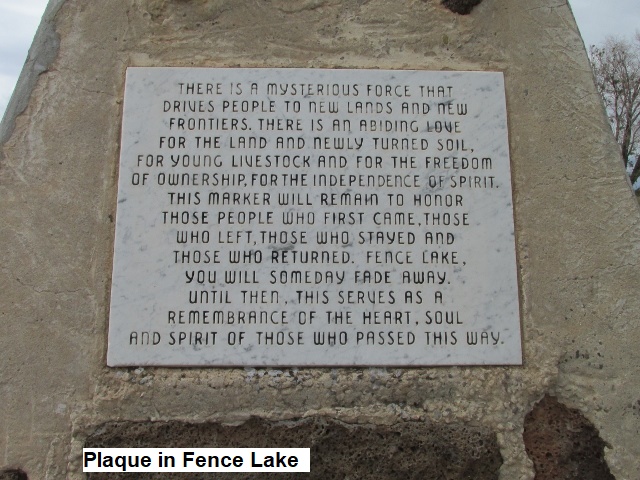
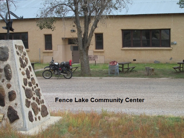
It’s now about 1:15 and I’m in the tiny town of Fence Lake, sitting at a picnic table in front of the community center. If you ever wondered where the “middle of nowhere” is, this is it. The community center was formerly an all-grade school established in 1937. Has been a good ride so far. The rain stopped and the roads were in good condition. Some are smooth gravel county roads allowing me to cruise at 50 mph or better. Rode through some scenic valleys a ways back before climbing onto Santa Rita mesa where Fence Lake resides. Earlier, a half–dozen mule deer jumped up and surprised me … beautiful animals. As I finish my lunch, it’s cool and windy so I’ll keep sporting my coat and rain jacket for a while. There are rains clouds all around me and I’ve been in and out of sunlight. At present there’s a large dark cloud in my path towards Grants.
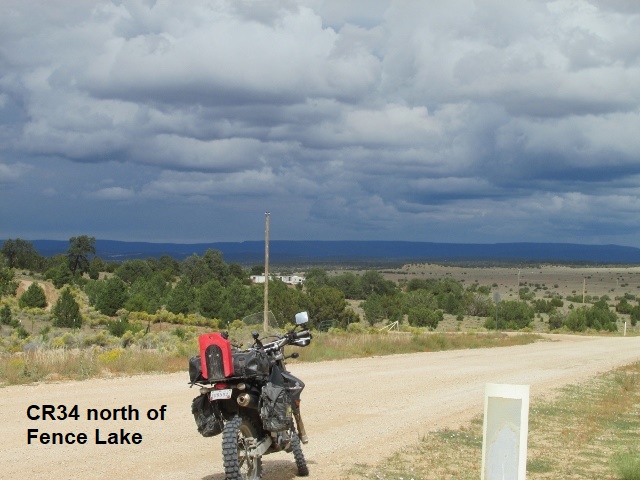
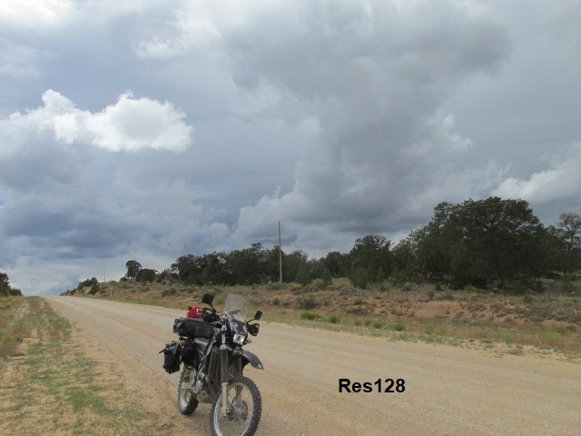
After leaving Fence Lake, I briefly rode NM36 before turning right onto CR34, a nice winding prairie road which became a wider, smoother Res128 as it crossed the Rahma Indian Reservation. A few miles on, the prairie gave way to pine forest and some really nice up-on-the-pegs riding. The dirt reservation roads are smooth and fast and the land lightly peopled as I pass through the Indian village of Candy Kitchen. Been staying dry … dodged the big thunderstorm north of Fence Lake but still surrounded by rain clouds.
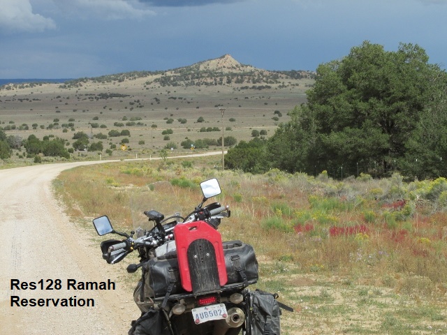
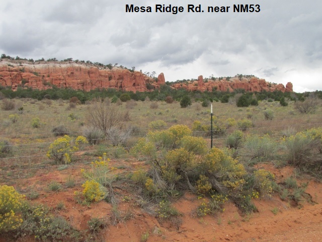 It’s now about 3 o’clock and I’ve been about 85 miles since leaving Yancey. Currently stopped at the junction of Mesa Ridge and NM53. As much as I love the Butler maps, they’re not always accurate. In this case they show C47 going all the way to NM53 when actually, I turned onto Mesa Ridge for about 3 miles before hitting NM53. Appears I’ll ride east about 10 miles before turning north again into Cibola National Forest and the Zuni Mountains. Still threatening rain but I’ve been really fortunate to miss anything of substance. Feeling good, having fun!
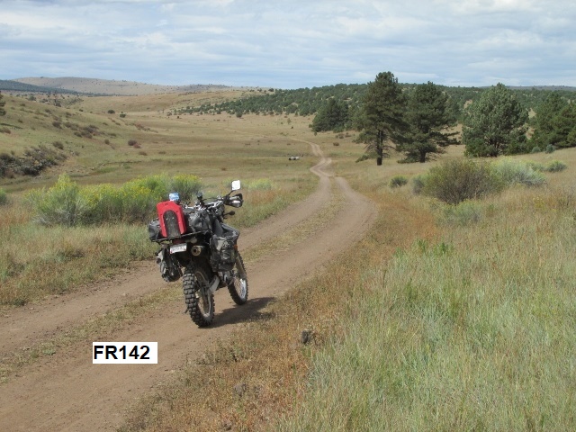
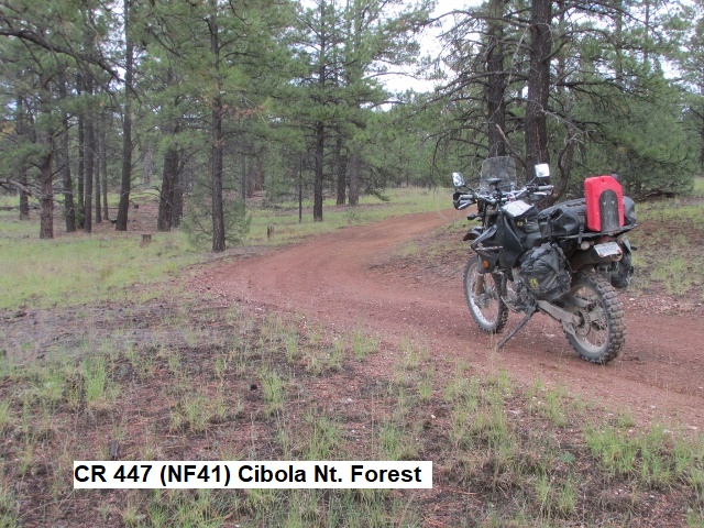
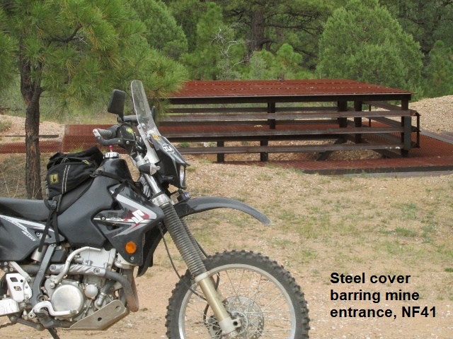
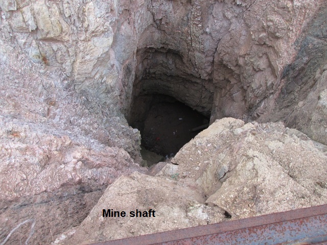
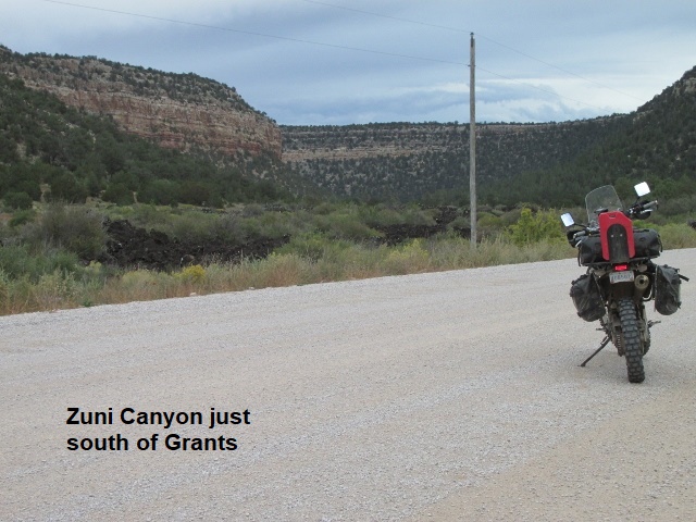
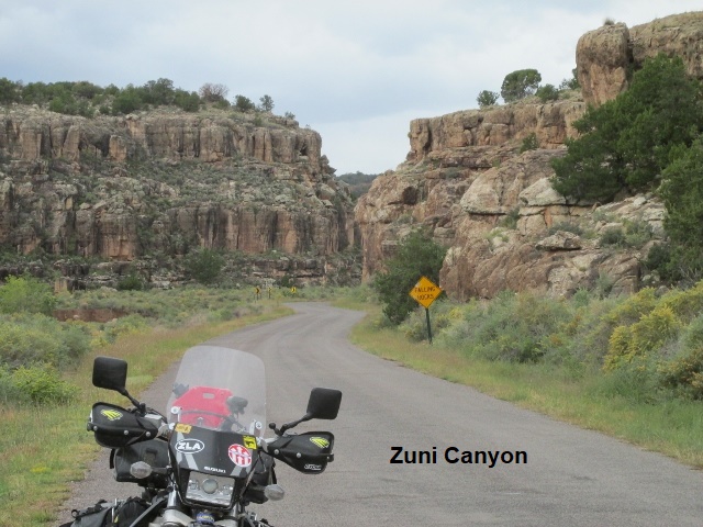
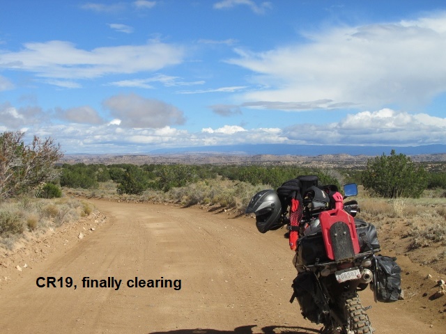
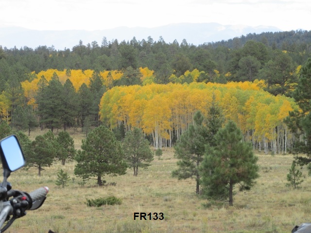
The clock says 4:15 and I’ve been 120 miles … just 3 miles south of Grants now. I turned north off NM53 onto FR50 for a few miles and then right on NF41 which took me deep into pine forest. It’s a great two-track, probably the most fun riding of the trip so far. The road is up and down with almost no rock, winding narrowly through the trees. Lots of mud holes from the just-passed rain, but they’re easy to ride around. Reminds me of the dirt bike rides we use to do around Red River, New Mexico. The road changed to FR447 before eventually intersecting FR49 – Zuni Canyon road, and came to my current location. Zuni Canyon was a beautiful ride with its 200 foot rock cliffs towering above both sides of the roadway.
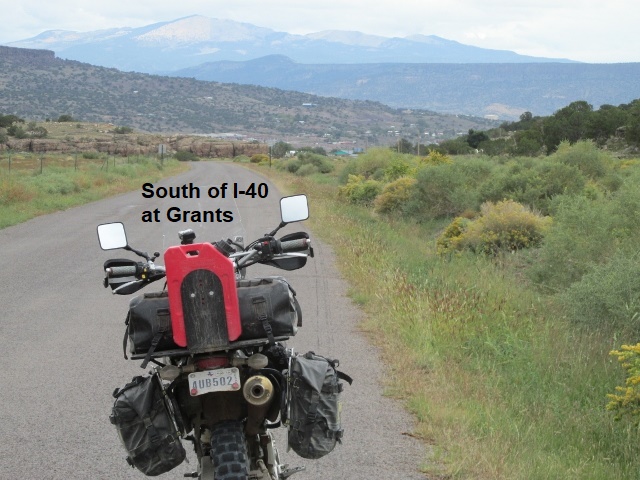
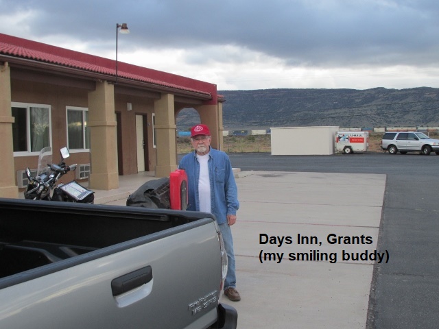
 I hit Grants on I-40 on the west side of town and traveled a few miles east through town to meet Yancey at the Days Inn. Yancey and I found some really tasty Mexican food before retiring. Traveled about 125 miles on the actual trail today. In spite of the weather it was another great day … loving it!
Day Seven – Wednesday, 3 October 2018
 Taking a break now … it’s 9:42 and I’ve covered 26 miles. We enjoyed a hearty breakfast at Denny’s before I left Yancey in Grants, a few minutes before 9.
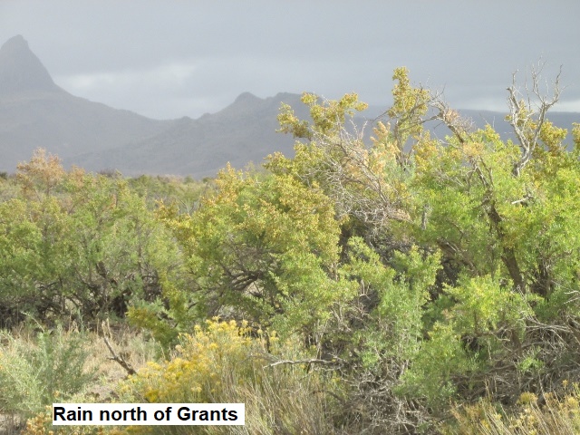
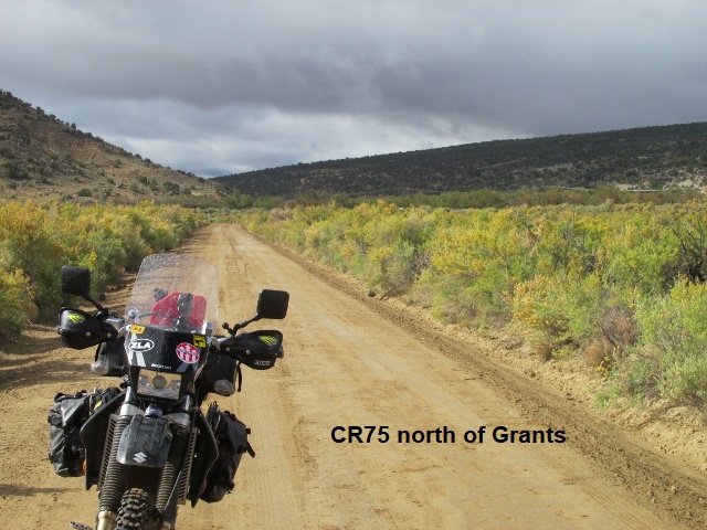
I followed paved NM 547 east, winding and climbing for 20 miles before turning into the mountains on FR239. Today’s route from Grants to Cuba is virtually identical to what Greg Camp and I rode in 2012 on the Continental Divide Trail, although we traveled in the opposite direction. The forest road is light gravel with good traction even though I’ve been riding in a light shower the last 10 miles. About 50 degrees now and there’s been some intermittent heavy fog. Currently over 9,000 feet, I can look down on the clouds settled among the trees of the Cibola National Forest. Not sure what’s in store, as the last time I crossed the mesa ahead of me it was muddy and deeply rutted. There’s heavy overcast now … really hope to break into some sunshine soon.
My watch indicates 10:20 and I’ve ridden about 40 miles. Wow! I’m looking at a beautiful rainbow! After my last stop the road meandered all over the San Mateo Mountains with one hairpin turn after another. With continuing showers the mercury dropped quickly and I got really cold. Eventually FR456 dropped down off the mountain to about 7400 feet and hit pavement on NM75. The pavement gave way to a smooth dirt ranch road which had no rock base. The sun is out now, but dark blue rain clouds lay in my path a few miles to the east … looks like a wall of rain. Much warmer at this elevation and the sun’s rays are really therapeutic. I’m getting anxious now about muddy roads ahead. Hope I don’t have to turn around and reroute.
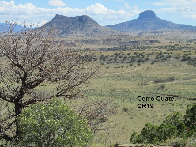
Noontime, 70 miles out and I just finished my meager lunch. As I mentioned at my last stop, I left pavement on a dirt ranch road headed mostly east past the San Miguel Ranch. The route traversed numerous arroyos (Chico, Seccion, Piedra Lumbre) which lie between the San Mateo Mountains and Cuba, New Mexico. Beautiful desert landscape with lots of mesas, bluffs and rock towers hundreds of feet high. The fascinating rock towers are said to be volcanic plugs left after softer surrounding rock has eroded away. For several miles the roads were freshly graded and easy riding. In front of me though was the darkest indigo cloud one can imagine. Didn’t know what to do but press on and try to ride through it. To turn around would mean a detour of over 100 miles and lots of pavement.
Actually didn’t rain on me that much, but it had rained hard just minutes before, leaving the roads very muddy. It wasn’t deep mud, maybe 1-2 inches, but slippery as owl poop. I slipped and slid all over the road for mile after mile trying keep from going down. In addition, about every mile or so I’d come to a wash where the rain had dug a deep furrow through the road bed with deep mud each side for a few yards. Each time I’d stop at the top, pick my best path and blast through the mud at the bottom and up the opposite bank. It was quite an ordeal but kind of exciting none the less. That’s why we call it an adventure☺.
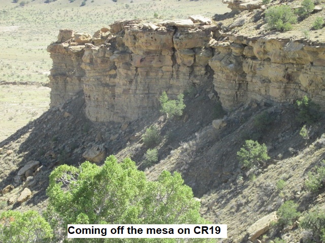
I’ve finally ridden out of the wet stuff and under the warm sunshine I just shed my coat. Best guess, I’m about 30 miles from NM550. As I continued east after lunch, there were still sections of muddy roads and washes so I continued to ride with some caution. The slippery stuff would sneak up on me … I’d be rolling along at a good clip and suddenly start fishtailing. With beautiful vistas all around, the road teetered along the edge of a mesa for a few miles before slithering down a switch back to the valley below. Really beautiful, rugged country.
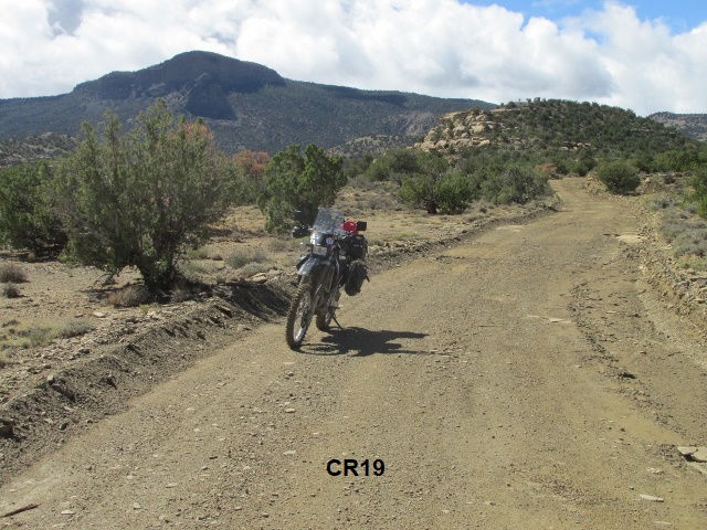
At 2 o’clock I’ve been about 104 miles. A little while ago, blasting along on CR39, I realized I had ignored my GPS and missed my turn about 2 miles back, so I went back to BLM1102 and headed east. For a couple of miles the road was good but suddenly ahead it was flooded gutter to gutter a few inches deep. Not to be deterred, I bounced off into the sandy sagebrush and piñon and skirted the flooded road for about a quarter mile. Back on the road, the surface was wet packed sand but offered good traction. As I continued on, three different times I had to ride off into the prairie to bypass washouts. Finally, I came to an impassable washout that was 6 feet deep and 6 feet across. When I tried to ride around in the sagebrush, I suddenly sensed danger and stopped about a foot from plunging into a hidden ravine about 10 feet deep. At that point I had no choice but to backtrack, again riding through prairie several times for the 7 miles back to CR39 where I am right now. As I scan the map for an alternate route, I’m once again frustrated with the Butler map. It doesn’t reflect some of the interconnecting roads and designations that will allow me to reroute with any certainty. I have a general idea of the lay of the land so I’ll continue east on CR39 and figure it out as I go. What an adventure!
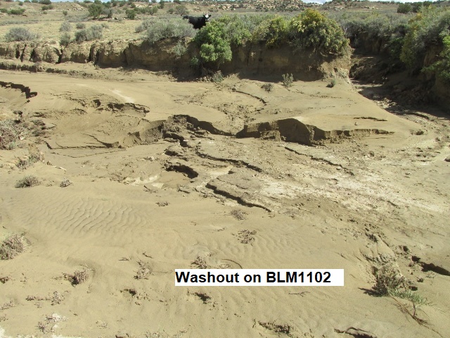
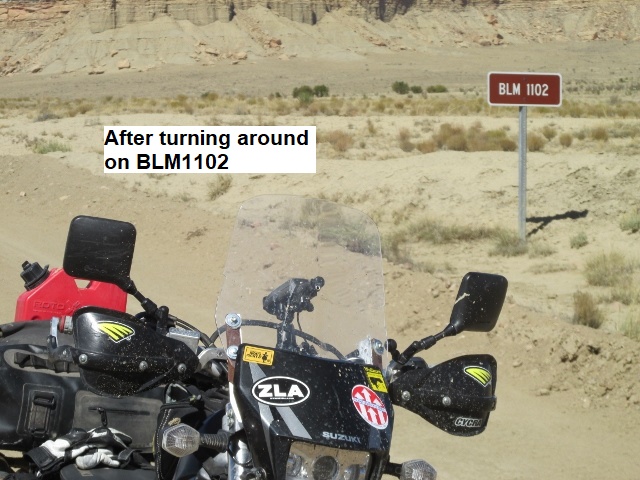
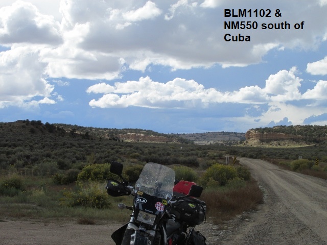 I’ve finally made it to US550 15 miles south of Cuba at 3:25. Ridden 135 miles so far, part of that being my unintended detour. As I rerouted, I followed CR39 for a ways and came to paved road NM24 and headed north. I followed it to the point where it crossed BLM1102, the same road I’d turned around on, but east of the washout. Just out of curiosity I turned west on BLM1102 to see if I could ride west all the way to the washout. After a couple of miles I came to a “lake” in the road and decided, “enough is enough”, turned around and rode back to NM24 and continued east on 1102 toward US550. It was further than I thought … 18 miles from the junction of BLM1102-NM24 to US550. As I rode this stretch of road that’s notorious for deep sand, out of nowhere a rider appeared headed my direction. To set the stage for this encounter, it’s important to picture just how desolate and isolated this country is. As we roll to a stop beside each other, he looks at me and says, “Hi, Jerry, how’s it going?” I thought he looked familiar and after a confused pause I said, “I’m good. How do I know you?” He laughed and confessed that he had run into Yancey in Cuba who told him to be on the watch for me. He was aboard a BMW GS800 and as we visited for a few minutes, he related he was on vacation and lived in North Carolina. The sand turned out not so bad, though there were some mud bogs necessitating riding into the brush again to get around them. Shortly after the BMW guy, I ran into a couple of bicyclists, a very friendly man and wife riding the Continental Divide Trail from Canada. They were lean and brown from the sun, and were still about 3 days from the end of their ride at the Mexico border. It’s really clouding up behind me to the west and I fear the three riders may be in for a wet ride this evening. They’re all camping, so I sure don’t envy them. My idea of camping is a warm, dry room and a good shower. BLM 1120 eventually hit US550 and I rode 15 miles north to Cuba. Met Yancey in Cuba about 4 and listened to him complain about the terrible traffic going through Albuquerque (poor baby! At least he was dry). My mileage for the day was supposed to be about 120 miles but turned out to be 150.
Day Eight – Thursday, 4 October 2018
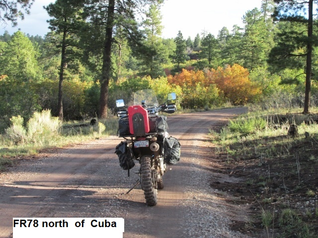
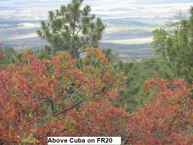
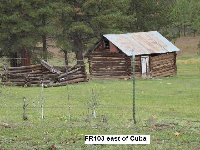
I left Cuba about 8 o’clock, have been riding about 40 minutes with the temp in the mid 50’s. Only covered about 15 miles and half of that distance was on CR11 pavement getting up to the forest, east of Cuba. FR78, FR20, and FR533 were pretty muddy as I climbed into the mountains above Cuba. The mud wasn’t deep and the rock base provided good traction so was able to make 25 mph most of the time. Had to ride around and through several mud bogs, but fun riding as the road climbed up to 8000 feet. Rained some more locally last night but looks like a nice day for riding. FR533 dropped off the mountain to NM126, so I’ll ride it a few miles east and then back into the mountains on FR103.
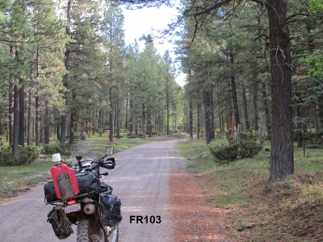
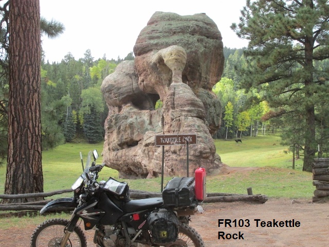
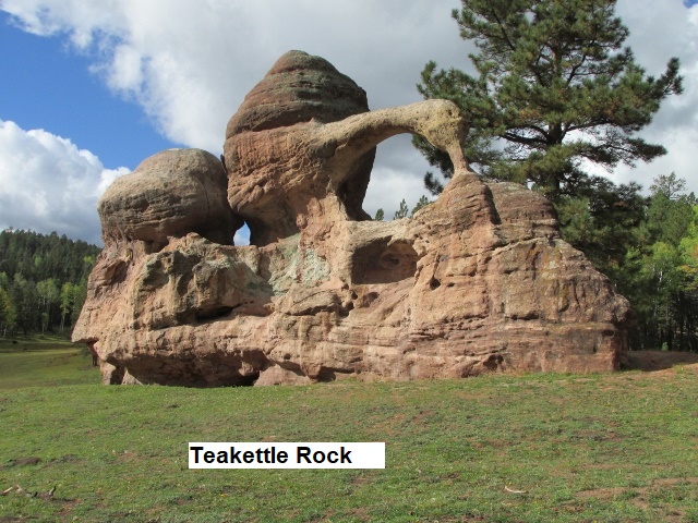
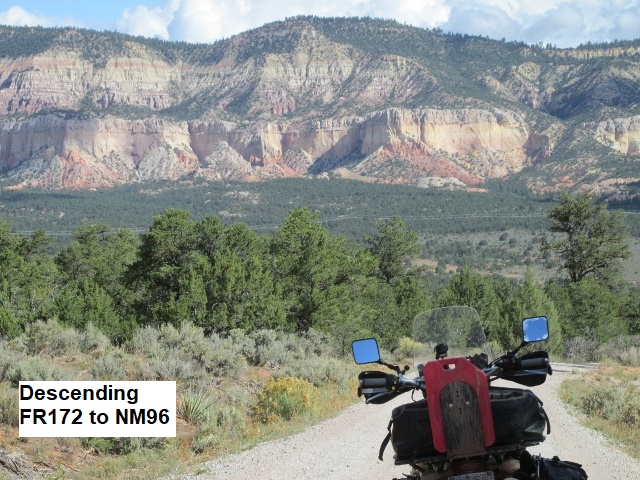
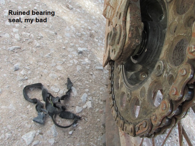
It’s my last day of riding, number seven … the clock says 10:15 and the odometer shows 50 miles. Warmer now as the skies have been clabbering up and then clearing for the last hour, so don’t know what to expect rain wise. FR103 has been a great mountain road, narrow, not too much rock and pretty fast as it winds up and down through the San Pedro Mountains in the Santa Fe National Forest. At one point I scared up a buck and some doe mule deer. Earlier, I stopped to take some photos and as I walked up to the back of the bike, I saw something hanging down from the rear sprocket. Upon closer inspection, it was the nylon strap from my tank bag. As I unwound it from around the axle, I discovered the friction generated by the strap had melted the plastic dust cover off my wheel bearing … not good! Glad it happened on the last day and not earlier. The bearing should be fine for the rest of the day. I stopped by Tea Kettle rock and snapped a picture then later ran into two groups of bear hunters with their pickups loaded with hunting dogs. I turned off FR103 onto FR172, a really fun road which quickly plunged me off the mountain to NM96 where I am now. NM96 will carry me several miles east. Beautiful day, beautiful ride!
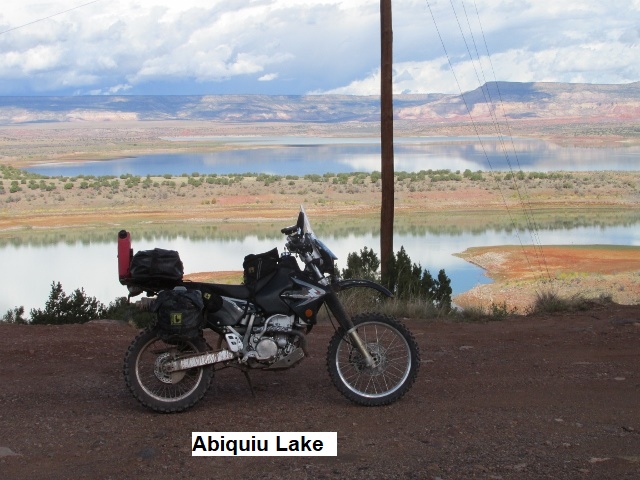
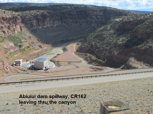
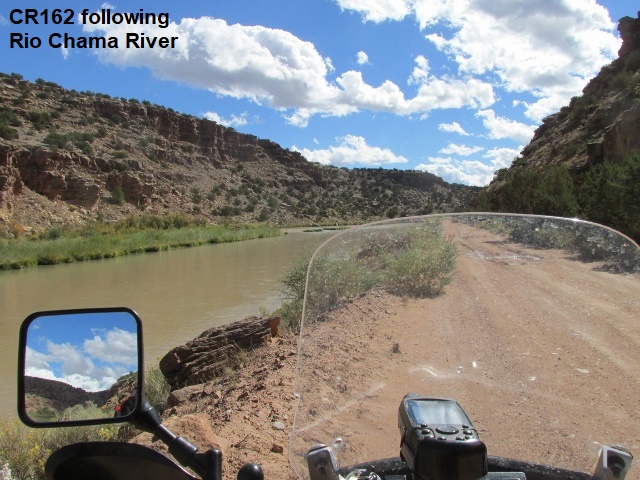
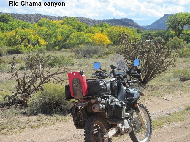
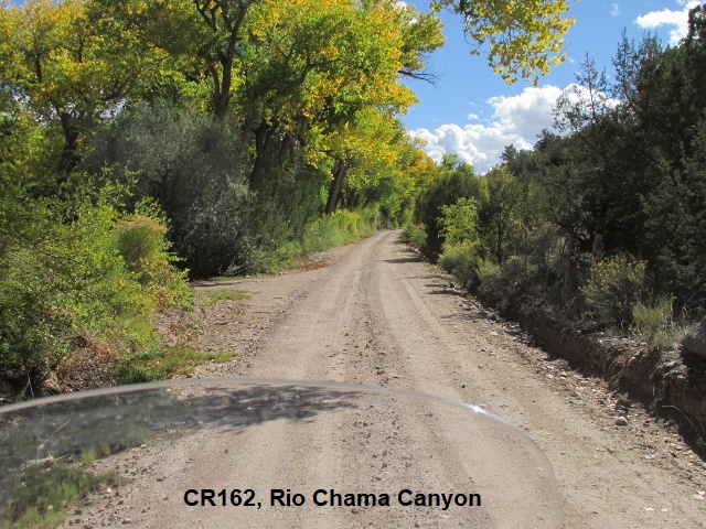
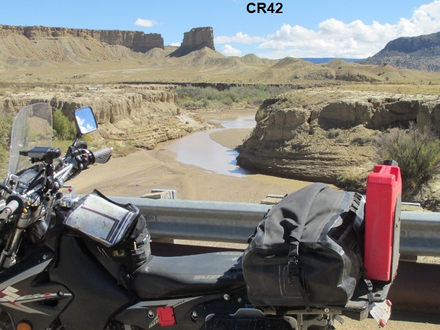
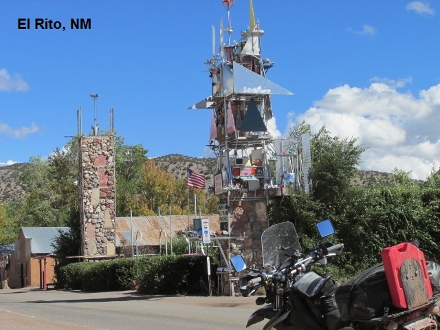
Just filled my 4 gallon tank in Abiquiu (Abby-Q). It’s 11:30, have been 80 miles. At the station, I chatted with a young fellow about my age who was interested in my adventure. Seems his boys were also into dual sport riding. As I approached beautiful Abiquiu Lake and its dam a few miles from town, my trail bailed of NM96 down some switchbacks to the bottom of the spillway. From there CR162 followed the Rio Chama river through a canyon for 7 miles before connecting with US84 at Abiquiu … great little road, very scenic. From Abiquiu, I’ll travel east on CR155 for a couple miles and then north on NM554 to El Rito. I toyed with taking a look at the “expert” track on FR23 and FR137 to El Rito to see if I dared ride it. However, when I realized it was 15 miles back on US84 I blew it off. Probably a fortuitous decision since I’ve read it’s the most technical stretch of the NMBDR with some rock shelves to climb over. Good way to get hurt on the last day!
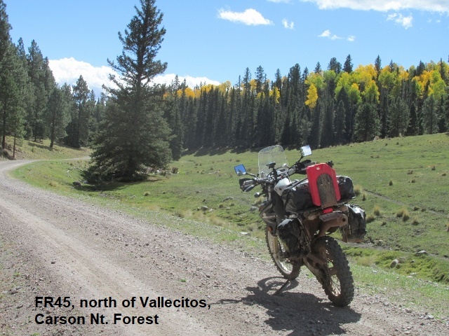
Now at the junction of FR712 and US64, I check my watch and see it’s 3 o’clock and I’ve ridden 160 miles. From El Rito, I rode north on NM110 to FR 559 then east on FR106 to FR44 to Vallecitos. Turning north again, the route took me over NM111 to FR45 to FR110 to FR42 to FR91 to FR712 to US64. Got all that? Most of that was great riding though a light rain fell on me for a ways. The map showed that FR42, a good road, would drop down quickly to US64. However, the track showed to bear left on FR91 where a sign warned “Not good for passenger cars”. Well, it wasn’t good for old farts on dual sports either☺. It was probably the most eroded forest road I’ve ridden this trip, climbing steeply up the mountain. It was a real booger, especially since it was raining again. At some point I stopped and put my raincoat on as I was getting wet and cold. FR91 finally topped out about 10,000 feet and I made an easy descent on FR712 to the highway. Back in 2012, this stretch from US64 back to Abiquiu was a section of the Trans America Trail that Greg and I had to skip when it got dark on us.
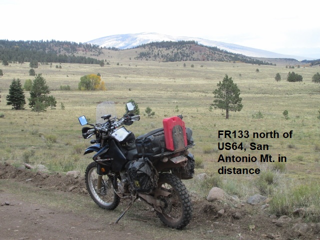
Crossing US64, I began climbing again on FR421 to FR133 where I’m now parked. US285 and the prominent silhouette of San Antonio Mountain are only about 15 miles east as a crow flies. For the moment, I’ve left the mountains behind but the elevation is still about 8,000 feet as I gaze out over wide mountain valley. As I enjoy the pleasing views to the north and west, it’s still chilly and very windy.
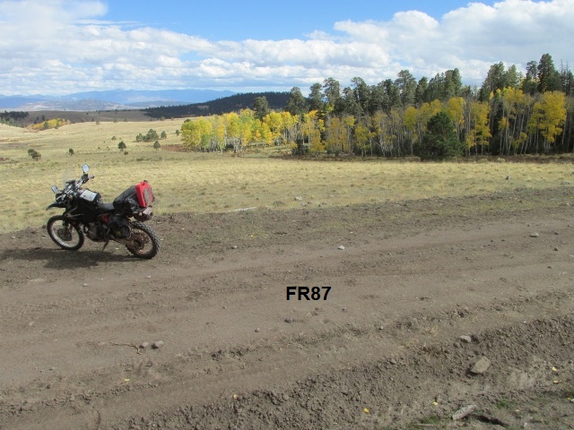
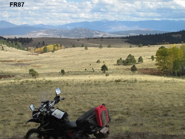
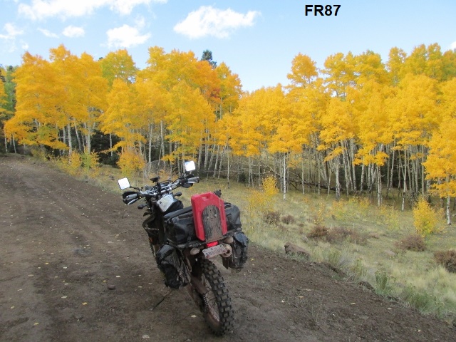
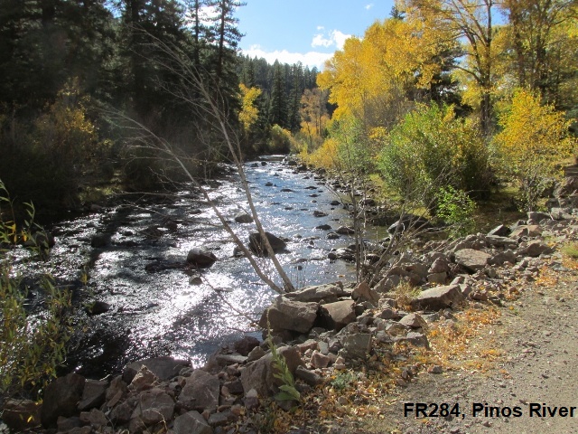
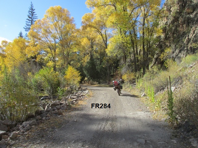
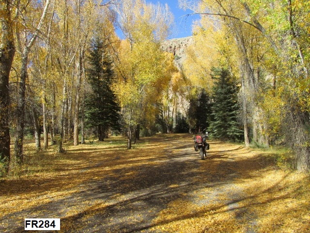
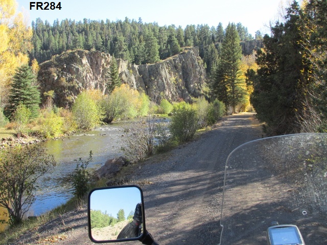
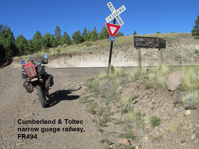
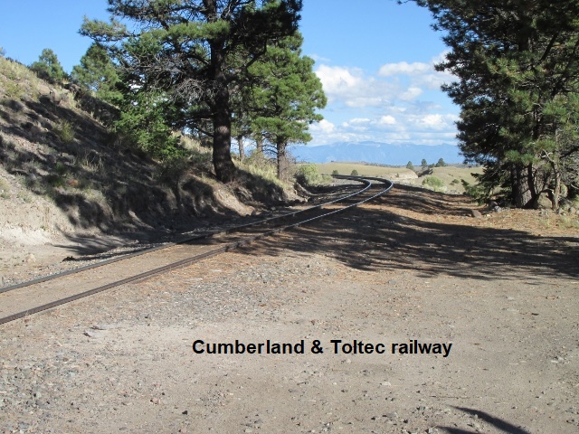
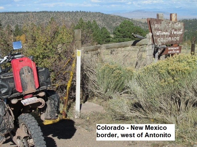
Just now arrived at CO17 after riding 195 miles. It’s 4:45 and Antonito, Colorado lies about 10 miles east. After my last stop, I forked left off FR133 onto FR87 which took me back into the forest and more rain, then turned north on FR87A. This two-track road was really steep and rocky as I climbed to over 10,000 feet. The storm clouds caught up with me on FR87A and I encountered more rain and this time some pea-size hail. The road eventually descended to FR284 which followed the banks of de los Piños River for a ways. It was a beautiful ride along the river with several free camp sites. Suddenly the road made a 90 degree, super steep turn onto FR494 … had to stop, back up, and get a run at it. I’m sure the designers of the NMBDR had a good laugh as they included this road and took one last shot at making me crash. The road continued very steeply for about a mile with large loose rocks and numerous washouts. Topping out, I crossed the Cumberland & Toltec railway and then about a mile later I crossed into colorful Colorado. The sun is out now, and I’m heading east on CO17 to meet Yancey in Antonito. It was a great day of riding, a challenging and fun way to finish a great dual sport trip.
 Yancey and I had agreed to meet at the Cumberland & Toltec railway station. He was already there when I arrived, so we quickly loaded the DRZ in a really stiff, cold wind. Just as quickly, I changed from my riding gear and he fired up the Tacoma and headed us south on US285. We made it about 85 miles south to Espanola, New Mexico. It was already dark as we checked in the Days Inn and walked next door for a burger. Turned out to be the worst motel of the trip, barely beating out the one in Cuba for last place. The drain in the fiberglass tub had fallen though the tub floor, so water wasn’t going down the drain but rather under the tub. Yuck!! The other clientele appeared somewhat rough so Yancey parked a chair in front of the door and both our pistols spent the night on the nightstand.
Day Nine – Friday, 5 October 2018
Our trip home was somewhat anti-climactic after 8 days of great adventure. We grabbed breakfast at the “Golden Arches” in Santa Fe and took I-25 southeast to US285, then I-40 to Santa Rosa, US84 to Fort Sumner, Clovis, and finally home to Lubbock. Thank you Lord for a safe trip!
EPILOGUE
The chimes are about sound as 2018 draws to a close this New Years Eve day. About two and a half months have passed since I finished the New Mexico Backcountry Discover Route. It was a great trip and I’m very grateful to the guys at BDR for all their work in designing the route. I hope to ride more discovery routes in the future. The variety of terrain was amazing and the difficulty level about right for my riding abilities. New Mexico has been called “the land of enchantment” and with good reason. At times it seems like a third world country, but perhaps that’s part of the enchantment. It was one of the “fun-est” rides I’ve made!
My ever trusty DRZ performed perfectly, the only issue being caused by my carelessness with the nylon strap. Overall, the weather was excellent. My only regret was the rain that made me miss 70 miles of the route west of Reserve. We ate well (too well?), and the motels were decent (all but Espanola).
I appreciate Yancey’s 45 years of friendship and for tagging along and helping me pursue the adventure. Also, I’m grateful to my wife Lyn, who humors me and even encourages my two-wheel hobby and need to explore. Most of all, I thank the Lord for the health and means to continue to ride at 72, and for giving Yancey and me a safe journey.
 As I type this epilogue, this cold last day of 2018, I’m not sure what’s next to ride, but Lord willing, I will ride again. Maybe … maybe I can persuade Kenny, Milton, and Jeff to ride the NMBDR with me next fall. If not, I may try the Colorado BDR.