Oklahoma Adventure Trail
September 30 – October 8, 2016
Ride Report
by Jerry Lewis
![[IMG]](https://jerryblewis.com/wp-content/uploads/2021/01/img.jpeg)
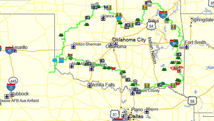
The Oklahoma Adventure Trail
I began planning my solo dual-sport ride of the Oklahoma Adventure Trail (OAT) during the summer of 2016. Having downloaded the GPS tracks from the ADVRider forum, I proceeded to highlight the tracks on photocopied map pages from an Oklahoma gazetteer. A GPS track is easy to follow when trail riding but I have learned to depend on paper maps as a backup while also allowing me the “big picture” of the remote areas I pass through. As usual, I planned my trip for early fall to take advantage of the typically mild weather. My ride would cover approximately 1,700 miles, so I shod my Suzuki DRZ 400S with new knobbys, front and rear. One major change I made to my bike in preparation was to install a WER steering damper. They are neither cheap nor easy to install, requiring the complete disassembly of the front triple-tree. However, I had heard great things about the advantages of a damper when riding in sand and rutted or rocky roads. The damper is a type of shock absorber which limits the sudden back and forth wobble of the front wheel, the condition that makes sand riding so squirrely. Also, I installed a “manual” cam-chain tensioner after my brother-in-law Jeff’s experience with his DRZ 400. When his stock “automatic” tensioner spring broke, it trashed the top-end of his motor and left him holding a $1,200 bill.
Since I would be riding “solo”, I carried a Fast-Find Personal Location Beacon (PLB) and a SPOT GPS Tracker. Both units have the capability of summoning first-responders to my exact location should I be seriously injured (assuming I’m conscious to activate them) ![C:\Users\Jerry\AppData\Local\Microsoft\Windows\INetCache\IE\A8PXQW29\emoticon[1].jpg](https://jerryblewis.com/wp-content/uploads/2021/01/c-users-jerry-appdata-local-microsoft-windows-ine.jpeg) In addition, the SPOT allows my wife and brother Dave to follow my track in real-time. Dave likes to follow my track as I’m riding, “flying” the track on his computer using Google Earth.
In addition, the SPOT allows my wife and brother Dave to follow my track in real-time. Dave likes to follow my track as I’m riding, “flying” the track on his computer using Google Earth.
As with most adventures, half of the fun is the planning and anticipation. As my departure date drew near my excitement continued to build. But as usual, there was a bit of dread in the back of my mind that something would prevent me from going.
Following is an internet description of the Oklahoma Adventure Trail:
The Oklahoma Adventure Trail, known as the OAT, is 70% dirt road 30% paved road route circling the state of Oklahoma. The route travels through some of the most diverse, historical and scenic areas of Oklahoma. The route was developed by Oklahoma dual-sport riders to be free and open to everyone.
The OAT can be ridden on a dual-sport motorcycle, bicycled, hiked, or a 4×4 vehicle. Some roads are paved, red dirt, brown dirt, yellow dirt, gravel, deep gravel, rutted, tore up, rocky, straight curvy, flat, hilly, etc… etc… you get the point.
Some interesting areas the route goes by is Gloss Mountain, The Great Salt Plains, Graffiti Wall, Ingalls out-law shoot out, Heavner, the Ouachita Mountains and National Forest, Hugo’s Circus performer cemetery, Carpenter’s Bluff bridge, Turner Falls, Mount Scott, Quartz Mountains, Fort Washita, Medicine Park, and Black Kettle National Grasslands to name a few.
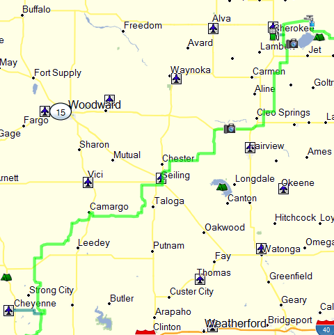
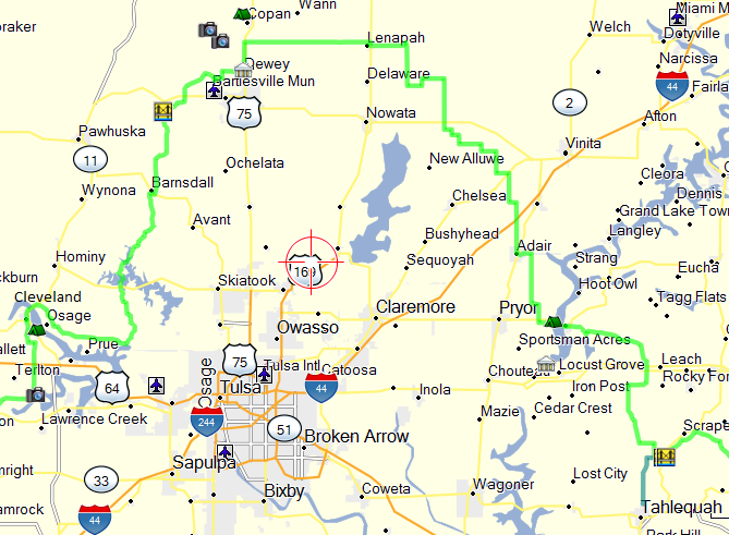
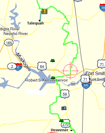
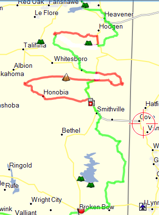
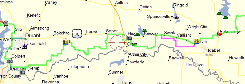
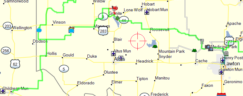
Below is a map of the OAT track I followed …
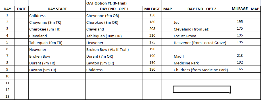
Below is my Itinerary for the OAT. I followed Option 1 precisely with the exception of the K-Trail which I’ll explain further on.
Day One – Friday, September 30, 2016
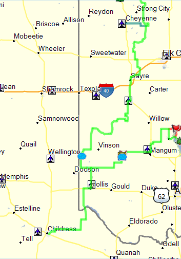
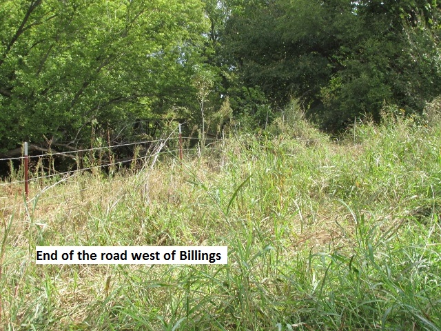
My wife Lyn and I left Lubbock about 7:30 a.m., trailering my DRZ the 145 miles to Childress, Texas. Since the OAT is a loop, the closest point for me to connect was 8 miles north of Hollis, Oklahoma. Therefore, my plan was to begin riding at Childress and follow dirt county roads for 40 miles to Hollis. 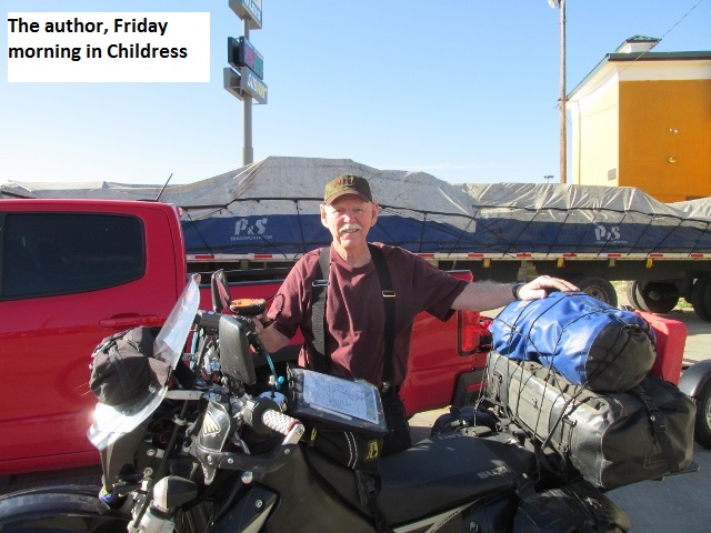

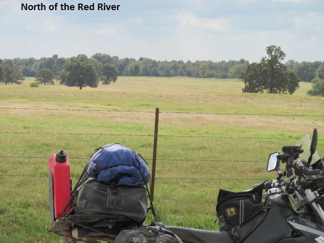
After a goodbye hug from my long-suffering wife, I left Childress at 10:15. As I traveled east under sunny skies, the temp was in the low 60’s so I was glad I’d decided to wear my coat. I soon encountered some sand and was very pleased with the stability the steering damper provided. As I topped a rise, I scared up a rafter of 20 or so large turkeys … don’t know who was more startled, me or the turkeys. Around eleven I crossed the Red River on FM 680, traversing a new concrete bridge which recently replaced the old single lane metal truss bridge. The Red is wide and sandy at the crossing with only rivulets of water. 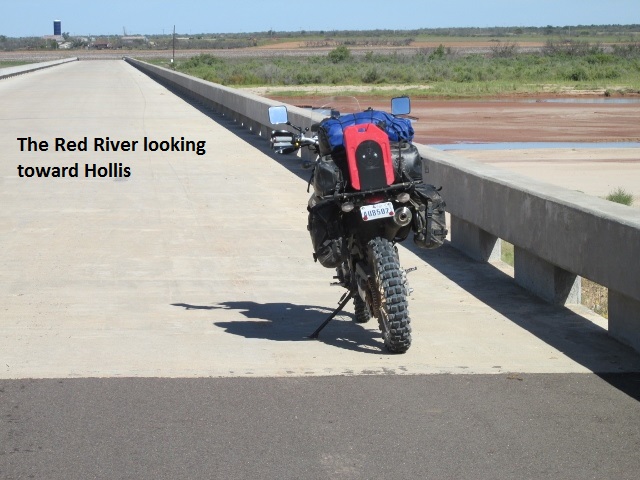
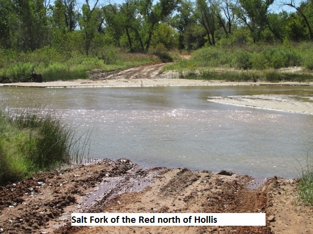 After an excellent BLT lunch in Hollis, I started the OAT Loop traveling in a clockwise direction. Heading north I came to my first water crossing a few miles later. The Salt Branch of the Red River was running about 18” deep as I cautiously forded the hundred feet of mud and sand. That western most portion of the OAT had numerous sections of deep sand and I was really appreciating my steering damper.
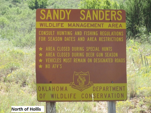
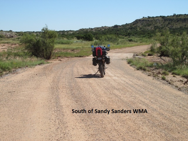
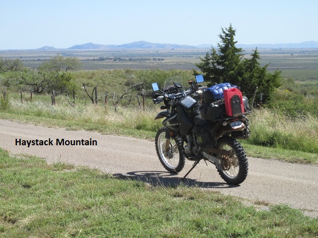
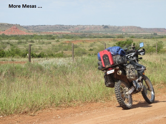
There was a brief stretch of pavement on SH 9 and SH 30 taking me across the Elm Branch of the Red before heading east on CR 1378. The road meanders across scenic ranch land as it passes south of Sandy Sanders WMA. Heading north, then east and back north, the road was really a great ride as I passed by numerous mesas just west of Haystack Mountain.
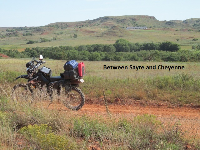
 A few miles south of Sayre, I topped out on an escarpment that reminded me of the Caprock in west Texas. The valley below was a pastoral scene as I rode gazing down from the escarpment. Eventually, I rode off the cap on a fun switchback into the valley where I met a group of six dual-sport riders on KTM bikes. We stopped and visited a few minutes and I learned they were also riding the OAT, but in a counter clockwise direction. We discussed road conditions both ways, and as I rode away I mentally kicked myself for not asking where they started and if they were riding all or only part of the OAT.
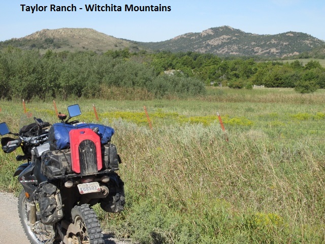
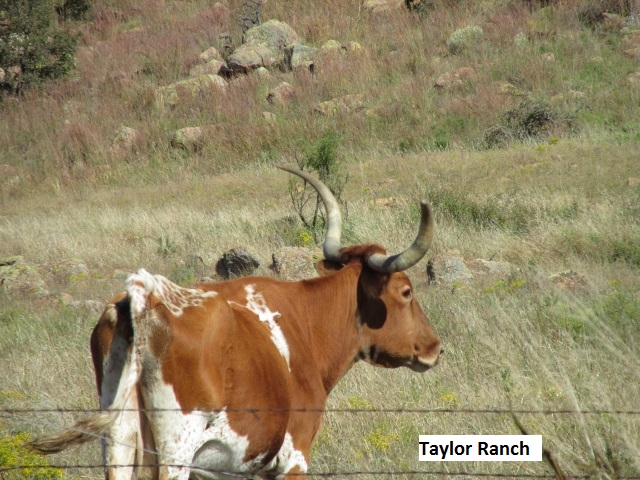
I crossed I-40 and rode into Sayre where I gassed up and grabbed a candy bar. I left Sayre on paved county roads, skirting highways and passing over railroad tracks and I-40 before eventually connecting again with dirt roads. These roads passed through some rugged breaks and across three private dams and small lakes. As I crossed the Taylor ranch, I slowed to a crawl as I passed within yards of their front door. It was a really nice ride through a picturesque valley surrounded by hills.
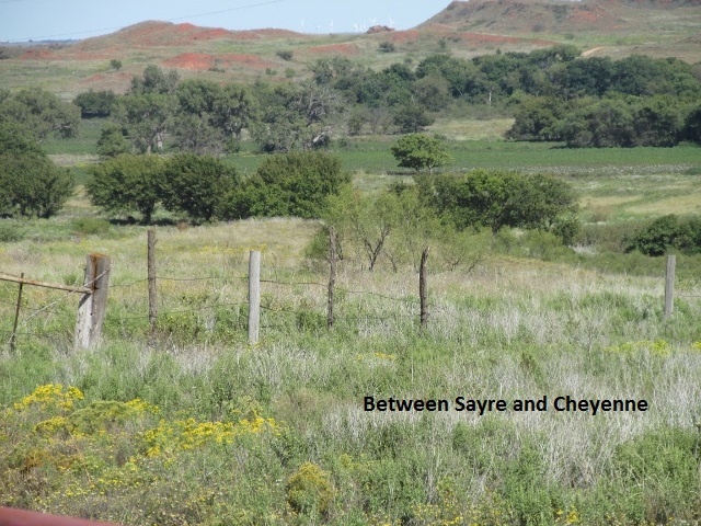
The pleasant ride through the breaks continued as I neared my nine mile detour off-route to Cheyenne. Traveling west into Cheyenne, I noticed a large cloud bank to the northwest and hoped it didn’t portend rain.
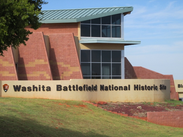
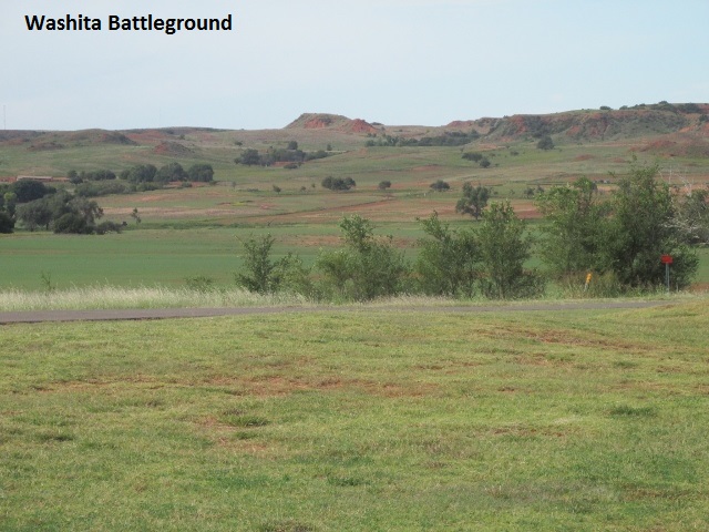
About 4:15 I rode west of town a couple of miles and toured the Washita Massacre Visitors Center. The center commemorates the raid on Cheyenne chief Black Kettle’s camp on the Washita River by General Custer. Occurring in November of 1868, Custer’s raid resulted from previous raids by renegade braves from Black Kettle’s camp.
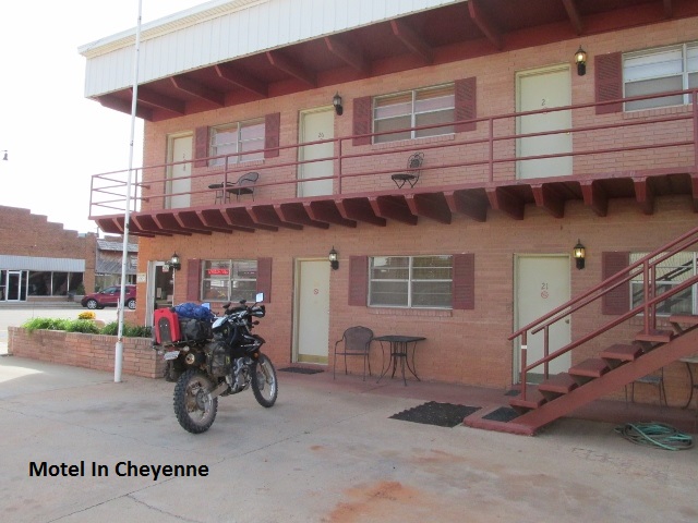
I returned to Cheyenne and checked into a comfortable mom-and-pop motel in downtown and inquired about supper options. At the proprietor’s suggestion, I enjoyed some great Mexican food and a Corona seated in a former Catholic church, complete with stain-glassed windows. It was an excellent first day having covered approximately 150 miles.
Day Two – Saturday, October 1, 2016
In the stillness of the morning darkness, I walked across the street to a store front café and broke my fast over some excellent eggs and pancakes. Returning to the motel I spent some time organizing my maps before commencing my morning “load-up”. Leaving town around 8:30, blessed with a breezy 60 degrees, I motored nine miles east on blacktop to rejoin the trail. The terrain was a mixture of grassland and rolling hills dotted with a variety of trees. Akin to yesterday, the roads seemed to follow the high ground revealing scenic valleys below. 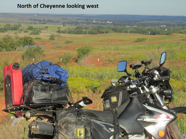
A good size coyote scampered across my path, and then shortly after six gobblers quickly took flight when I spooked them.
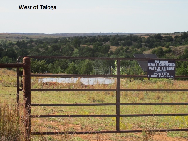
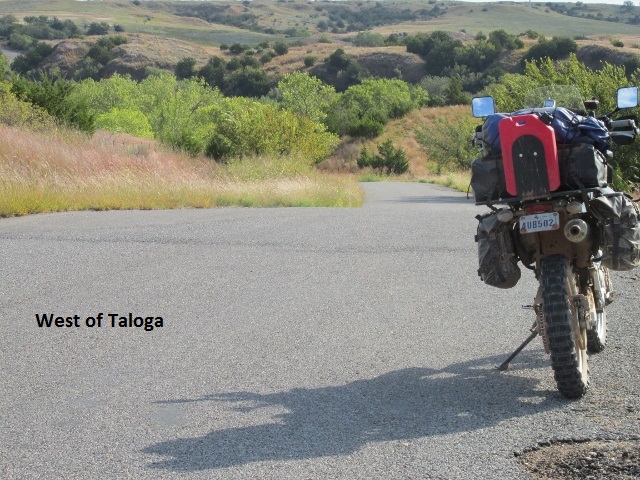
As I rode north of Leedey, the wind began to pick up from the south and I encountered a second coyote. The land there was more open, mostly populated by oil and gas fields. The trail dropped into a pretty valley before connecting with pavement. SH 34 took me across the Canadian River and into the tiny hamlet of Camargo. As the morning slipped by, I traveled easy gravel roads with occasional blacktop and thus made really good time. Around 11:30 I had covered 80 miles, and as it was warming up, I stopped and traded my coat for my armored shirt. Once again I had the opportunity to appreciate my damper as I hit some deep sand in a cultivated area. I turned north just west of Taloga and rode into Seiling. After filling up my bike, I filled my tummy at the Broken Arrow Café, enjoying the ubiquitous cheeseburger and cherry pie.
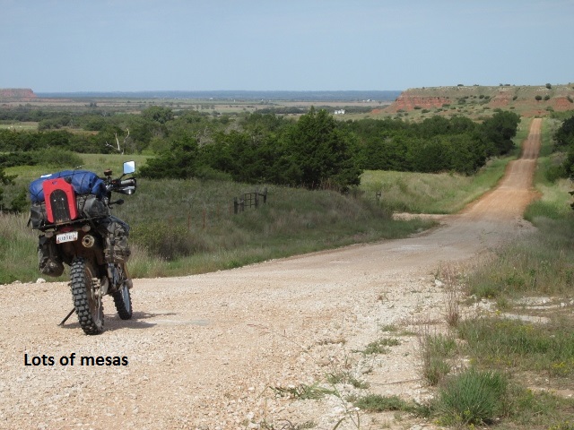
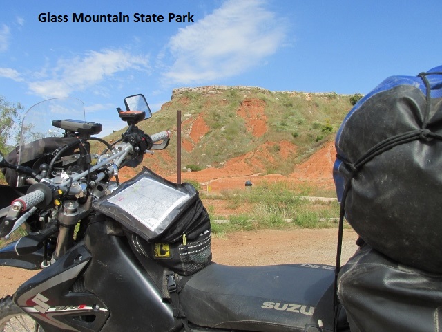
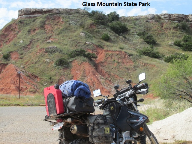
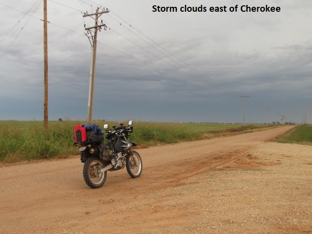
Shortly after lunch I met up with CR 52, a really great road which meandered through picturesque ranch country. Mid-afternoon I passed through a scenic landscape where I was surrounded by large stand-alone mesas. The mesas are part of the Blaine Escarpment. When I intersected US 412, I stopped for some pictures at one of the mesas known as Glass Mountain State Park. The name Glass Mountain comes from the sparkling selenite crystals on the slopes and tops of the mesas.
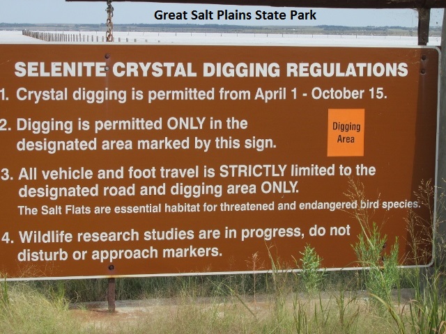
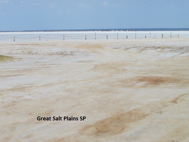
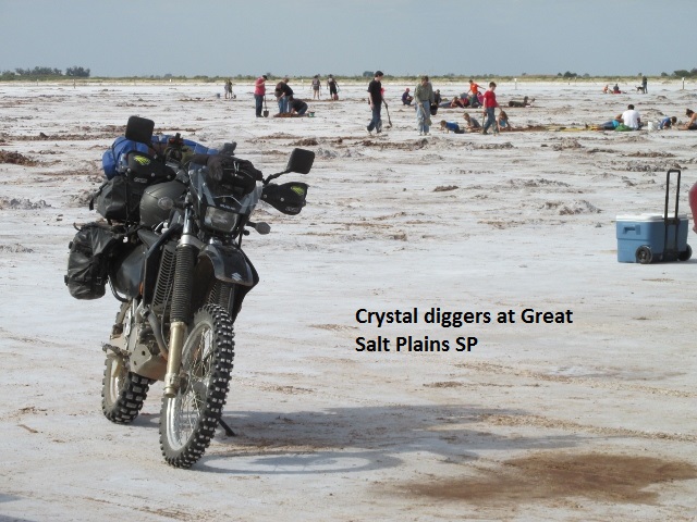
Just east of the town of Cherokee I came to the Great Salt Plains State Park. I rode out onto the salt and watched a large number of people digging in the salt. I quizzed a fellow there whose two kids were busy digging. He informed me they were digging for selenite crystals. The barren landscape of the Great Salt Plains is comprised of salt left over from an ocean that covered Oklahoma in prehistoric times. The moisture below the salt continues to create the crystals about a foot below the surface.
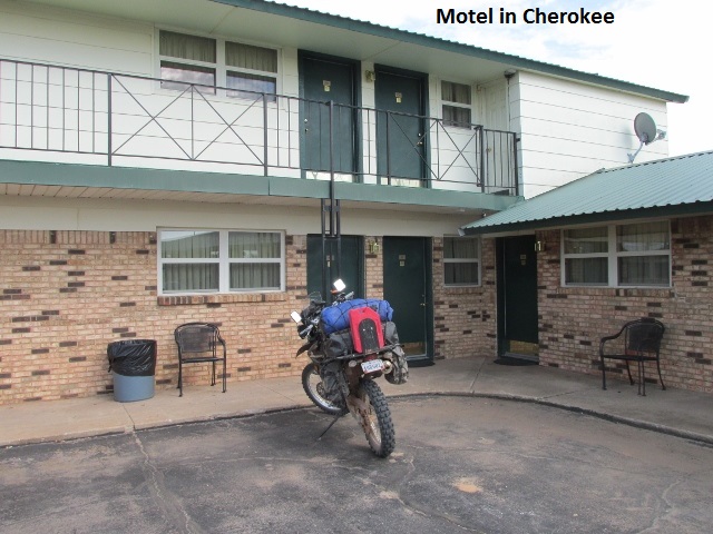
My destination for the night was Cherokee so I rode the three miles off-trail and got a room at the Cherokee Inn and enjoyed a shrimp dinner next door at the Cherokee Steak House. It was a pleasant if largely uneventful day of riding. I rode 180 miles through some really pretty country and enjoyed really mild weather. I’m glad to report my DRZ is performing without a hitch.
Day Three – Sunday, October 2, 2016
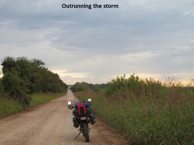
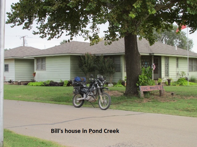
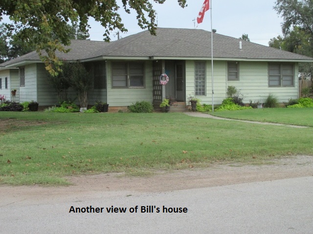
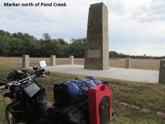
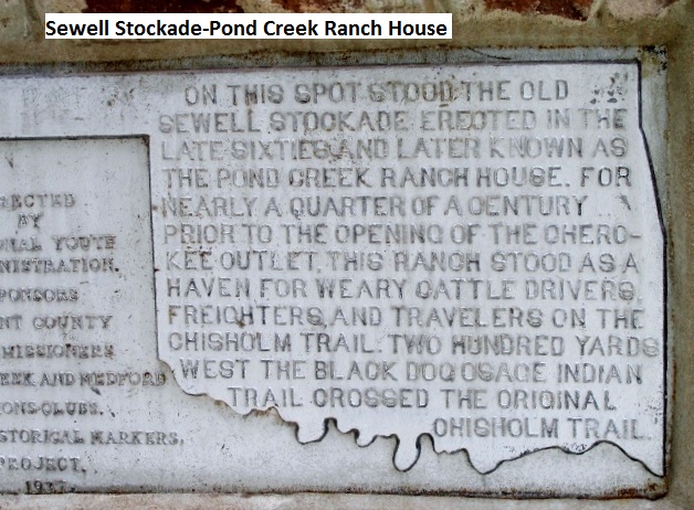
I really like to begin my day with a hardy breakfast, so I was bitterly disappointed to learn that there were no cafés open on Sunday morning. So I hiked across the highway to a convenience store and purchased a coffee and readymade sausage-egg-biscuit to stave off starvation. Actually starvation might have been better … the food was awful. As I walked back to the room it was still dark and I observed lightning northwest of town. I checked the radar on my phone-app which revealed a large thunderstorm a few miles northwest moving toward Cherokee. As I would be traveling east, and since the radar looked better that direction, I loaded up in record time and left in an attempt to get ahead of the storm. As I rode around the east end of the Great Salt Lake I was just behind a light shower that had left damp roads but, thankfully, no mud. The OAT track passes 3 miles north of the town of Pond Creek so I detoured there to take some pictures for my mom. Mother was married to a nice man by the name of Bill Hawkins who owned a house in Pond Creek. They lived there a few years in the late ‘80’s until his passing. I wasn’t sure of the address so I rode up and down streets until I found the house and took some photos.
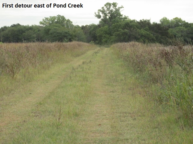
I made my way back to the trail and continued east, passing by cultivated fields with no interesting photo ops. The skies were overcast but the rain had stopped and the temperature was round 60. Just east of Pond Creek I ran into my first detour of the trip. The 210 county road turned to grass two-track and then to overgrown weeds, finally ending close to a muddy creek, sans bridge. Taking an alternate track a mile north, east, and south I was back on the trail.
While rumbling along enjoying the cool morning, I flushed out the first deer of the trip, a doe and fawn and then a mile later, another doe. My deer whistles seemed to be helping as the deer ran away from me at right angles.
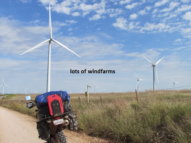
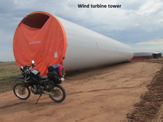
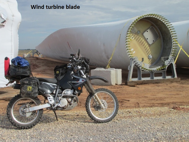
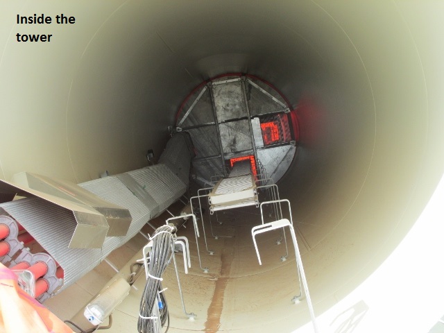
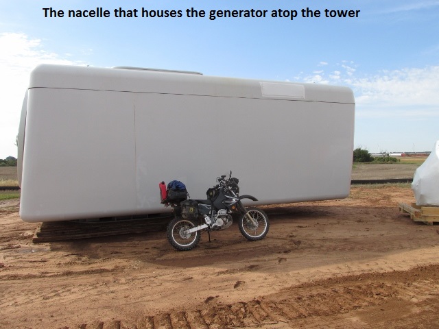
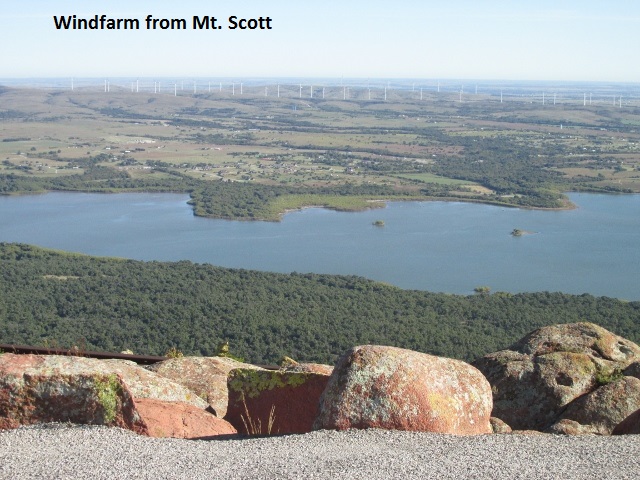
Just east of Hunter I passed by a wind-farm under construction. To aid with size perspective, I parked the bike in turn next to a turbine blade, tower, and nacelle which were lying in a field and grabbed my camera.
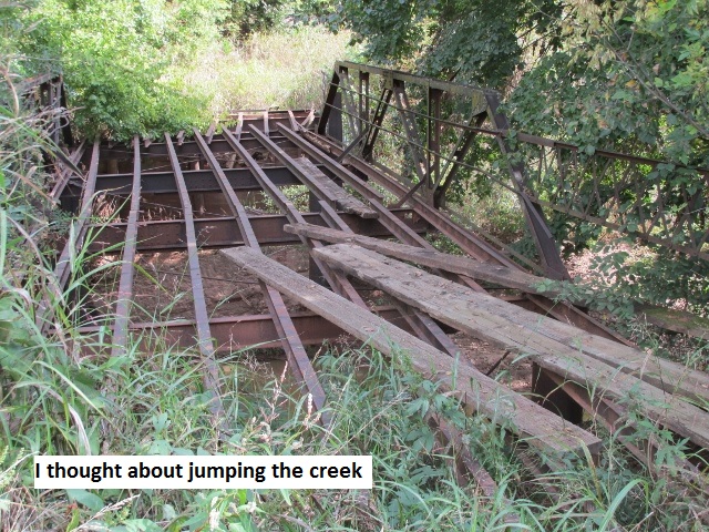
About five miles further I came to my second road closure. I was traveling by a creek and through a draw when I saw a barricade off to the side and the road began to appear unmaintained. After a mile or so I came to a creek and the metal skeleton of an old truss bridge. So it was a mile back west then south and then east another mile and I was back on track. It’s fortunate when detours are required that the road-grid is based on one-mile increments.
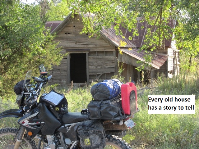
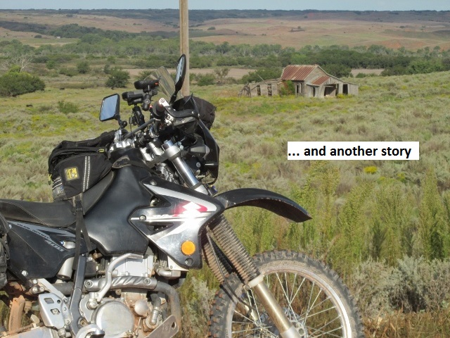
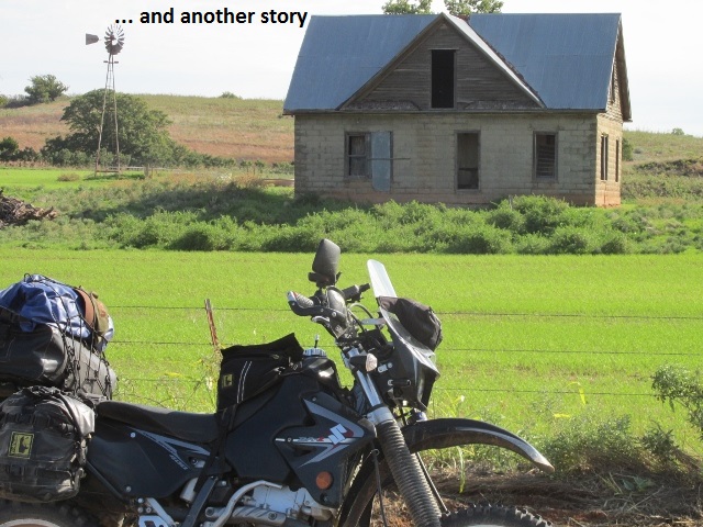
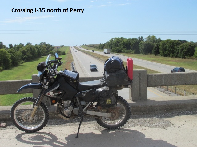
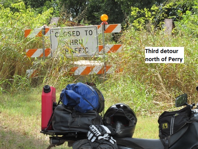
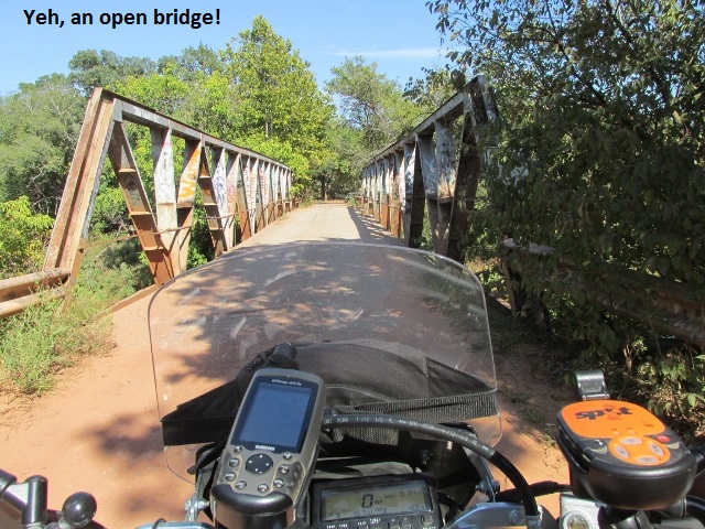
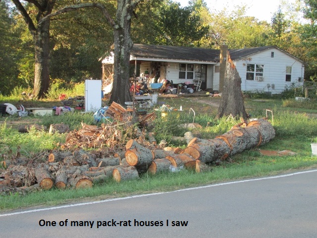
I was fascinated by some of the 100-140 year old houses I’d ridden by … many still inhabited and in excellent shape. Ten miles later, I crossed over I-35 north of Perry and came to another barricaded bridge on CR 120. With no way through, I turned around and made my usual mile-square detour. In this part of Oklahoma I’ve experienced a plethora of creeks. Having come to a third detour, I began to wonder how long it had been since the OAT creators had actually ridden these county roads.
Around noon, while riding through mostly flat terrain, I turned off-track two miles into Perry for fuel and then lunch at Pizza Hut. With the temp in the 80’s I changed to my armored shirt and headed east out of Perry on US 64 to CR 150. CR 150 turned out to be one of the “fun-nest” roads yet … heavily wooded and up and down graded dirt, it soon led me around the south end of McMurtry Lake on a winding blacktop.
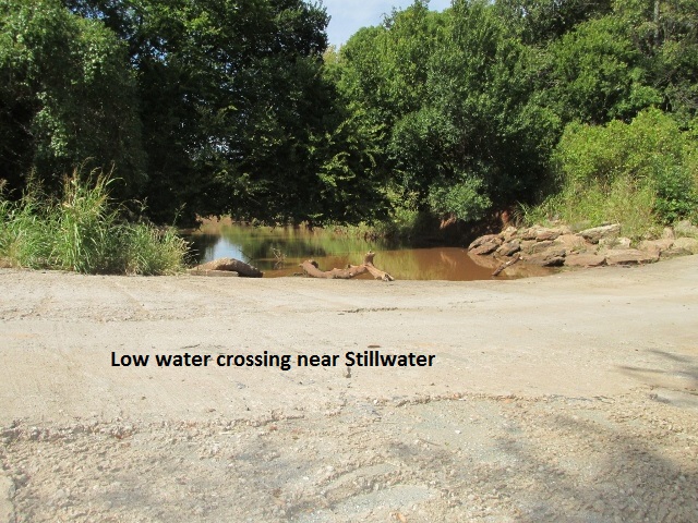
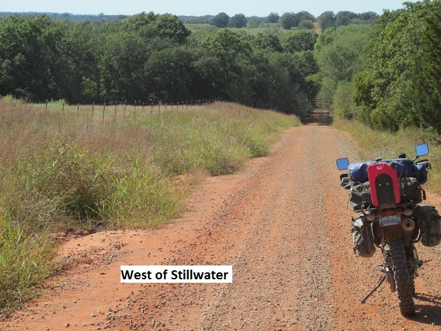
A bit later, I bypassed Stillwater to the west while traveling through pretty tree covered hills on rutted but dry dirt roads. South of Stillwater I thought I was going to have to detour again when I came to signs and barricades with heavy dirt equipment blocking a low water crossing. Being a Sunday there were no workers, so with some trepidation I rode down the ravine and around the equipment and continued south. I’ve found that riding off-road it’s best not to “believe everything you read”, especially road construction signs.
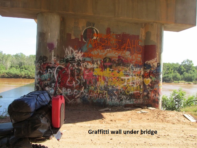
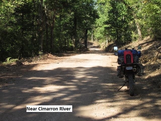
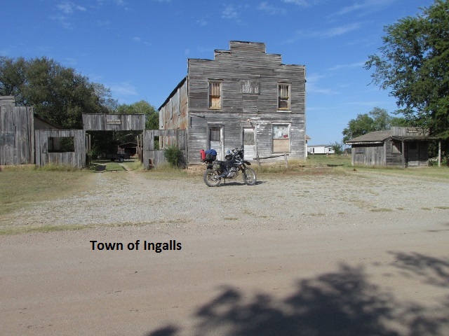
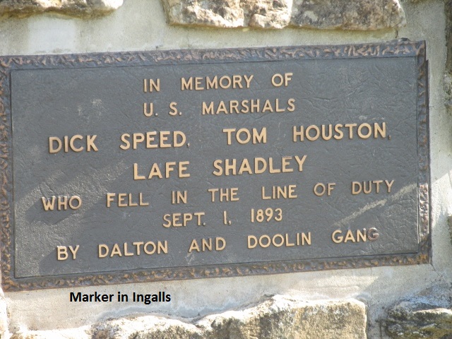
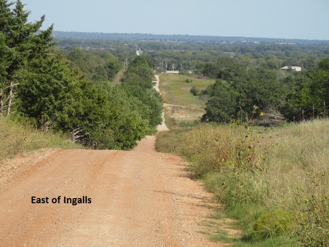
Paralleling the Cimarron River, I stopped and took a picture of the “Graffiti Wall” before turning north to the tiny town of Ingalls. There I took a picture of the Outlaw Marker commemorating a shootout between lawmen and outlaws in the 1800’s.
While riding narrow dirt county roads and approaching steep hills with limited sight distance, I have learned to move as far to the right as possible as I top the hill. Case in point … just east of Ingalls I nearly had a head-on with a woman in a pickup. As we simultaneously topped such a hill she was dead center of the narrow road. My precautionary habit probably saved me from a serious collision or at the least, a fall.
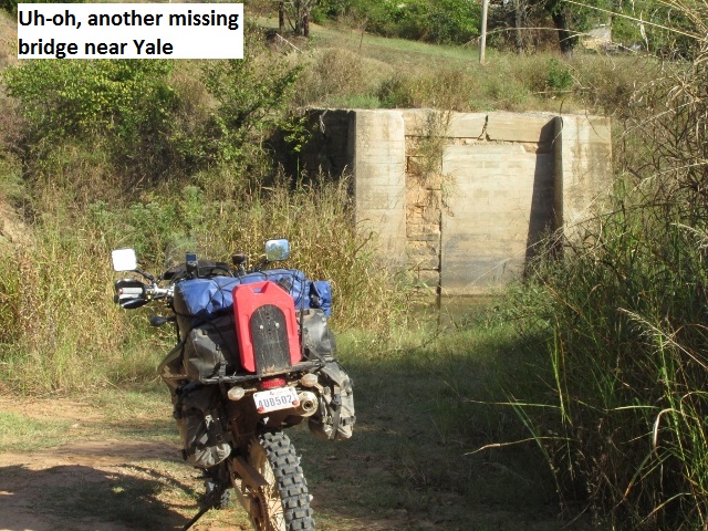
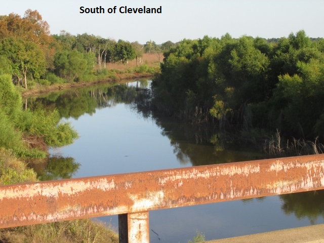
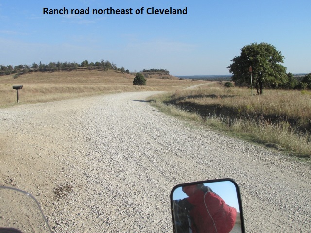
As I neared the town of Yale, I came to my fourth missing bridge where all that was left was the concrete abutment on each side of the creek. I back tracked a couple of miles to SH 51 and continued east past Yale. I arrived in Cleveland on the Arkansas River at Keystone Lake at six on the nose. 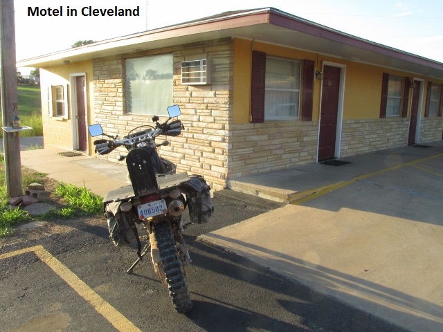 After the longest day so far … 235 miles … I was really tired as I checked into the Budget ZZZ motel.
As I reflected on the day I considered the afternoon’s riding to be the best so far … winding and roller-coaster-like roads passing through heavily wooded and scenic countryside. The day was pretty uneventful … except for dodging rain, four detours, being chased by dogs, and nearly being run over by a pickup.
Day Four – Monday, October 3, 2016
Leaving my room in the dark, I walked across the highway to a nice restaurant and enjoyed some eggs and pancakes. Bumming a pen off the waitress (I’d lost mine), I went back to the room and transcribed my audio notes from yesterday. I’m trying something new on this trip … using my I-phone to make audio memos as I travel and then putting them on paper in the evening. This makes it much easier to recall the events of the day.
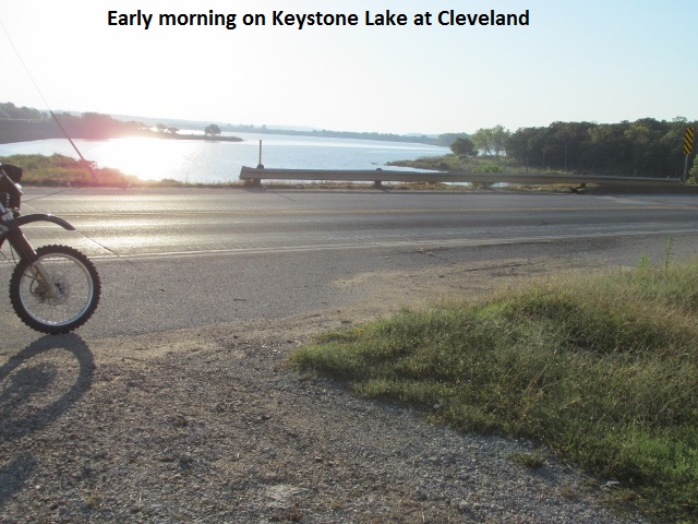
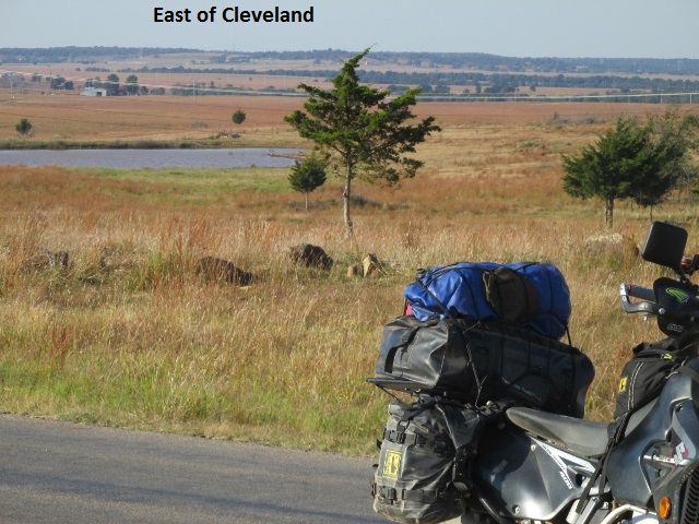
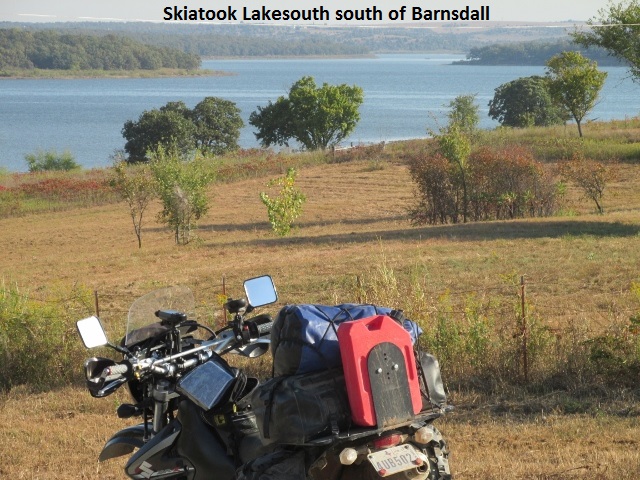
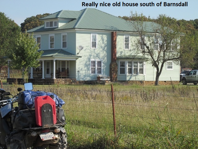
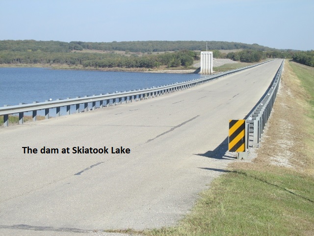
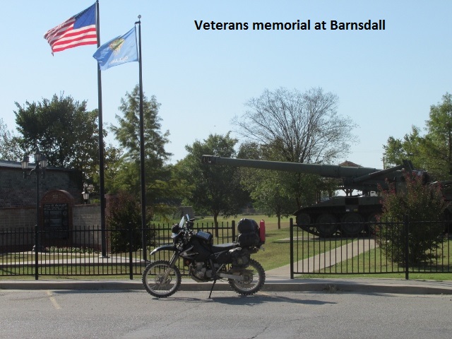
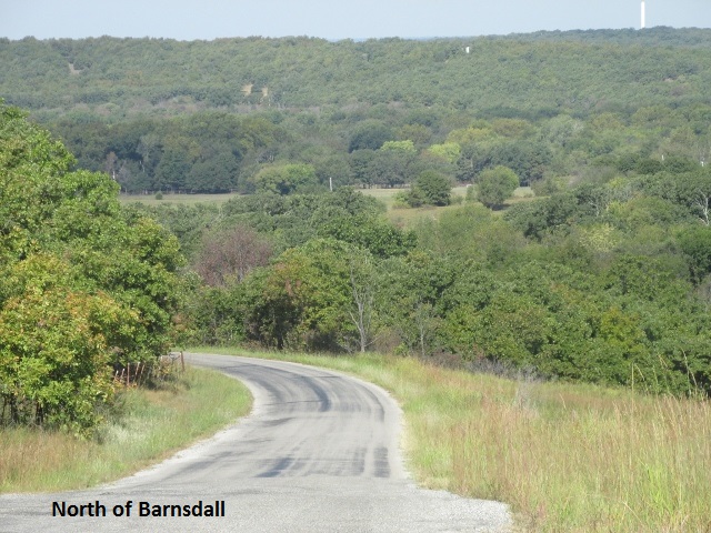
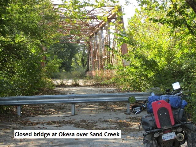
Leaving Cleveland around 8:30, under clear skies and about 60 degrees, I crossed Keystone Lake and followed its shoreline on CR 1200 for about 18 miles. It was good riding over a winding blacktop. When I turned north on CR 1401 the land opened up with fewer trees. The road was a well maintained cattle-ranch road that wandered across grassy rolling hills. Continuing north I passed through the nice small town of Barnsdall and then passed by the Woolaroc Wildlife Preserve. A few miles from there I came to a minor detour at Okesa … the old truss bridge across Sand Creek was closed and a new concrete bridge offered passageway about a 200 yards away.
Riding the pegs and living the dream, I was startled when a large dog came out of some bushes and nearly dumped me. Putting my new braking practice to use, I managed to avoid him. More than one article I’d read suggested riding with two fingers on the front brake leaver. I had been trying to make that a habit on this trip. Doing that cuts down reaction time as well as limiting the pull force (only two fingers) for panic stops. What I’d discovered was that it was also a tactile reminder to “use” the front brake in an emergency situation and not rely solely on the rear brake.
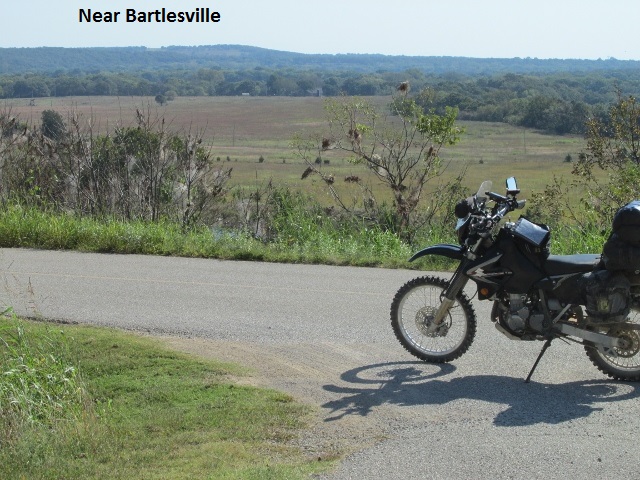
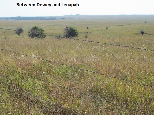
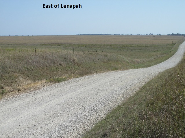
As the morning passed on, I was still traveling nice ranch roads which led me just north of Bartlesville. 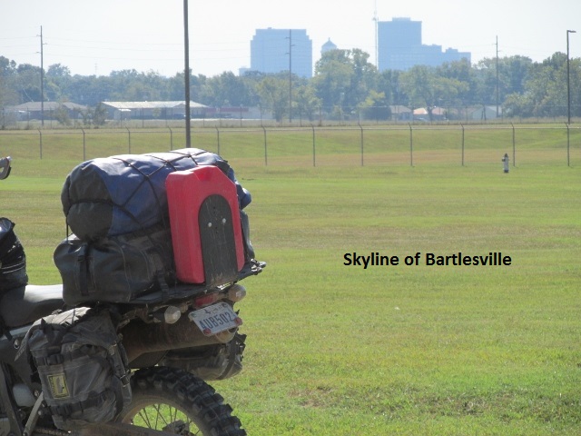 The dirt roads gave way to a paved CR 3012 where I wound past ranchettes, complete with really nice rural housing for Bartlesville. A little further east I went through Dewey, home of the Tom Mix Museum. It was a little before noon when I decided to continue on to Lenapah for lunch. To my chagrin, Lenapha had neither gas nor food. It was, however, geographically the farthest north I would travel on the OAT. With my one-gallon Rotopax in reserve, I had plenty of gas, so I fought off my hunger pains and rode on.
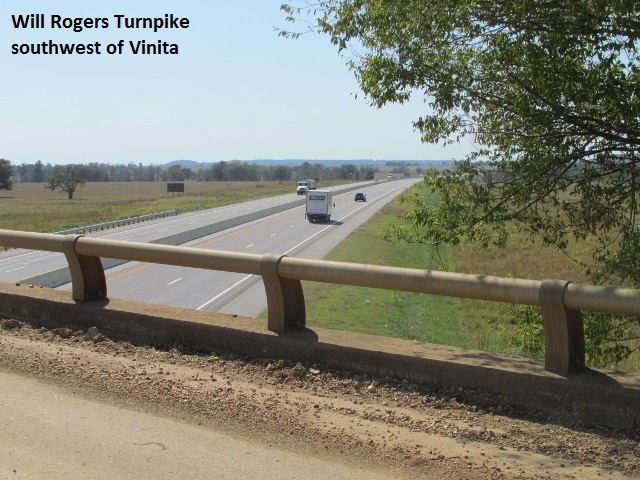
Traveling east across more ranches, the rolling grasslands had very few trees, only occasional “pump jacks for the cattle to scratch their back on”. When I began a zigzag course south and east, the woodlands reappeared once again. Some of the roads were really nice two-track, always fun to ride. About 1:45 I crossed the Will Rogers Turnpike (I-44) just southwest of Vinita. I had previously traveled this area while riding the Trans America Trail in 2013. I made it to Adair about 2:00 and pigged out on a cheeseburger, tots, and blackberry cobbler with ice cream (No supper tonight!)
Chock-full of food and fuel I continued south from Adair then crossed huge Lake Hudson at Salina. East and south of Salina, I enjoyed some of the best and most technically challenging roads thus far. On narrow and rocky, Colorado-like roads, I passed through almost continuous tree-tunnels. As I traveled through the dense forest I was having a ball, finding my two-wheeled groove!
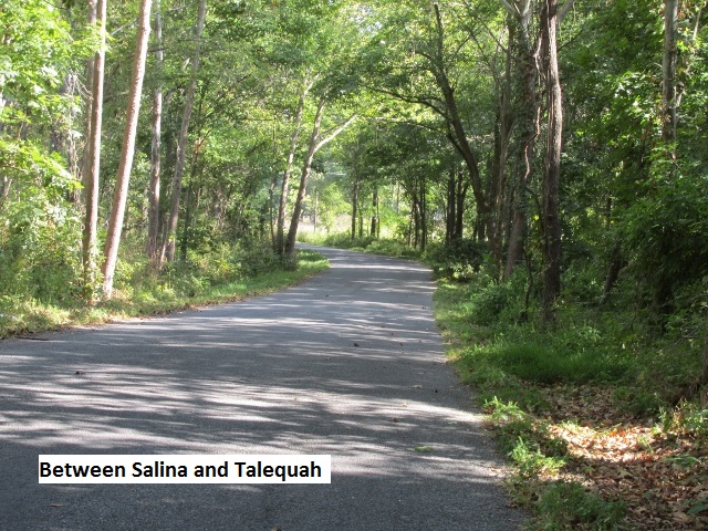
Taking one of my longest off-track detours, I rode 10 miles into Talequah for the night. After checking out some really dumpy court type motels, I got a room at a nice Quality Inn. I really prefer the courts when they’re kept up as I can park in front of my door. At the Quality with inside room access, I had to use a porter-cart to get all my gear to my room.
It was a fun day, blessed with good roads, good weather, and no falls or bike problems.
Day Five – Tuesday, October 4, 2016
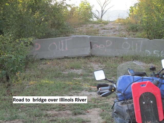
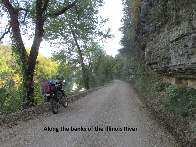
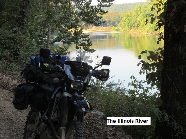
After leaving Talequah about 8:15, I enjoyed a nice blacktop road meandering through the woods on SH 82. A couple of miles after rejoining the trail, the GPS track led me to a missing bridge across the Illinois River. Studying the map, it appeared I’d have to make a 10 mile detour north to get across the river. Thinking there surely must be another way across, I decided to explore south on SH 10. Thankfully, I discovered the new concrete Combs Bridge about an eighth of a mile away that crossed the Illinois.
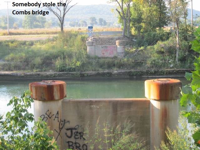
I was really glad I was able to cross the river there after I saw what a great road CR 563 turned out to be. Postcard worthy, CR 563 follows the bank of the Illinois surrounded by lush foliage down to the waters edge with overhanging rock bluffs along the south side of the road. The 40 mile ride from Combs Bridge to SH 62 was just fantastic. The area was really remote and the rocky, up, down, and around track nearly wore me out. The roads reminded me of my ride through the Arkansas Ozarks on the Trans America Trail … really dense forest, fun but more technical riding. I wasn’t able to do but 20-25 mph as I traveled through almost nonstop tree tunnels. I didn’t see a lot of wildlife except a small deer and some wild turkey.
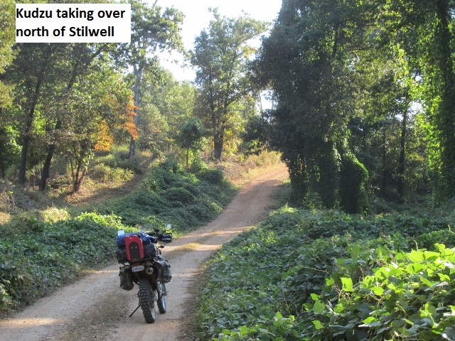
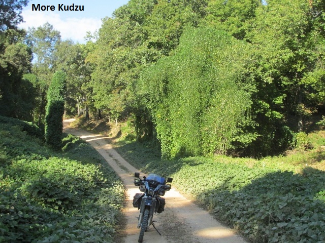
The excellent forest roads continued till I hit SH 51, which took me 4 miles into Stillwell. I’d only been about 60 miles and at 11:00 it was a little early for lunch. I located a Subway and grabbed a sandwich and some Gatorade, planning on finding a pretty spot for an impromptu picnic. After about 15 miles, I came upon a small rural park at a road juncture. I dismounted and enjoyed my lunch in the company of a fine-looking horse munching grass a few yards away.
After lunch the wind got up but I continued to enjoy more tree-tunnel ranch roads … love it! Many miles later, I came to a winding SH 101 that connected for a long paved stretch on SH 64B and into Muldrow.
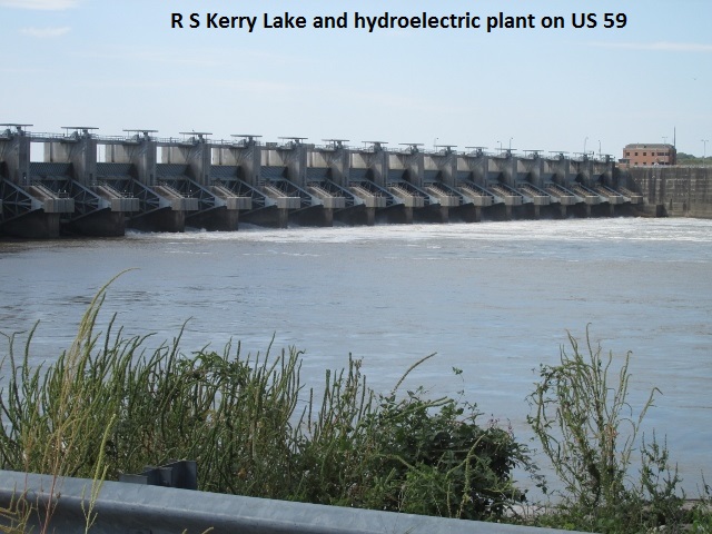
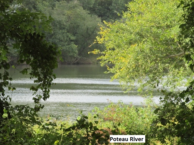
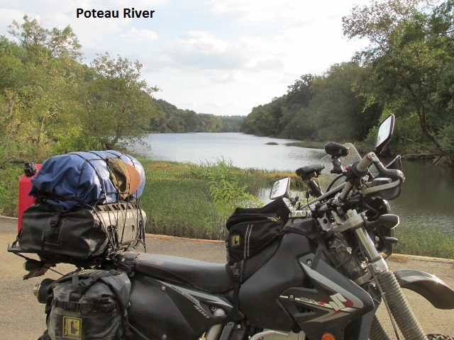
Leaving Muldrow, I crossed under I-40 and rode SH 41 to US 59. US 59 crosses Robert S Kerr Lake and hydro-electric plant on the Arkansas River. I exited 59 for a short stretch of the old abandoned highway and river bridge before turning onto some county roads that took me south to Bokoshe. Passing south of the town, the asphalt gave way to some fun dirt once more.
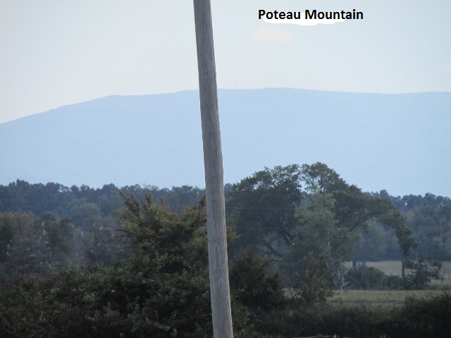
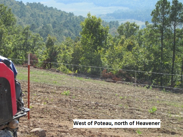
Via some nice switchbacks, I rode up and back down Buck Creek Mountain enjoying beautiful overlooks of the valley below. In the distance I could see the blue-grey silhouette of Poteau Mountain.
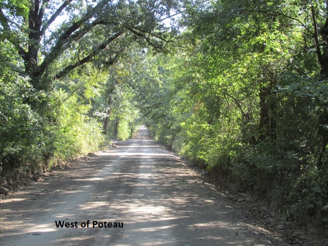
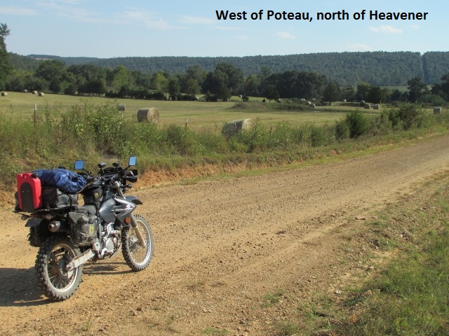
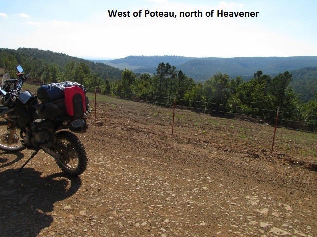
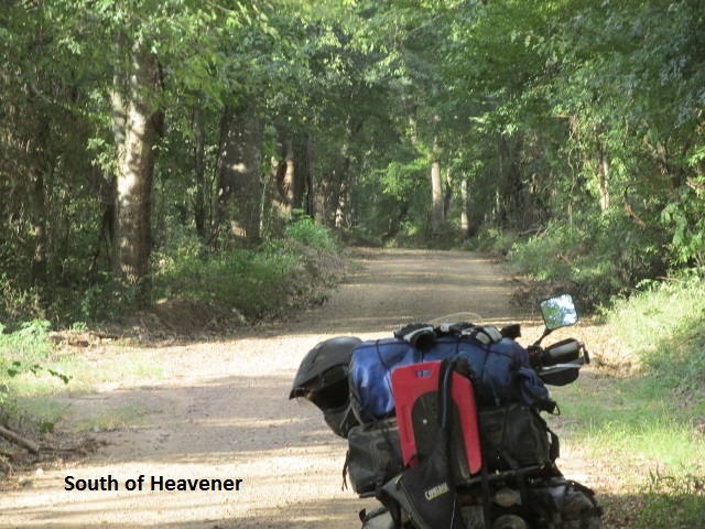
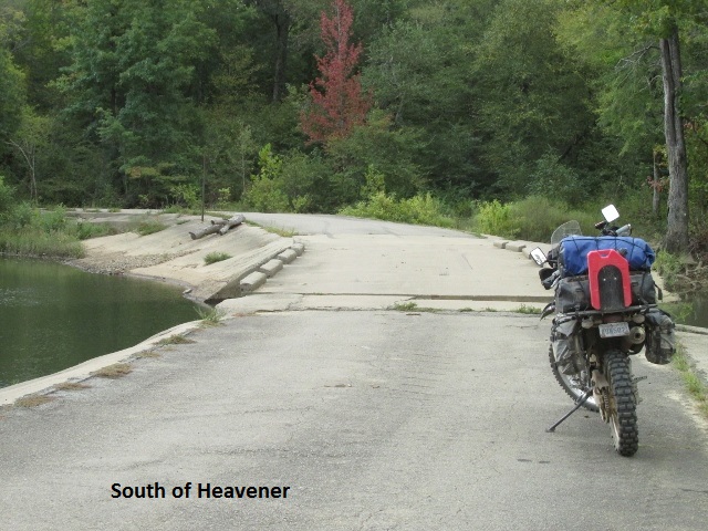
 As I rode dirt roads south, I encountered some road construction which delayed me a few minutes. When the crew let me by, I had to ride freshly oiled rock and dirt up a steep hill … a little bit squirrely. Once over the hill, I traveled a great road through Wildhorse Hollow, which took me to Wister. I rode across the dam at Lake Wister and then traveled mostly pavement into Heavener for the night.
I arrived at Heavener about 4:15, having made 180 miles for the day. After checking in at the Green Country Inn, I relaxed for a bit and then found a mom-and-pop Mexican café for an excellent meal.
Day Six – Wednesday, October 5, 2016
All loaded up and ready to roll by 7:45 … I booted my GPS and realized I hadn’t loaded it with the next group of tracks. My Garmin 60CSX will only hold twenty tracks, so I had separated the OAT GPS file into two groups. Digging my laptop out of my tail-bag, I booted it up and proceeded to load the GPS with the second group of tracks. I still managed to get away a few minutes after 8:00 and left town on SH 128.
Promptly, the trail turned off pavement onto a forest service road and into the Ouachita National Forest. That road connected to CR 1550, a typical mountain road … steep and rocky as it hugged a mountain stream. While passing through a tree-tunnel, a clumsy squirrel fell from a branch above me and hit on his back, laid there a second, and then took off with what looked like an embarrassed grin on his face. It was already warm with a forecast for the low 90’s and I’d already traded my coat for my armored shirt. It had been sprinkling off and on since leaving town, and occasionally it turned to a light shower. There was no mud, but the rocks were wet and slippery.
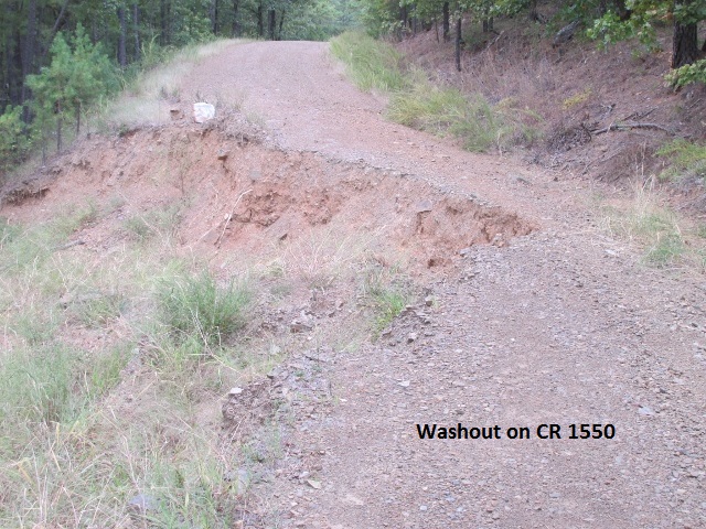
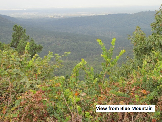
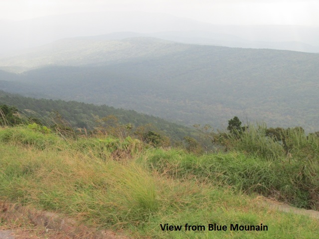
Taking a four mile ride north on US 270, I turned west on a forest service road that connected with CR 1510, the road from hell. This road climbs over Blue Mountain and I’m amazed they consider it a county road … it obviously has had no county maintenance in years. It was very steep and literally a “rock garden” with bad washouts. The road rated at least a class 2 or 3 designation. In my opinion it should have never been part of a dual-sport trail, especially for a bike loaded with gear like mine was. There is a good county road, a continuation of 1550, that parallels 1510 in the valley below. That road would still give a good look at the area but be a much safer ride. I was really thankful to get off Blue Mountain in one piece.
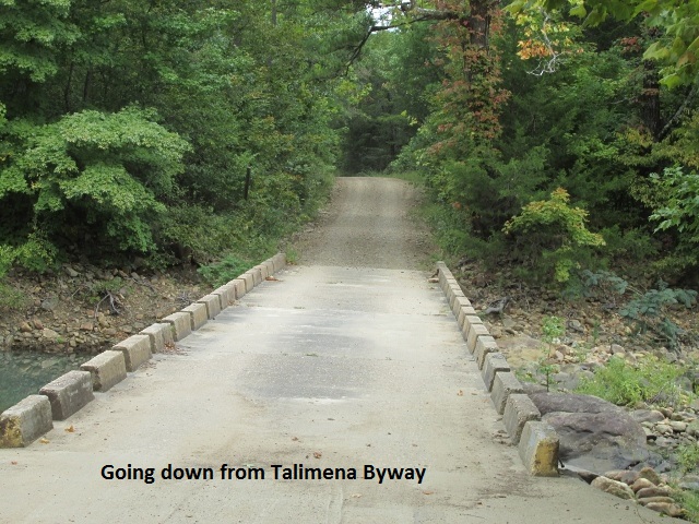
Next the trail followed CR 4585 up the side of Winding Stair Mountain. This was a technical but fun ride that connected with the Talimena Scenic Drive, a route I’ve ridden several times on my Yamaha Venture. After five miles of the Scenic Drive, the trail plunged off the mountain on CR 4664 winding down to SH 63.
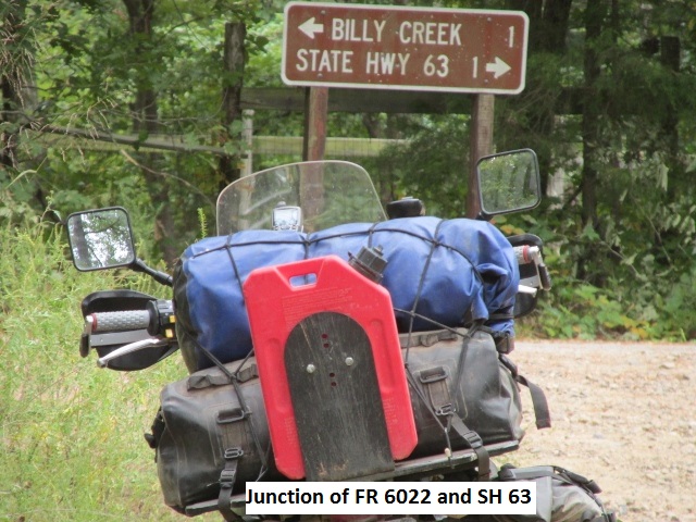
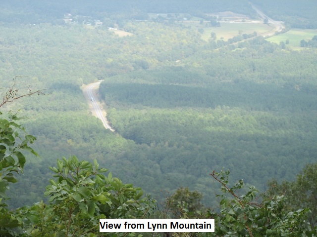
I followed SH 63 east to within a couple of miles of the Arkansas border and then south onto FR 6026. 6026 was a good road until it forked right onto FR 6025 to climb over Lynn Mountain. Well, I couldn’t believe it, but it was worse than the Blue Mountain road. It was the roughest, rockiest, steepest jeep road I’ve ever 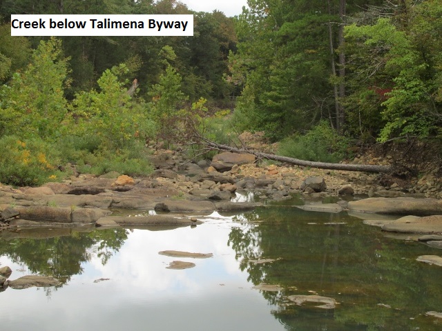 ridden, even on a pure dirt bike. It was terrible!! As I bounced over boulders, dabbing my feet and praying, I smiled to think that my guardian angel was probably worn out too. It was one of those roads that you have to keep the power on because you know if you ever lose traction you may not get moving again. Finally, I hit US 259 and rode a 100 yards up the K-Trail before turning around. It was decision time. I had planned all along to ride the K-Trail, an alternate 50-mile finger of trail to the west and back. K-Trail is designated as “advanced” where as Blue and Lynn Mountains are not so designated. If K-Trail was worse than those, I certainly didn’t have any business riding it solo. My better judgment (fear?) won out and I continued south on US 259. In retrospect, I wish I had ridden south at the junction of SH 63 and US 259 and bypassed Lynn Mountain.
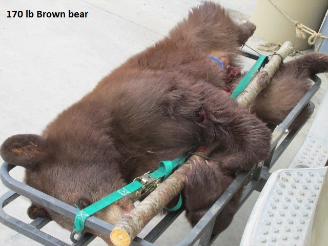
There was a “do-it-all” gas station on 259 so I stopped for lunch and gassed up. There was a SUV parked there with one of those trailer hitch baskets with a still-warm brown bear tied to it. I visited with the hunter and he told me he’d shot the 170 pound bear with a crossbow about 9:30 that morning, up in the mountains I’d just come through.
After lunch I continued south through Smithville and then followed good county roads through more of the Ouachita National Forest. There were lots of tree-tunnel roads and one long stretch on Union valley Trail. I was making better time, riding 30-45 mph on most of the roads. There wasn’t much to see except for trees so I didn’t bother stopping for pictures. The riding was fun though, and at one point I scared up half a dozen feral hogs.
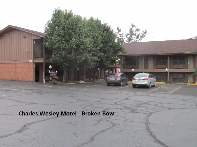
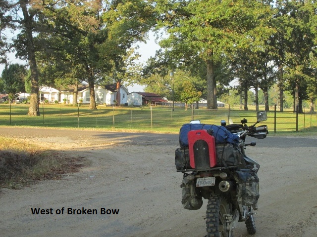
I rode into Broken Bow about 4:00 and got a room at the Charles Wesley Lodge. I’d only ridden 165 miles but it felt like 300 due to the technical aspect of much of the ride. Later in the evening I walked across the parking lot for some Mexican food at Papa Poblanos. It was a good day, though it was the most difficult day of riding yet … and I was really grateful to be there in one piece.
Day Seven – Thursday, October 6, 2016
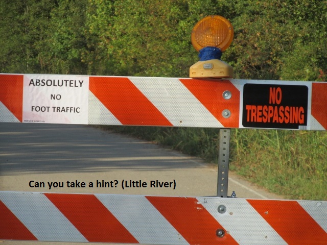
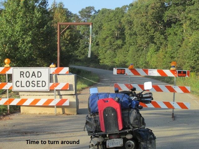
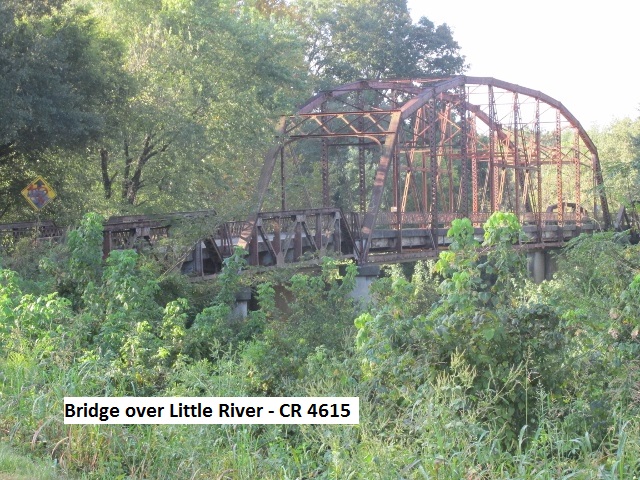
After a good breakfast provided by the motel, I left Broken Bow about 8:15 and headed west on county roads. I had traveled about 15 miles when I came to a sign on CR 2090 that said “Road Closed -Bridge Out”. I have a habit of disregarding such claims until I see for myself (Reagan – “Trust but verify”). I continued on about a mile when I came to a major barricade across the road with “No Trespassing” signs … it even said “Absolutely no foot traffic”. At that point, I decided it was time to backtrack. I consulted my paper map and found an alternate crossing of the Little River. I traveled back east on 2090 about 6 miles and turned south on CR 4615 where I crossed the Little on an old metal truss bridge. I then joined US 70 just north of Idabel and headed west to Garvin to reconnect with the trail. When I got to Garvin I rode out to CR 2090 to see what was on the south end of the “bridge out”. There was a major construction project in the process of building a new concrete bridge to replace the old truss bridge. I visited a minute with the job superintendent and was told the project should be completed by the end of November of this year.
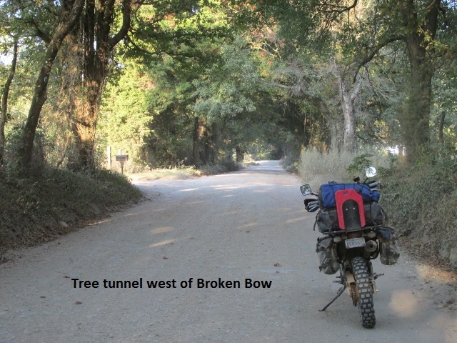
The OAT GPS track shows to continue west on US 70 from Garvin. Previously, I had laid out an alternate dirt track that ran just south of US 70. Not being a fan of pavement, I decided to ride the dirt even though it added a few miles. I was really enjoying the mild temperature and the more relaxed terrain after what I’d experienced the day before. The roads on my alternate track were excellent as I passed through scenic ranchland with occasional wooded areas. My whole morning was more of the same, following a zigzag course just north of the Red River.
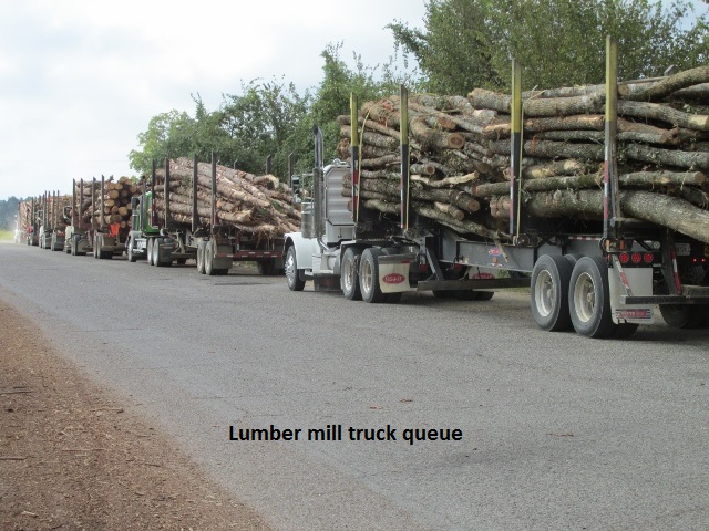
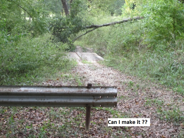
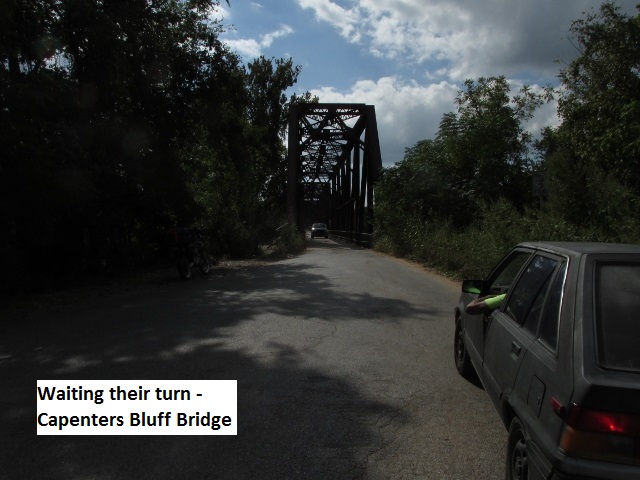
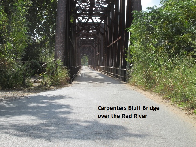
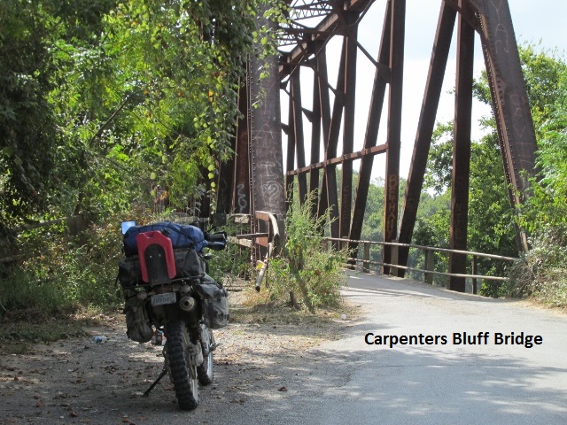
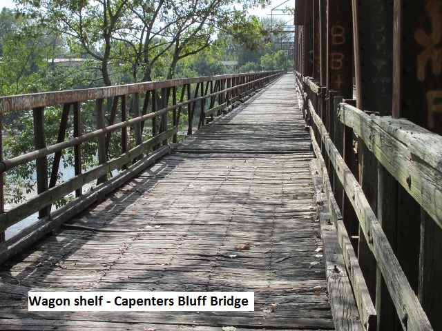
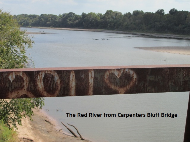
After 95 miles, I rode into Hugo about 11:30 and ate a barbeque sandwich at an outdoor café. I traveled west from Hugo for a ways before turning back south toward the Red River. At one point I stopped for a minute and was greeted by a real friendly bird dog, so I passed a few minutes scratching his ears and discussing the weather. Somewhere on those back roads I passed by a really large lumber mill with a long line of logging trucks queued up to unload. Just south of Bennington I ran across another “Road Closed” sign on Post Oak Crossing road. Doubter that I am, I explored further down the road and came to a barricade at an old wooden bridge. It was obvious four-wheelers had been going around the barricade and across the creek. However, there was a dead tree leaning across the bridge with only about five feet of clearance … wasn’t sure my bike would clear. It just did so I didn’t have to detour. The roads were 45 mph and smooth, well maintained dirt as I continued to parallel the Red River. Around 3:15, having covered 185 miles, I was just south of Hendrix when I came to the historic Carpenters Bluff Bridge.
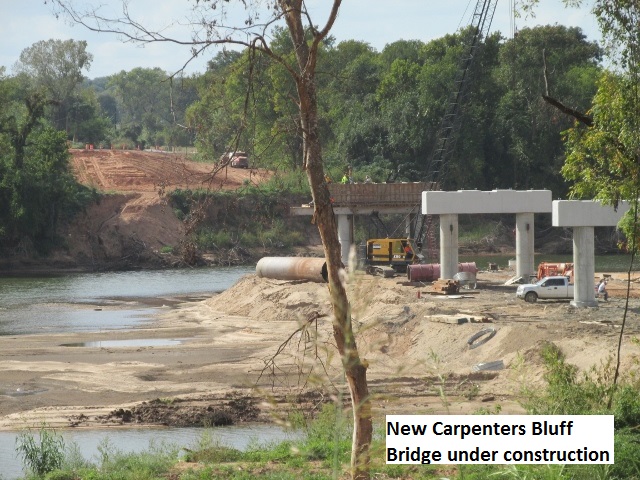
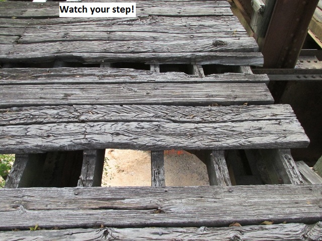
Located just east of Denison, Texas, the steel truss bridge was completed in the late summer of 1910. Originally a railroad bridge for the Missouri, Oklahoma & Gulf Railroad, it was converted to a vehicular bridge in 1965. The bridge is only one lane so it was interesting to watch cars (and my bike) cue up on each side of the Red River and take turns crossing. Being originally a railroad bridge, it has a wagon shelf attached to the side for wagon, horse, and foot traffic. Many of the wood planks on the shelf are missing so I was mucho careful as I hiked out over the river for some pictures. I observed a bit of the construction of the new concrete replacement bridge a few hundred yards west. Texas and Oklahoma are splitting the $7,000,000 price tag.
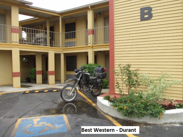
The OAT turned north at that point as I made my way through Colbert and then a few miles further intersecting US 70 again. At that point I rode US 70 off-trail 8 miles east into Durant for the night. I arrived at the Best Western about 4:30 after a pretty easy 225 miles. After I walked across the parking lot for some Colonel Sanders, I returned to the room and started checking the weather. The forecast was for thunderstorms and heavy rain all across southern and central Oklahoma. When I turned out the light, I was a bit worried about what the morrow held in store.
Day Eight – Friday, October 7, 2016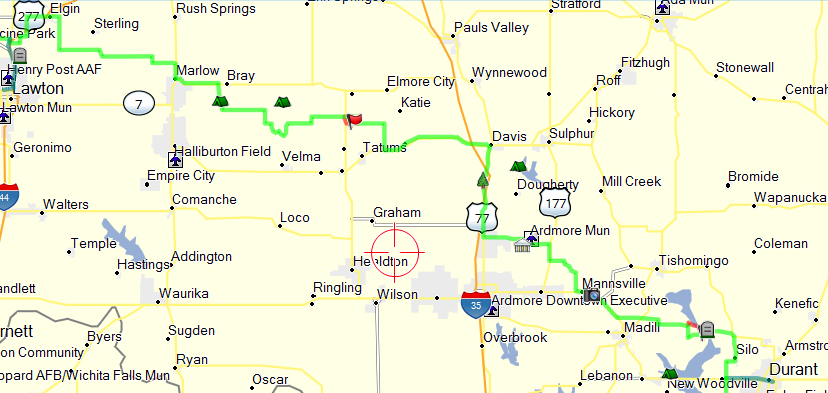
Well, the weather forecasters got it right … rain all across Oklahoma. It finally started raining in Durant about 2:00 a.m. along with much lighting, and thunder loud enough that even I heard it. It was still raining when I got up around six. I jogged/limped through the rain filled parking lot to the Waffle House where I ate a good but expensive breakfast. By the time I finished, the rain had let up some. Back in my room, I laid around watching weather on the TV and pondering what to do. I figured all the dirt roads would be too muddy to ride. Even good knobbys don’t help in slick, gooey mud. I considered giving up the last 400 miles of the OAT and just riding pavement to Childress or Vernon and trailering home. Also thought about just holing up in Duran for the day and giving the roads a day to dry. After studying the maps I determined that a large percentage of the last two days of the OAT consisted of pavement. I fired up my laptop and Mapsource software and designed a track that closely followed the OAT track but was all pavement. That would give me an option each time I came to a dirt road … if the road was too muddy I could take the alternate pavement.
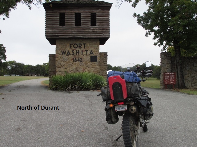
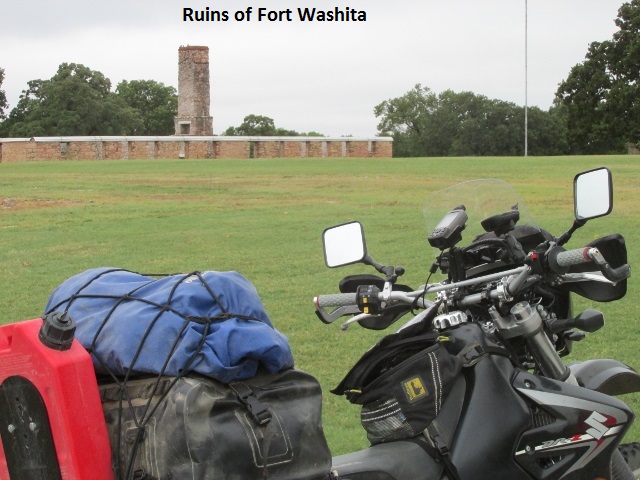
I loaded up and left Durant at 10:30. The rain had stopped but it was in the mid 50’s with a strong north wind and heavy overcast skies. Due to chilly weather I had bundled up with a sweatshirt, heavy coat, and my rain jacket for wind protection. Northeast of Durant I stopped for some photos at Fort Washita on SH 199 but didn’t have time to tour the historic site. The fort was established in 1842 by General (later President) Zachary Taylor to protect citizens of the Choctaw and Chickasaw Nations from the Plains Indians. It was later abandoned by Federal forces at the beginning of the American Civil War. Confederate troops held the post until the end of the war when they burned the remaining structures.
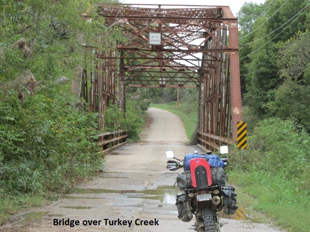
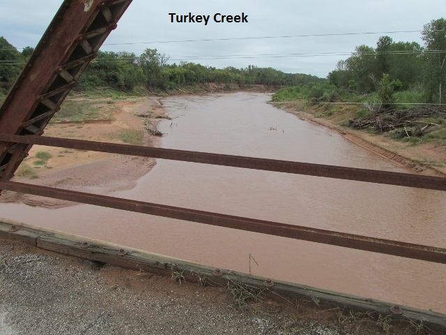
Around noon I had covered 36 miles and hadn’t had to miss any dirt portions of the trail. There was one exception when I came to a barricade and closure sign. It was a short undesignated two-track along the west side of Lake Texoma just west of the fort. I detoured a couple of miles west on SH 199 and turned on a county road to connect back with trail. What little dirt I’d ridden had a good gravel base, although I had seen some deep muddy ruts down some side roads. As usual on a bike, the wind had been robbing my core temperature and I was getting really chilled. My small windshield didn’t give much wind protection … was sure wishing for some sunshine. It was still windy and overcast when I stopped for a picture at Turkey Creek Bridge at Mannsville.
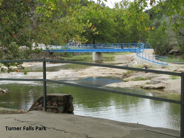
At Springer I turned north on US 77 which parallels I-35 for several miles. Just south of Davis, US 77 winds down into a canyon where Turner Falls Park is located. The park is a family recreation spot with a 77 foot waterfall and swimming hole. I came to a convenience store and stopped for a bathroom break and spent 5 minutes warming my hands with their hand dryer. For the life of me I can’t remember when or if I stopped for lunch.
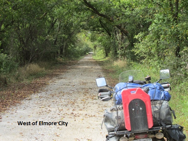
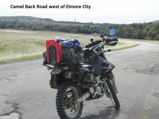
Just south of Elmore City I came to CR 1700 which is permanently closed so I detoured a mile north and got back on track. Once again I questioned when the last time the OAT creators had ridden the trail. Around 2:15 the sun was peeking through the clouds as I checked my trip meter … 115 miles. It was finally warming up some, and the good condition of the dirt roads was allowing me to make good time. About 45 minutes later I was riding over the Camel Back Canyon road. It was a great road, meandering though scenic ranchland dotted with numerous pump jacks.
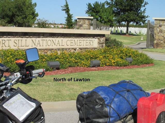
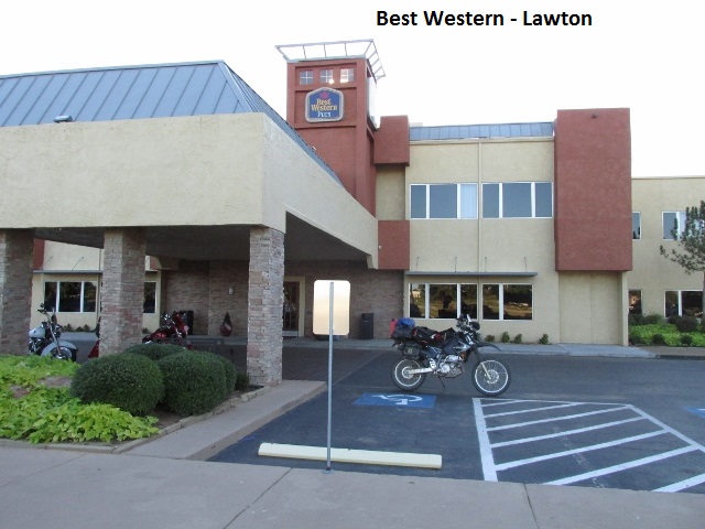
By 3:30, I was still several miles east of Lawton having put 160 miles under my belt. Most of the roads in the area are blacktop or gravel … still no problem with mud. I was traveling through ranch land … rolling hills, tree lined fences, and the ever present creeks. The clouds had burned off and it was now a comfortable mid 60’s afternoon. After crossing I-44 I turned south on a farm road and stopped for a minute at the Fort Sill National Cemetery and paid a moments tribute to those who have served. I merged back with I-44 and rode into Lawton about 4:30 after 195 miles. I got a nice room at an older Best Western off the interstate. It had an interior hallway door and another door opening onto a pretty private park area. I finished off the day with a good meal a Cracker Barrel. One day to go!
Day Nine – Saturday, October 8, 2016
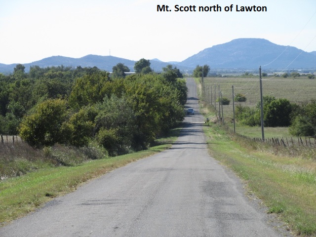
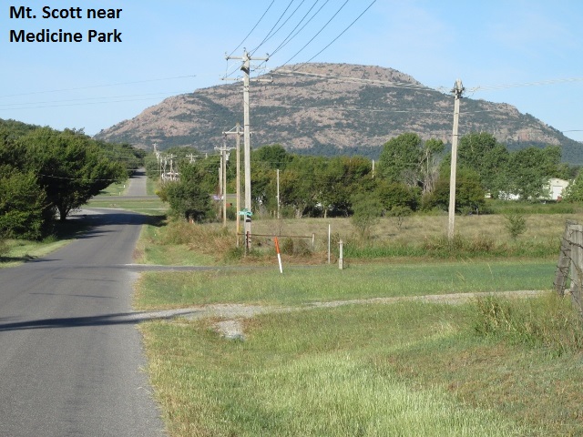
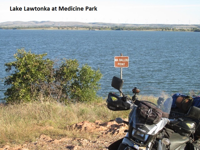
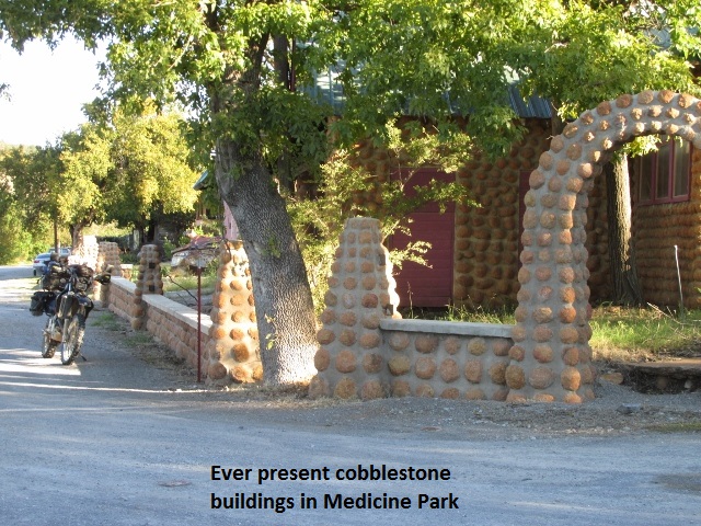
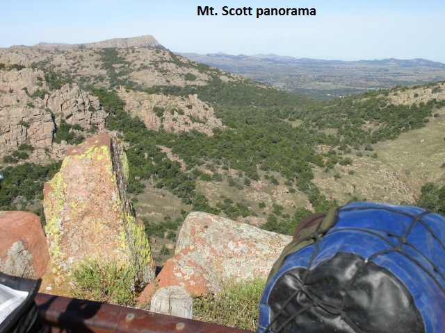
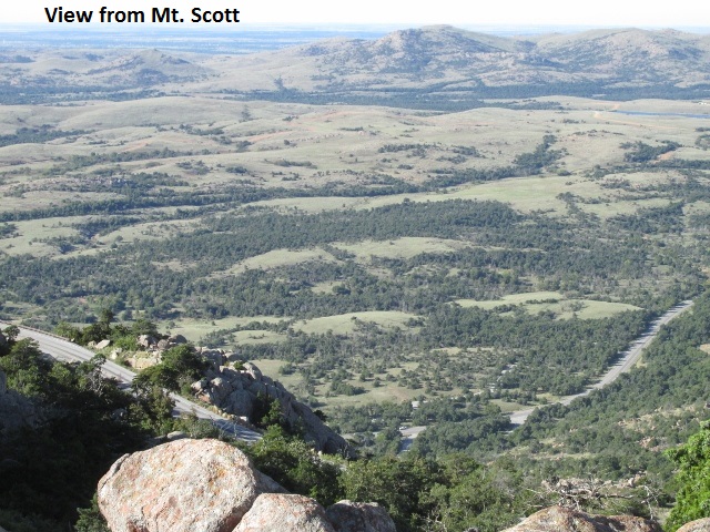
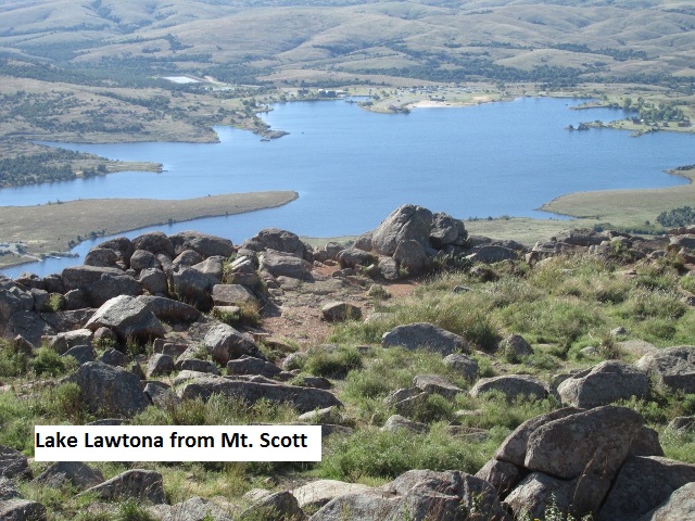
It was Saturday morning, the ninth and final day of my ride, so I indulged myself with breakfast at Cracker Barrel. I left Lawton about 8:00 with the temp in the mid 40’s and headed for Medicine Park. Medicine Park is a town situated in the Wichita Mountains near the entrance to the Wichita Mountain Wildlife Refuge. Since the 1920’s, Medicine Park has enjoyed a long history as a vintage cobblestone resort town. It is located next to Lake Lawtonka and Mt. Scott. I stopped there for some pictures of the unique cobblestone buildings. As I left town, I made my biggest navigation boo-boo of the trip. Amidst some road construction, I turned the wrong way and traveled 6 miles back toward Lawton before I realized it.
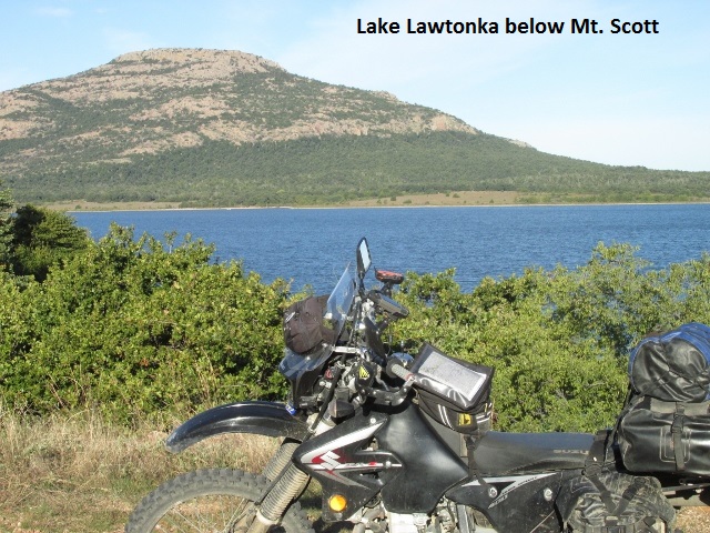
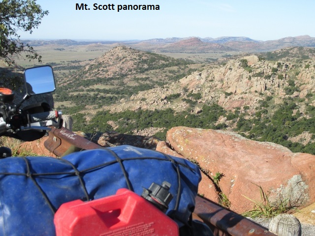
Heading back west, I diverted off-trail and rode up the narrow asphalt to the top of Mt. Scott. It was a really nice road with amazing vistas as it made a circuitous climb up the mountain. My GPS indicated 2450 feet when I reached the top. I took a few minutes to enjoy the great airplane-like views of the country side, seeing 100 miles in every direction. Coming back down I continued west on SH 49 and then north on SH 115. SH 115 was a nice winding road that took me through some hills and to my first dirt of the day.
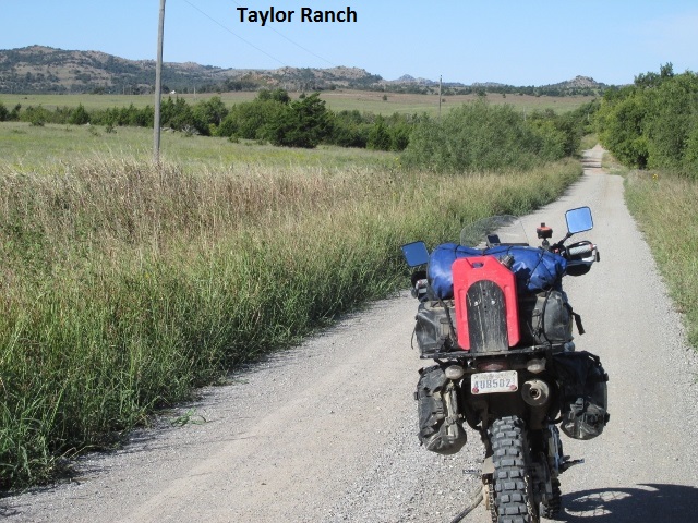
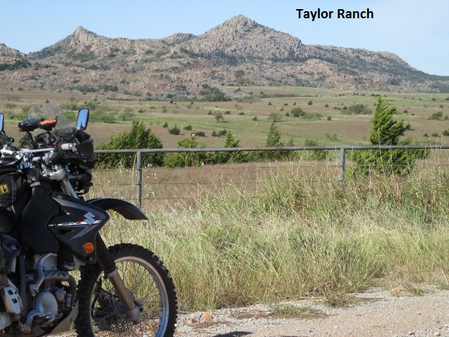
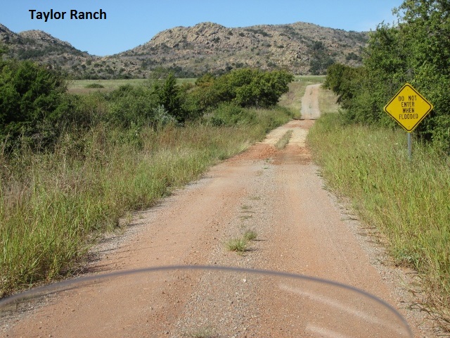
About 12:40, I stopped for a short break after 108 miles. I’d ridden across Taylor Ranch on really nice roads, passing through hills and small rock covered mountains. The great thing about the dirt ranch roads is they led me right through the middle of the mountains, rather than skirting them as the highways do.
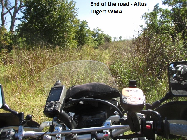
A little later I came to Altus Lake and rode pavement around the east shore, passing by continuous small lake cabins. The OAT track shows to follow a “dotted-line” road north of SH 9 and through the Altus-Lugert WMA. After riding the rutted and vague two-track for 3 or 4 miles, it became overgrown and impassable. After doubling back, I consulted some hunters who told me there was no longer a road through to CR 1380. I motored back to SH 9 and connected to SH 6 then went north to reconnect with the trail at CR 1380.
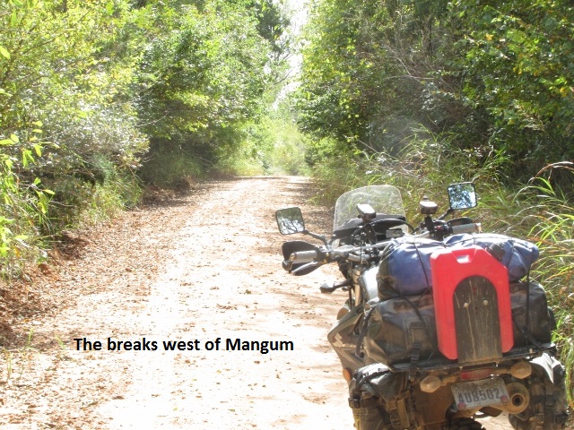
Turning south on CR 1990 I rode around the slope of Granite Mountain and a few miles further, I turned west to Mangum. West of Mangum the trail took me over 11 miles of cool rugged breaks … up, down, and around through the ravines.
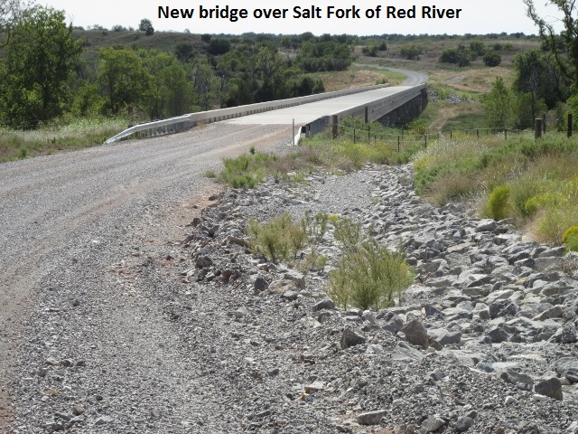 The GPS track showed to ford the Salt Fork of the Red River on CR 1840. As I neared the river on 1840, my GPS track showed to continue straight … straight through a locked cattle gate. It was obvious the main road turned back west. I checked my map and it appeared I’d have to make a zigzag detour west to SH 30. Resigned to my fate, I headed west. After only a ¼ mile, I was delighted to discover that CR 1840 picked back up and headed south with a brand new concrete bridge spanning the Salt Fork. A mile or so later the new road reconnected with the GPS track.
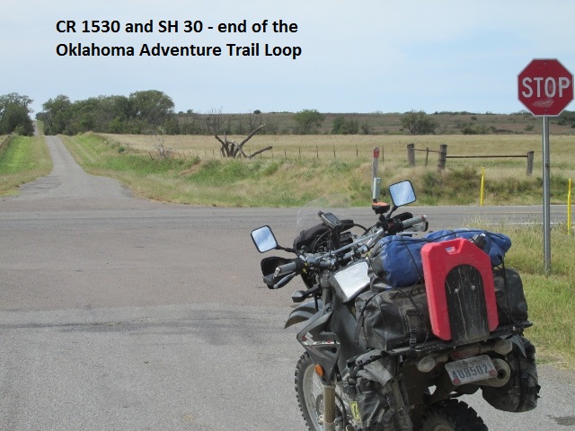
I then turned west onto CR 1510, a very sandy two-track … the deepest sand I had experienced on the trip. Even with the damper, I almost dumped the bike a couple of times. The terrain, however, was really neat as I rode through more of the breaks, even scaring up a couple of deer. Thankfully, the sand turned to a narrow blacktop on CR 1530. I was clipping along about 50 and topping a rise, I narrowly missed colliding with a half-dozen turkey.
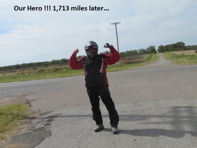
About 3:00, I intersected SH 30 north of Hollis, completing the Oklahoma Adventure Trail Loop. After taking a celebration selfie, I checked the mileage on my GPS. I had traveled 1,713 miles since a week ago Friday. I rode into Hollis and took US 62 back to back to Childress … back to Texas. Lyn was right on-time and we loaded the bike and headed for Lubbock. It felt really strange to be riding on four wheels instead of two.
Epilogue
As I complete this ride report, it’s been a few weeks now since I finished the Oklahoma Adventure Trail. It truly was a great “adventure”, one I’m glad to have had the opportunity to ride! I really appreciate the developers of the trail for all their work … they did a superb job. Oklahoma is really a beautiful state, much more so than I realized. There was an excellent variety of terrain and road conditions on the trail. Also, the people of Oklahoma were especially friendly and laidback. Several times when I had stopped in the middle of nowhere, someone would drive up and ask if I was having problems or needed help.
The distance I rode each day was about right, and the time of year was ideal. If I were to ride the OAT again, the only thing I’d change would be to bypass Blue Mountain and Lynn Mountain.
I’m grateful to my wife for supporting my need to find adventure on two wheels (of course she may just enjoy the break from me ![C:\Users\Jerry\AppData\Local\Microsoft\Windows\INetCache\IE\44G9MBLR\emoticon[1].jpg](https://jerryblewis.com/wp-content/uploads/2021/01/c-users-jerry-appdata-local-microsoft-windows-ine-1.jpeg) ). I’m also very grateful to the Lord for the opportunity, for a safe trip, and for the lack of any bike problems. I’m already thinking about next year and another adventure.
). I’m also very grateful to the Lord for the opportunity, for a safe trip, and for the lack of any bike problems. I’m already thinking about next year and another adventure.
