Jerry & Greg’s Great Adventure
(As recalled by Jerry Lewis)
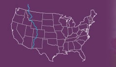
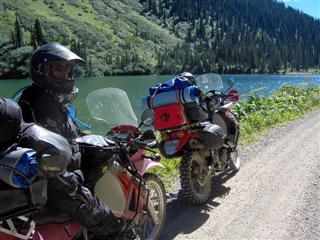
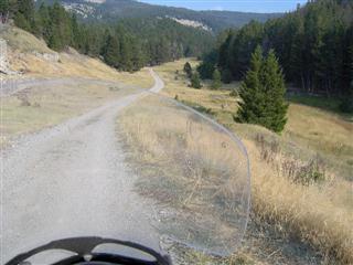
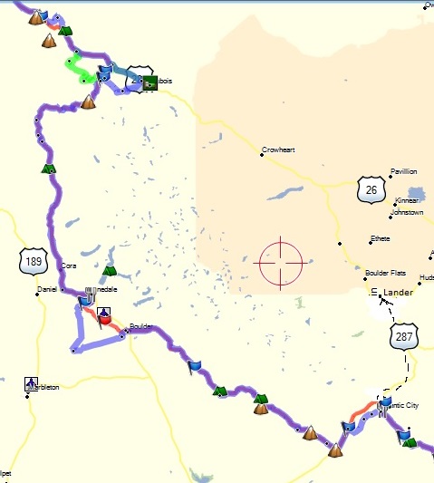
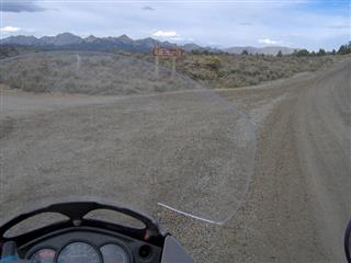
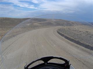
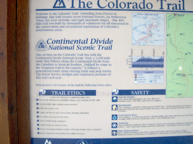
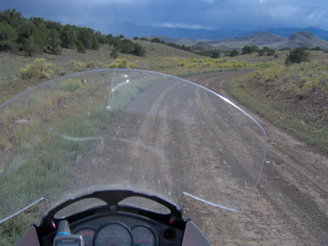
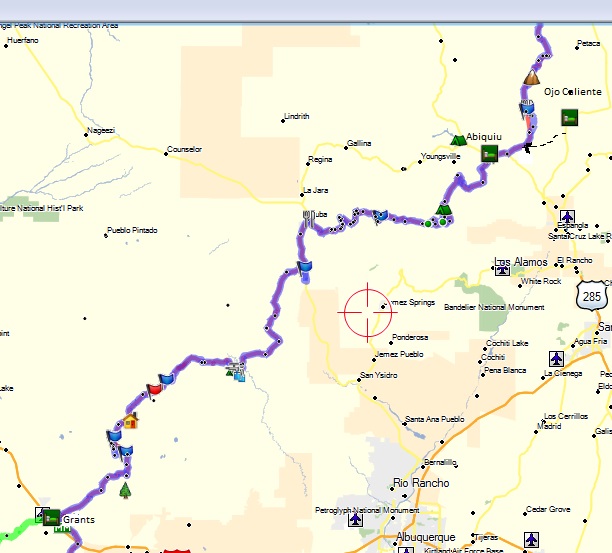
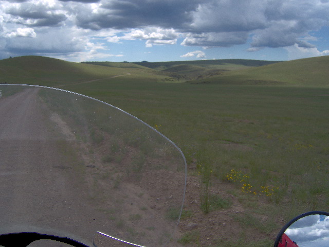
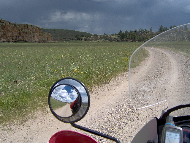
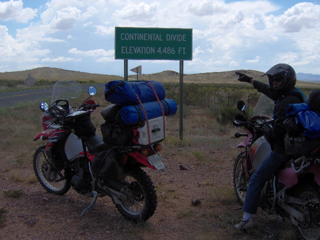
This is the narrative of my trip with my good friend Gregory Boy Camp as we traveled the Continental Divide Trail from Roosville, Montana to Antelope Wells, New Mexico. We rode our Kawasaki 650 KLR dual-sport motorcycles … dual-sport referring to the bikes ride-ability on both paved and dirt roads. The ride took 14 days and the mileage on my GPS at Antelope Wells read 2,826 miles. The trail was originally established for off-road bicycles and consists of approximately 80% dirt roads. These dirt roads are comprised of county and forest service roads and anything from high-speed gravel to 10 mph, rugged, two-track jeep roads covered in loose rock or deep sand. Greg refers to it as “the trip of a lifetime” but I hope there are many more to come.
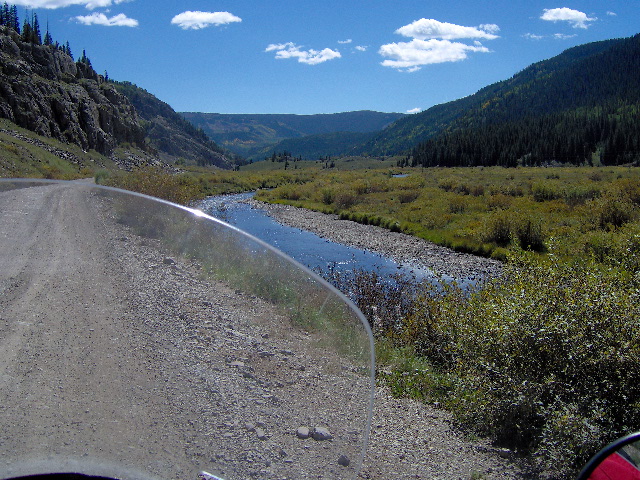
The Plan
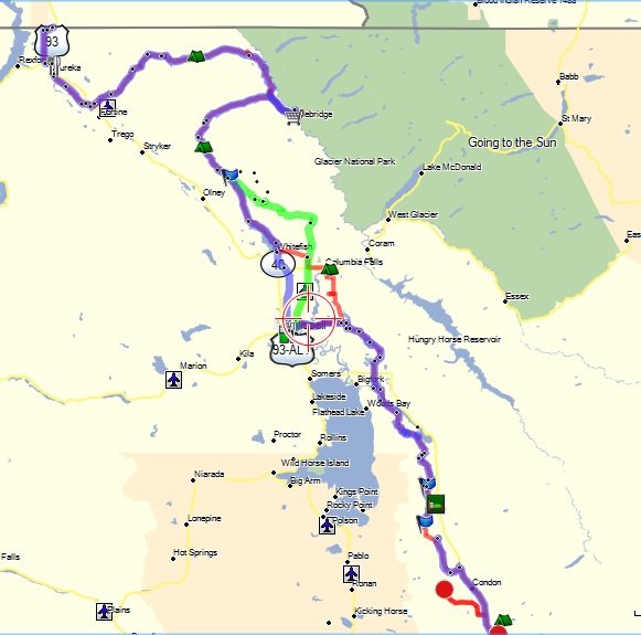
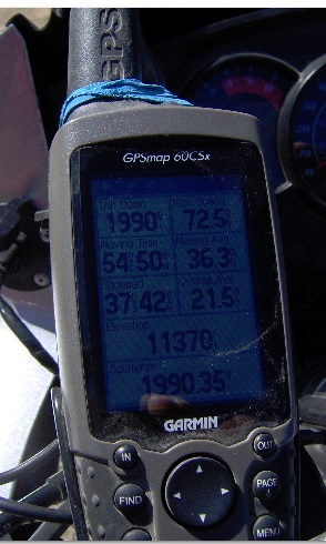
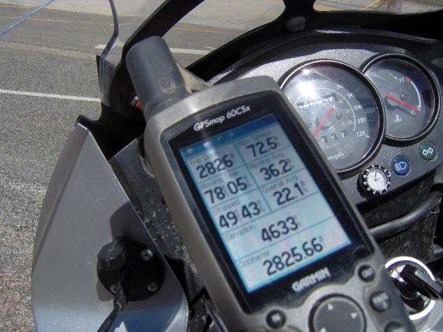
Having made several much shorter dual-sport motorcycle trips, I read a great deal about the CDT (Continental Divide Trail) on the internet and in magazines. Early in 2012 I started talking it up with Greg and we began to consider the logistics of such an adventure. It was obvious that good maps and a GPS were essential as well as going to school on others who had already made the trip. I was a total novice in terms of a GPS and thought that my TomTom street model would suffice. I contacted Big Dog (Mark Sampson) who is the granddaddy of motorcycling the CDT. When I mentioned my TomTom he informed me that dual-sport riders referred to it as a “soccer mom” GPS. Mark was a great help in deciding which GPS I needed, in learning to use it, and in planning the trip. I purchased a Garmin 60 CSX GPS and Garmin City Navigator 2012 map software and began a several month learning process of GPS route construction and navigation.
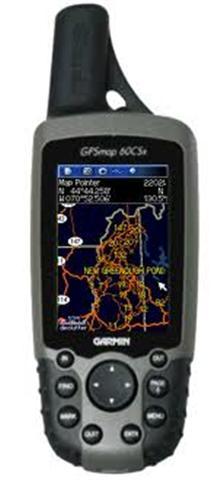 Garmin 60 CSX
I used Big Dog’s “tracks” for the trail and created “follow-the-road routes” for the entire trail. Being use to paper maps I wanted a set as a backup for the GPS and they came in very handy on several occasions. As good as Garmin’s maps are, they will occasionally show a road where there is only a goat trail. In order to get a map scale detailed enough (but not too, as in US Forest Service maps) I purchased gazetteer map books for each state and Xeroxed the map pages I needed. I then transposed the GPS route onto the paper maps. I separated these into groups by state and planned to carry each day’s maps in my tank-bag map viewer. I also made a spread-sheet itinerary showing each day’s destination, mileage, gas stops, and lodging.
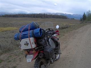
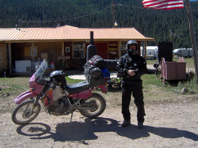
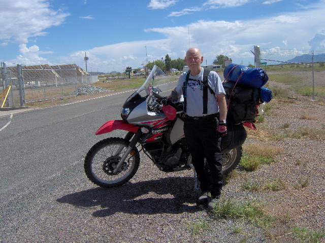
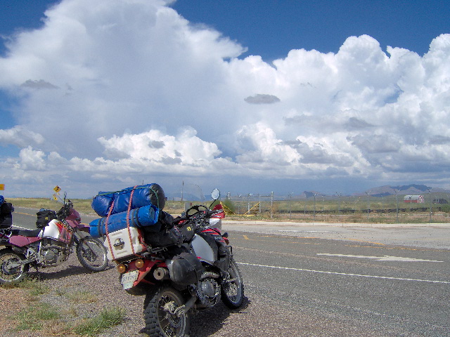
The plan was to camp 3 or 4 nights and motel-it the rest of the time. We planned to carry enough clothing for 8 days with one day to wash clothes for the remainder of the trip. We also needed to carry our body armor coats and rain gear along with a tent each, sleeping bags, and pads. Needless to say that’s a lot of gear so I built platforms for our luggage racks and incorporated a means to carry a gallon of extra gas each and 1 gallon of water. The KLR’s are rugged bikes and didn’t need much except new Dunlop 606 tires and an oil change. However, I should mention that the bikes are heavily accessorized (many farkles) for dual-sport riding.
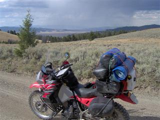
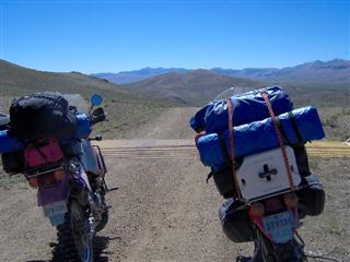
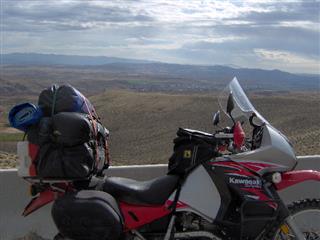
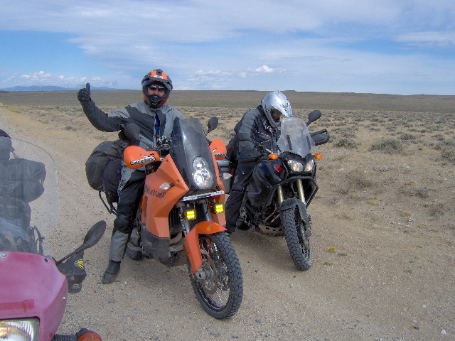
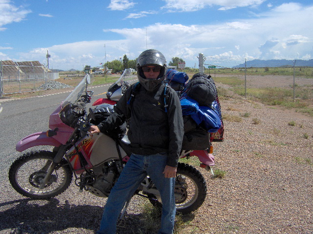
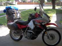 Jerry’s bike loaded for trip
The Trip
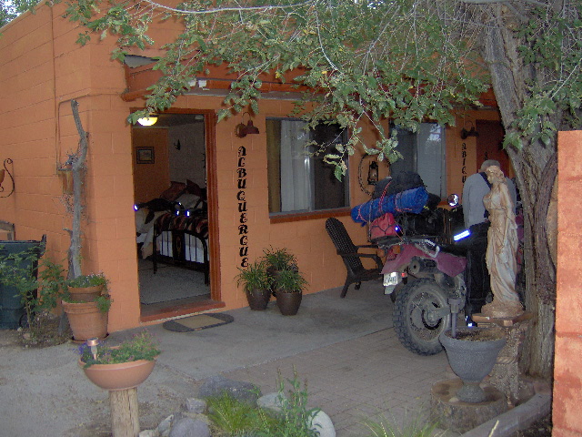
On Wednesday morning, August 15, my wife Lyn, Greg, and myself left Lubbock Texas in Greg’s Nissan Quest with the bikes loaded on the trailer. My sweet, understanding wife had agreed to travel with us to Eureka, Montana and then drive the van and trailer back to Lubbock.
(Greg, Jerry, and Lyn leaving Lubbock) (Lyn & Jerry- Ksanka Inn, Eureka, Montana)
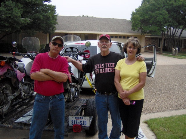
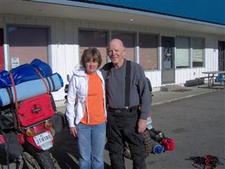
We spent 2 nights on the road and after traveling about 1600 miles without mishap we arrived Friday evening in Eureka and stayed at the Ksanka Motor Inn.
Day One, Saturday August 18,2012
Saturday morning was chilly with sunshine and after loading the bikes we discovered Greg’s battery was dead. After boosting it we said goodbye to Lyn and headed 15 miles up US 93 to Roosville so we could begin the trip at the Canadian border. 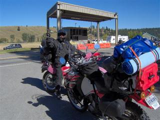
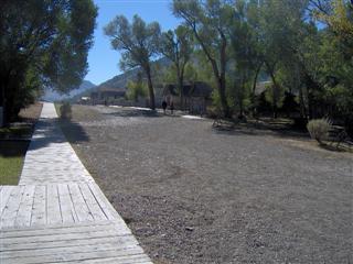
We left Roosville on Airport road south back to Eureka and followed Tobacco Rd. to where we crossed US 93 and travelled FR 114 east into the mountains. FR 114 is a single lane paved road for several miles meandering through the forest but eventually becomes a jeep road to Trail Creek. Along this road we passed some bicyclists and stopped and visited with a young man cycling from Canada. He began the CDT about 150 miles north of the Canadian border and was planning to make Antelope Wells by the end of September.
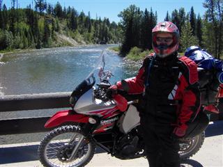
(Jerry at Flathead River) (Greg on FR 115)
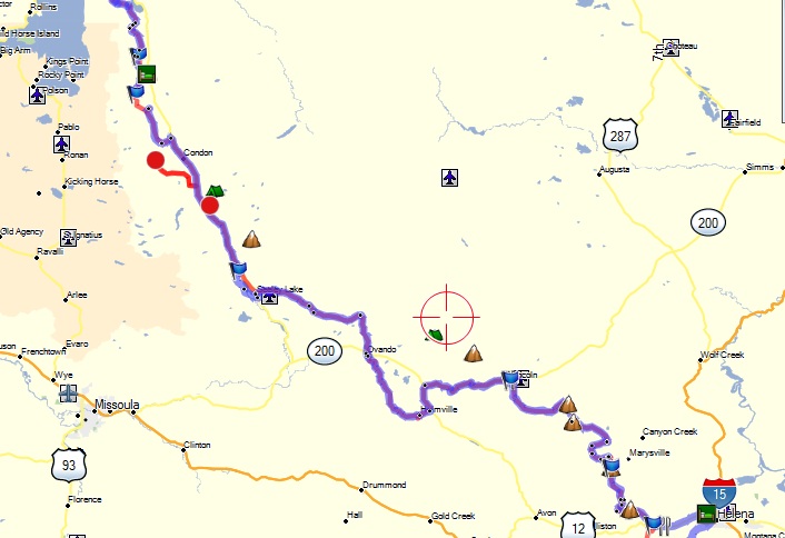
The road turned southeast following the Flathead River where we made a 3 mile detour down to the river and then doubled back and headed west on FR115 (Red Meadow road) then south to the town of Whitefish. Greg’s battery was dead and so we headed south on SH292 to Kalispell where some helpful guys at a NAPA parts store sold us a battery. It was late afternoon by then so we ate an early supper and picked up some breakfast food since we planned on camping that night.
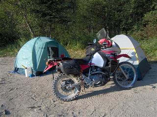
From Kalispell we went east on SH35 and south on foothill road to Bug Creek Rd. to FR9714 and then 9719 arriving at Fatty Creek campground at late dusk. We pitched our tents by flashlight next to the creek and I crawled, very tired, into my sleeping bag about 10:00. Our mileage for the day was about 220 miles.
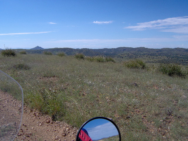
In summary, day one was a long one, due in part to the dead battery. The roads were not especially difficult and the scenery was beautiful and varied with an abundance of lakes and rivers. We enjoyed sunshine and mild temperatures though the night was cold … all in all, a very good first day.
Day Two, Sunday August 19, 2012
We both had a restless night … ground was lumpy and temperature cold. I finally gave up and got up at first light. Greg’s not an early riser even on a warm day and there was ice on the bikes so I made a token camp fire.
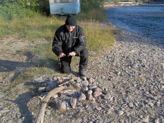
I had carried a small backpacking stove but when I tried to light it the propane had leaked out so I tried another can. Hot coffee wasn’t meant to be as the second can also leaked out immediately. Breakfast was a sweet roll and some water. By the time we broke camp and repacked the bikes it was almost 10:00 o’clock.
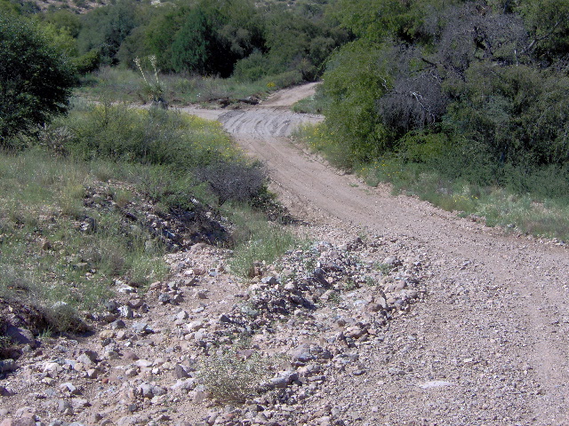
We followed FR10182 (Fatty Creek Rd) south to FR10381, to FR888 (Cold Creek Rd) to its intersection with SH83 which took us about 25 miles to the town of Seeley Lake. The Forest Service roads that morning were scenic and well maintained.
Over hamburgers and pie at Seeley Lake we discussed the previous nights camping experience. We came to the unanimous conclusion that the ground was too hard, the temperature too cold, and that the setup and breaking camp took too much time. We decided that we would detour off the CDT on the evenings we had planned to camp, ride to the nearest town with a motel, and then double back and pick up the trail where we left it the following morning.
After lunch we headed east on CR107 (Cottonwood Lakes Rd) and then south on Monture Rd to Ovando road and continued south. These roads ran through a large valley and we encountered a great deal of smoke from the forest fires in the mountains to the southwest. At Helmville we took SH141 about 15 miles to Lincoln where we left the pavement on Stemple Pass Rd. Once over the pass we followed Marsh Creek Rd to Little Prickly Pear Rd to Lost Horse creek Rd to Empire Creek Rd to FR 1855 (Blossburg Rd). The GPS was vague in this area and we wandered around on top of the mountains for a while with some of the roads being very rocky, washed out, and some deep sand. We came to a locked gate on FR1855 with signs saying private property and “No CDT traffic”. Apparently the owners got tired of the CDT riders and put a stop to it. We doubled back and rode LaSalle Gulch Rd into the old mining town of Marysville where we hit pavement again after several hours of dirt. The main problem was that many of the roads after we went over Stemple Pass were not marked so the paper maps were of limited help. Also, the roads were so close together that the GPS was hard to follow.
We were really glad to finally hit pavement because it was getting close to sunset and we still had about 20 miles on SH279 to I-15 and into Helena for the night. We got a room at a La Quinta about dark, ate a good supper and then crashed … two sore and tired old farts.
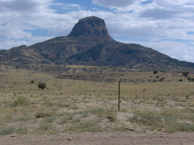
In retrospect, day 2 was good day despite getting lost for a while and some pretty technical riding on some of the roads. As I mentioned earlier, the KLRs are great, rugged bikes but they are a tad heavy for really rough Jeep roads and then too I was carrying over a 100 lbs of gear. We rode a little over 200 miles and the bikes performed just great … no flats on the entire 2800 miles. We topped off the oil and lubed the chains each morning before taking off. Again, the scenery was beautiful and varied, as it was the whole trip … as seen through the eyes of a couple of flatlanders.
Day Three, Monday August 20, 2012
After a good night’s sleep in a comfortable bed and a big breakfast (two benefits to not camping anymore) , Greg and I started looking for our route out of Helena on Grizzly Gulch road. In town the road was designated something else so we pursued the tried-and-true method of “stop at a convenience store and ask directions”. Grizzly Gulch led us to Travis Creek Rd to Lump Gulch Rd to Corral Gulch Rd. to Ohner Meadows Rd., all of which were good graded forest roads. But that was when things went south … the CDT showed to take FR692 which we did. I digress, but one of our means of navigation, when all else failed, was to look for bicycle tracks left by riders traveling the CDT, and we did see tracks on FR692. Well, FR692 was some of the most difficult riding we experienced on the entire trip. It would have been a fun ride on a 225 lb. dirt bike but we were tipping the scales at over twice that. It was a rough, up and down, rocky, and washed out jeep road. It took a couple of hours to negotiate about 10 miles. We were so relieved when we dropped down to FR175 (Cataract Creek Rd.) which dropped us off in Basin, an old mining town on I-15.
Basin had great mom-and-pop restaurant in an 1800’s brick building. While there, four guys road up on some BMW 1200 GS dual-sports. Turns out they were from Oklahoma and had trailered to Lander, Wyoming and started the CDT headed north. We traded war stories for a while and warned them about FR692 so they decided to catch some pavement and pick up the trail further north. If FR692 was bad on the KLR I can’t imagine on a 1200 GS. Since I had the maps and GPS, I knew that by that time Greg was having doubts about following me. Looking at the map now, with 20/20 hindsight, I see there was a good graded road that would have bypassed FR692 and hit I-15 about three miles east of Basin.
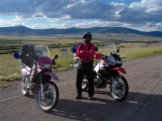
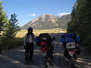
(Greg at Basin, Montana) (FR 84 south of Butte)
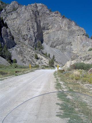
Leaving Basin, we rode county roads that paralleled I-15 to Butte and then south on SH2 and right on FR84 which took us west across I-15. I haven’t mentioned yet that we usually didn’t know where we would be at lunch time each day so we carried peanut-butter crackers and Paydays just in case. Well, while we were stopped on FR84 eating our crackers my bike, parked on a slight grade, rolled off the kickstand and broke my left mirror glass. At I-15 we took the parallel old highway south to SH43. On SH43 we traveled west to Wise River where we left the asphalt on the Wise River-Polaris road. The next 40 miles of good dirt riding ended at SH278 which took us east into Dillon for the night.
(Greg and Jerry near Wise River, Montana)
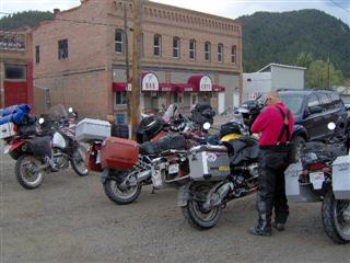
Dillon was about 20 miles off-trail but we had a good steak that night and a good bed. At our motel we ran into about 10 dual-sport riders doing a portion of the CDT led by a “ride promoter”. They didn’t seem to want to visit much … if memory serves me some of them were foreign nationals. I was tired of trying to see in a shattered mirror so I bought a 3” convex mirror in Dillon and stuck it on the mirror head.
Day three was again slightly over 200 miles with sunshine and mild temperatures. After leaving Basin, the dirt riding was relatively easy. The ride from Wise River to Polaris followed a narrow valley between some low mountains. The scenery was less spectacular but we just enjoyed the great feeling of two wheels in the dirt.
Day Four, Tuesday August 21, 2012
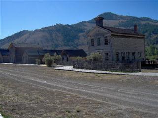
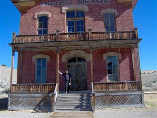
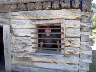
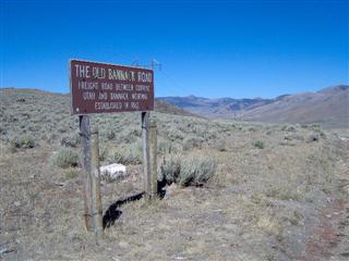
We left Dillon on dirt riding 10 Mile Road to SH278 and took the exit to Bannack State Park. Bannack is a ghost town located about 20 miles west of Dillon. As Montana’s first capitol it has a colorful history that reads like a Louis L’amour western. Greg and I were really glad we stopped and toured the town and took a lot of pictures. Most of the old buildings are still standing on Main Street with entrance permitted on most.
After a two hour break in Bannack, we travel south to SH324 to a really great road FR527 known as Medicine Lodge Road. This road travels over rugged open prairie and rolling hills and was once a wagon freight road between Bannack and Corrine, Utah.
Medicine Lodge intersects Big Sheep Creek Rd which is a spectacular gravel road carved out of low mountains that eventually meets I-15 just south of tiny Dell, Montana.
 We detoured to Dell for gas and lunch. There was an old school house there that had been converted to a family run restaurant with of all things … home-made pie. Big Sheep Creek Rd
 Lunch in Dell
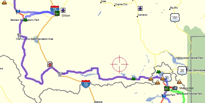
From Dell we traveled a few miles south to Lima and took the Lima Dam road east which parallels the Idaho border about 3 miles south. The border follows the continental divide atop the Centennial Mountains. 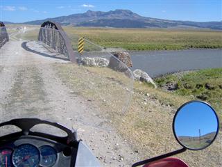
(Lima Dam Road east of Lima) (SH509 – South Valley Road)
I decided (go ahead Greg and blame me) we should take a shortcut south to SH509 (South Valley Rd). What started out as a good two-track ranch road turned into 3 miles of a deep-sand trail. Well, we gutted it out and hit 509 which turned out to be a good gravel road and headed east across the Idaho border to US20 and the small town of Mack’s Inn. Having checked on lodging at Mack’s Inn and located a motel, it turned out to be an old but nice two bedroom cabin with a kitchen and a restaurant about 100 yards away. We were really roughing it … there was no air conditioner or TV. Fortunately I had my Kindle reader for entertainment and the beds and shower were good.
At the end of another 200 mile ride, day 4 found us in Idaho about 10 miles south of Montana and 10 miles west of the boundary of Yellowstone Parks in Wyoming. It was a really good day with the sand section the only bad riding. Greg and I were finding that we enjoy riding in the valleys surrounded by the mountains rather than in the mountains and surrounded by forests. The valley vistas are beautiful so maybe it’s just the Texas boys needing to see the horizon. Bikes are doing great, riders are old and tired … but really having fun.
Day 5, Wednesday August 22, 2012
Wednesday morning (Day 5) we left Mack’s Inn, Idaho headed south on US 20. Because we would only be in Idaho for a short distance, when planning the trip I didn’t think we would need Idaho paper maps. Wrong-g-g! We couldn’t find our turn off for Old Chick road. Fortunately there was a US Forest Ranger office on the highway with a very helpful lady ranger. She gave us a free off-road map of the area and good directions. Old Chick (the road not the ranger) took us south to Eccles Rd to and Warm River Rd.
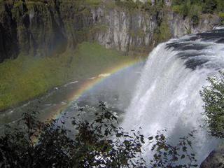
We then took a detour 3 miles west to SH47 to see Upper Mesa Falls that the ranger lady said was a must see. It was indeed worth the time. There is a real nice visitor’s center there and a paved walkway that leads out to a cliff overlooking the falls. After 30 minutes of picture taking we headed back to Warm River Rd to Wood Rd and reconnected with SH47.
This area is mountainous and heavily recreational. As we followed SH47 we topped a hill and it was like we had been transported to another state … the landscape was very flat and all under cultivation. We rode into the small farming community of Ashton where we purchased gas, and snacks for lunch down the road. SH32 took us south to CR1200 (Ashton-Flagg Rd.) which took us east toward the Wyoming border.
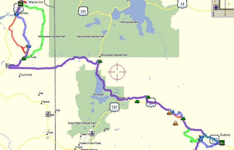
At the Wyoming border our road changed to FR261 (Grassy Lakes Rd.) … a great dirt ride that meanders east through the Caribou-Targhee Forest eventually hitting pavement at US 89-191-287. The highway took us south past Jackson Lake, the reservoir for Jackson Hole. It is a beautiful lake with the Grand Tetons in the background. There was a great deal of smoke over the Teton from area forest fires.
(Jackson Lake) (Forest fire on CR 5)
At Mora Junction US 287 turns east but after a few miles we took CR 5, a loop that winds through the foothills above and parallel to 287. It was here that we almost rode into a forest fire… we could see the smoke billowing up but the fire was just on the back side of the hills about a half mile away. CR 5 turned into FR30050 before it dumped us back on US 287. We took a break at a small country store and decided we better just follow US 287 on in to Dubois as it was already late afternoon. I had laid out a couple of alternative routes through the forest but time and tired said find a motel. We found a motel about 3 miles west of Dubois but rode on into town for supper and by the time we got back to our motel it was chilly and dark.
Day 5 was a good day of riding consisting of mild forest roads and a little more pavement than we would have preferred. Again, as we traveled our 200 miles, we saw a beautiful variety of mountain vistas, big valleys, and bright blue lakes.
Day 6, Thursday August 23, 2012
To begin my tale of Day 6, I must take a moment to clarify the physical issues Greg was dealing with. Greg has nerve damage in his spine which makes his feet and legs feel numb as well as almost constant pain in his arm and shoulder. The numbness affects his balance and thus riding is at times a real challenge. As we planned our adventure there was a real concern about his ability to ride 14 consecutive days. I mention his situation because when I climbed out of the sack that morning, Greg was in a great deal of pain and felt he really needed a day to recoup. We had already decided to motel in Lander about 25 miles north of the CDT rather than on the trail in Atlantic City where all that was available was a campground. As a result, Greg would be able to ride US 287 from Dubois to Lander while I rode the trail. Although months earlier I had considered riding the whole CDT alone if Greg couldn’t go, I now faced the day with some trepidation. I had seen firsthand how tough some of the jeep roads could be with 700 pounds of bike, gear, and rider. As it turned out my trepidation was well founded.
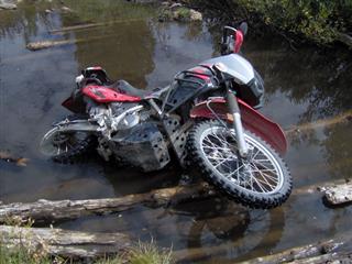
I traveled only half a mile west from the motel and turned south off US 287 on Warm Springs road. The map showed Warm Springs would intersect Union Pass Rd after a few miles. Warm Springs climbed quickly through a housing development to a Forest Service gate. The jeep road made a “Y” and I took the left fork which dead-ended after a mile. I went back to the “Y” and took the right fork for about 3 miles. It was pretty rough and then it came to deep, washed out ravine that I was leery of crossing alone. I went back to the gate and soon discovered that Warm Springs went left before the gate. All went well for a while riding through the forest when I came to another unmarked “Y”. After studying the map I decided to go left. One of the things I was discovering was the GPS could be very ambiguous when jeep roads are very close together. Often I couldn’t tell I was off route until I had traveled a mile or so. Well, immediately I came to a creek about 2 feet deep and 15 feet across with logs laid in the bottom at right angles to the road. When I tried to cross, the bike high-centered on a log and I couldn’t go in either direction. I dismounted and started unloading the bike, pitching everything on the bank. I then laid the bike down on its side and drug it across the logs. Well trying to lift a KLR by yourself is tough and after about 3 hernias I righted the bike, cranked it up and walked it onto the road. Exhausted, I sat down and drained my boots and wrung out my socks. After re-examining the map, I concluded I had taken the wrong fork and should never have crossed the creek. Oh, man-n-n! With no other choice, I walked the bike back across the creek, threw my gear across and reloaded everything. After about 3 more miles I came to Union Pass Rd., a nice graded road climbing south to Union Pass and crossing the Divide. I had covered only about 15 miles and had been riding almost 3 hours by this time. If I had only continued about 3 miles down US 287 I would have intersected Union Pass Rd and avoided all the problems.
(Looking down on Dubois) (Just before I dragged my bike over the logs)
(Over 9,000 ft near Union Pass) (SR352 looking back at Union Pass Road)
Union Pass Rd turned from graded gravel to a jeep road before I topped the pass but it was a great ride. The road traversed a high mountain valley above 9,000 feet for about 30 miles through the Wind River Mountains. The scenery was spectacular. Eventually the road dropped down into a big valley on the edge of Bridger-Teton National Forest. It was at that point I came upon THE SAND that the guys from Oklahoma had warned us about. The sand was about a foot deep for a couple of hundred yards where the road dropped off a hill. I was concerned I would bury the front end and high-side, loaded as heavy as I was. So using gravity and feathering my front brake I eased down the hill. I knew if I dropped it here I was in a world of hurt. Safely down, within a mile or so I hit pavement on SR 352 and soon came upon a really bad pickup roll-over. A sheriff was there investigating and apparently they had already hauled the driver off, presumably dead from the looks of the truck. CR352 hit US 191 and in about 5 miles I was in the town of Pinedale. I ate a late lunch and found a store where I bought a pair of socks as mine were still soaked.
I left Pinedale on US 191 for about 10 miles then turned east on SR353 which was paved till it became CR118 (Big Sandy-Elkhorn Road). As I’m traveling these roads southeast I’m parallel with and 5 miles west of the Continental Divide. The terrain is high desert with occasional low mountains or hills but it’s really pretty in its starkness and I feel like I’m riding across a moonscape. I have several close calls with antelope who like to sit in the middle of the road just over every other hill. The road forks and I take the east fork, CR132 (Lander Cutoff) and after many miles I hit pavement again at SR28. After about 5 miles I take a planned detour to South Pass City and Atlantic City, two historic mining towns which sit a couple of miles off the highway. By this time it’s getting late with about an hour of daylight left so I hook it 30 miles up SR28 to Lander to meet Greg.
(Big Sandy Road) (Lander Cutoff Road)
Early in the trip when we elected not to camp anymore, part of our rationale was that even if we had to ride 20 or 30 miles for a motel, what is 30 more minutes added to a 10 hour day for the benefit of a good bed and a hot meal. Greg had us an old but comfortable court with covered parking. While we ate supper, I regaled him with all my war-stories from the day. He feels better after a day’s rest and plans to ride the next day.
Day 6 was quite an adventure covering about 240 miles. I had good weather, didn’t fall or get hurt, and experienced more really beautiful country.
Day 7, Friday August 24, 2012
Greg and I got an early start Friday morning and headed south down SR 28 to Atlantic City to pick up the CDT. CR 22 (Three Forks Rd) is smooth gravel through high desert as it heads southeast from A.C. We were able to run 60-65 mph most of the time while keeping a constant eye out for antelope. While we were stopped for a break (bathrooms are readily available in the middle of nowhere) a couple of riders on large-bore adventure bikes caught up with us. They were riding a portion of the CDT south when one of their buddies hit an antelope just south of A.C and went down. Though we didn’t see the rider, they said he was pretty shaken up and most of the plastic was ripped off his bike. They took off and were really haulin’ it so we only saw them in the far distance. Very much like late Thursdays ride, this was wide open barren land but with a rugged beauty of its own.
(SR 28 between Lander & Atlantic City) (Three Forks Rd – riders we met) 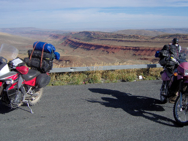
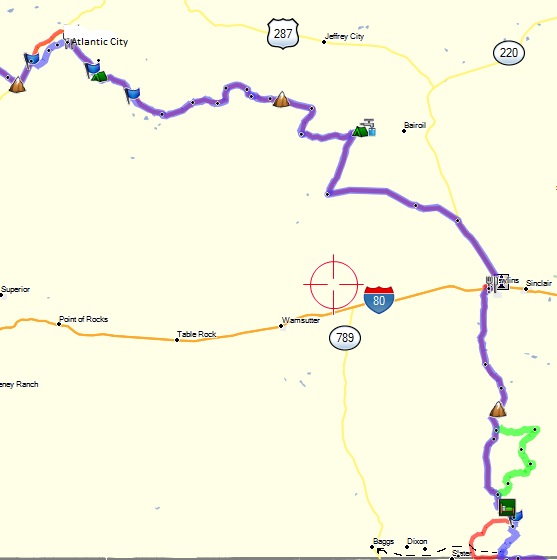
We traveled mostly east on Three Forks and then zigzaged south and east on County Roads 318, 23N, 22E, BLM 3215, and 63E, all the while crisscrossing the Continental Divide. About 15 miles north of Rawlins we hit pavement on US 287 and headed into town. After getting gas and a late lunch we left Rawlins and headed south on paved SR 71 which turned to dirt after about 10 miles and became CR 401 (Salt Creek Rd.). The day had been sunny and warm but about the time we hit CR401, we could see lots of rain clouds hanging over the mountains to the south-southeast and thought we might get our first taste of bad weather.  CR 401
The mountains were in the Medicine Bow National Forest and our road took us through the west foothills. Our gravel road turned into a good jeep road (CR 801 –Sage Creek ) as we entered the forest. Though the clouds were a few miles to our east we were getting a heavy sprinkle blown off the storm. We stopped and put on rain jackets without the pants in case it got worse and rode past Sage Creek Campground where we originally planned to camp. After a few more miles we hit SR 70 with pavement wet from the storm that had passed a few minutes earlier. We then headed 25 miles west to the small town of Baggs. I had reconnoitered Baggs before we left and knew they had a couple of motels. One motel was full but fortunately we found a room at the other, an old court. It wasn’t terrible but probably the worst room we stayed in the whole trip.
Day 7 was about 10 hour and 230 miles long. The scenery was somewhat monotonous until we came to the forest but a good day with no bike problems, no injuries, and only some sprinkles. We were both tired but glad Greg had a good day riding after his days rest.
Day 8, Saturday August 25, 2012
Well, it’s Saturday morning and eight days into our adventure. After a hardy breakfast …they were all hardy because we never knew where we’d eat lunch … we headed east on SR 70 to join back up with the CDT. We were looking for Colorado CR129 which showed to crisscross the state line, eventually heading south toward Steamboat Springs. Our first access point to CR129 turned out to be a dead end after a couple of miles so we continued down 70 to another junction. There we found a large sign that declared CR129 closed 10 miles ahead. As we were looking at the map and considering other options some gravel trucks met us. We flagged them down and asked about CR129 and were informed that that was an old sign and the road was open all the way to Steamboat. CR129 was a great scenic ride through the Routt National Forest with the mountains paralleling us to the east marking the Continental Divide. Eventually 129 turned to asphalt and the area became more and more developed as we got closer to Steamboat.
(Gated community along CR 129) (Stagecoach Lake)
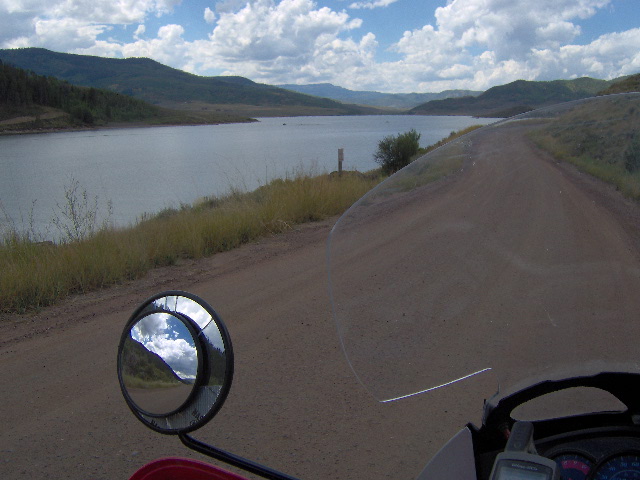
 By the time we got to Steamboat it was burger time so we relaxed and watched the vast crowds of weekenders come to the mountains to play. We left town on 14 Rd headed south, meandering through a valley filled with bicyclists. 18 Rd then took us around the west side of Stagecoach Lake then southeast on the 16 Rd to SH 134 about 50 south of Steamboat.
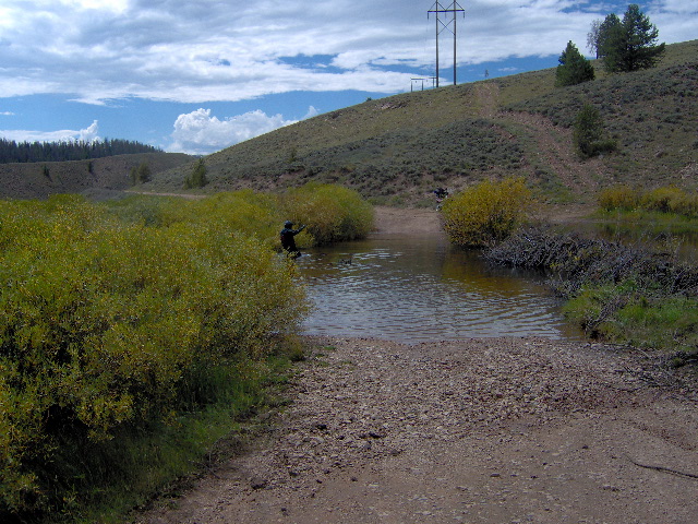
We crossed 134 and came to a wide creek. I sat and looked at it for a minute and decided to cross. Wrong-g. The creek was much deeper than it looked, about 2 ½ feet, and after about 20 feet the KLR drowned out. The bed was rock so I put down the kickstand, climbed off and started trying to push it. Greg was still on the bank so he waded out and together we pushed it another 20 feet to the far bank.
(Greg wading back to his bike after helping get my bike out of the creek on CR 117- His bike is just visible beside the bush on the right)
CR117 that we were on intersected SH134 about 3 miles further so I suggested Greg just ride the highway and meet me rather than trying to cross the creek. So I went east to 134 and waited for Greg. When he got back to the highway without a map, he inadvertently turned the wrong way so we spent about an hour riding around in circles looking for each other. Well, that’s why they call it an adventure. Our route was supposed to take us over the mountain on FS 212 to SH 9 but since we turned off CR 117 because of the creek we could never find access. Looking at the map now, I think I see where we missed it. As a result, we rode SH 134 into Kremmling and picked up SH 9 for a couple of miles then left on gravel on River Drive. River Drive became Williams Fork Dam road which was paved after a few miles to Ute Pass road, a beautiful ride up and over the pass. After a fast switchback road off the pass we hit SH 9 again and rode the 15 miles into Silverthorne.
We were not familiar with the area but found that Dillon, Frisco, and Silverthorne all blend together at the junction of SH 9 and IH 70. We began looking for a room but everything was booked. Finally we found a nice room at the Silver Inn about a mile off the interstate and walked down the street for a good supper.
The mileage for the day was again around 200 miles with mostly sunshine and mild temperatures. We did dodge some rain that hung over some of the surrounding mountains. Bikes did well, riders tired. The roads were good and the scenery was a mix of large valleys and forest roads. We did encounter a lot of vehicle traffic on some of the forest roads as it seems Colorado folks are not averse to driving their $60K BMW SUVs off-road.
Day 9, Sunday August 26, 2012
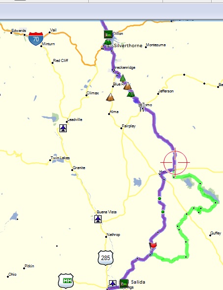
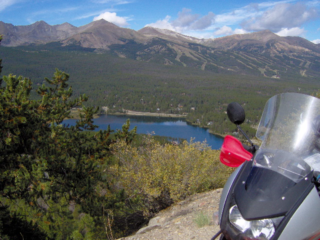
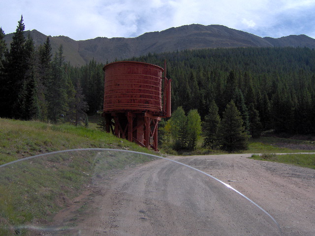
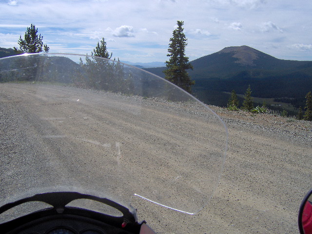
After breakfast at Village Inn, we rode across Dillon Dam which overlooks the reservoir on the south and Silverthorne in the valley to the north … a really nice view. We rode 10 miles down SH 9 to Breckenridge and took Boreas Pass road (FR 33) as it quickly climbed high above Breckenridge. There is a lot of SUV traffic on this dirt road but a great ride with good overlooks and a crossing of the Divide at Boreas Pass. At US 285 we made a short jog and took Elkhorn road south just west of Pike National Forest to US 24.
(Dillon Reservoir from Boreas Pass Rd) (Water tank near Boreas Pass)
It was here we ran into two-legged trouble. Garmin maps showed the road that continued on south of US 24 to be a county road. There was an unlocked gate, not uncommon on county roads in Texas, so we went through the gate and continued on for a mile. The road petered out at a construction site but we could see our road, 59 RD., just over a barbed wire fence. While we stopped to see if there was a gate to access 59, two cowboys in a truck pulled up across the fence and started yelling at us that we were on private land and threatening us. We tried to explain we were lost but they just kept shouting to get the hell off their land. Though we were both legally packing we didn’t want any more trouble, so we headed quickly back to US 24. At the highway we turned toward Hartsell 3 miles west. We stopped at Hartsell only to see our cowboy “friends”… fortunately they kept going. That was the only incident of its kind we had on the entire trip but it left a bad taste in our mouths.
(San Isabel NF from the 53 Road) (San Isabel NF near Salida)
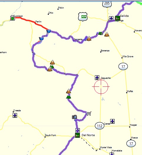
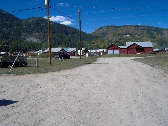
Leaving Hartsell, we turned south on the 53 RD through a large valley and into the foothills of the San Isabel National Forest. We were about 20 miles east of Buena Vista as we rode through the forest on a progression of roads, 85A, 902A, and 175, which dumped us out of the mountains into Salida, our destination for this short day of about 110 miles. We arrived as planned shortly after noon, in order to get a room, do some laundry, and generally rest up.
Salida is a neat small town of about 5,000 and it was really hopping that Sunday afternoon. There were storm clouds all around but not raining on us, so we rode around looking for a motel and checking out the town. After looking at a couple of rooms we went to a Sonic for a burger. Of course while we were eating the rain started to move in so we made a quick decision on a motel and got in the room just in time. Fortunately they had a guest laundry so we spent the afternoon resting and doing enough clothes to last the rest of the trip. We walked next door to eat rather than ride somewhere in the rain and then called it a day.
By now we had settled into a comfortable routine of stripping the gear off our bikes and filling every available space in our room with our stuff. Likewise, we had a morning routine of breakfast, then loading the bikes. We were using the D28 and D38 DrySpec bags from Twisted Throttle. These bags worked great and made loading and unloading a simple task.
Day 10, Monday August 27, 2012
We awoke Monday morning to clear skies with our goal being Del Norte that evening and another short ride of about 160 miles. The ride was short because the chief factor in deciding the distance for each day was the availability of lodging. About 5 miles west was Poncha Springs and US 285 so we headed south a few miles on 285 to Marshall Pass road. The pass road was a great dirt ride that quickly climbed out of the valley floor on switchbacks. There were a lot of campers, bicyclists, and four wheelers on the road. A couple of lady bicyclist on the road took our picture at the pass.
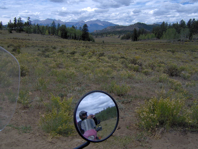
(Marshall Pass road-Greg in mirror) (Marshall Pass road)

(Marshall Pass road) (Marshall Pass road)
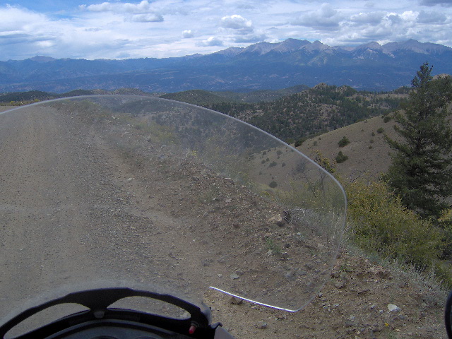
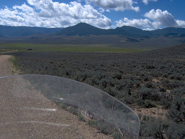
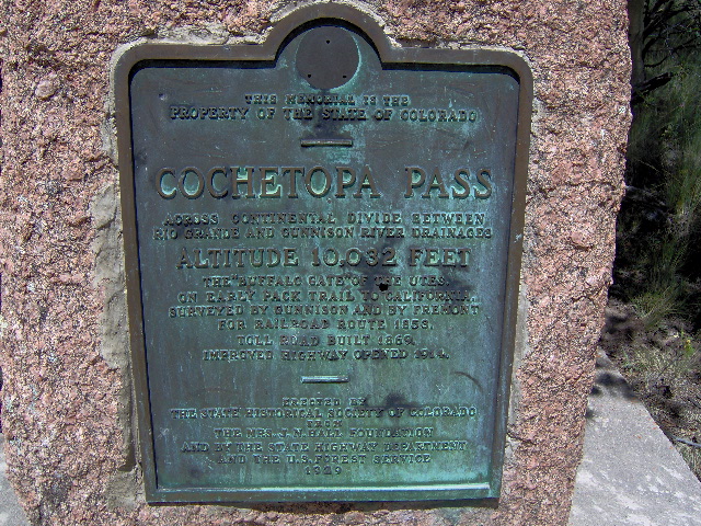
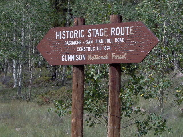
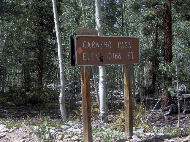
The pass road hits US 50 about 25 miles east of Gunnison and we continued down it to the 45 RD which took us into the Gunnison NF and onto the 14PP RD. At SH 114 we crossed and continued south on NN14 which is part of the historic Saguache-San Juan wagon toll road. The road passes over the Divide at 10,032 foot Cochetopa Pass, then back to SH 114. After about 5 miles on 114 we rode south again on the 41G road. On 41G we climb up and over Carnero Pass at 10,166 feet and then through the foothills of the Rio Grande N.
(NN14 road southeast of Gunnison) (NN14 road southeast of Gunnison)
(NN14 road southeast of Gunnison) (41G road north of Del Norte)
Much of the road was now more like high desert with rocky, sandy hills. At one point a wall of rain was just to our west but after donning rain jackets we only got sprinkles. As we neared Del Norte from the north we zizzagged on several short forest service roads, some of which were pretty sandy and came to the north edge of the Del Norte airport. According to the paper maps and Garmin the road continued across the airfield but it is now blocked and we had to detour a couple of miles west around the field. As what came to be our motto for the trip says, “It is what is”.
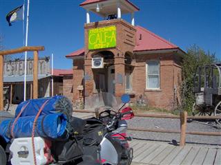
Del Norte sits at the juncture of US 160 and SH 112 with mountains to the southwest and plains to the east. It was about five in the afternoon (early for us) so we checked on lodging. There was one court (really a dog) and old historic hotel that had been remodeled with a $150 a night price tag. Greg’s wife Holley Jo had worked at the hotel for a summer while in college. Monte Vista was only 13 miles east down US 160 so we decided to give it a try. On the outskirts of MV we came to Best Western Movie Manor. When we checked in the lady desk clerk asked if we were familiar with their motel, then went on to explain. The motel backed up to a drive-in theater and all the rooms on the east side had big picture windows that looked out on the movie screen. The sound was piped into each room where you could control the volume. How cool is that?
We unloaded, crashed for while, and then rode a couple of miles into MV for supper. It was dark and chilly riding back but we made in time to watch “Brave” from our motel room on the big screen.
It seems that adversity has the positive benefit of making things memorable. I mention that because after traversing the passes, most of Monday is lost to me. The latter part was so uneventful that I remember very little of the actual ride. The weather was great, no bike problems, and we never got lost. Probably the highlight of the day was Marshall Pass and our free movie night.
Day 11, Tuesday August 28, 2012
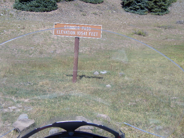
As we began our ride Tuesday morning, we were looking forward to finishing the Colorado portion of the CDT and spending our first night in New Mexico at Abiquiu. We left US 160 at Del Norte on Summitville road (FS 320). We began to climb quickly through the Rio Grande NF and rode a good deal of the morning above 11,000 feet. The 380 road took us over Indiana Pass and a little later over Elwood and Stunner passes, by the ruins of an old mining town, and then down into another mining town of Platoro. There were a number of RVs parked there and a small country store and restaurant. We grabbed a drink and candy bar and visited with the lady running the store. She told us a little about the town … basically that it was established in the late 1800’s for mining purposes but was now just a summer haven for vacationers wanting to get off the beaten path. She related that she and her husband were from Texas and that everybody left town when the snow started and then returned in the late spring. The town is pretty well isolated as it’s about 25 miles of dirt on the 250 road to Colorado SH 17 and then 25 miles west to Chama, New Mexico.
(On Summitville Road) (On 380 Road) (11,380 feet on 380 Road)
(On 380 Road) (Greg on 380 Road)
(On 380 Road) (On 380 Road)
(Stunner Pass on 380 Road) (On 380 Road)
(Greg at Platora store) (Platora, Colorado – Fnd. 1882, elev. 9800 ft.)
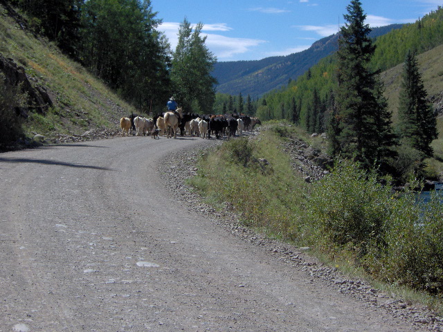
As we headed south down 250 paralleling the scenic Conejos River, we came upon a rancher moving some cattle on the road. With the mountain on one side and river on the other we followed them for a quarter mile before he moved them over enough for us to idle quietly by. I imagined that I heard him say something like, “Damn bikers”, as we rode past.
(On the 250 Road south of Platora)
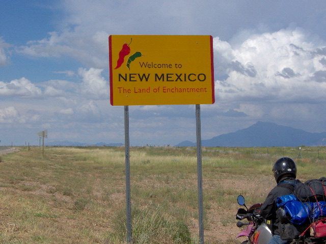
. (On the 250 Road south of Platora) (On the 155 Road entering New Mexico)
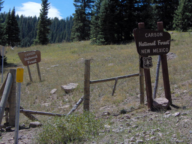
We continued southwest on SH 17, a very scenic stretch of asphalt over Pass La Manga to road 115, the dirt road which would take us into New Mexico. After about 3 miles we came to a barbed wire fence and a cattle guard announcing with little fanfare that we were crossing into Carson NF New Mexico. The road, designated RD 53 on Garmin maps, led us to a fork with some RV’s parked there. Following Yogi Berra’s advice, “When you come to a fork in the road, take it”, I told Greg to wait and I’d explore the right fork. After nearly crashing 3 times in a hundred yards I decide to ask the camper’s advice. They suggested going left which turned out to be correct but bad news. This was FR 87 and after about a mile we came to perhaps the worst section of road on the entire trip. With no warning the road turned to loose, bowling ball size rocks and was seriously steep for about a half mile. Once I started up all I could do was give it gas to maintain momentum and try to hang on. I bounced all over but managed to reach a small summit. When Greg didn’t appear after a few minutes, I started walking back down fearing what I might find. About half way up the rock strewn hill his bike had thrown its chain. We finally got it back on and he was able to make the summit where we made adjustments to the chain before continuing on.
 (From the 87 Road where we adjusted Greg’s chain after the “hill from hell”)
FS 87 continued to be really slow and difficult and the day was slipping away, as was our 65-year-old energy supply. FS 87 finally forked onto FS 133 and a good forest ride down to US 64 which was about 15 miles west of Tres Piedras at the junction of US 285. The CDT showed to head west on US 64 for a few miles and then turn south on FS 191B to Abiquiu. Most of the 60 mile ride on to Abiquiu was FS roads of unknown condition. So far we had not been too impressed with New Mexico forest roads. There is one inn at Abiquiu and we didn’t know if a room was available meaning we might have to camp. After considering the time of day, the questionable roads and lodging, we elected to head east to Tre Piedras and see if they had any lodging.
Tres Piedras is pretty much a ghost town with one ramshackle store/restaurant but no lodging. We went in for a drink and talked to the proprietor about lodging. He first said Espanola that was 55 miles south on US 285 but then suggested Ojo Caliente which he thought had an old motel and was only 30 miles. The motel had recently been purchased and updated by a man and his wife and turned out to be my favorite room of the trip. The structure was concrete block but the room was really nice with good beds, fresh paint, and unique decorations. It even had a courtyard where he let us park our bikes off the highway. There was a Mexican food mom-and-pop restaurant where we ate supper then went back to the room and watched a movie on a DVD he loaned us
(Motel in Ojo Caliente – “Does Greg look tired?”) 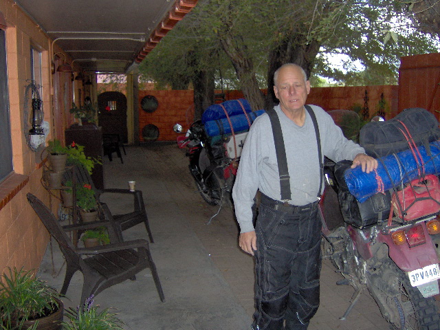
We were a little frustrated at the end of the day having traveled over 200 miles and wound up about 50 miles off the CDT. We visited with the motel owner about some options for Wednesday’s departure and came up with a plan. The day’s weather was good though at times there was rain over the surrounding mountains.
Day 12, Wednesday August 29, 2012
The plan we had come up with the night before was to travel SR 111 and SR 554 to Abiquiu on US 84 and pick up the CDT. We decided it wasn’t worth trying to go north and west 60 miles to just to ride that section of forest road. Both 111 and 554 were very narrow paved roads that took us through some remarkable scenery. We arrived quickly at Abiquiu and chose to bypass FR 31 and find an alternate route through the Santé Fe NF to Cuba. The Mapsco paper maps for New Mexico were too small a scale to be of much use with most of the forest service roads looking like mere squiggly lines. Our fear was that we would get lost or run into more bad jeep roads. We traveled up US 84 a few miles to SR 96 which crosses the Abiquiu Dam heading west. After several miles and a couple of dead end FS roads we took CR 413 south to Highline Trail, Penas Negras Trail and onto Fire road 70 … alas we were back on the CDT route. It was on Penas Negras that we came upon a lost calf that softhearted Greg wanted to herd up the road to find its mama. I persuaded him to move on with warnings that we might have to sleep in the desert under the stars. Eventually, FR 170 hits paved SR 126 which dumped us in Cuba on US 550.
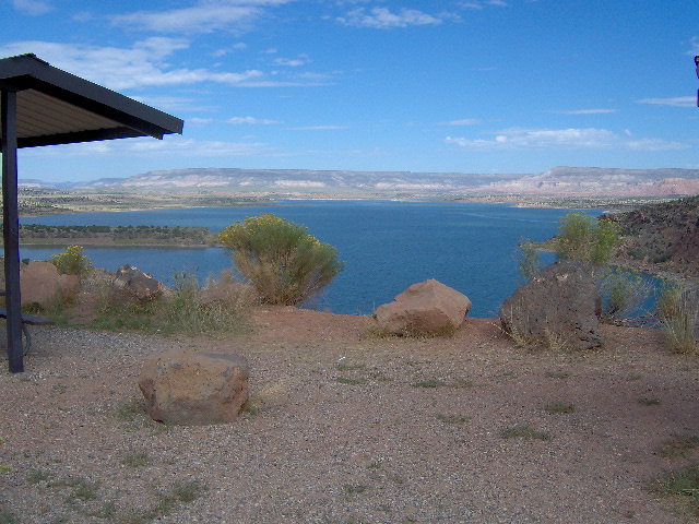
(Abiquiu Reservoir) (On the Penas Negras Trail east of Cuba)
After gassing up and chowing down we left Cuba on 550 for about 15 miles to our dirt turn off on Piedra Lumbre road. The morning had been an easy ride but as soon as we hit dirt we knew the afternoon was going to be a different story. Our road was little more than a two-track jeep road, rutted with 6” deep sand. There’s not much more intimidating than riding with top heavy bike in deep sand. The secret is to scoot back on the bike and keep the throttle on, maintaining 25 to 30 mph so the front wheel will plane-out on the sand. Easy, right? Wrong-g-g! It’s hard to make yourself go fast when the bike is squirming around and you just know your gonna’ crash any second
(On Guadalupe Road)
 (On Guadalupe Road)
The terrain was high desert with 6-8,000 foot rocky peaks and buttes interspersed with deep arroyos. After many miles of sand we hit the San Luis road which was gravel and graded dirt. The road forked at CR 25 (Guadalupe Rd) which took us up an amazing switchback road to the top of the huge Sarcio Mesa. The road on the mesa was deeply rutted and rough and at times we had to ride beside the ruts to avoid crashing. I’m not sure of the distance but it seemed about 20 miles across the mesa to San Lucas road. After several miles we hit the 192 road, then gravel SR 605, then road 239 which was a great switchback road that meandered down and down till we finally hit pavement at SR 547. We were really glad to see pavement and we rode quickly the 10 miles into Grants on IH 40 for the night. When we got to our motel on 40 we were exhausted. Rather than cleanup and go eat I called in a pizza and we ate in the room and crashed.
I think we were both more tired that evening than any other night. We traveled about 200 miles and had good weather all day, but the afternoon roads were a real bear and just wiped us out.
Day 13, Thursday August 30, 2012
Greg woke up hurting Thursday morning and decided to not ride the main dirt section of the day. The first half of the day was mostly pavement and he could ride the afternoon on pavement down US 180 to Silver City, our destination for Thursday.
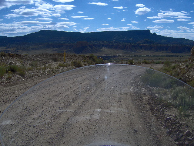
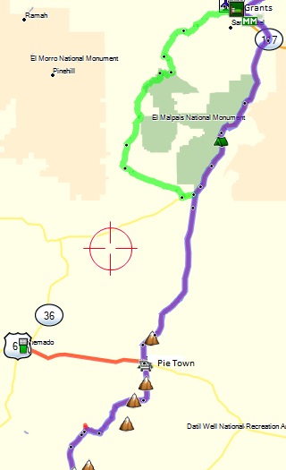
We left Grants on paved SR 117 headed south around the east side of El Malpais National Monument. El Malpais is a huge lava flow about 20 miles north to south and 10 miles east to west. SR 117 was a nice scenic 40 mile ride to the intersection with Pie Town Road (road 41) which was about 30 miles of gravel across high desert. We intersected SR 603 and rode into Pie Town.
(South end of Malpais) (Toaster House in Pie Town)
The community of Pie Town is very small but it has two restaurants famous for their pie. It was only 10:30 in the morning but one of the traditions of riding the CDT is to have pie in Pie Town. The pie was delicious but I’m not sure Greg enjoyed it much as he was in a lot of pain. The restaurant closed as soon as we left so they could bake pies for the weekend Pie Town Festival. After Greg left on the highway, I rode by the Toaster House. This house gets its name from several defunct electric toasters fastened to the front gate arch. When a local lady’s mother passed away, she made her mother’s vacant home available for no charge to travelers on the CDT. No one lives in the house but it has a stove for cooking while sleeping is relegated to the floor in your own sleeping bag … at least it gets one out of the weather.
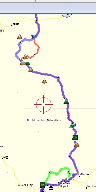
Now alone, I took Bar Road south to Ed Jones Road which led me into the Gila NF mountains on NF 214. I had crossed the Divide three times in about 25 miles. NF 214 forked onto Route 93 and then intersected with SR 12 where I crossed onto Bursum Road. By this time I was out of mountains and into a high valley for about 10 miles.
(On Ed Jones Road) (On Bursum Road)
Bursum forked off left and I took RD 47 back into the mountains and then merged on to FR 94 on which I crossed the Divide two more times. FR 94 intersected SR 159 which I had assumed was paved and would allow me to make some time. The forest roads had been somewhat slow, having to climb up and down and back up again. Well, 159 was gravel and then dirt and then very rutted dirt that ran through a valley for several miles before forking onto SR 61, also dirt … so much for making up time. (“It is what is”)
(From SR 159 looking south toward rain in the mountains)
By this time I could see thunderstorms over the mountains in my path to the south and wondered what I was in for. By the time I got back into the mountains the rain had just moved out leaving the roads slippery with mud and the temperature had dropped considerably. SR 61 further on became Star Road with the two together crossing over 50 miles of the Gila National Forest. Added to the mud and cool temp, the road ascended each mountain by switchback and then descended the other side by switchback, over and over and over again … there was no high road that would take me across the mountains. That portion of the ride would have been a lot of fun if the roads had been dry but the mud was really treacherous. That was the most difficult “sustained” ride of the trip. I thought I’d never see pavement again but finally hit SR 35 whose glorious asphalt took me to SR 152 and west into Silver City.
As I came into Silver City I called Greg and got directions to our motel. He still wasn’t feeling great so we walked across the parking lot to a local steak house. Once again he had to endure my telling of the day’s adventure while we ate. The day’s mileage was around 250 miles with the bikes doing fine … but this rider was worn out.
Day 14, Friday August 30, 2012
Friday morning, Greg was still not feeling well so he decided to ride paved SR 90 from Silver City to Lordsburg where we intended to spend the night. At our motel in Silver City we met a man and his wife (I think from Tennessee) who were riding the CDT on a couple of street-legal KTMs, a 350 and a 500 cc. They had previously ridden from Canada to Salida, Colorado and this year were riding from Salida to Antelope Wells. They were traveling much lighter than we were with very little gear. We had a good but brief visit with them and as it turned out we would run into them 3 more times that day.
I left Greg at the motel about 8:30 planning to meet in Lordsburg. The plan was to finish our ride to Antelope Wells at the Mexico border the following day, then meet our wives in Las Cruces that evening. I rode south on SR 90 then left on Separ Road, a dirt road meandering through high desert. The road was scenic but had fairly deep sand and crossed several ravines that were almost washed out. I made fairly good time but as always I hated the sand. I had planned to angle off Separ Road on a natural gas road to Lordsburg. When I got there it was just a sandy track so I continued south where I hit IH 10 about 15 miles east of Lordsburg. There I met the KTM riders who were headed south on SR 146 which would take them to Antelope Wells. I turned west and was in Lordsburg by 11:00 and tried to call Greg. I finally got hold of him and waited for him at a MacDonald’s.
(Scenery on Separ Road) (Wash out on Separ Road)
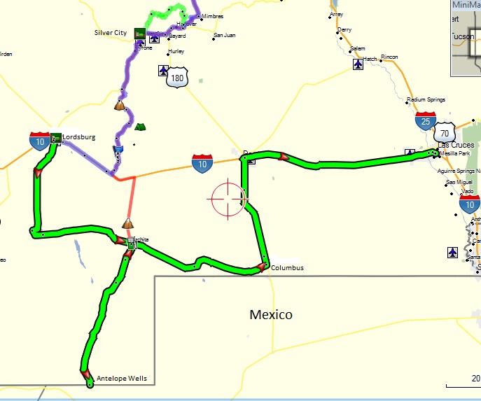
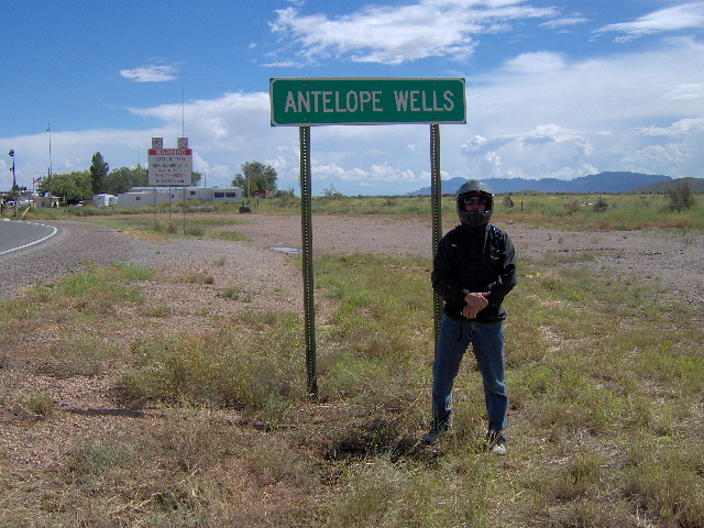
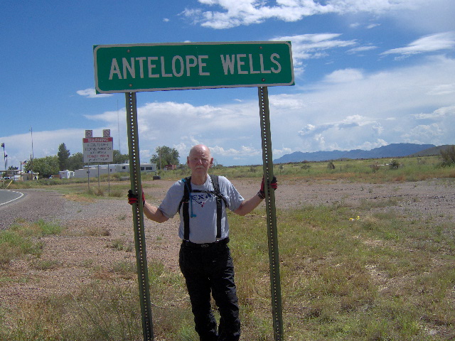
Originally we had planned to ride mostly dirt from Lordsburg down to Antelope Wells, though the CDT shows to follow SR 146 from IH 10. After seeing how sandy the dirt roads were I suggested to Greg that we just ride pavement to the border. I also proposed that we leave right then for the border and then continue on to Las Cruces a day early. It would be a long day but seemed crazy to hole up in the motel for the rest of the day. Greg concurred, so we headed south out of Lordsburg on CR A009 to SR 9 then headed east. We crossed the Divide twice before we reached the tiny town of Hachita. There we turned south again on SR 81 that took us the rest of the way to Antelope Wells. We passed by some high rocky peaks and, as one might expect, we saw a plethora of US border Patrol. We passed our KTM friends as they headed north from the border. There is no real town at Antelope Wells but we stopped and took the requisite number of photos to verify the end of our ride on the CDT.
(On SR 9) (Jerry at the border of Mexico)
(Greg at the border of Mexico) ( 2826.66 miles border to border)
(Looking north from the border) (Looking north from the border)
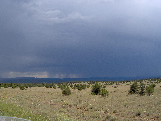
As we headed back north on SR 81 we saw that the storm clouds over the mountains were moving toward the highway. As we turned east at Hachita on SR 9 we were right on the edge of a large thunderstorm and picked up spray off of it for several miles. We rode on to Columbus where we stopped for gas and a drink, once again catching up to the KTM folks. They told us they were heading on to El Paso for the night and then were going to ride part of the “Shadow of the Rockies Trail” north. Originally we had planned to ride dirt county roads from the border to Las Cruces. But concern about sandy roads and the lateness of the day persuaded us to head north on SR 11 to Deming and then east on IH 10 to Las Cruces. As we neared Las Cruces the storm clouds were gathering all around the city so we headed straight for the La Quinta. The mileage for the day was about 360 miles and we had fortunately dodged the rain once more. It was good day and a good ending to “the trip of a lifetime”. We were really glad we had come all the way to Las Cruces as it rained all night and all the next day.
Epilogue
As I think back on the trip I feel truly blessed by the Lord to have the time and money to make the trip … and especially an understanding wife and a great friend to share the adventure with. There were times toward the end of the trip when I really wondered if I wanted to continue to ride dual-sport. To be honest, there was an element of fear in my rumination because of the many times on the trip I came close to taking a bad fall. To explain, I must digress to a month before we began our CDT trip. In preparation for the CDT we made a shake-down trip Sipapu, New Mexico. We loaded our bikes with all our CDT gear to see how well they would handle and took off on some forest service roads. Before long we got in over our heads on some badly rutted and washed out jeep roads high in the Carson NF. I fell twice really hard within a quarter mile, once on my left side and once on my right. The bike was okay but I was hurting as bad as I ever had. I could barely get on my bike and we still had miles of bad road to go. Greg had to ride both bikes over a couple of really bad places but we finally made it down to a good FS road and made it back to camp at dark. I knew I couldn’t sleep on the ground with ribs on both sides killing me so we headed back to Las Vegas. There I spent the night trying to sleep in a motel recliner. Fortunately my ribs were only badly bruised but were still hurting at the beginning of our Divide trip. As a result, the fall was fresh on my mind the entire CDT trip.
Now fast forward to September, back home in Lubbock with our adventure behind us. Over lunch Greg and I debated the future of dual-sport adventures for us. We both agreed that the primary difficulty we experienced on the trip was due to the top heavy weight and short travel suspension of the KLRs. Make no mistake, the KLR’s did us proud and they are great bikes. However, since we trailer our bikes to the beginning of most rides we concluded we could get by on a lighter dual-sport bike. I had just received my Cycle World magazine and they had an article about upgrading a Suzuki DRZ400S for dual-sport riding. The more we read and researched it the more we decided the DRZ was the way we wanted to go. The bike was more like a dirt bike with almost twice the suspension travel and over a hundred pounds lighter. That week I found a 2012 DRZ400S at my local dealer with 400 miles so I bought it and sold my 2008 KLR. Since then I have made numerous upgrades including aluminum panniers designed to keep the weight low on the bike. Greg just recently purchased his DRZ400S and we plan to make a 600 mile ride next month. So the jury’s still out on our decision but I think there are many more adventure rides still to come.
Jerry Lewis March, 2013