TRANS-AMERICA TRAIL RIDE REPORT 
Jerry Lewis & Yancey Jones
Part 2: Salida, CO to Port Orford, OR
By Jerry Lewis
Prologue
As I mentioned in part 1, the Trans-America Trail is a dual-sport motorcycle adventure designed by Sam Correro. The route consists of about 80 percent off-pavement roads which crosses 4,800 miles of the U.S. from eastern Tennessee to the Pacific coast in Oregon. The official trail head is Tellico Plains, TN and ends in Port Orford, OR.
Having ridden solo and completed the eastern half of the TAT at Salida, Co. in September 2013, my intention was to finish the trail to Port Orford in the summer of 2014.
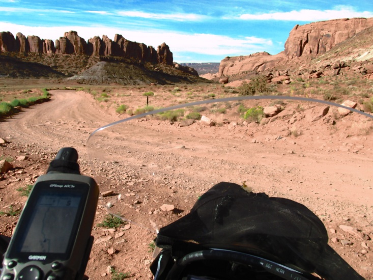
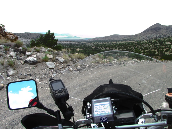
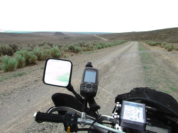
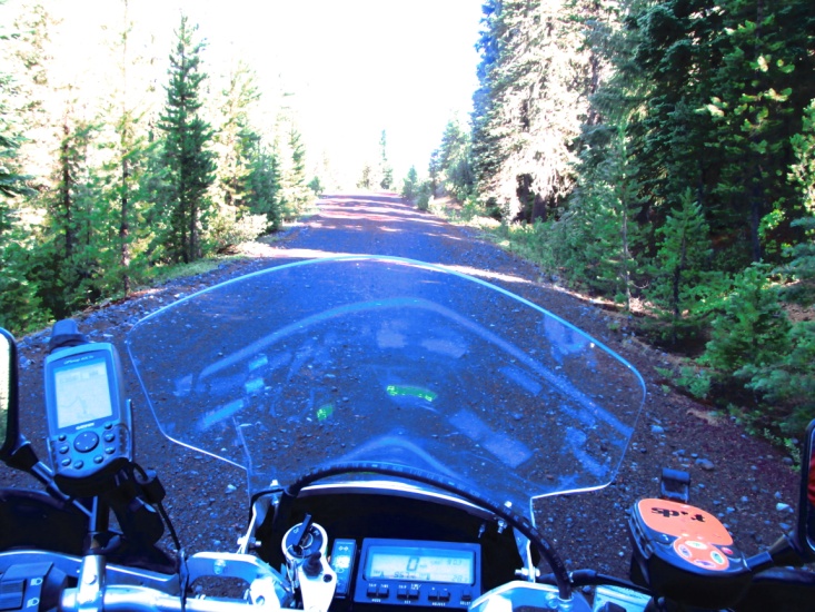
I purchased the Utah, Nevada, California, and Oregon roll-charts and paper maps from Sam. Using his paper maps, I once again constructed my own GPS tracks and routes in Garmin Map Source to load on my Garmin 60CSX GPS.
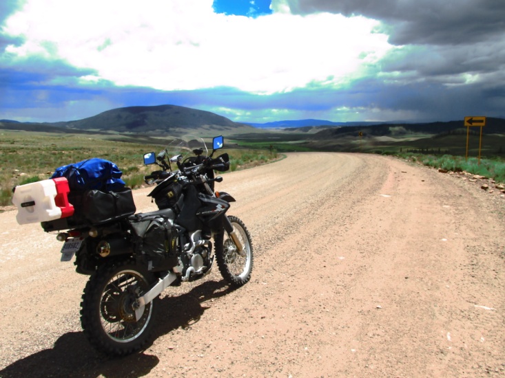
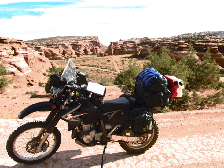
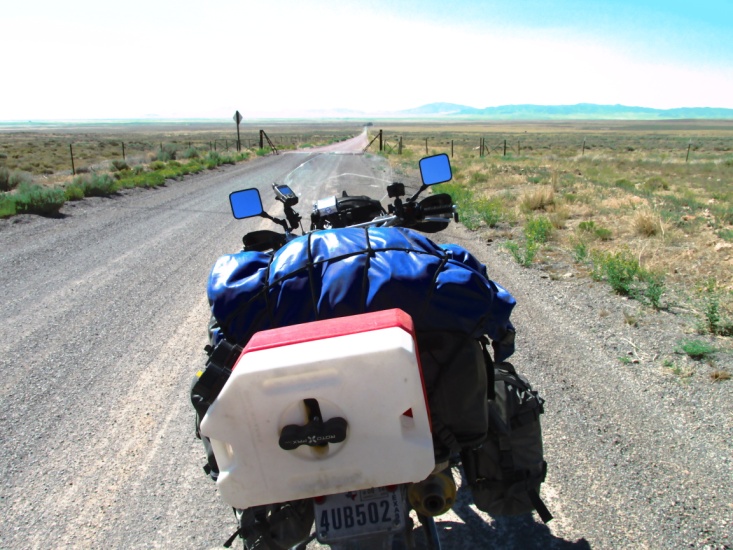
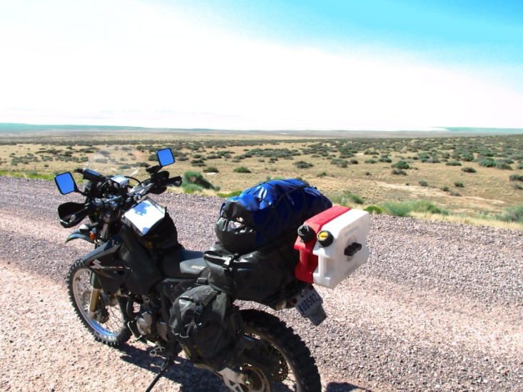
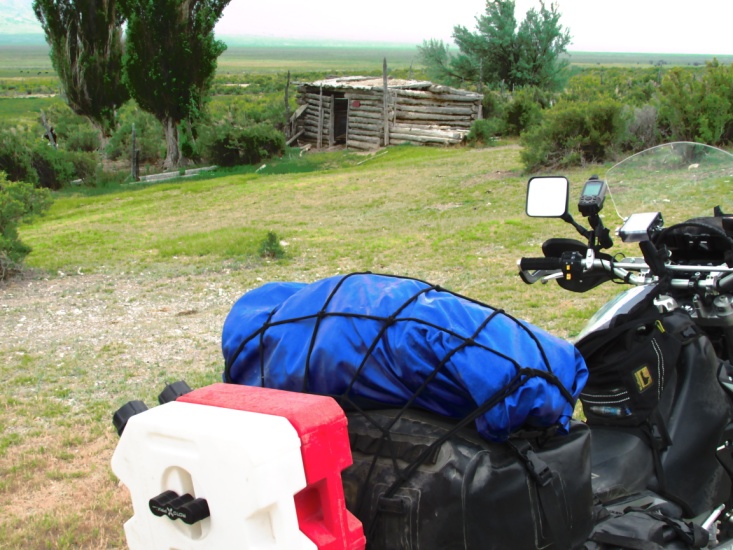
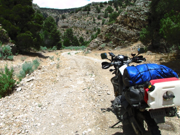
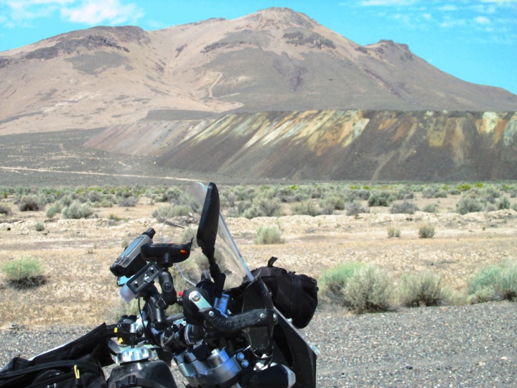
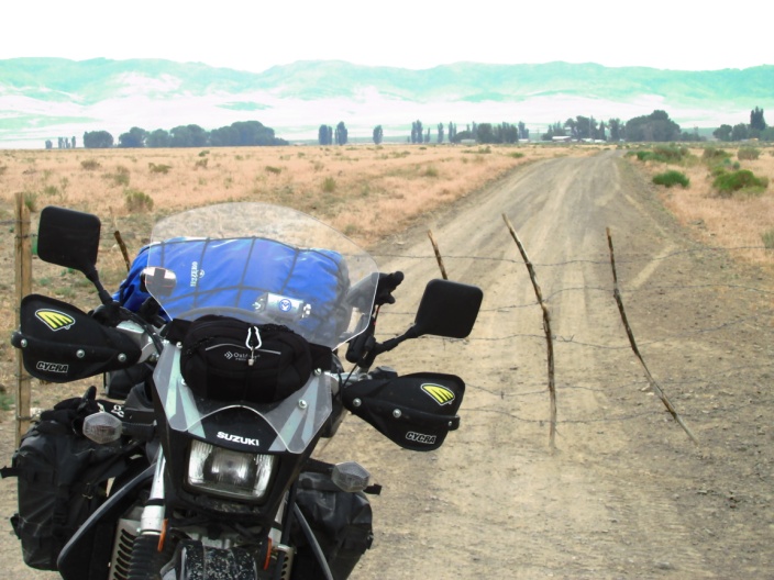
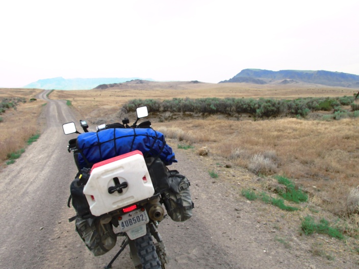
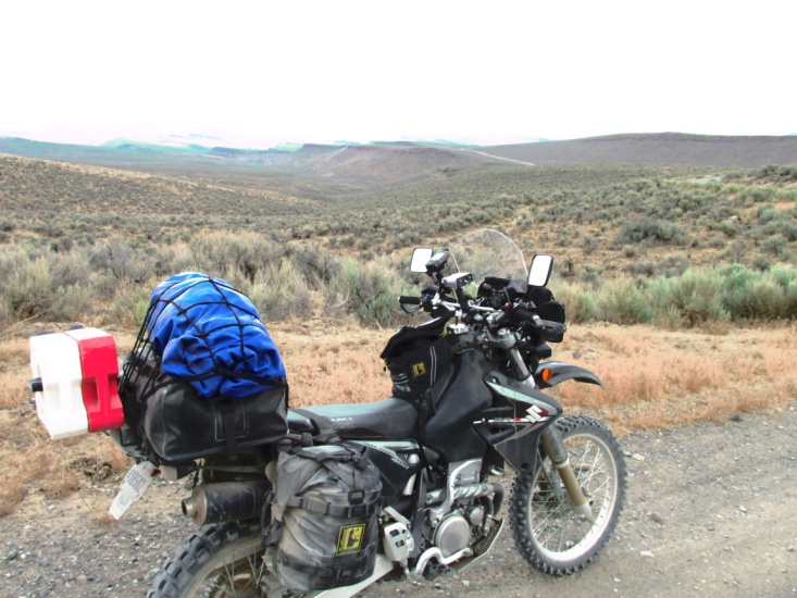
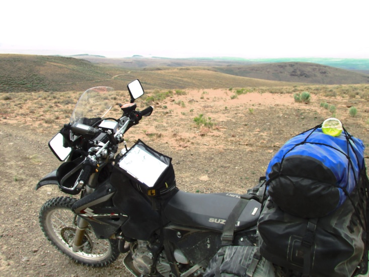
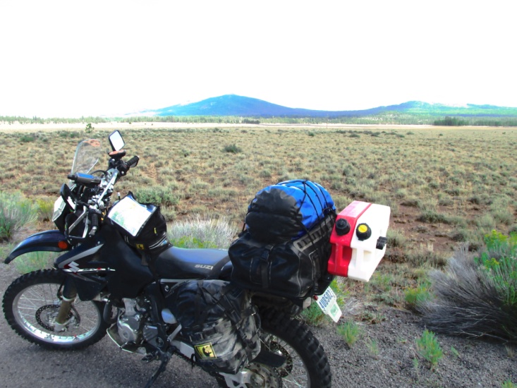
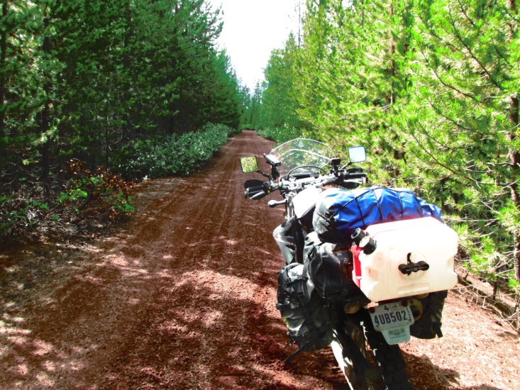
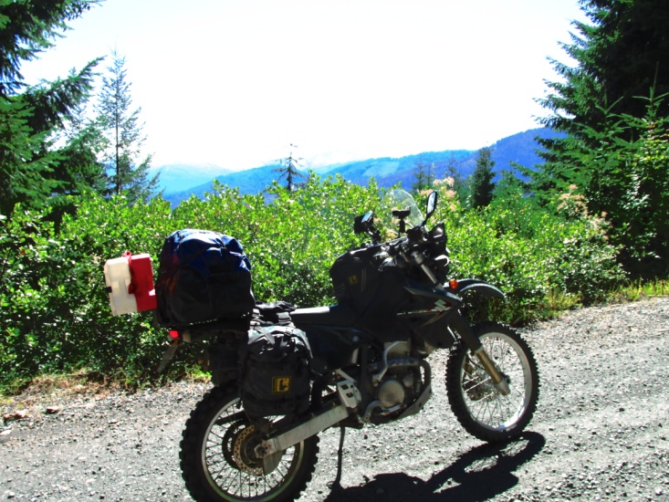
My 2012 Suzuki RZ400S was still in great shape needing only new tires. I invested in a set of Tubliss tire inserts which means the tires are tube-less and you can repair flats with only a plug. I rode the eastern TAT with the Happy-Trails aluminum pannier system. Last fall I sold the panniers on Craig’s List and purchased a set of Wolfman Expedition bags and side racks. The metal panniers were very convenient and waterproof but I was concerned about injuries in the event of a fall. The soft bags are much more forgiving when the bike is lying on top of you.
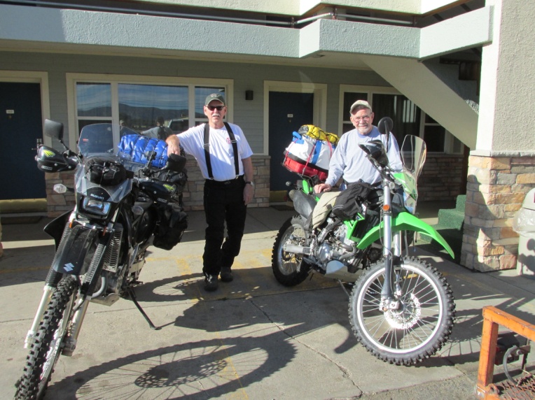
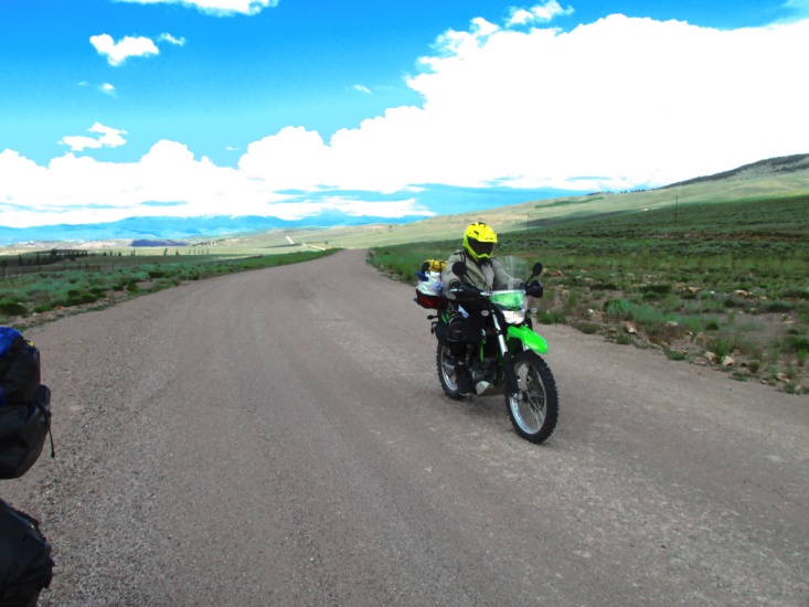
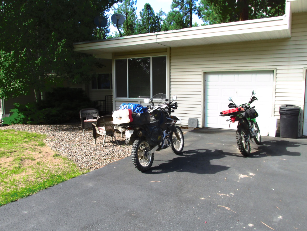
My plans changed in February when long-time friend Yancey Jones expressed an interest in accompanying me on the adventure. Yancey is 73 (older than dirt) but in good physical shape and a former dirt rider. Having not ridden in several years, he wanted a bike that was lighter and lower in seat height than my DRZ400. We found a 2012 KLX250S with 1,200 miles on it in Denver. We made a two day trip to pick it up in the middle of a snow storm. After lowering the bike and a great deal more accessorizing, we made a day long trial run through west Texas ranch country. We followed that up with a 4-day dirt loop to Weatherford, TX and back, allowing Yancey to get comfortable again with riding off-highway.
Confident that we and the bikes were ready for this arduous trip to the west coast, we set our sights on mid-July.
Once again, my brother-in-law Kenny Paxton generously agreed to haul us to our starting location. Kenny brought his truck and trailer to Lubbock on Thursday and on Friday, July 11th we left for Salida, CO arriving about 6 pm that evening.
Day One – Saturday July 12th
(Salida, Co to Lake City, CO)
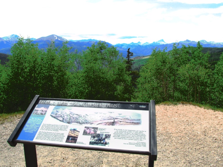
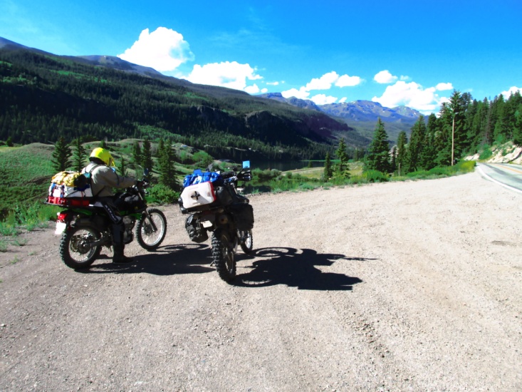
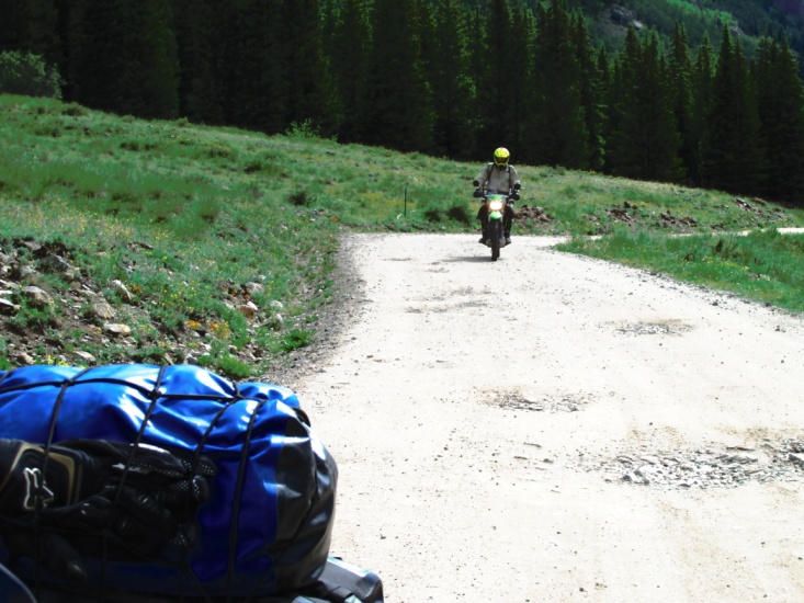
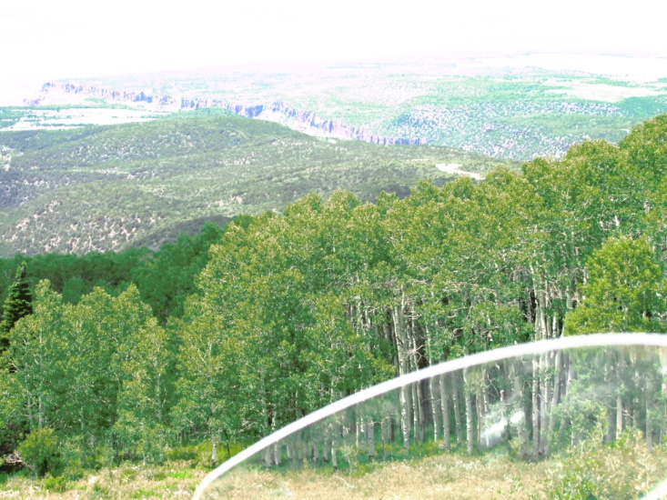
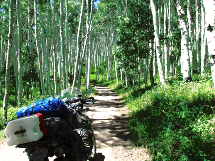
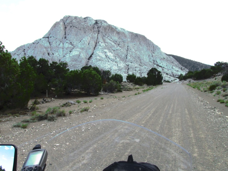
The morning was cool as we left Kenny and the Salida Inn. Our destination was Lake City, CO … a planned short-day of only about 140 miles. We headed west on US 50 for 10 miles where we turned south on US 285 at Poncha Springs. After a few more miles we turned west on a dirt forest service road to climb up and over Marshall Pass. This is a great ride which is also part of the Continental Divide Trail. We met four guys from Atlanta on WR 250’s at the summit who were camped out and riding all of the area forest roads. They alarmed us when they said the road blocked by snow.
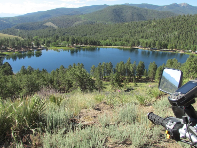
Salida, CO – Saturday morning Lake on Marshall Pass
Yancey – Marshall Summit Jerry – Marshall Pass
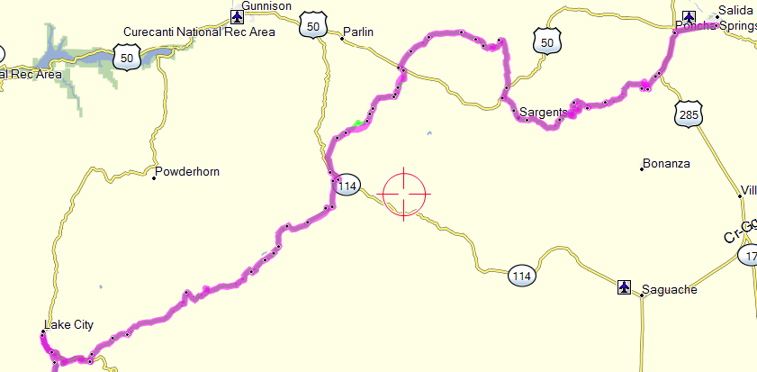
As it turned out the snow was on a side road off our route. About 11 am we arrived in Sargent’s on US 50 and ate an early lunch (great sandwich) at the gas/store/café. My first mistake of the day was telling Yancey we didn’t need gas. The second mistake was forgetting the trail now deviated from the roll chart. I notice my green track-line on the GPS had disappeared so we wound up backtracking on US 50 for 5 miles then turning north on the Tomichi Creek dirt road. We rode through very scenic country and over a pass before eventually crossing US 50 again. Passing through some really pretty valleys we stopped to put on rain jackets as the storm clouds were building in our path. It never rained hard but some of the Forest Service roads got a bit slippery. I stopped a short ways ahead to wait for Yancey but when he didn’t show up I began to worry and went back to find him. He had run out of gas and was unloading his bike to access his Rotopax gas can. In my head I had the distance to Lake City as 120 miles when it was actually 140. Eventually we hit paved CO 149 with great twistys down the mountain to Lake City. When I pulled into Lake City I waited for Yancey for a while then went back and discovered he had run out of gas again about 5 miles from town. Back in west Texas he was getting 65-70 mpg but at 8,ooo feet of elevation he was getting about 50 mpg. We located our motel, North Face Lodge, and checked in. It was a cool place with a friendly manager. It was perfect for dual sports as it had a steep gravel access drive on both ends of the property. It began raining a bit as we rode to a supper of pulled pork and cherry pie alamode. We were both pretty tired and Y’s boots were hurting his feet.
All in all it was a good day … no falls, good weather, and 150 miles of beautiful scenery.
Scenes between Sargent’s and Lake City
Day Two – Sunday July 13th (happy birthday Jerry)
(Lake City, CO to Norwood, CO)
There’s a saying in the military that even the best plan of battle last for about 15 minutes once the shooting starts. The same could be said for dual-sport adventures, though we did make it to the second day before things began going south.
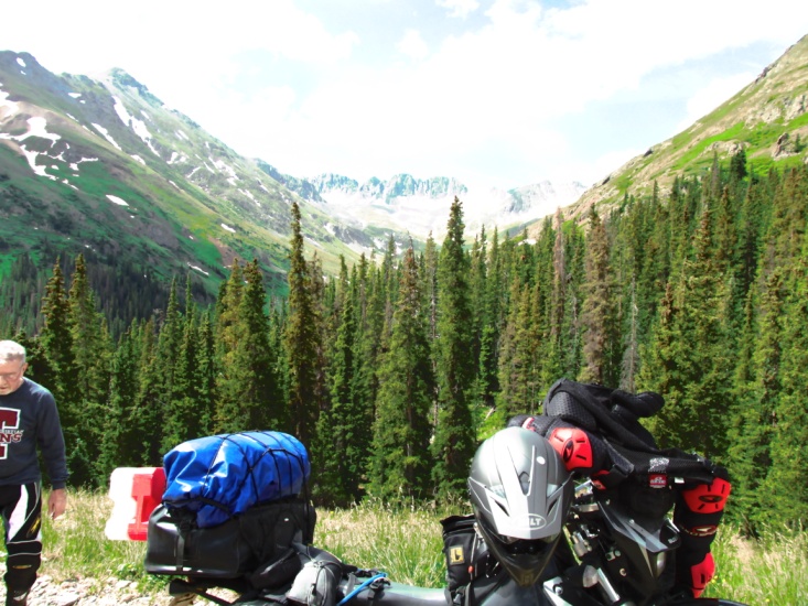
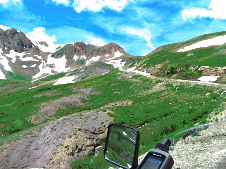
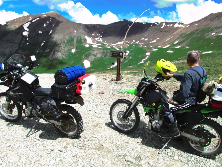
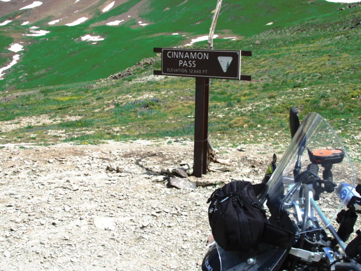
After a great breakfast at the Tic Toc we loaded up and rode west to San Cristobal Lake then started up the jeep road to Cinnamon Pass. At first the road wasn’t too bad but then got very rocky and washed out with steep switchbacks.
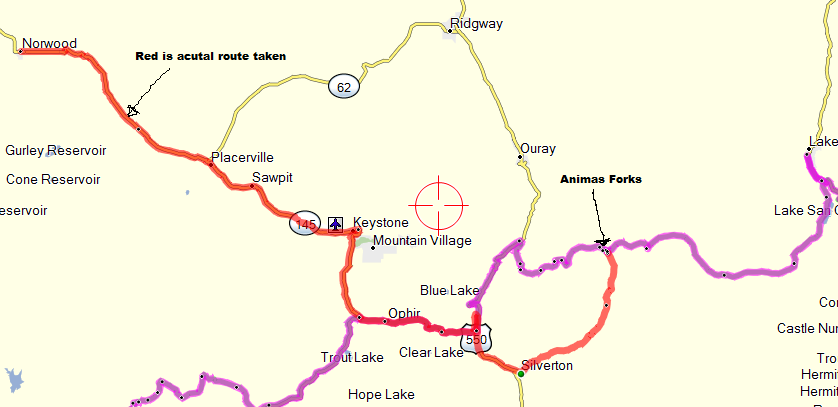
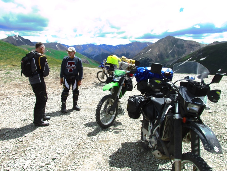
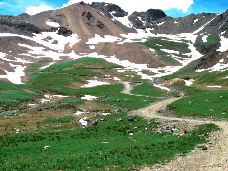
On one of the switchbacks Yancey took a bad fall and wound up with his leg pinned under the bike. Some 4-wheelers stopped to help and a lady examined Y’s ankle and pronounced it a bad sprain but probably not broken. He could still ride so we continued on to the summit and then on to the ghost mining town of Animas Forks. As we started climbing up California Gulch the road got steeper and was carved out of 15 foot snow drifts. Yancey crashed hard on another switch back. After we got his bike back up I rode down a ways and then tried the same switch back. I barely made it as the bike was loading-up badly due to the almost 13,000 foot elevation. Since there was much more climbing to reach the summit we conferred and decide to return to Animas Forks and take the jeep road down to Silverton. By the time we reached Silverton it was 3 pm so we ate a late lunch of peanut butter crackers. We decide it was too late to make our destination of Monticello, UT so we decided to try for Telluride and find a room there. Highway 550 would take us north to reconnect with the trail. On the erroneous advice of some locals we rode 550 to the jeep road over Ophir Pass. Ophir Pass, so we were told, was the easiest of the pass roads and it really wasn’t too bad going up. However, the descent was very difficult as the road passed over long stretches of very treacherous mine tailings causing Yancey to fall two more times. Further down we crossed a couple of fast moving streams before finally hitting pavement that took us into Telluride. After conferring at length with a lady at the visitor’s center we discovered there were no rooms to be had in the entire town. The closest town going west was Norwood, CO, 50 miles further down the road. After making a reservation, we rode through a short shower and finally made Norwood about 8 pm. We barely made it to a saloon/café for supper before they closed. Then we returned to our room which was surprisingly one of the nicest rooms of our trip.
Yancey’s ankle was purple and swollen and he could barely walk. We did about 185 miles for the day but we were about 60 miles off-trail. I spent some time looking at maps to see what our options were for reconnecting with the trail.
 Headed out of Lake City 14,000 footer’s on the horizon
 San Cristobal Lake out of Lake City Headed up Cinnamon Pass
 Headed up Cinnamon Pass See … Yancey can keep the shiny side up
 Headed up Cinnamon Pass
 Yancey’s helmet wore his hair off the back of his head Summit — Cinnamon Pass
 Yancey to another rider, “Did I tell you about my ankle? California Gulch
 Headed from Animas Forks to Silverton Going up Ophir Pass
Day Three – Monday July 14th
(Norwood, CO to Moab, UT)
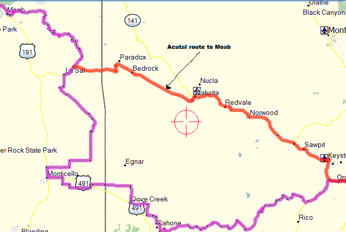
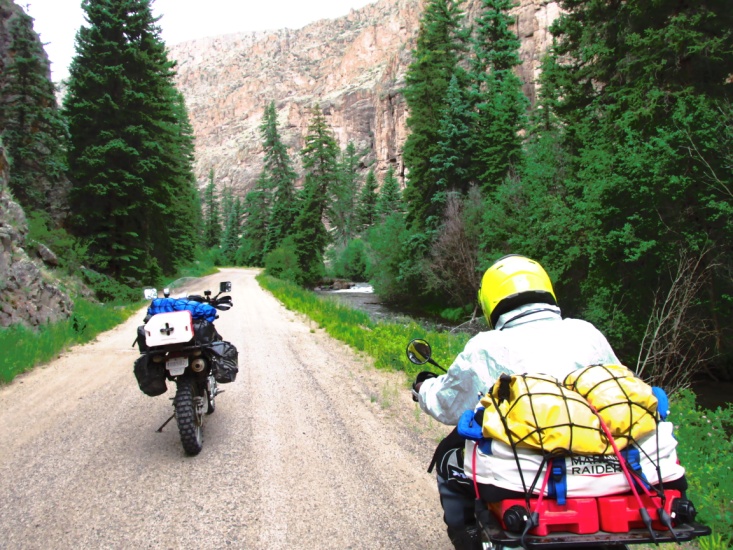
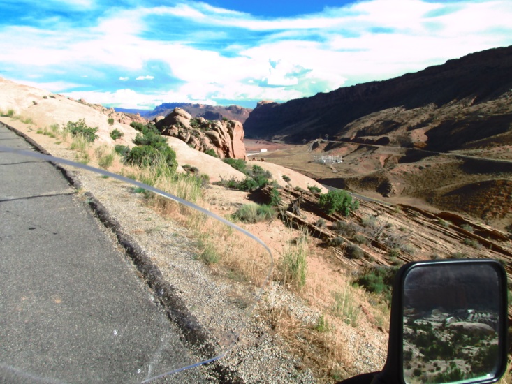
After breakfast we returned to the motel to do some repair on Y’s bike. His handlebars and one of his brush guards were bent so I took the aluminum guard frame to a local garage and borrowed a hammer and vise and bent it back in shape. The handlebar would have to wait. About 10:30 we headed west out of Norwood on CO 145 to CO 141 and then CO 90 to the Utah border. 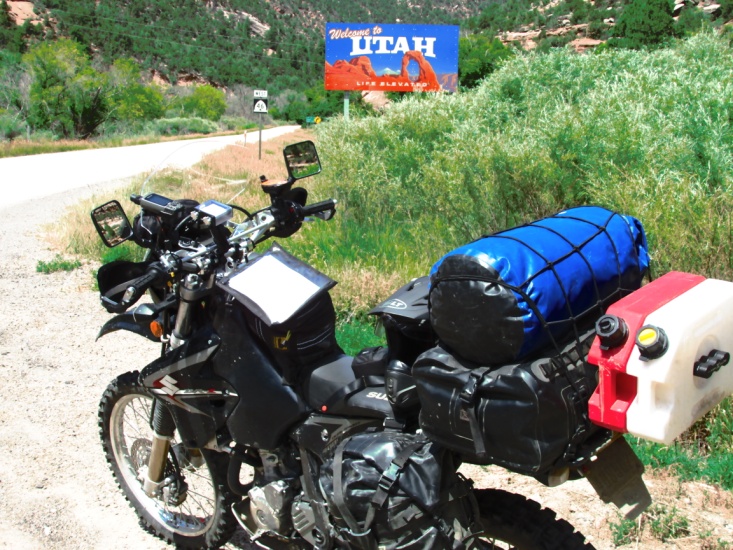 In Utah the road changed to UT 46 which intersected the TAT several miles north of Monticello, UT. The ride there was very scenic passing through some long canyons and climbing out through paved switchbacks. As it turned out, the mileage was almost the same … instead of going west to Monticello and north to the trail junction with UT 46, we went north from the trail to Norwood then west to the same junction. What we missed was some foothill roads in Colorado before the trail turned to county roads going into Monticello. The TAT went north off UT 46 and followed Dark Canyon Lake Road just below tree-line on 13,000 foot Mt. Peale and Mt. Mellenthin, and then over Geyser Pass. It was a great ride … the weather was cool and the road was good. Yancey fell once on another switchback skinning his knee. Eventually we came out of the forest overlooking a huge valley southeast of Moab.
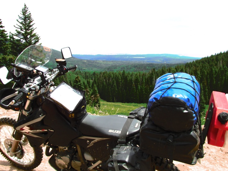
 View from Dark Canyon Lake Road View from Geyser Pass Road looking toward Moab
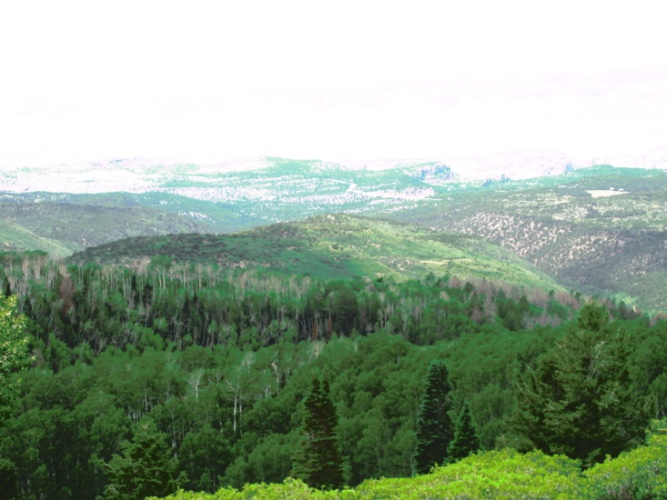
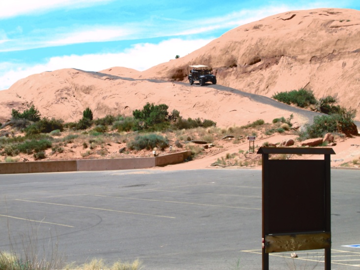
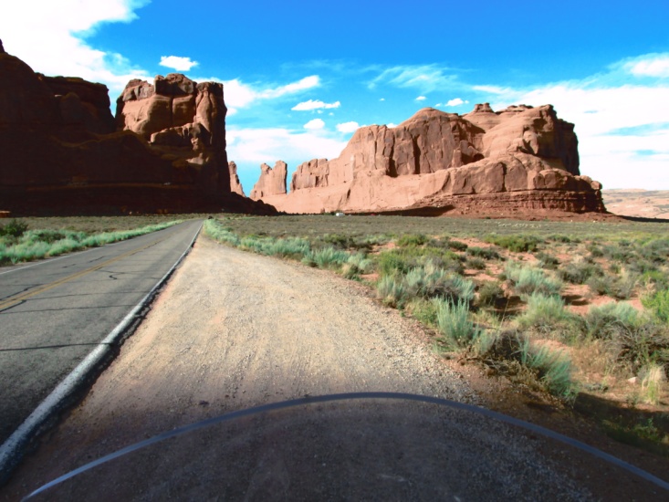
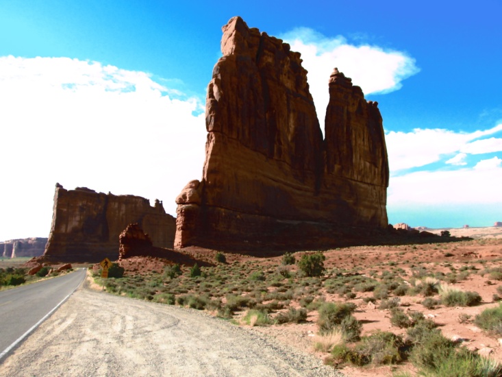
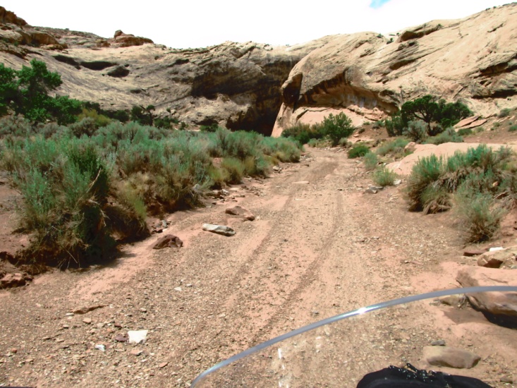
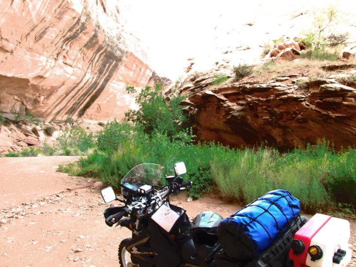
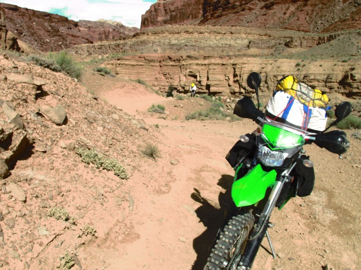
We followed Sand Flats Road for 25 miles through awesome canyons and rock formations before arriving in Moab about 4:00 pm. We hadn’t eaten lunch so after checking in to the motel we had an early supper. Moab was experiencing a brown-out so the only thing we found to eat was a pizza buffet and salad. It was really hot and Y was tired and hurting so I left him at the motel and headed out of town to the Canyon Lands National Park. Riding through the park I took lots of pictures then headed back to the motel.
← View from Geyser Pass Road looking toward Moab
We had planned a short day in order to tour the park so we only did about 120 miles on the trail then I did another 40 in the park. It was a good day but was really hot in the afternoon. The scenery around Moab was really spectacular.
 Salt Flats Road heading into Moab
 4-wheel playground east of Moab Entering Canyon Lands National Park
 Canyon Lands National Park
 Canyon Lands National Park
Day Four – Tuesday July 15th
(Moab, UT to Salina, UT)
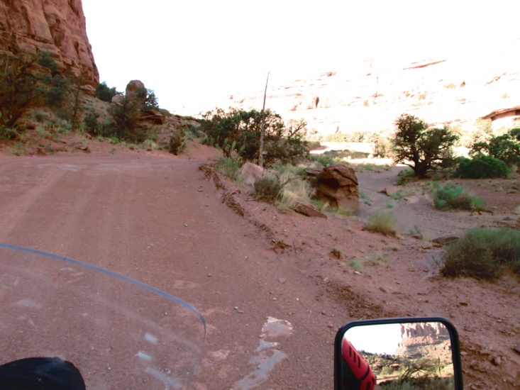
 Hoping to get an earlier start we donned our riding gear and loaded the bikes, stopping for breakfast at Denny’s on the way out of Moab. Leaving highway 191 we climbed quickly up a bluff overlooking Moab to the south. We then descended into a wide canyon on the Gemini Bridges road which was mostly solid bedrock with occasional patches of deep sand. We met one group of 4-wheelers then a group 15 or so mountain bikers. After hitting pavement on highway 313 for 5 miles, we were back on dirt meandering through a huge valley for 35 miles eventually connecting with I-70, 15 miles east of Green River, UT.
Leaving Moab overlooking the city →
 Gemni Bridges Road
 Gemni Bridges Road Junction with I-70
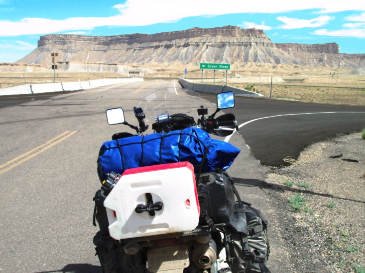
From that point we rode what was left of old US 50 … part dirt, part pot-holed asphalt, into Green River. It was really hot so we enjoyed a hamburger relaxing under a swamp-cooler, and then refilled our camelbacks and gas tanks. Leaving town headed west on dirt we intersected I-70 after a few miles, and then rode the slab for 5 miles to the exit for Black Dragon Wash (theme from “Jaws” plays in background). I had been concerned about the Wash ever since viewing a blog a few months earlier. I asked Y if he was sure he wanted to attempt it or would he rather meet me further down the interstate. He said he’d rather take his chances in the dirt than on the interstate. Little did we know the difficult trial that awaited us. The wash is a very narrow canyon with sheer walls 100-150 feet high and a dry floor of deep river sand and boulders. Occasionally there were very short stretches of road parallel to the stream bed. I never knew whether to follow the stream or the road because one or the other often became impassable. I’d have Yancey wait while I explored the best path, often having to backtrack. Yancey’s lack of experience in this type of terrain began to take its toll. He fell 10-12 times before we finally made it back to pavement. Each time he fell I parked my bike and walked back to help him lift his bike up. Part of the time it was necessary for me to ride his bike to a level spot while he walked very slowly on his bad ankle. He was also so exhausted he had difficulty maintaining his balance in the deep river sand, often falling again after 50-100 feet. At one point I realized I was close to heat exhaustion so I sat in the shade of a bush for 15 minutes and doused myself with water. The canyon began to open up a bit as we came to a narrow, steep, and rocky trail up out of the canyon floor. I rode to the top and stopped, expecting Yancey to have trouble. I was much relieved when he made it to the top without falling. At that point we still had about 12 miles of very rough jeep road to I-70.
 Black Dragon Wash
 Coming out of the Wash (Yancey walking up in background) Back at I-70
By the time we finally reached I-70 again it had taken us almost 5 hours to cover the 15 miles through the wash. Earlier, while still in the wash, we decided Yancey should take the highway into Salina, UT while I rode the remainder of the dirt south of I-70. However, it was already 7:15 pm and too late to do anything but ride the interstate into Salina. I-70 in this area is very scenic so we enjoyed that aspect of the ride. Yancey led the way but had difficulty maintaining even 60 mph over the steep grades which sometimes topped out over 12,000 feet. As we continued west we rode into a major thunderstorm and darkness fell early. We stopped on the shoulder and put on rain jackets about dark. We were only able to make about 45 mph as Yancey’s headlight was pointing into the sky and he couldn’t see but a short distance. About 10 miles from Salina Yancey ran out of gas. He coasted onto the shoulder but as he came to a stop he fell over, pinning himself between the guard rail and the bike. Amazingly he wasn’t hurt, just p-o’d. After we extricated his body we began unloading his gear to get to his Rotopax gas. Fortunately a highway patrol stopped to check on us and then shielded us with his lights and cruiser. We pulled into a very nice Super 8 about 10 pm and walked next door for a late supper at Denny’s. While we ate we decided to sleep in the next day and take the day to recoup, do some laundry, and work on Y’s bike. For that day we covered about 170 miles, only around 100 of which was on dirt.
Day 5 – Wednesday July 16th
(Salina, UT)
After sleeping in, we got up sore and tired and I harassed Gimpy as he hobbled across the parking lot to Denny’s. Later we found some shade and while I worked on Y’s bike, he did laundry. I hunted around in a pasture behind the motel and found a long pipe which I use to straighten Yancey’s handlebars. 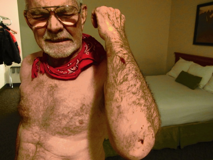 Yancey was so tired that he put the clothes and laundry soap in the dryer thinking it was the washer and ran it. He had to clean out the dryer and start over with the wash. Aside from damage from Y’s falls, the bikes have performed Yancey showing off his wounds (what a ham!) great. We lube the chains every morning and check the oil, neither bike using any oil … in fact we didn’t add oil to either bike for the duration of the TAT. I visited with a father and son from Florida who were doing portions of the TAT on BMW 800’s. We ate supper that night at a nearby Mexican food place and made it to bed early.
Day 6 – Thursday July 17th
(Salina, UT to Border Inn, NV)
We got up at 5:30 in an attempt to get an earlier start but it was still 8:30 by the time we ate breakfast, donned riding gear, and loaded up. 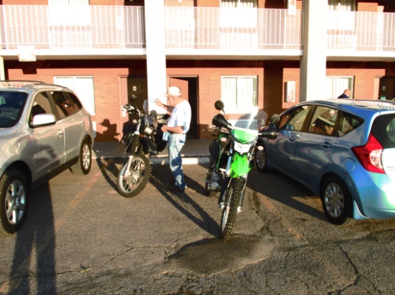 We left Salina on a graded dirt road that quickly turned into a 2-track beside an irrigation canal paralleling I-70. After about 25 miles we arrived at Richfield, UT then turned west into the Fish Lake National Forest. The area was designated as an ATV park and climbed quickly as we looked down on Richfield. About 5 miles in, Yancey ran off the road on a switchback and wound up under the bike. Following on the heels of the Black Dragon Wash fiasco, we decided maybe the Lord was trying to tell Yancey something. Preparing to leave Salina →
We elected to return to Richfield and find a route he could follow on pavement. I rode back to town with him and after buying a highway map we agreed to meet for lunch in Kanosh, UT. Back in the Fish Lake Forest I found the road somewhat technical but still a good ride. After several miles, Sam’s roll chart and my GPS showed to turn onto an ATV trail. The trail was set-off with steel posts 50” wide and a sign that said “Most Difficult”. I had real misgivings but didn’t see much option so I decided to continue on. At first it was just a steep climb with deep ATV ruts and rocks. Without warning the trail bailed off the side of the mountain on a 45 degree slope with occasional switchbacks. It was too steep and narrow to attempt to ride so I put the bike in first gear and killed the engine. The engine then acted like a rear brake as I feathered the clutch along with the front brake. This allowed me to control my speed while keeping both boots on the ground to maintain balance. After about a mile the trail crossed a jeep road so I went left about 2 miles looking for a relief route but alas, the road just kept climbing. I then went right of the ATV trail for another 2 miles at which point I met a cowboy on horseback. I ask him the easiest way off the mountain to Kanosh and was dismayed when he said I should return to the ATV trail. He said the road I was on would take me miles out of the way so I grudgingly returned to the trail and continued my careful slide down the mountain. All told, the ATV trail was about 5 miles long and with my detours, took me 2 hours. I was really relieved when I finally hit a good Forest Service road that took me into Kanosh.
 Fish Lake Forest west of Richfield
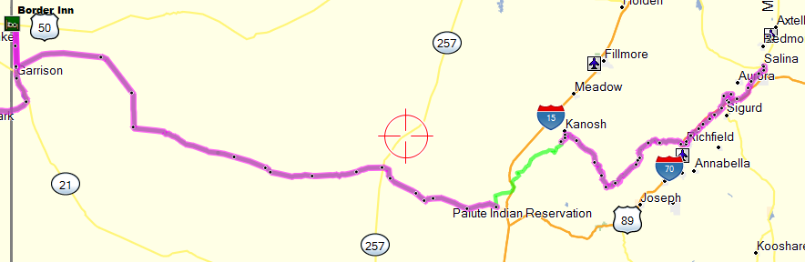
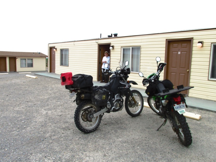
 Yancey had been waiting in Kanosh for about 30 minutes. The only food we could find were frozen pizzas at the garage/gas station. Yancey left to ride pavement north to Delta, UT and then west to Border Inn, NV, a total distance of 120 miles. The trail left Kanosh and took me south back into Fish Lake Forest for about 20 miles before crossing I-15. There I connected with Black Rock Road, Crystal Peak Road, then finally Pine Valley Road. These roads were gravel … deep gravel in places … but I was able to ride 50-60 mph. It was 90 miles before I hit pavement again 5 miles south of Border Inn. The landscape was some of the most remote, stark, and barren desert of the entire trip. Border Inn is not actually a town but a casino-restaurant-motel on US 50 at the Utah-Nevada border. I arrived about 6:30pm and Y got in about 45 minutes later. With the exception of the ATV trail it was a good day of riding. I was fortunate to have cloud cover for most of the desert ride keeping the temps around 90 degrees. I covered 185 miles of the TAT for the day.
The ATV trail from hell !!! →
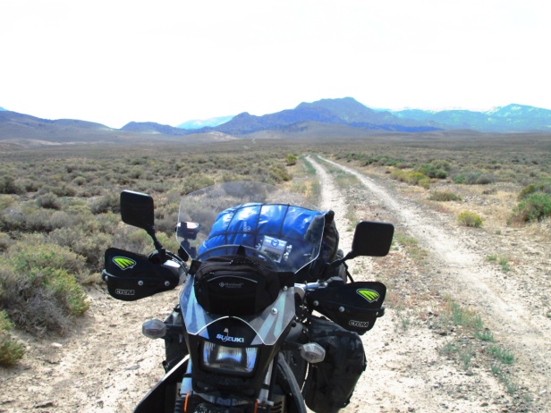
Roads between Kanosh and Border Inn … perhaps the most remote, barren section of the TAT
 More roads between Kanosh and Border Inn (must have been in a picture taking mood)
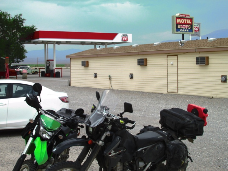 I accused Yancey of being the architect on the fancy motel at Border Inn
Day 7 – Friday July 18th
(Border Inn, NV to Eureka, NV)
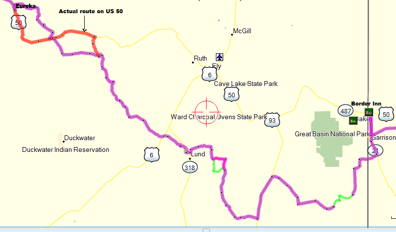
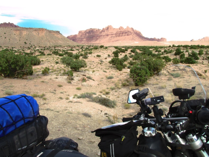
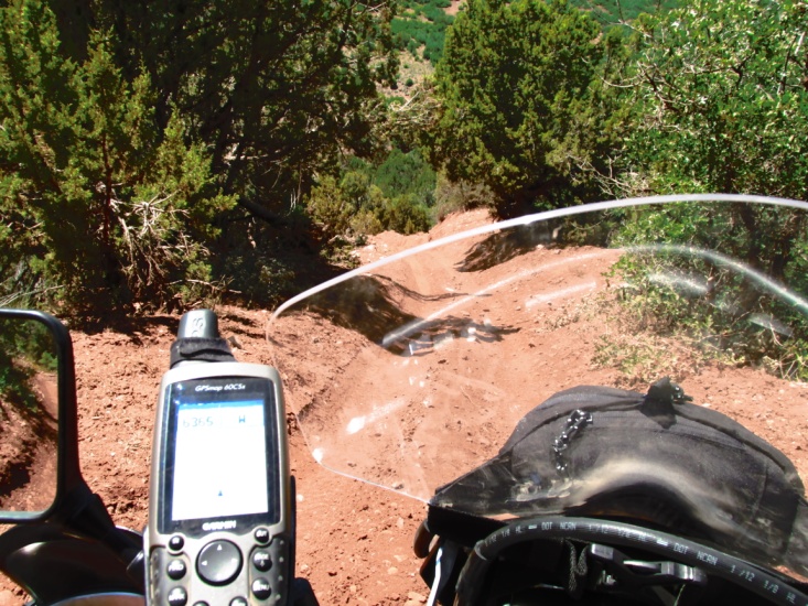
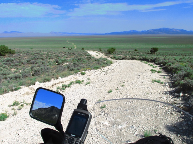
Yancey planned to ride the highway to Eureka, NV so I left him at the motel and headed south on pavement, bypassing a short section of dirt trail near Baker, NV. After about 10 miles I turned west for 5 miles on Nf-450 headed toward the mountains in Great Basin National Park. The trail then turned south on a 2-track through the foothills in order to skirt the Great Basin Park. It seemed like I rode through a wash every 50 yards as I crossed the drainage plain of the mountains. As the 2-track turned more westward it became all but impassable as both tracks were ruts 2 feet deep. It was necessary to ride beside the road over rocks and sagebrush for several miles.
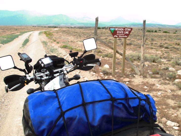
 State line south of Border Inn looking toward Great Basin Park and old cabin same area
 Looking toward Great Basin Park Between US 93 and Lund
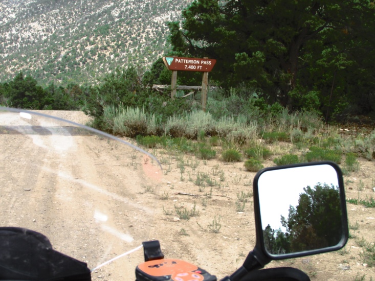
Eventually I hit a graded county road that took me to US 93 where I turned south for a few miles of pavement. I turned west again on Patterson Pass Road that took me over the pass, into a valley and then over another pass before intersecting NV 318. I rode south on 318 a couple of miles to Lund where I grabbed a good burger in the back of a mom-and-pop store and café. After gassing up nearby, I headed west on Long Valley Road and back into the mountains again. Sometimes the roads were graded but then would turn steep and rocky. The TAT trail took me over one mountain and then down through a descending canyon and then would repeat the whole process again. I believe I crossed four different mountain ranges that day.
 One of many passes I crossed One of many canyon descents
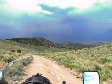 Storms were building all around me so I geared up just before it hit. The rain wasn’t heavy but the roads became muddy and slick. Finally I rode out of the rain while high on a mountain. Around 4 pm I stopped to check the maps and discovered I had a flat rear tire. I wasn’t too concerned because with the Tubliss inserts I could just plug the tire and keep going. For the longest time I couldn’t locate the hole so I started pouring water over it. I was about to give up when I heard it spewing. With the tire plugged, I loaded up and took off having lost an hour of time. While I was stopped the rain clouds had built over me again and as I looked down into the valley I could see it was pouring down. I rode through a gate and hit a good county road so I stopped for a minute to consult the maps. It was obvious if I continued west on the trail, I would be riding into a literal wall of rain about a half mile away. Instead, I turned north on Cr-9 and hit US 50 after about 6 miles. Had I followed the trail it would have taken me west over another mountain range then north of US 50 then west over another mountain and down into Eureka. Based on that day’s experience in the previous mountains I crossed, I estimated it would take me another 3-4 hours to reach Eureka. In addition, the whole area was inundated with rain. It was already 6 pm so I gladly (and wisely) jumped on US 50 and hustled the 30 miles to Eureka in the rain.
Yancey had a good ride but had run into high winds and rain east of Eureka before arriving about 3:30 pm. He checked into the motel and by 6 pm he had begun to worry about me. He had no cell service and was about to borrow a phone and call my wife Lyn when I rode up. The Gold Country Inn was really nice … best so far and with covered parking. I walked and Yancey hobbled (ankle still real sore) a couple of blocks and ate supper.
I had ridden 220 miles for the day. The designated TAT trail from Border Inn to Eureka was too technical to attempt to ride in one day. Also, there are alternate roads that should be considered to bypass the washed out roads I encountered south of the Great Basin Park.
Day 8 – Saturday July 19th
(Eureka, NV to Battle Mountain, NV)
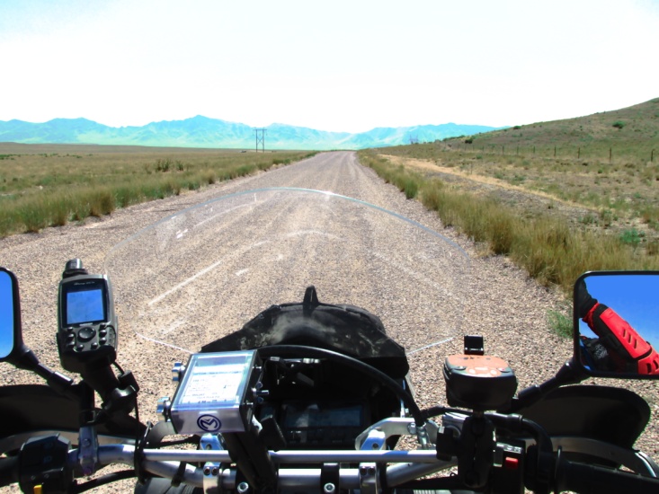
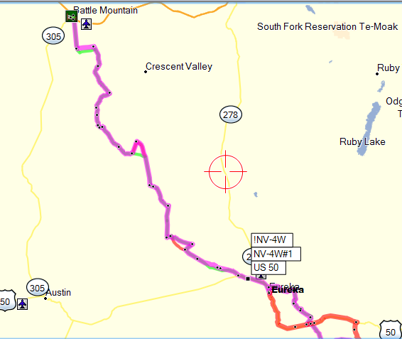 Yancey and I again discussed whether he should ride dirt or highway. There was no way to know how difficult the dirt sections would be so he again decided to ride the pavement. He usually travels 150-175 miles each day on the highway and says his bike seat feels like a 2 x 4 turned edgewise by the end of the day. This should be a short day of 125 miles as we had originally planned to wash clothes in Battle Mountain. I left about 8 am and after a short trip on US 50, passed through a gate and headed northwest on a 2-track. The road wasn’t bad but there was some muddy silt from the recent rains. The 2-track turned more westerly as it crossed a basin headed toward some distant mountains. At times the track was almost indistinguishable as it traversed the grassy basin. After several miles on the 3-bar Ranch Road I got on Cr-304 and was able to run 55-60 mph.
The scenery was great as the road turned north and took me up and over a couple of mountain passes. The second pass descended into a winding canyon that went on for miles, eventually dumping me onto a plain 20 miles south of Battle Mountain. The dirt county road was smooth enough that I was able to ride 55-60 mph, thus making it to the Super 8 in battle Mountain about 12:30 pm. It was a good day of fast riding with some technical sections going over the passes. Yancey showed up about 2 pm having had a leisurely ride. I rode 130 miles for the day. It was over 100 degrees that afternoon so we mostly stayed inside and napped. We had a good dinner at a local casino.
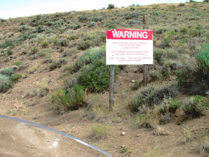
 Sign reads “WARNING – Mud flow & rolling bolder hazard area. Stay out of Canyons during rain storms.”
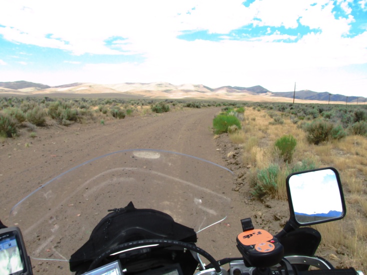
 Five scenes of road from Eureka to Battle Mountain
 Mine tailings left … more roads from Eureka to Battle Mountain
Day 9 – Sunday July 20th
(Battle Mountain, NV to Denio Junction, NV)
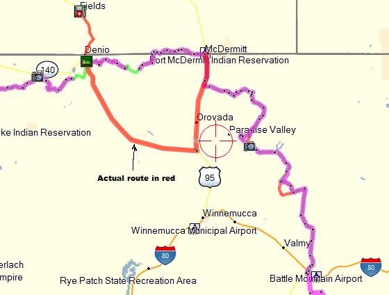
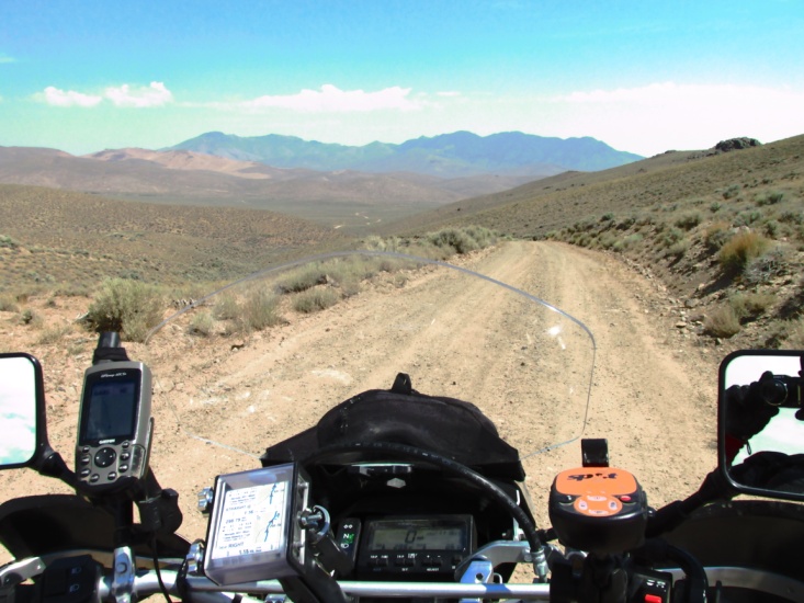
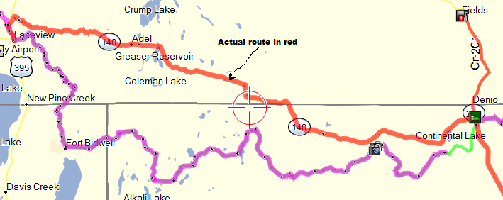
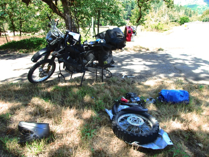
I left the motel about 7:15 (earliest departure yet) leaving Yancey to ride the slab to Denio Junction. I hadn’t gone more than a mile when I realized my track wasn’t displayed on the GPS. It quickly dawned on me that I hadn’t loaded segment 3 of the track, and segment 2 had ended at Battle Mountain. I rode back to the motel, fired up my laptop in the lobby and downloaded the track to the GPS. Now almost 8 am, I left town on pavement that soon turned to gravel crossing Izzenhood Ranch. The roads meandered across a large valley skirting some mountains and I passed slowly through the front yard of a couple of ranches. Late morning I was enjoying Greely Crossing Road as it made its way through the mountains when I realized I had missed a turn. After back tracking a couple of miles I found my turn off and climbed up a steep and rocky jeep road past Coyote Peak. Though difficult, it was worth it as it brought me out on the edge of the mountains with an awesome view of the valley below. I descended on Indian Creek Canyon Road into the valley via a dozen switchbacks that resembled pictures of roads in the Alps. I encountered more than one small herd of cattle on the road that had nowhere to move. I slowly bluffed my way through them without incident. As I neared the valley floor I momentarily looked off … I don’t recall at what … and when I looked back at the road I was approaching a very sharp right curve at about 40 mph. I knew I was too fast to make the turn so I locked both brakes and slid over the sloping embankment. Still upright, I realized there was a barbed wire fence in my path so I laid the bike down. I hit the ground really hard and laid there a moment, hurt and dazed. My first thought was to get the bike up and assess the damage. I still don’t know how I was able to pick the bike up with all the gear on it but somehow I did. Perhaps it was adrenalin or maybe my guardian angel lent a hand. The only damage to the bike was a bent windshield frame and my windshield bag was toast. My ribs on the right side were really hurting and I knew I’d pulled some muscles in my neck and upper back. I’m really glad I was wearing my armored jersey or my injuries probably would have been worse. After mounting up, I rode about 20 miles and intersected US 95, 15 miles south of McDermitt, NV. About 5 miles from McDermitt I realized I had a flat on the rear so I pulled over and began to try and locate the hole. My 12 volt pump quit working so I rode slowly on the flat tire on in to town. I found a store with an air compressor and soon found the leak and plugged it. Bad news … the hole was too big and the plug wouldn’t seal. My only recourse was to remove the Tubliss bladder and liner and install a tube. The Tubliss system is good in theory but it assumes you can maintain the integrity of the tire and the rim … if either fails it is a deal-breaker. By the time I had the bike back together it was around 5 pm and storms were building all around me. I knew it was too late to attempt to ride the remainder of the dirt section from McDermitt to Denio Junction, especially with storms in that direction. I was able to get hold of Yancey through the motel in Denio Junction and tell him I was going to ride pavement the rest of the way. My route would take me south on US 95 to NV 140, a distance of 80-90 miles. As I turned west onto NV 140 I rode directly into a severe thunderstorm with 50 mph side winds that made it difficult o stay on the road. Eventually I rode out of the rain and about dusk I could see the lights at Denio Junction ahead. Suddenly I became aware my rear tire was again flat. I pulled over and considered my options. If I rode it flat I mostly likely would ruin the tire with no place within 150 miles to get another. I decided to repair the flat but all I had was my 21” front tube. I had read the front tube would work in the 18”rear in an emergency and this was surely that. About the time I got the wheel off, the rain and wind caught up with me so I’m sitting in the bar-ditch in the dark changing the tube. In due course I got the bike back together but it was really difficult as my ribs were killing me. Fortunately, I carry a small bicycle pump so I aired up the tire and rode the 3 miles into Denio Junction. Yancey was thinking ahead and bought me a hamburger before the café closed. Grateful, I ate my burger and regaled him with war stories of my disastrous day. I rode a little over 200 miles for the day.
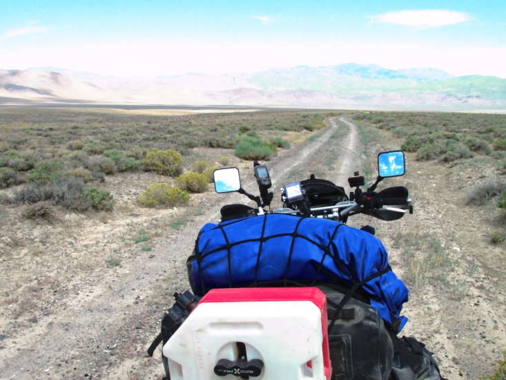
 Roads between Battle Mountain and McDermitt
 Roads between Battle Mountain and McDermitt
 Starting down Coyote Peak Road Looking into the valley toward McDermitt
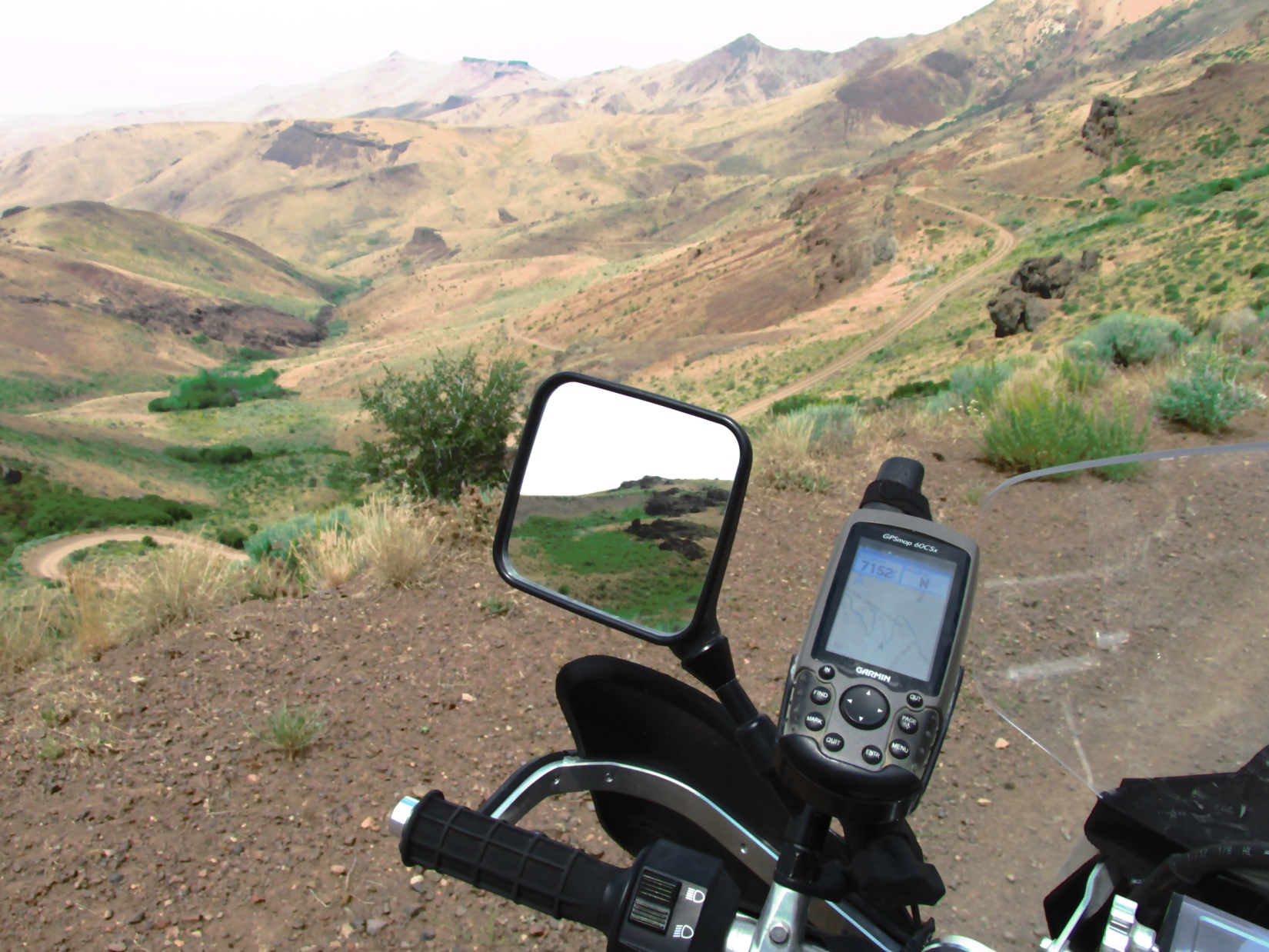 Switchbacks leading down Indian Creek Canyon Road (Elev.7152). Near the bottom is where I crashed.
Day 10 – Monday July 21st
Denio Junction, NV to Lakeview, OR)
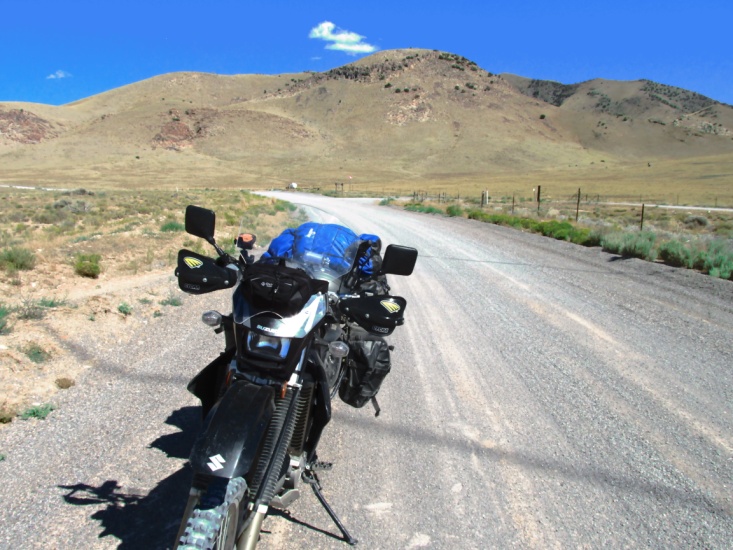
Denio Junction is just that, a junction … a highway junction with a restaurant-motel-casino. They use to have gas (per Sam’s map) but now the closet gas is in Fields, OR, 25 miles north. We were aware of this so Yancey bought a 2 gallon gas can in Winnemucca and hauled it full of gas to Denio. Given the pain I was in from my fall and the tire problems I was experiencing, I decided to ride the pavement with Yancey to Lakeview, OR. As it turned out that was a good decision … 10 miles out of Denio I had another flat on the rear tire. When I pulled the 21” tube it was split down the middle so I assumed it was because it was the wrong size. I installed Yancey’s spare tube and we took off again. Highway NV 140 was very scenic with lots of curves. There were storms building around us once we crossed into Oregon. Fortunately the highway turned just in time to miss the rain and we arrived in Lakeview early afternoon. 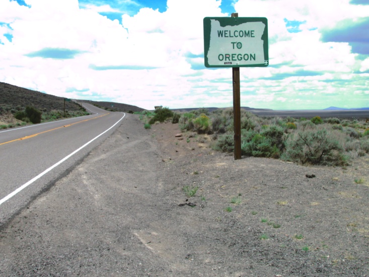 As I climbed off my bike at the Interstate 8 motel, Yancey said, “I think you got another flat”. Okay, enough is enough … there has to be something wrong with the tire. This time I pulled the tire completely off the rim and, low and behold, it had a tear on the inside which was pinching the tube causing the flats. My tire guru, brother-in-law Kenny, calls it an “impact break”. I rode Y’s KLX to a tire store and ask if they could put a “boot” (large patch) inside the tire. They declined to do so (liability issues?) but did patch the two tubes for me. They sent me to an ATV shop to look for a new tire. He didn’t have one but could order it and have it in two days. I explained to the owner that the tire store had refused to put in a boot so he called a small independent tire shop and they agreed to do it. The ATV guy was really helpful and even more so as I’ll relate later. Sometime during all of this, Yancey and I conferred and decided to stay an extra day in Lakeview. I really needed another day to recuperate as well as get my bike back in shape. While I was working on the bike, Y was washing our dirty clothes across the street at a Laundromat. I installed a new tube, got the bike back together and we rode to eat some really good Mexican food. We rode about 125 miles for the day.
Day 11 – Tuesday July 22nd
(Lakeview, OR)
Tuesday morning I awoke feeling pretty stove-up from my crash. Right across the street from the motel was great little breakfast diner. After we indulged ourselves I was determined to repair my windshield frame and do some general maintenance. It took most of the morning to repair the bike and once again it was necessary to borrow a vise and hammer at the Napa shop across the street. In the afternoon I bought an Oregon gazetteer map book, traced the TAT route on the appropriate pages, and removed them to take with me. Sam’s paper maps of Oregon leave a lot to be desired and I also wanted to be able to locate relief roads in case I had problems. That evening we ate some good pizza at the local bowling alley and then hit the sack early.
Day 12 – Wednesday July 23rd
(Lakeview, OR to Gilcrest, OR)
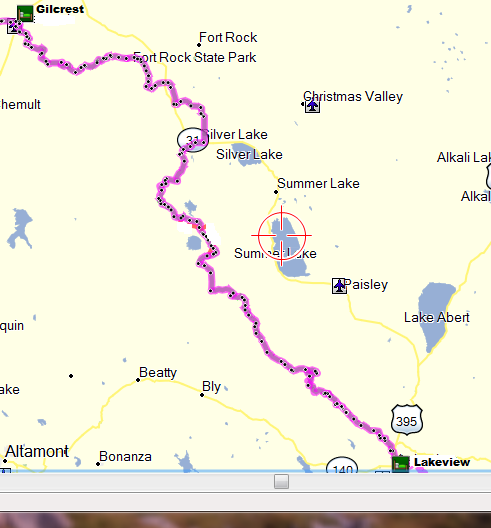
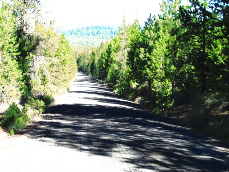
Yancey planned to ride the highway to Gilcrest, so I left about 7:30 and headed into the Fremont Nat. Forest on a graded road northwest of Lakeview. The road soon gave way to an easy 2-track Forest Service road. About 15 miles out I felt a pop when I pulled in the clutch lever … uh-oh, broken cable. Rather than stop immediately I kept going, shifting without the clutch while I pondered what to do. Shortly, I came to a paved forest road and decided to stop and investigate the problem. The cable was broken right at the barrel that fits in the lever. After trying a couple of things, I rerouted the clutch cable and cut off a couple of inches of the sheath. This gave me enough cable to run through the lever hole and clamp it to the lever with some small vice grips. At first I considered continuing on but decided it would be better to return to Lakeview and see if the ATV shop had a generic cable I could make work. The shop didn’t have a cable but between me and the owner we were able to modify a cable barrel clamp I purchased at Napa and get the clutch working again. By then it was mid-morning so I elected to ride Fs-28, a one-lane Forest Service road that closely paralleled the TAT track. I made good time on Fs-28 and arrived in Silverlake where I gassed up and ate lunch. The guy at the gas station asked me if I was the infamous Jerry Lewis … Yancey had already been there and warned him I was on the loose.
 South of Silverlake Between Silverlake and Gilcrest
The afternoon found me back on the TAT, in the Deschutes Nat. Forest and riding 2-tracks in a bit of sand and occasional deep ruts. There wasn’t much to see as I was surrounded the whole time by tall pine trees. It was a fairly easy ride and I arrived at Gilcrest around 5 pm. Yancey had checked us in to the Gilcrest Inn, a group of recently redecorated bungalows … arguably the best lodging of the trip. Our unit had two bedrooms, a kitchen, and a large living room which gave us the opportunity to spread out a bit. That evening I spent some time on my maps and Mapsource. I was re-evaluating the trail, looking for the least technical riding as I was still in some pain and really tired. There was rain that evening and the temperature was dropping quickly. We called Penske Truck rentals and pushed our pickup date to Saturday. I rode about 160 miles plus 40 backtracking to repair the clutch.
Gilcrest Inn
Day 13 – Thursday July 24th
(Gilcrest, OR to Canyonville, OR)
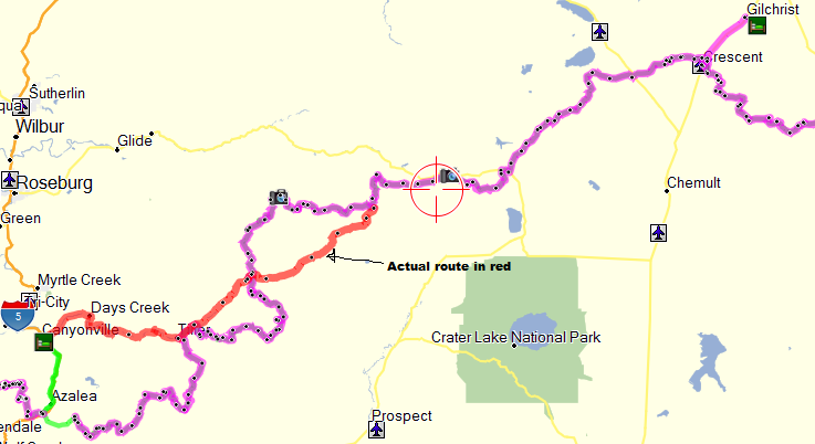
We awoke to a really chilly morning … 32 degrees according to the lady at the Deli-store where we ate breakfast. Yancey once again planned to ride pavement. As I mentioned previously, the issue was that though some of the forest roads were fairly easy, I would inevitably encounter some that were very difficult. I bundled up well but was still cold as the road took me west into the Umpqua Nat. Forest. I followed the TAT trail over Windigo Pass to OR 138 and then eventually connected with Fs-28. The riding was not too technical but what should have been really scenic along the mountain ridges was hidden from view by 100 foot tall Sugar pines. Only occasionally did I get a glimpse of the surrounding mountains. Fs-28 was not the actual trail but paralleled it until it intersected the Umpqua River Road. The actual trail went both south and north of Fs-28. I had decided the night before to pickup Tiller road that would take me into Canyonville. The TAT goes south of Tiller road and eventually hits I-5, necessitating riding north 15 miles to Canyonville. I passed through Tiller which is supposed to have gas, a grocery, and a café but all are closed. About 1:30 pm I was 12 miles east of Canyonville when I realized my rear tire was flat AGAIN. I found a shade tree and removed the wheel and pulled the tire off the rim. I quickly determined that I had another impact break in the tire and my new tube was ruined. I’m not sure if this was new break or if we just missed in Lakeview. I placed three layers of duct tape over the break and installed my patched tube and thus made it on to Canyonville. I checked into the motel then rode to a tire store nearby and asked them if I pulled the tire would they install another boot. He turned me down and referred me to another tire store 10 miles north on I-5. Instead, I went to Napa to see if they had a boot, which they did. After conferring again with Kenny, my tire guru, he assured me “even I” could put in a tire boot. Finally finished with the tire repair, I was exhausted and had inflamed my sore ribs and neck. I lay down and waited for Yancey to show up. I was starting to get worried when he finally made it in about 6 pm. He had waited till nearly noon to leave and then took some back roads to Canyonville. We ate some good Mexican food and kicked around the next day’s ride. We were now only about 130 miles “by the trail” from the coast. I had ridden about 140 miles for the day.
 West of Gilcrest Windigo Pass Road
 Windigo Pass Road
 Windigo Pass Road Last flat, 12 miles east of Canyonville
Day 14 – Friday July 25th
(Canyonville, OR to Port Orford, OR to Grants Pass, OR)
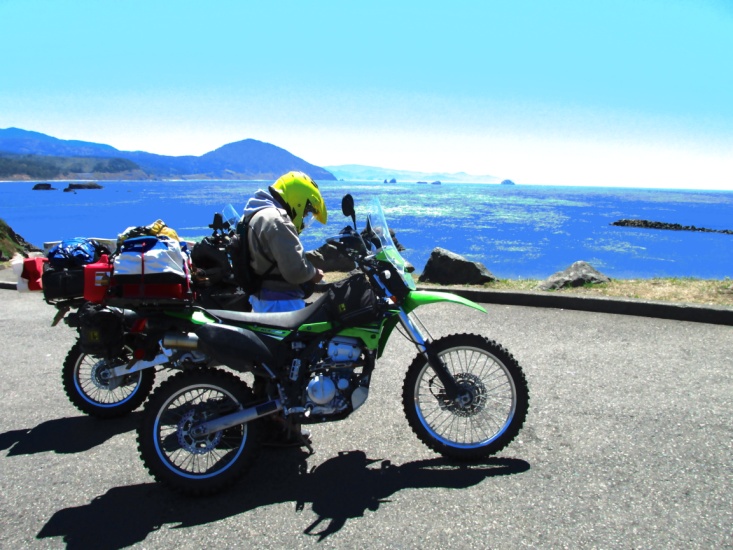
I had decided the night before that I would ride pavement with Yancey to Port Orford rather than ride the trail through the mountains. Given my bad tire and iffy clutch, not to mention my sore ribs and neck and general fatigue, I felt it was the smart thing to do. We left Canyonville on I-5 headed north, then on to old Highway 99 to OR 42. We then rode OR 42-S which is a very scenic ride along the Coquille River that intersects US 101 at the coast. The 101 was a beautiful ride and we made it into Port Orford about 11:30. We located an authentic fish and chips café and pigged out on some fresh cod. After lunch we rode to the bluff overlooking the Pacific coast and took several obligatory “hey-we-done-it” pictures.
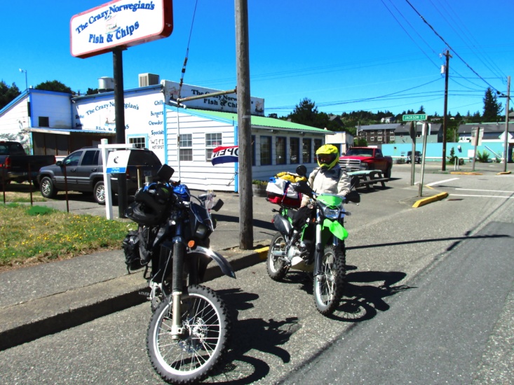
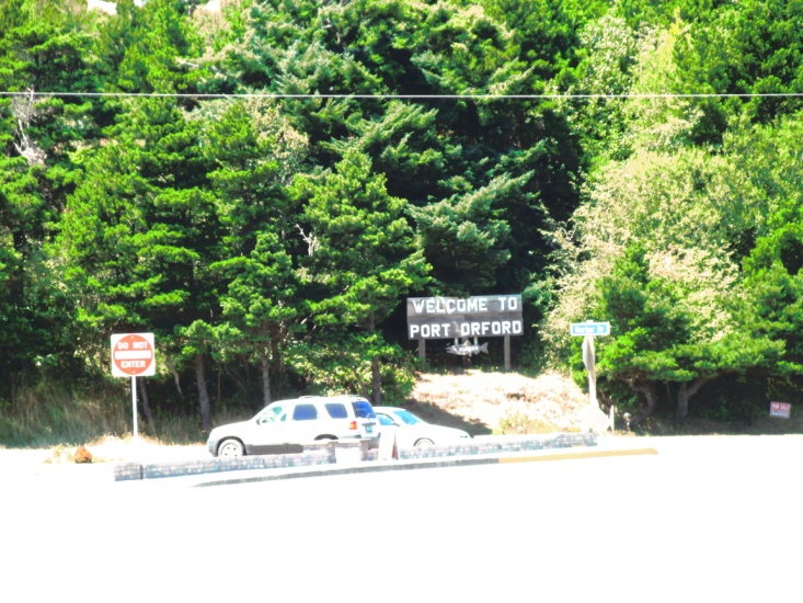 Fish and Chips at Port Orford Welcome to Port Orford – end of the TAT
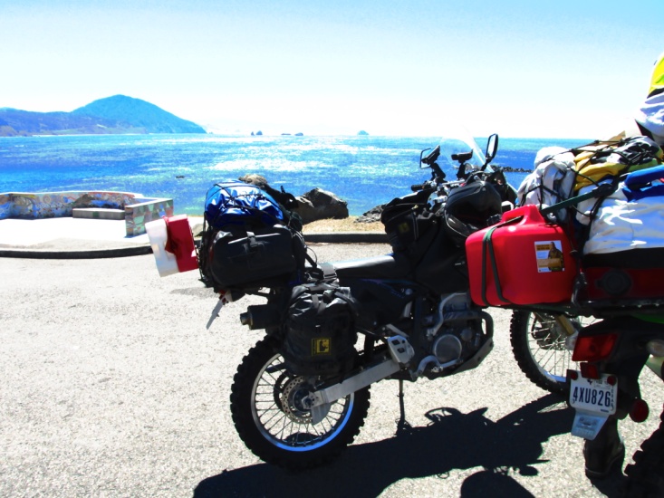
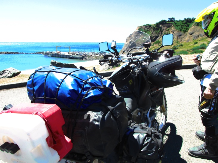
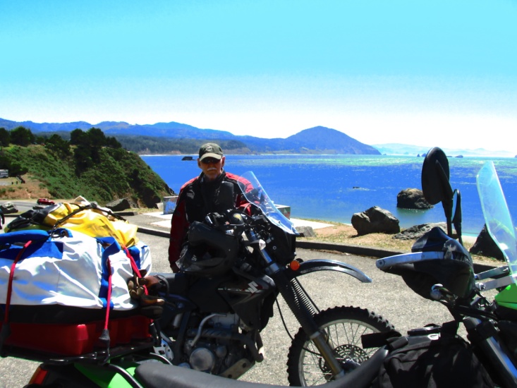 Four views of the Pacific Ocean from Port Orford
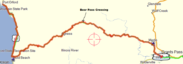
Since we were to pick up the Penske truck the next morning we decided to spend the night at Gold Beach 25 miles south on 101. The plan was that I would leave at dawn and ride as quickly as I could the 90 miles over the mountains on a paved Forest Service road to Grants Pass at I-5. I needed to make it by 11:30am as the truck rental closed at noon. Yancey would follow a bit later riding a more conservative pace. It was only 2:00 pm when we got to Gold Beach so I persuaded Yancey to continue on to Grants Pass. The road over the mountains is known as Bear Camp Route. It is a one lane, mostly paved, Forest Service road. It leaves Gold Beach on Jerry’s Flat Road … causing me a bit of concern given all of my “flats”. From Gold Beach to Galice, OR, Bear Camp Route is 70 miles of twisted and steep mountain road with occasional patches of gravel and sunken pavement. 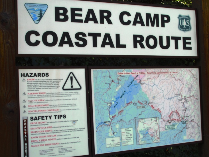 It took us almost three hours to reach Galice and then another hour into Grant’s Pass. After first locating the rental store and then the motel section of town, we checked into Motel 6. We then enjoyed a good evening meal topped off with blackberry cobbler alamode. After riding Bear Camp we were both glad that we got it behind us on Friday. I was a little disappointed not to ride the dirt into Port Orford, but even now I believe it was the right decision. We rode 260 miles for the day and were really tired. We rode a little over 2000 miles from Salida, Co to Port Orford, OR.
Day 15, 16, 17 – Saturday July 26th – Monday July 28th
(Grants Pass, OR to Lubbock, TX)
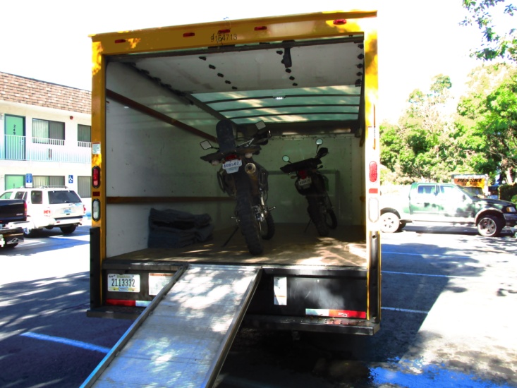
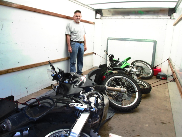
After breakfast at Denny’s I found a Wal-Mart and bought some rope to secure the bikes. We called a cab and I rode to the rental store and picked up our 16’ Ford box van. At the motel we used the integral ramp to load the bikes. We then drained the gas and oil out of the bikes and laid them on their sides, securing the bikes with rope to the wall cleats on the inside of the truck. After loading our remaining gear we headed south on I-5 eventually connecting with US 395 which took us into Reno, NV about 6pm. The truck drove great with good AC but we really wished for a cruise control.
The next day we continued south through Las Vegas, NV, over the new Hoover Dam bridge, and passed through a ha-boob going into Kingman, Az. 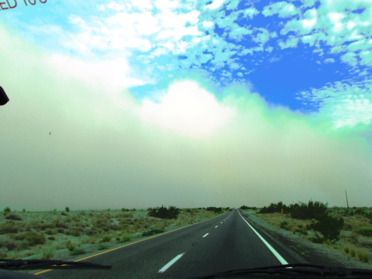
Monday the 28th and now on I-40 headed east we planned to spend the night in Albuquerque, NM. We arrived there about 4pm but “smelling the barn” we elected to continue on to Lubbock, arriving about 11:30 Monday night.
Ha-boob →
Epilogue
Well, I had lots of fun, rode some good roads, enjoyed Yancey’s companionship, saw some unique and beautiful country … really glad I got to do it … wouldn’t want to do it again.
I found the western half of the Trans America Trail to be much more technical and difficult then the eastern half. The western TAT is obviously much more remote and I believe the goal of 200 miles per day is not realistic on some sections … perhaps for 30 year olds on KTM 500s. I believe it would be really helpful if Sam included a section on his web site for riders to post opinions and conditions on different sections of the road. This would allow people some flexibility in deciding their route. I kidded with Yancey that someone needed to develop the “Geezer TAT” for older, slower riders.
As I mentioned earlier, I had planned to ride the western half solo as I did in the east. Though I did ride a significant portion solo, I knew that Yancey knew where I would be riding and awaiting my arrival. Given the remoteness and potential dangers I wouldn’t recommend anyone riding it solo if they are planning to stick to the actual route.
I want to include a word about the Tubliss tire system. It is great in theory but I’m not a fan. I called Dunlop technical support a few days ago about my problem with my 606 rear tire. After advising him I was running the Tubliss system, he stated emphatically that the Tubliss system was indeed my problem and that Dunlop did not support its use. He said it encourages running lower tire pressure which invites the impact breaks that I had experienced. He said that they had tried to use them on enduro bikes but they had encountered my problem along with others.
Things I regret: Yancey hurting his ankle; Yancey unable to ride more dirt; My fall and injury (so unnecessary); The sections of the TAT I felt I had to skip; Days too long; Some roads too technical or deteriorated …
The bikes: Yancey’s KLX250S performed admirably except for high altitude. My DRZ400S was all the bike I could want … never missing a lick, or failing to start, or using any oil. I was very pleased with the Wolfman Expedition bags.
As for future dual sport adventures, I’ll probably stick to 3-4 day trips closer to home. Yancey intends to continue riding and we are looking at a different luggage arraignment that will lower his center of gravity. The further I get from the actual ride, the more I remember the good things and forget the bad.
After all, it is supposed to be an adventure. Jerry Lewis — Wednesday, August 20th